 |
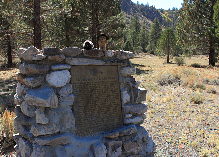
| Landmark #995A-2 | Mono County | Visited: Sept. 30, 2012 | Plaque? YES! 🙂 |
| What is it? | A plaque on the side of the road! |
| What makes it historical? | THE GUIDE SAYS: In 1844, while exploring and mapping the area of what is presently the western United States, Lt. John C. Frémont’s party passed through northern Mono County during the last week of January. After passing through Mono County, Frémont passed over the Sierra and travelled to Sutter’s Fort in the Sacramento Valley, where the party rested. To leave California the expedition headed south through the San Joaquin Valley, and then headed easterly to leave California by the Old Spanish Trail to Utah.
OTHER TIDBITS: Being late January, Lieutenant Frémont’s party got stuck in the snow and had to leave their Howitzer cannon behind so they could get out of the mountains to Sutter’s Fort! |
| How can I Help the Helpers? | HERE’S HOW:
|
| Where is this place? | LISTED DIRECTIONS: Big Bend-Mountain Gate area Toiyabe National Forest Bridgeport, CA 96107 ANNOTATIONS: From Los Angeles: ~369mi (594km) — 6.2hrs |
| When should I go? | I suggest going during the summer time, because you don’t want to lose your Howitzer in the snow! |