Thanksgiving is more of a daily practice than a holiday for beavers, but I still decided to accept an invitation to dinner from my good friends in Kingston, Utah, where the food is really, really delicious! It also happens that Kingston is about an hour and a half east of Capitol Reef National Park! Since my national park visits have been pretty sparse for 2012, I decided to get going before the aspen crack of dawn and see as much of this park as possible before dinner! Little did I know that, in the spirit of the holiday, I would be thankful to be alive by the end of this trip!
 |
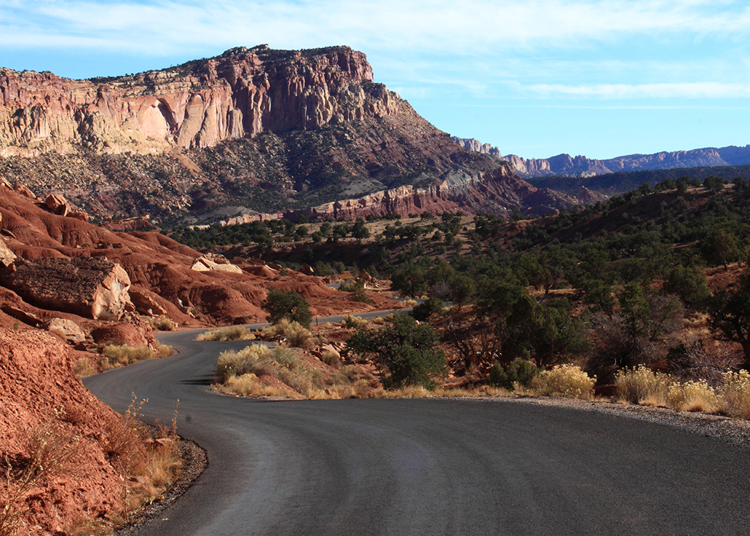
Capitol Reef has a funny name for a park settled unmistakably in the middle of the desert, where there aren’t even coral fossils! The prospectors who first explored this reason had once been seafaring men, and after passing the sandstone formations shaped like capitol domes, they pulled to a halt at the Waterpocket Fold, a massive warp (or fold) in the Earth’s crust that is full of pits (or pockets) eroded by water! Since they hadn’t packed any dictionaries in their survival kits, they named the barrier according to their experience of navigational obstacles. Therefore, they called it a reef, which happened to be surrounded by capitol domes!
Capitol Reef is one of Utah’s longest and least visited national parks, probably because it is not as easy to market as Arches (though Capitol Reef does have arches). However, what it lacks in instantly identifiable landmarks, it fully possesses in vivid layers of color, great hiking, and smaller crowds!
 |
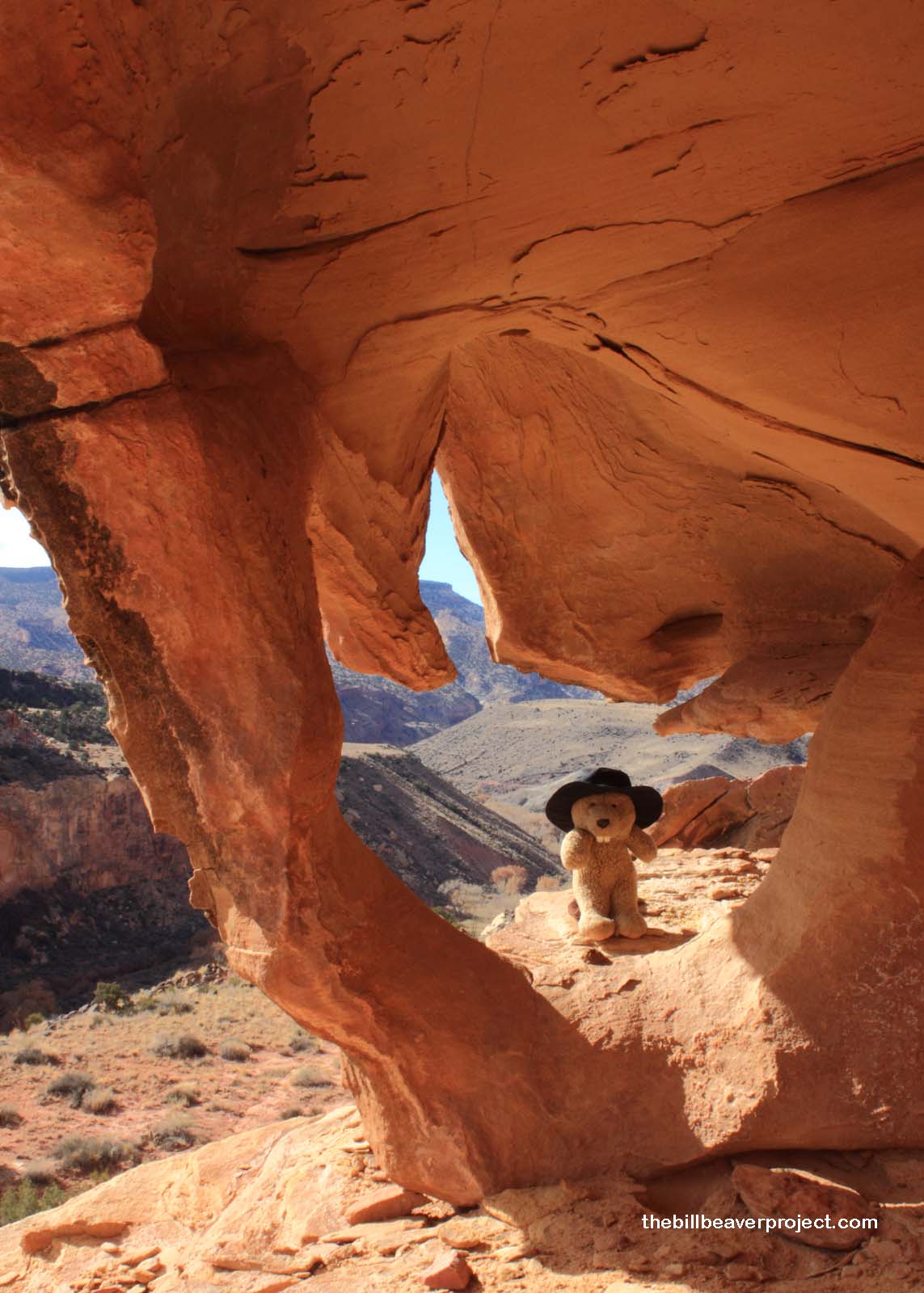
I started this expedition on one such colorful, uncrowded, hiking trail toward one of Capitol Reef’s natural bridges: Hickman Bridge! There are many longer and more challenging trails along the hundred-mile length of the park, but with time constrained, I picked a two-mile jaunt that would leave some time in the afternoon. Apart from the obvious destination of Hickman Bridge, the trail also offers some great views of Capitol Dome, which contributed to the naming of the park!
 |
Hickman Bridge takes its name from Joseph Hickman, one of the park’s co-founders who, along with his brother-in-law, Congressman Ephraim Pectol, petitioned President Franklin Roosevelt to declare the area a National Monument. It’s a good thing they did too! Seventy-five years later, this sunny hike still leads to an undefiled bridge with spectacular views and friendly hikers wishing me a happy Thanksgiving! The experience was well worth my risky photography, perched over a narrow crevasse where the last direct light was shining!
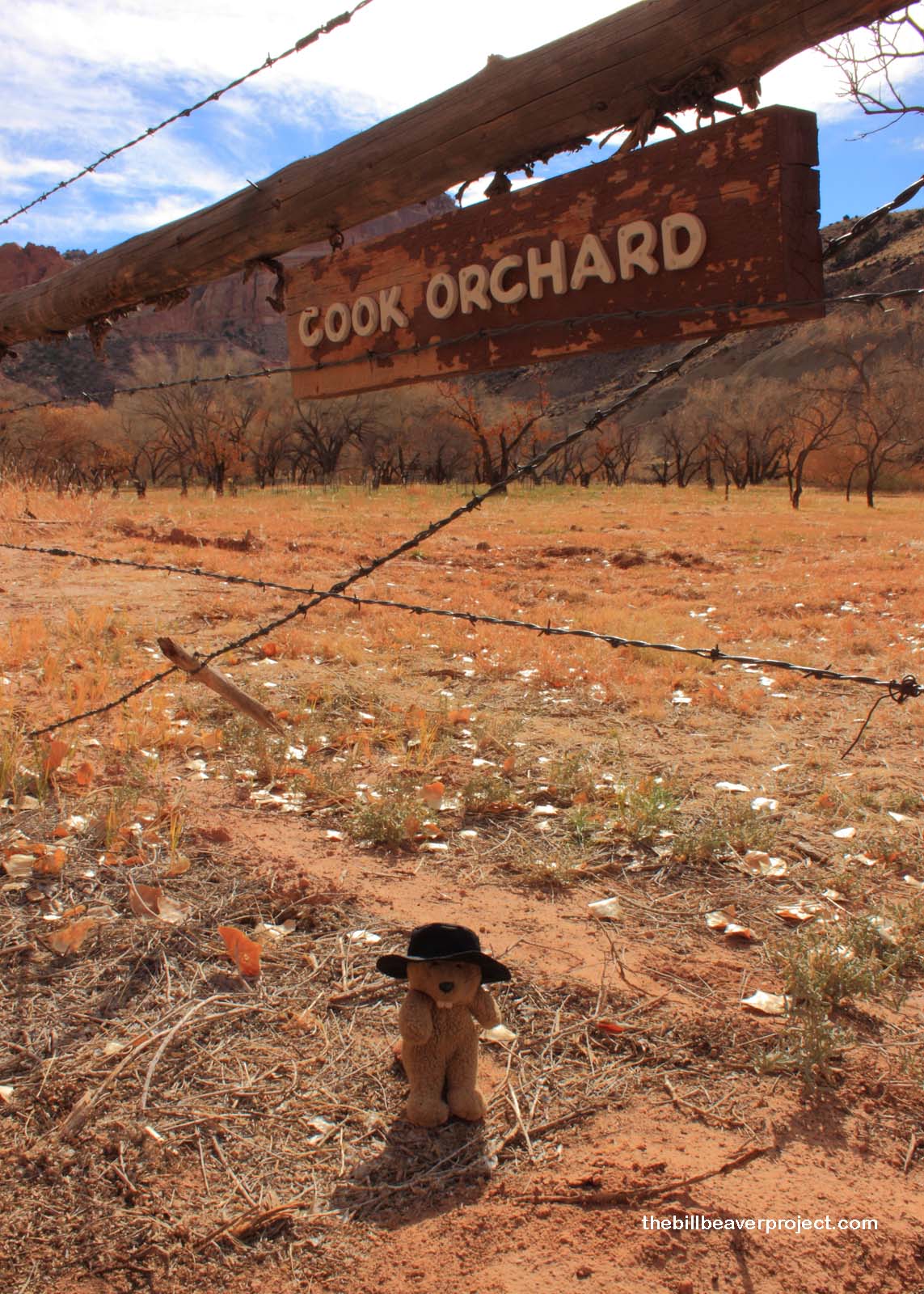
My next stop took me to the aptly named town of Fruita, home to Capitol Reef’s 3,100 fruit trees! In 1880, when Mormon pioneer Nels Johnson moved into the area, he realized that the shelter of the cliffs and abundance of water would be perfect for growing fruit trees, and as more enterprising farmers entered the area, they brought with them the makings of apple, pear, apricot, peach, plum, cherry, quince, walnut, almond, and pecan orchards (plus a couple of vineyards)! Capitol Reef is even home to its own unique breed of apple, the Capitol Reef Red! Other varieties have either been planted recently or identified through advanced DNA testing! I’m serious!
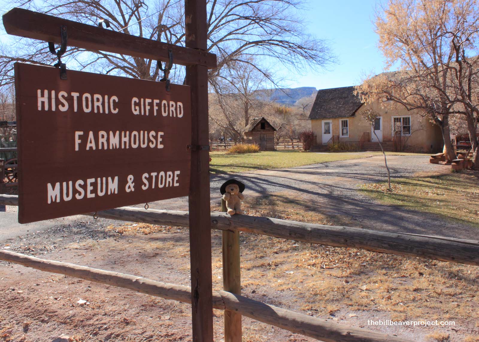
These fruit trees serve as the park’s main draw, because every year from June to September, the orchards open up for park visitors to pick as much of the fruit as they want, for free! Some of the fruit is made into pies at the Gifford House, but alas, in November, both the orchards and the Gifford House are empty!
 |
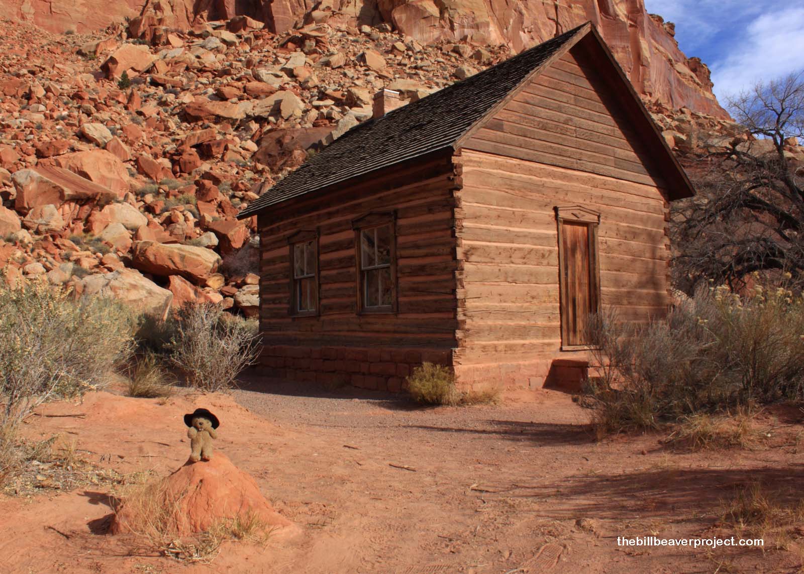
Fruita wasn’t known as Fruita until 1902, when it had been settled for 22 years! Before that, this tiny town of ten families was called Junction because it sat at the confluence of the Fremont River and Sulphur Creek! This self-sufficient location and its barter system spared its residents the ravages of downstream flooding and, later, the Great Depression, but it also meant long trips to trade with the outside world.
 |
 |
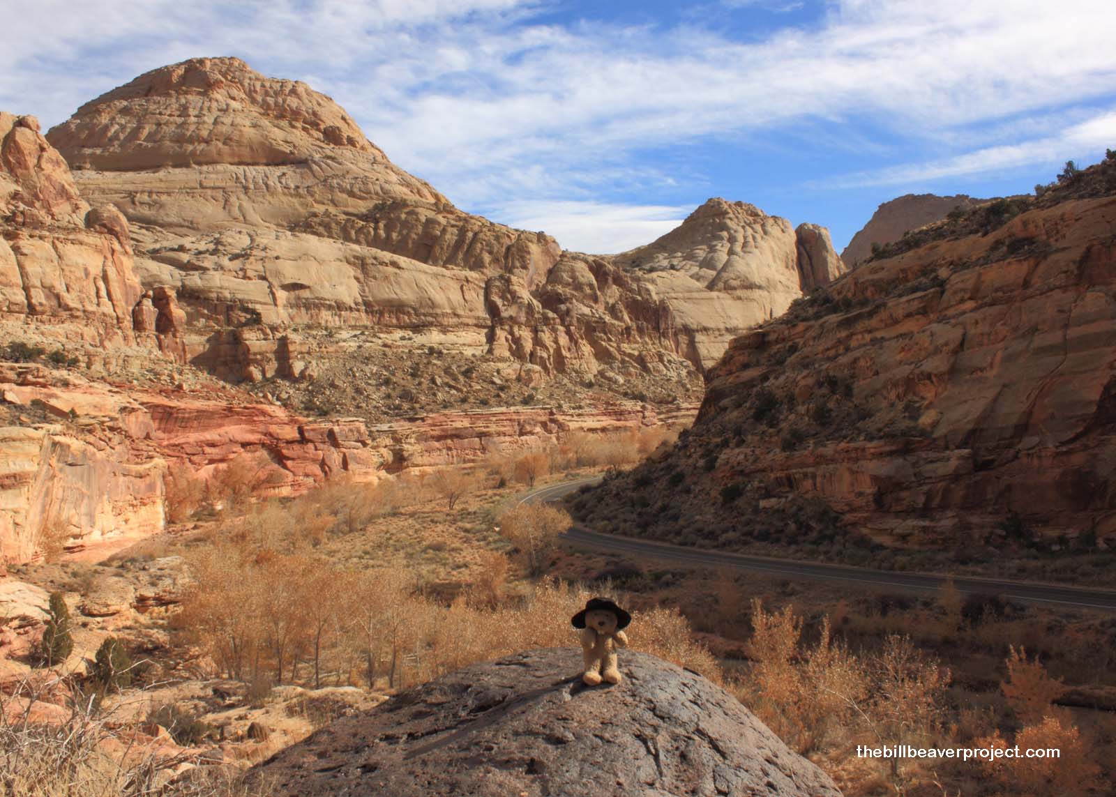
There weren’t a lot of fruit markets in southern Utah in the early 20th century, and the roads were not in the best condition. The 1901 rate of wagon travel, for instance, was about nine miles per hour. Those farmers who opted to sell their fruit in Price, 141 miles to the north, faced 21 straight hours of travel each way! This led some determined locals to seek another route to the closer towns of Caineville and Hanksville, blasting their way through the boulders of Capitol Gorge!
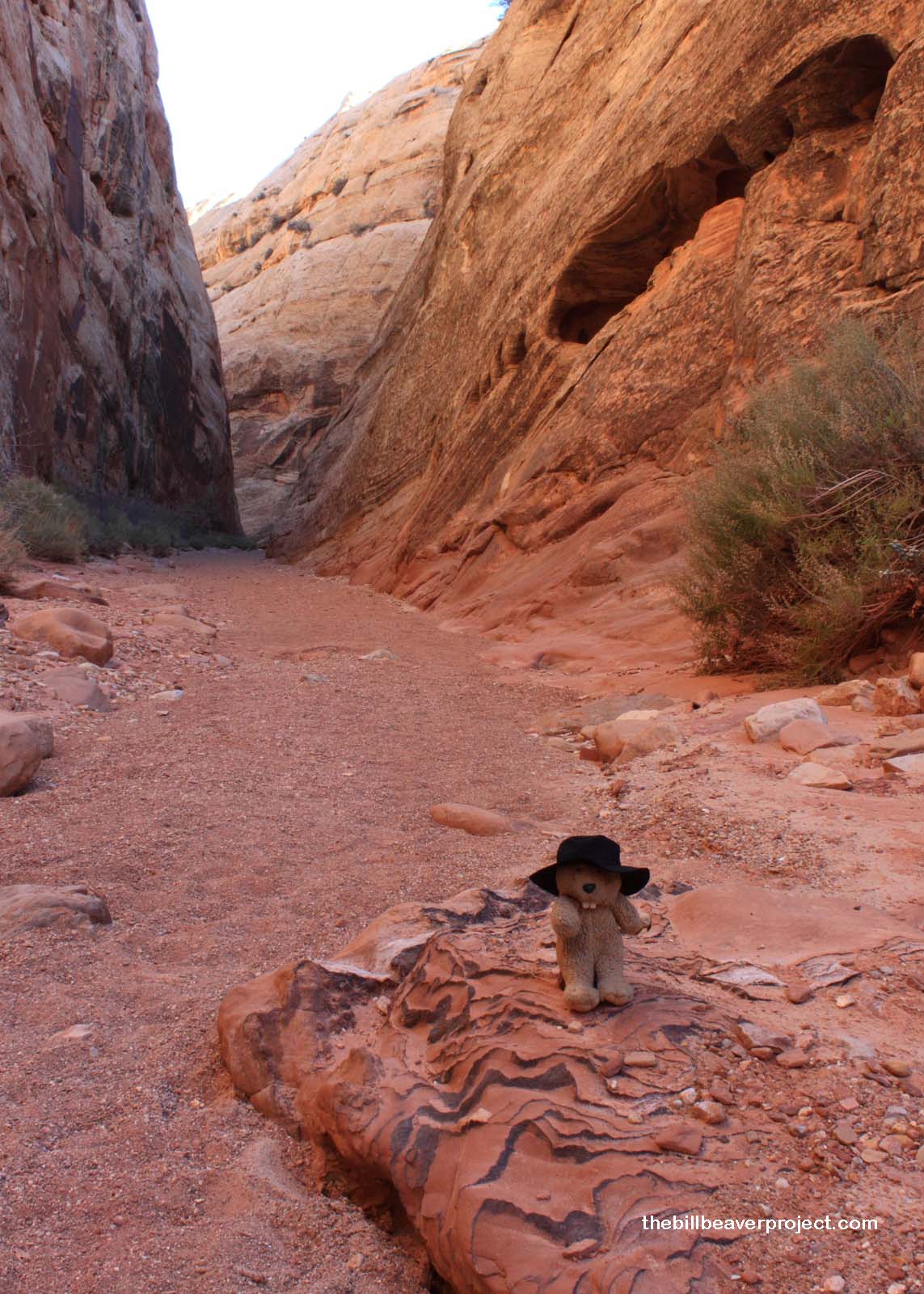 |
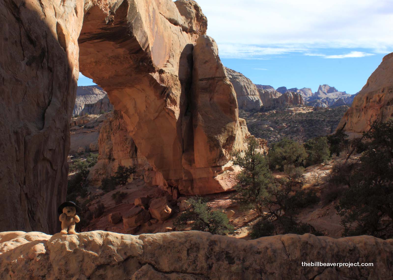
Yes, folks, where you see me was once the primary eastern route out of Fruita, called the Blue Dugway. In 1884, a group of pioneers, led by Elijah Behunin, devoted eight days to clearing boulders from this 3 1/2 mile stretch of Capitol Gorge to make way for automobile traffic. Cars are now off limits on this route and for good reason! The gorge is really narrow, full of super loose sand, and floods regularly when it rains! Nonetheless, despite the hazards and regular need for debris cleanup following floods, the residents of Fruita made use of what they had. All things considered, though, I’m glad Highway 24 does not run through this gorge!
 |
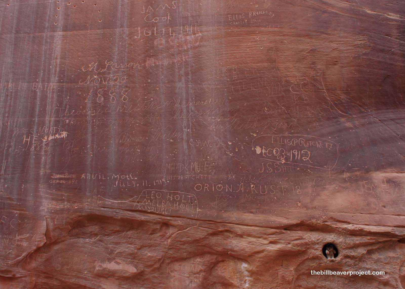 |
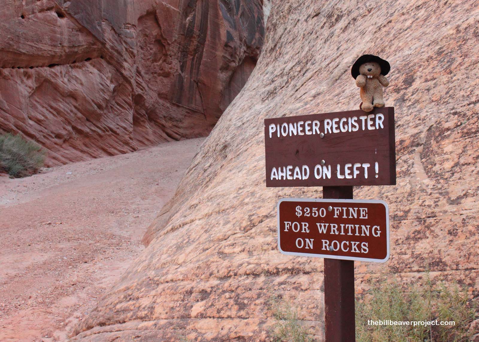
About a mile into the gorge, these demolition experts and subsequent travelers carved their names and the dates of their visits into the rock! This pioneer register stretches upwards of twenty feet on the cliff, and covers visitors from 1884 until the early 1900s! Some of these names, I think, were shot, dot by dot, into the rock from a distance!
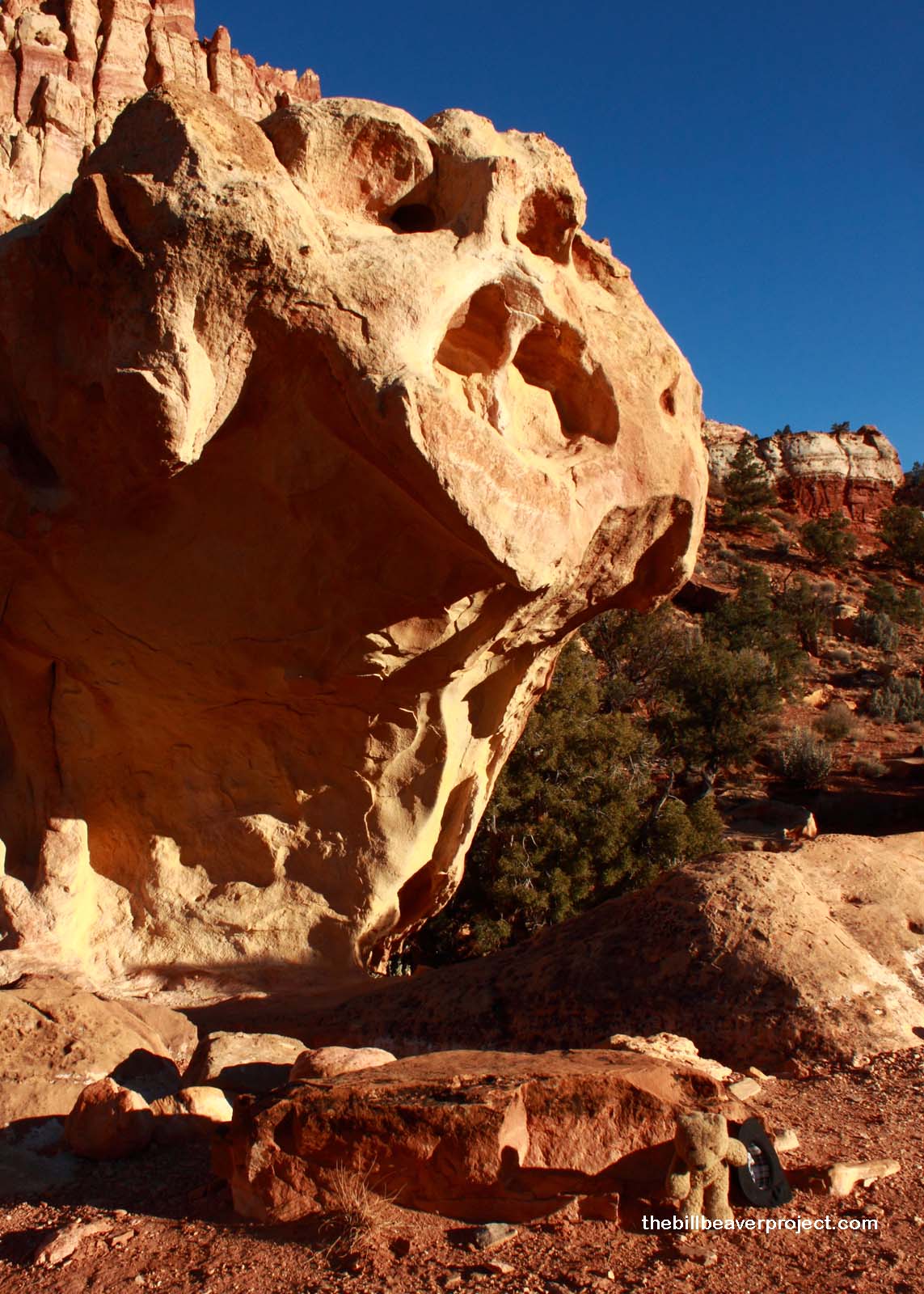
No sooner had I clicked the photo of the register than I realized I had to hit the road. Dinner time was fast approaching! As I hustled out of the gorge, I noticed that some pairs of water pockets seemed closer together than the others, kind of like eyes. I didn’t think much of it until one of them blinked! I figured this could either have been a hunger-induced hallucination or—and I hoped this wasn’t the case—one of the dreaded Gor stone demons said to inhabit these desert regions!
I picked up my pace as I heard rocks crumbling behind me. Something was pushing its way out of the cliff! I instantly wracked my brain for the Deadly Art most effective against stone monsters, but, I had forgotten to bring dynamite! I ran as fast as I could, not daring to look back at the creature! I only heard the crushing of stones and cracking of juniper branches behind me, and, unfamiliar as I was with the terrain, I tripped on a rock, sending both my hat and my camera flying! I didn’t dare go back for my hat, so I had to leave it to its fate. Luckily, it distracted the Gor, and I made my escape into a pile of driftwood. The demon stomped around looking for me for about fifteen minutes before giving up and disappearing among the boulders! Later, I found that the fall had triggered my camera to take a picture:
 |
I consider myself extremely lucky to have made it to Kingston in one piece. Though I mourned the loss of my hat over dinner, I truly gave thanks for every bite I was still able to take at the end of the day. My strongest recommendation to anyone set on visiting Capitol Reef: enjoy the beautiful landscape and pick some fruit if you can, but if the cliff blinks at you, run!
Happy Thanksgiving!
