 |
| Landmark #40 | Clark County | Visited: December 23, 2014 | Plaque? YES! 🙂 |
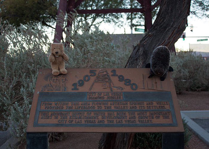
| What is it? | A marker and well over the spring that launched Las Vegas! |
| What makes it historical? | THE PLAQUE SAYS: From within this area flowing artesian springs and wells provided the lifeblood to the valley and its settlers. This abundant supply of water has been the most important asset in the establishment, development, and growth of the city of Las Vegas and the Las Vegas Valley!
OTHER TIDBITS: An unknown Spanish wanderer named this valley “Las Vegas,” or “the Meadows!” In 1829, Las Vegas became part of the Old Spanish Trail and served as an important stopping point for traders, emigrants, and frontiersmen, including John C. Frémont! Before it ever became Sin City, Las Vegas was a cattle ranch and a Mormon mission and fort! The city we know today arose in 1905 and uses far more water than this little spring can put out! |
| How can I Help the Helpers? | HERE’S HOW:
|
| How do I find it? | Listed Directions: The northwest corner of Charleston Avenue and Valley View Road Las Vegas, Nevada 89102 Annotations: From Carson City: ~429mi (691km) — 7.2hrs |
| When should I go? | Whenever the mood strikes you! |