 |
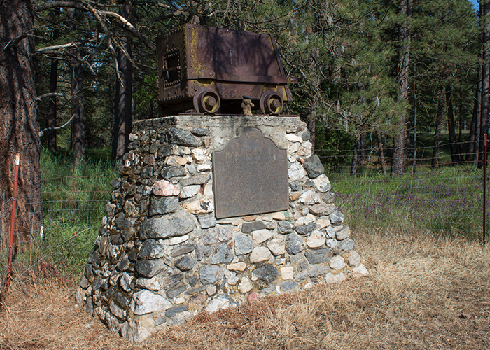
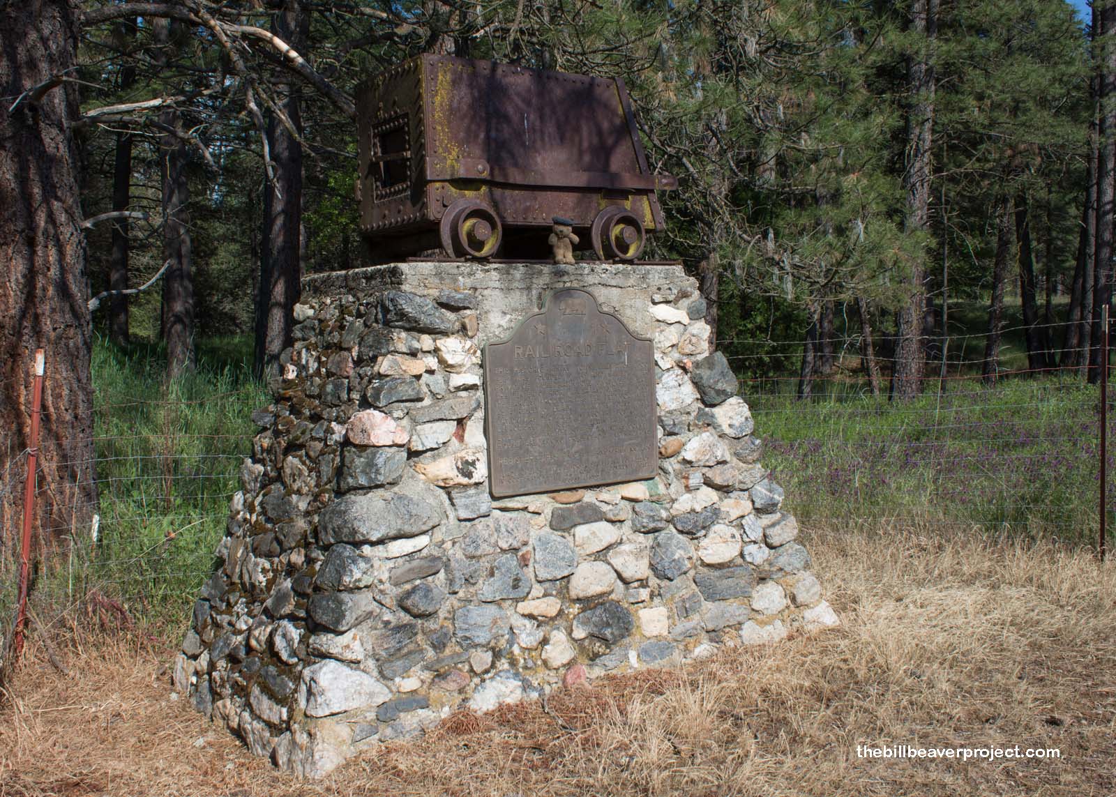
| Landmark #286 | Calaveras County | Visited: May 9, 2015 | Plaque? YES! 🙂 |
| What is it? | There was a plaque when I was here, but I don’t know if it survived the Butte Fire of 2015! |
| What makes it historical? | THE GUIDE SAYS: This historic mining town, elevation 2,600 feet, was named after primitive mule-drawn ore cars used here. It was the site of an Indian council as well as the center of rich placer and quartz mining. Its largest producer was the Petticoat Mine. The post office was established in 1857, and the Edwin Taylor store built in 1867. The town’s population was decimated in 1880 by black fever.
OTHER TIDBITS: That pretty well sums it up! |
| How can I Help the Helpers? | HERE’S HOW:
|
| Where is this place? | LISTED DIRECTIONS: NE of intersection of Railroad Flat (County Road 13) and Summit Level Rds 0.5 mi W of post office Rail Road Flat, CA 95248 ANNOTATIONS: From Los Angeles: ~372mi (599km) — 6.2hrs |
| When should I go? | Whenever the mood strikes you! |