 |
| Landmark #253 | Calaveras County | Visited: May 9, 2015 | Plaque? YES! 🙂 |
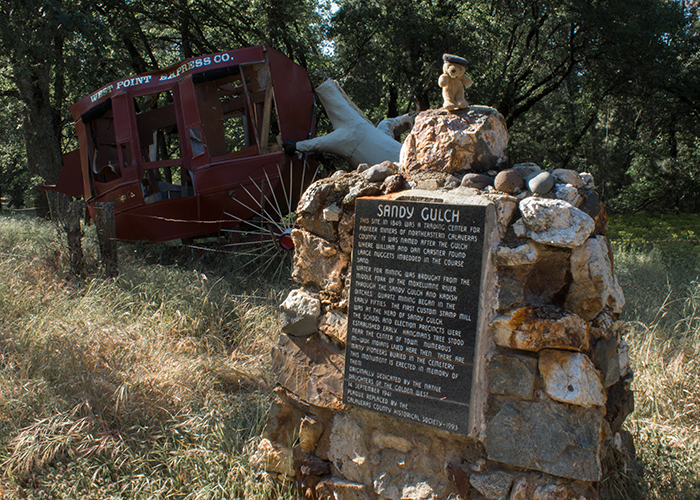
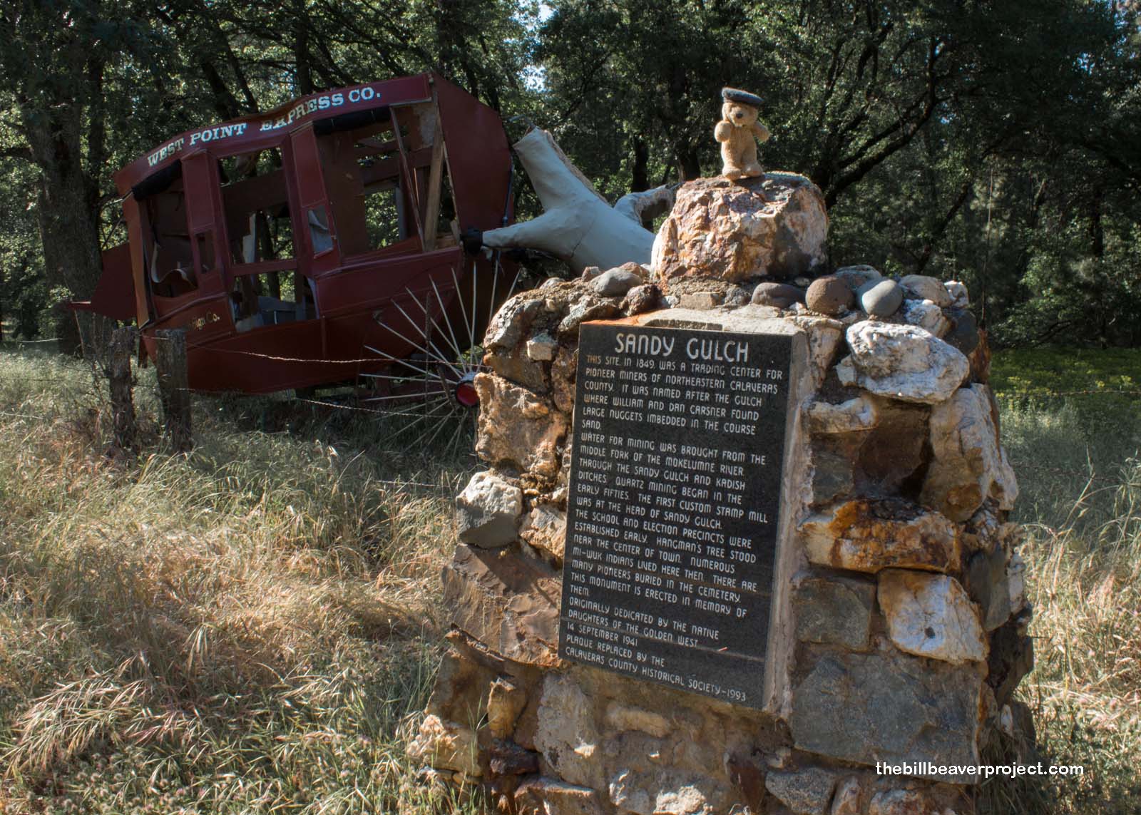
| What is it? | When I visited this site, there was a plaque and an elaborate diorama of a stagecoach and a headless horse, but I’m not sure if they survived the Butte Fire of 2015! |
| What makes it historical? | THE GUIDE SAYS: This monument was erected to the memory of pioneers of Sandy Gulch, 1849 trading center for miners of northeastern Calaveras County. The settlement, in an area that was home to many Miwok Indians, was named after the gulch where William and Dan Carsner found large nuggets of gold embedded in the coarse sands. Water for mining was brought from the middle fork of the Mokelumne River through Sandy Gulch and Kadish Ditches. Quartz mining began in the early 1850s, and the first custom stamp mill in the district was located at the head of Sandy Gulch. School and election precincts were established early, and one of California’s many Hangman’s Trees stood near the center of town.
OTHER TIDBITS: That pretty well sums it up! |
| How can I Help the Helpers? | HERE’S HOW:
|
| Where is this place? | LISTED DIRECTIONS: On State Hwy 26 (P.M. 32.3) 2.1 mi W of West Point, CA 95255 ANNOTATIONS: From Los Angeles: ~371mi (598km) — 6.2hrs |
| When should I go? | Whenever the mood strikes you! |