 |
| Landmark #661 | Alpine County | Visited: July 12, 2015 | Plaque? YES! 🙂 |
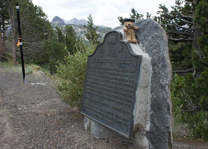
| What is it? | A plaque commemorating the Old Emigrant Road! |
| What makes it historical? | THE GUIDE SAYS: Here the Old Emigrant Road of 1848 swung down across the meadow now covered by Caples Lake (Twin Lakes) and climbed along the ridge at the right to the gap at the head of the valley. From this summit (9,460 feet) it descended to Placerville. This rough and circuitous section became obsolete in 1863 when a better route was blasted out of the face of the cliff at Carson Spur.
OTHER TIDBITS: This was the route by which thousands of emigrants (pioneers) flocked to California over the Sierras, first to find land, then to find gold! |
| How can I Help the Helpers? | HERE’S HOW:
|
| Where is this place? | LISTED DIRECTIONS: Lake Caples, on State Hwy 88 (P.M. 2.4) 17.3 mi W of Woodfords, CA 96150 ANNOTATIONS: From Los Angeles: ~439mi (707km) — 7.4hrs |
| When should I go? | Whenever the mood strikes you! |