 |
| Landmark #GO0002.91 | Goshen County | Visited: June 10, 2017 | Plaque? YES! 🙂 |
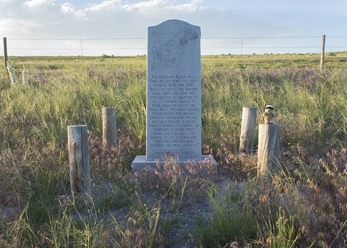
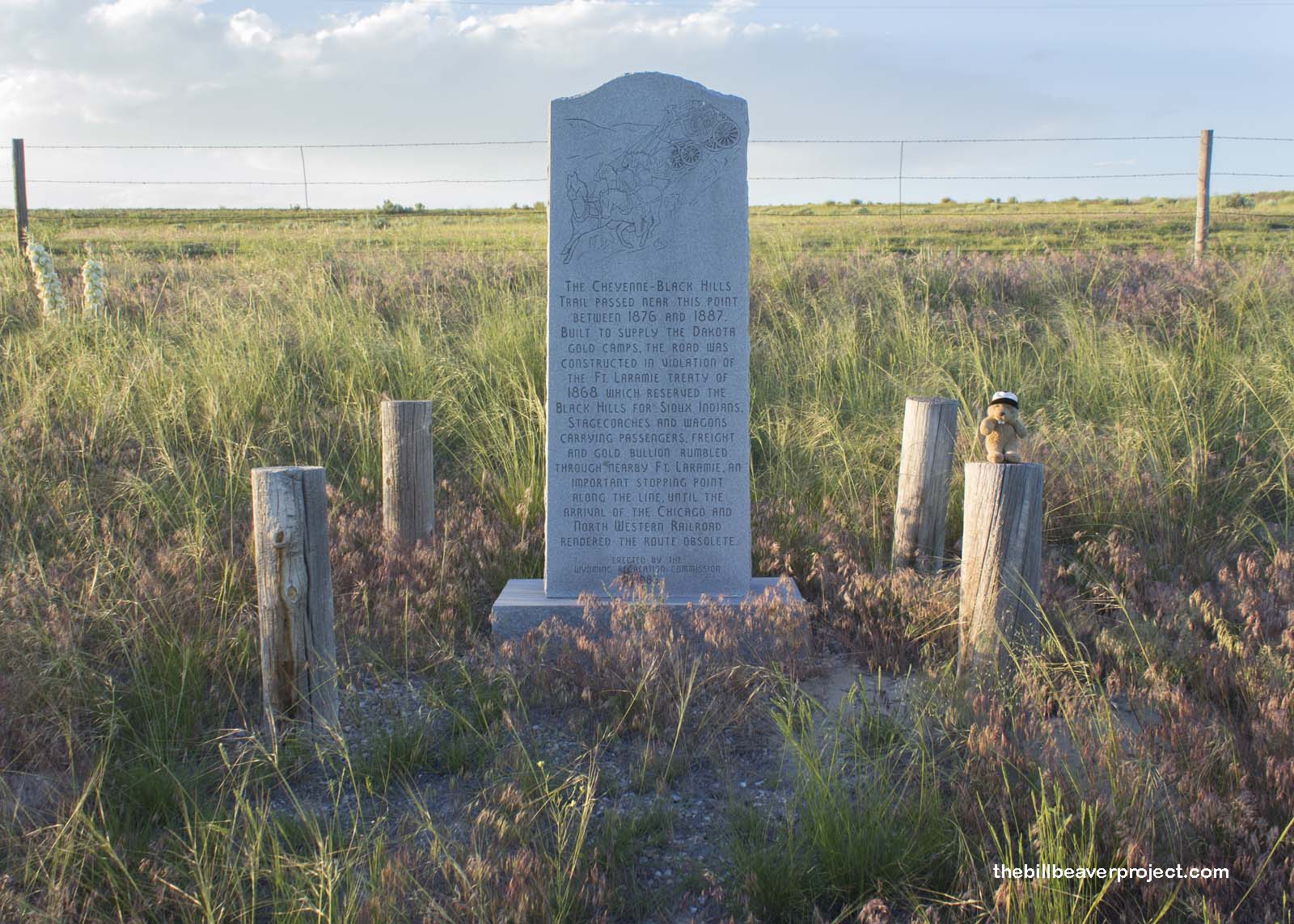
| What is it? | A stone monument by the side of the road! |
| What makes it historical? | THE SIGN SAYS: The Cheyenne-Black Hills Trail passed near this point between 1876 and 1887. Built to supply the Dakota gold camps, the road was constructed in violation of the Ft. Laramie Treaty of 1868 which reserved the Black Hills for the Sioux Indians. Stagecoaches and wagons carrying passengers, freight and gold bullion rumbled through nearby Ft. Laramie, an important stopping point along the line, until the arrival of the Chicago and North Western Railroad rendered the route obsolete. Erected by the Wyoming Recreational Commission 1985.
OTHER TIDBITS: That pretty well sums it up! |
| How can I Help the Helpers? | HERE’S HOW:
|
| How do I find it? | Listed Directions: The north side of US-26 4.2 miles west of Fort Laramie, Wyoming 82212! Annotations: From Casper: ~119mi (192km) — 2hrs |
| When should I go? | Whenever the mood strikes you! |