
 |
| Landmark #AB0016.93 | Albany County | Visited: June 10, 2017 | Plaque? YES! 🙂 |
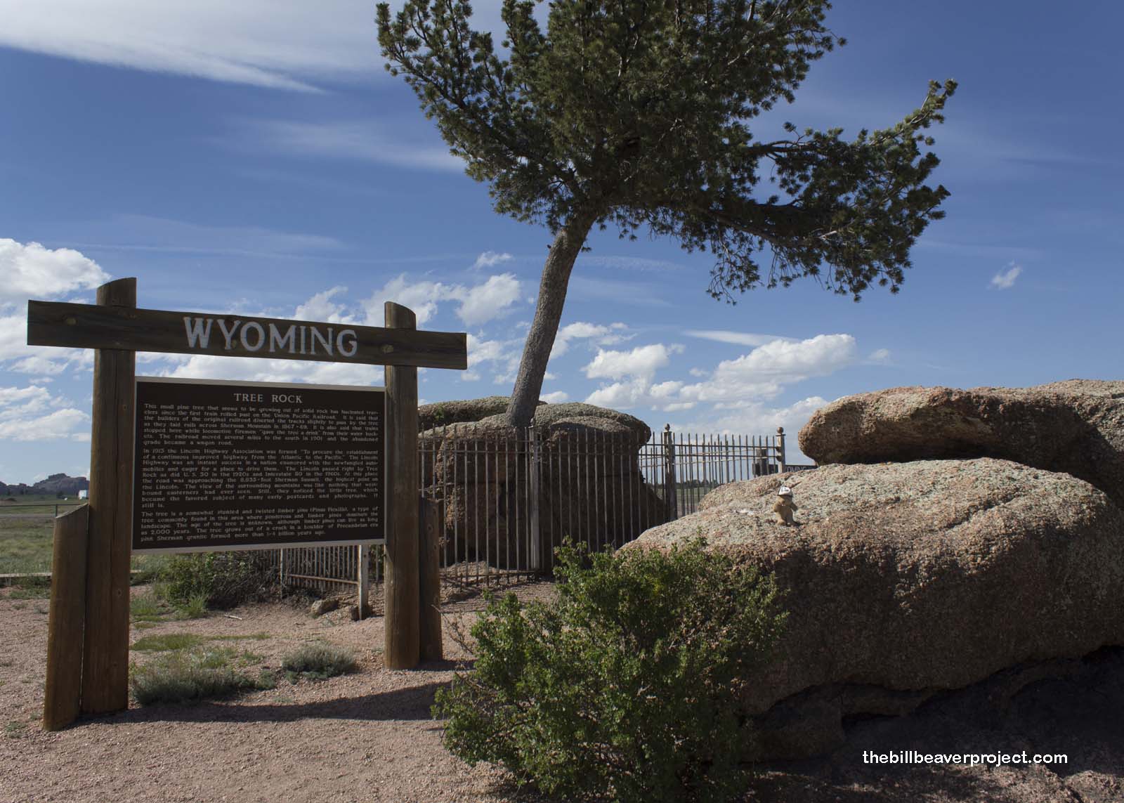
| What is it? | It’s a limber pine tree growing out of a boulder! |
| What makes it historical? | THE SIGN SAYS: This small pine tree that seems to be growing out of solid rock has fascinated travelers since the first train rolled past on the Union Pacific Railroad. It is said that the builders of the original railroad diverted the tracks slightly to pass by the tree as they laid rails across Sherman Mountain in 1867-69. It is also said that trains stopped here while locomotive firemen “gave the tree a drink” from their water buckets. The railroad moved several miles to the south in 1901 and the abandoned grade became a wagon road.
In 1913 the Lincoln Highway Association was formed “To procure the establishment of a continuous improved highway from the Atlantic to the Pacific.” The Lincoln Highway was an instant success in a nation enamored with the newfangled automobiles and eager for a place to drive them. The Lincoln passed right by Tree Rock, as did U.S. 30 in the 1920s and Interstate 80 in the 1960s. At this place the road was approaching the 8,835-foot Sherman Summit, the highest points on the Lincoln. The view of the surrounding mountains was like nothing that westbound easterners had ever seen. Still, they noticed the little tree, which became the favored subject of many early postcards and photographs. It still is. The tree is a somewhat stunted and twisted limber pine (Pinus Flexilis), a type of tree commonly found in this area where ponderosa and limber pines dominate the landscape. The age of the tree is unknown, although limber pines can live as long as 2,000 years. The tree grows out of a crack in a boulder of Precambrian-era pink Sherman granite formed more than 1-4 billion years ago. OTHER TIDBITS: That pretty well sums it up! |
| How can I Help the Helpers? | HERE’S HOW:
|
| How do I find it? | Listed Directions: Located in the median of I-80 between Cheyenne and Laramie Annotations: From Casper: ~174mi (281km) — 2.9hrs |
| When should I go? | Whenever the mood strikes you! |