 Previous Day |
Canyonlands National Park → Blanding 78.9 mi (127.0 km) |
 Next Day |
We’re ready to red rock, everyone!
This morning, Mom, Flatty, and I were up and at ’em for our hike through two amazing canyons in Canyonlands’ Needles District. Woodchuck, who isn’t a fan of long hikes, made us breakfast and stayed behind to read his book, asking us to report back on the colors of the cottonwoods along the way. We’ve got 10 miles to explore (less than half of Mount Whitney), so let’s hit the trail!
 |
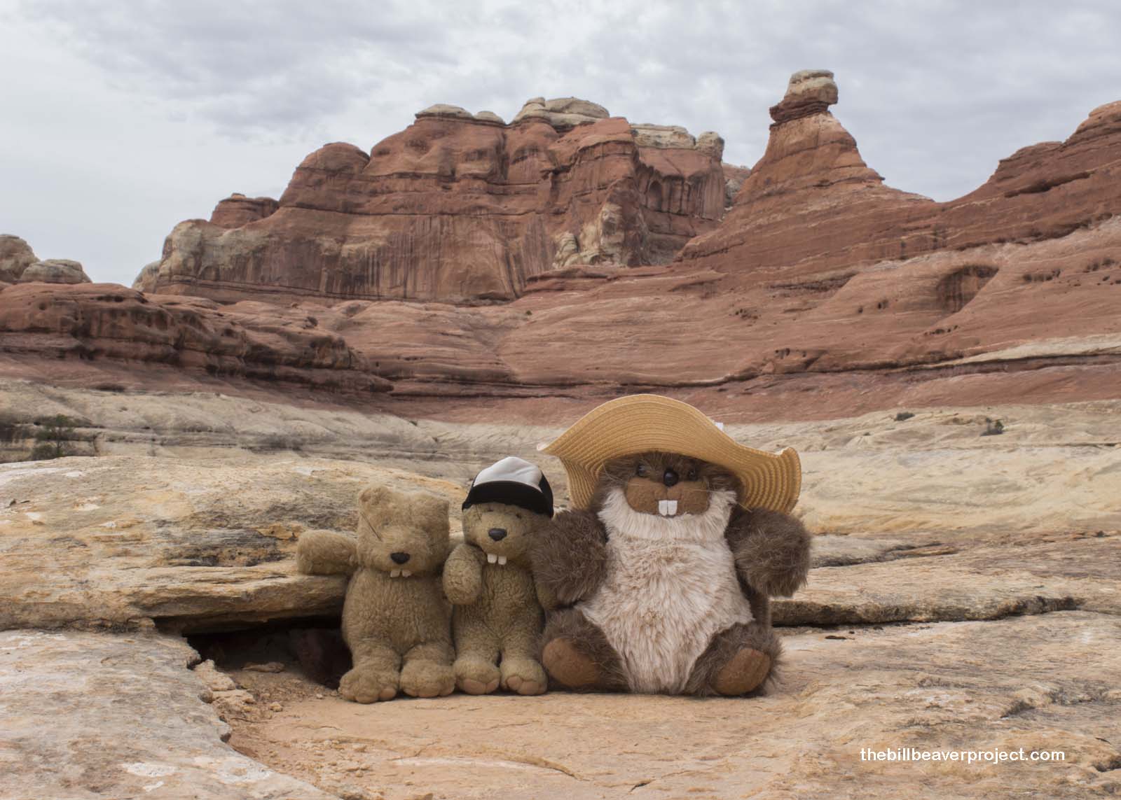
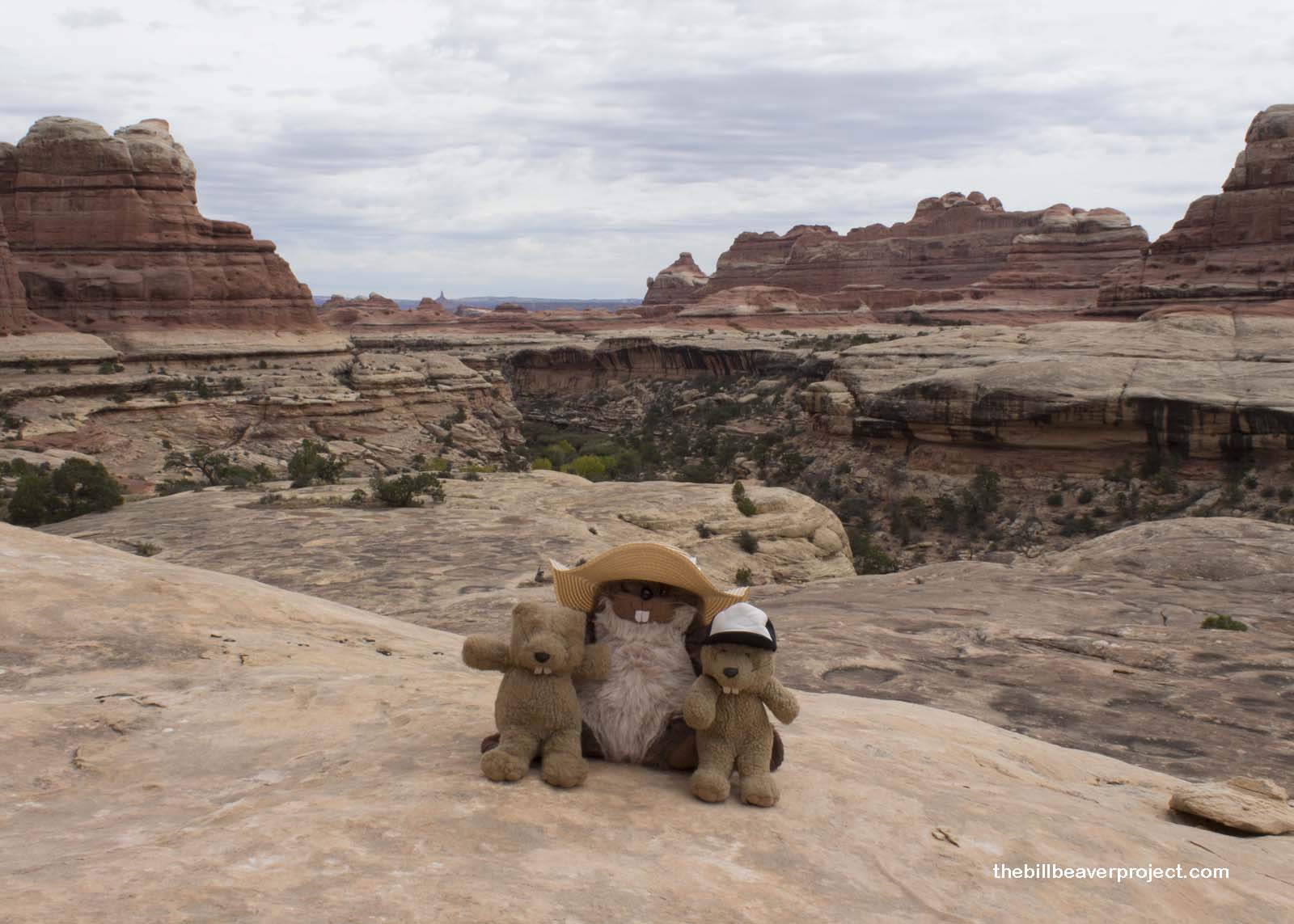
We started through flat meadowlands leading into Squaw Canyon, one of almost 40 places in Utah named for either a Native American woman or her lady parts, depending on who you ask. Lots of controversy there. What wasn’t controversial is that the canyon’s towering red rocks against the bright blue sky filled the morning with all the color that the cottonwoods were lacking! It may have been too early for Lastleaf, but Mom’s look of wonder at this whole new landscape told us that we were on the right path!
 |
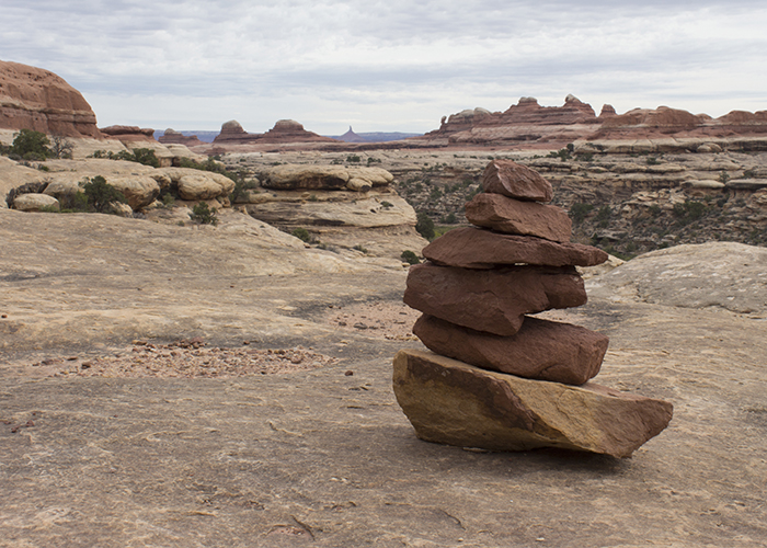
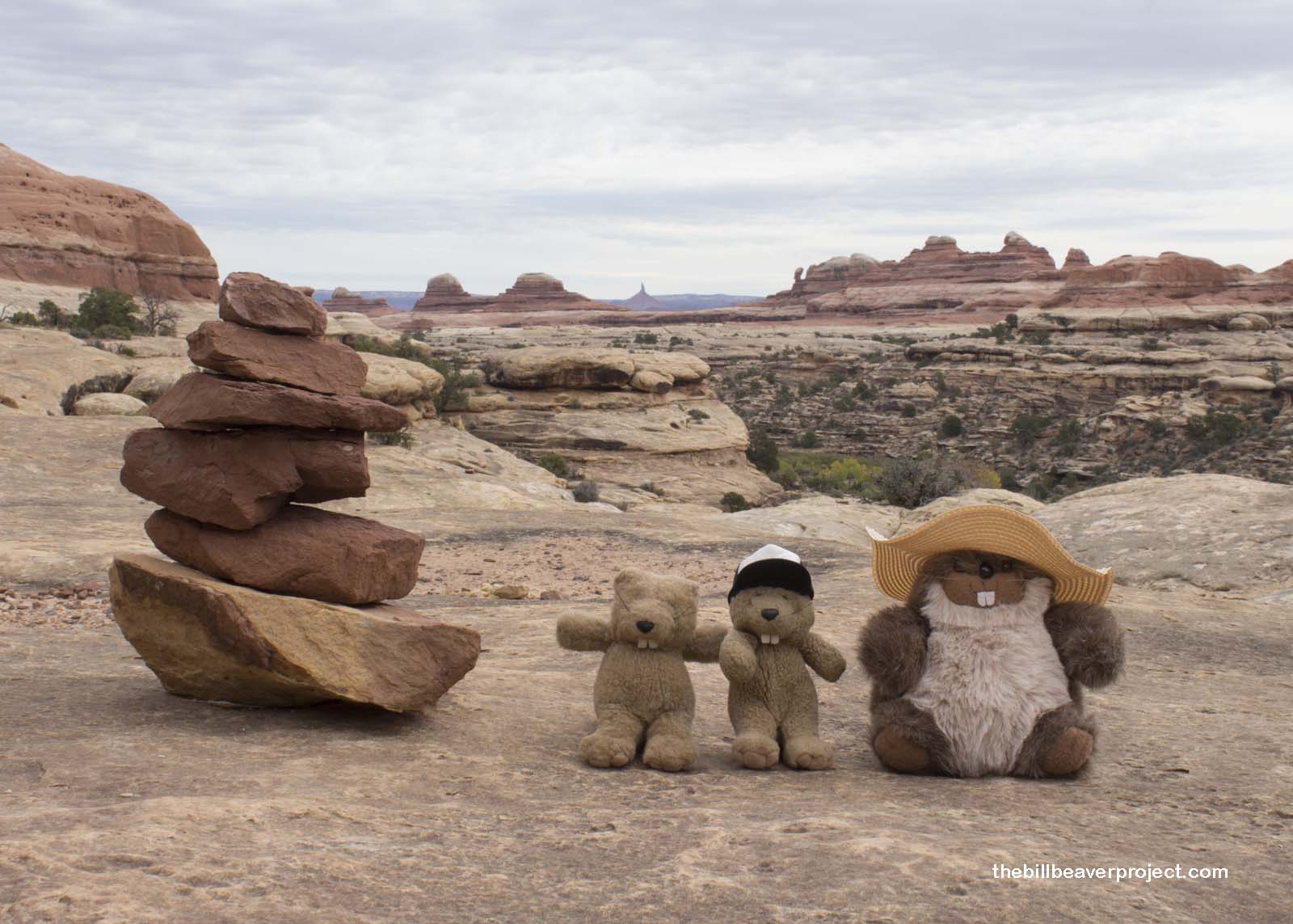
After a couple of miles, the trail started to climb up onto the red rocks and disappeared, replaced by cairns, small stacks of stones showing us where to go! Most of our hike from here on out was going to be guided by these cairns. We’d need to be extra vigilant to avoid getting lost!
 |
Some thin clouds rolled in, which made us wonder about storms and flash floods, super dangerous in the desert. They didn’t build, though, and they kept the temperature cool, with occasional gusts of wind that sent Mom chasing her hat across the massive red rock amphitheater we were traversing!
 |
The higher we climbed, the better the view became! Off in the distance, we spotted Six Shooter Peak, which looks and sounds like a gun when struck by lightning! There was also a neat balancing rock way off in the distance that looked like a pharaoh’s head or an alien!
 |
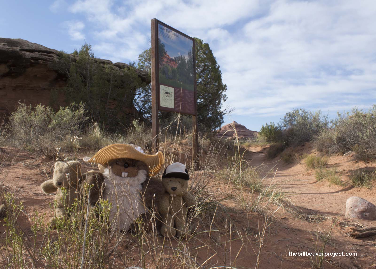
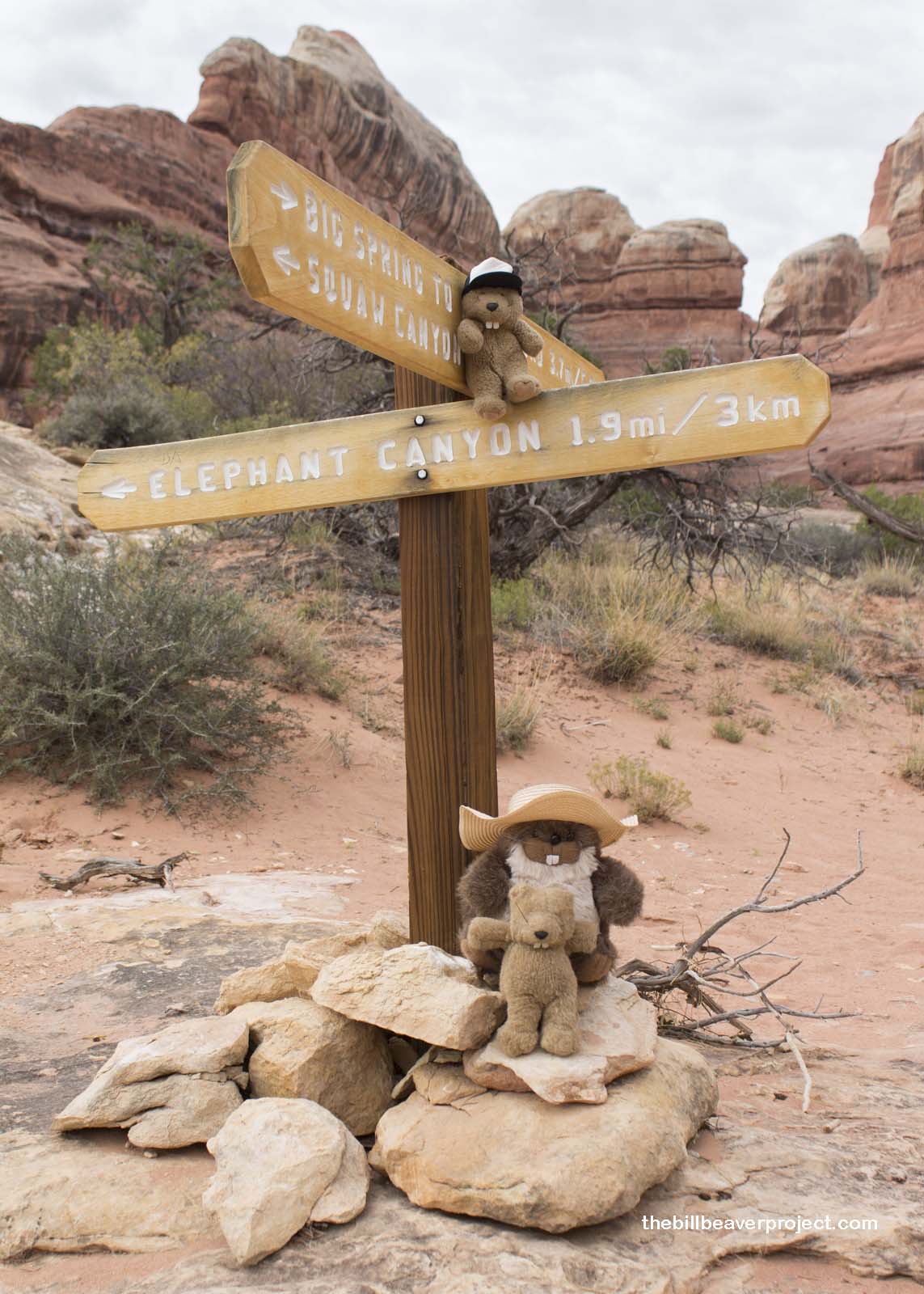
Among the cairns, we encountered a wooden sign pointing us toward our next canyon: Elephant Canyon, named for huge, round, sandstone formations that look like elephant backs! To get there, we would have to face some obstacles, and our fears. Woodchuck would definitely not have enjoyed this hike!
 |
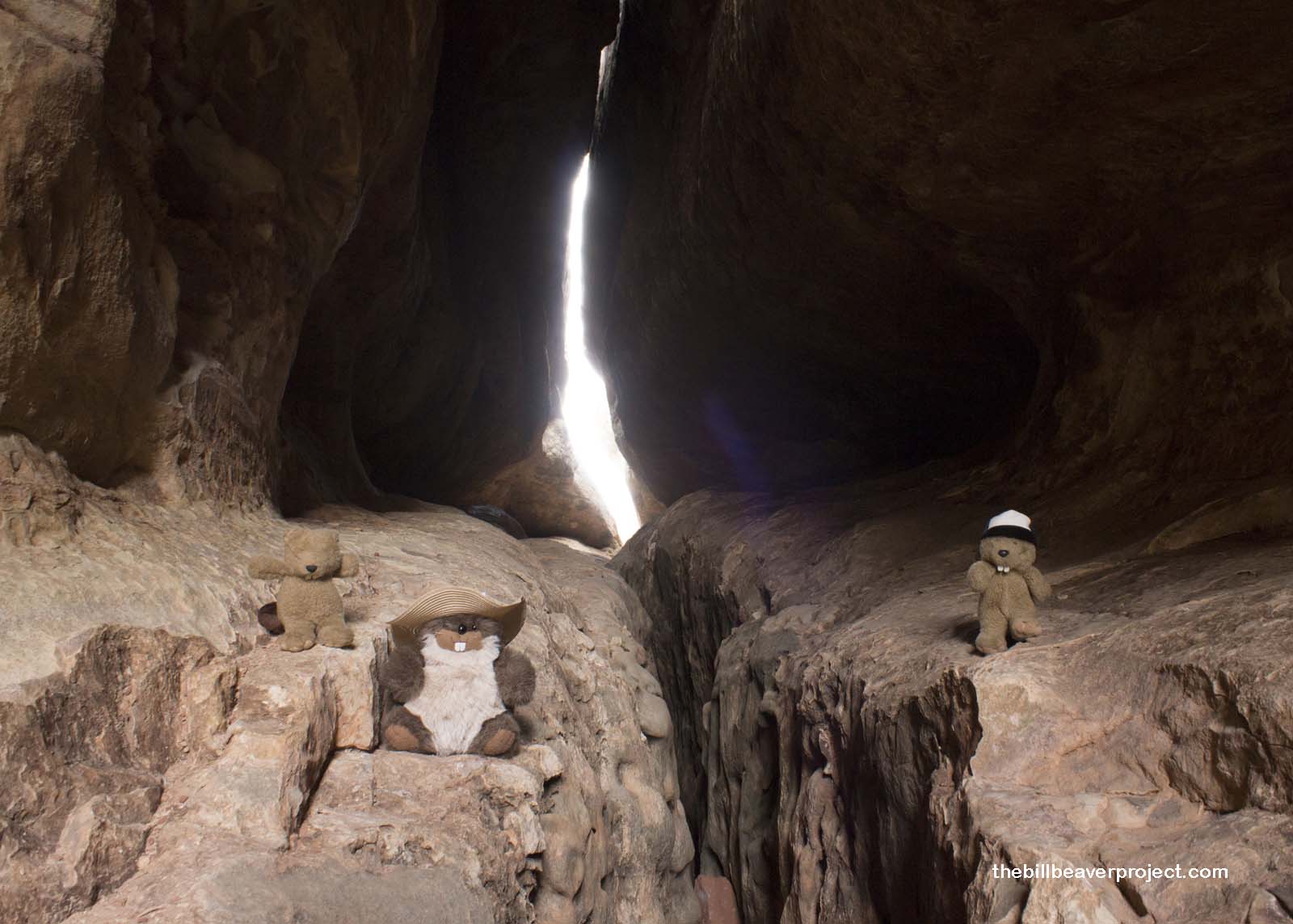
First, we had to pass through a slot between two huge boulders! They were close enough for the average human to squeeze through, but we were going to have to hop from wall to wall, bounce off a log that had wedged between the boulders, and land safely on the rocky shelf just beyond! If we missed, we’d fall into an abyss that stretched down who knows how far into unknown darkness!
Mom raised us to be great jumpers, though, and apart from a scary scramble midway through, we all reached the shelf, only I’d gone to the wrong side! Luckily for us, the abyss rose up and turned into a pathway, so we were able to reconnect a few steps away.
 |
We climbed higher and higher on the slickrock, checking potholes for tadpole shrimp and peering up mysterious side canyons, wondering if anyone had set foot up them in a long time! Tempting though it was to explore, it’s not wise to journey too far into unknown territory if you’re only prepared for a day hike!
 |
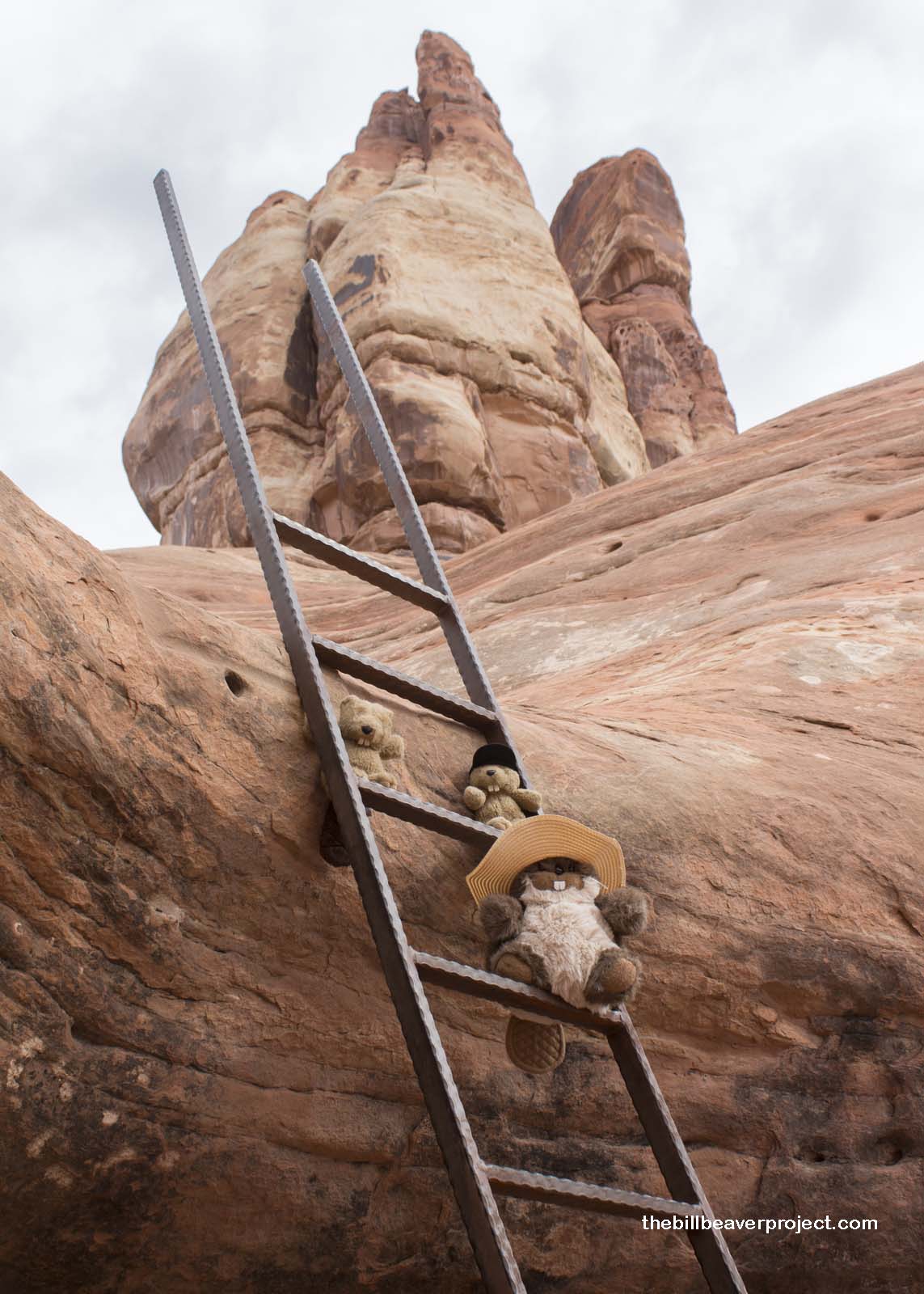
Moments later, we reached the ladder that would take us into our next canyon. We could hear the wind whipping over us, nerve-wracking as we climbed carefully up the human-portioned ladder into the sky. Once we crested the saddle, we dropped down one more ladder into Elephant Canyon!
 |
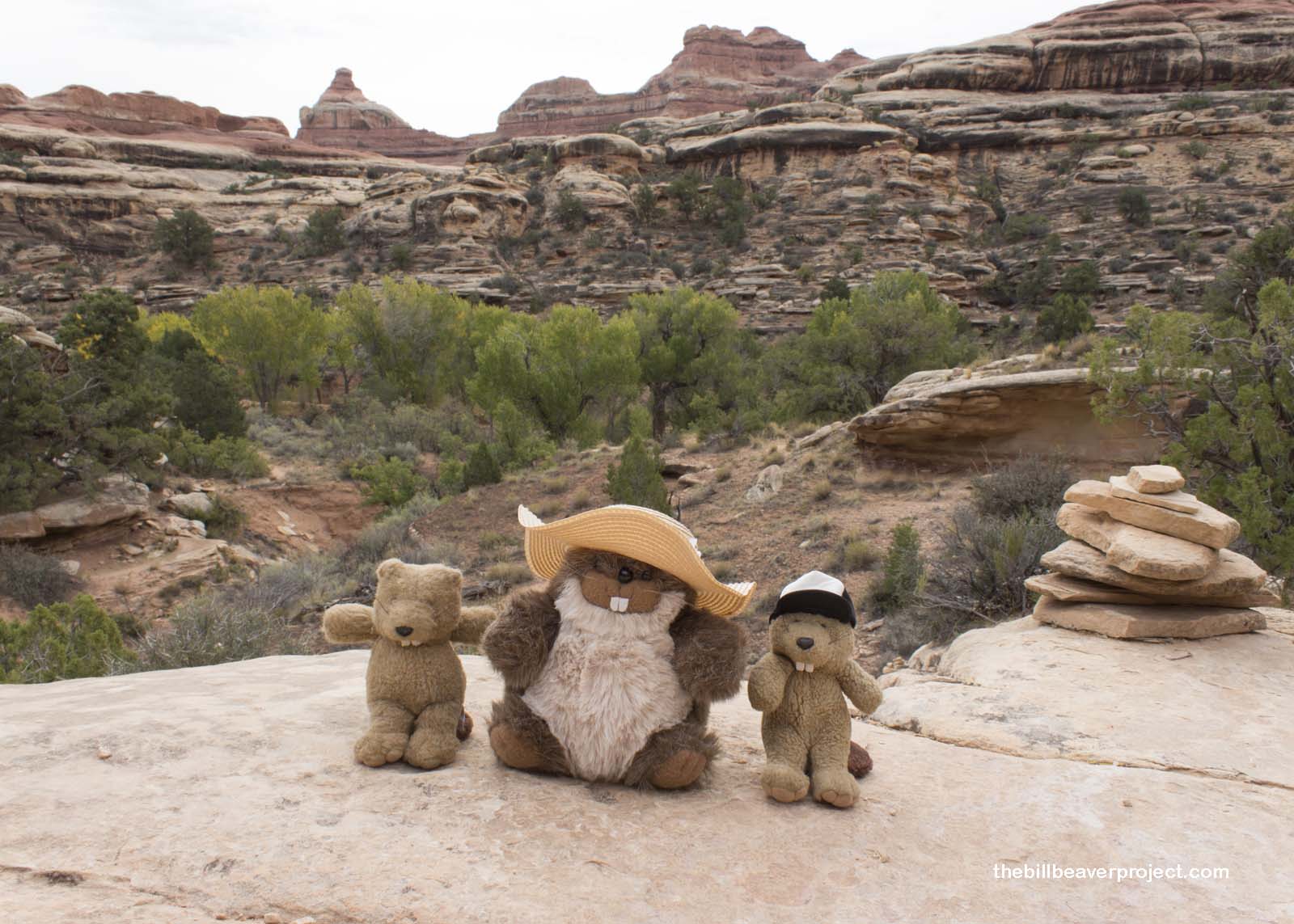
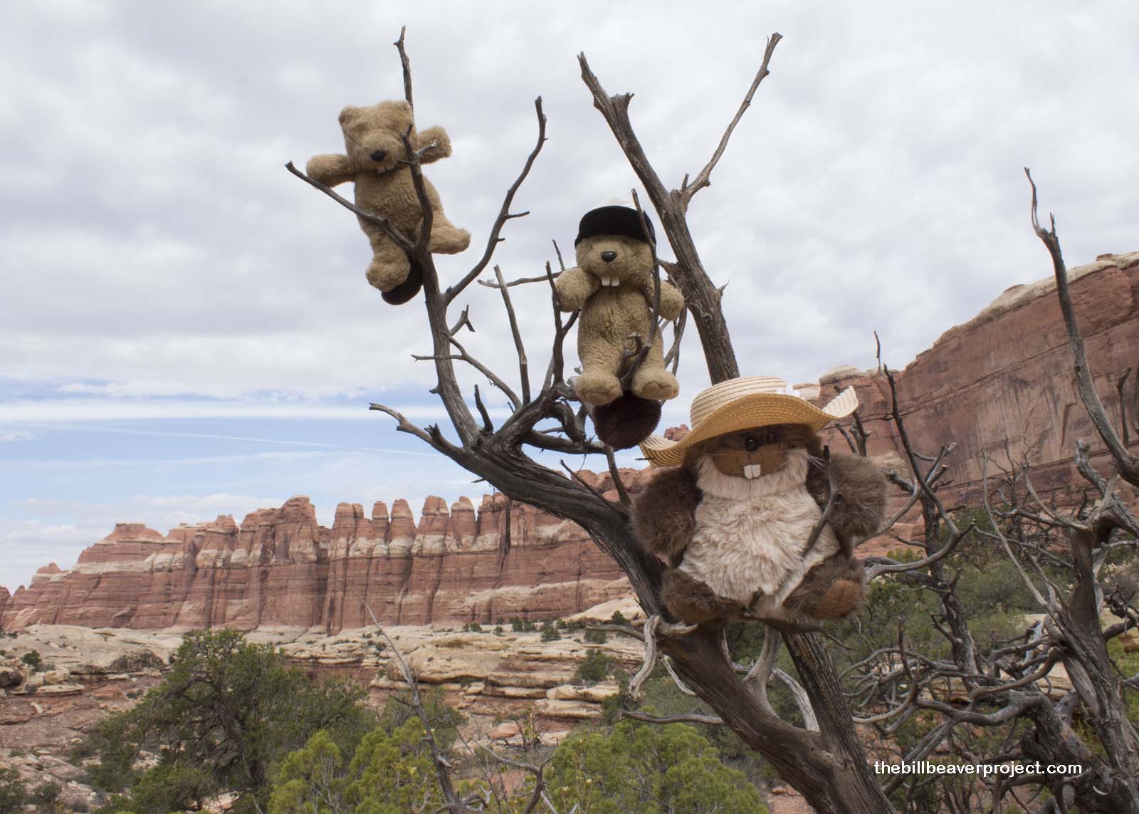
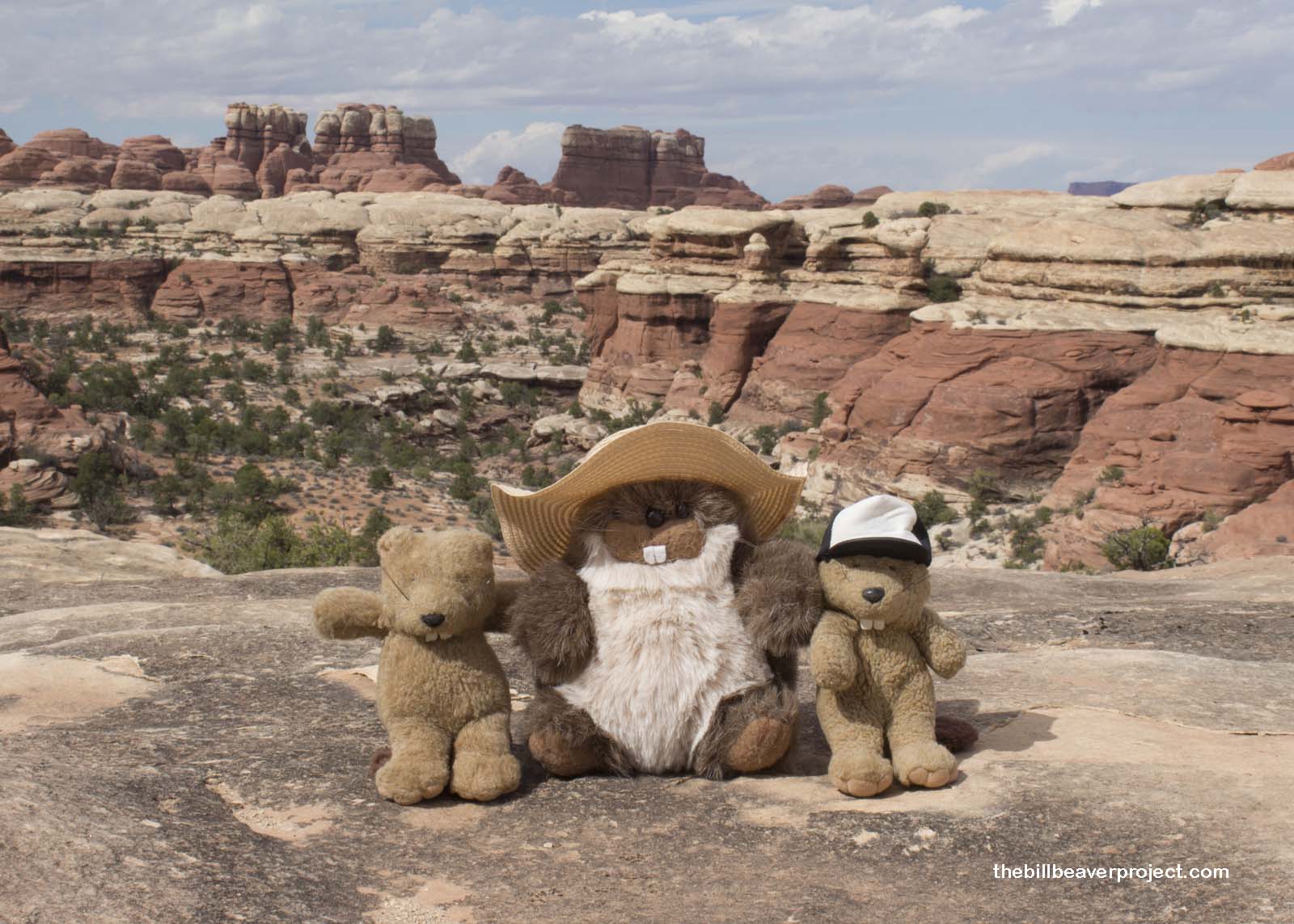
Here, we were able to really enjoy the towering needle-like formations that give the Needles District its name! Red, white, and red again, they looked to me like a candy cane factory! These color layers formed from 200 million year old sand dunes on the edge of a shallow sea. Red soil from distant floods mixed with the white sands and gradually hardened into sandstone.
Then, 20 million years ago, the Earth’s crust got pushed up, and a combination of wind, water, and a moving layer of subterranean salt called the Paradox Formation caused parts of this stone to fall away and form the amazing needle formations ahead of us!
 |
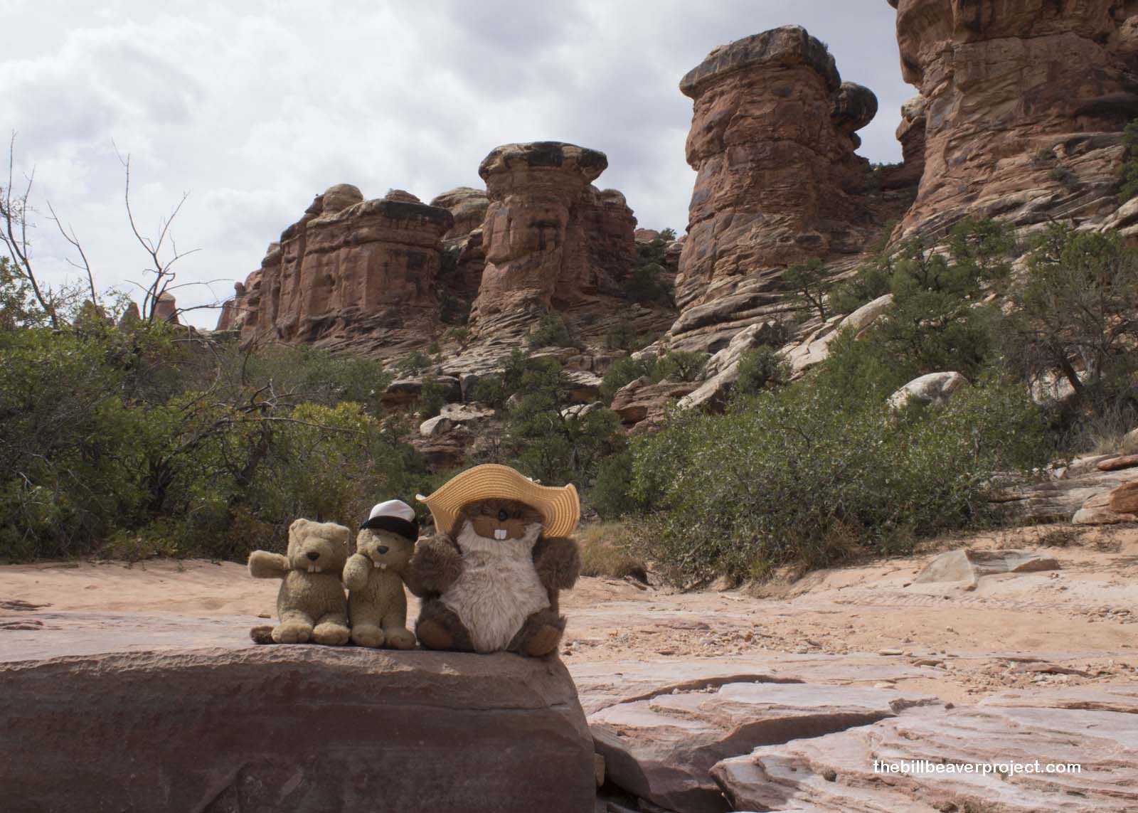
These formations captured our attention so much that it took us all by surprise when Flatty pointed out that the cairns and footprints ahead of us had all disappeared! We’d lost the trail, and we were supposed to meet Woodchuck back at the parking lot for lunch!
Searching for cairns on the cliffs lining the riverbed, we backtracked as fast as we could, hoping to find the trail quickly and not worry Woodchuck too much. Mom laughed at our concern and said she should be the one worrying about all of us! After about twenty minutes of searching, we spotted another cairn where the trail had crossed the riverbed. It wasn’t very well marked at all!
 |
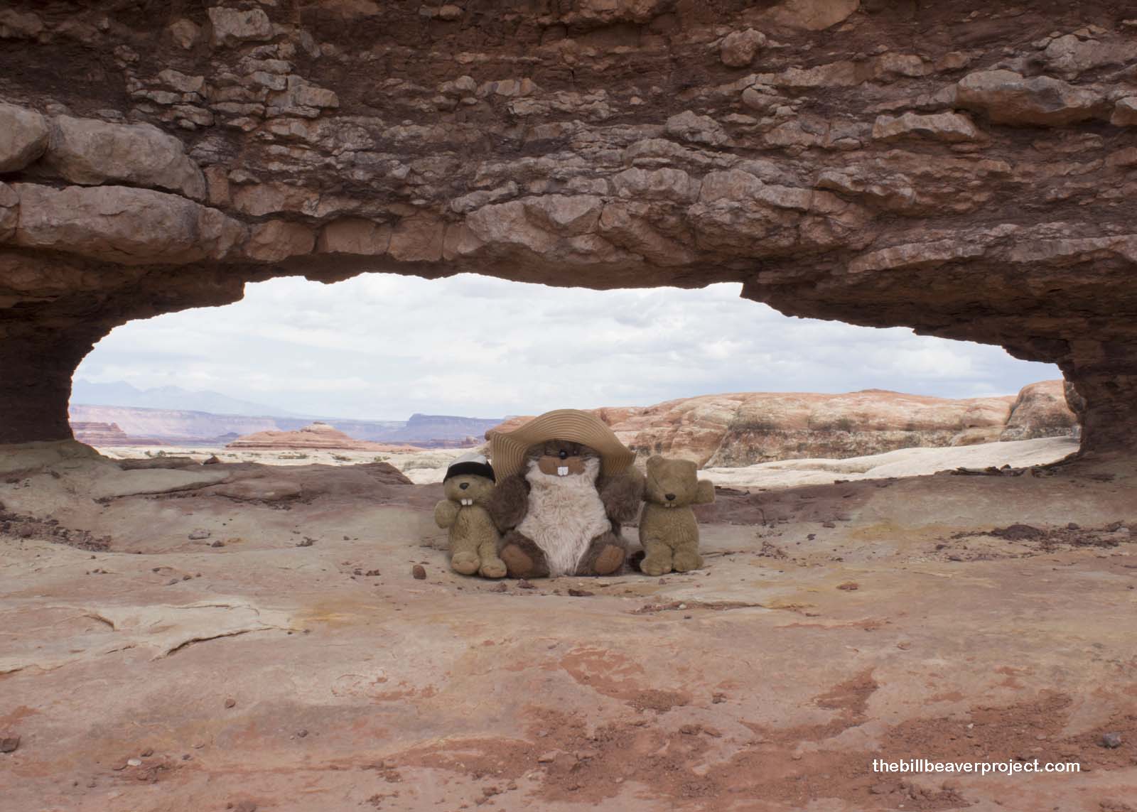
With four miles left, we pushed ourselves to play catchup, just as the trail turned steep! We wheezed up sheer switchbacks that reminded me of Baegundae and over hills, through a lovely desert “garden” among the spires. We took a breather at a proper beaver-sized arch with a great view, then continued our downhill jog!
 |
The sun peeked back through the clouds as we made our last climb out of a basin, huffing and puffing. From the top of the ridge, we spotted the trailhead off in the distance and took off, fueled by our hungry bellies! Nonplussed, Woodchuck looked up from his book in the shade as we careened into the parking lot and fixed us up some spinach salads with cool spring water for lunch!
 |
Over lunch, we reported back that the colors of the rocks were vivid and wonderful but that the leaves still needed a few weeks before we could celebrate Lastleaf. Woodchuck suggested we keep searching around southern Utah. Maybe there would be some better leaves at higher elevations. We agreed to start by moving on to the next national park unit to the south: Natural Bridges National Monument!
Traveling on!

Previous Day |
Total Ground Covered: 425.9 mi (685.4 km) |
Next Day |