 Previous Day |
Chinle → Chaco Culture NHP 170 mi (273.6 km) |
 Next Day |
Good morning, everyone!
We spent last night enjoying the rustling of leaves through the trees at Cottonwood Campground just inside the border of Canyon de Chelly National Monument! From our vantage point, we had no way of seeing the deep canyon containing at least nine ancient ruins from the Ancestral Puebloan people, so right after breakfast, we headed over to the South Rim Drive for a closer look!
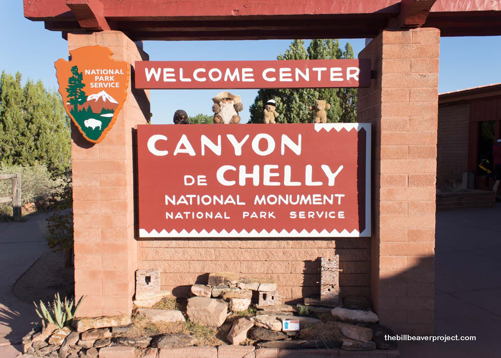 |
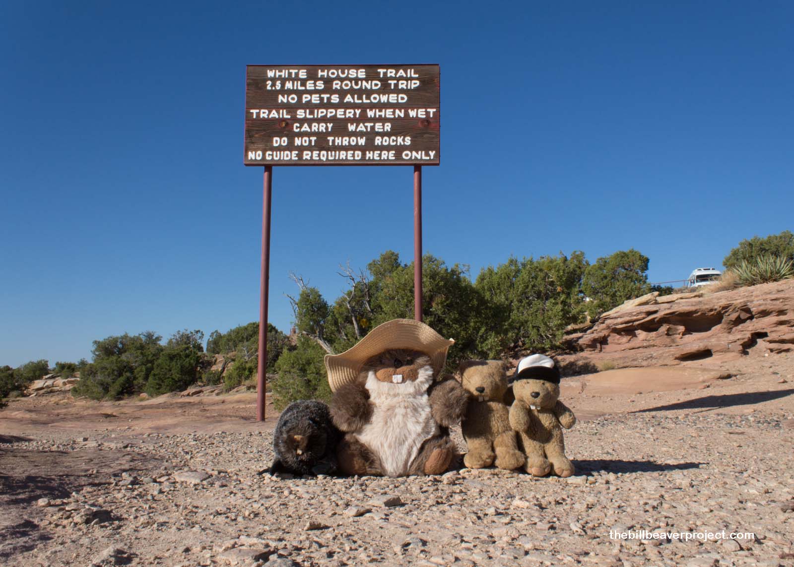
This is one of the most visited national monuments in the country and the only one that is owned entirely by the Navajo nation! Like Monument Valley, it’s mostly closed off to visitors unless they’re on a tour, but one trail, to White House Ruin, was open, and we were going to check it out!
 |
Canyon de Chelly (“shay”) sounds like it’s named after a French explorer named Chelly, but it’s actually an Americanized Spanish term for the Navajo expression tseyi’, which means “canyon.” Basically, this monument is named Canyon of Canyon!
The Navajo had made their home here for centuries until Kit Carson led an invasion in 1863, scorching crops and hogans and seizing 200 sheep! This invasion followed a series of raids by the Ute tribes, and the overwhelming losses led to Navajo surrender. They were forced on a Long Walk to Bosque Redondo, New Mexico, during which some 300 of their people died.
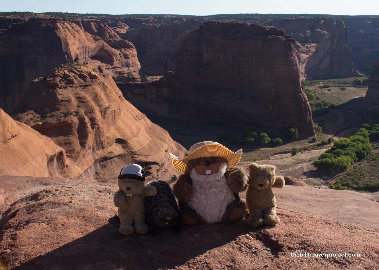 |
Today, though, as we descended into the canyon, we passed several Navajo craftsfolk hiking up and down the trail and exchanged pleasantries (the Navajo word for “beaver” is chaá). Thanks to a change of thinking, over forty Navajo families reside in the canyon! We could see at least one of their homes with crops and turkeys as we wove our way down the switchbacks…
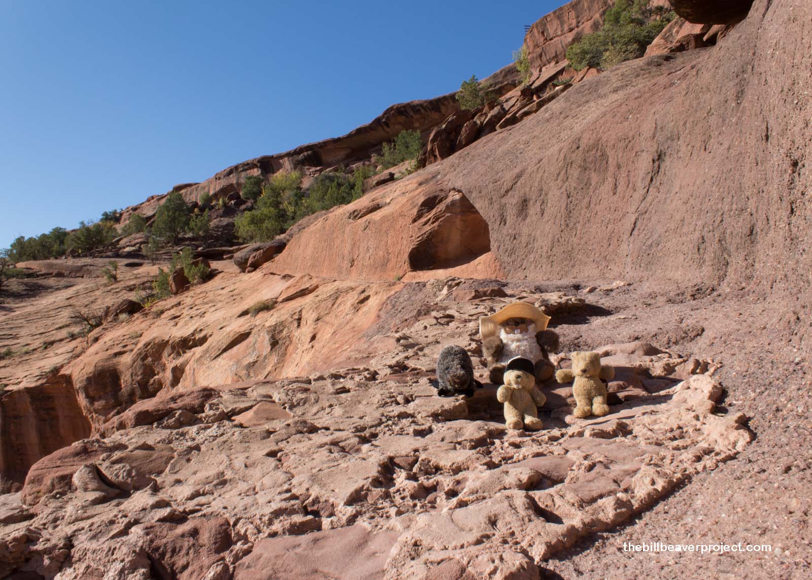 |
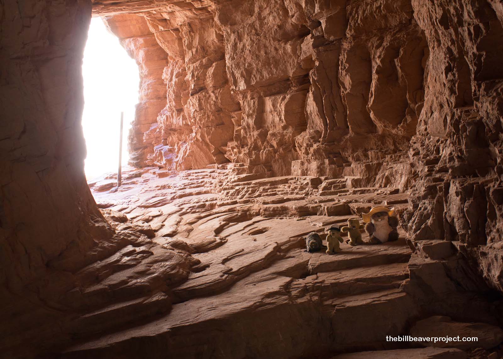
…and through a tunnel carved through the rock!
 |
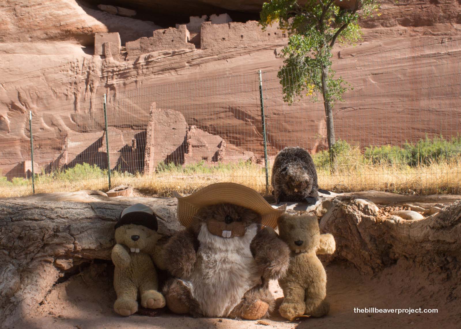
And at last to the White House Ruin, a two-part structure spread over the ground and up on the cliff. It sure didn’t look very white or Washingtonian to us, but apparently the back wall behind the upper ruin was plastered white at one point! We weren’t able to go up to it because of the fence, but after walking past so many names carved into the rocks on the way down, I was glad this place will be preserved.
 |
We spent some time enjoying the fall temperatures, and Mom spent some time browsing jewelry and crafts on sale by a few members of the renowned Yazzie family. There were intricate vases and turtles textured by horse hairs dipped in paint! There was even one fellow named Teddy who told us he stumbled upon a photo of his mom holding his older brother in an Ansel Adams book! Mr. Adams had taken lots of photos of Canyon de Chelly and its residents when he visited in 1937. Like many photo books, this one describes the Navajo woman but doesn’t give her a name. Apparently, her name was Rose Chee Henry!
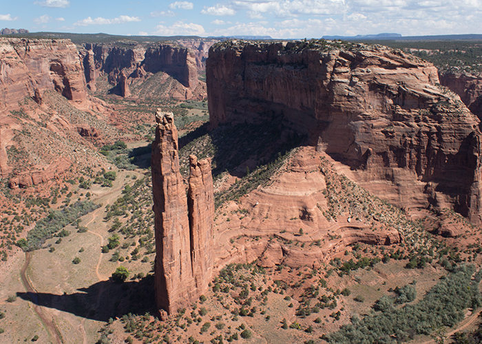
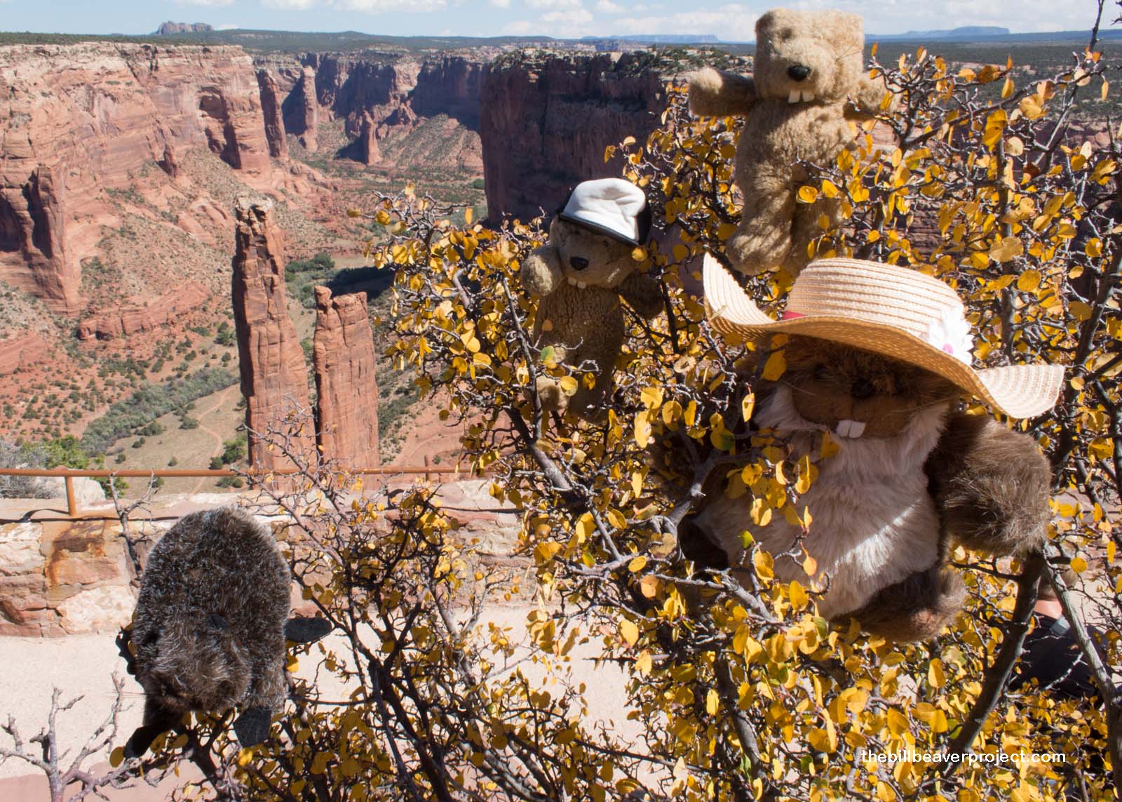
After hiking out of the canyon and having a tasty lunch, we detoured to the Spider Rock overlook, where the wind was a-whipping! We had to hold on to the tree branches just to keep from blowing over the cliff, but it was worth the view! These two giant stone spires were once believed to be the home of Na’ashjéii Asdzáá, the Spider Grandmother who spun a web in the sky and collected dew to make the stars!
 |
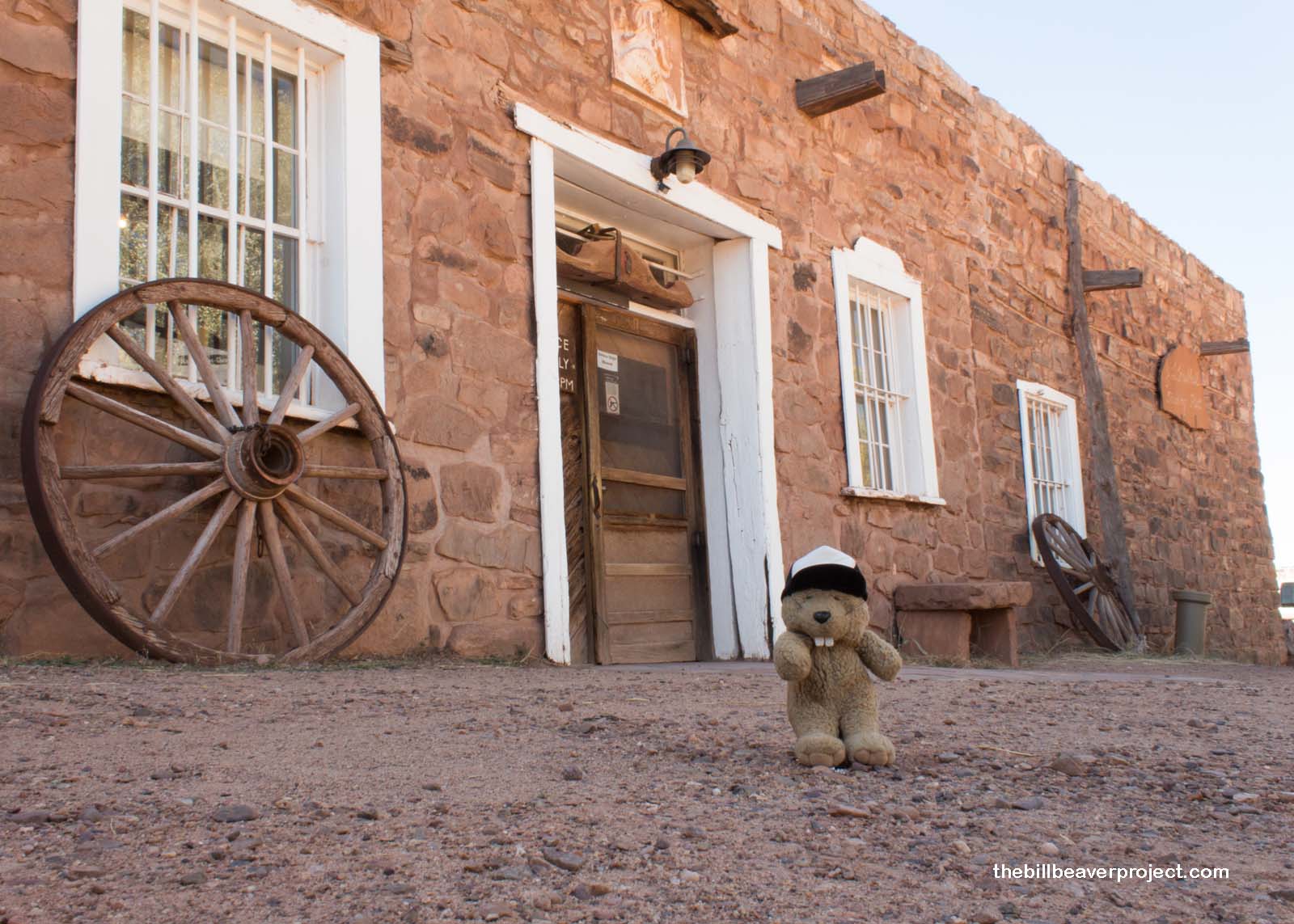
From there, we had some ground to cover, heading south toward the Arizona-New Mexico border, stopping briefly at the Hubbell Trading Post, so I could jump out and grab some chocolate! This trading post, the oldest in the Navajo Nation, has been in operation since 1878! John Hubbell settled here as the Navajo were finally returning from their exile and built a trading empire with the tribe! He introduced many new items, like coffee, to the Navajo, and encouraged them to produce amazing artwork to sell for profit!
 |
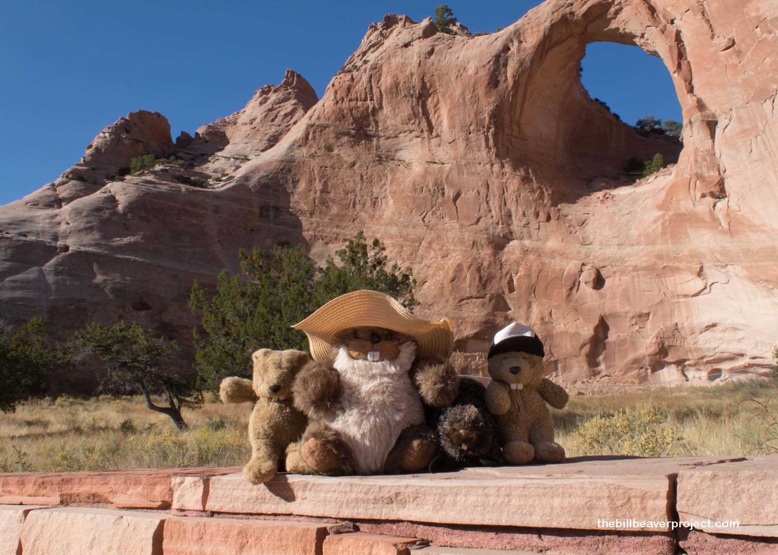
A little further down the road, we came to the capital of the Navajo Nation, Window Rock, named for an arch on a rocky hill that looked just like the skull of a sleeping dragon! In the Navajo language, it’s called Tségháhoodzání (“perforated rock”), and it’s where medicine men used to come and collect water running off the sandstone. They would use this water in a ceremony called Tóhee to encourage abundant rain during the year!
 |
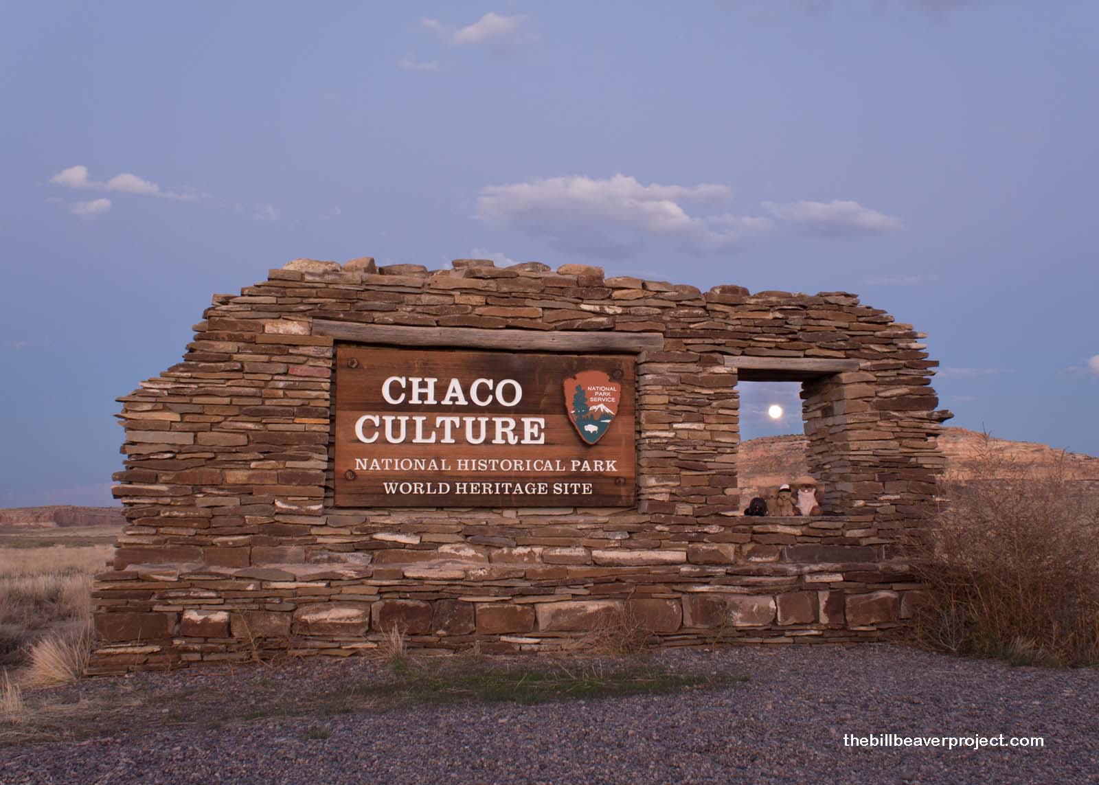
Then, we crossed over into New Mexico, winding our way up to the famous pot-holed road leading to Chaco Culture National Historical Park, a UNESCO World Heritage site. The sun set right as we entered the park, and the full moon rose right behind the sign!
 |
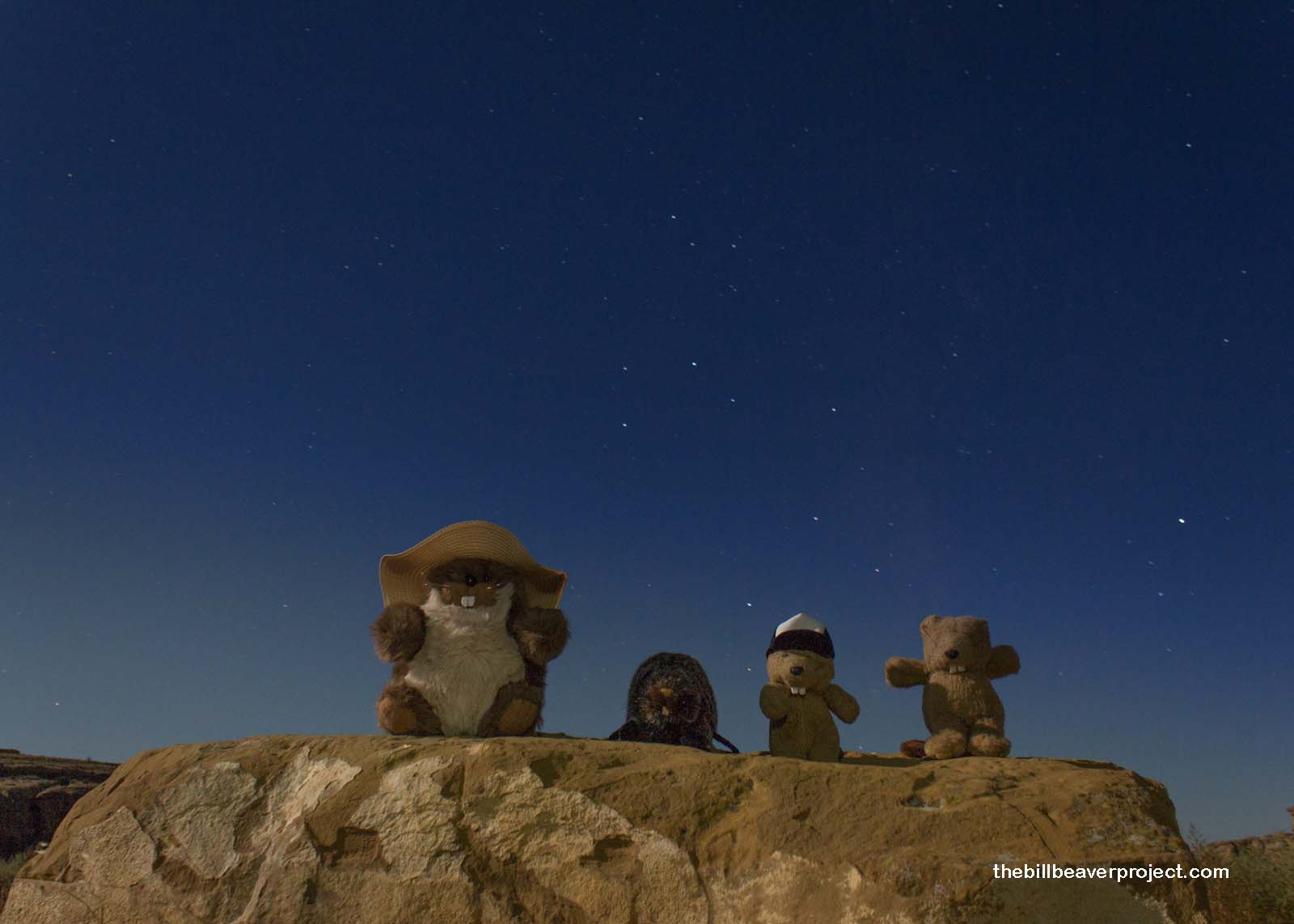
On moonless nights, Chaco Culture is an International Dark Sky Park, one of the best places to view billions of stars almost exactly as the original residents viewed them, but tonight, we had a much brighter light getting in the way. Oh well!
 |
After a nice supper and some marshmallow roasting, we tucked ourselves in to bed, ready to be up and at ’em first thing when the gate to the park’s scenic loop opened. We could only hope that the weather would be nice!
Chelly ya later!

Previous Day |
Total Ground Covered: 887.9 mi (1,428.9 km) |
Next Day |