 Previous Day |
Flagstaff, AZ → Clarkdale, AZ → Flagstaff, AZ 224.0 mi (360.5 km) |
 More 2016 Adventures |
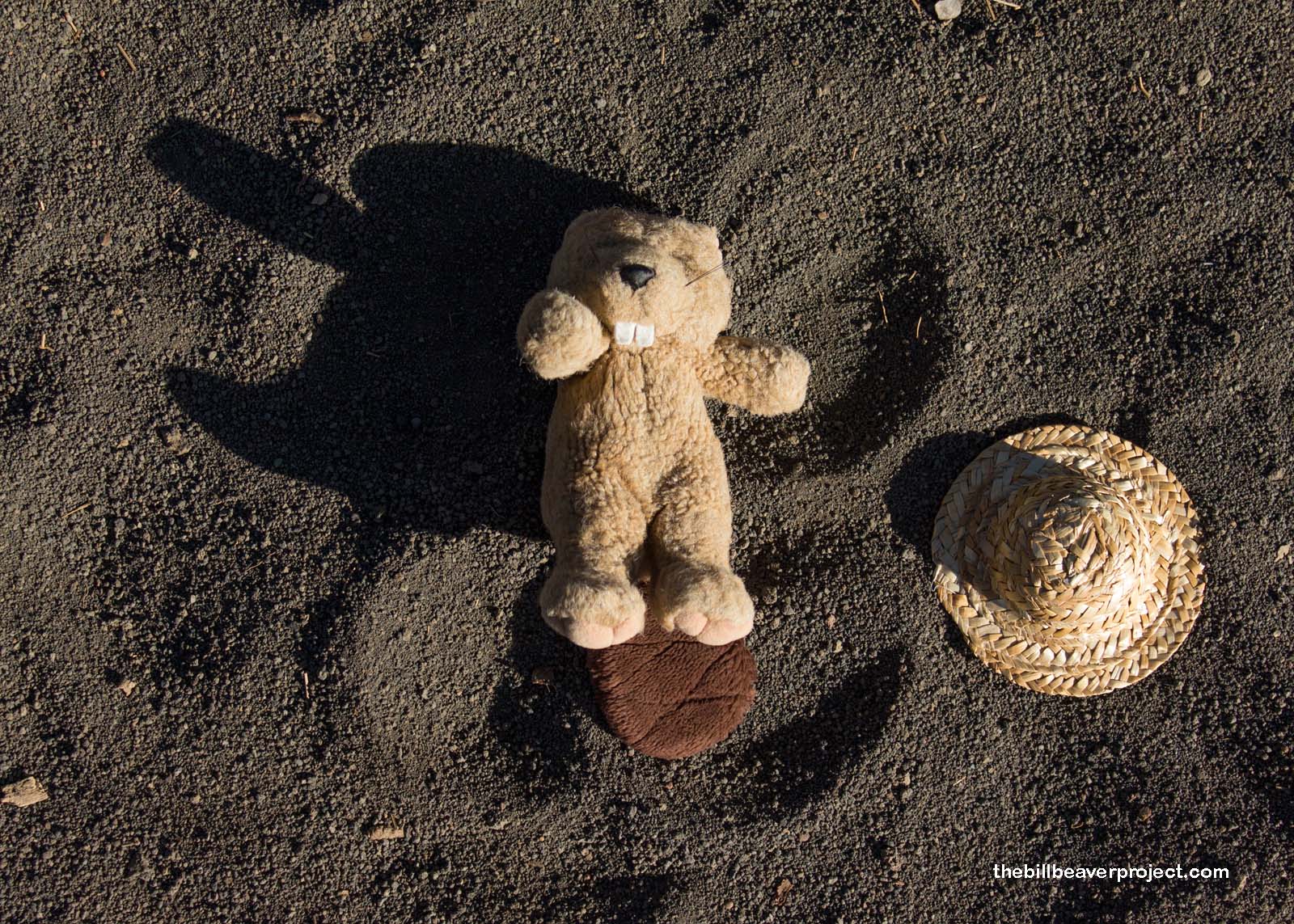
Ha’u, everyone!
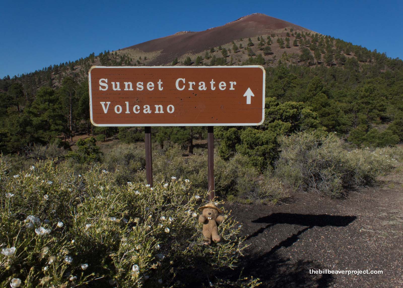
This morning, I was up with the sun once again to make the most of my last day exploring the national monuments of Coconino County, five on the docket for today! I checked out of my AirBNB before the sun came up and headed north to a place more associated with the dusk than the dawn: Sunset Crater Volcano National Monument!
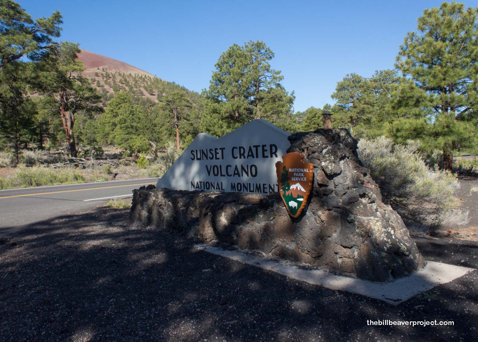 |
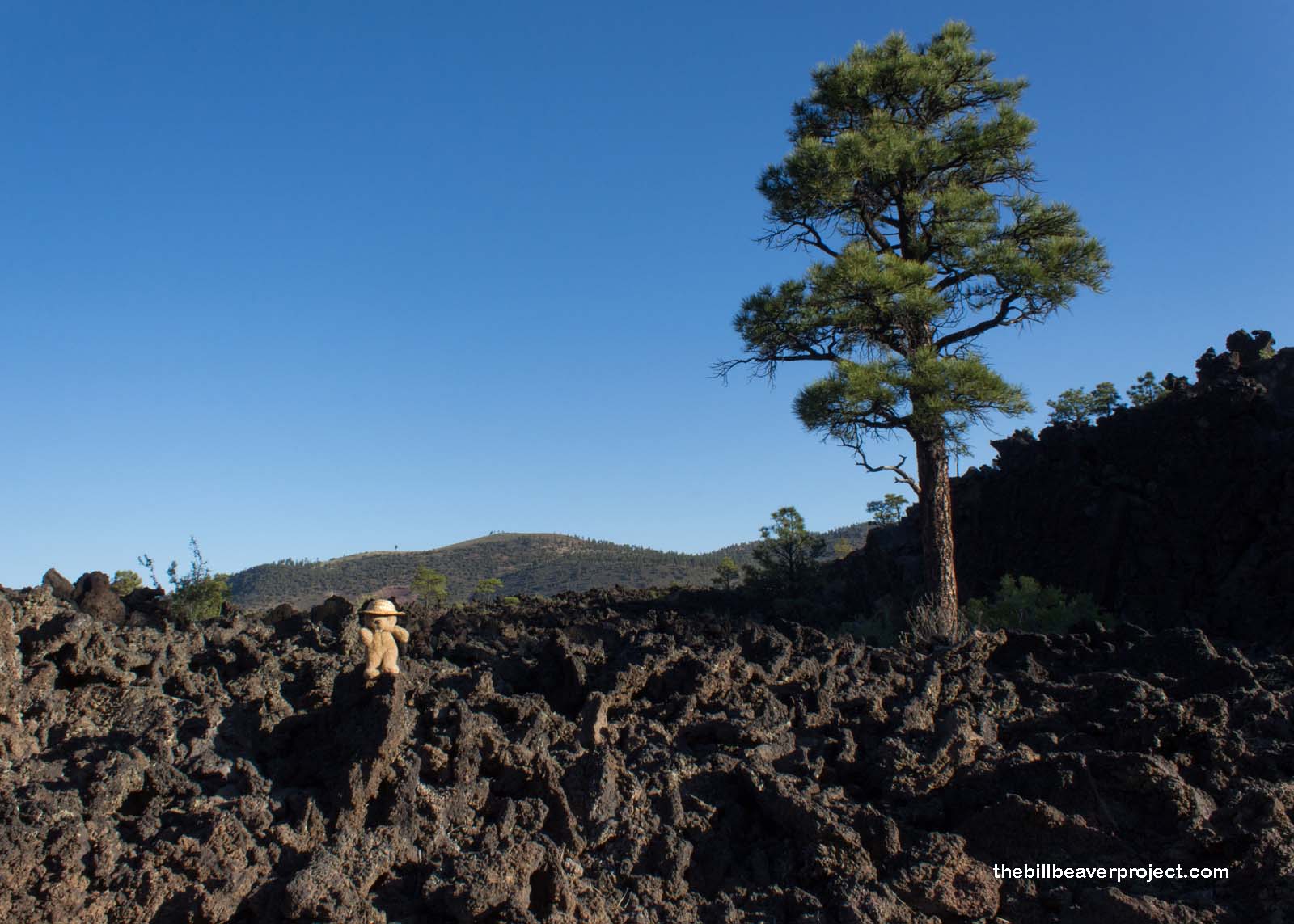
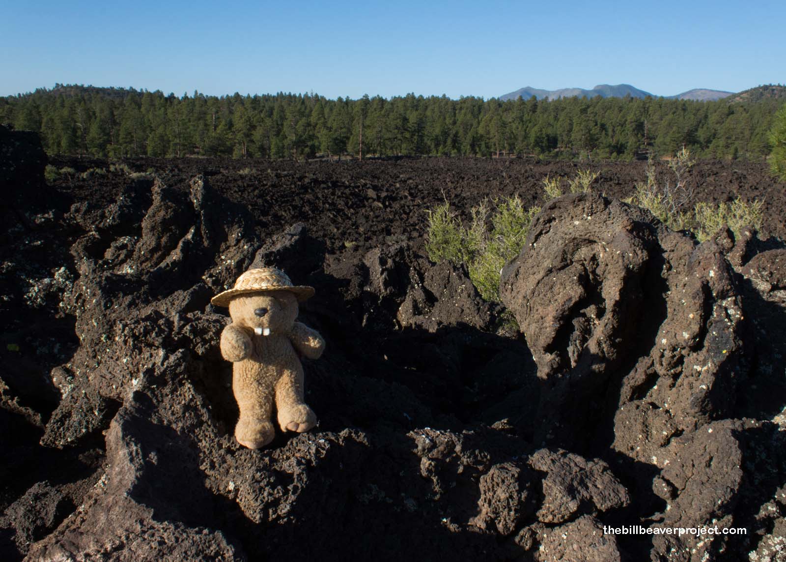
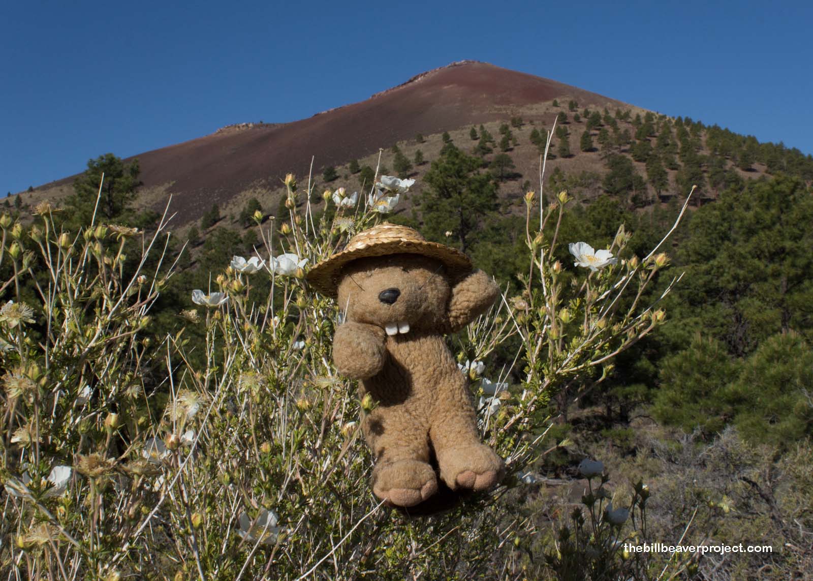
My entrance to this tiny monument kicked off with a field of destruction, vast stretches of jagged lava rocks speckled with sparse, hardy plants like rabbitbrush and ponderosas. This was part of the Bonito Lava Flow, the remains of an enormous eruption that took place in roughly 1085 CE! It was colossal with a 5-mile high ash cloud that could have been seen from as far as modern Las Vegas, Durango, and Tucson! Its ash and lava covered a 900-square mile swath, up to a hundred feet deep in some places, which forced native folks across the region to pack up and move! Amazingly, this was just one of over 600 cinder cones making up the San Francisco Volcanic Field!
 |
 |
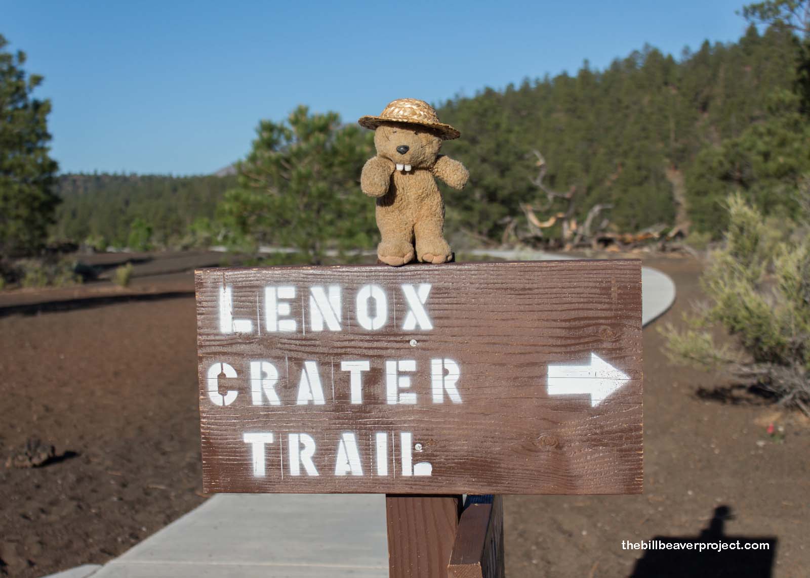
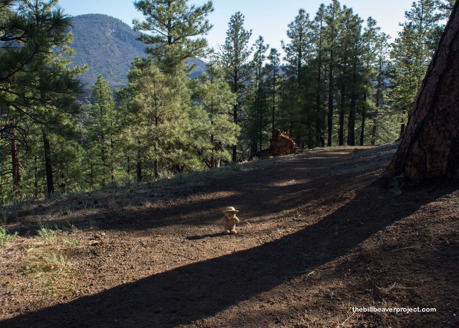
Today, there are no trails to the summit of this monument’s namesake cinder cone. It was closed in 1973 because it had been too popular among hikers, whose feet had irreparably eroded the summit! I was determined to get as close as I could, in any case which meant tackling the 1.6-mile Lenox Crater Trail. This one led me up crunchy, gravelly slope through the ponderosa forests that had reclaimed this blasted land!
 |
 |
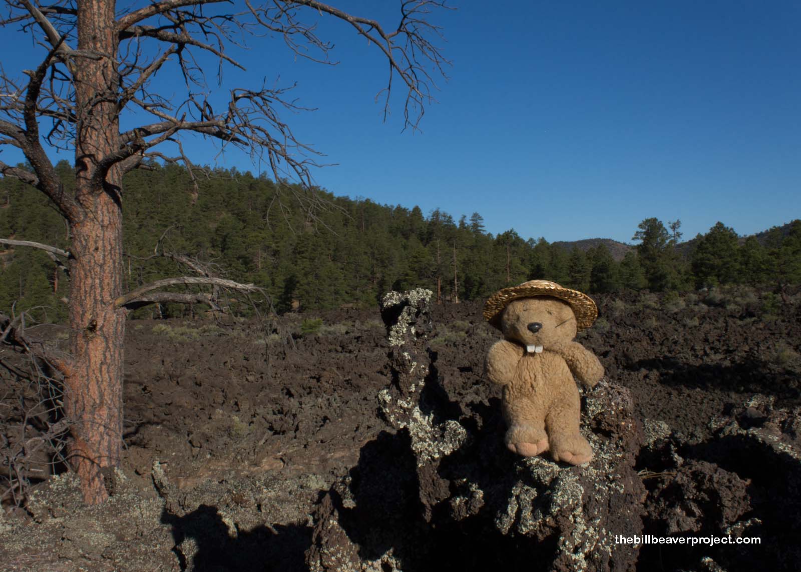
Along the way, there were more views of the lava field, including a great example of the first life to reappear after any volcanic eruption: lichen! These understated plants, along with mosses, don’t need soil to grow, but once they start to die, their remains, along with the lava rocks they’ve started to break down, create rich, new soils that enable other plants to take root! I don’t know about you, but I sure am lichen these plant-based pioneers!
 |
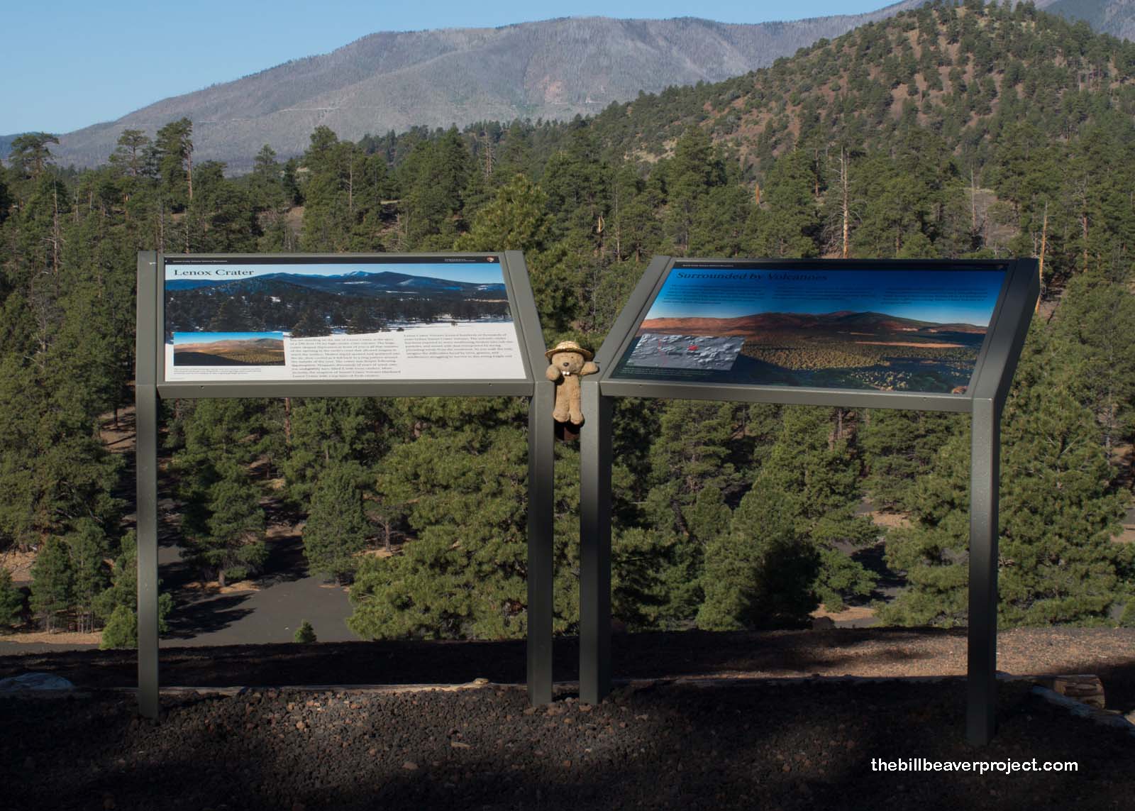
The Lenox Crater is actually hundreds of thousands of years older than Sunset Crater, so old it was hard to make out the shape at the overlook. It’s filled in not just with thousands of years worth of rain, ice, and landslides, but also the flow of its younger cone-panion, now little more than some hills in loose circular formation.
 |
But I could still tell this was an old volcano based on the dirt! Finely ground, difficult to hike in and dusty beyond belief, it was fine enough to make ash angels in! Was that necessarily a good idea? Maybe not, but when the chance to commune with an ancient volcano arises, and you’re super tired from a long hike the day before, you might as well make at least one ash angel!
 |
Although I didn’t make it to the top of Sunset Crater, I did end up with a few good looks at its deep red summit. It’s well known in these parts by the descendants of the Sinagua, who were impacted by its eruption. The Hopi call it Palatsmo (Red Hill), the Apache call it Ha Gudni Káá (Where It Burned), and and Diné call it Dził Bilátah Łitsoí (Yellow-Tipped Mountain). Their ancestors all found themselves forced from their homes by a monstrous curtain of lava and falling ash, so they left this suddenly inhospitable area to settle elsewhere!
 |
 |
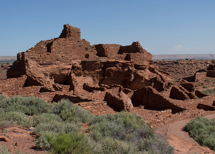
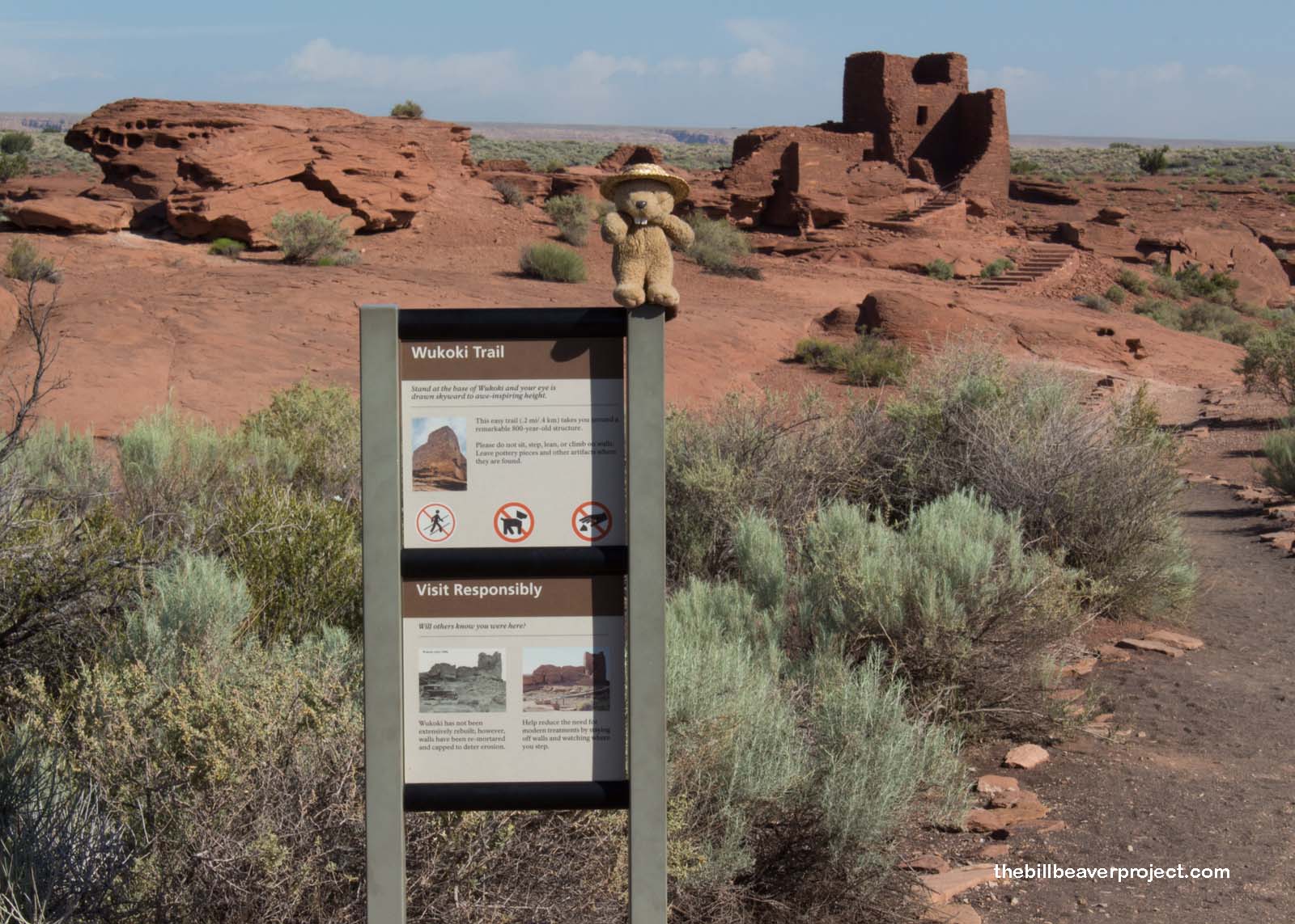
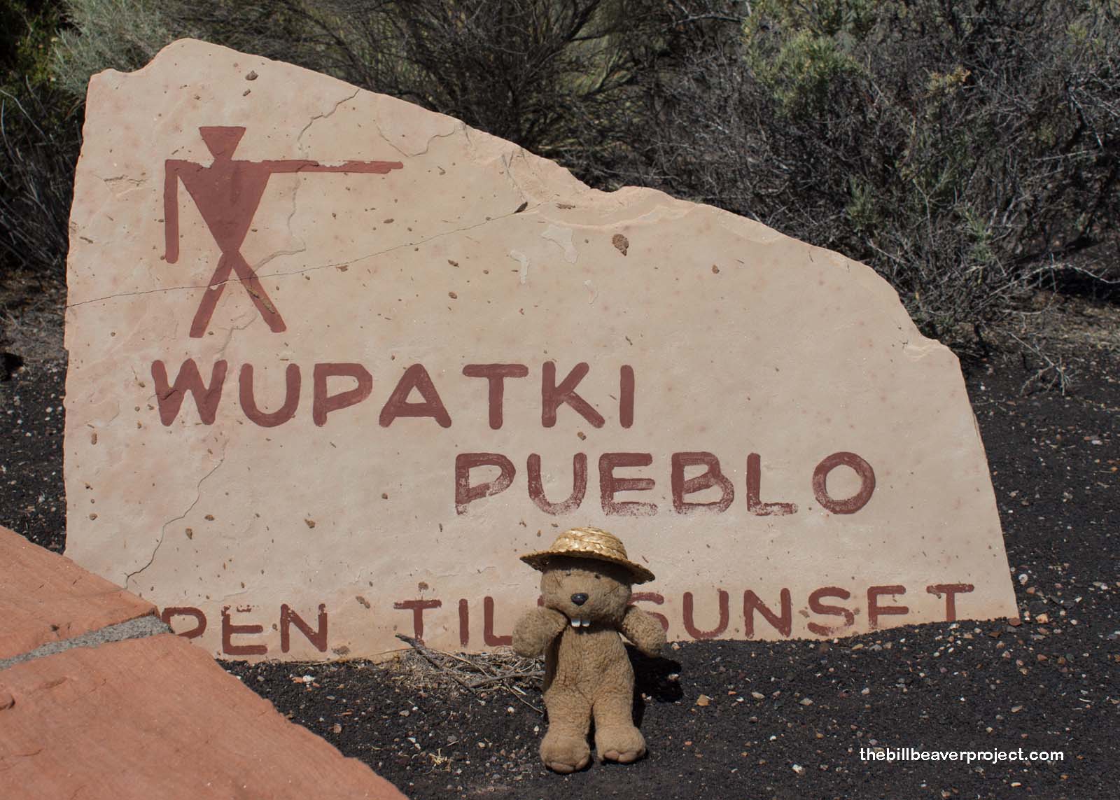
One such place was about twenty miles to the north, where those ancient folks who fled the eruption settled and rebuilt, turning pit houses into pueblos. This place became Wupatki National Monument in 1924, named from the Hopi word meaning “Long Cut House!”
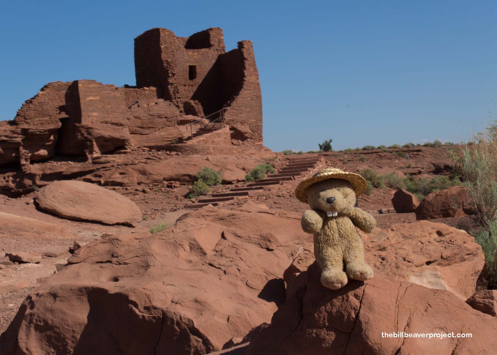
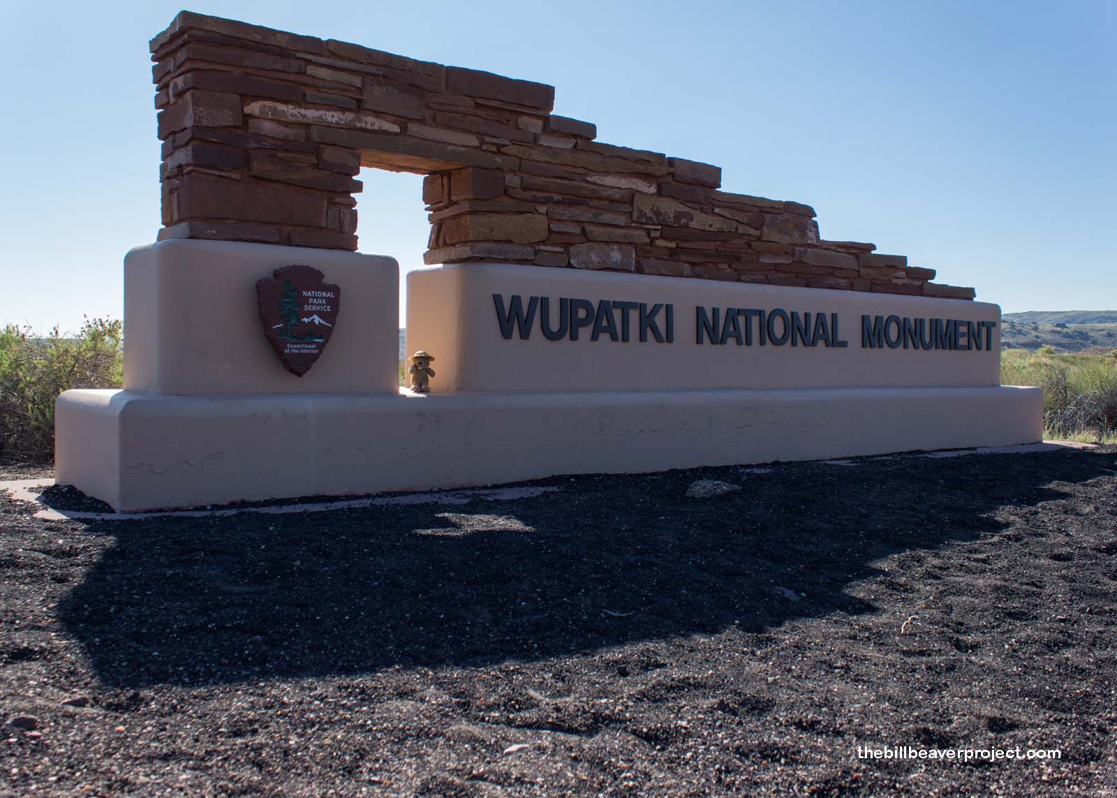 |
My first stop on the road into the monument was a pueblo with a similar-sounding name: Wukoki! Meaning “big house,” this 6-room, 3-story tower was first excavated in 1896 by Jesse Walter Fewkes, following a lead from modern Hopi folks on the reservation 50 miles to the east. Wukoki is still considered a place where the spirits of the Sinagua linger, and folks still journey here to pay their respects to their ancestors. As I stood at the door, with no sound but the desert wind, I really felt like I was on the threshold of the spirit world, like the past was moving through and around me. I didn’t want to leave!
 |
 |
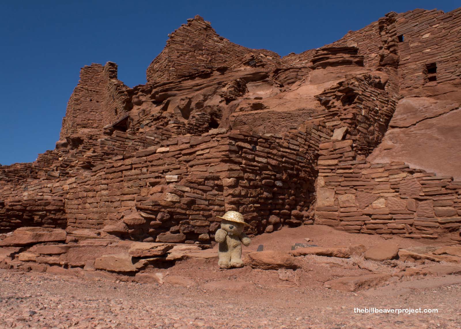
But I did eventually need to see the park’s namesake, the amazing 104-room Wupatki Pueblo, the largest freestanding pueblo in Northern Arizona! Based on studies of the tree timbers used in construction, it’s most likely that folks started building here around 100 years after the eruption of Sunset Crater Volcano! It would have been a major trading and cultural center into the 1200s CE, when heavy drought upended civilizations across the Southwest!
 |
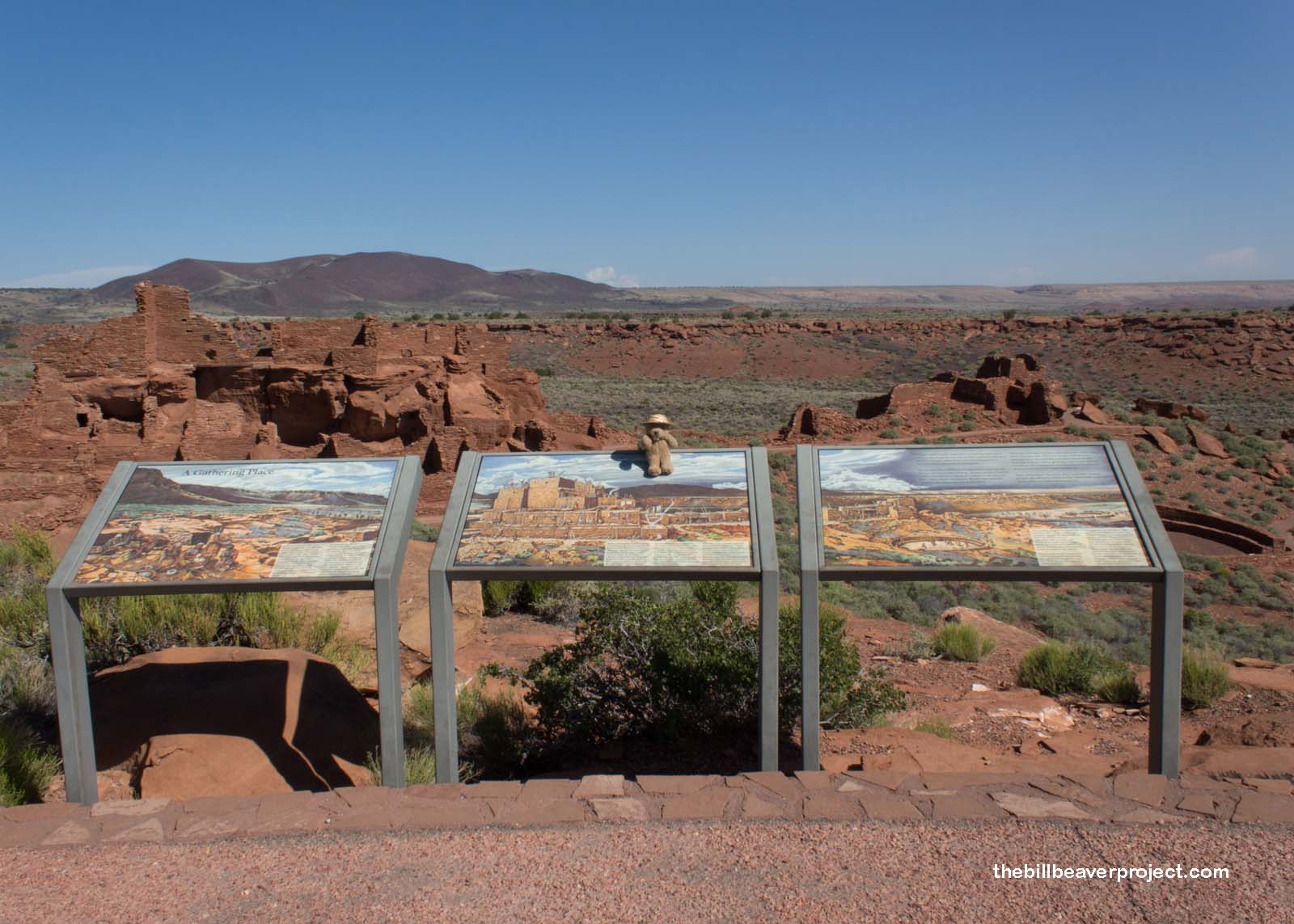 |
There were a few other visitors wandering the paths around Wupatki Pueblo this morning, so it didn’t have the same mystical feeling as Wukoki, but this place is also revered by three different tribes and at least seven clans of Hopi, in whose language all sites in this park are named.
 |
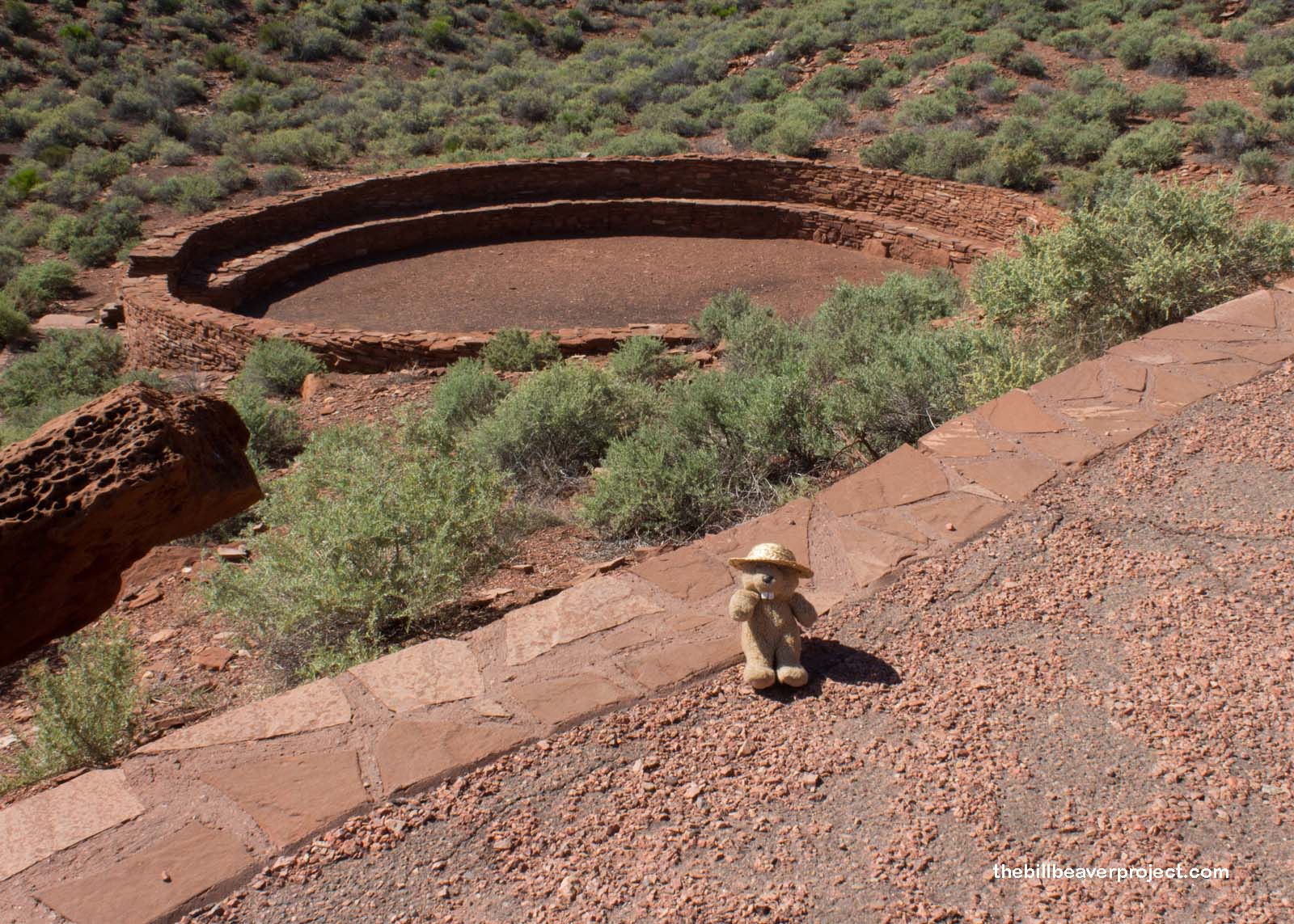
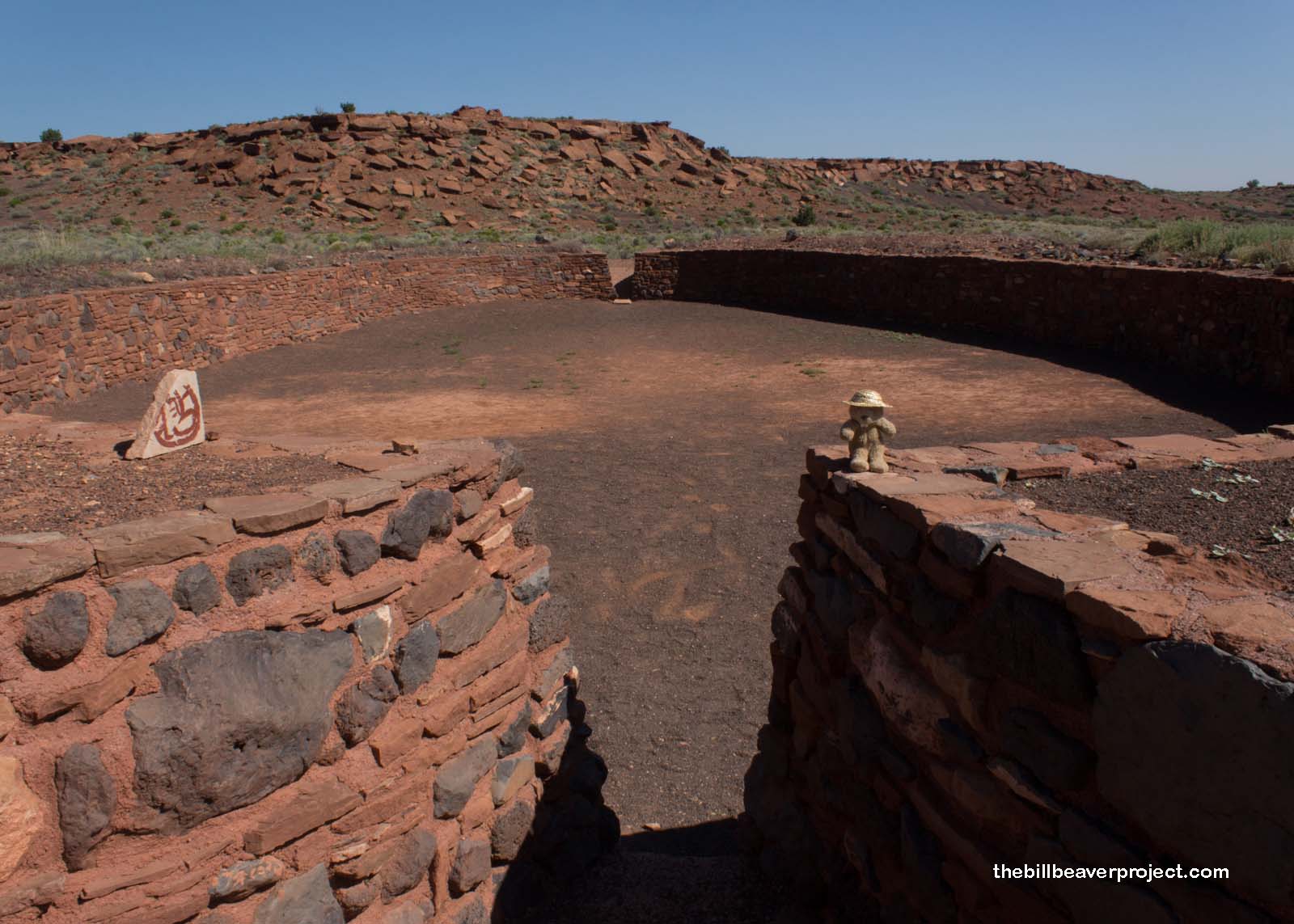
There was so much more to this pueblo than just living space, though. Away from the main rooms were more culturally significant spots, like a ball court and a blowhole! With plenty of questions, I went to investigate.
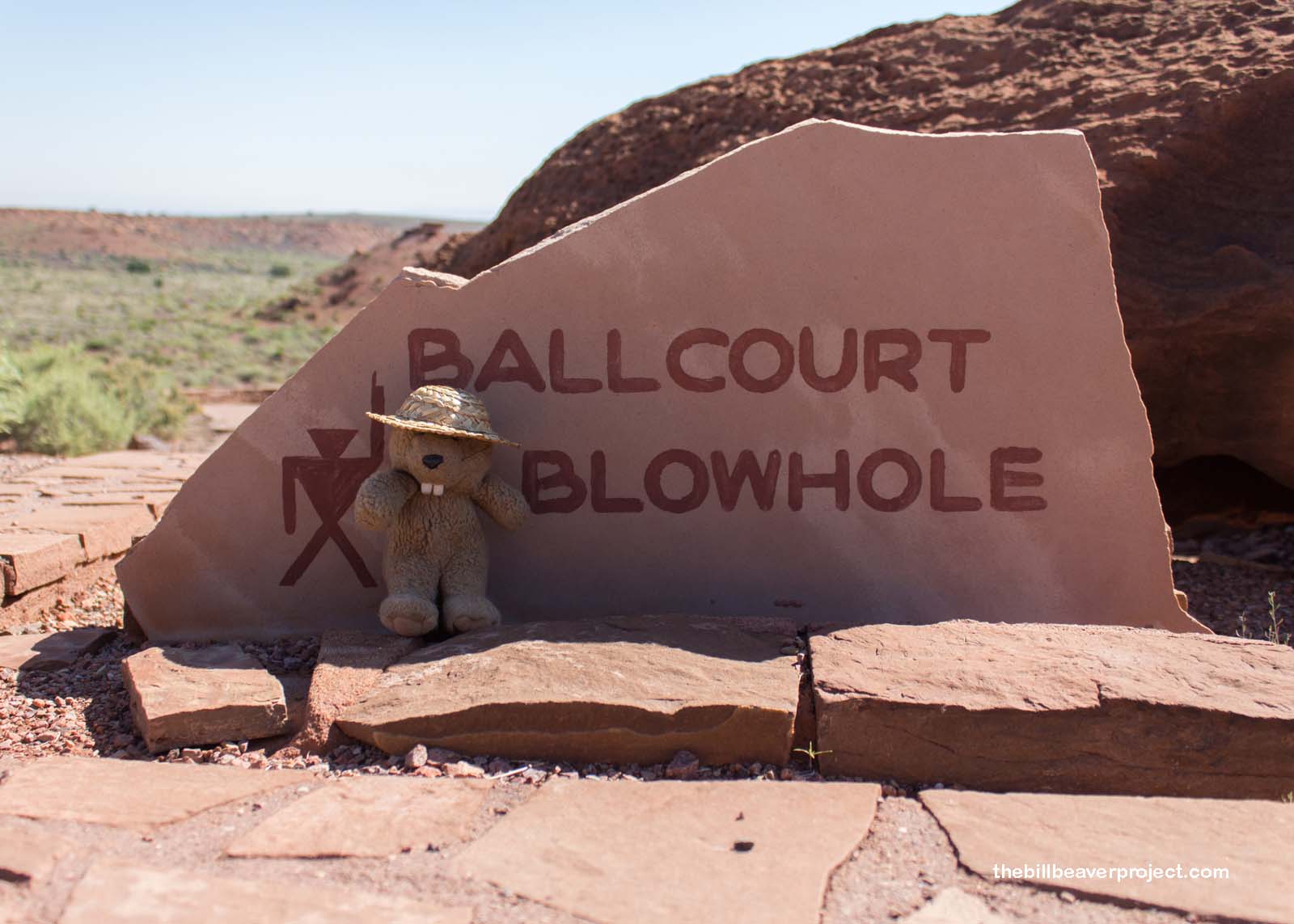 |
No one knows exactly what game was played in this painstakingly reconstructed ball court, but there were some clues left behind. There were artifacts found here with origins in Mexico, and there were rubber balls found in other spots in Arizona, connecting these ball courts to Aztec-style ball games, a real luxury in this part of the world because of the resources required to build such a court. However they played, and whether it was for religious purposes or fun, the space was close enough that it must have been fast-paced and exciting!
 |
 |
Nearby, a blowhole was puffing, as it had been for thousands of years! There are several blowholes around Wupatki, and many more prehistoric sites have been found near them. These cracks in the earth haven’t expanded into full-on caves, but as air pressure changes, winds whooshes in and out through the gaps on the surface! There could have been all sorts of reasons to set up a pueblo near one, from the way it spews out cool air in the summer or how its response to air pressure changes can predict upcoming storms!
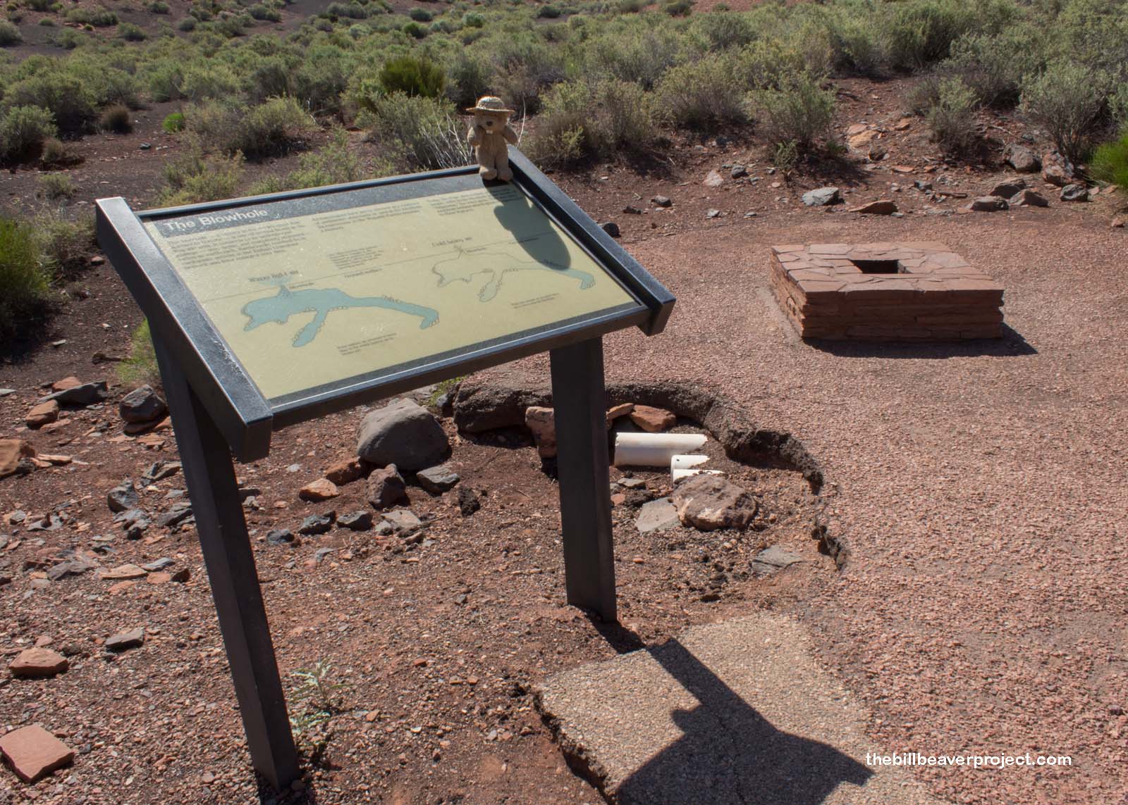 |
Getting up next to the blowhole, another hypothesis came to mind, that these cracks in the earth are associated with the wind god the Hopi now call Yaponcha! With the wind coming in and out, it sure did feel like some primordial god breathing. That god must have liked my hat, because it went sailing right off! Luckily, I caught it before it disappeared into the depths!
The next stop on my circuit through Wupatki National Monument was a very short trail leading to the top of a cinder hill and the fortress-like structure known in modern times as The Citadel!
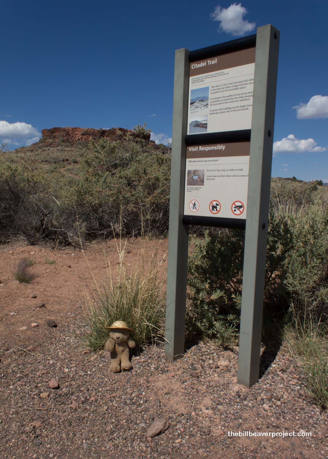 |
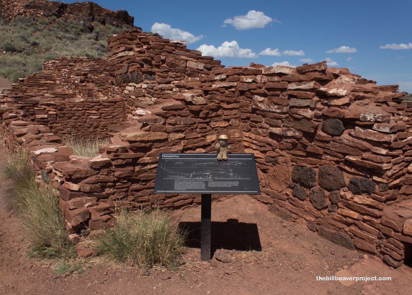
To get there, I passed through another small pueblo called Nalakihu, which means “house standing outside the village.” This 2-story, 14-room structure was the monument’s original headquarters and contact station from 1933 until 1953, reconstructed with best guesswork that sadly ruined some important details. That reconstructed part was removed in 1953 with the opening of the visitor center by Wupatki Pueblo, leaving behind the crumbling walls I passed today.
 |
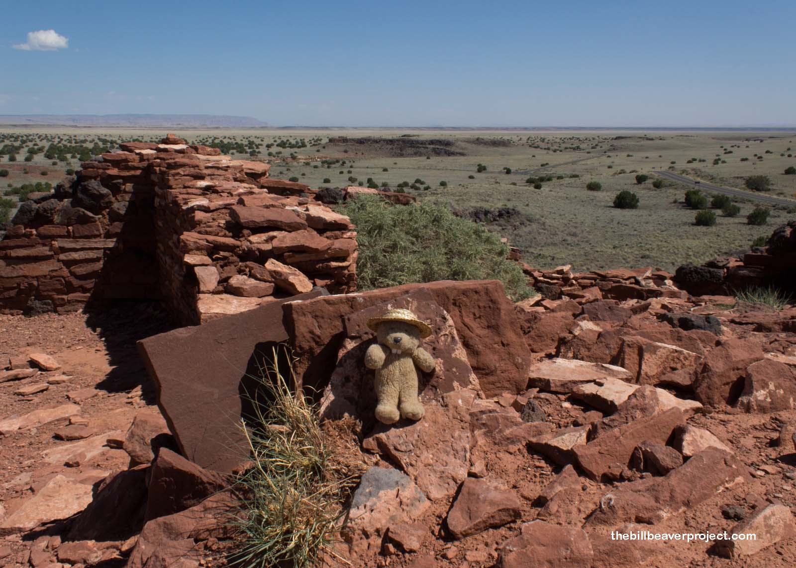
At the top of the hill, a quick 0.2-mile jaunt, I got sweeping views of the surrounding area from The Citadel! It would have been the perfect spot to keep watch for danger, whether from enemy tribes or another volcanic eruption! Meanwhile, based on seed and pollen findings, we know today that these lookouts were protecting fields full of veggies, tobacco, and cotton, making use of a layer of volcanic cinders that acted as mulch!
 |
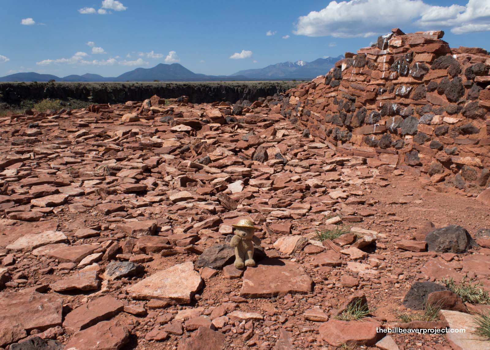 |
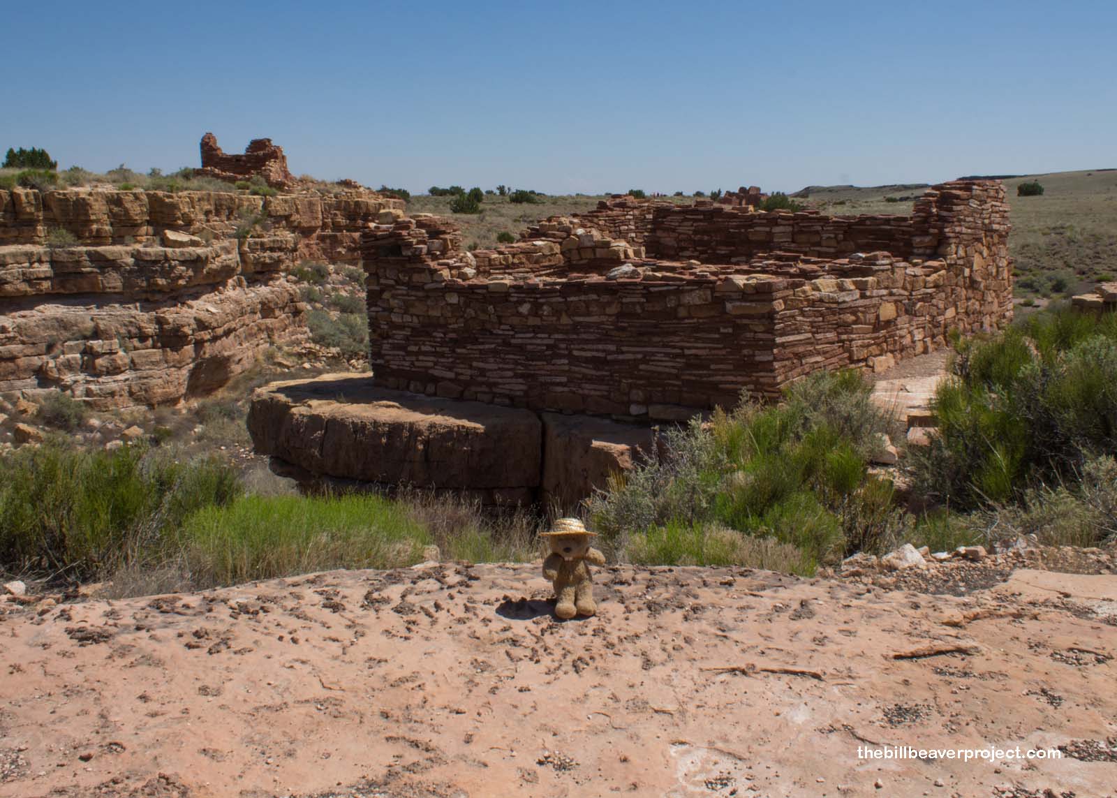
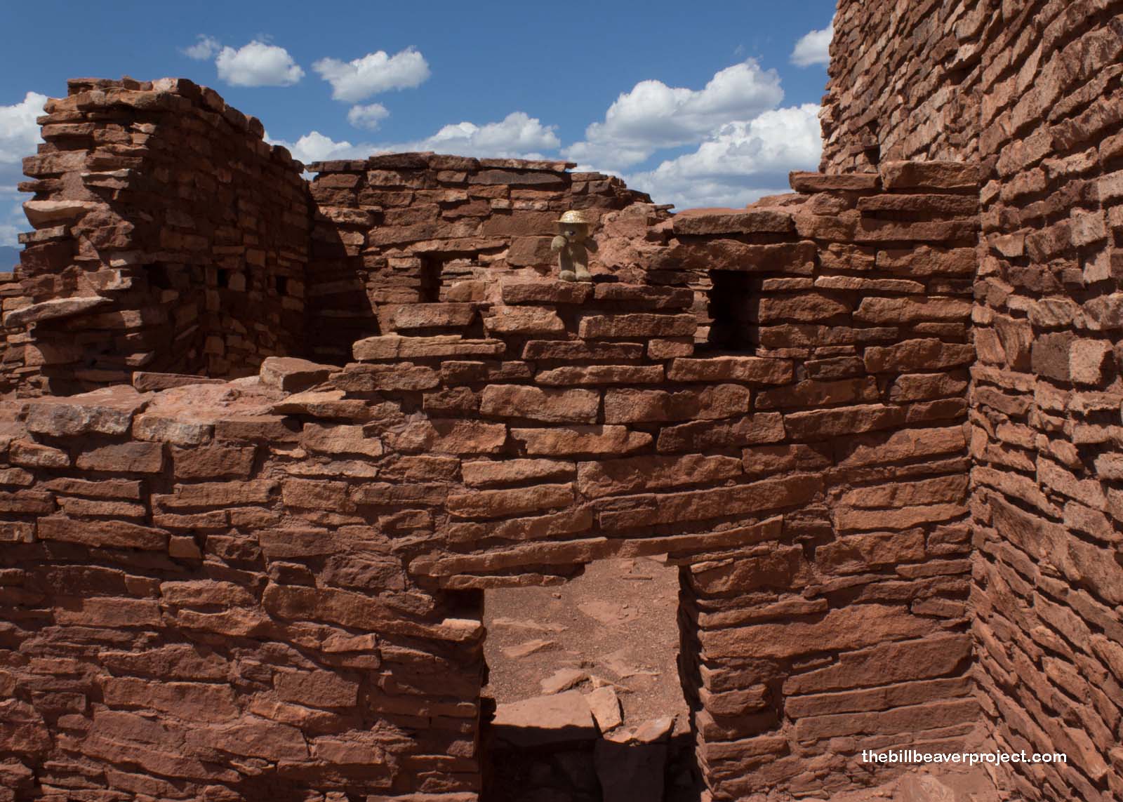
After a good look around, I descended the hill to take a look at some of these farmers’ homes. That was going to be my final stop on my circuit of Wupatki National Monument, a couple of pueblos called Lomaki (“Beautiful House”) and Box Canyon Pueblos. This was going to be a gentle 0.5-mile stroll, which would allow me to focus on the namesake beauty.
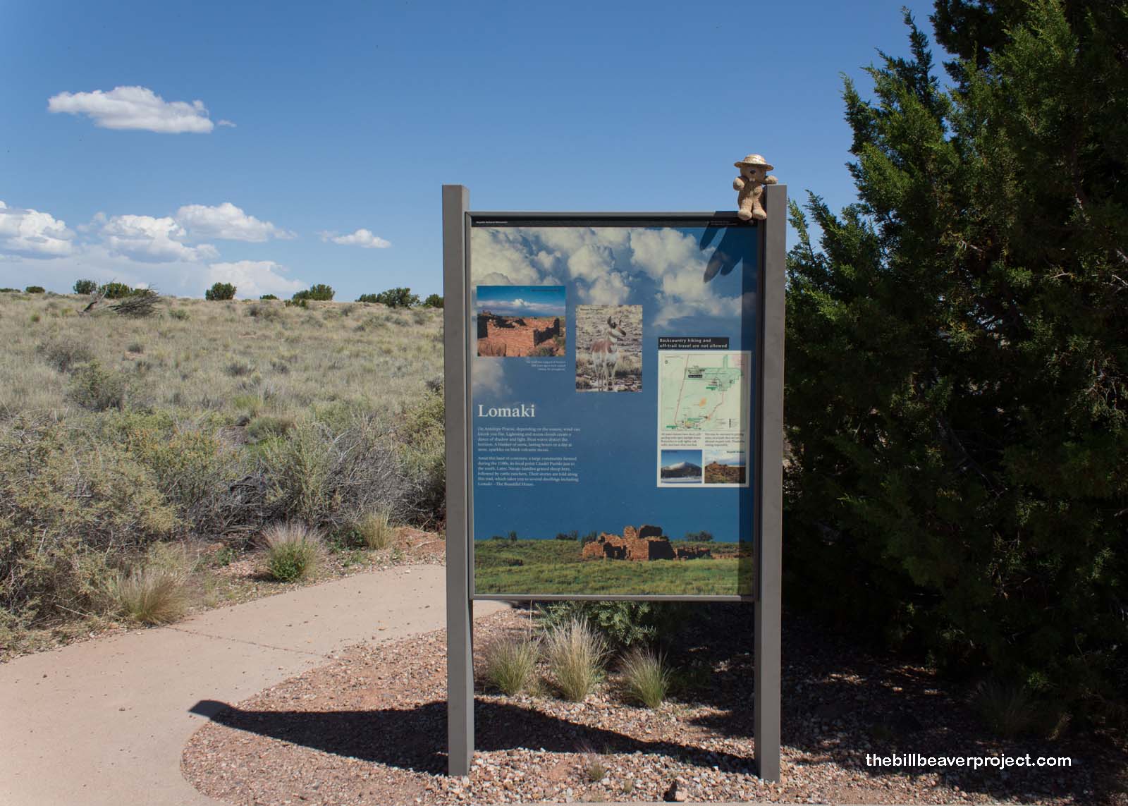 |
Lomaki Pueblo had nine rooms and may have been covered in plaster at one point, which would have lent itself to the “beautiful” nickname. The other two Box Canyon pueblos may have been part of the extended family. These are just some of the many, many known pueblos scattered across this area!
 |
 |
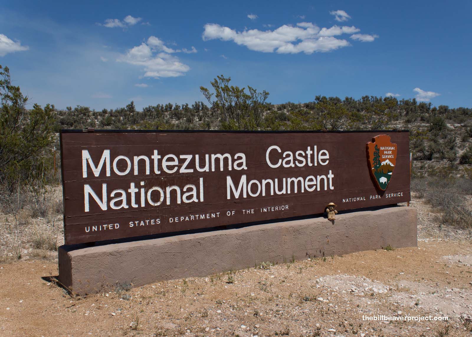
Sinagua culture, which is what we call it without knowing what those ancient folks called themselves, extended far to the south of here as I headed out of Wupatki National Monument, down past Flagstaff, into a crush of traffic caused by a grass fire just off I-17, and safely off into the community of Rimrock, Arizona, home to one of two units in my next national monument stop. This was the Montezuma Well portion of Montezuma Castle National Monument!
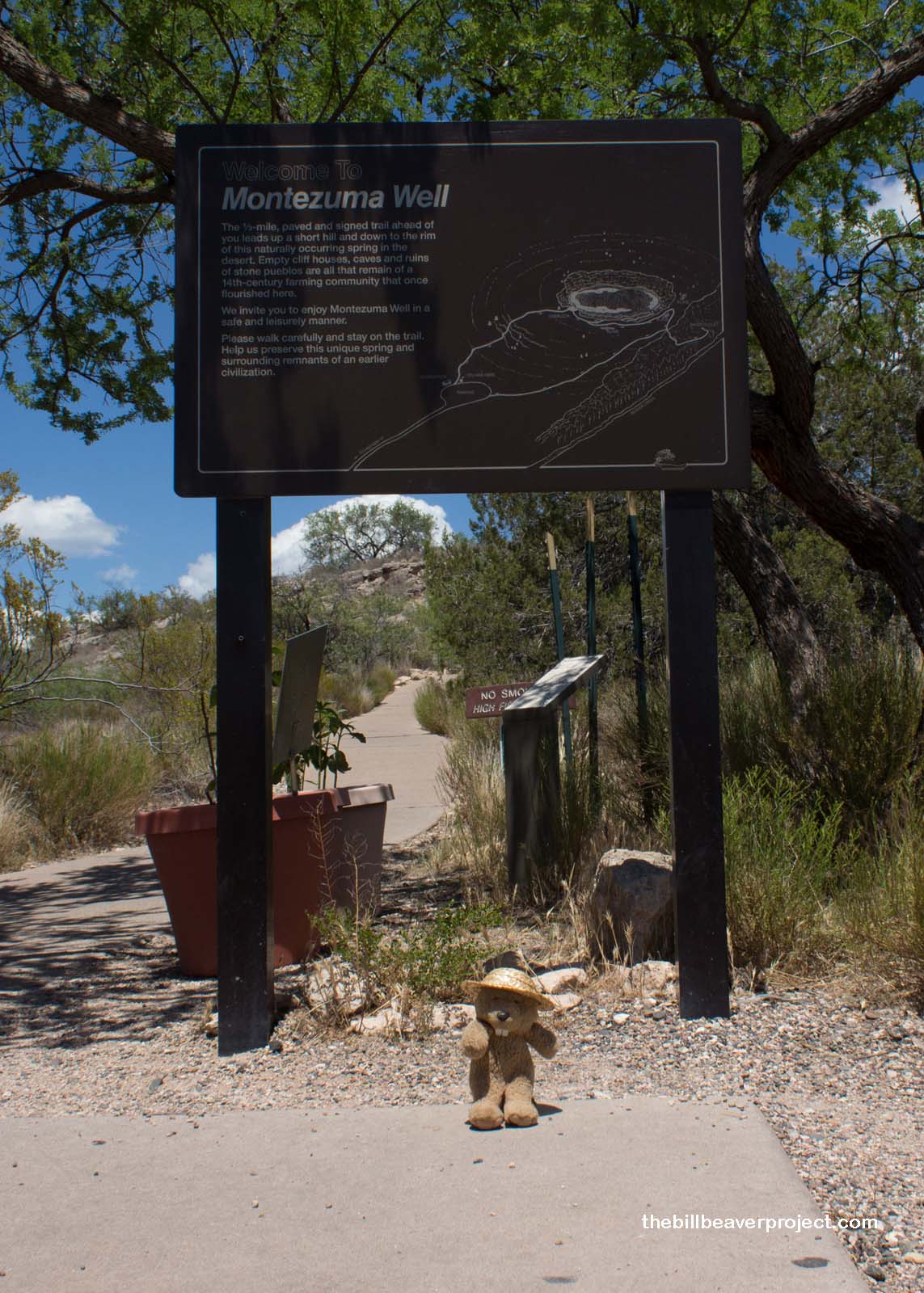 |
This is really the ultimate kind of oasis, a haven of 15 million gallons of fresh water in a place that receives less than 13 inches of rain a year! It was formed by 10,000 years of filtration as rain and snowmelt seeped through the desert soil until it hit hard volcanic basalt. It then crept very, very gradually downslope until it reached this low spot, eroding a very, very deep well, which overflows and is replenished daily, 1.5 million gallons at a time!
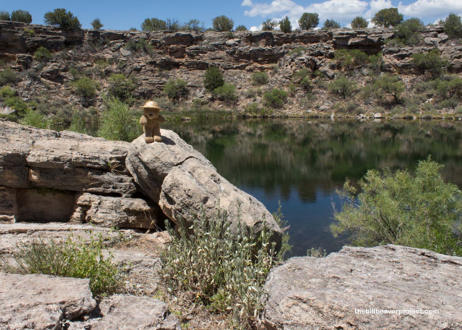 |
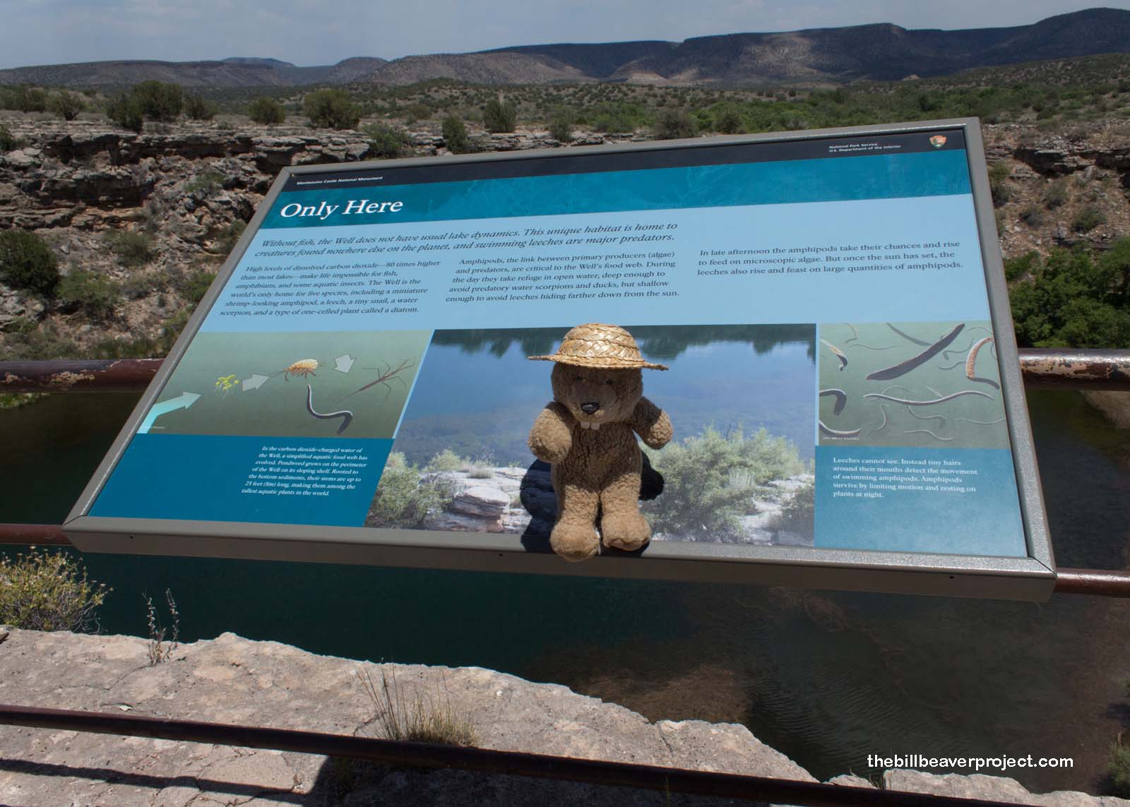
Not just an oasis, this well is kind of like a lost world too! The surrounding rocks have filled this water with carbon dioxide and arsenic, meaning it’s too poisonous for fish and other large animals. That’s not the case for its pond weed, the deepest growing in the world, and other endemic species, found only here, which shelter in it. There are two species of tiny crustaceans called amphipods, which are then food for water scorpions and four different species of predatory leeches, which have adapted to eating amphipods instead of sucking blood! The days here belong to the amphipods, while the nights belong to the leeches, like a real horror story under the desert sand!
 |
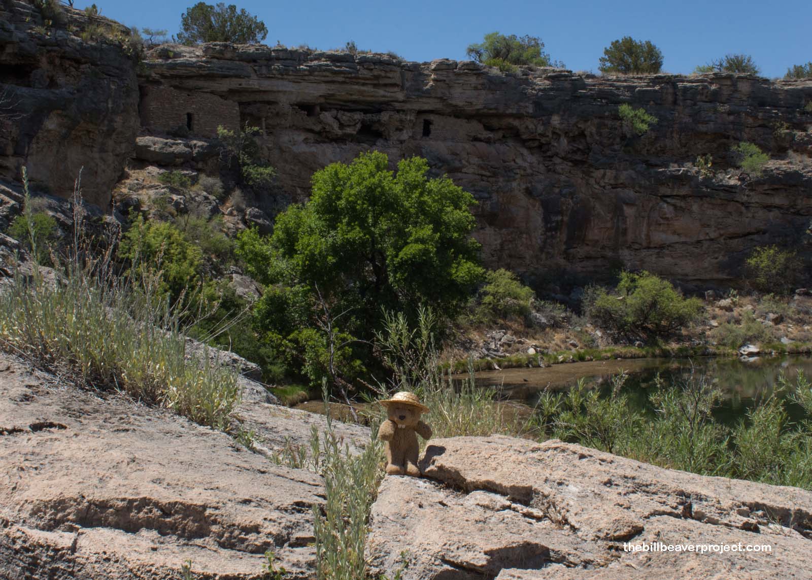
Despite all that drama under the surface, and despite the arsenic in the well water, folks from Sinagua to Hohokam have called this well home for thousands of years, using the water for irrigation and as a place to find cool refuge from the desert heat! At the height of this area’s settlement, there were over 30 rooms along the well’s rim, and around it, a community of 40 to 60 villages lasting into the 1400s, ahead of Spanish incursion.
 |
 |
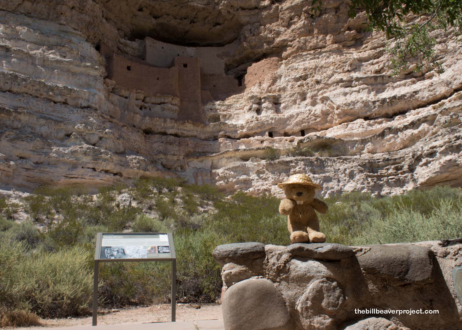
Spanish influence came in unusual forms here, starting with the national monument’s name: Montezuma Castle. Montezuma, as you well know, was emperor of the Aztecs about a century after the Well was abandoned, but European-American settlers arriving in the 1860s drew from what they’d read about. It was the name President Teddy Roosevelt used when declaring it a national monument in 1906 and the name that was bound to draw more Route 66 tourists than “Sinagua Apartments!”
 |
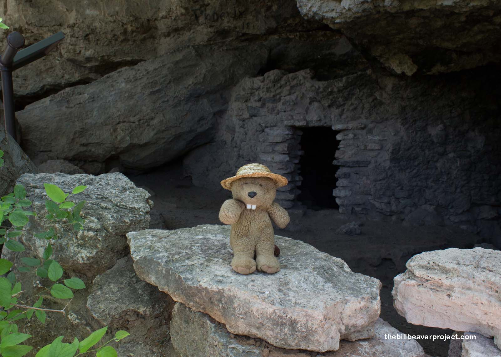
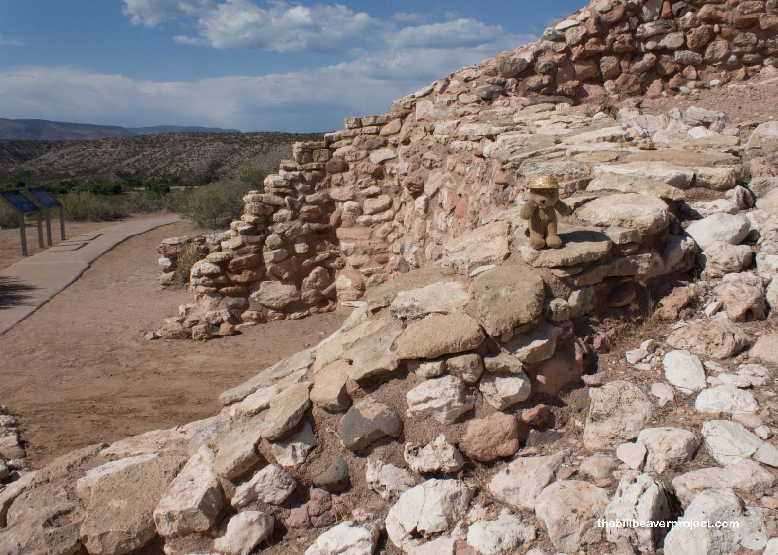
After a short walk from the parking lot along Beaver Creek, it was easy to see why this colossal cliff complex would have been called a castle! Even after the wear and tear of tourists who could climb up to it from 1933 to 1951, it was still impressive: a 5-story, 20-room masonry structure staring down from ninety feet up on the cliff! It’s the best preserved remnant of the builders here, who reached their height between 1300 and 1425 CE, a period called the Tuzigoot Phase.
 |
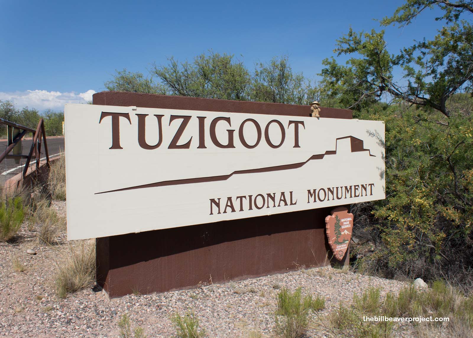
And wouldn’t you know it, 22 miles to the northwest, my final national park site on this grand tour happened to be called Tuzigoot National Monument! Tuzigoot is a rendition of the Apache Tú Digiz, referring to the “crooked waters” of the Verde River, and this pueblo became a monument under the auspices of the second President Roosevelt in 1939!
 |
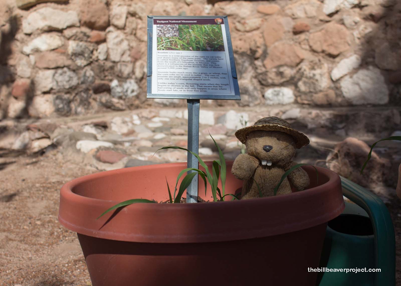
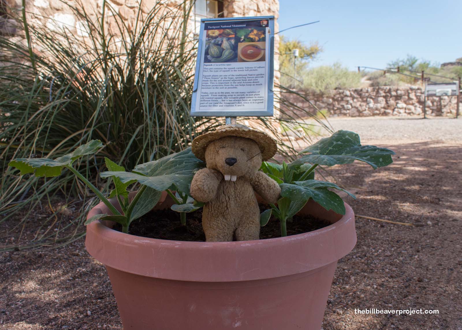
The first thing I noticed at the visitor center were the big pots of vegetables outside. There were some that I recognized, like corn and beans, and some that I did not, like the devil’s claw (Proboscidea parviflora)! This plant produces scary-looking hooked seed pods that get stuck in animal fur and shake out their seeds as the animal moves! The seeds are edible, and the spindly claw parts of the seed pods could be stripped off and used in basket weaving!
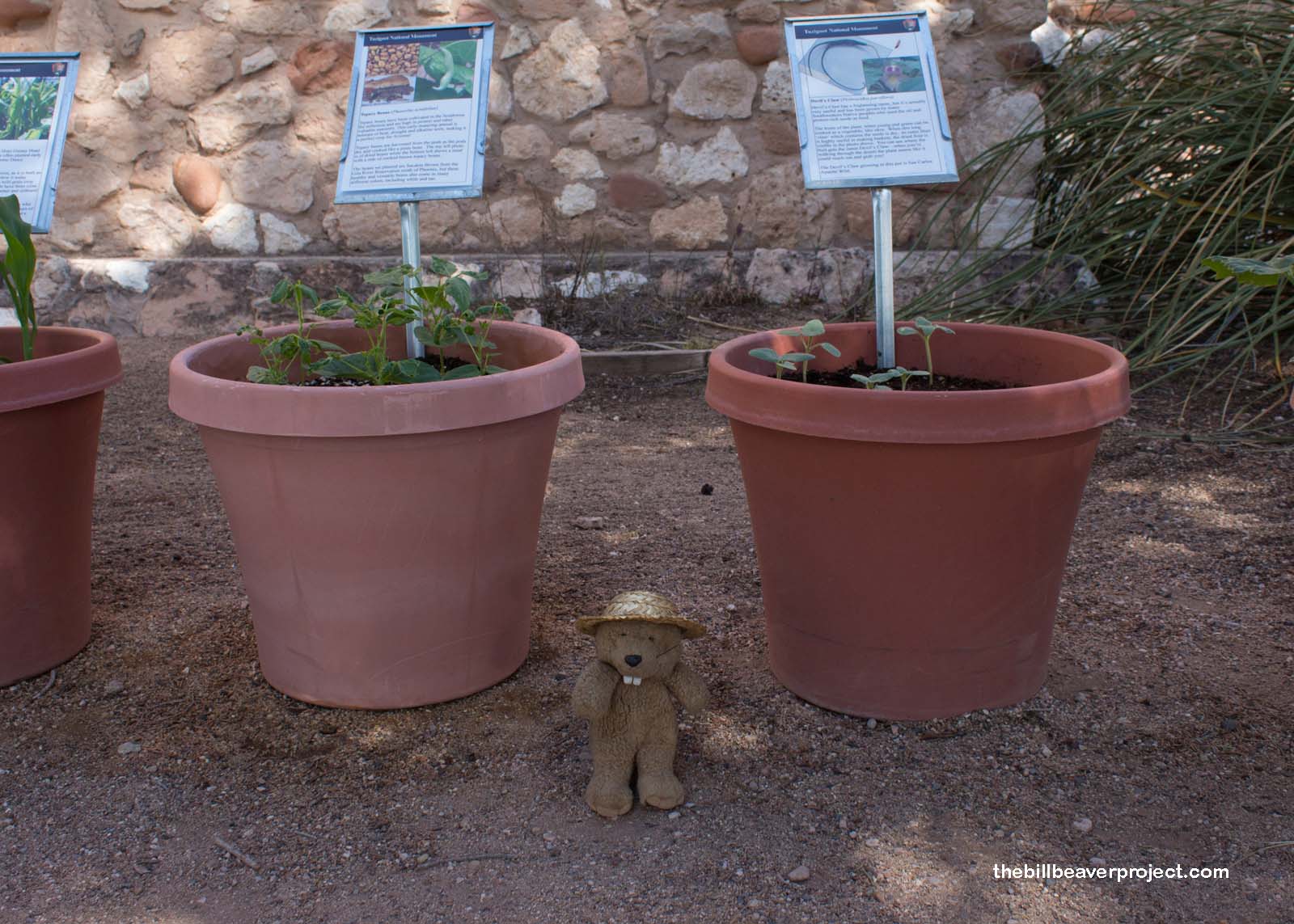 |
But I think the most important lesson I learned from this potted garden was the concept of the Three Sisters: corn, squash, and beans! These three plants get their title because they grow well together like a family. The corn stalk gives support to the bean vine, which adds nitrogen to the soil. The nitrogen then feeds the corn and the squash, which spreads its leaves over the ground, trapping moisture and inhibiting weeds!
 |
 |
Plus, these Three Sisters each form part of a complete protein, so folks who ate them regularly could be nourished and healthy, even when meat was scarce! A lot of these local, heirloom varieties were still catalogued online as part of the Native American Seed Share Program, metate not included!
 |
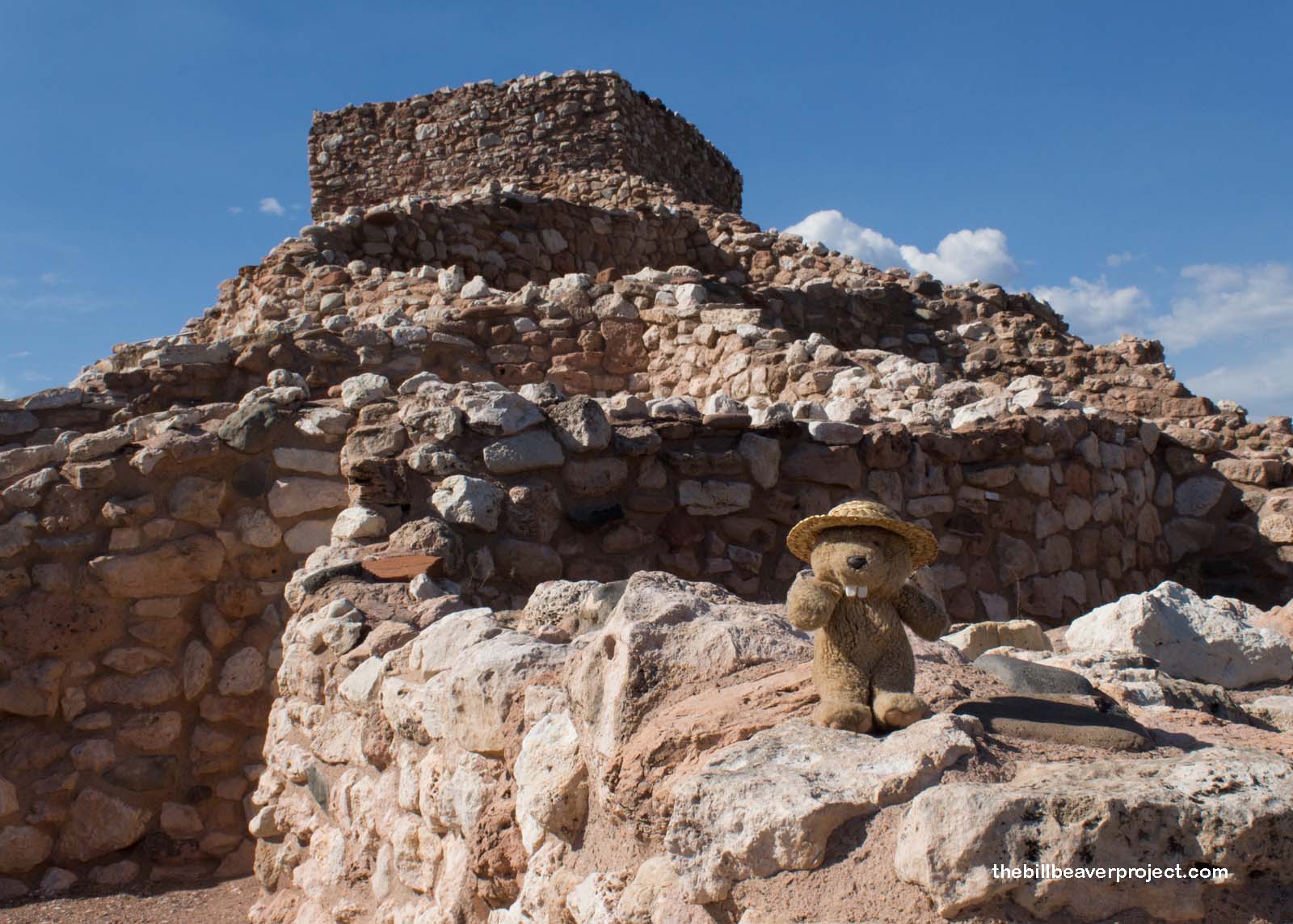
As for the pueblo itself, it was much more petit than either Montezuma Castle or Wupatki and built from local stone that was much more muted in color. But what makes this 2-story, 87-room, hilltop pueblo so special is what artifacts were unearthed here and what they revealed about ancient trade networks here and across the Southwest!
 |
In particular, it was the macaw feathers that astonished early excavators! These folks in northern Arizona traded as far as Mexico and South America, giving at least some relevance to the idea of “Montezuma Castle!” These feathers, plus shells and obsidian arrived in exchange for local minerals like copper and azurite, plus salt and cotton cloth! Many of these colorful trade items were used in ceremonies to build what was known as the Flower World, a paradise of birds and flowers that was rumored to await folks after they died!
 |
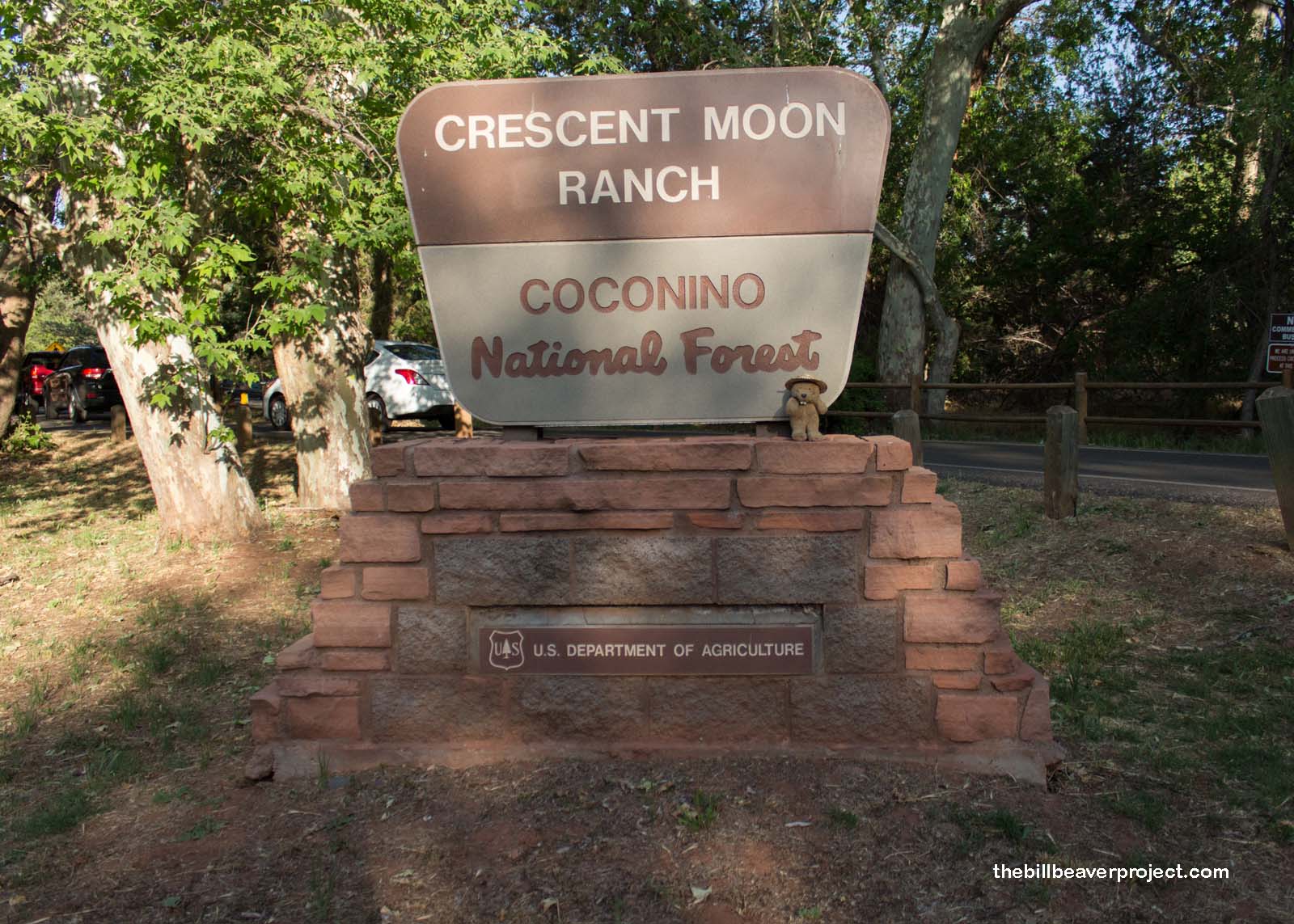
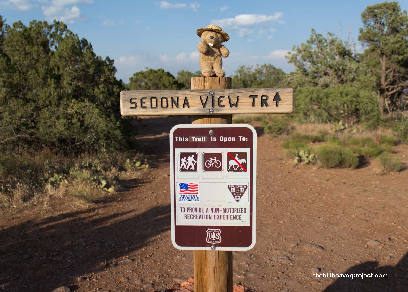
Rumors of paradise and supernatural presence still abound in this section of Arizona! As I wrapped up my circumnavigation of Tuzigoot and checked off my final national monument for the day, I decided to take advantage of the daylight and make a detour to a place that draws a different sort of flower children. Starting at the Crescent Moon Ranch, I set out to experience as many of Sedona’s famous energy vortexes as I could before the actual moon took over the sky!
 |
With a map in my mitt, I selected two vortexes that were going to be easier to find with limited time, starting with Cathedral Rock! This magnificent set of sandstone cliffs sure did look like a gateway to another realm! The path leading toward it was flat, sandy, and speckled all with people all throughout!
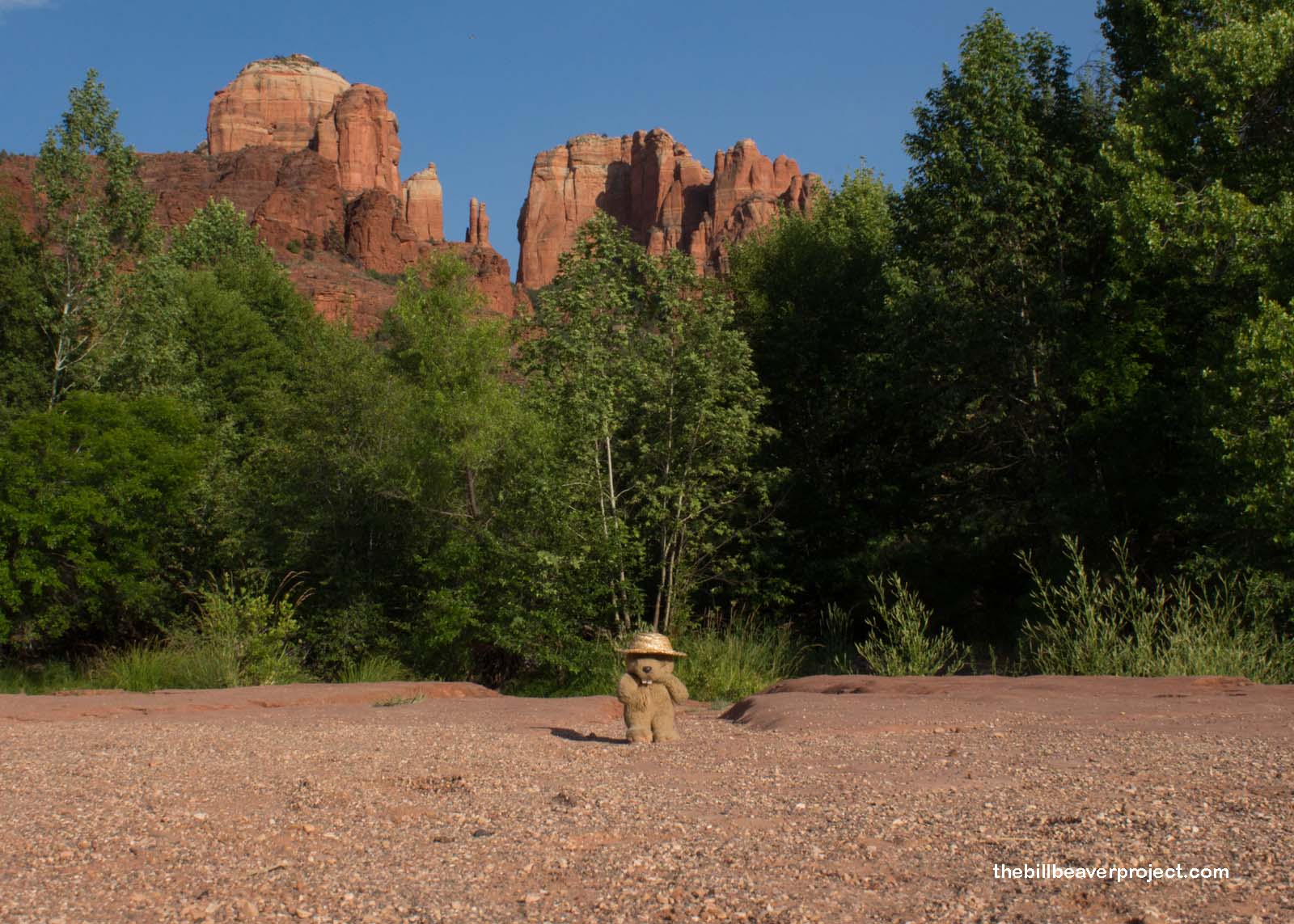 |
Folks come here to meditate, do yoga, and release their negative emotions with the help of energy flowing up from the ground here! This has made Sedona (originally Schnebly Station) a major New Age destination since at least the 1980s! I passed one such pilgrim pounding rhythmically on a drum as I navigated the sandy riverbed on foot, spotting cairns and stacked rocks, which weren’t very good at guiding, more focusing that meditative energy!
 |
These vortexes aren’t really visible, and the actual vortex is supposed to be a mile-long scramble onto Cathedral Rock itself! I wasn’t sure if I had enough daylight to make the full trek out and back safely, so I found the closest thing I could to a vortex and twitched my whiskers to see if I could feel any energy flowing through my body. Well, maybe I did have to be on it to feel it. I decided to try a second one for good measure.
 |
 |
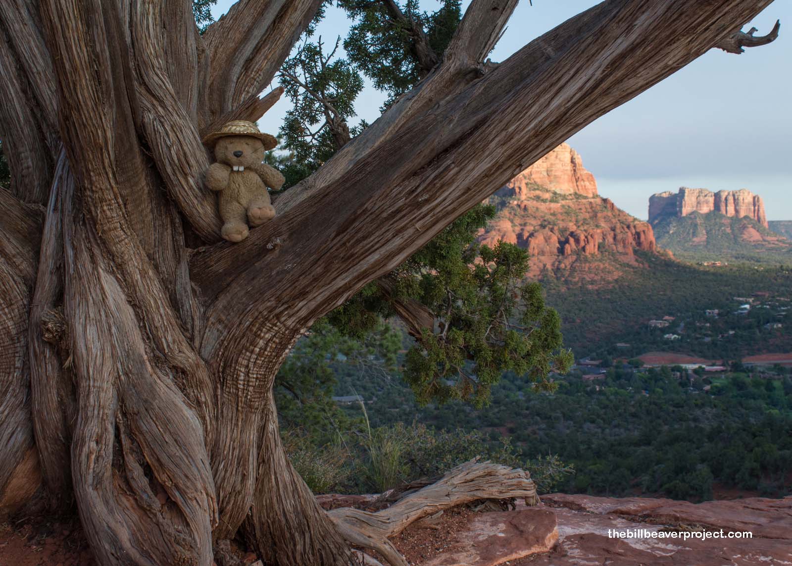
Of the three other major vortexes—Bell Rock, Boynton Canyon, and Airport Mesa—I picked the short hike up to the ridge line of Airport Mesa! As you might guess, it’s so named because it’s a mesa near the Sedona airport!
 |
Unlike the Cathedral Rock vortex, this one is supposed to be a downward vortex, promoting introspection and reflection! But I’ll tell you, as I got farther up the trail, it was harder and harder to look inward, because the views outward were increasingly spectacular!
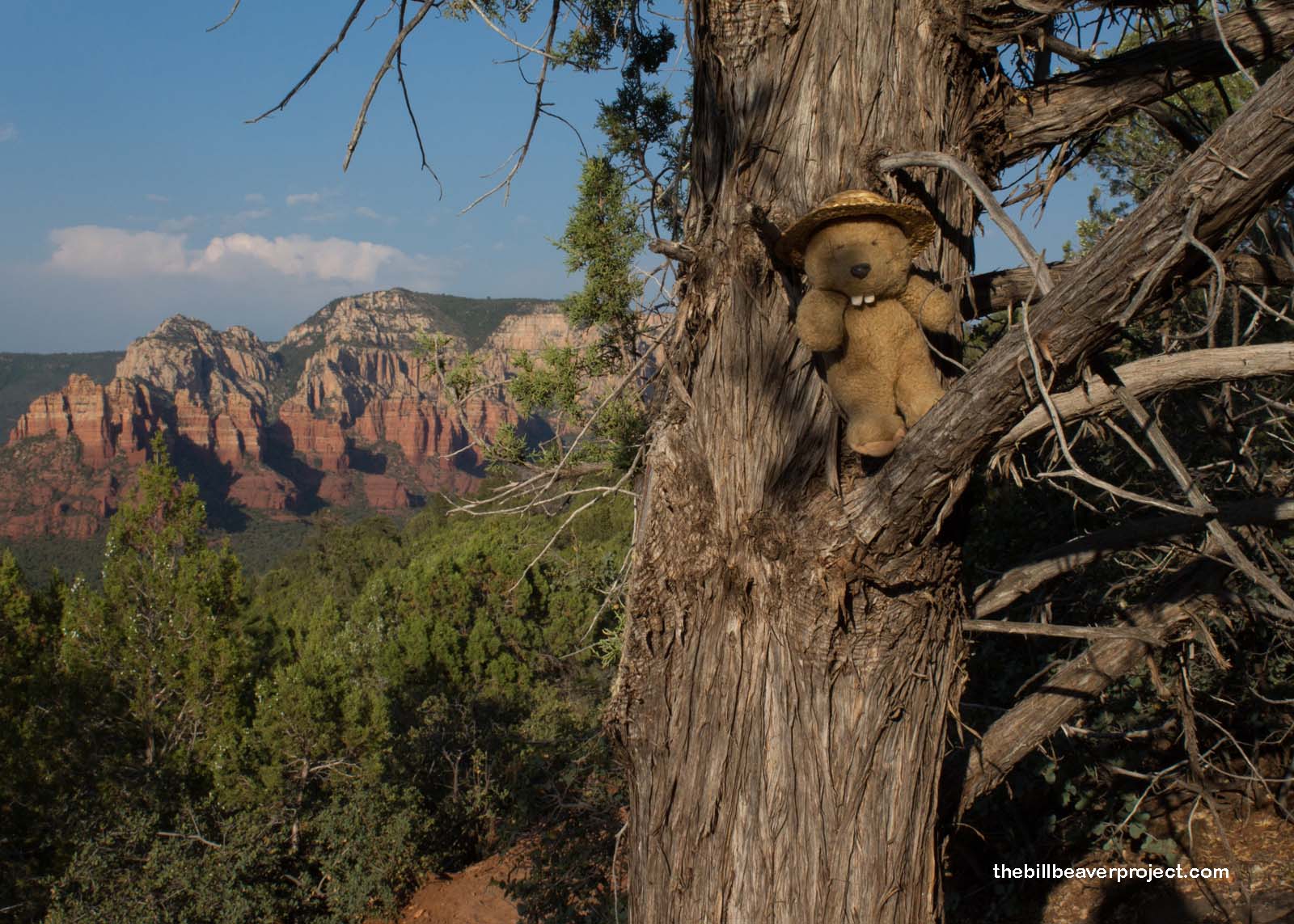 |
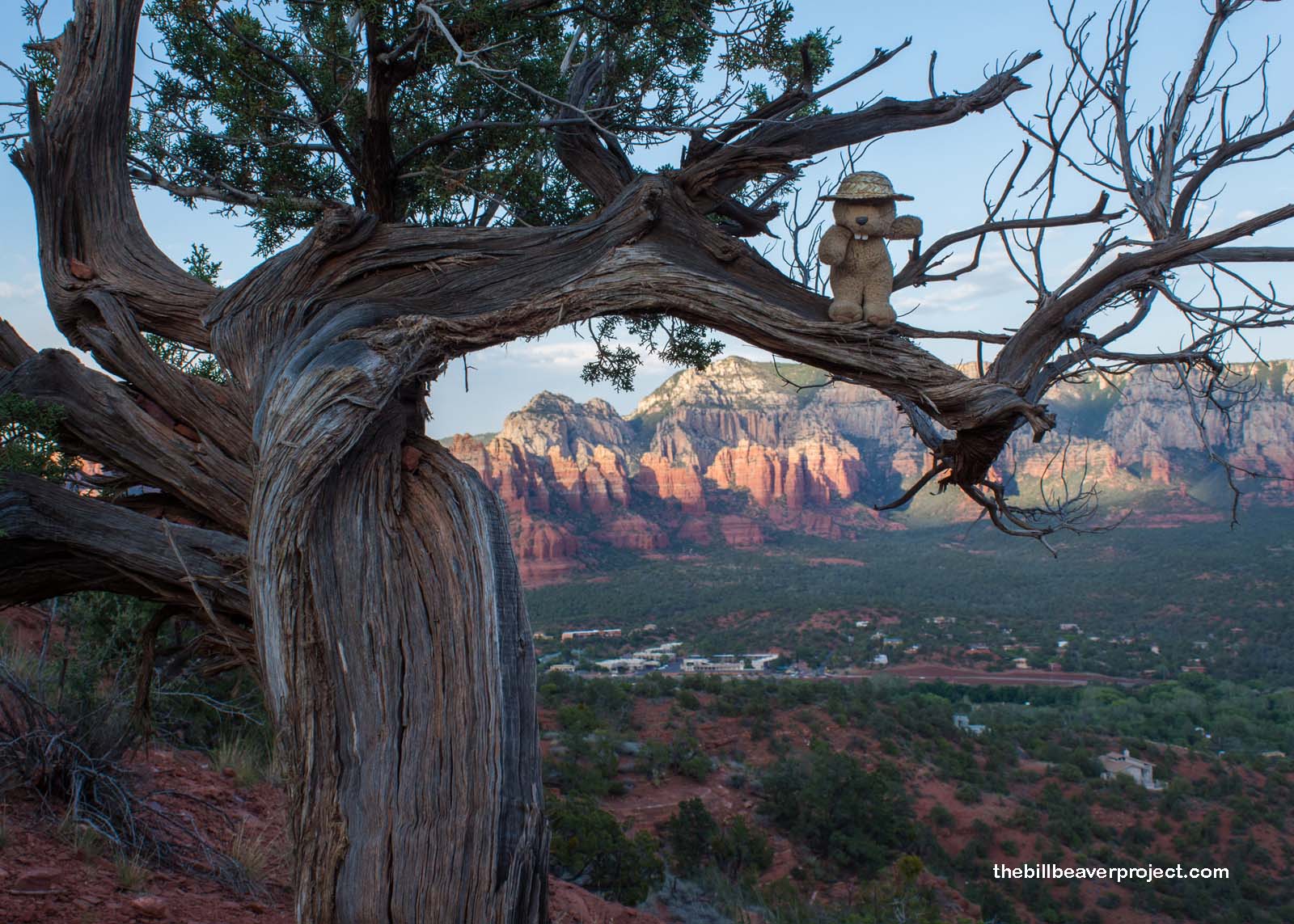
At the vortex site, the guide mentioned that the energy had twisted the trees into all kinds of unusual shapes! Sure enough, these trees were a lot more contorted than some of the others, but juniper trees are also famously twisty, a feature treasured by bonsai artists! Nevertheless, as I stared out toward the amazing cliffs and formations, thinking back on all the wonders I’d explored today, I couldn’t help but feel more at peace and definitely energized for my next big adventure!
 |
 |
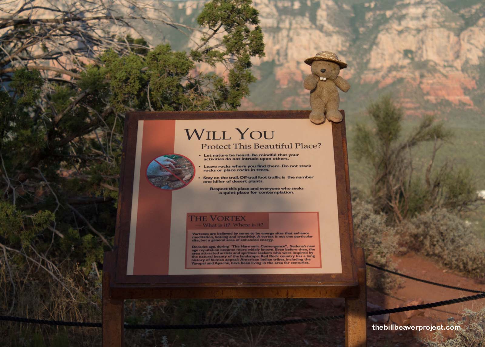
Like lots of supernatural places, whether they’re “real” or not doesn’t really matter. They’re out of the ordinary, off the beaten path, and so rich with stories and experiences that it feels like a rite of passage just being there. I was happy to see a sign asking visitors to treat the place respectfully, letting folks meditate in the quiet and certainly keeping trash where it belongs! As far as I could see, folks were doing just that.
 |
By then, the sun had fully set over Sedona, and I was northbound once again to drop off the rental, Uber back to Flagstaff, and catch the 8:15 train back to LA. It’s a complex process getting here, but what a treasure trove of ancient civilizations and hidden worlds! I think I’ll come back here again one day, maybe when my running days are done and my meditating days are in full swing! Those days are a long way off, though!
See you at the next station!

Previous Day |
Total Ground Covered: 670.4 mi (1,078.9 km) |
More 2016 Adventures |