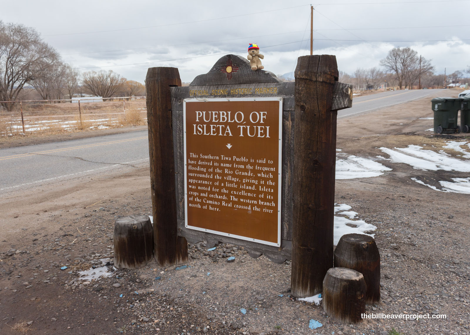
Sign Text for This New Mexico Landmark:
This Southern Tiwa Pueblo is said to have derived its name from the frequent flooding of the Rio Grande, which surrounded the village, giving it the appearance of a little island. Isleta was noted for the excellence of its crops and orchards. The western branch of the Camino Real crossed the river north of here.
More about the Pueblo of Isleta Tuei:
The Tiwa name for this pueblo is Shiewhibak, which means “whib stick laid in lava!” That’s because the lava reef on which the pueblo was built is shaped like one of the sticks used in the racing game of whib! It is one of the few pueblos that still sits in its original location from before the arrival of Coronado in 1540!
Like Zuni Pueblo, Isleta grew from multiple other pueblos, like Pure Tuei in the 1200s as the ancestors’ cliff dwellings famously vacated! Isleta did not participate in the Pueblo Revolt, but the Spanish burned the pueblo anyway, taking many of its inhabitants to El Paso.
Today, the Pueblo of Isleta Tuei is federally recognized with its own constitution and about 211,000 acres of land south of Albuquerque. After centuries of cultural assault by missionaries, it has become a different kind of Isleta with some parts open to visitors but the historic core only available to tribal members!
How Can I #HelpTheHelpers?
- Donate to the Isleta Pueblo Department of Cultural & Historic Preservation!
- Be a responsible visitor! Please respect the signs and pathways, and treat all structures and artifacts with respect. They’ve endured a lot to survive into the present. They’ll need our help to make it into the future!
How Do I Get There?
S of NM-147
0.3 mi. SE of NM-314
Isleta Pueblo, NM 87022
(Take Me There!)
When Should I Visit?
Visit the landmark sign whenever you like, but you’d have to be a member of the tribe to visit the historic village.
