 More 2024 Adventures |
Bangor, ME → Mt. Chase, ME → Bangor, ME 234.0 mi (376.6 km) |
 Next Day |
It’s the Maine event, everyone!
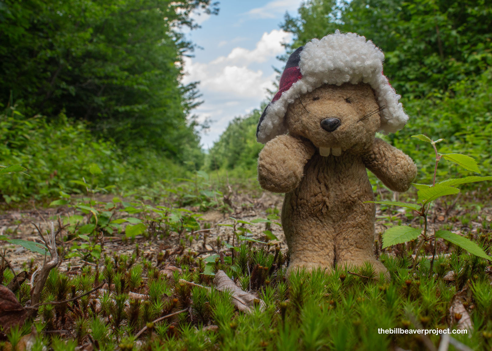
Today, I set foot in my 50th state! Yes folks, as of now, I have officially touched the soil of all fifty US states from Alabama to Wyoming! Somewhere in the middle alphabetically, Maine is home to several gorgeous national park sites, and after a rough overnight flight, first to Boston, then to Bangor, I am bleary-eyed entering one of the newer and less developed national monuments, Katahdin Woods and Waters National Monument!
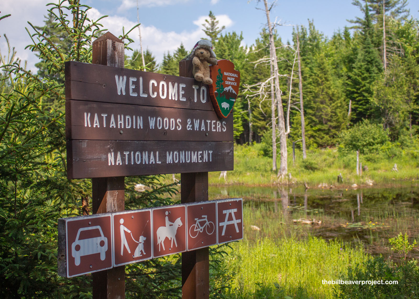 |
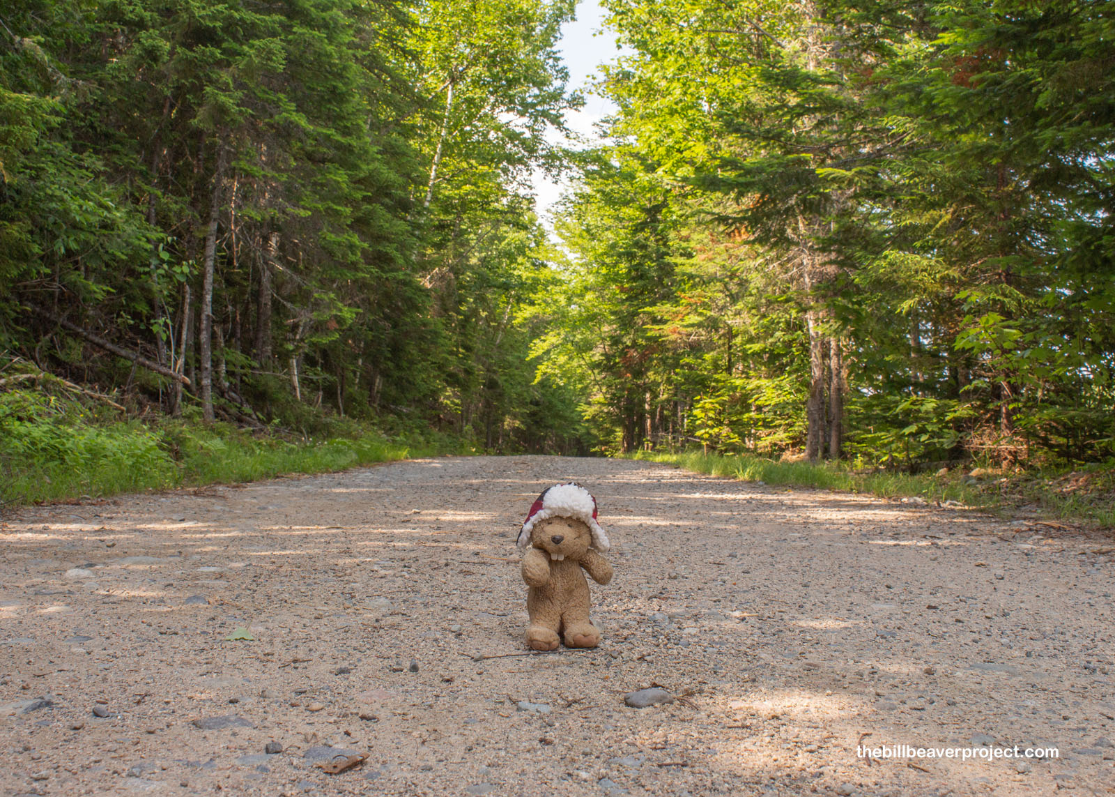
This is an odd monument for sure! As you can see, it’s got woods! It’s got waters! It does not got Katahdin! That mountain, sacred to the Penobscot, is completely enclosed by nearby Baxter State Park. These 87,500 acres of wilderness were donated to the federal government in 2016 by Elliotsville Plantation Inc. and Roxanne Quimby, co-founder of Burt’s Bees. Not everyone was happy, though! There were lots of signs leading into the monument letting me know the bridge owner didn’t approve the park. The road owner didn’t approve the park. In short, like in Shenandoah National Park, folks got eminent domained for this one!
 |
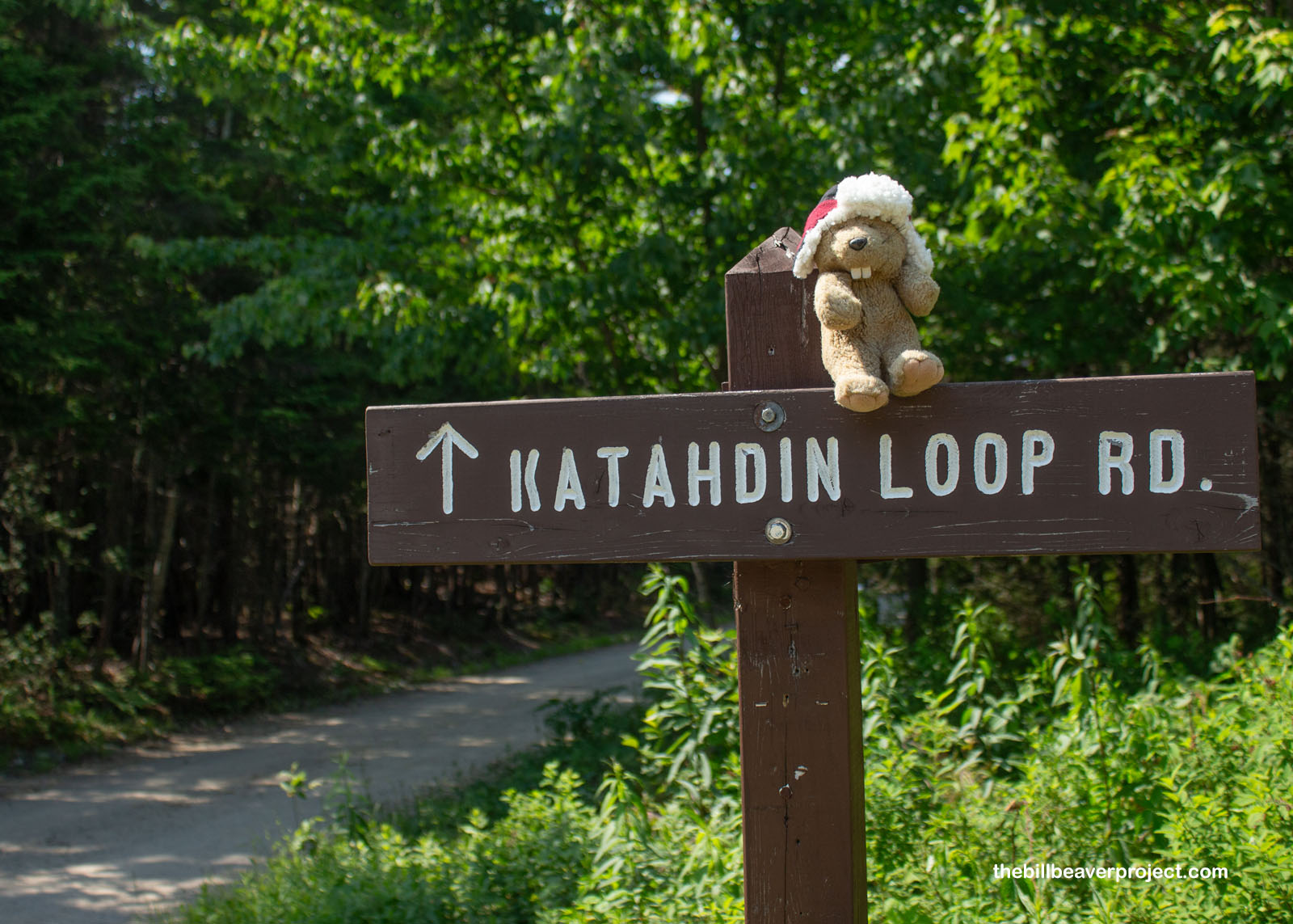
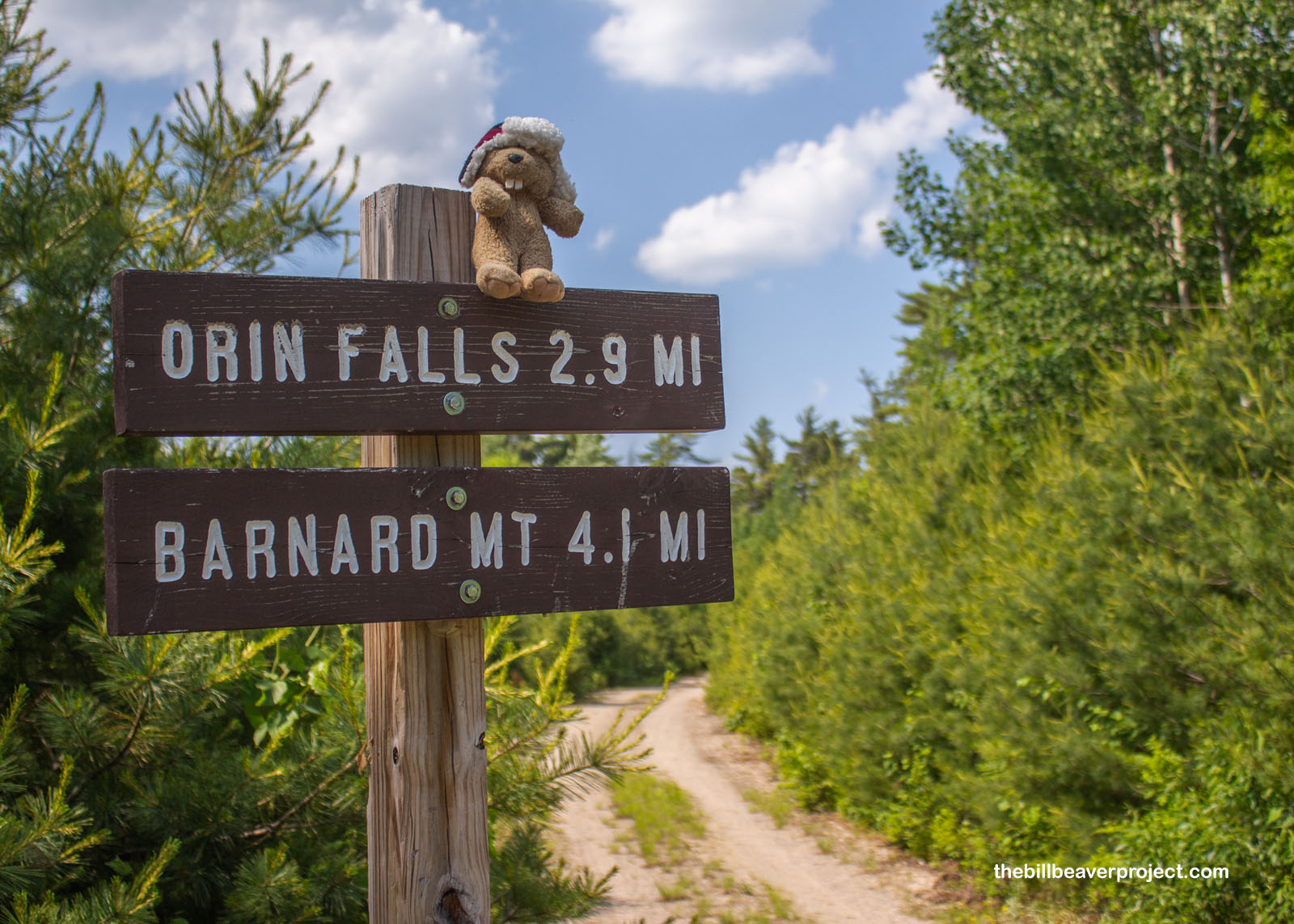
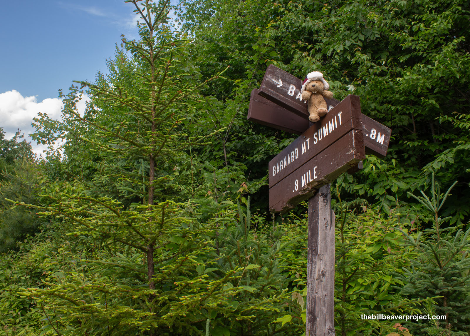
Without being able to hike Mt. Katahdin from here, I set my sights on a different summit, Barnard Mountain, which was supposed to give great views of the park’s namesake. To get there would require heading down the Katahdin Loop Road, the main route to the monument’s main sights, and taking a nice 4-mile roundtrip trail to the summit. There were wooden signs to follow, but as I soon found out, the designers did not pay the strictest attention to detail!
 |
 |
After rumbling down a rugged dirt path covered in tree branches that had either been pruned and left or brought down in a storm, I arrived at what I was pretty sure to be the Barnard Mountain trailhead, only the numbers were far from what I’d expected. I must have gone in the back way! Rather than four miles roundtrip, this sign said four miles each way! Was I ready for an 8.2-mile trek at 4:00 PM with a historic heat dome bringing temperatures into the high 90s? Sure, why not?!
 |
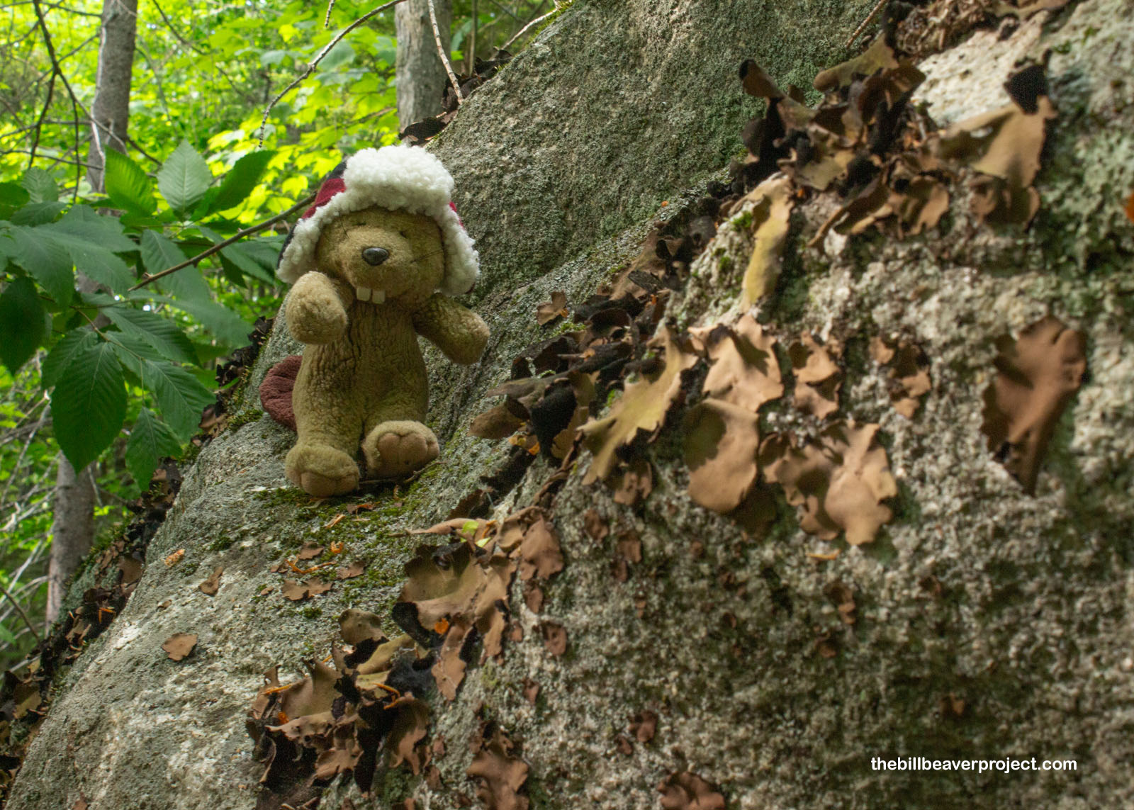
The start of the trail was pleasant enough, pretty flat and lined with dense pine trees on either side. The shade was very, very welcome, and I hoped it would last. At the same time, it was very hard to see anything beyond these trees, and I wasn’t sure if that made me more or less safe from big critters who might be craving beaver for dinner!
 |
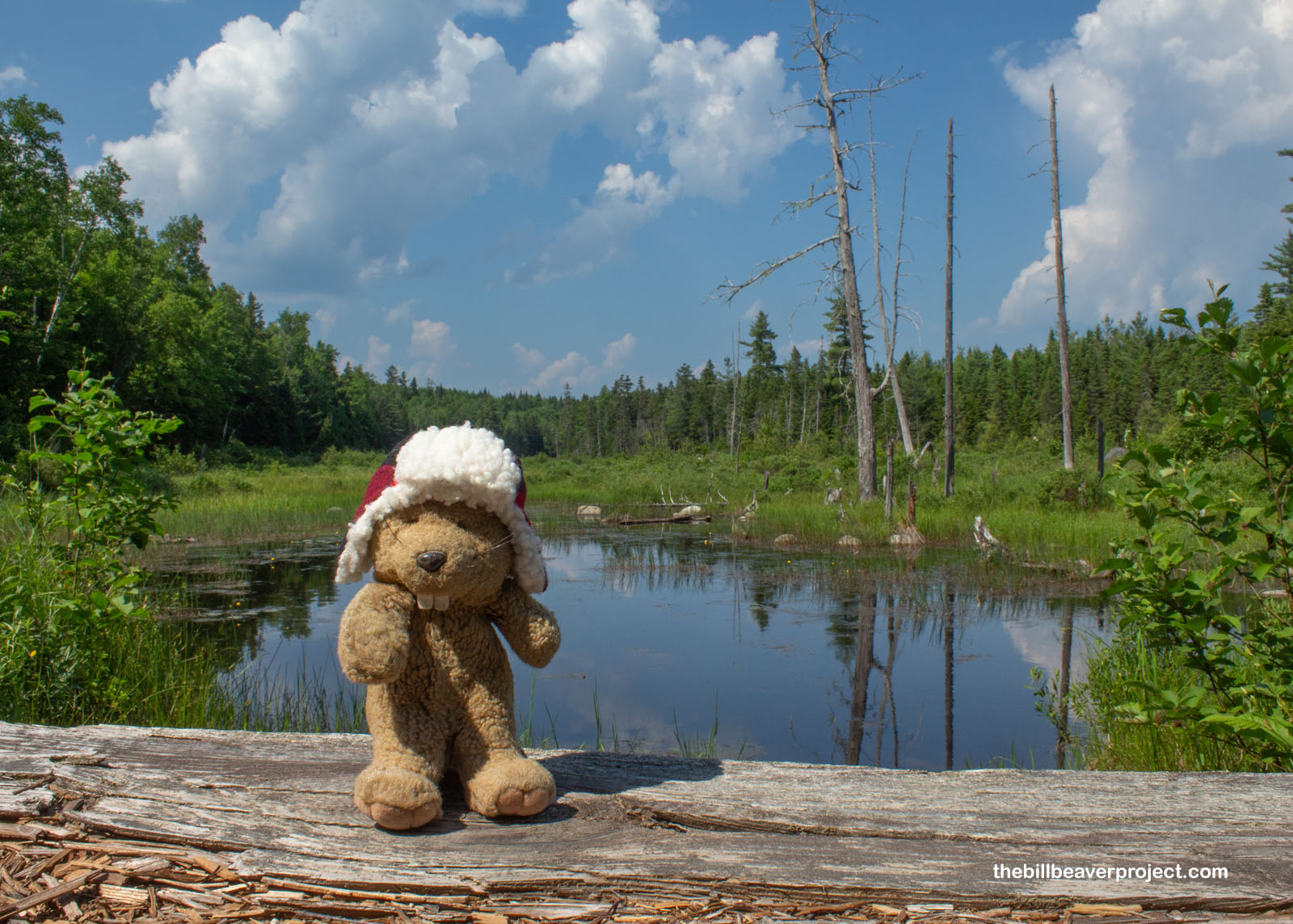
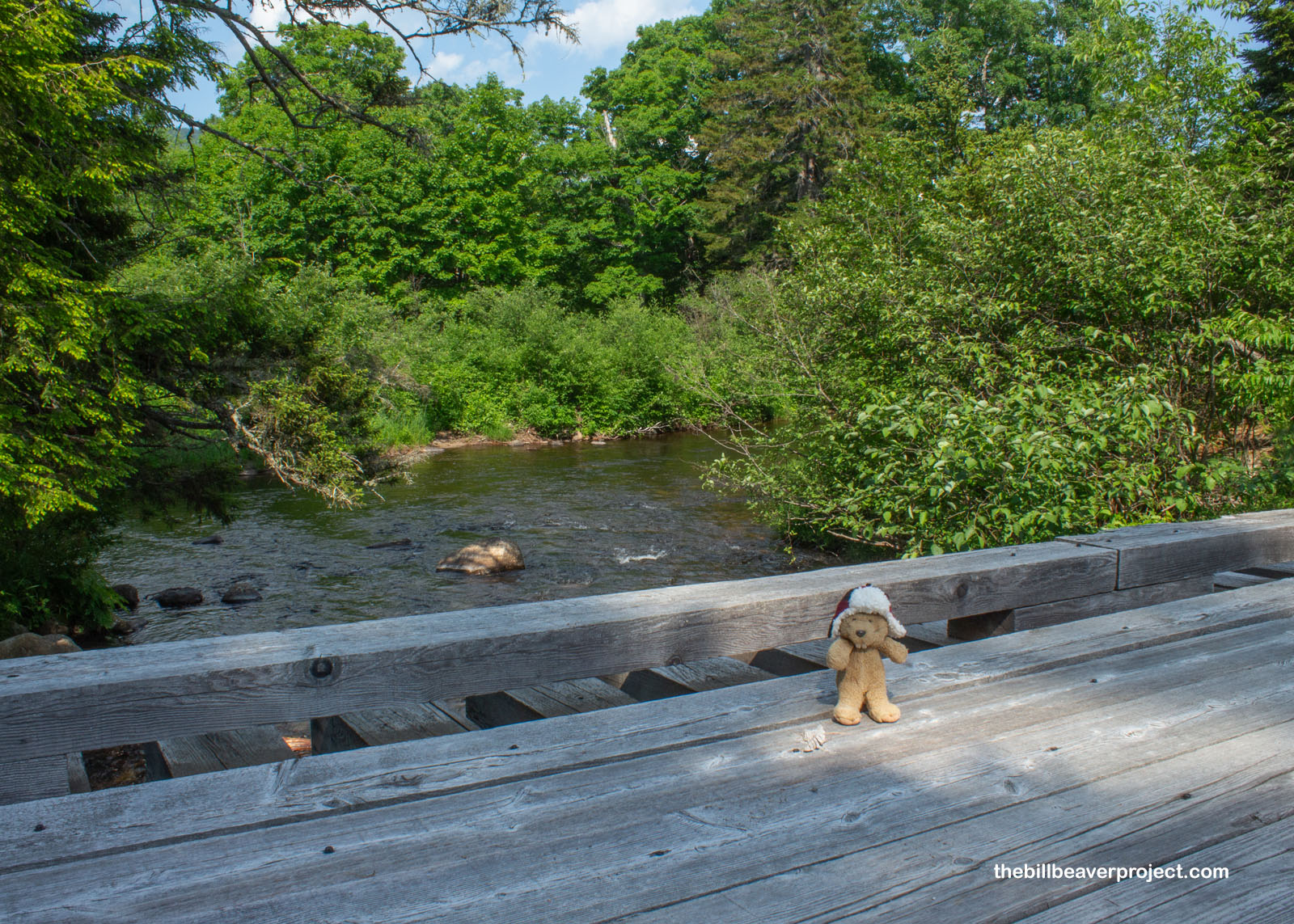
About a mile into the trail, I crossed Katahdin Brook, a tributary of the Wassataquoik Stream, home not only to brook trout but also increasingly rare Atlantic salmon! In fact, Wassataquoik means “place to spear fish by torchlight” in the Penobscot language, but I had neither time to fish nor a torch to carry. Every second I sat still, I was assaulted by bugs!
 |
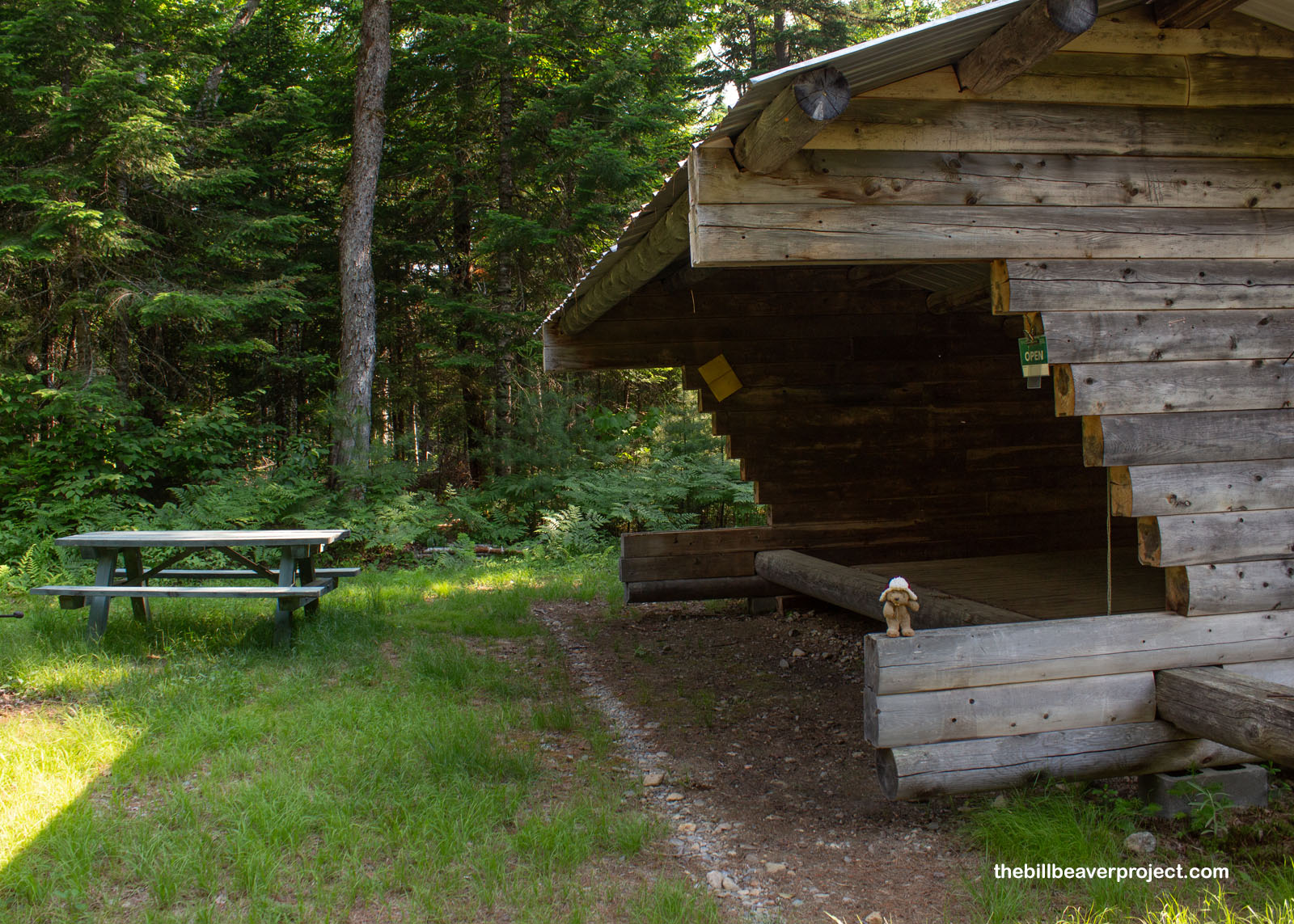
Specifically, those bugs were deer flies, nasty biting bugs that I’d never encountered before! Unlike mosquitoes, which suck blood through a thin proboscis, deer flies have sharp mouth parts that cut skin and make it itch way more! And they were everywhere. As I passed the Wassataquoik Lean-To, open to day campers and travelers on the International Appalachian Trail, I imagined how tough it must be to spend multiple days in these woods, or live in them, as would be the case for moose!
 |
Speaking of moose, I found some of their huge tracks in the sand about two miles in! Luckily, that was all I saw, because I’d be in big trouble if I ran into a moose driven mad by the heat and fly bites! Jeepers, these tracks were so huge I could have laid down flat in each of them! I’d need to be extra cautious the rest of the way. The best way to escape a moose charge is to duck behind a tree, and luckily, I was surrounded by very thick trees.
 |
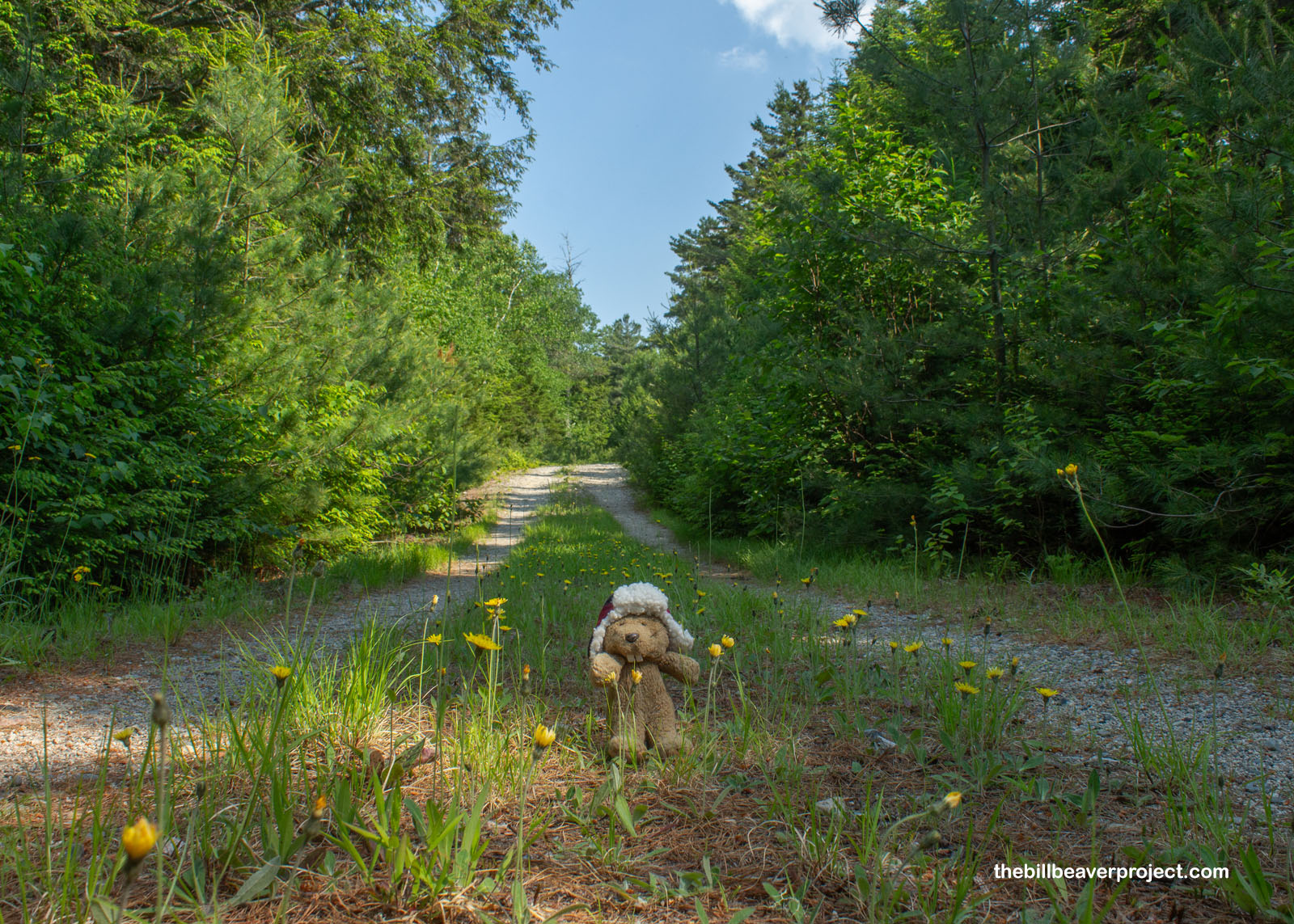
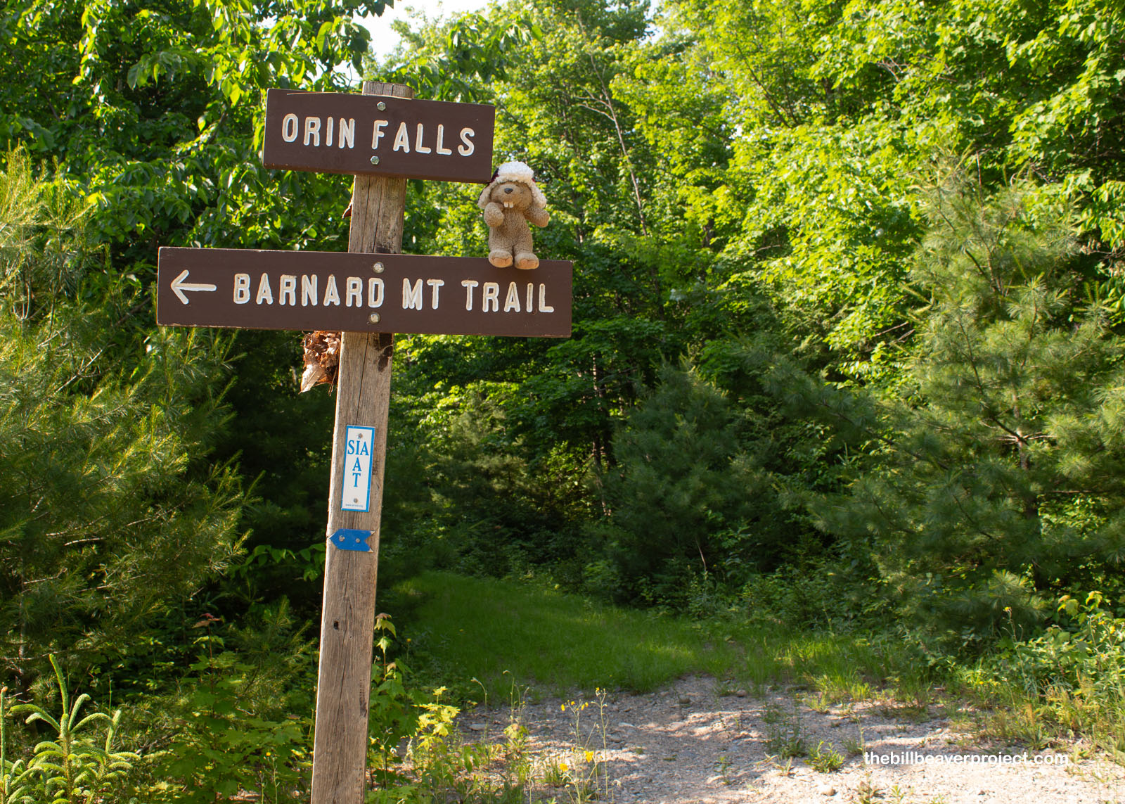
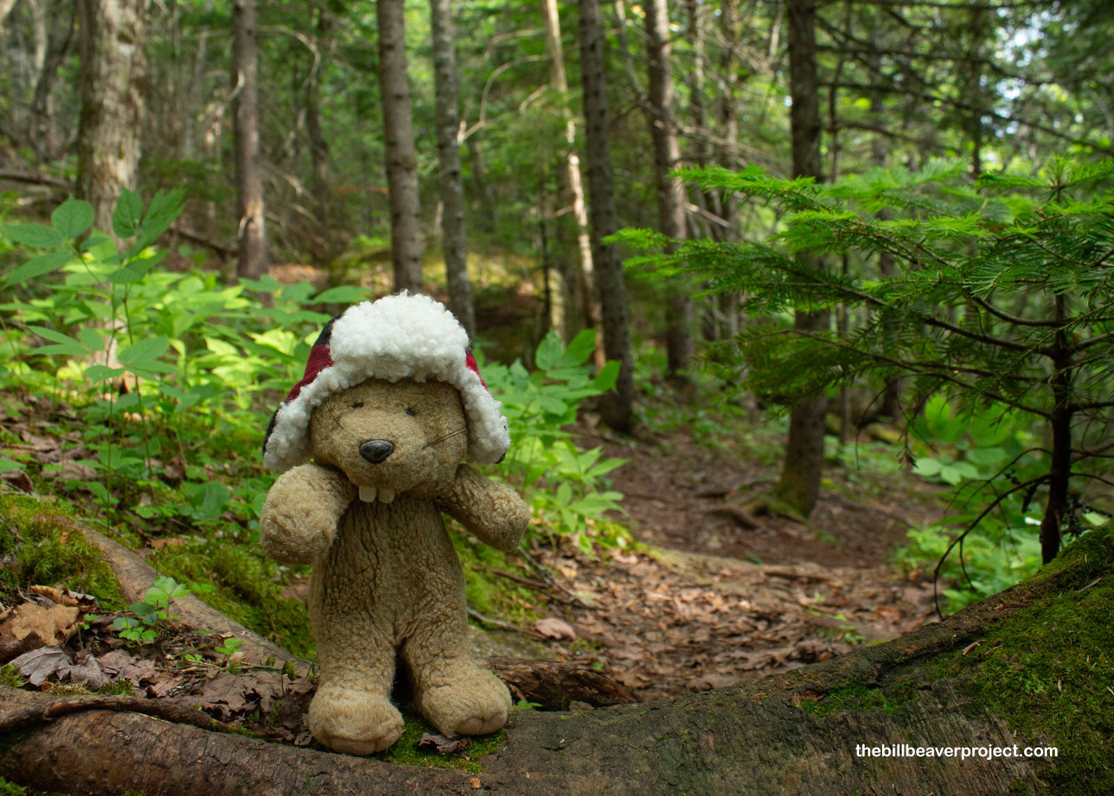
At one hour’s stroll, I hit the sign where the Orin Falls trail diverged from the Appalachian Trail, marking roughly the halfway point. Here, the thick border of trees, which had been giving me some shade, disappeared, and the path turned open and upward toward the sun!
 |
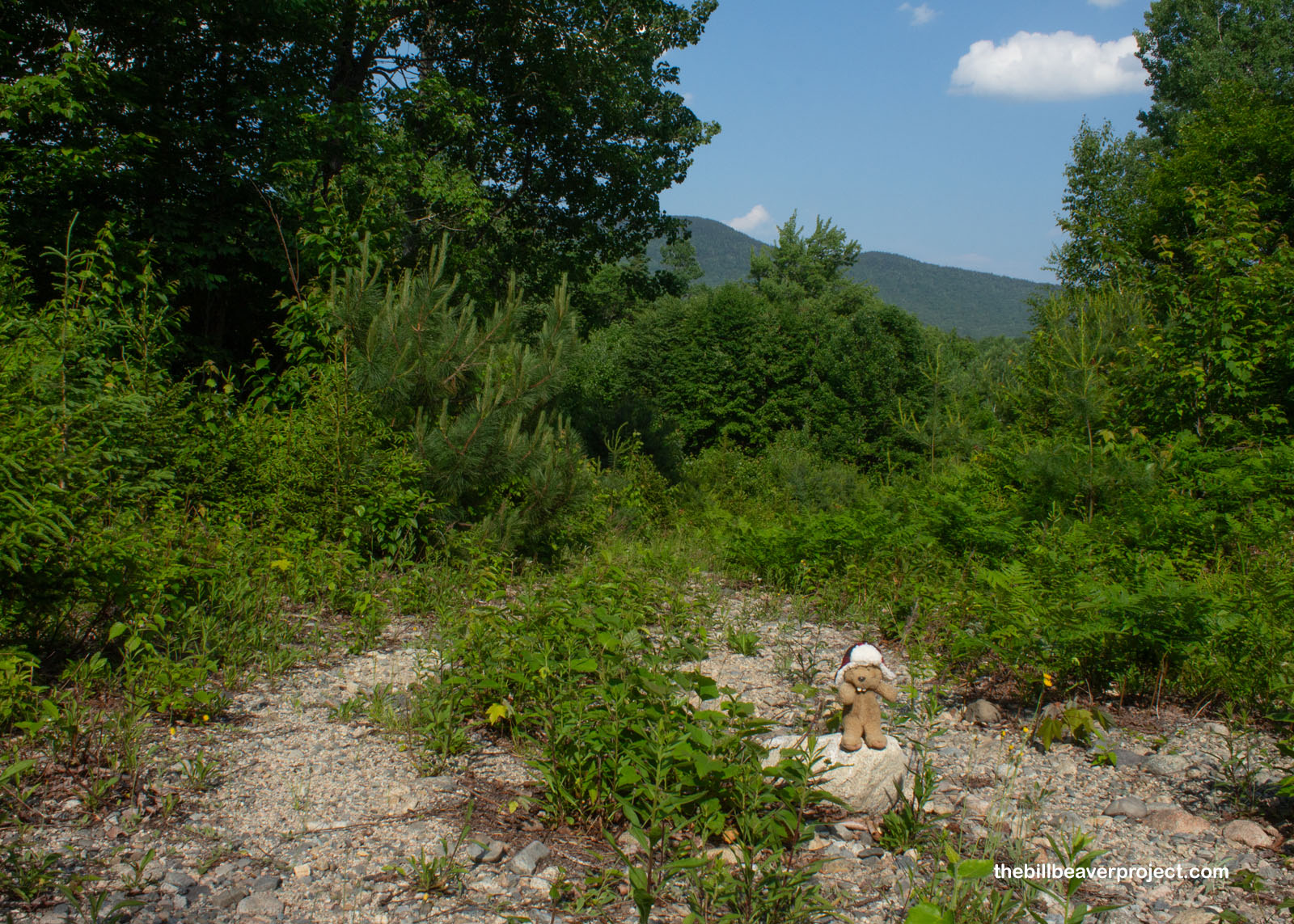
The photo of this section of the trail just doesn’t do it justice: high 90s, humid, uphill, swarming with bugs… This was definitely more of an adventure than a leisurely walk in the woods! I felt pretty foolish, but I was also very determined!
 |
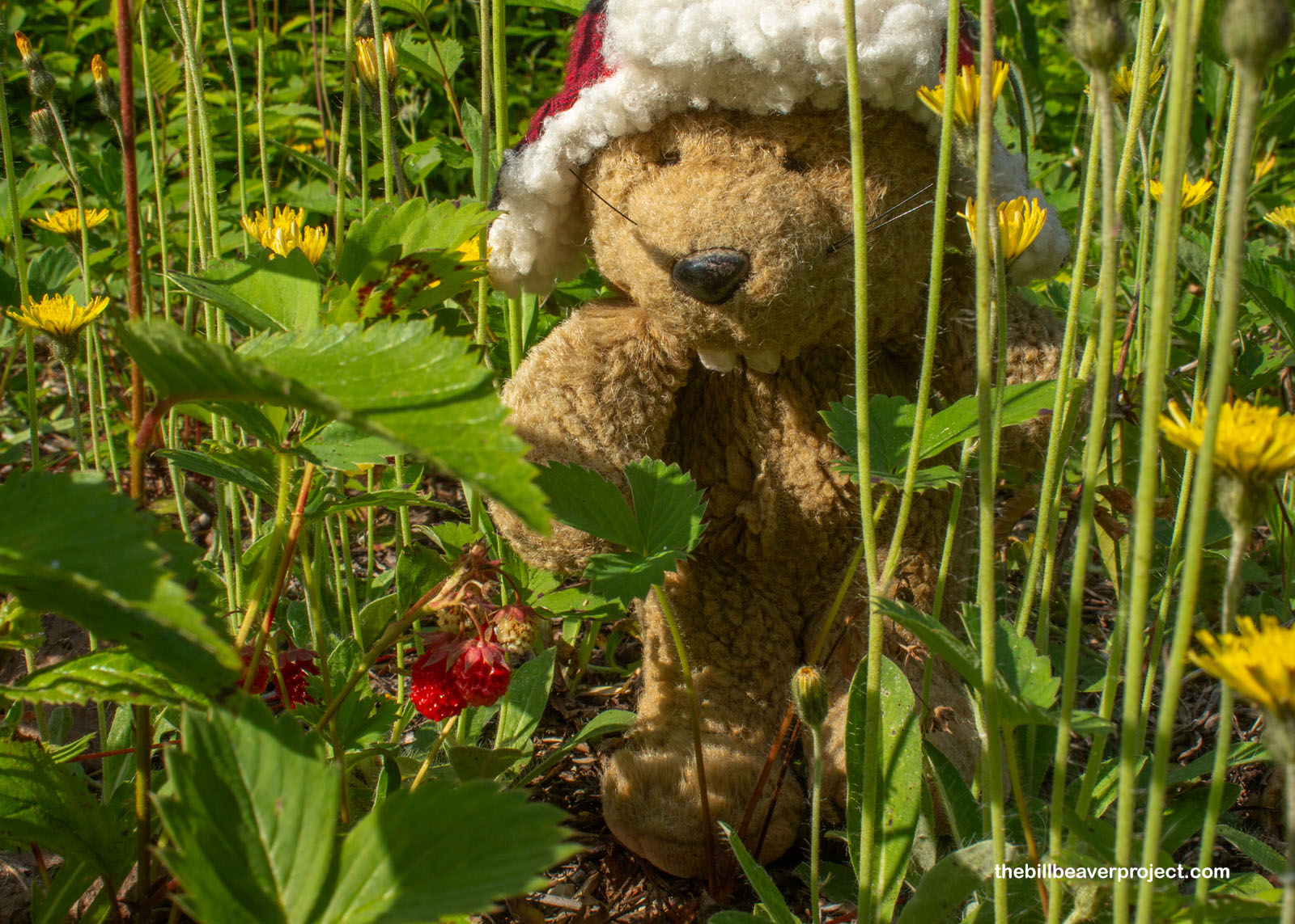
But was I without nourishment and hydration? Nay! As luck would have it, the trail was chock-full of wild strawberry plants, and those strawberries were ripe! Being low to the ground, this was very convenient for me. I could walk a few feet, grab a snack, and walk some more. Searching for strawberries really took my mind off the slog!
 |
The hotter it got, the more fascinated I got by what was growing on the ground. This clubmoss looked like a carpet of tiny pine trees covering the trail! In fact, some clubmoss is known as ground-pine and has a history of being brewed into medicinal teas to treat everything from headaches to diarrhea!
 |
Just over three quarters of the way into my hike, I caught sight of an encouraging sign: less than a mile to go to the summit of Barnard Mountain! It was a surprising side spur, which I wouldn’t have noticed at all without the sign pointing me in the right direction. That’s because it was incredibly overgrown and led off into some dense, dark, and intimidating woods! I mulled it over for a second: potential danger or relieving shade? At that point, I was willing to risk just about anything for some shade!
 |
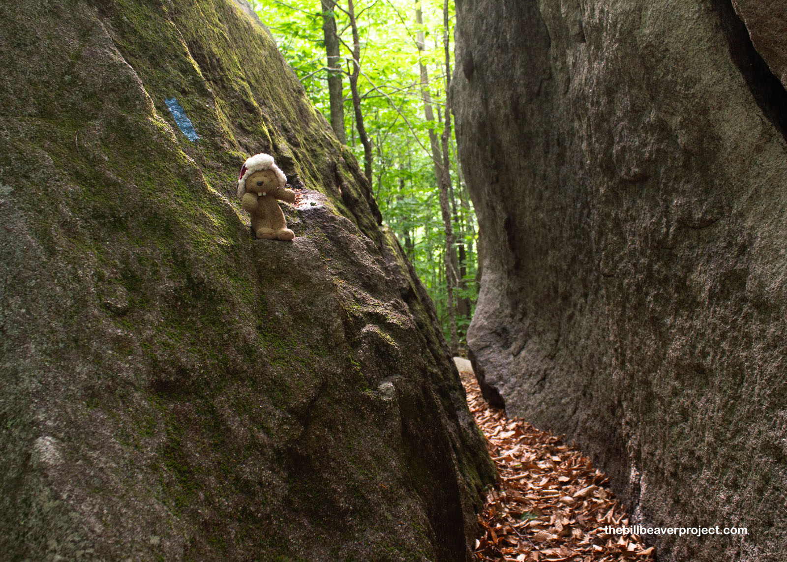
Oh boy, what a relief! Stepping into the woods dropped the temperature by a good ten degrees, and though the shade added mosquitoes to the onslaught of deer flies, my skin positively soaked in the cool air. Plus, I was completely engulfed in amazingly deep green, marked by blue blazes on the trees to help me navigate the gentle, rocky switchbacks!
 |
A wiggle in the trail took me between two monstrous boulders for no real reason other than to be a cool gateway and distance marker! And growing on these rocks was one of the world’s largest lichens: Umbilicaria mammulata, the smooth rock tripe! Able to grow as large as a dinner plate, rock tripe is edible and was even one of the foraged foods that helped the Continental Army survive their winter at Valley Forge!
 |
 |
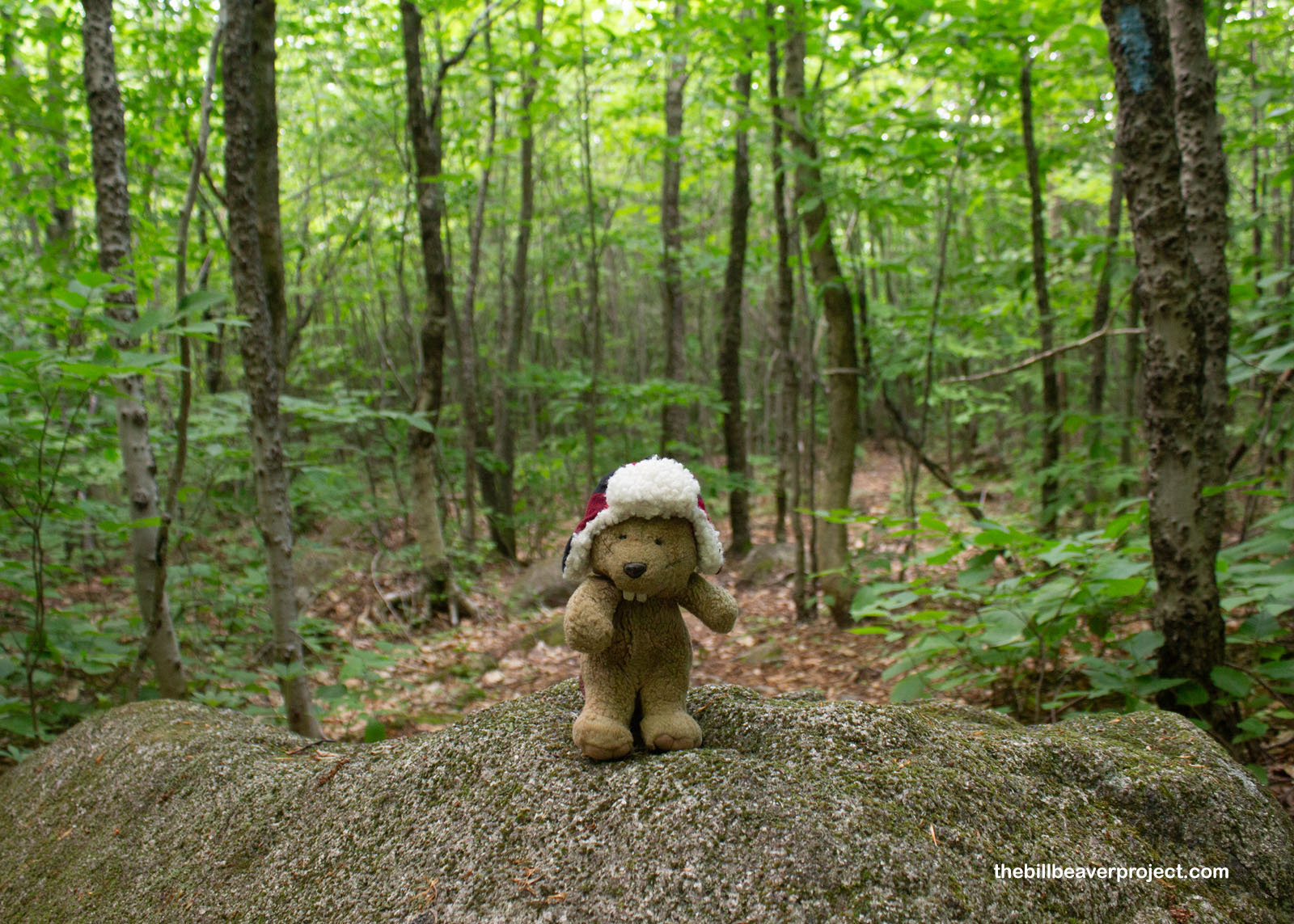
Bugs aside, it was a super calm final ascent to the summit of Barnard Mountain, and though I wasn’t fast enough to snap any photos, I saw two wood frogs hanging out on the trail! I was surprised to see these frogs so far from any water, but wood frogs are well adapted for dry lives. They’re even able to survive freezing in the winter by building up urea and glucose in their blood. You might call these frogs “sweet pee!”
 |
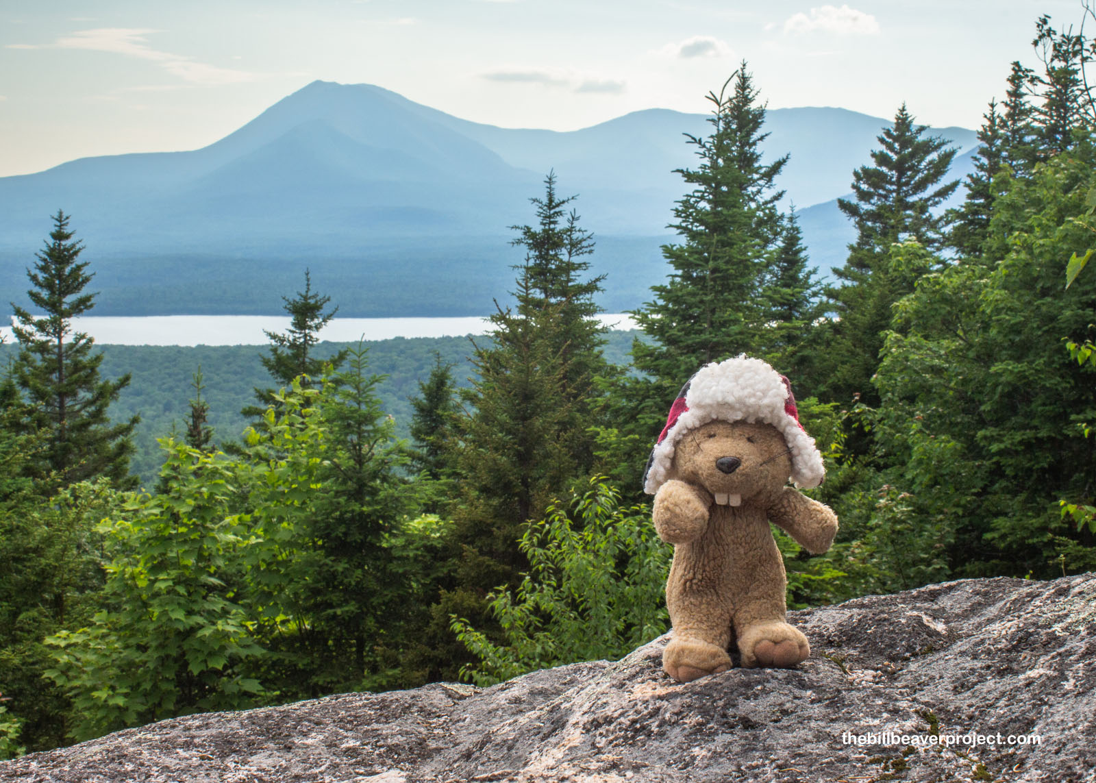
Suddenly, I emerged into the sunlight once again! I’d made it to the top of Barnard Mountain, a mere 1,558 feet in elevation, but after four miles and some change, it really felt like an accomplishment! What also must have been quite the accomplishment was the picnic table set up on the rocky slope! Had I collected more strawberries and had more than a few hours before nightfall, this would have been the perfect place to kick back and enjoy a snack with one amazing view!
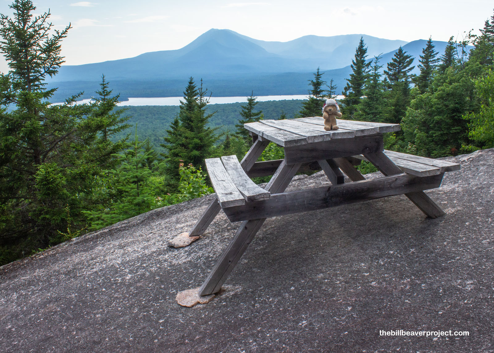 |
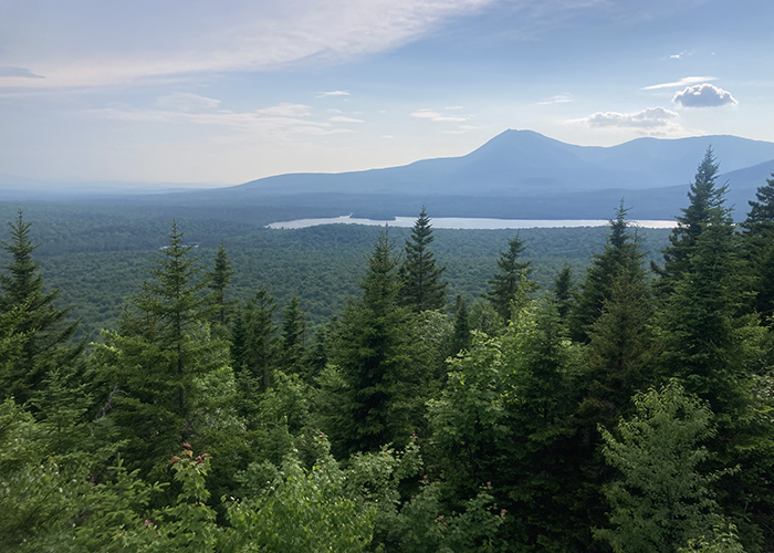
Sure enough, off to the west towered Katahdin, the “Great Mountain,” the highest in Maine at 5,269 feet, and the official northern terminus of the 2,200-mile Appalachian Trail! To the Penobscot and Abenaki, its peak is home to Pamola, the moose-headed, eagle-winged thunder god, responsible for cold weather! Had I broken taboo and climbed Katahdin, I don’t know what I would have done if I’d met such a creature, but I definitely would have wanted to be its friend!
 |
After a nice, long break with a view, the time had come to return to civilization. I had not seen another hiker on this trail, or even another car on the roads leading into the park. It was as remote and wild as could be! Swatting flies the whole way, I hustled on back to the trailhead, completing my eight-mile journey after just under four hours of adventuring. After some twists, turns, and wrong ways trying to get out of the park with no GPS, I made it back to the road and back to Bangor, where I tucked in to rest, despite sore feet and huge welts from the deer flies, and did my best to dream sweet dreams of tomorrow’s epic conclusion to a major side quest!
Onward to Augusta!

More 2024 Adventures |
Total Ground Covered: 234.0 mi (376.6 km) |
Next Day |