 Previous Day |
Bangor, ME → Acadia NP → Bangor, ME 138.0 mi (222.1 km) |
 More 2024 Adventures |
It’s the Maine attraction, everyone!
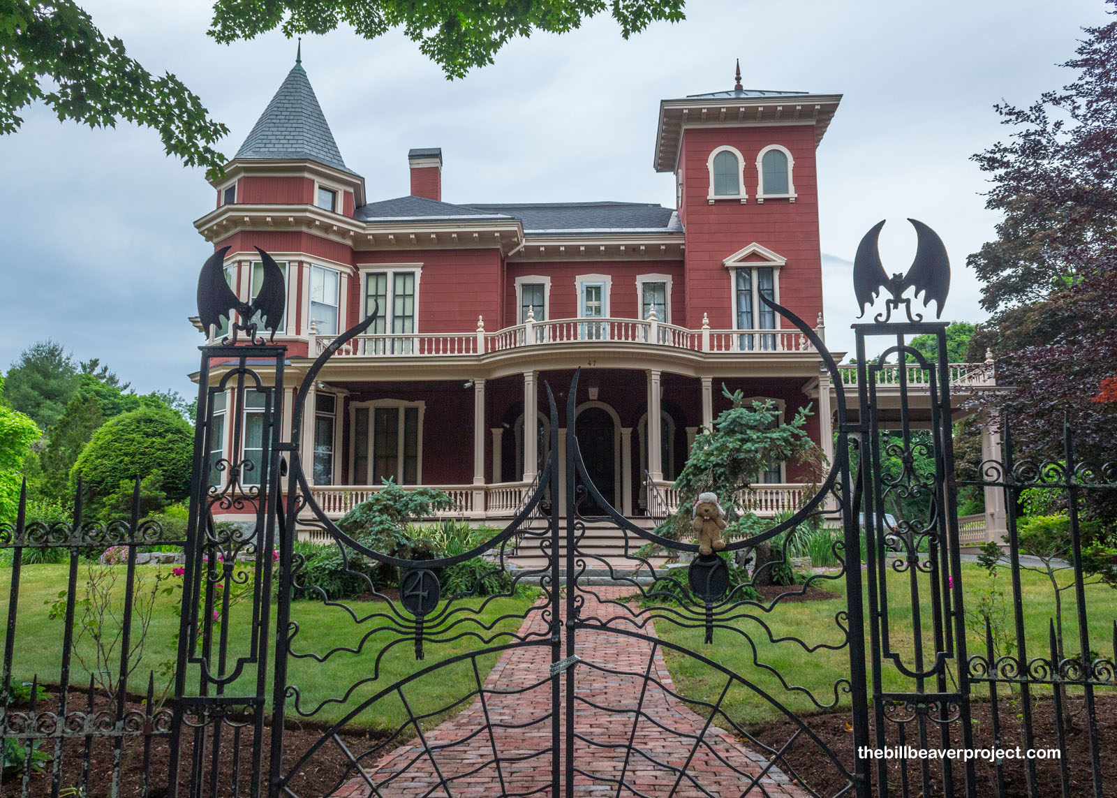
My final day in Maine dawned nice and spooky! The wild hot heat of the last few days had been replaced by clouds, which made it perfect to kick off today’s adventure at the famous former home of Stephen and Tabitha King! A pilgrimage site for horror fans across the globe, today, it’s the headquarters of their foundation! There are no hungry clowns or pet cemeteries here. This foundation does a lot of not-scary things, like funding arts and literature, education, and historical preservation within the state of Maine!
 |
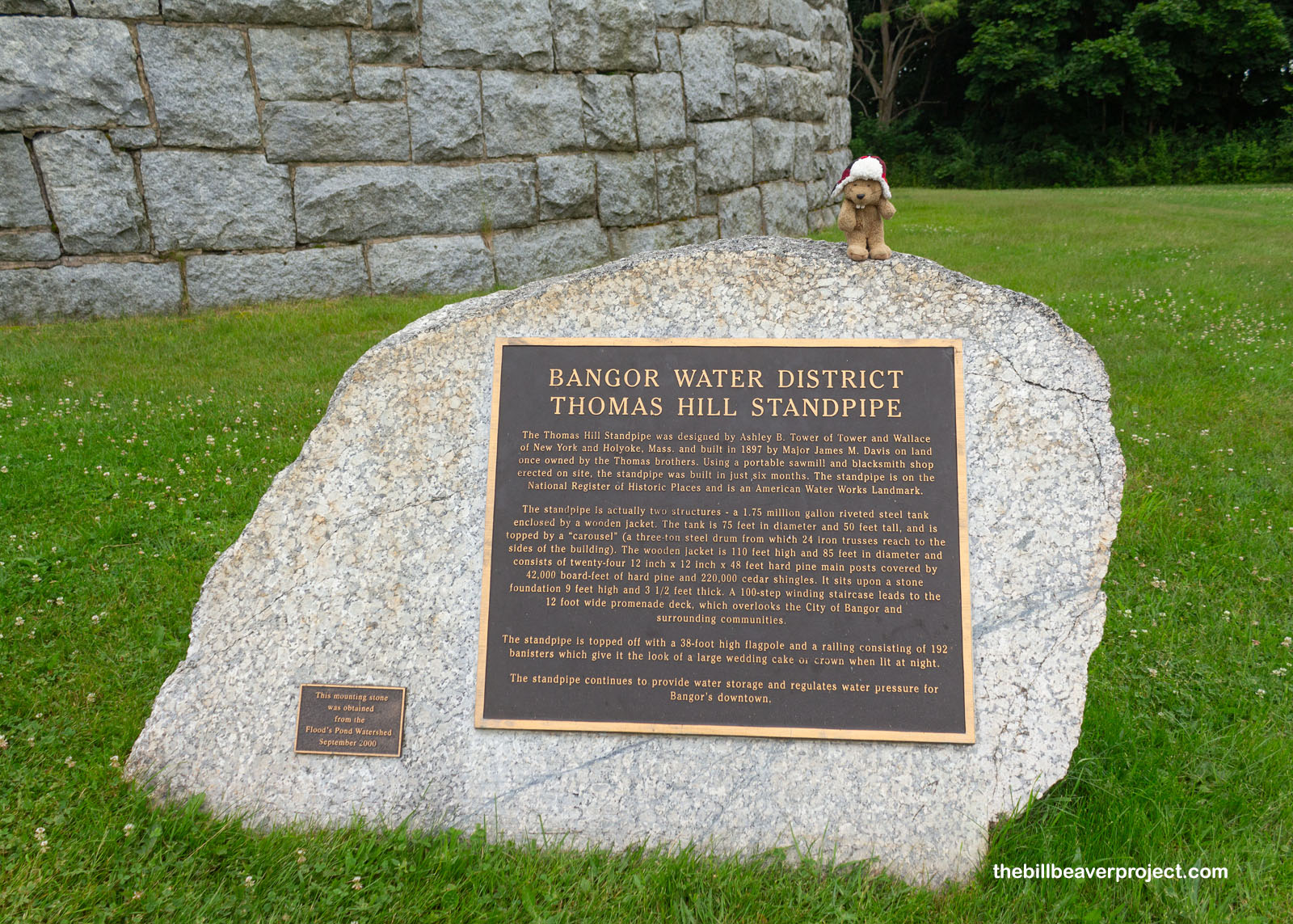
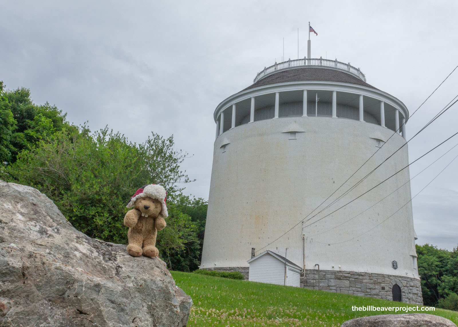
But some of Stephen King’s scariest works did originate here in Bangor, like It, inspired in part by the Thomas Hill Standpipe! Though not actually the lair of Pennywise the dancing clown, this National Historic Landmark is the life blood of Bangor! Built in 1897, it still holds a million and a half gallons of water, which regulates the city’s water pressure and provides a really useful resource for firefighting!
 |
 |
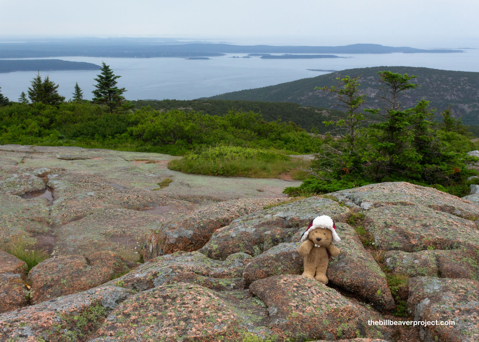
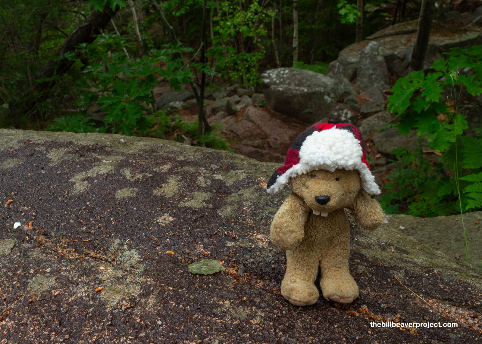
Firefighting was not likely to be on the docket today, because it was cool, cloudy, and damp. Plus, I was going to be spending a lot of time by the water in Acadia National Park! One of the ten most visited national parks in the USA, even with the rain, I was racing to beat the crowds and make my timed entry to the park’s most popular destination: Cadillac Mountain!
 |
Cadillac Mountain is the only place in the park that limits visitors to timed entry! That’s because it is the tallest point on Mount Desert, Maine’s largest island and the bedrock for most of Acadia National Park, and therefore offers the most breathtaking views! My entry time was set for 8:00 AM, which put me well ahead of the crowds but right in the midst of some gusty wind and drizzly rain! It was well worth it, though! The baldness of the summit, which lent itself to the island’s name of “Desert,” offered up stunning panoramas of the Hancock County coastline!
 |
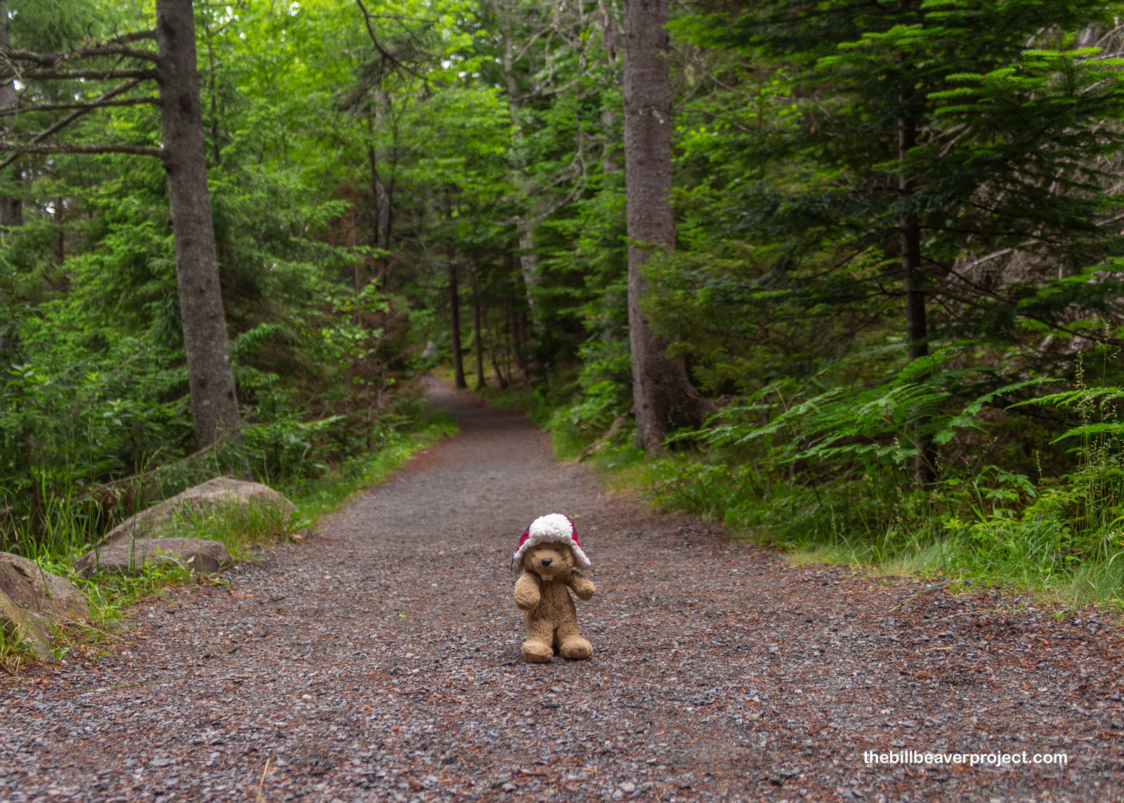
From here, I was able to chart my course for the day, spanning the many ecosystems of Acadia from high conifer to deciduous forests to the park’s famous rocky shores! Before me lay a banquet of opportunities for hiking, climbing, kayaking, and general exploring! However was I to decide? Well, as the showers came and went, I pointed my compass in the direction of adventure and hoped for clearer skies by the time I hit an actual trail!
 |
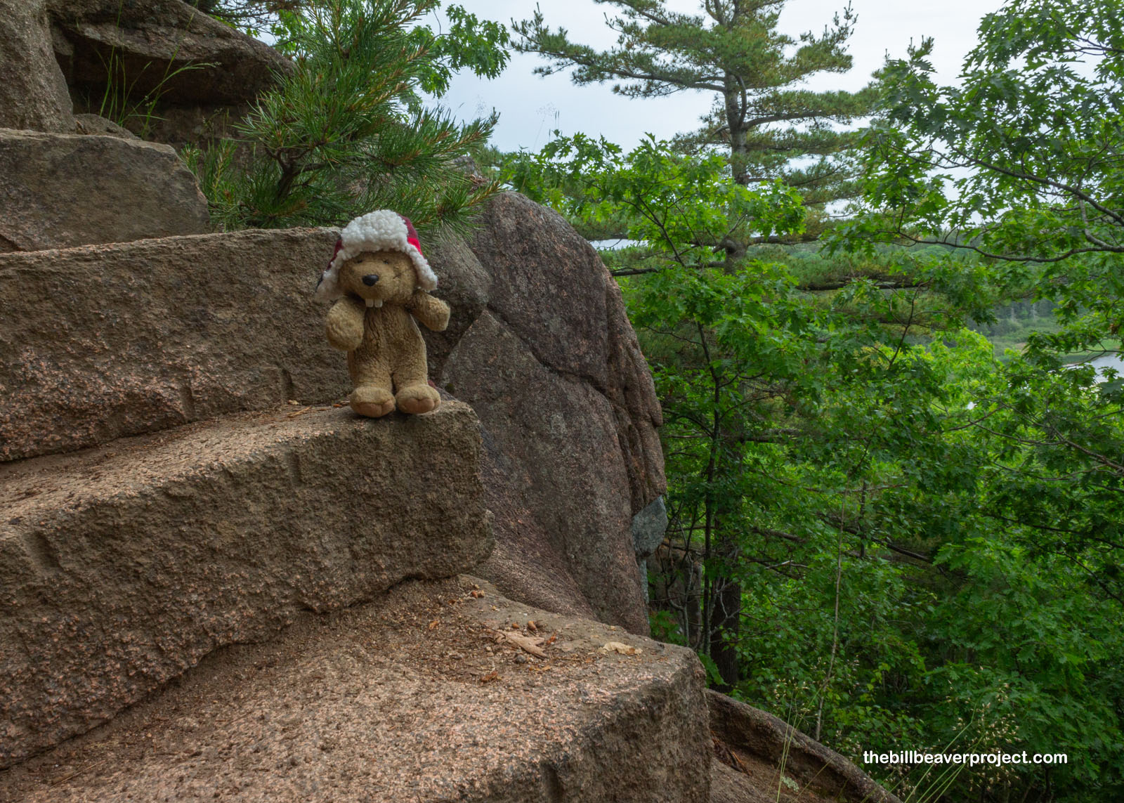
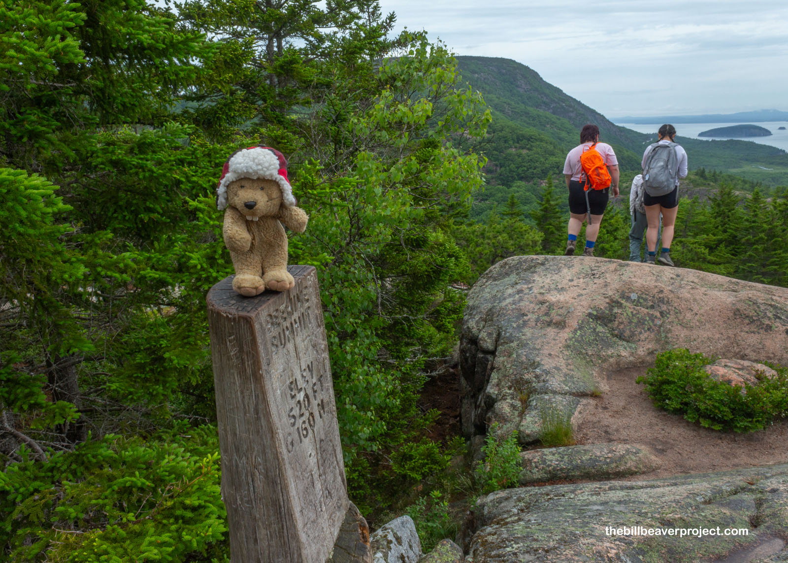
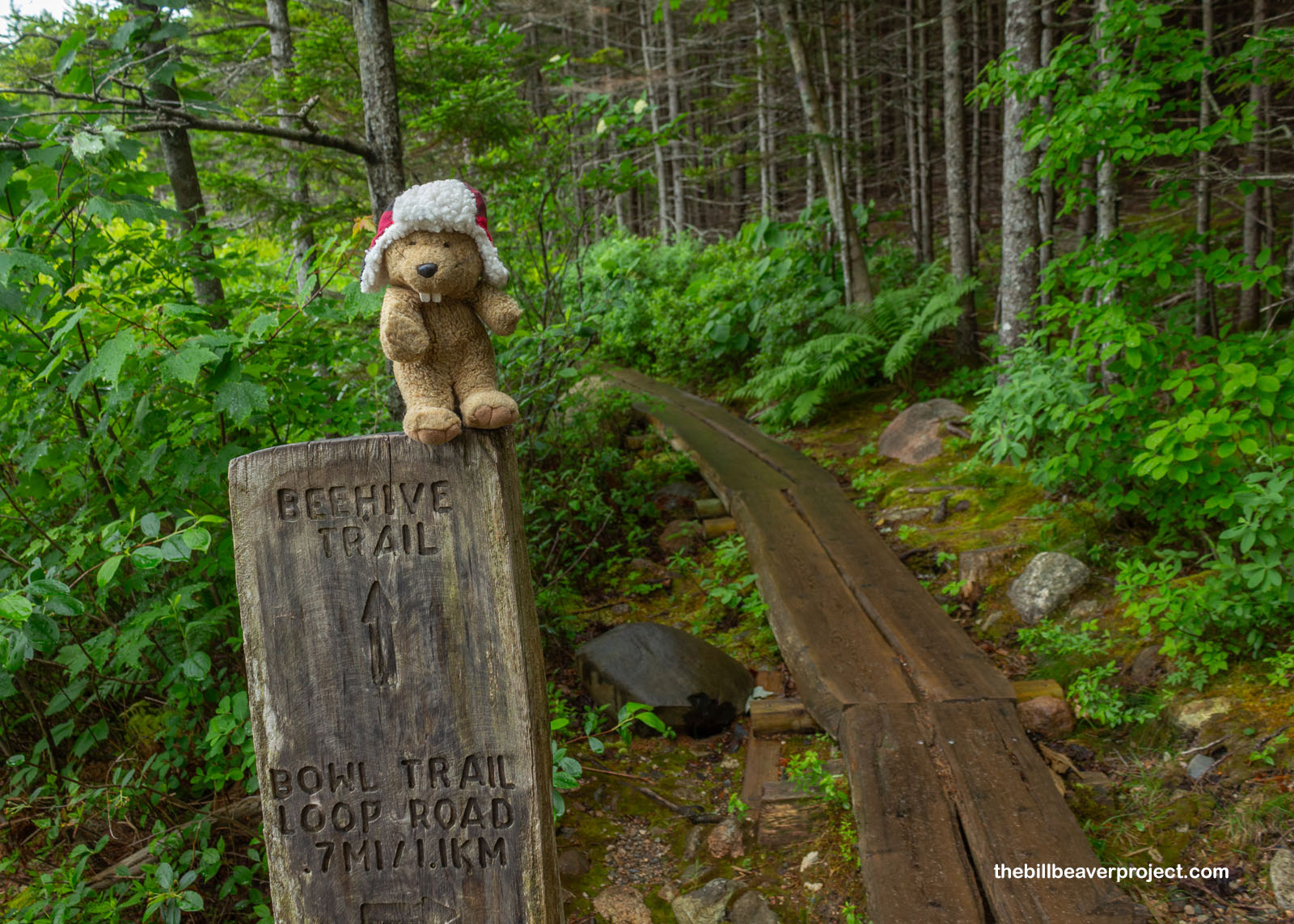
First up, I took a recommendation from the fellow at the hotel’s check-in desk! He said I simply must not miss the Beehive Trail, so long as I was brave and adventurous! After thirteen years of close calls, I still count myself as brave and adventurous, even though the trail came with some pretty unmissable warnings: Nearly Vertical! Exposed Cliffs! Avoid in Wet Conditions! That sounded just perfect, so after shoving through the parking lot, I set off into the Beehive!
 |
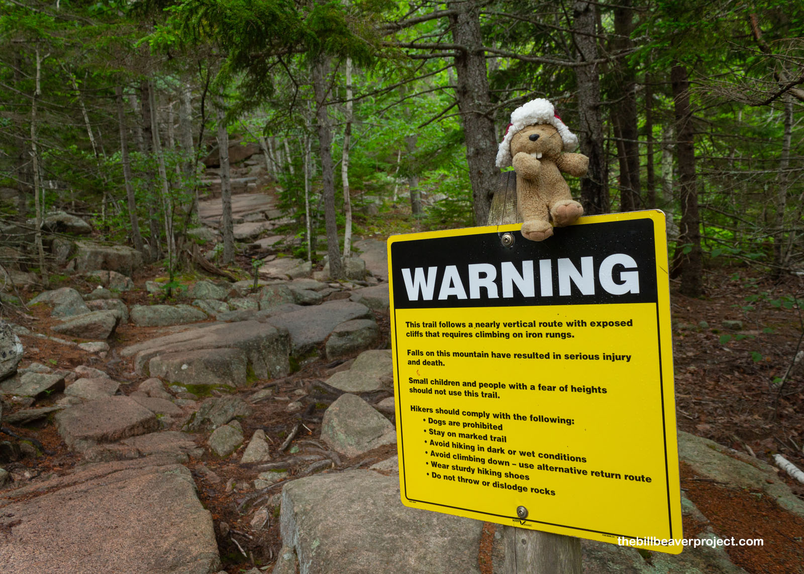 |
I wasn’t too intimidated when I saw the trail distance, only 1.4 miles long, but here be warned, fellow travelers! This was going to be a scramble, starting with boulders to skirt and scale, then building into steep stone steps cut right into the rock!
 |
 |
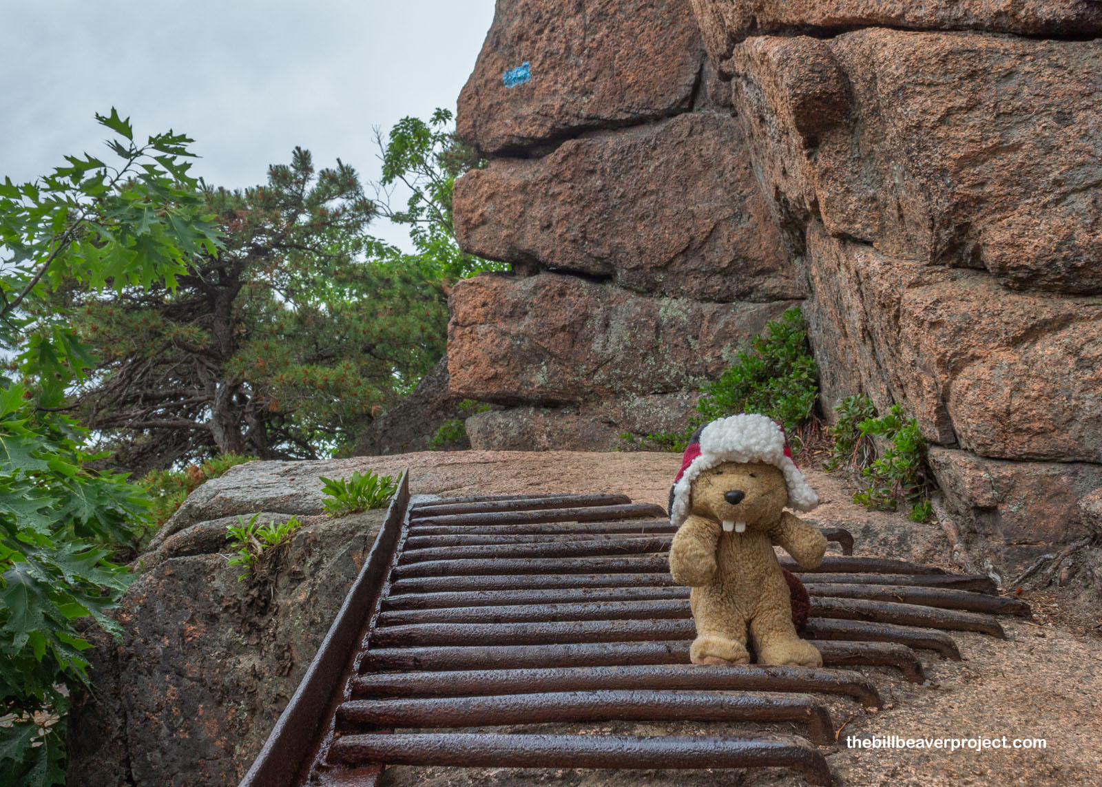
At one point, the trail had eroded away so precariously that it had been fortified with an iron grate! This was very slippery after the rain, so I had to tread very carefully. This was followed by iron rungs going right up the face of the cliff! These required me to leap like a gymnast from rung to rung, stopping to catch my breath and wipe my paws to keep from slipping to my doom! Oof! It reminded me of the chains I used to climb Angel’s Landing in Zion National Park, but this old beaver can’t take the strain like I could back in 2011!
 |
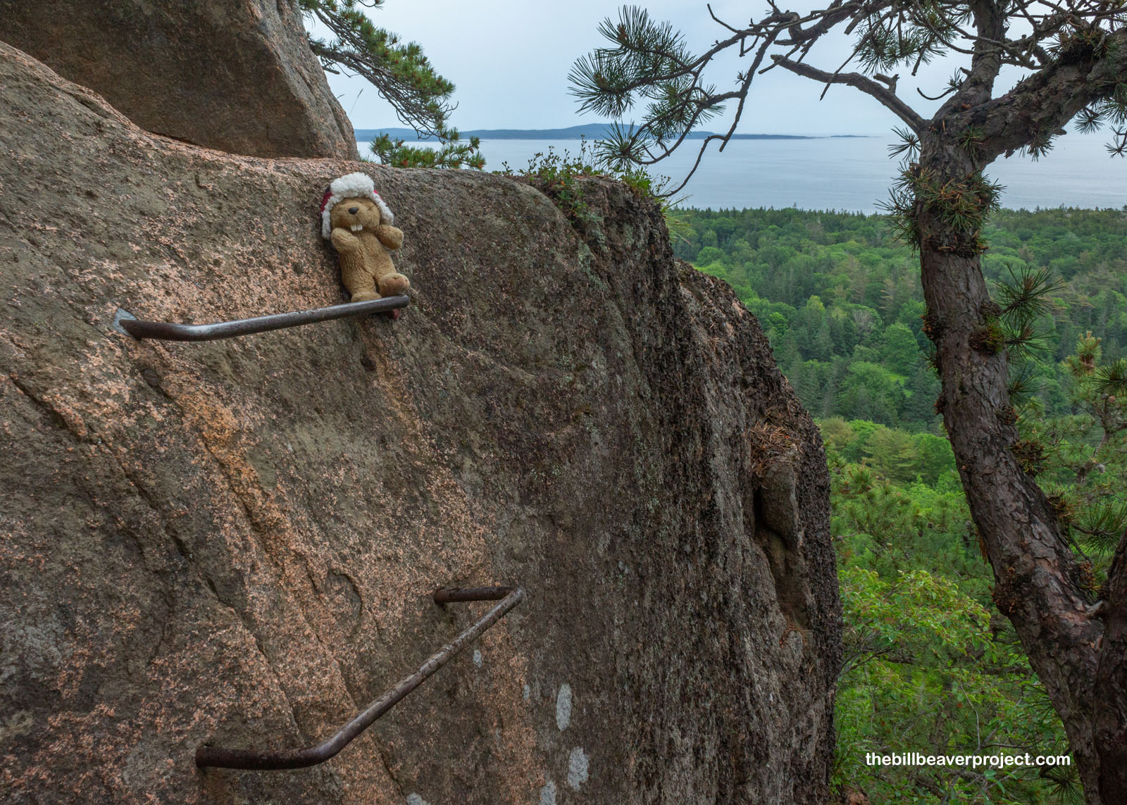 |
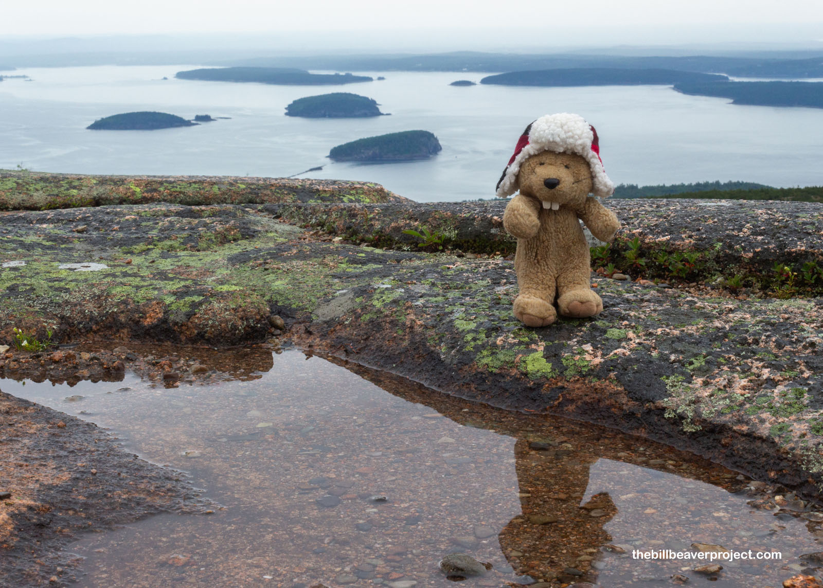
But these kinds of adventures are always worth it for how they elevate a perspective! Down below, I could see Sand Beach, one of the park’s most famous stopping points. From the parking lot, Sand Beach was an absolute cacophony of cars, but from way up here, it looked downright peaceful, a place I might take a nap if it weren’t so drizzly!
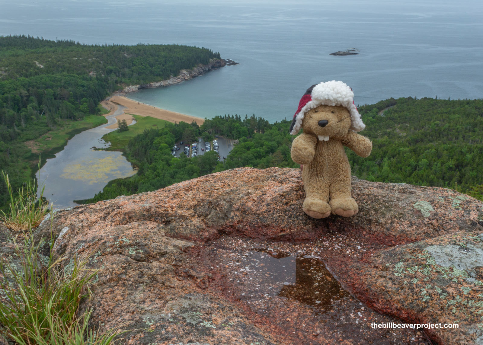 |
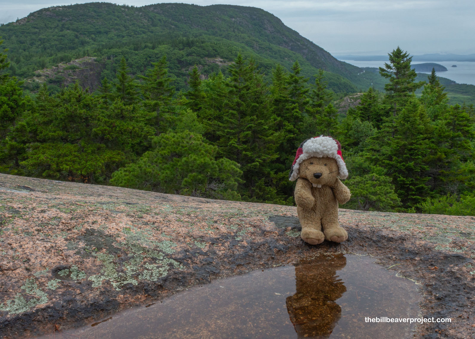
It didn’t even take an hour to reach the summit at a mere 520 feet above sea level. What the top of the Beehive lacked in elevation, it made up for in pretty views of Enoch Mountain and the ocean beyond! This whole area was at one point owned by Eliza Homans, who donated it to the creation of a national park, which was finalized as Acadia in 1929! It was the first national park created entirely from private land donations! And there were quite a few folks up here enjoying the results of those donations, including some young’uns who really wanted to know why I wasn’t eating lunch like they were. It was still too early by my standards, but I had my mind set on one of Maine’s famous lobster rolls a little later!
 |
 |
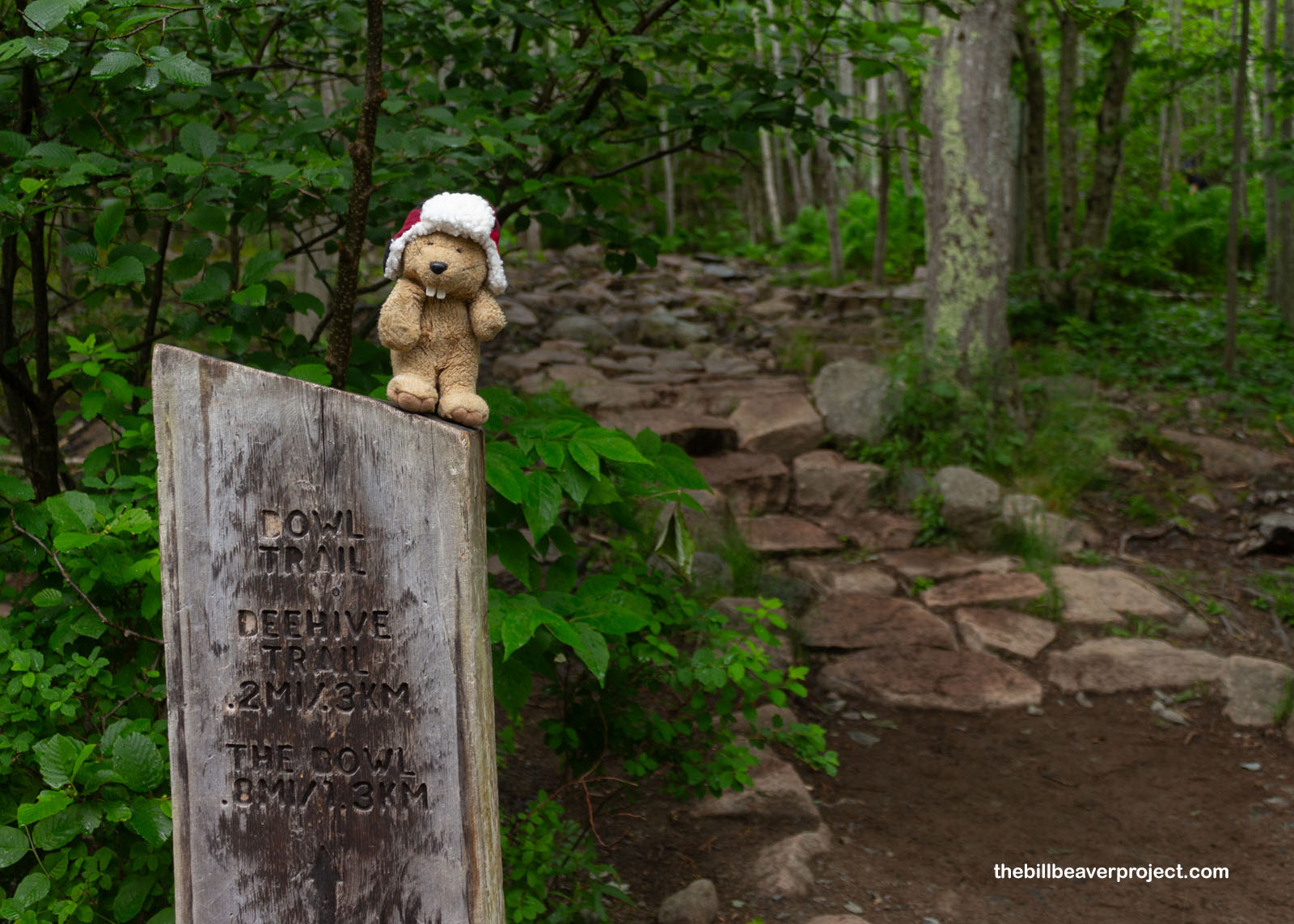
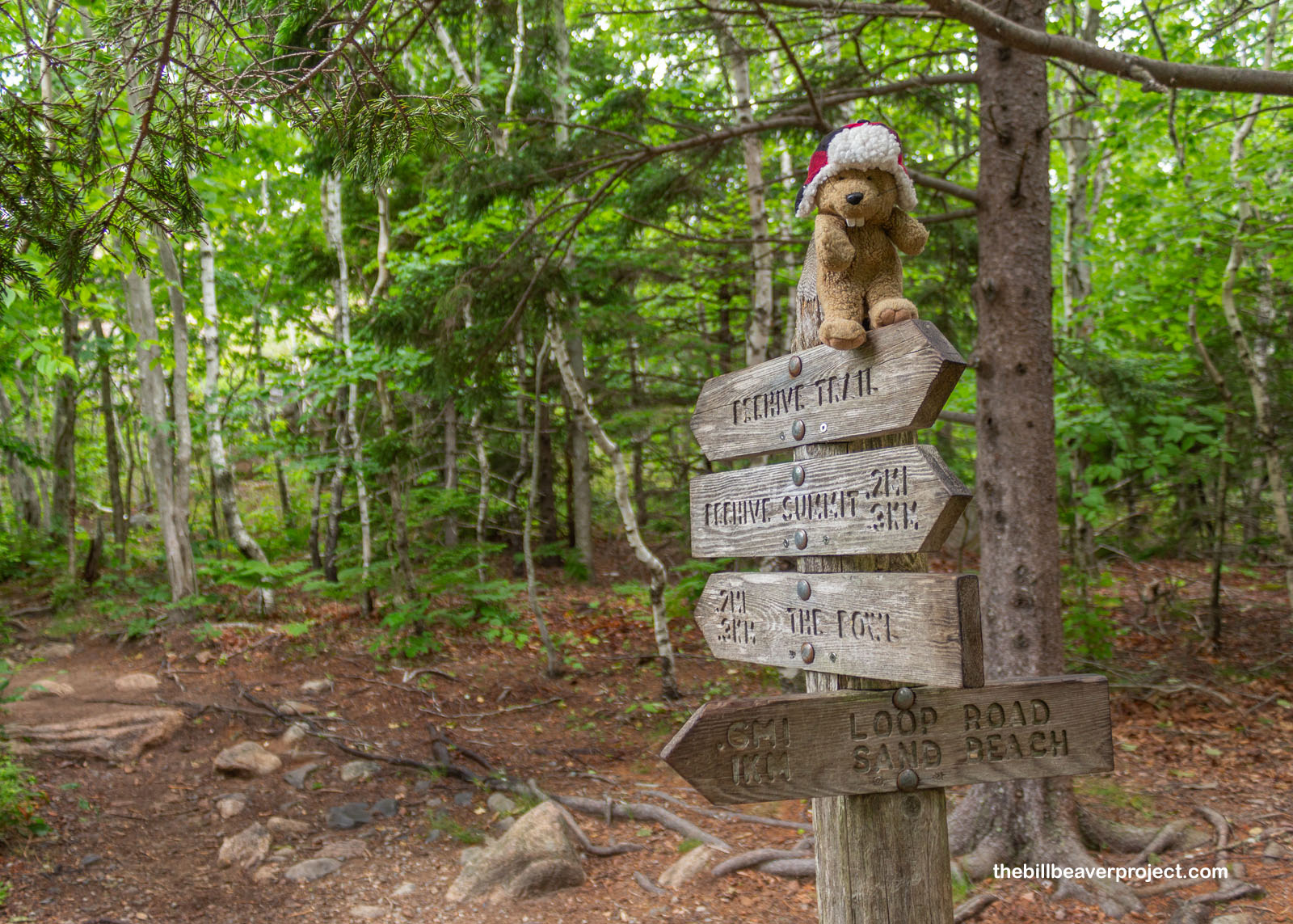
Since it hadn’t taken long at all to conquer the Beehive, despite its perilous steps and ladders, I had some extra time to extend my loop, and I am a sucker for vaguely named geographical features! In short, a sign pointed to the Bowl. What exactly the Bowl was, I couldn’t tell, but there were plenty of blue blazes to follow and enough unripe blueberries to make me wish I’d stopped by a month later! A bowl full of those would be mighty nice!
 |
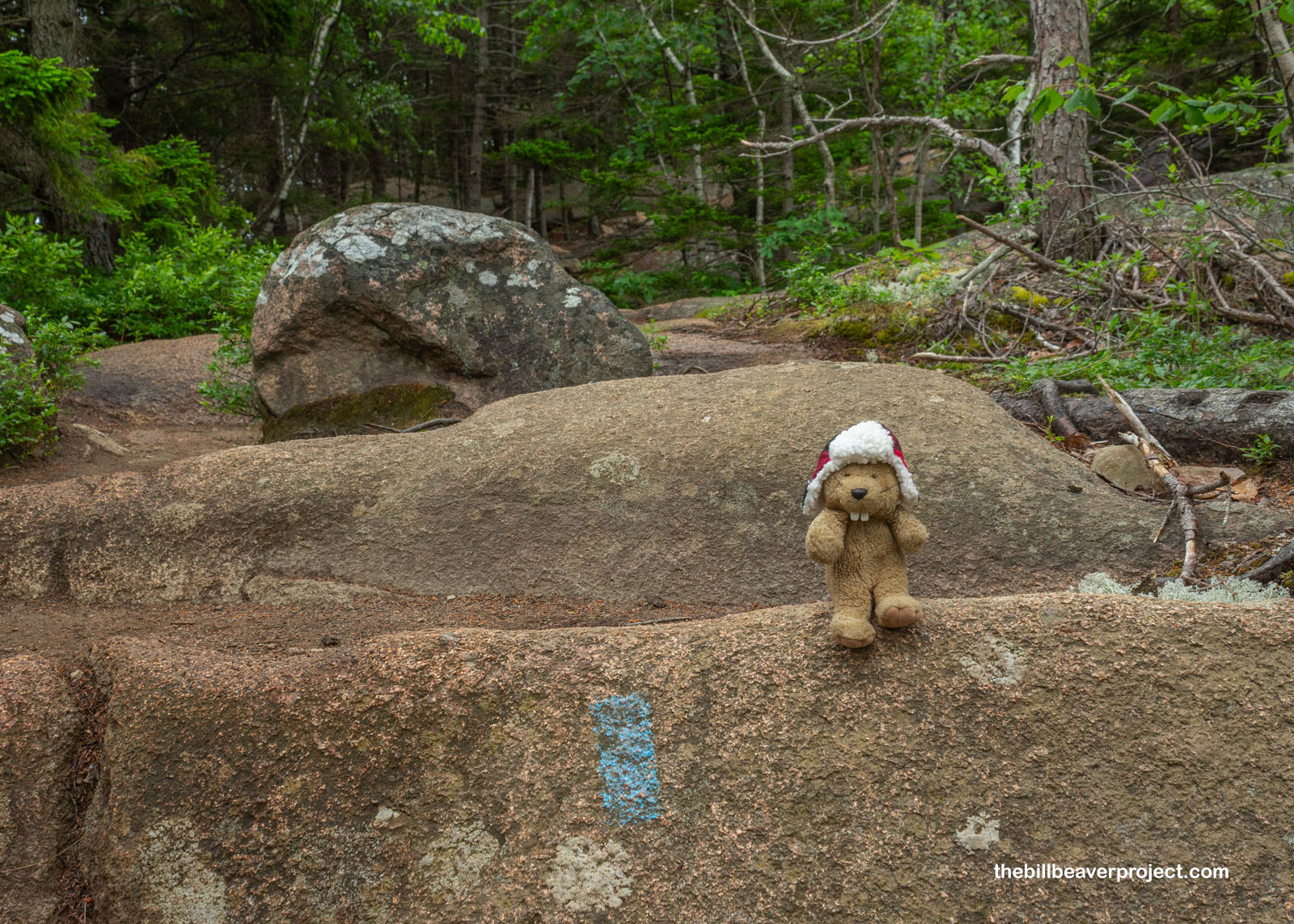 |
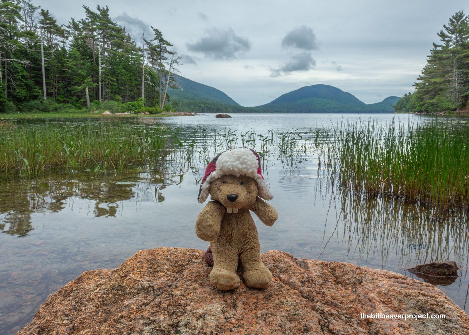
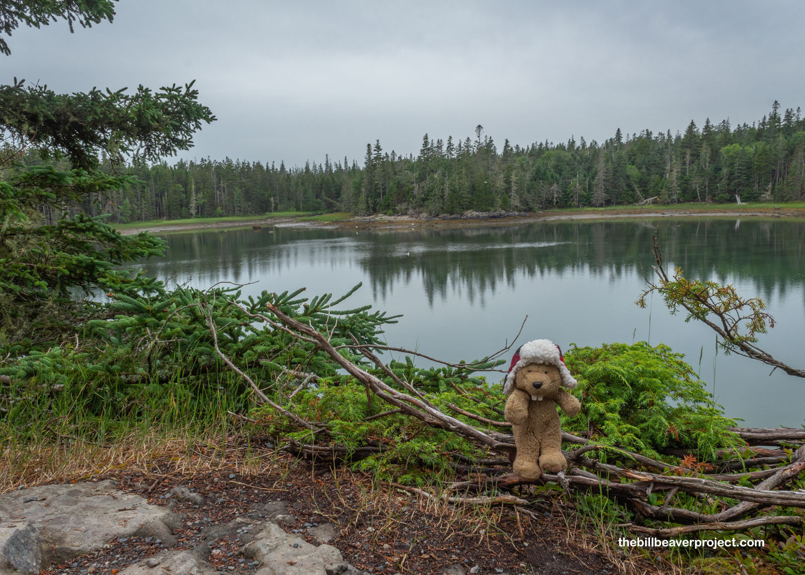
Not even half a mile away, the Bowl revealed itself: a lovely pond, carved into these spruce-covered hills by long-gone glaciers! Even up here, I could hear frogs singing, which made me wonder if they’d had to climb up the perilous cliffs or found another way to colonize this mountainous pond!
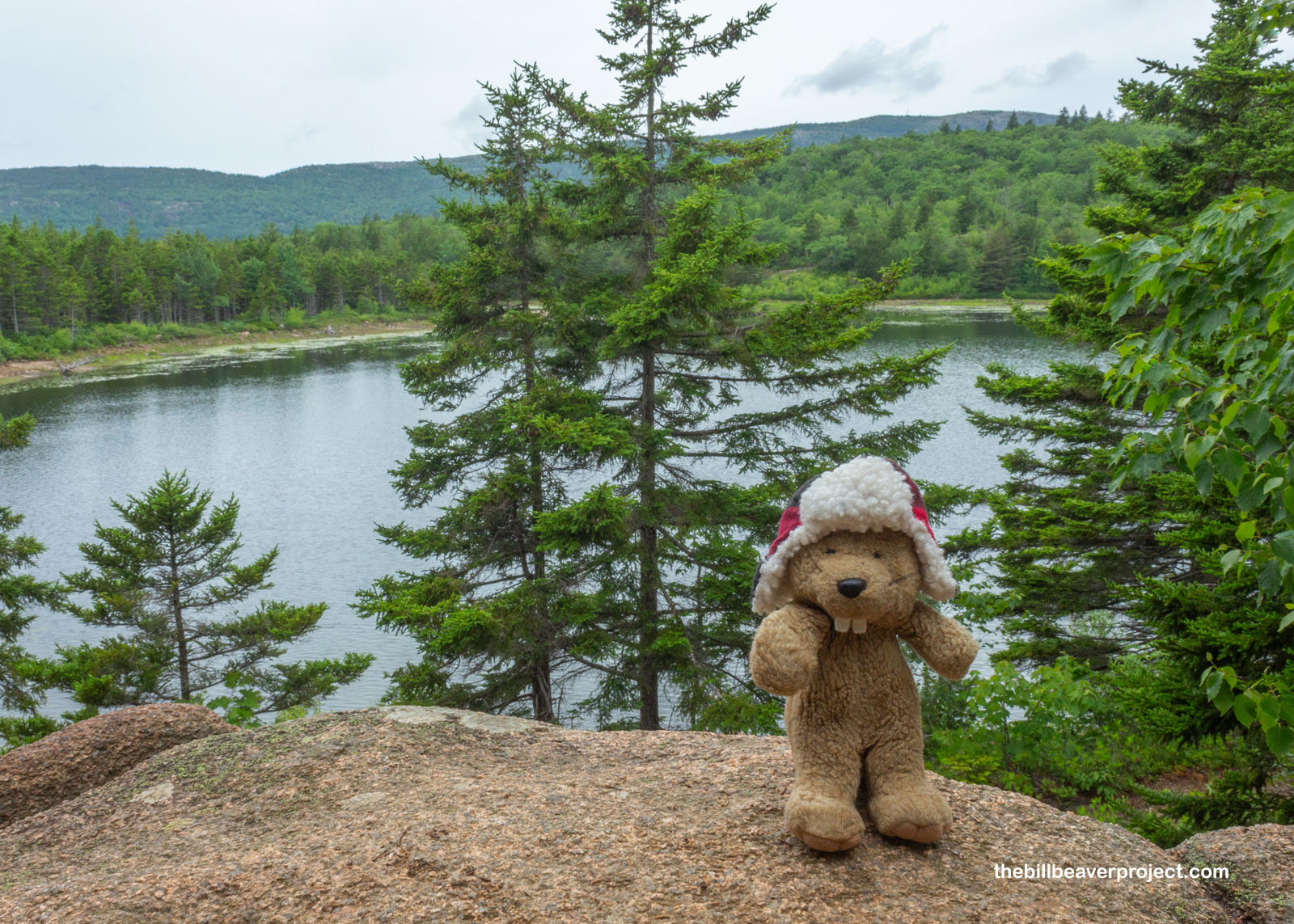 |
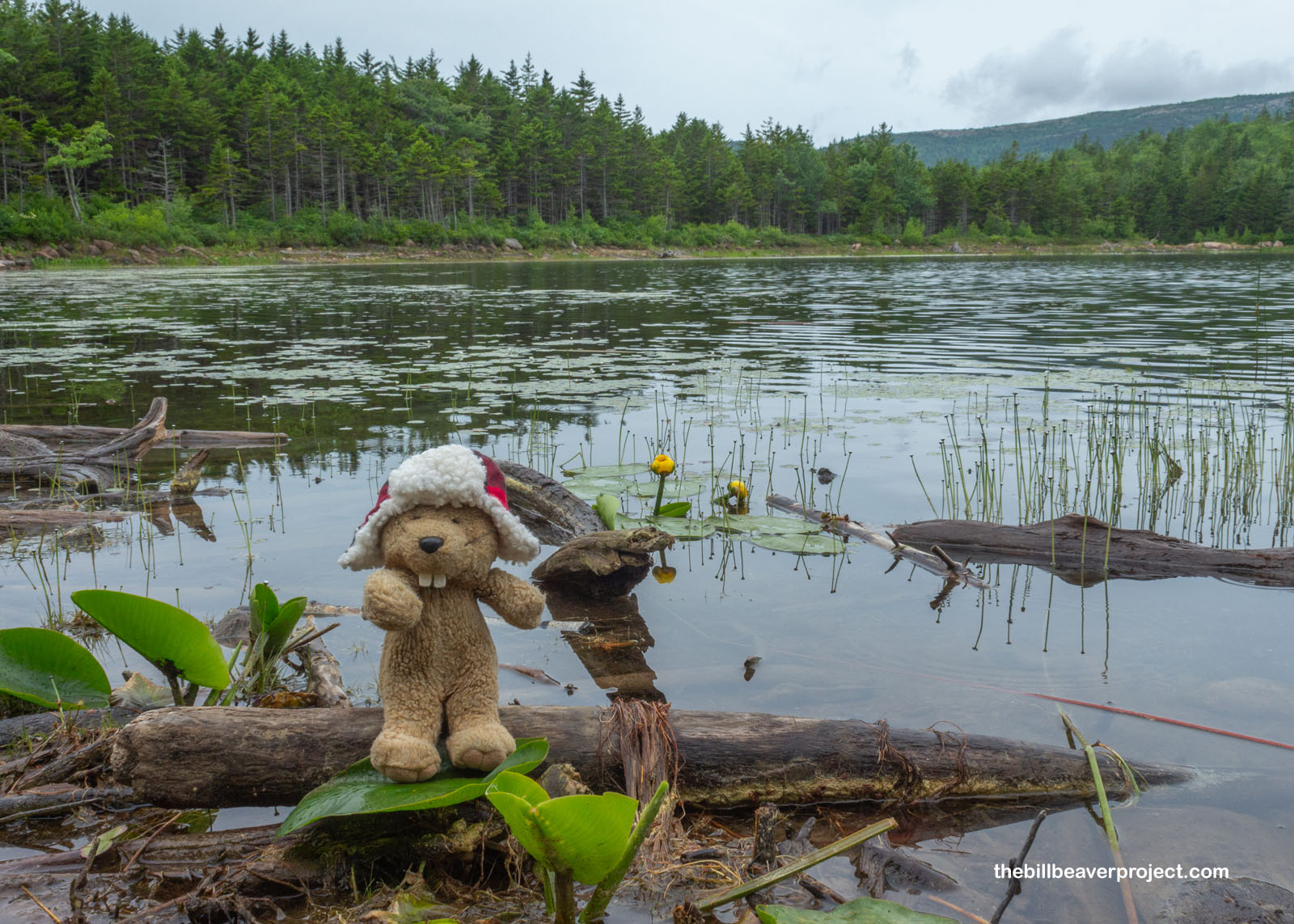
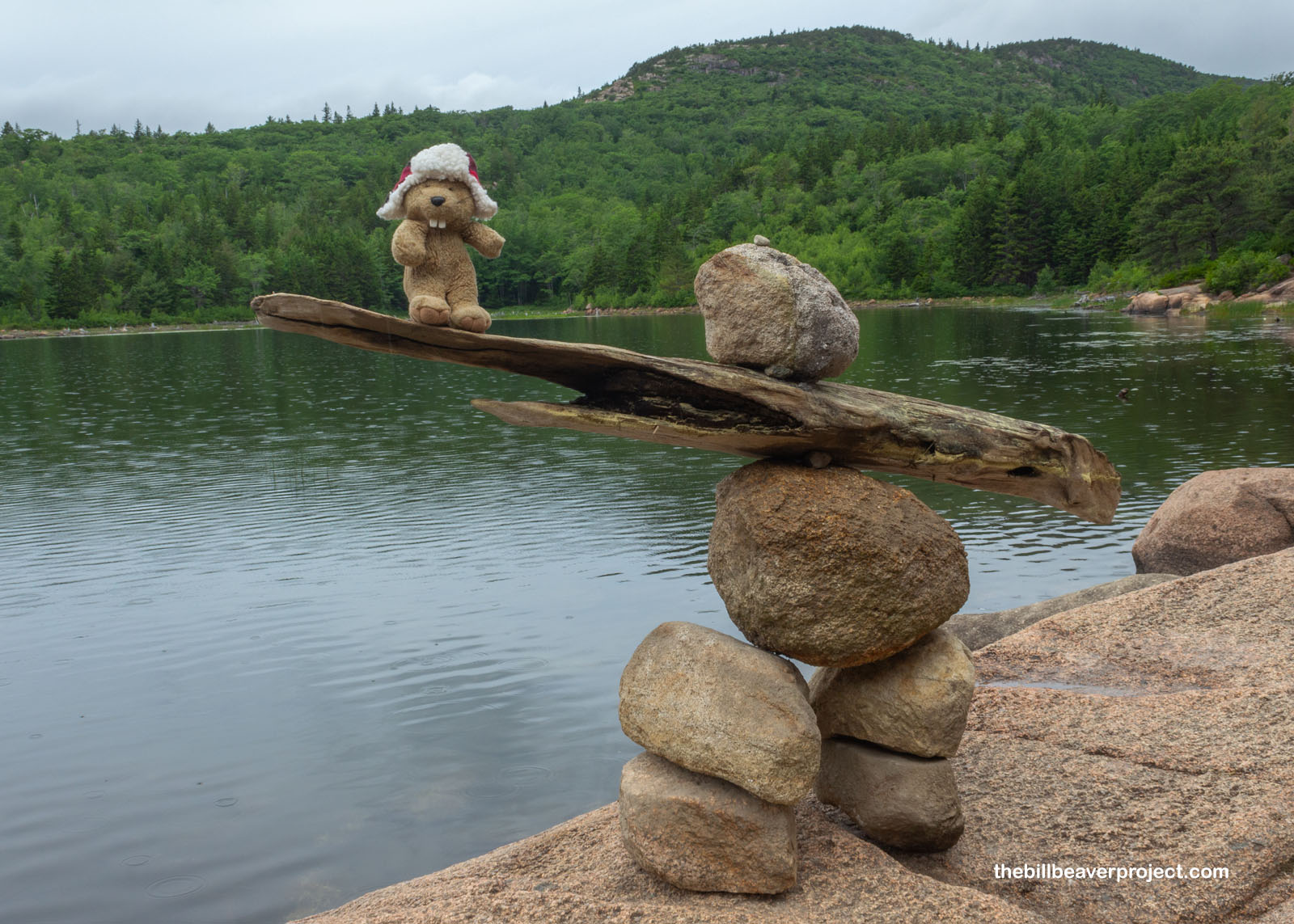
Down by the shore, the water lilies were blooming, and I could see little frogs swimming about underwater! Nearby, someone had created an Inuksuk out of rocks and driftwood, even though this was neither Canada nor an appropriate place to make one. There were lots of signs warning hikers not to stack rocks or knock them over, because the park had installed specific cairns to help folks navigate! Folks could easily get lost following fake cairns, but down here on the shore of the Bowl, there weren’t many other places to go off-trail except into the water, and it would take someone pretty foolish to make that mistake!
 |
 |
The rain kept misting off and on, and I felt very well misted as I followed a two-plank boardwalk around the shore, enjoying the bright green plants and a little taste of solitude on this trail extension. I passed lots more folks on the downhill, which was thankfully not another cliff face but instead a gently sloping dirt trail kept just spicy enough by some slippery rocks! As the loop reconnected with the original trail, I looked back up at the towering Beehive and was both astonished I’d climbed so high and very grateful I’d started when I did. There was a big old line of people waiting for passage up that precarious route, and that is one place I definitely did not want to get crowded out!
 |
Speaking of crowding out, Acadia’s famous Thunder Hole was absolutely jam-packed with tourists, filling up the parking lots and lining the road for a long way. On top of it all, the blowhole wasn’t even spouting, so I bypassed that roadside attraction and pressed on past full lots at Otter Point and Little Hunters Beach before arriving at the Wildwood Stables, where I was surprised to find bunches of horses and their trailers! This area was previously the farm of Ernest and Helen Dane, and after Mrs. Dane donated the land to the park, it continued to serve as a hub for horse-based adventures! In fact, horses played a very unique role in the development of this national park!
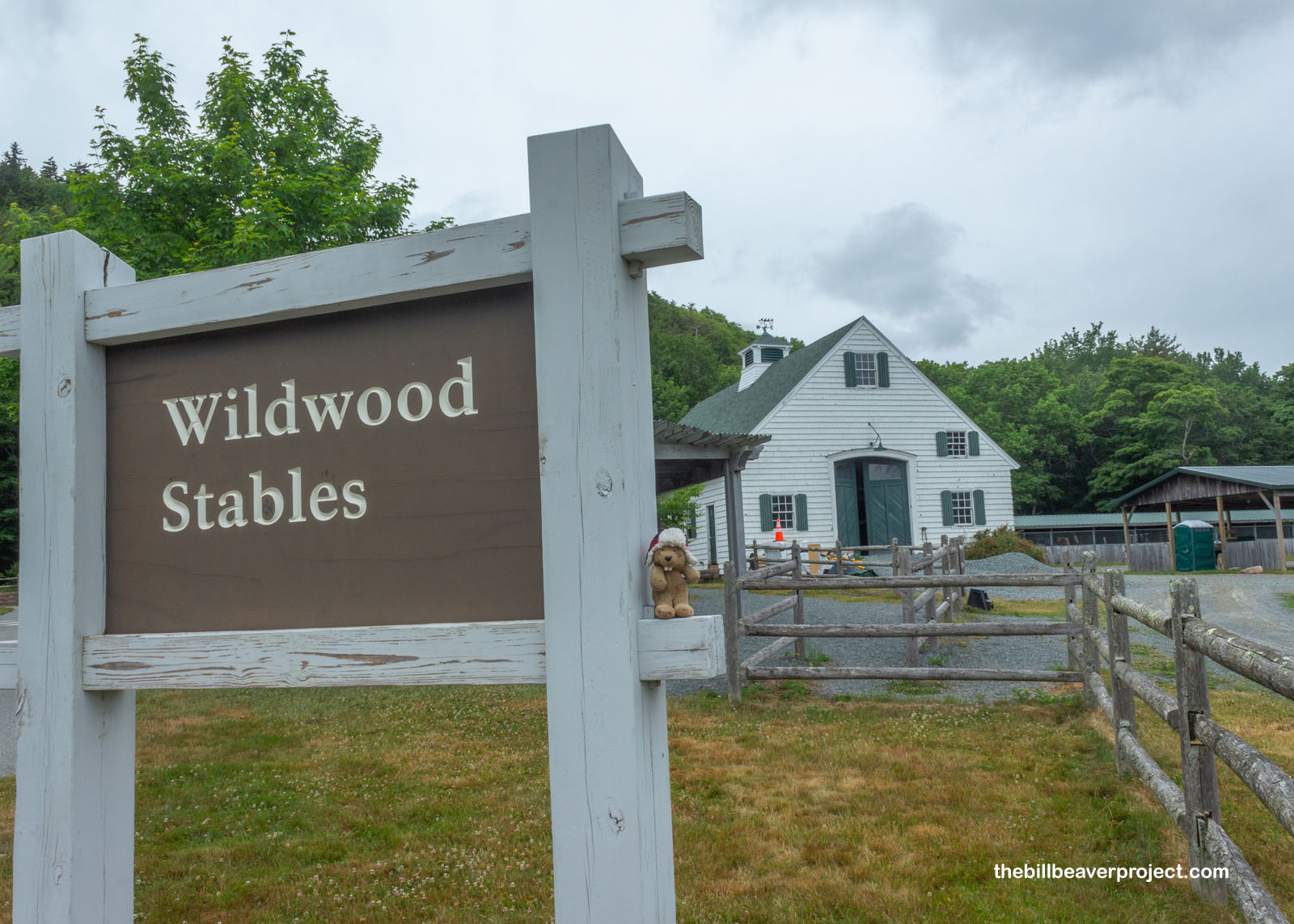 |
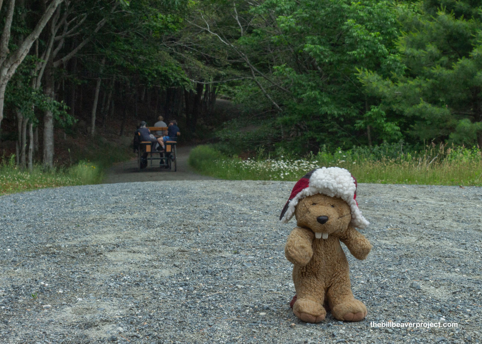
In Acadia’s early planning days, this was supposed to be a motor-free park! John D. Rockefeller, Jr., one of the park’s major sponsors, really pushed for this park to allow horses only for transportation, and so he gifted Acadia with 45 miles of carriage roads, built between 1913 and 1940! These weather-hardy, broken-stone roads are still preserved across the park, and as I stared down one of these heavily wooded paths, a carriage full of visitors clopped right on past me! It turns out, the historic carriage roads are still wide open for both organized carriage rides and for equestrians who want to explore Mount Desert on their own horses! I marveled about this with a mother-and-daughter duo of Texas horse trainers, who shared their delicious chips, dips, and apples with me rather than fight for lunch space at nearby Jordan Pond!
 |
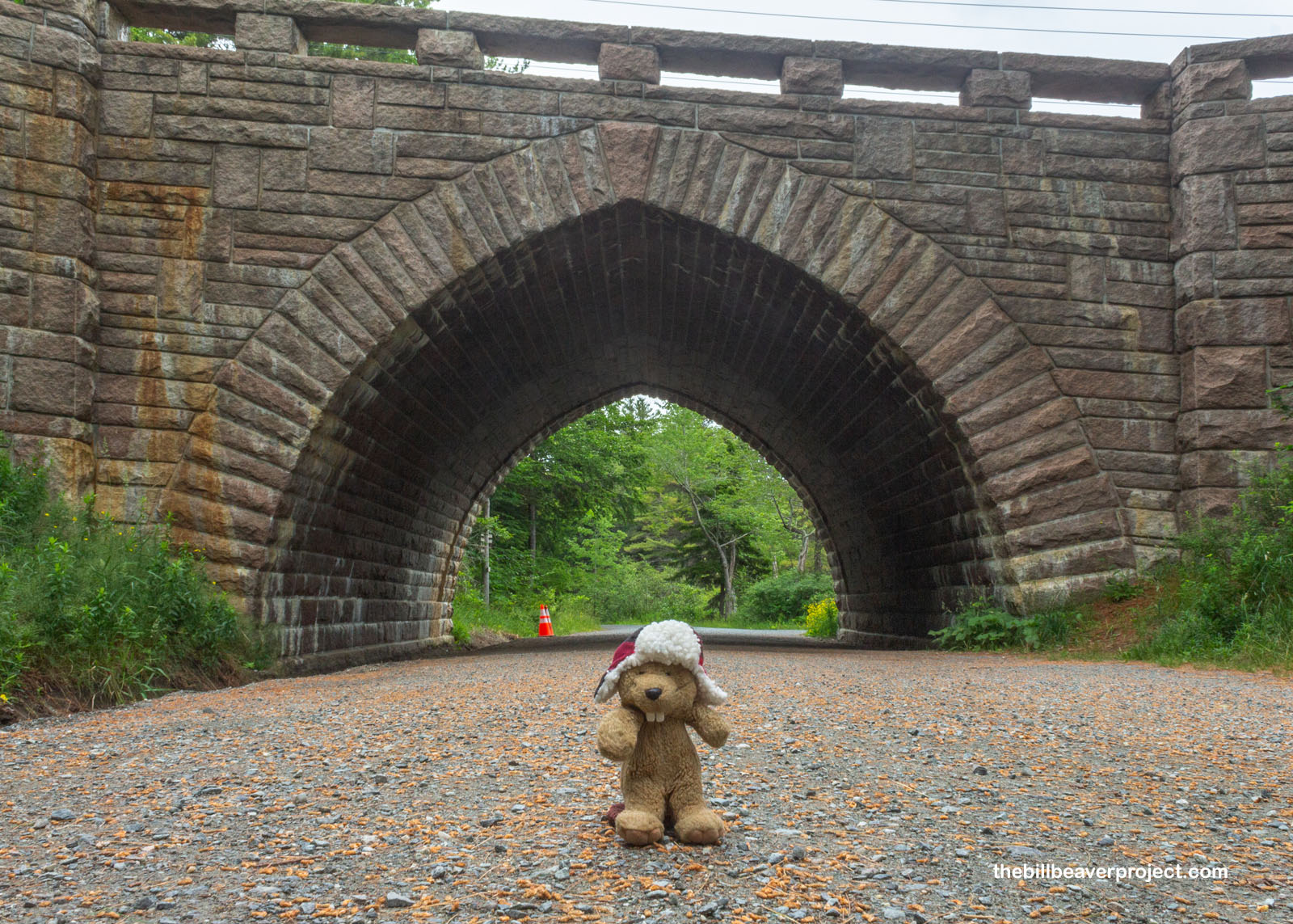
And a fight it was! Parking at picturesque Jordan Pond (named for Wildwood’s original owners, George and John Jordan) was not to be found, and after much circling, I gave up out of sheet annoyance. As the years go by, and more and more people cram into our national parks, a certain amount of magic goes out of its most famous places. Standing in line at a picturesque viewpoint or pushing precariously past a line of tourists on a trail can make an outdoor jaunt miserable, but the wonderful thing about national parks is they’re full of less famous, equally beautiful spots! That sent me farther north of Jordan Pond, past more full parking lots, to a small bike lot for bikers, leading back onto a historic carriage road and under one of Rockefeller, Jr’s historic arched bridges!
 |
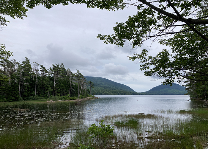
All this improvising led me to the shore of Eagle Lake! By comparison, this lake was completely pristine and not blocked by a single tourist’s camera! It was just the sort of place that makes a national park such a great escape, quiet and full of neat things to look at, all reflected in the water! Eagle Lake is the largest on this side of Mount Desert, and it’s super important, providing the nearby city of Bar Harbor with its drinking water! For that reason, swimming isn’t allowed, but for some reason, motor boating is! Luckily, none of those were out here today, and I had a good while to enjoy the serenity!
 |
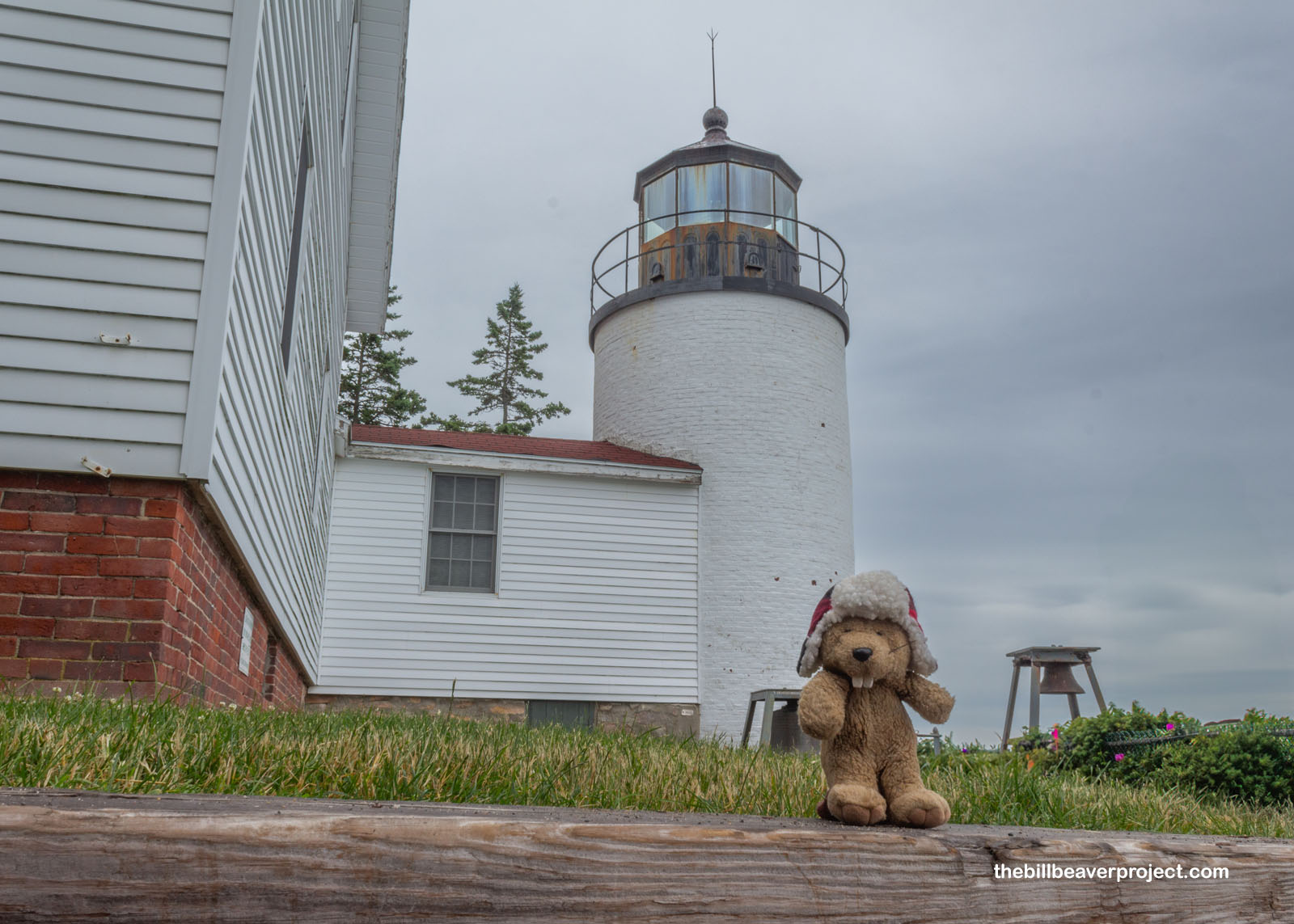
Alas, the peace and quiet were not to last, because of one must-see historical structure way over on the other side of the island. Practically the Old Faithful of Acadia National Park, the Bass Harbor Head Light Station, perched precariously atop a sea cliff, is an iconic part of the park. As such, with a tiny parking lot, it was very, very crowded! So rather than wait in an impossible long line to see this lighthouse, I parked a quarter of a mile away and strolled in, passing the enormous line of cars in the rain and scrambling down the small trail to the most famous viewpoint of this 1858 lighthouse! (Not pictured: dozens of other folks all scrambling on the rocks to get their own photos of this widely captured angle!)
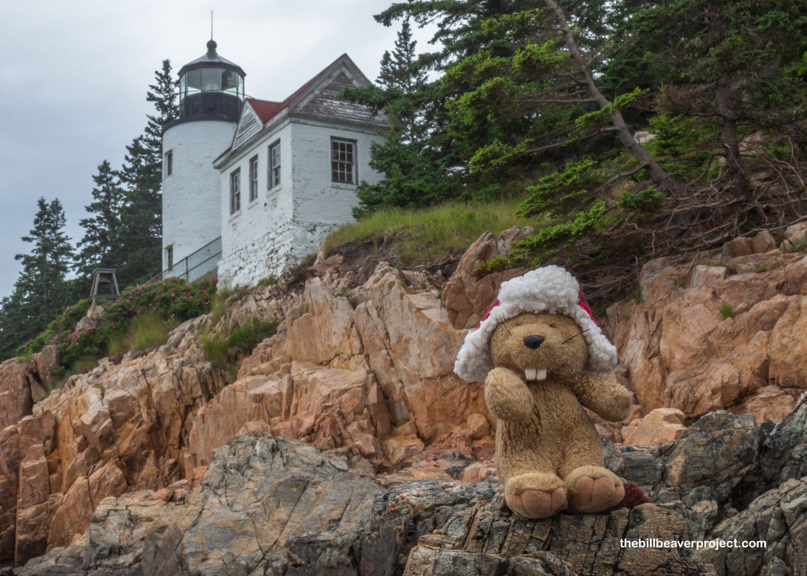 |
The lighthouse was installed here to help guide boats coming into the village of Bass Harbor, which, despite its name, is actually more famous for its lobster harvest than any bass! The first keeper keeper here at the light was John Thurston in 1858, and its last, before the lighthouse got automated, was Walter D. Moulton in 1962. It was run by the U.S. Coast Guard as recently as July 8, 2020, when they transferred it to the National Park Service, but even today, the Coast Guard still operates and maintains the navigation light!
 |
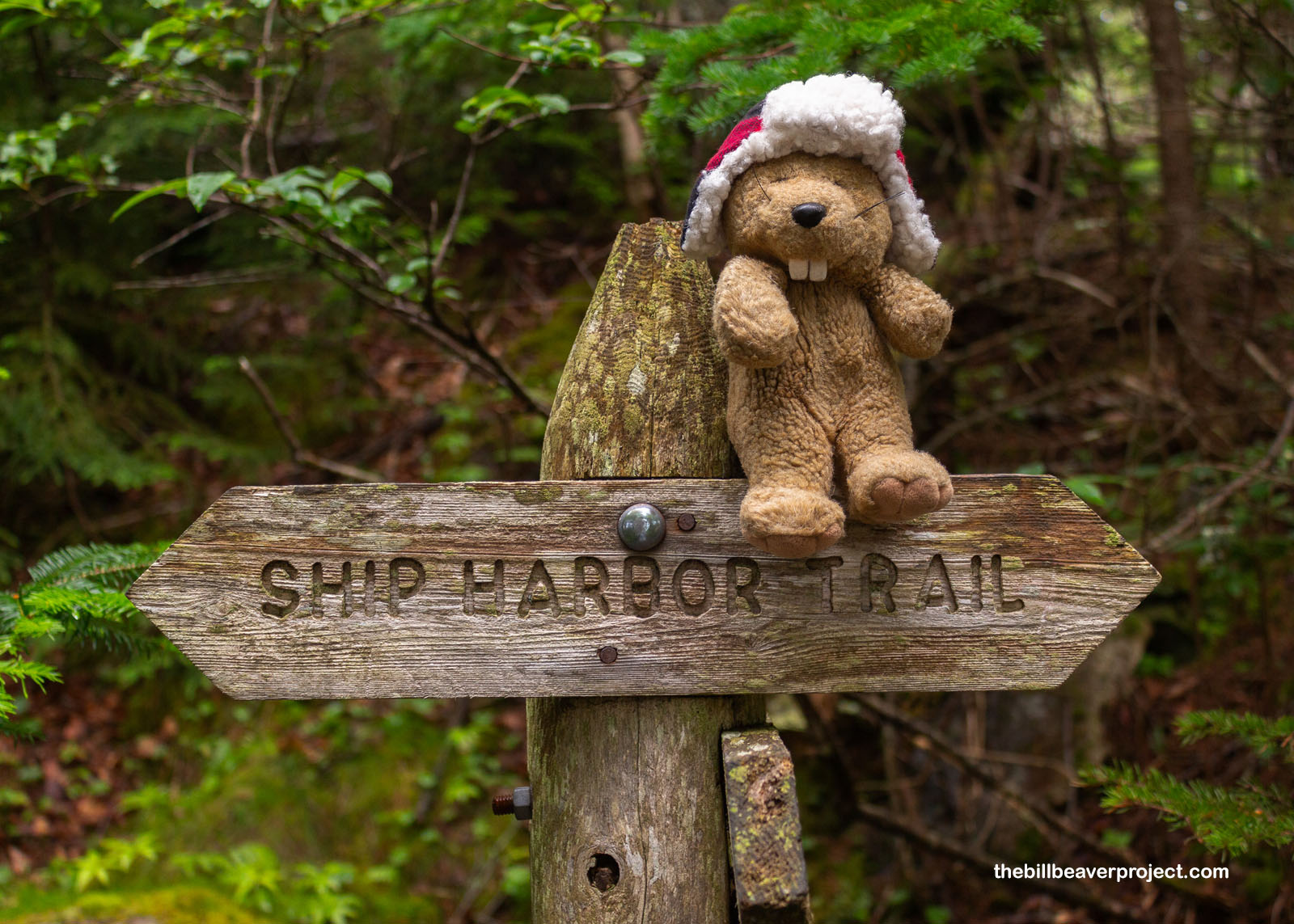
After pushing my way out of the lighthouse lot, I needed a little more peace and quiet. My lunch buddies at Wildwood had recommended a short stroll called the Ship Harbor Trail and said it had a beautiful reveal of the coastline out of nowhere! I had just enough time to check it out, and even before seeing the coast, the path was lush, flat, and tranquil, a perfect stroll to conclude my day in the park!
 |
 |
Surprisingly, Ship Harbor was never meant to be a harbor! In fact, it’s believed that its name came from multiple shipwrecks on its rocky shores, dating back to 1740! The story usually points to an Irish immigrant ship called the Grand Design bound for Pennsylvania, but there’s never been proof that the ship ran aground here! This is a coast of tales, of Revolutionary War beachings, fleeing privateers, and gold coins plumbed up from below! However the name actually originated, from this vantage point at least, Ship Harbor still looked deceptively friendly to boats of all sizes!
 |
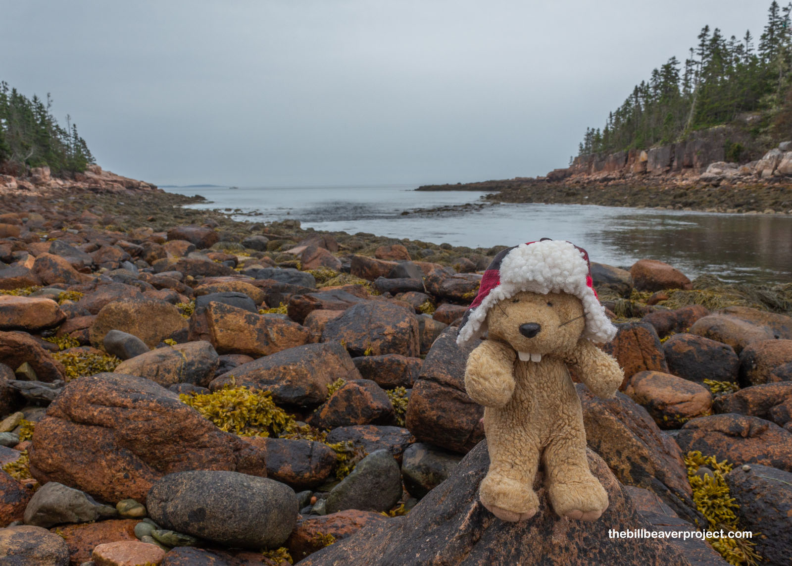
Rounding a curve in the trail, the opposite was very quickly proven to be true! The “harbor” was behind a narrow channel of rocky shallows! Beyond was the granite-bouldered coast that so bedeviled ships and required so many lighthouses to be installed across Maine! This stretch of coastline turns into an area called Wonderland, named for its vivid granite boulders, colored pink by feldspar, and the picturesque spruce groves that pepper the cliff tops. The 64 miles of coastline surrounding Acadia were one of the major reasons why it became a national park, preserving the tallest headlands on the whole US Atlantic coast!
 |
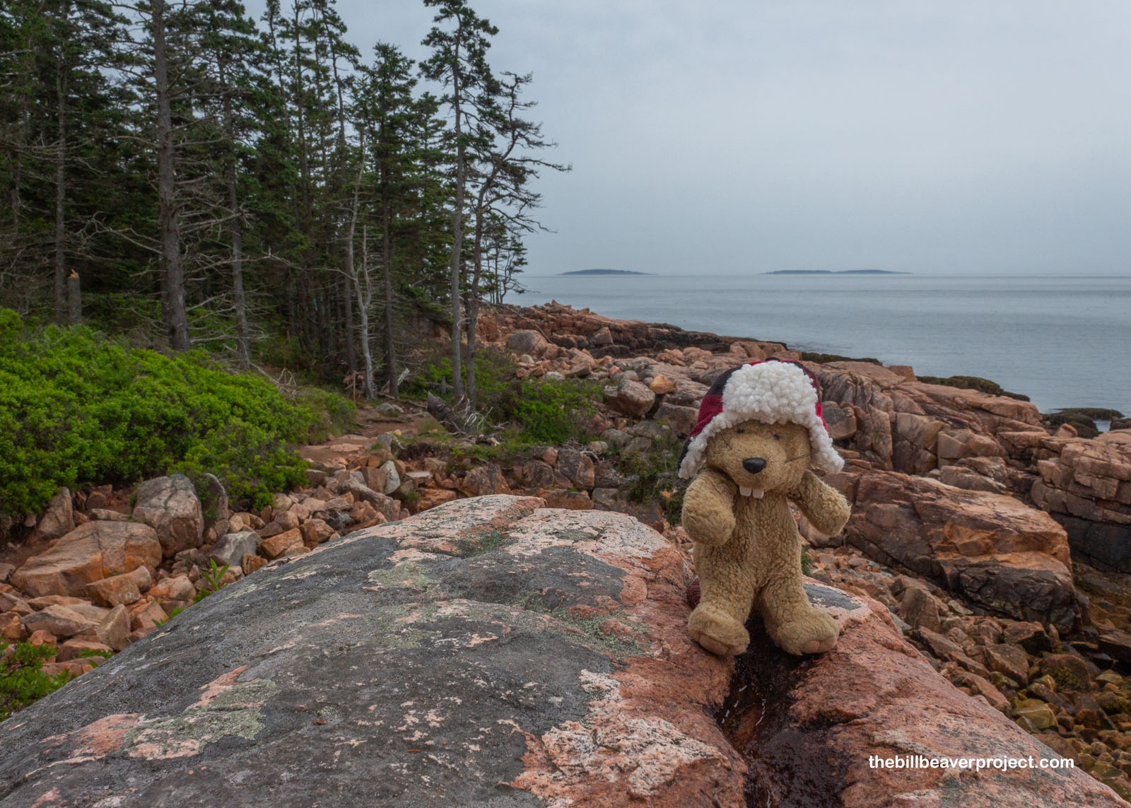 |
For me, it was a wonderful conclusion to a jam-packed day here in Acadia. I’d started way up on the top of the tallest mountain and zig-zagged on down to sea level with plenty of neat sights along the way. There were so many neat tide pools peeking out from these boulders, and though there wasn’t much to see inside, they made for some very pretty reflections! This coastline is changing rapidly on a geological scale, with sea levels rising an inch every decade, so the tide pools will only get higher up on the beach. Who knows what all this will look like in the next twenty or thirty years?!
 |
As it started to get late in the afternoon, the rain started to pick up even more, and despite thinking about the warming of the globe, I was getting a little chilly. I returned to the trailhead and stopped to dry off in Southwest Harbor with a delicious, buttery lobster roll, Maine blueberry soda, and vanilla ice cream with homemade caramel sauce! There’s a lot to love about this state, and I wouldn’t mind coming back here to spend more time once I’m done with my quests. For now, though, I must be off to return my rental car and prepare for the trip home!
By plane outta Maine!

P.S. I’d booked a hotel close to the airport thinking I could drop off the rental car early and just walk to the airport in the morning. As it turned out, the hotel was close to the airport but not the airport’s entrance! Plus, there were no rideshares available at 4:30 AM in Bangor, so I ended up hoofing it three miles in the dark and the rain to catch my connecting flight through Washington, DC! It’s a good thing I’m so well trained in walking quickly, because I caught my flight without a hitch and made my way safely home with no further issues!
Previous Day |
Total Ground Covered: 901.0 mi (1,450.0 km) |
More 2024 Adventures |