 More 2025 Adventures |
Jackson, WY → Bondurant, WY → Moose, WY 133.4 mi (214.7 km) |
 Next Day |
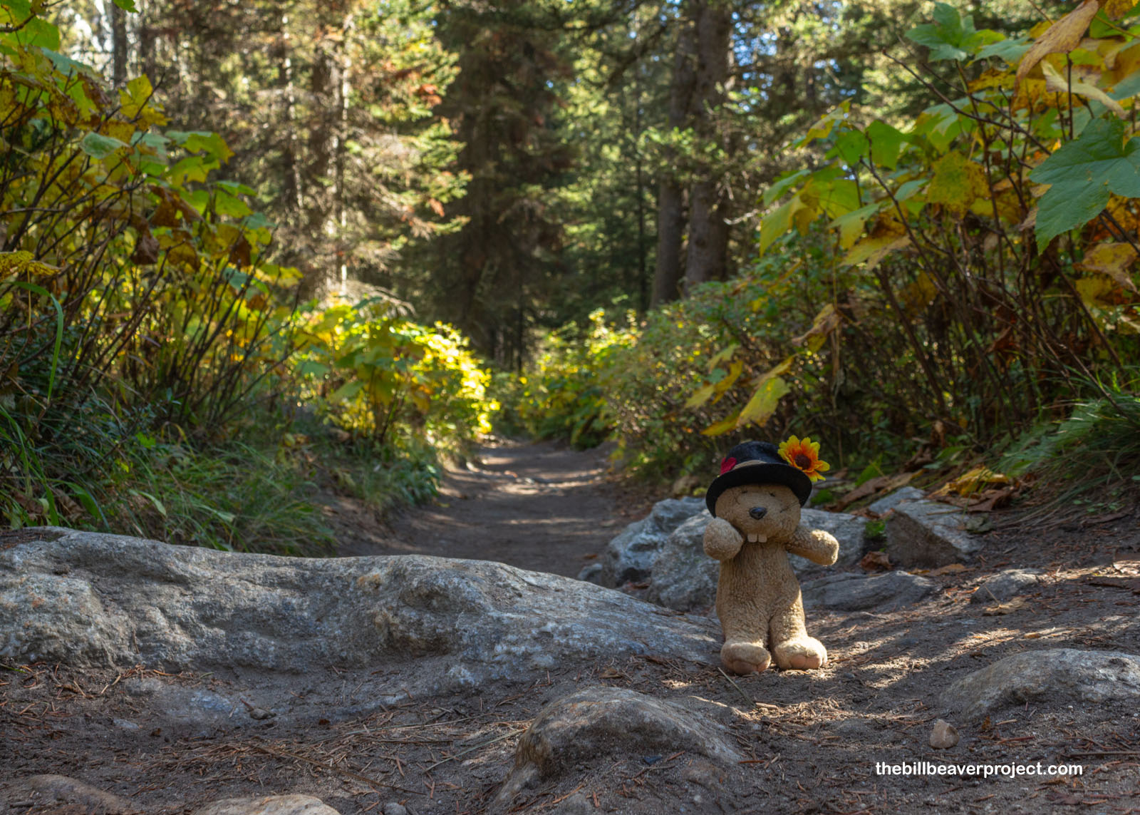
Here they are, everyone!
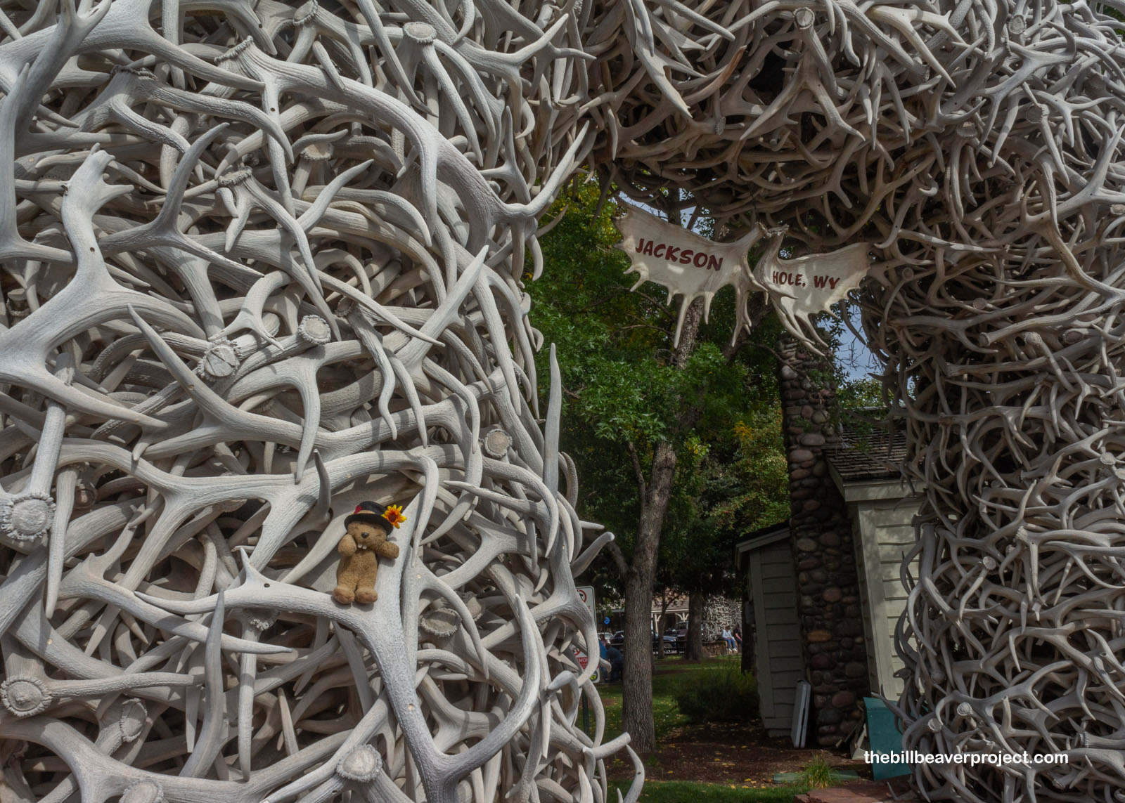
I’ve put off my last Wyoming national park for a while, because even though it’s an easy 2-hour flight from LAX to Jackson Hole, lodging is super heckin’ expensive compared to Cody! I was happy to meet up with my friends, Terri and Ross, to split the cost, learning over lunch how Jackson is the town, while Jackson Hole is the geographic region the town is in! Together, we planned out our weekend under the town’s iconic elk antler arches, gathered during shedding season and replaced every 30 to 40 years!
 |
First things first, we had some solemn business to attend, heading south to the community of Bondurant, where my friend—and Terri’s dad—Reuel had spent several summers ranching with the Bowlsby family back in the 1940s. After burying his ashes in a quiet, remote spot, we returned to town for a small wake at the Church of St. Hubert the Hunter, which would have been brand new when Reuel was here ranching. This church had been gifted in part by Episcopalian bishop, Winford H. Ziegler, in gratitude to the Bondurant locals who housed him during a blizzard in 1937! Today, our refreshments and memorial were delivered by local monkey rancher, Peter Tagge, who claimed he had known Reuel personally way back in the day and even saw him bucked off a horse that got spooked by a rattlesnake!
 |
 |
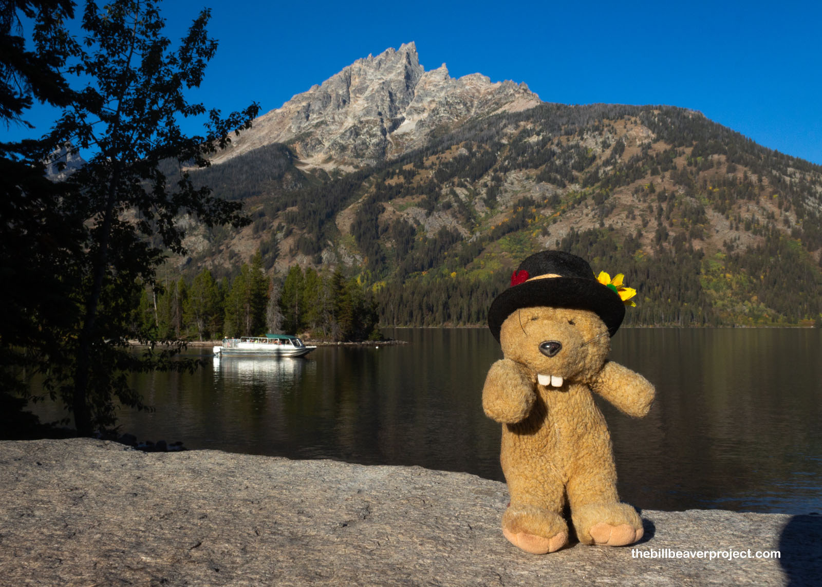
With Friday evening taken up in reminiscing, we adjourned to our condo in Teton Village in anticipation of a big outdoor adventure tomorrow. With only a weekend to fill, I wanted to get super immersed in the Tetons, originally called Teewinot (“many pinnacles”) by the Shoshone, renamed Les Trois Tetons (“three boobies”) by French explorers. That was just the start of the naughty names as we pulled up to Jenny Lake, named for Jenny Leigh, the Shoshone guide for the Hayden Expedition of 1872 as they surveyed the region that would become Yellowstone National Park. There’s nothing naughty in her name, but she was married to trapper Richard Leigh, more widely known as “Beaver Dick!”
 |
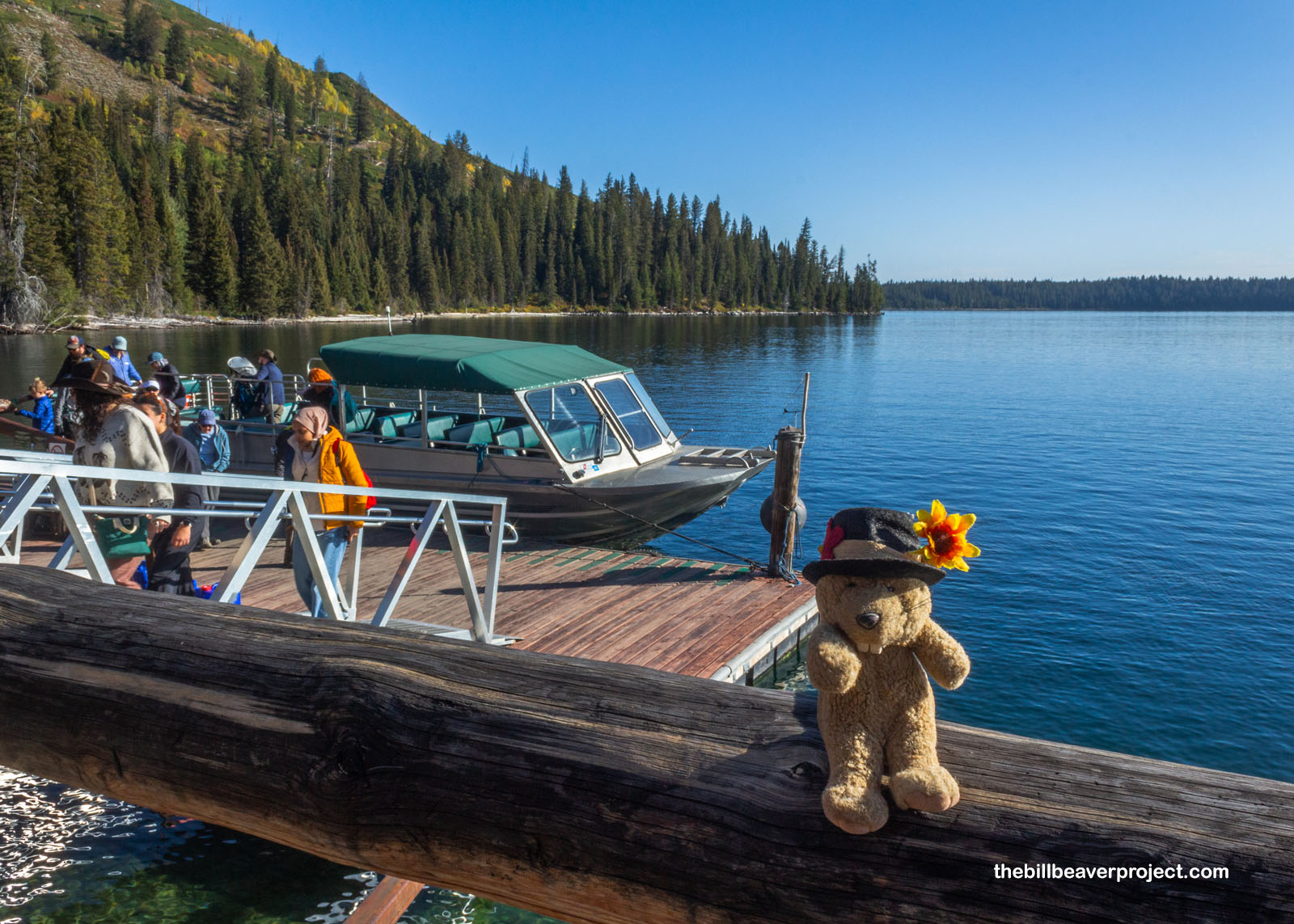
We walked right into line for the Jenny Lake Boat Shuttle, a first-come, first-served transportation option that would cut two miles off any journey into the Teton wilderness, and after about three boatloads of nature lovers, we were off on the short ride across the lake. With some words of caution about bears and a pause for questions, our boat pulled up to the dock, and our small morning crew hopped ashore on the west end of Jenny Lake to begin our journey!
 |
 |
At the end of the dock, our itinerary was practically laid out for us! We were going to hike the half mile to Hidden Falls, another half mile to Inspiration Point, then let Terri go do some painting while Ross and I trekked up Cascade Canyon in what was colloquially known as a “Death March!” We’d meant to be back by 3:30, because there was a rumor of a thunderstorm coming in this afternoon, but since we were starting an hour later than expected, we’d have to see just how far we’d actually get today before the weather turned inclement.
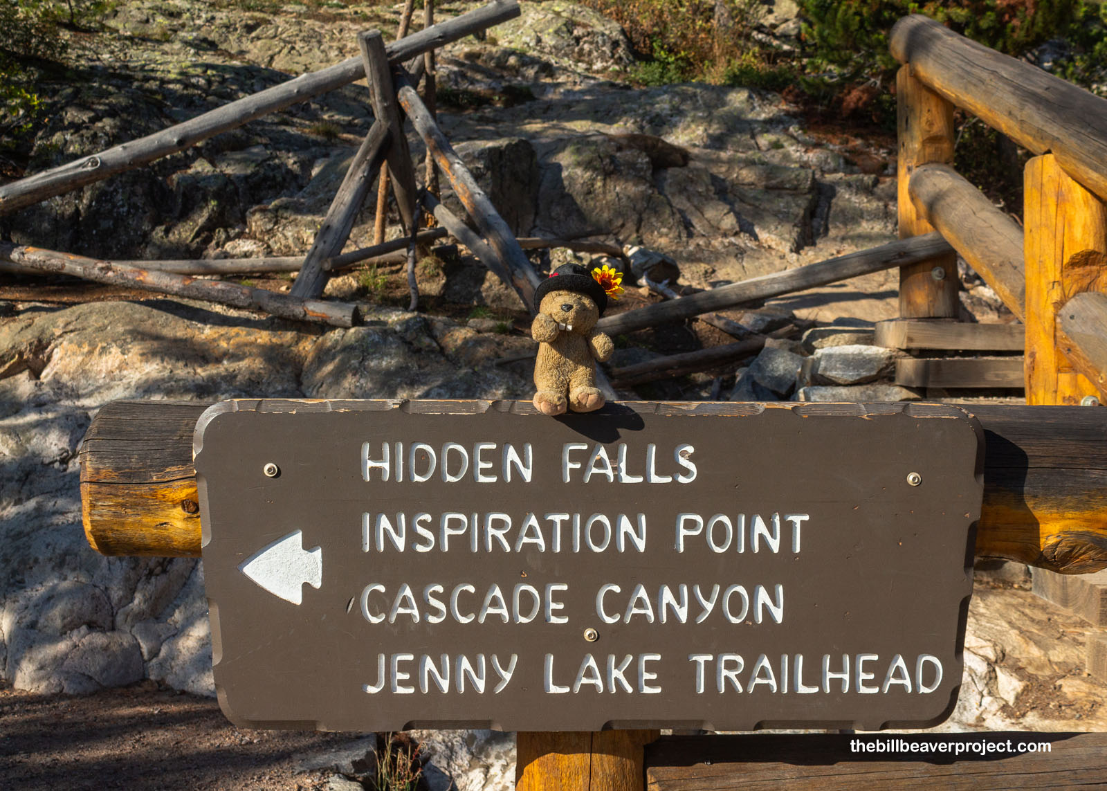 |
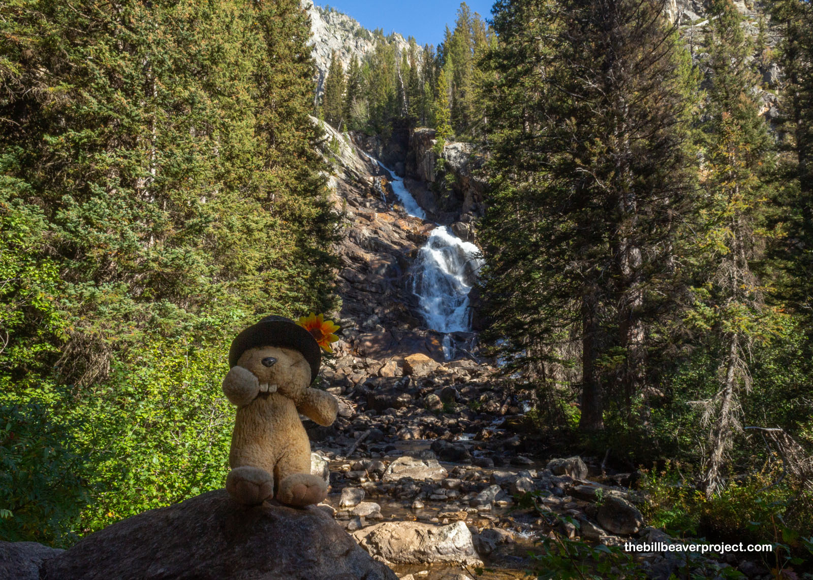
The path to Hidden Falls was kind of steep and definitely the most crowded part of the whole trail, as the quickest photo point to see once off the boat. We passed a fake “Hidden Falls,” and nearly missed the turn-off to see the real one, which really explained how this cascade got its name! I thought it was so pretty that it didn’t need to hide, but I kept that to myself. Don’t go praising waterfalls, they say!
 |
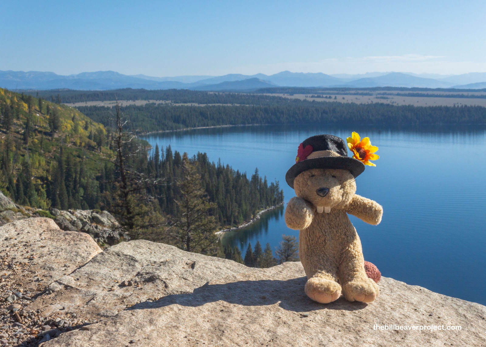
From there, we traipsed another half mile, up a pretty precarious switchback with a surprisingly sheer cliff on one side. I was amazed that so many people hike up here in a given day and there aren’t a lot of falls and injuries. It made me think of Horseshoe Bend, actually. But at the top of this trail was Inspiration Point, giving a clear view of Jenny Lake and Greater Jackson Hole beyond! Was it inspiring? I mean, it was a great view, but I found what was in the opposite direction much more breathtaking!
 |
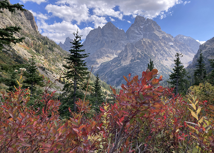
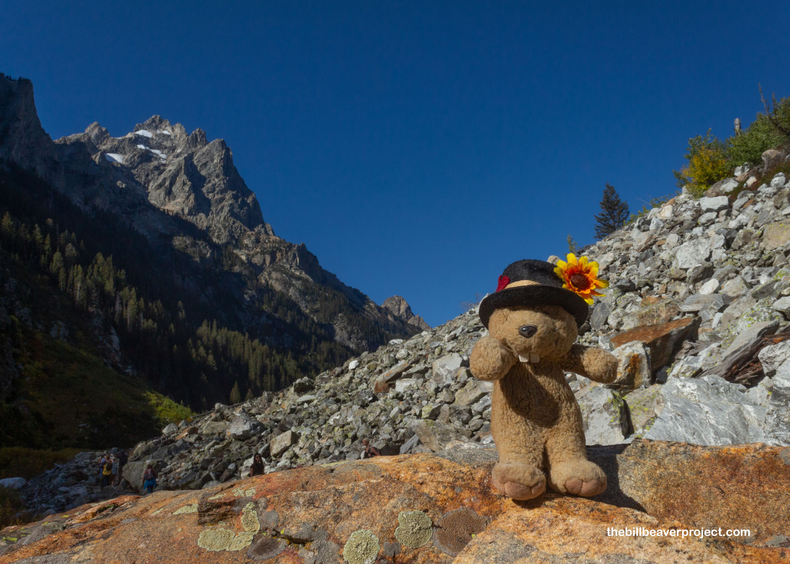
Cascade Canyon was lined on all sides by majestically jagged mountains! We’d landed at the base of Teewinot Mountain, and that was the peak that stayed with us for a good half of the trail, a pretty straightforward out-and-back with plenty of other hikers around! Most of the cascades we encountered in Cascade Canyon were mostly rockfalls and talus fields, home to a chorus of singing pikas that were scampering among the rocks.
 |
Those talus fields were interspersed with forests, and in the undergrowth of those forests were the wonderfully familiar leaves of thimbleberries, completely past their prime, but still making me reminisce fondly about enjoying them on a different French-named out-and-back trek last year, the Grand Portage! I wondered if these thimbleberries tasted any different from their Midwestern counterparts!
 |
We stopped to look for moose along this lazy stretch of Cascade Creek, which flows all the way from the high glaciers of the Tetons down over Hidden Falls and into Jenny Lake, but we had no such luck this morning. The gently flowing stream did make for excellent viewing of Mount Owen, and the tiniest bit of the park’s namesake off to the side. I couldn’t wait to see that peak bare it all!
 |
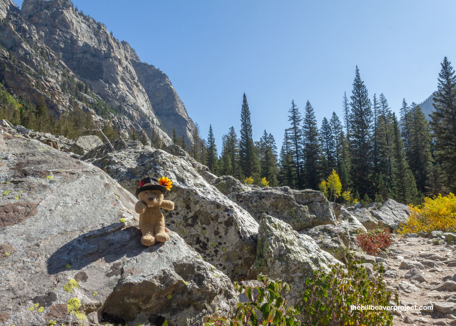
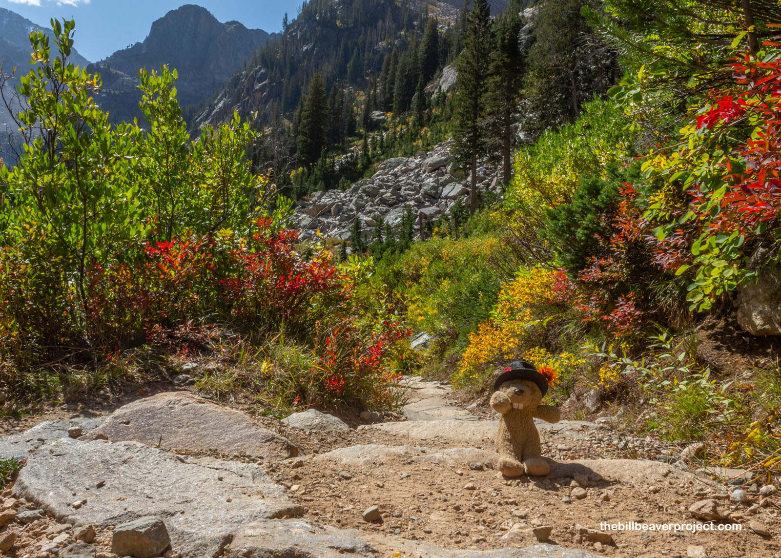
As we passed through more exposed boulder fields, the population of hikers started to dwindle, most saying they never made it as far as our destination, Lake Solitude, and I wondered if it really was such a tough trail ahead that most folks just couldn’t reach it. So far, Cascade Canyon had been long but very, very gentle. Too gentle, I suspected! As we approached the terminus of the canyon, I couldn’t imagine choosing to turn around here! The aspen leaves were just starting to get vivid, inviting us to journey deeper into their colorful cathedral! With Lastleaf in the back of my mind, I was more than ready to accept that invitation!
 |
 |
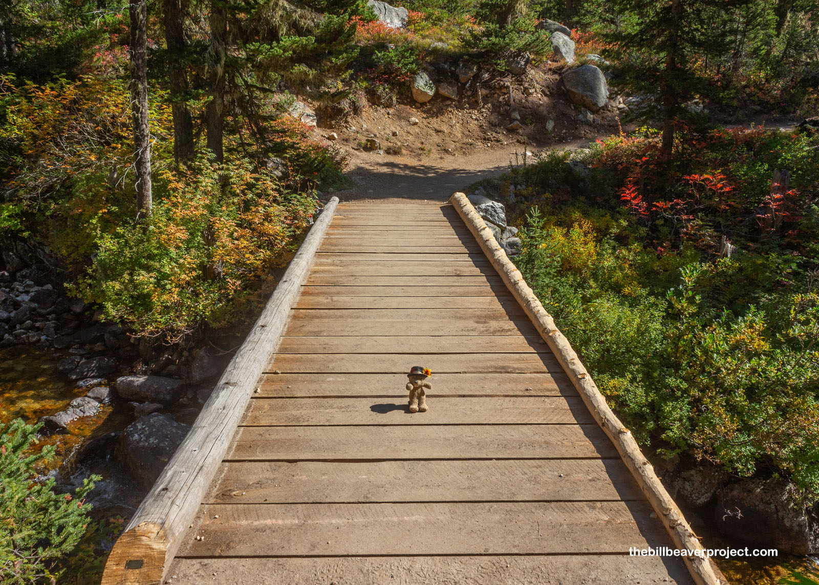
Ross and I stopped for a snack around Mile 4 and reminisced about snack breaks we’d had on our trek through Katmai National Preserve back in June. This trail was strenuous in its own way, but it sure was nice having a trail to follow and no tents to carry. The sky was still blue with no sign of foul weather to muck up our plans. Plus, the stream crossings here even came with bridges! What a luxury!
 |
 |
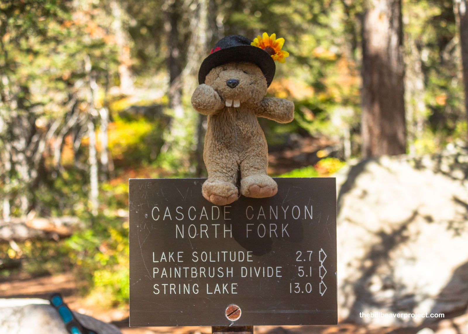
At around four and a half miles, we hit the Cascade Canyon North Fork Junction. Here, lots of backpackers were paused for a rest, and for good reason! From here, folks could hike south along the entire western face of the Tetons, across glaciers and remote lakes, exiting, if they so chose, right back into the condos and timeshares of Teton Village! Since we were on a day trip schedule, we veered to the right instead.
 |
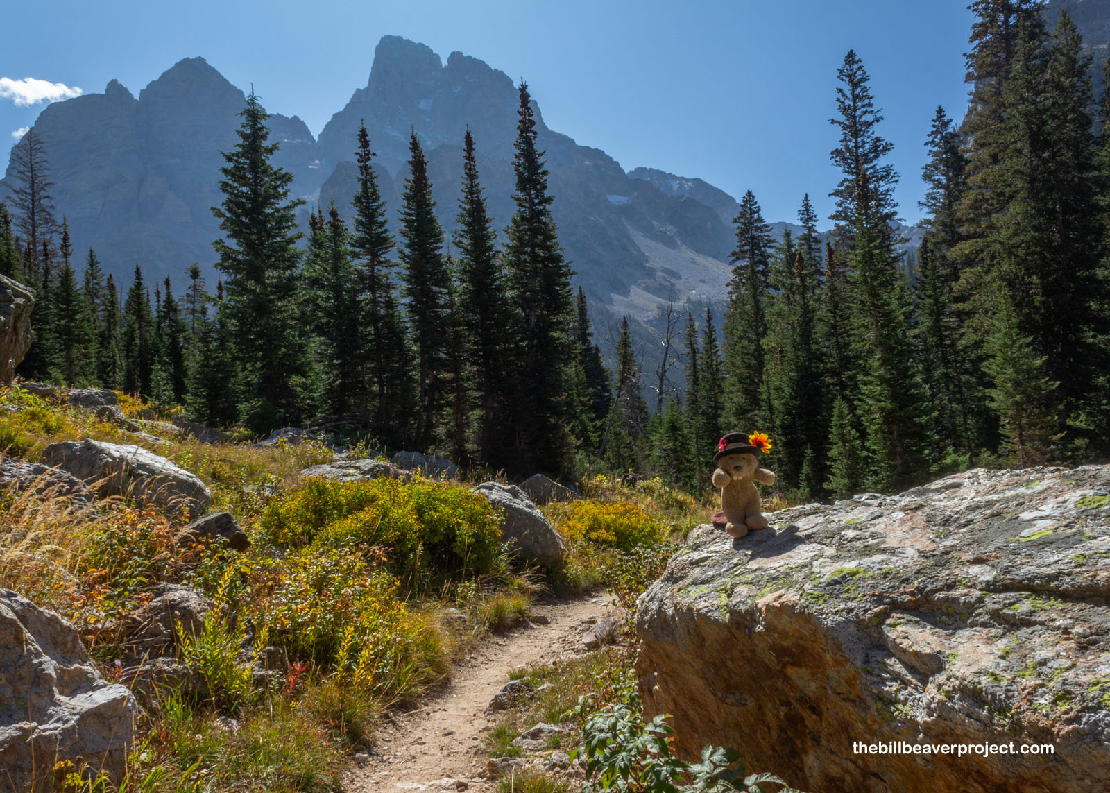
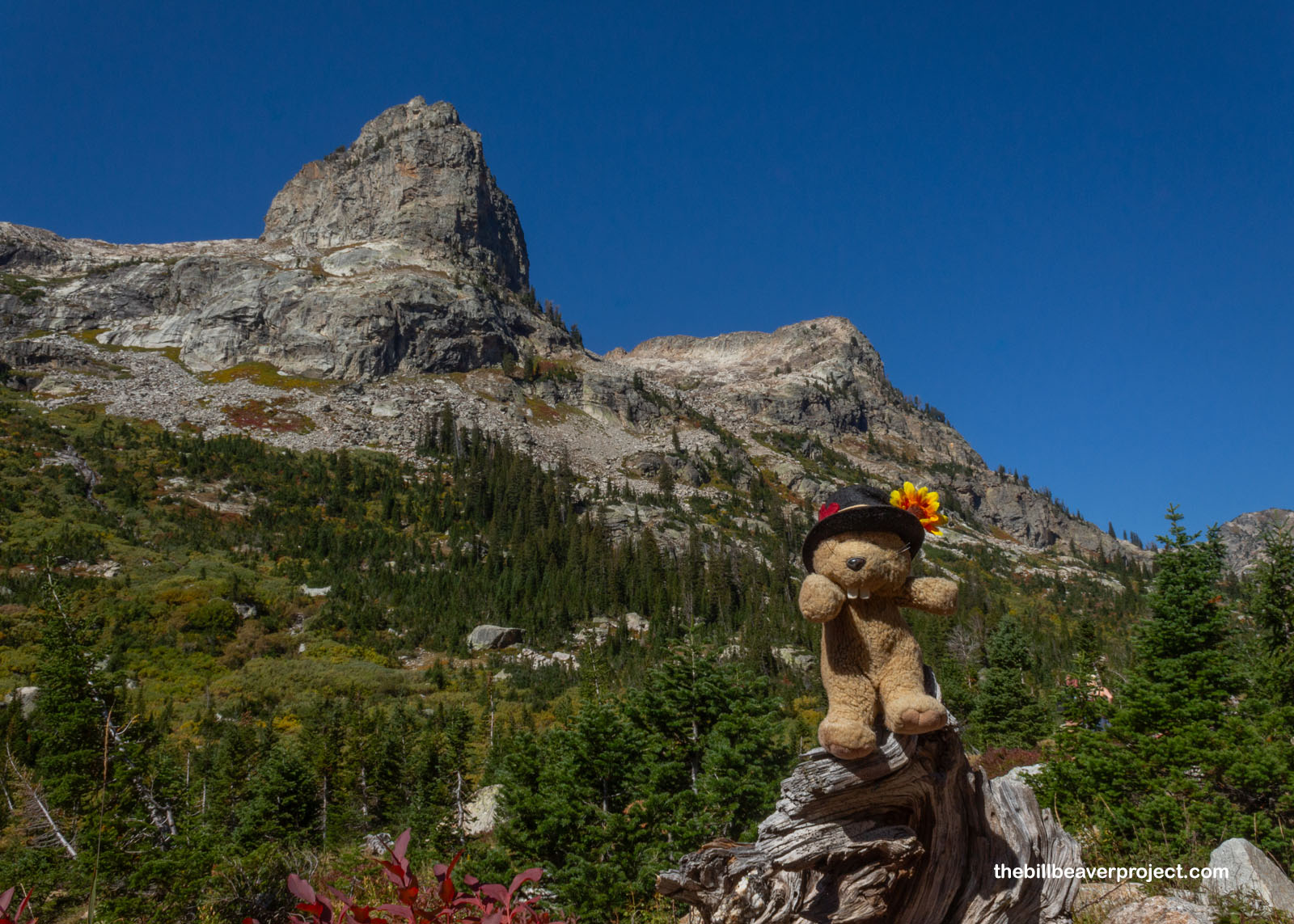
From here, the trail became the inverse of itself. Where it had been long stretches of dense pine forest with sporadic views, now it was more alpine with long stretches of views and occasional patches of pine forest! On this narrower, steeper part of the trail, lined by huge rock monoliths on all sides, we looked back and caught our first glimpses of the Grand Teton, backlit and ominous, maybe dusted with fresh snow from the night before! We couldn’t have asked for a more pleasant day to view it!
 |
 |
Oh, and while it might have been past thimbleberry season, the raspberries were still plenty ripe up here! There are four varieties of raspberry up here in the high Tetons, but unlike their domestic counterparts, these ones were super thorny! In fact, they may have been more thorn than berry, so I didn’t spend nearly as much time looking for berry snacks as I did among the thornless huckleberries in North Cascades National Park.
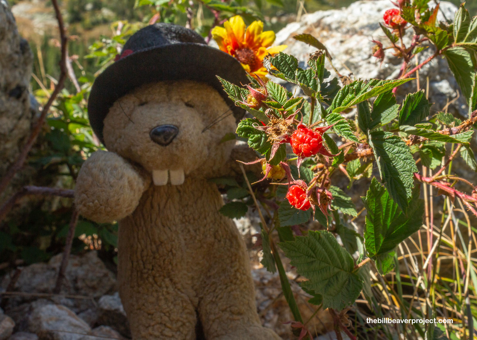 |
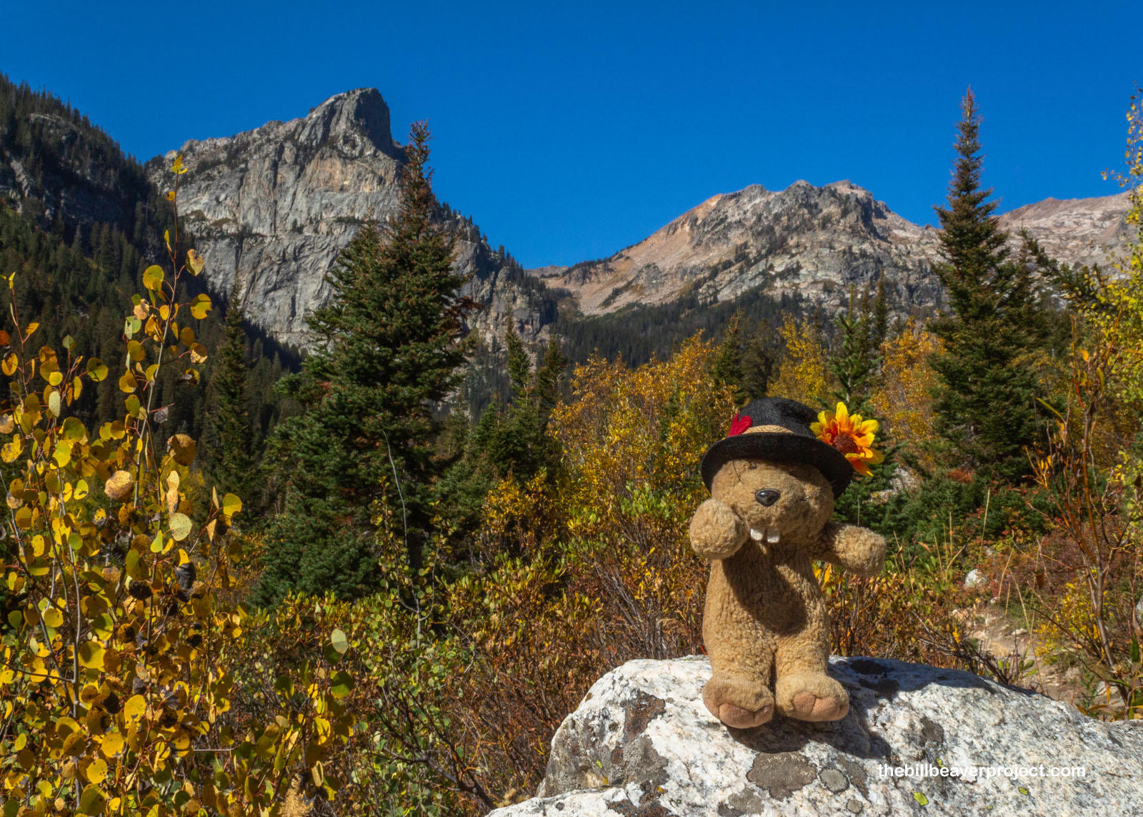
Speaking of huckleberries, they were here too! Well past their fruiting prime, their bright red leaves were brightening the hillsides at an elevation where shrubs were the main source of autumn color! And even though some dastardly trail blazer thought it would be funny to build steps into this party of the trail, the views of the Grand Teton just kept getting more amazing! We worked our way through a hub of campsites, each designated by a little arrow sign leading off the trail, and a good part of me wished I had brought my camping gear. Waking up to this view would be just sublime!
 |
 |
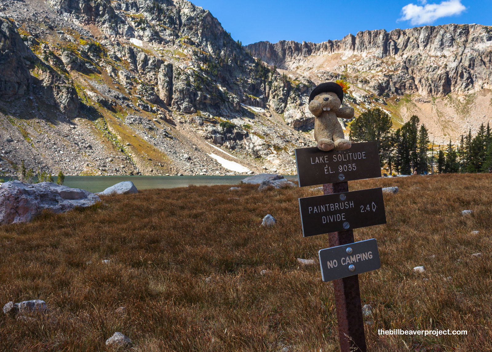
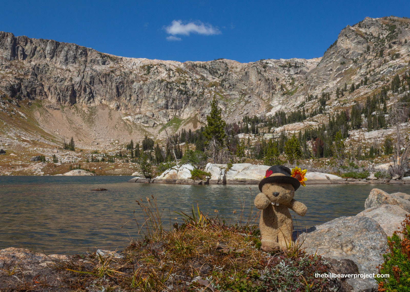
At last, after 7.2 miles of trekking, we reached Lake Solitude at 1:00 sharp! Puffy white clouds were starting to roll in over the cliffs surrounding the lake, but there was really no other indication of storms, or solitude. Yup, unlike Lonesome Lake in the Wind Rivers, Lake Solitude was pretty popular. Folks were picnicking on the shore, sunbathing on the rocks, and even doing cannonballs into the water! Well, this was our destination, and we had no trouble finding rocks of our own to sit down, have lunch, and watch the clouds go by while dipping our feet!
 |
 |
I’d been wanting to visit this park for a long time but had kept making excuses to put it off a little longer, from lodging being too expensive to worries about grizzly bears. This was a great trail for a day hike into the Tetons, easy to navigate and with great views! I’d been hoping for some Lastleaf celebrations up here at the top, but there weren’t enough colors to make it official. We can look into that tomorrow!
 |
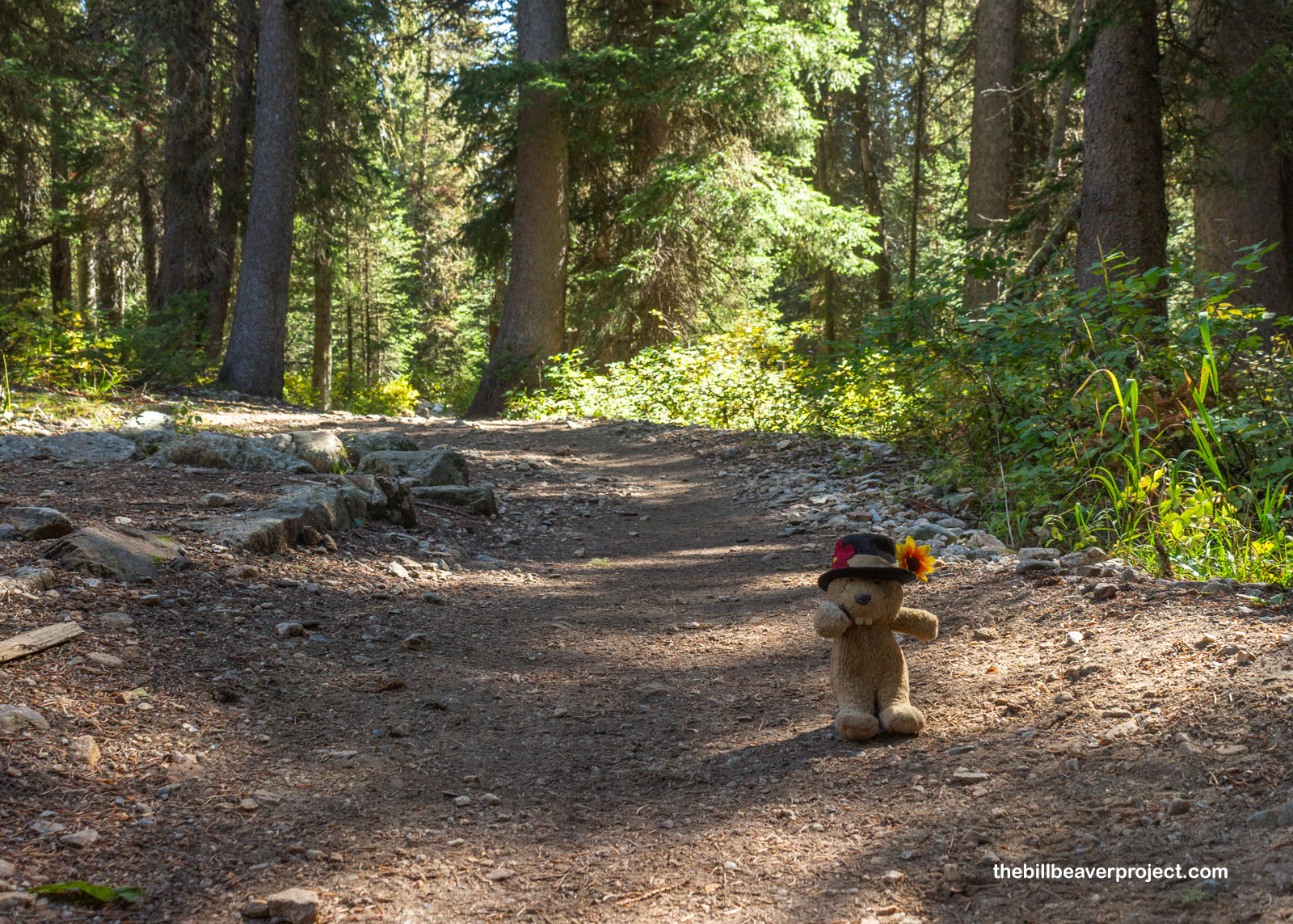
We breezed back down the trail, held up briefly by a bull moose crossing the trail but unbothered by a storm that never appeared, and arrived at the dock to find one enormous line of folks waiting for boat shuttles! It turns out, tons of folks had taken the shuttle after us, and there were plenty of passengers eager to be back on the other side of the lake before the boat stopped at 6:00 PM. We ended up getting back much later than expected, but we were all very enthusiastic about dinner and even saw some hungry black bears off the side of the road on our way back! Tomorrow, we’ll only have the morning and part of the afternoon, since I’ve already checked in for my return flight, but I’m sure we’ll find some really pretty sights to wrap up a long Teton weekend!
‘Til Teton-morrow!

More 2025 Adventures |
Total Ground Covered: 133.4 mi (214.7 km) |
Next Day |