 More 2024 Adventures |
Duluth, MN → Tofte, MN 83.5 mi (134.4 km) |
 Next Day |
Get ready to raise Duluth, everyone!
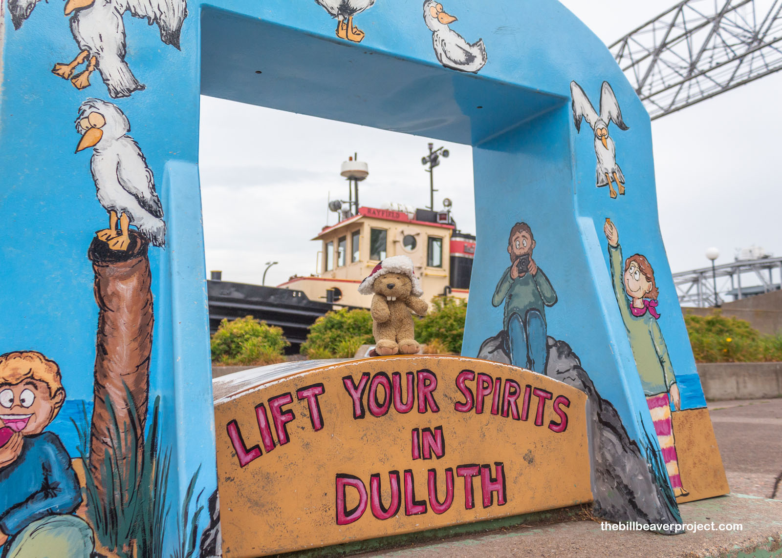
After an eye-burning overnight connection, I’ve returned to Minnesota, this time, moseying out into the northern national park hub of Duluth on the shores of Lake Superior! This port city was going to be my jumping-off point to visit Isle Royale National Park and Grand Portage National Monument, but before I go there, a little history first!
 |
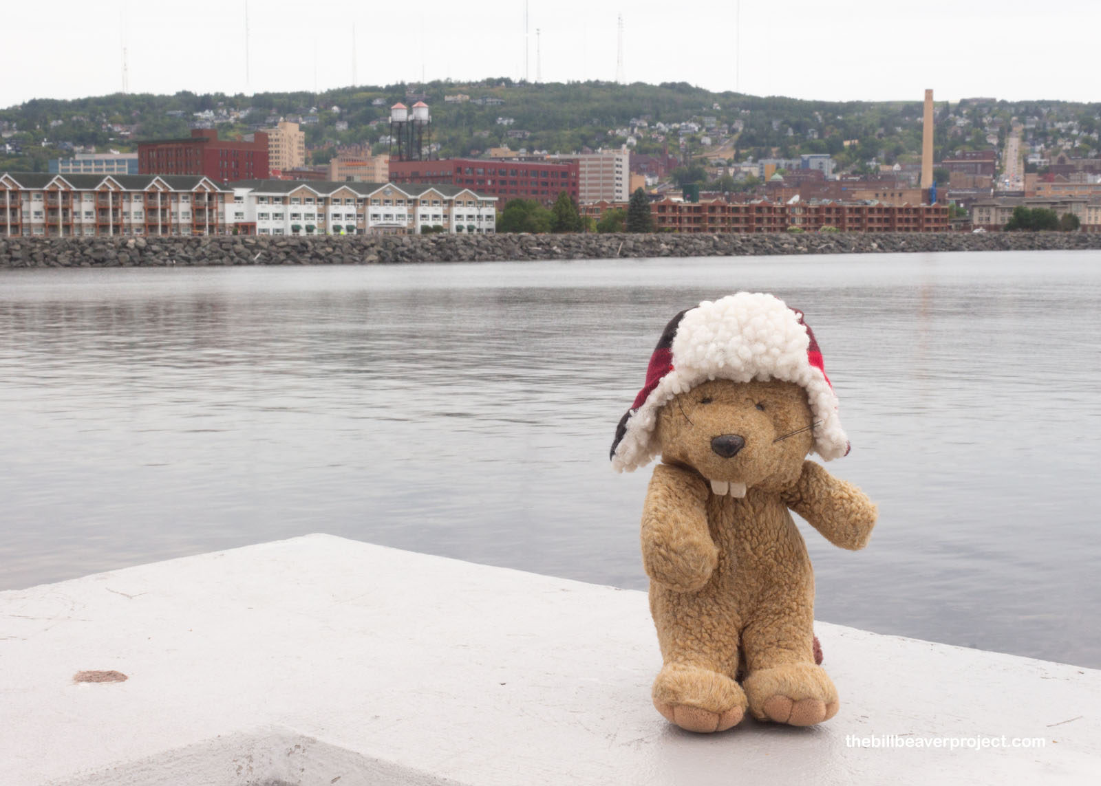
Named for fur trader, Daniel Greysolon, Sieur du Lhut, Duluth was built on industry, in particular, mining and logging! It was the northern terminus of the Lake Superior & Mississippi Railroad, and by 1871 had a canal that allowed ocean ships to enter port after sailing all 2,342 miles from the ocean and across the Great Lakes. This enabled Duluth to become the world’s largest inland harbor!
 |
 |
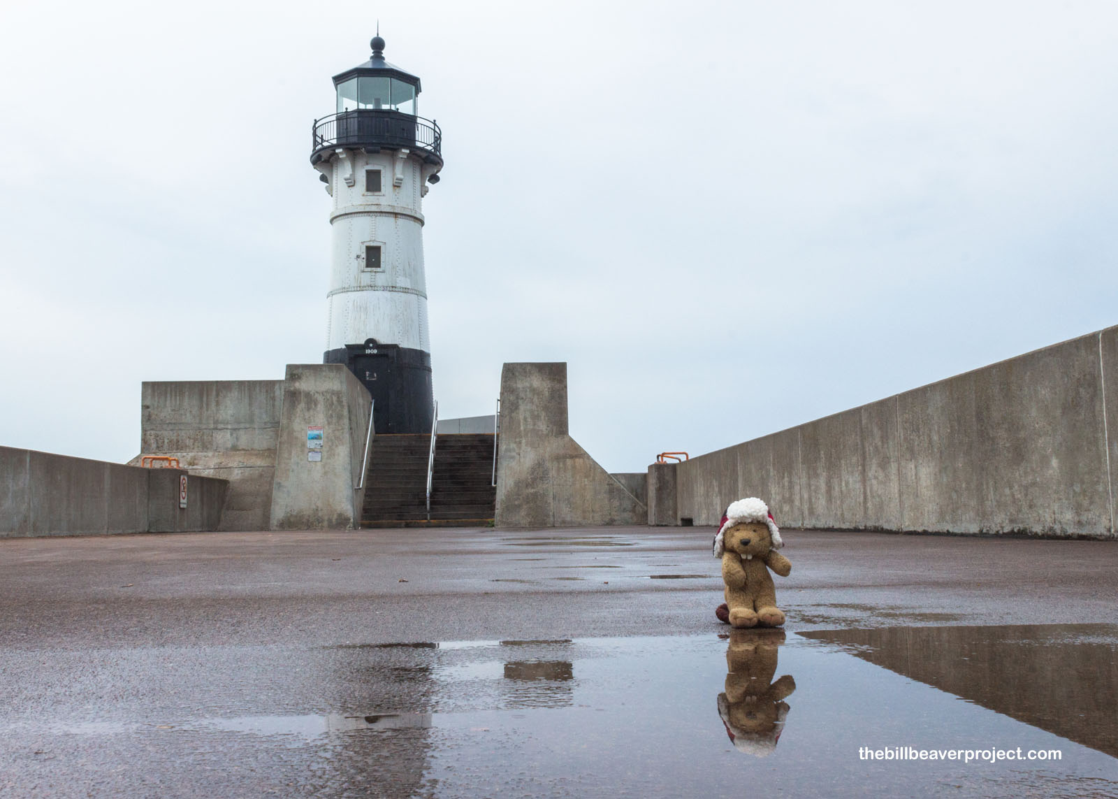
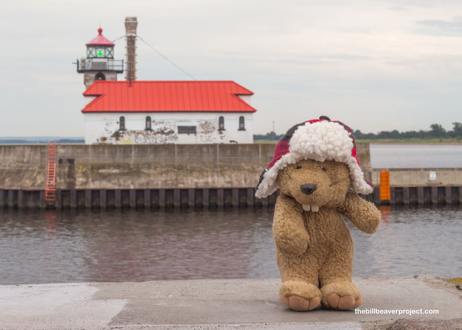
At the entrance to that 1871 canal stood two different light stations, both on the National Register of Historic Places: the towering North Pier Light and the red-roofed South Breakwater Outer Light! South came first in 1901 with a green light that was visible for 17 miles, but for nine years, it was the only light marking the canal’s narrow entrance! To really be effective, the north pier needed a light too, so finally, in 1909, the U.S. Lighthouse Service stepped in and installed its northern counterpart with a white light atop a 37-foot tower! Together, these two lights welcomed ships to both Duluth, Minnesota and Superior, Wisconsin in all weather conditions!
 |
 |
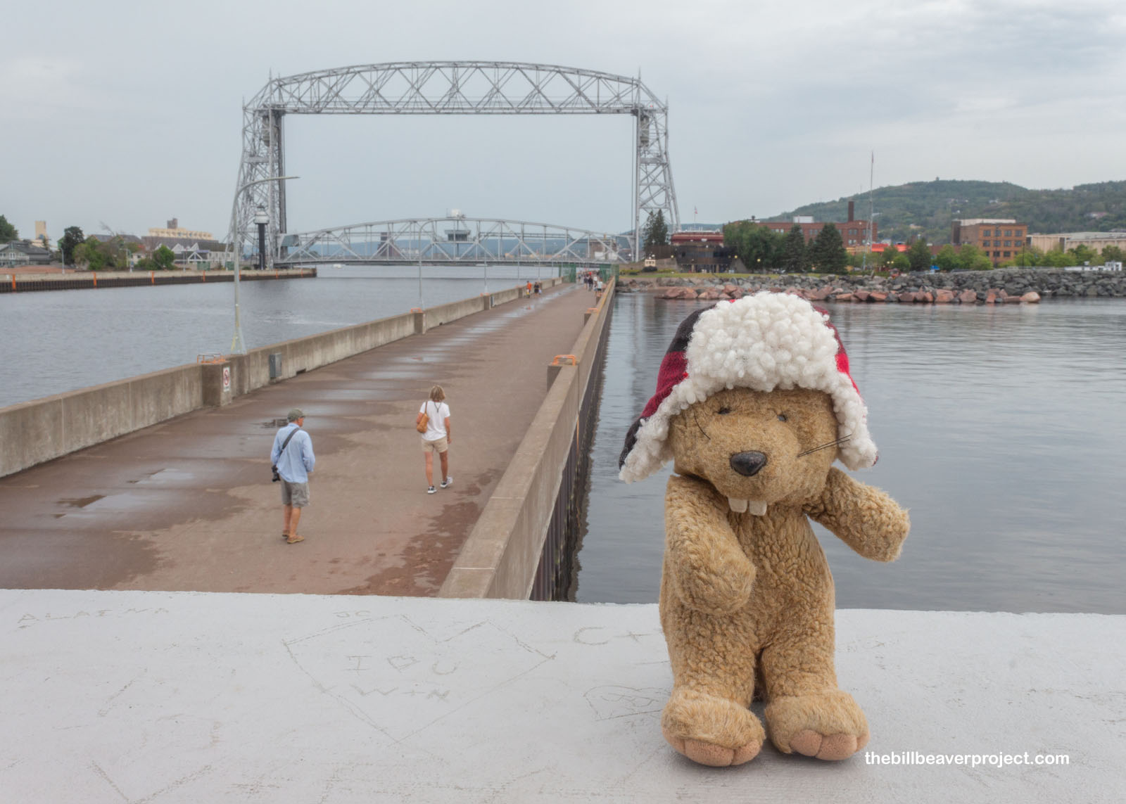
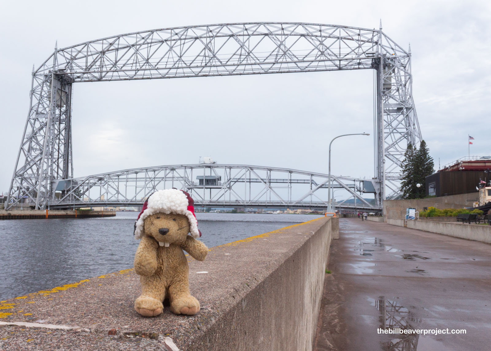
The lights funneled ships in toward Duluth’s famous Aerial Lift Bridge, a really remarkable contraption for getting folks across the canal. Designed by Thomas McGilvray, this was one of only two hoist bridges built in the USA and featured a huge gondola that could carry 350 people and their cars at a time across the canal! This design only lasted about 24 years before the demand exceeded its capacity, and Claude Allen Turner was brought in to reimagine it. Today, the gondola has been replaced by a more traditional bridge over the canal with one huge distinction: when ships need to come through, that bridge gets hoisted 135 feet into the air in only a minute! I didn’t see the bridge rise on this visit, but it gets lifted over 5,000 times a year!
 |
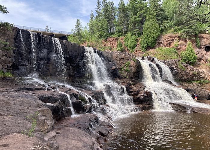
After lunching on a tasty wild rice salad from Grandma’s Saloon & Grill, I began my journey north along the shore of Lake Superior. What an amazing drive! The whole coast line was a smorgasbord of state parks and lighthouses, and since I was in no real hurry to get to the hotel, I decided to take some detours and experience the beauty of this greatest (in my opinion) of lakes! My first stop was at Gooseberry Falls State Park!
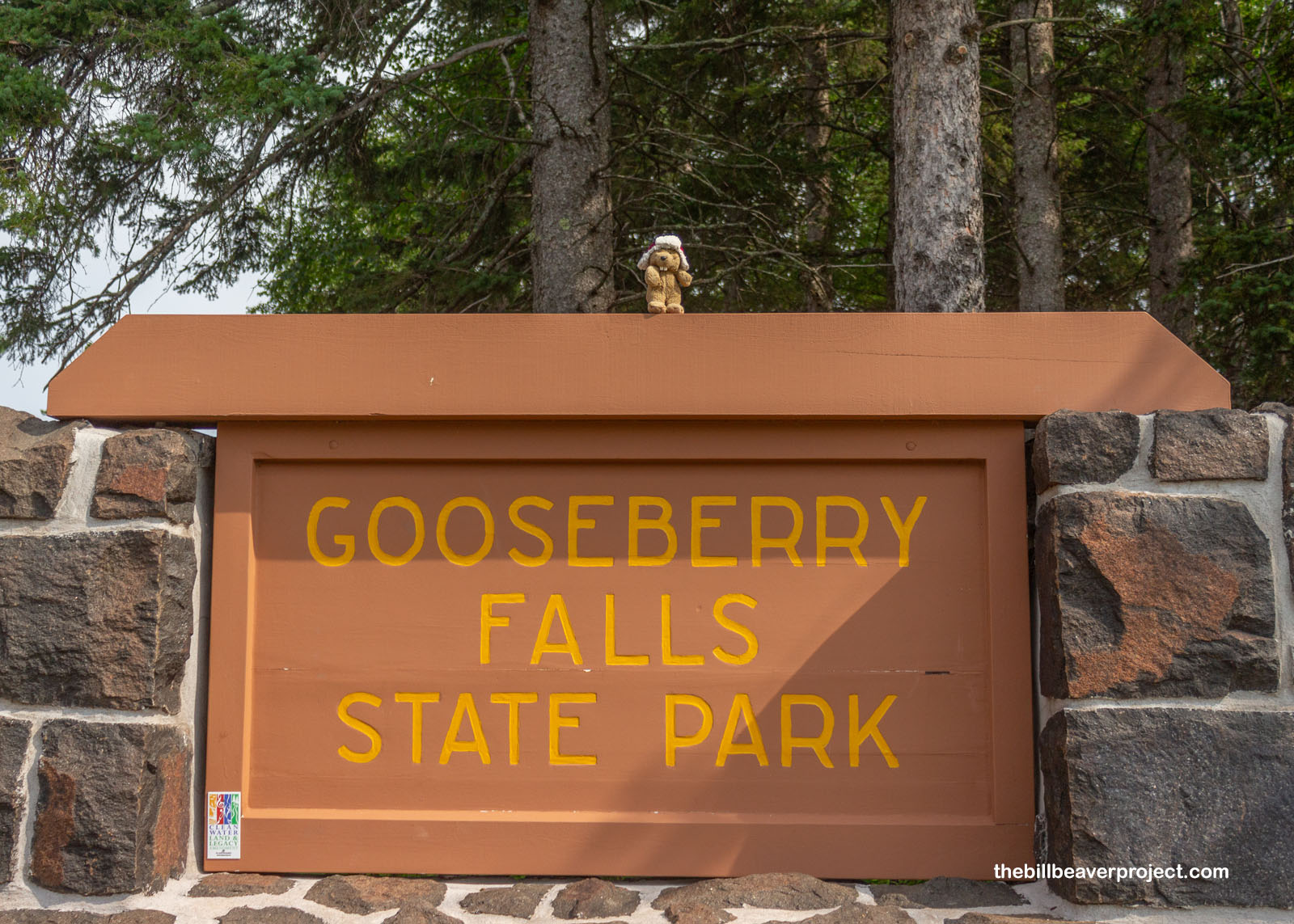 |
At first, I was disappointed not to find any scrumptious gooseberries here at all, and that’s because Gooseberry Falls is on the Riviere des Groseilliers, named for 17th Century fur trader, Medard Chouart sieur des Groseilliers, whose last name means “gooseberries.” Instead, I found three gorgeous cascades running into a gorgeous lake. Silver linings!
 |
Don’t let the photos fool you! I waited a while for folks to clear out of the frames! There were throngs of folks swimming in the pools between the falls, even on a Thursday! And I couldn’t blame ’em. The second Gooseberry Fall was definitely the most beautiful of the three, and by this point, the gloomy morning had started to brighten into a toasty afternoon!
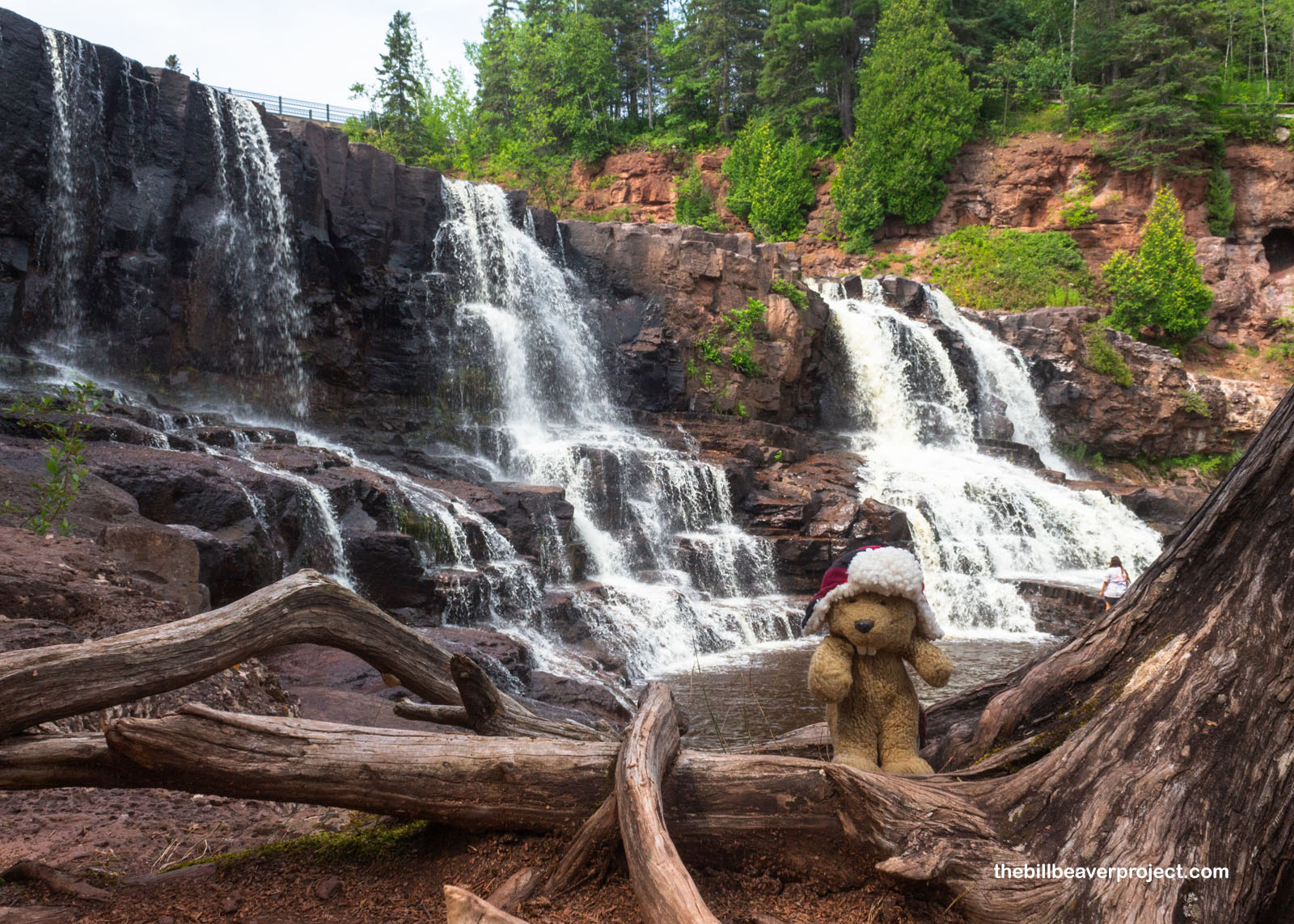 |
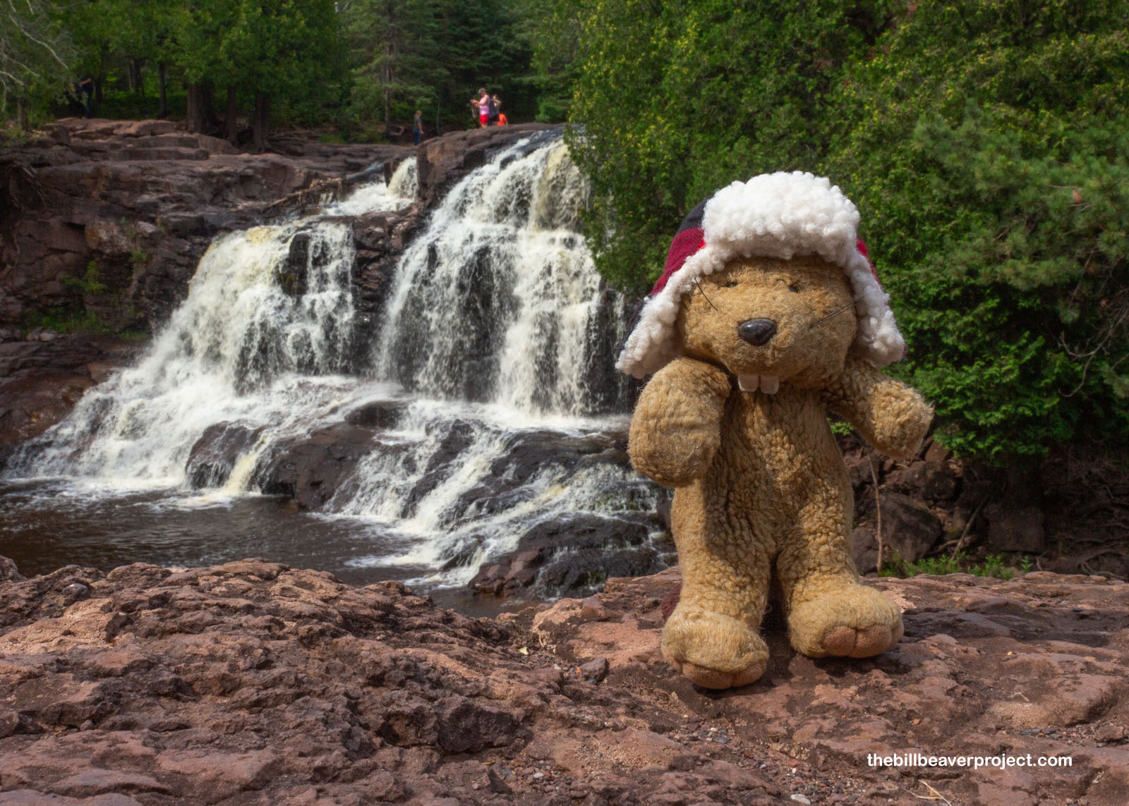
I trekked a little up the trail to see the third and largest of the waterfalls, where there was no one swimming at all! That’s because there were no trails down to the water, only benches and overlooks. Had I thought to bring a snack, it would have been the perfect setting for a picnic!
 |
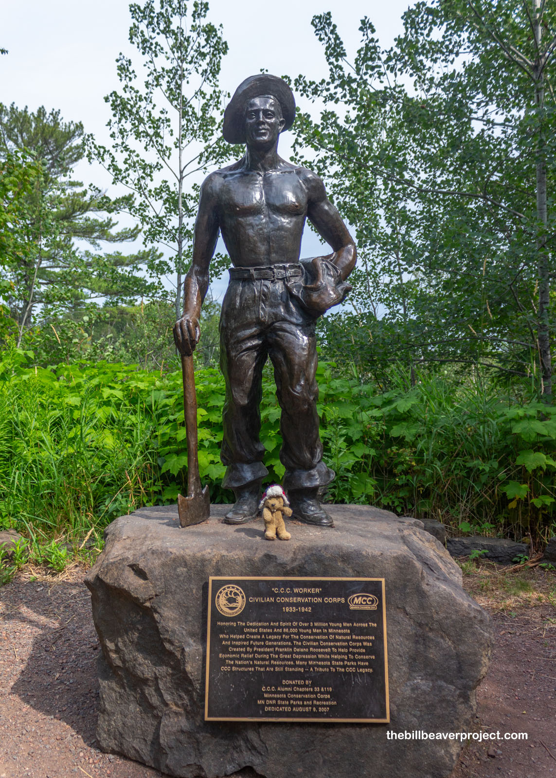
That I could have enjoyed a picnic here at all was largely thanks to the young men of the Civilian Conservation Corps, known as the CCC Boys, who developed trails and visitor facilities at the top of the falls, between 1933 and 1941! With this opening as a state park in 1937, it was set in stone that this would be open to all, not just wealthy vacationers, for as long as there would be a state of Minnesota!
 |
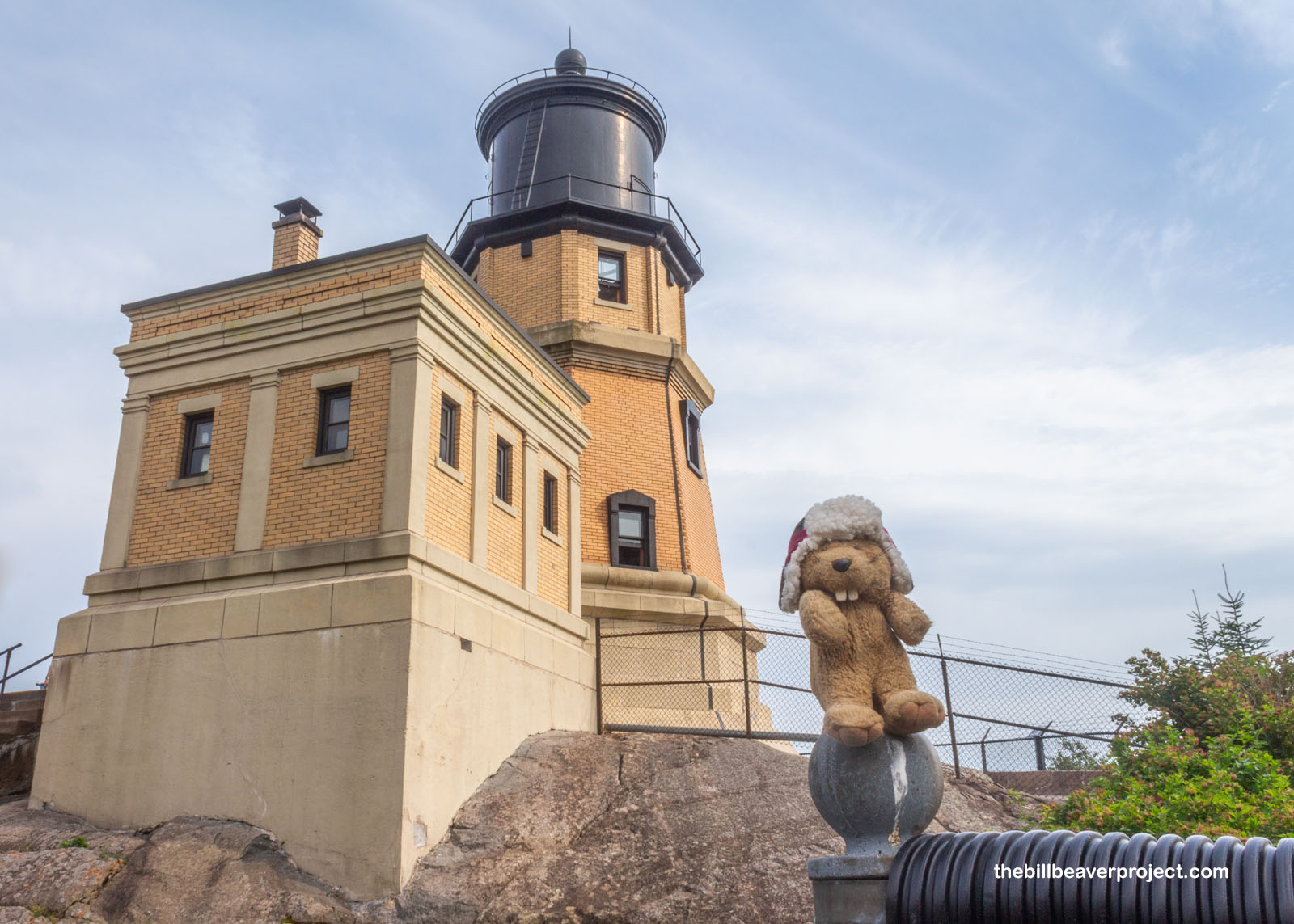
Next up in the patchwork of waterfalls and lighthouses was a path to the famous Split Rock Lighthouse, which I spotted on plenty of postcards, flyers, and must-see lists down in Duluth. Right off the bat, I learned that it was in an odd setup, a privately run historical site in the middle of a public state park of the same name, with two different entrance fees! I got confused and ended up paying both.
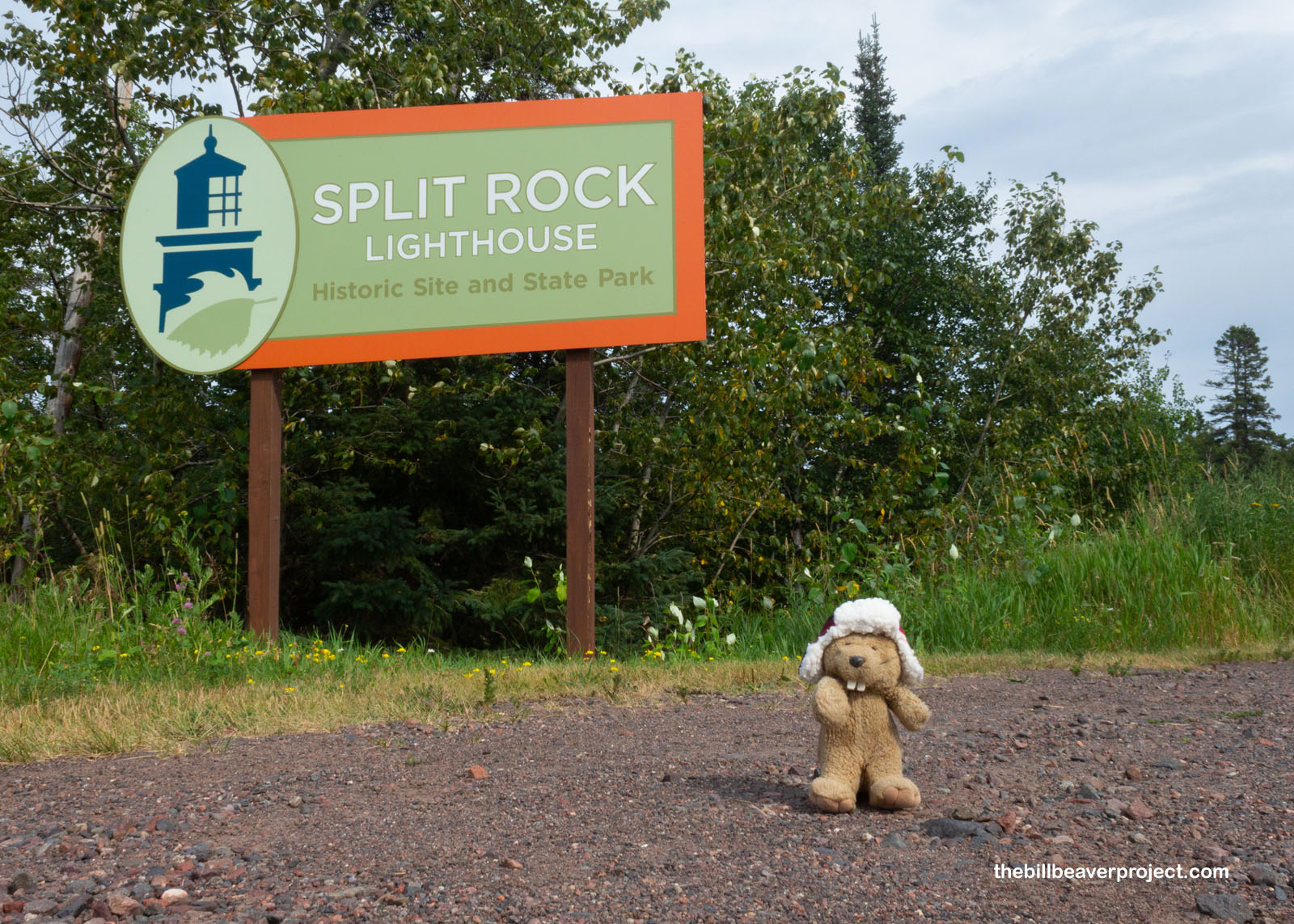 |
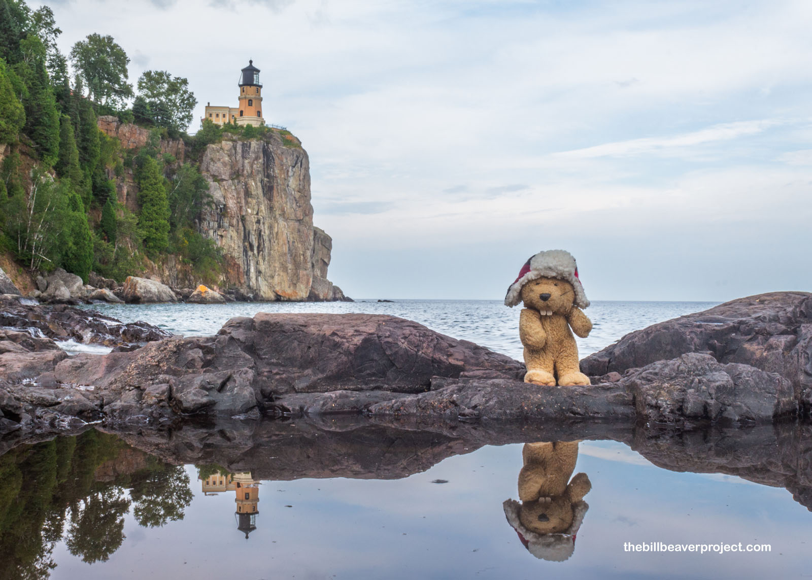
In any case, the Split Rock Lighthouse is one of two survivors from the age of Superior lighthouses, warning ships of peril on the great Gitchi-Gami! It was built in the same year as Duluth’s North Pier Light, part of a four-year lobbying campaign by U.S. Steel, which lost two ships on the rocks here on November 28, 1905! The lighthouse was designed by Ralph Tinkham, and constructed very precariously. There were no roads here at the time, so every piece (310 tons in total!) had to be shipped up to these dangerous rocks and hoisted up the 100-foot cliffs!
 |
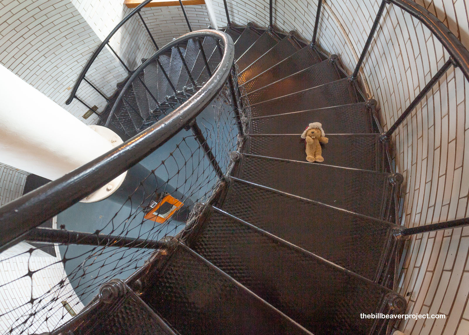
If you can believe it, in all my years of photographing lighthouses of the world, this was the very first I’d ever climbed! The whole complex was open for visitors, though the docents advised everyone at the bottom to wait patiently for the spiral staircase to clear because it was narrow and there wasn’t a lot of room up top. But it was so cool getting to look out at the coastal views and watch the still spinning, two-paneled Fresnel lens up close!
 |
 |
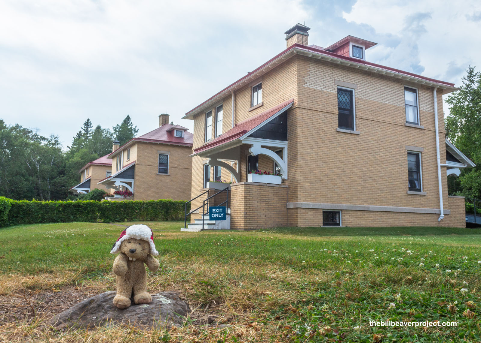
Outside, I took a look at the keepers’ homes. Because this lighthouse was so remote, a crew of a keeper and two assistant keepers were stationed here from May to December, checking weather, sounding the foghorn, and monitoring the light in four-hour intervals! They were away from their families, except for short visits, and very far from supplies, which arrived by boat, often delayed by weather, and still had to be hauled up the cliffs for the first six years of operation!
 |
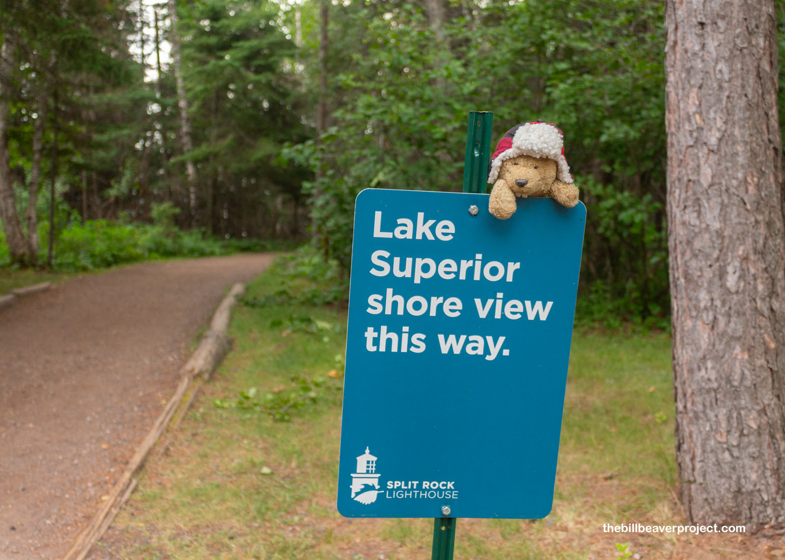
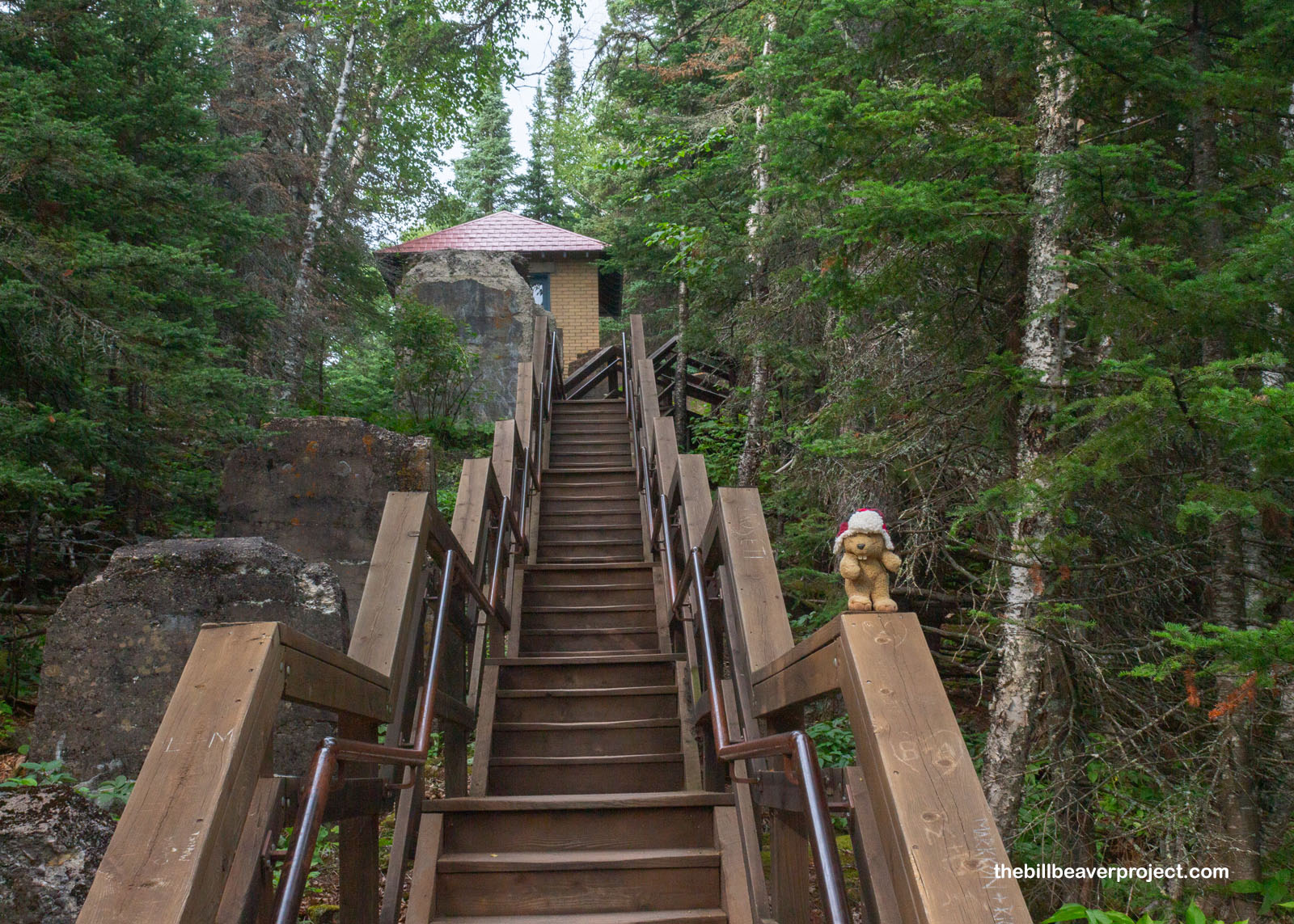
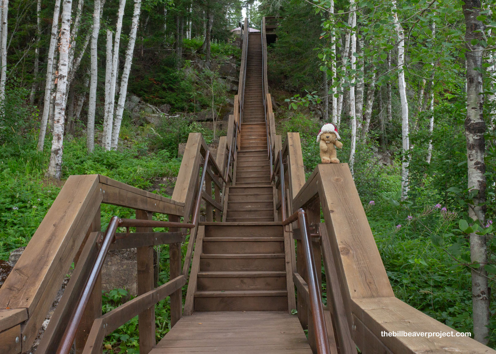
To see how the keepers eventually got around this cumbersome supply system, I jaunted on over to a trail leading down to the lake shore and its iconic views!
 |
Off to the left, I found myself at a long, wooden staircase leading down, down, down to the shore. Next to it were the stone remains of the tramway system completed in 1916, which had an actual dock at its base, where boats could unload their supplies into a car and up to the storage house with ease! This system worked wonders for the keepers until 1934 when a spur road connected the lighthouse with the new North Coast Highway and the station got its very own truck to make grocery runs!
 |
 |
I made it to the rugged shore, where I got a sense of how tough it must have been to safely land a ship. It was pretty calm, though, which is not what it looked like in November 1975 when the famous Edmund Fitzgerald passed Split Rock on its way from Superior, Wisconsin to Sault Ste. Marie, Michigan. Sadly, the 60 mile-an-hour winds and 29-foot waves led to flooding in the cargo hold, and the whole ship with its crew of 29 went down on November 10th.
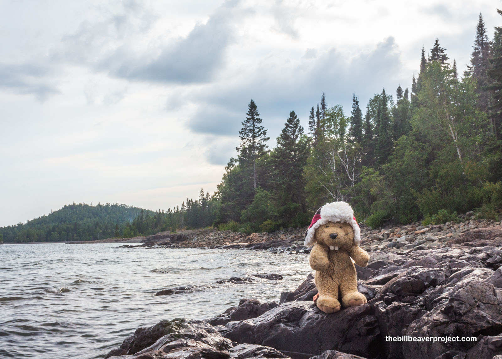 |
Today, the Split Rock Lighthouse, like most of its kind, is preserved as a historic site and tourist attraction. Sonar and GPS technology made lighthouses functionally obsolete, but the arrival of the highway and motor tourism in the early 1930s made this a beloved spot to visit and photograph. Exploring the tide pools at its base and admiring the reflection of the lighthouse on its towering cliff, I could see why!
 |
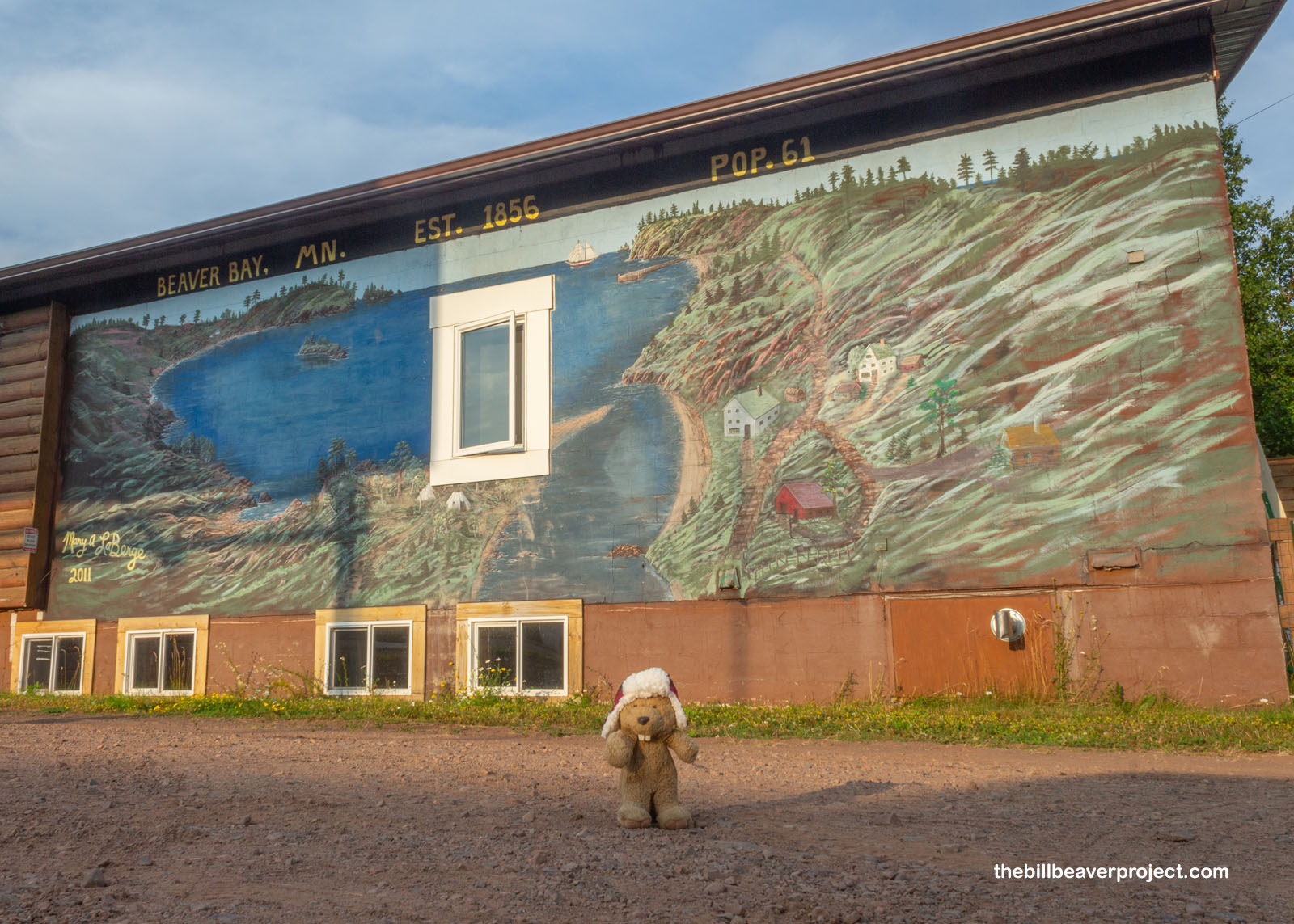
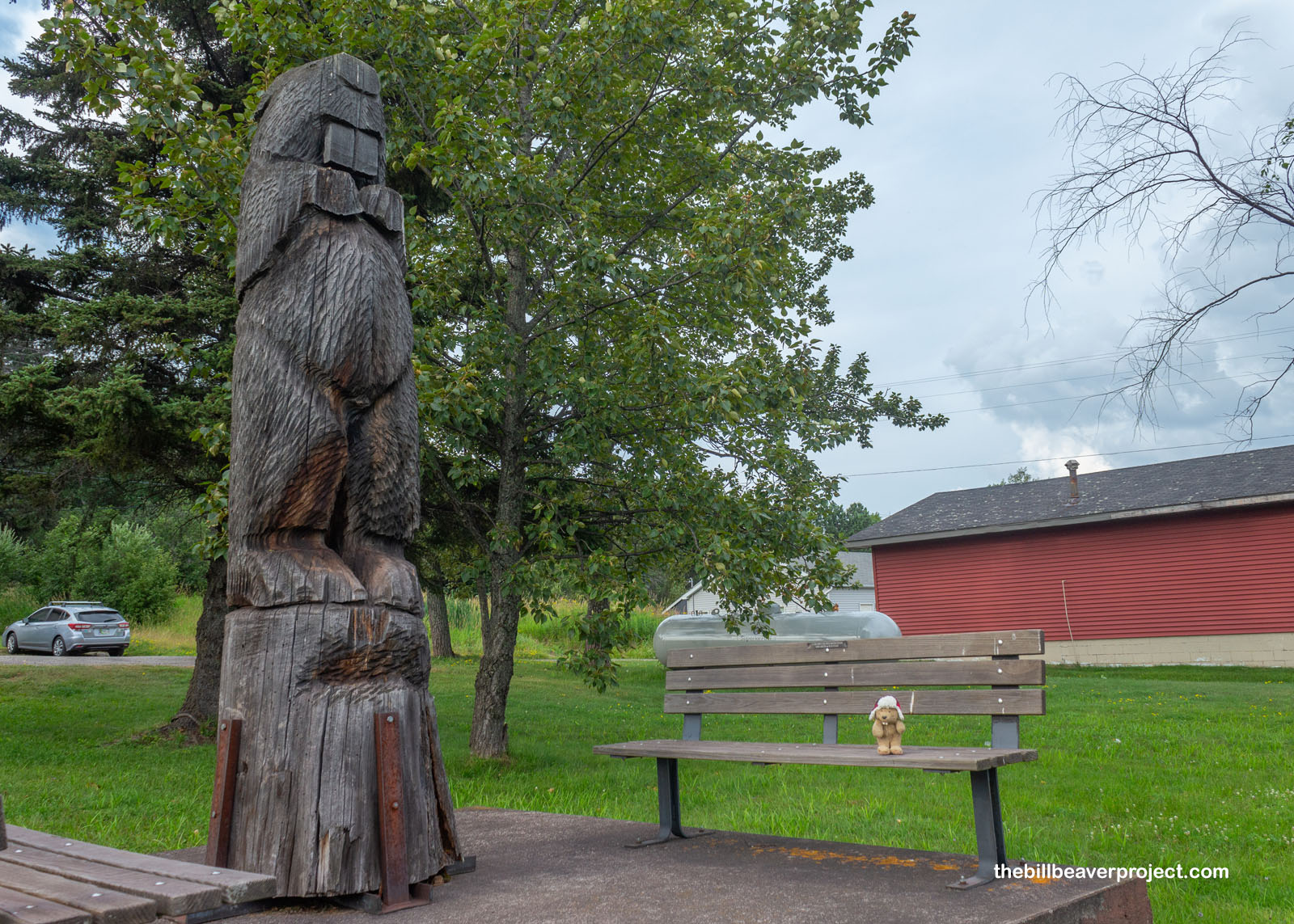
Before reaching the hotel, I wanted to stop and see what I could see in the town of Beaver Bay, for obvious reasons! Home to a towering wooden beaver statue, Beaver Bay was actually the site of first settlement by European settlers, specifically the five Wieland brothers from Germany in 1856!
 |
 |
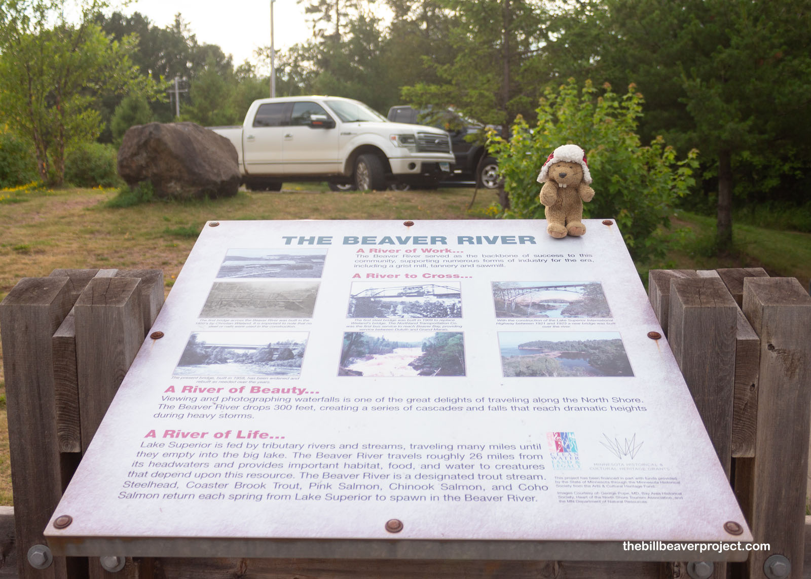
I went down to the Beaver River to see if I could spot any of my kind, learning something really neat en route. Salmon spawn in this river! Usually, salmon spend most of their lives in the salty ocean, but these live in the freshwater lakes! Three species were introduced to the Great Lakes between 1956 and 1970: pink, chinook, and coho, replacing the original Atlantic salmon, which were extirpated by the milling industry in the late 1800s!
 |
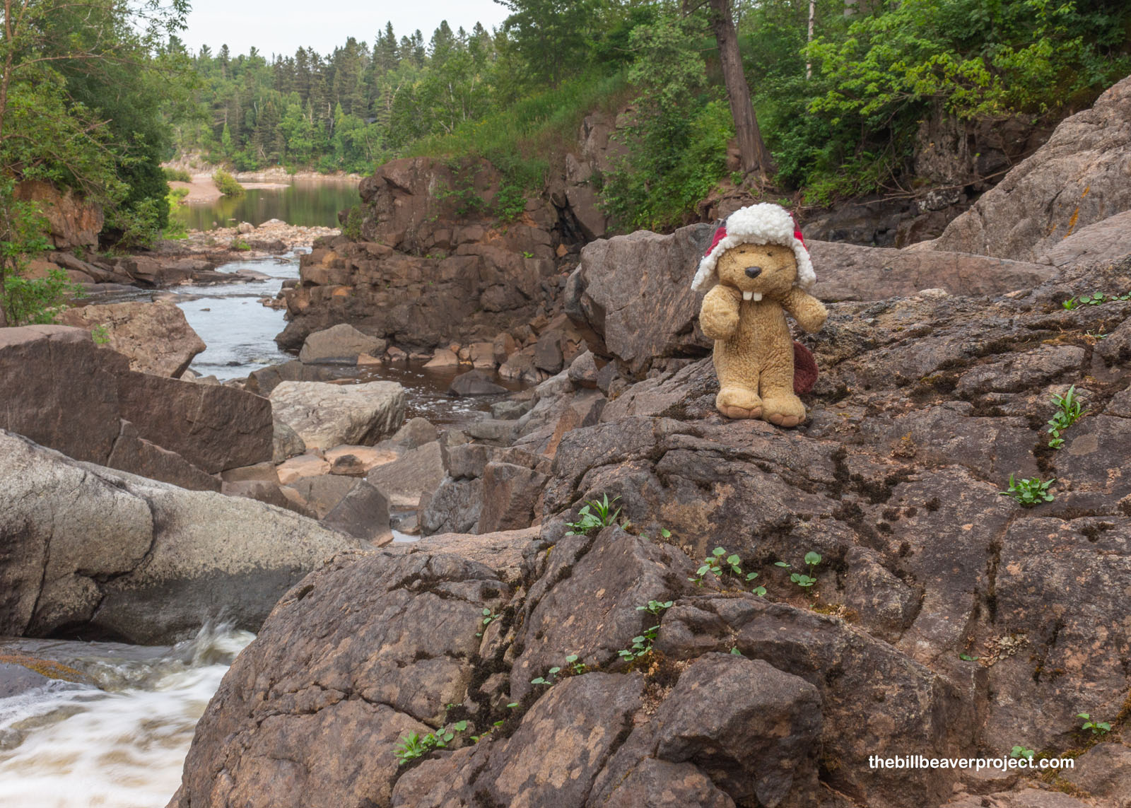
I could certainly imagine those salmon leaping up this waterfall on the Beaver River to get to their spawning grounds, but what a wild thing to imagine these ocean-going species living out their whole lives here in fresh water! It made me wonder how they might evolve differently into distinct species over the generations, but I wouldn’t have long enough to find out. Instead, I swatted mosquitoes and enjoyed the natural beauty surrounding me at the Beaver River cascade!
 |
 |
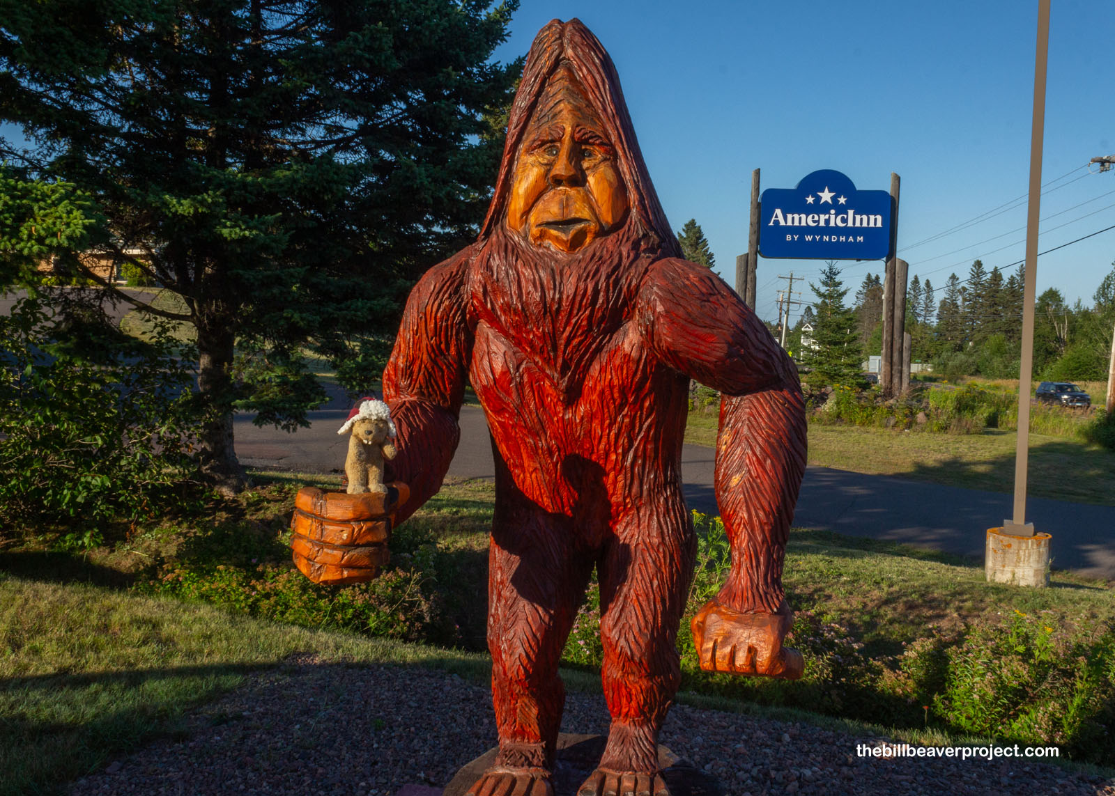
And then, I wrapped up my day at the AmericInn in the town of Tofte, greeted by my old friend, Bigfoot, at the neighboring gas station. Tofte was still about an hour and some change south of the ferry to Isle Royale, but that was because of the unusual adventure situation I was in: when I booked this trip, it was because I spotted a surprise opening in a completely full ferry season! After booking my passage to Isle Royale, I went looking for lodging, and wouldn’t you know it, everything from campsites to hotels were completely booked up for sixty miles around the community of Grand Portage!
 |
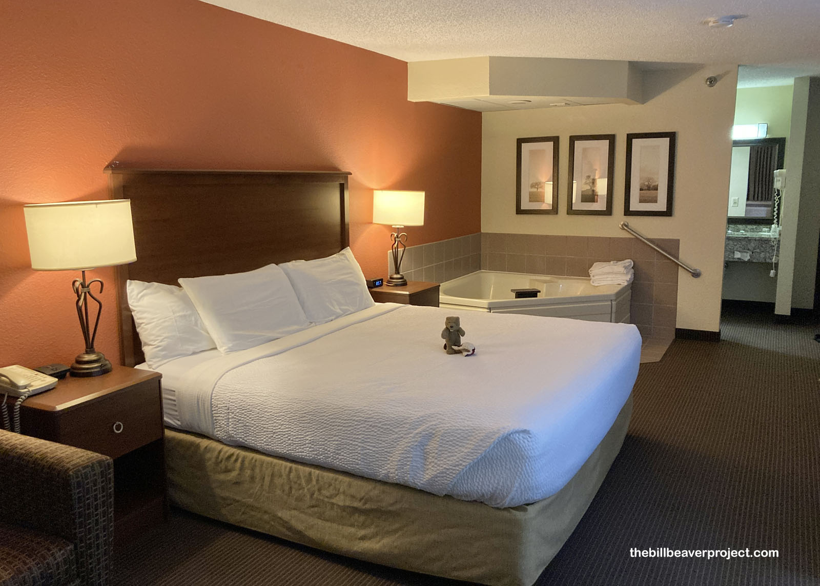 |
Luckily, the AmericInn was just lovely with a communal TV broadcasting the Paris Summer Olympics and a full jacuzzi in the room! I think a good soak will charge me up for an early morning sprint to the ferry dock and an adventure onto Gitchi-Gami for my final Michigan national park!
Isle see you then!

More 2024 Adventures |
Total Ground Covered: 83.5 mi (134.4 km) |
Next Day |