 Previous Day |
Tofte, MN → Grand Portage, MN → Duluth, MN 226.6 mi (364.8 km) |
 More 2024 Adventures |
Aaniin gakina awiya!
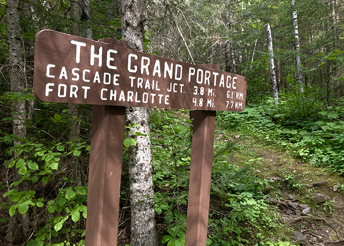
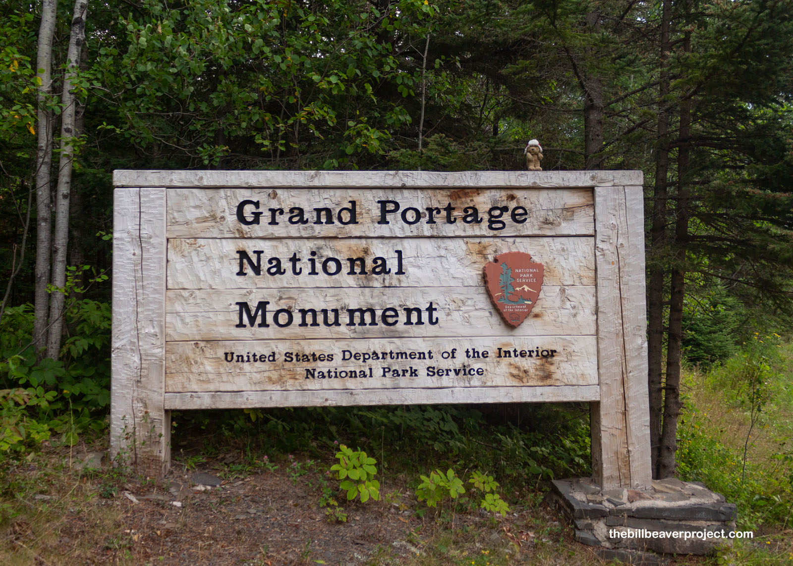
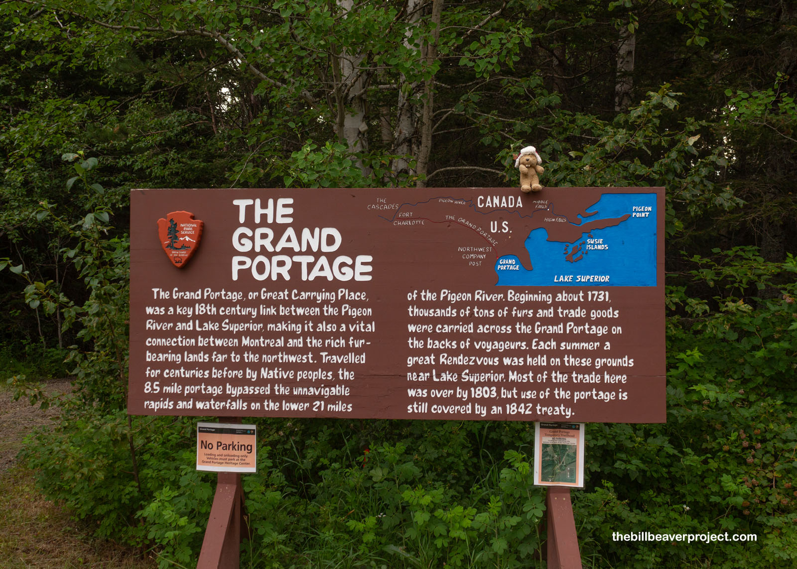
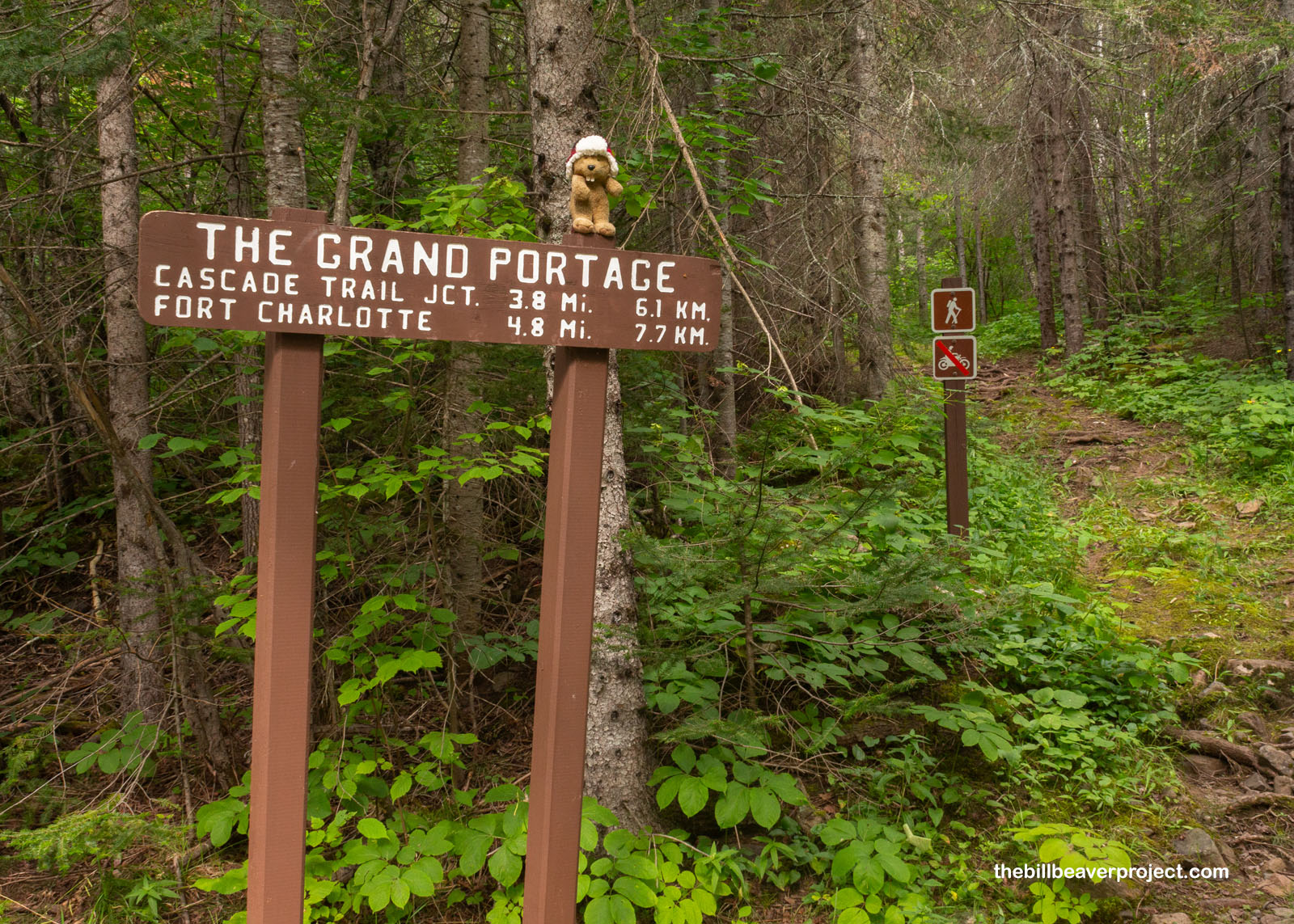
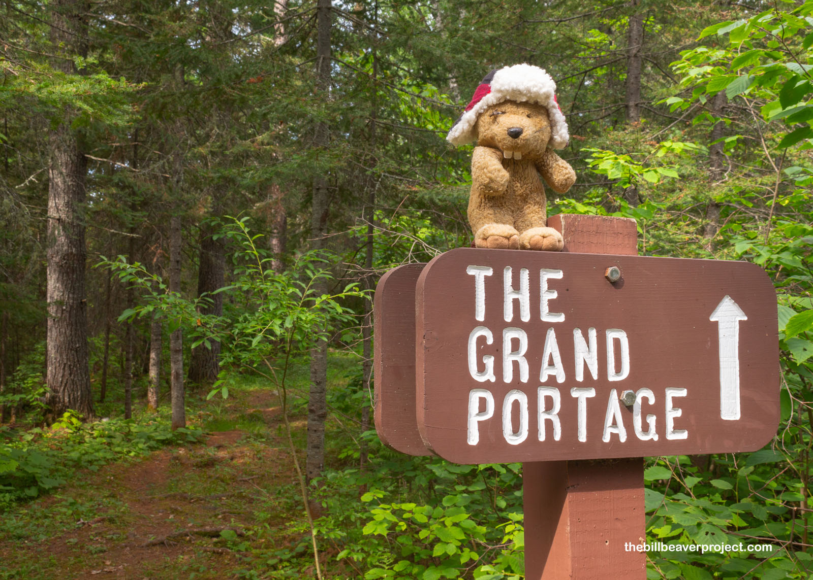
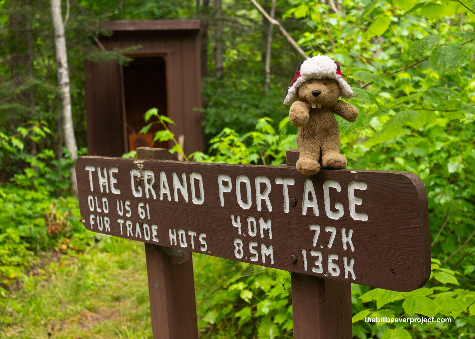
I’ve returned north to the Grand Portage Reservation, bright-eyed and bushy-tailed, to embark on a heck of a trek! From this tiny community stretches a vast network of trails that, since time immemorial, has connected the shipping shores of Lake Superior with inland trading posts far to the northwest in the heart of Canada. In Anishinaabe, this “great carrying place” is known as Gichi-onigamiing, but today, the national monument preserving the trail on the USA side of the border is known by its French name: Grand Portage! That 8.5-mile trek to the Canadian border and back was my goal for today!
 |
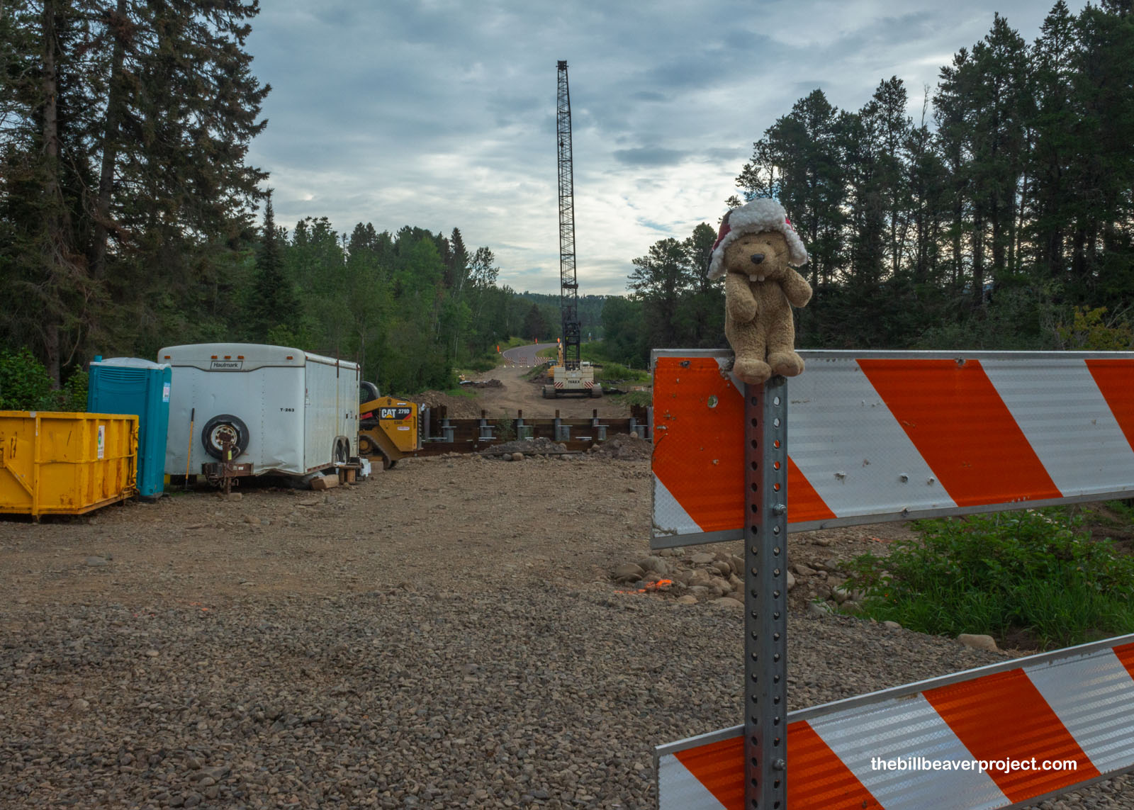
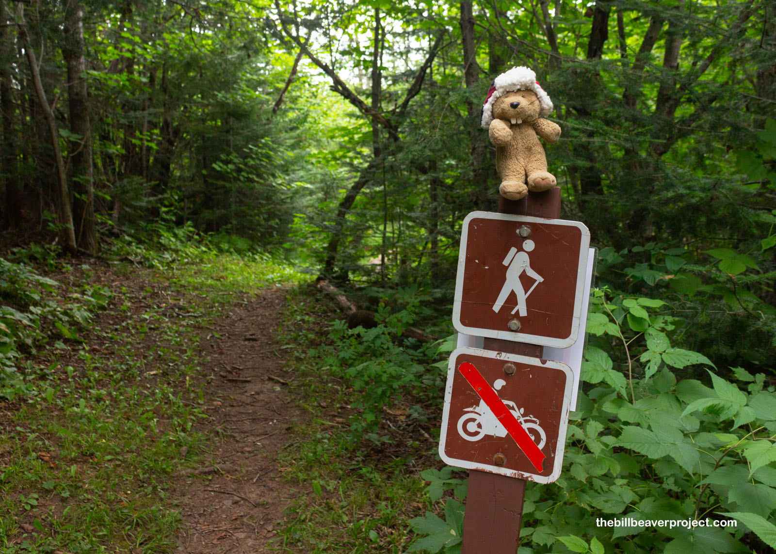
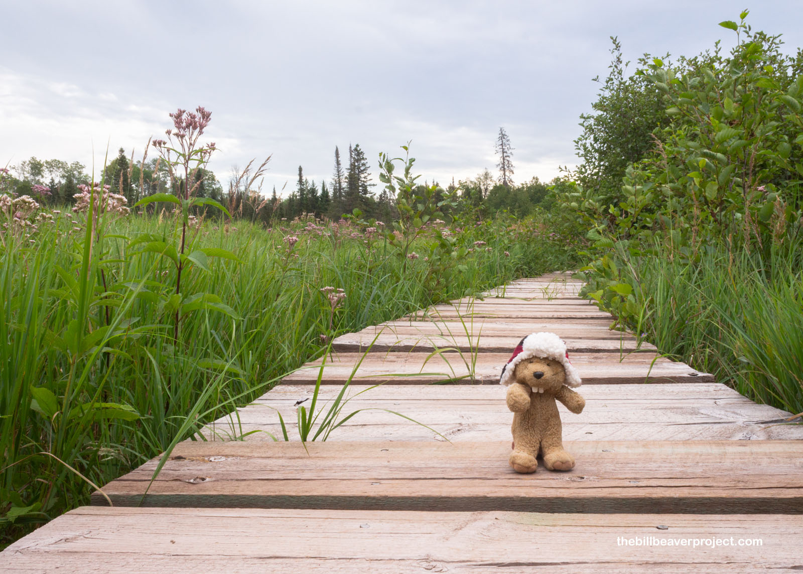
Right from the start, I could tell this wasn’t going to be an ordinary trek. The trailhead was under construction after all! Because there’s been so much tourism here in recent years, it’s put a strain on the historic bridge on Mile Creek Road, so on May 28th, the Grand Portage trailhead moved from its usual spot by the North West Company Fur Post to the Grand Portage fire station, up Shop Road!
 |
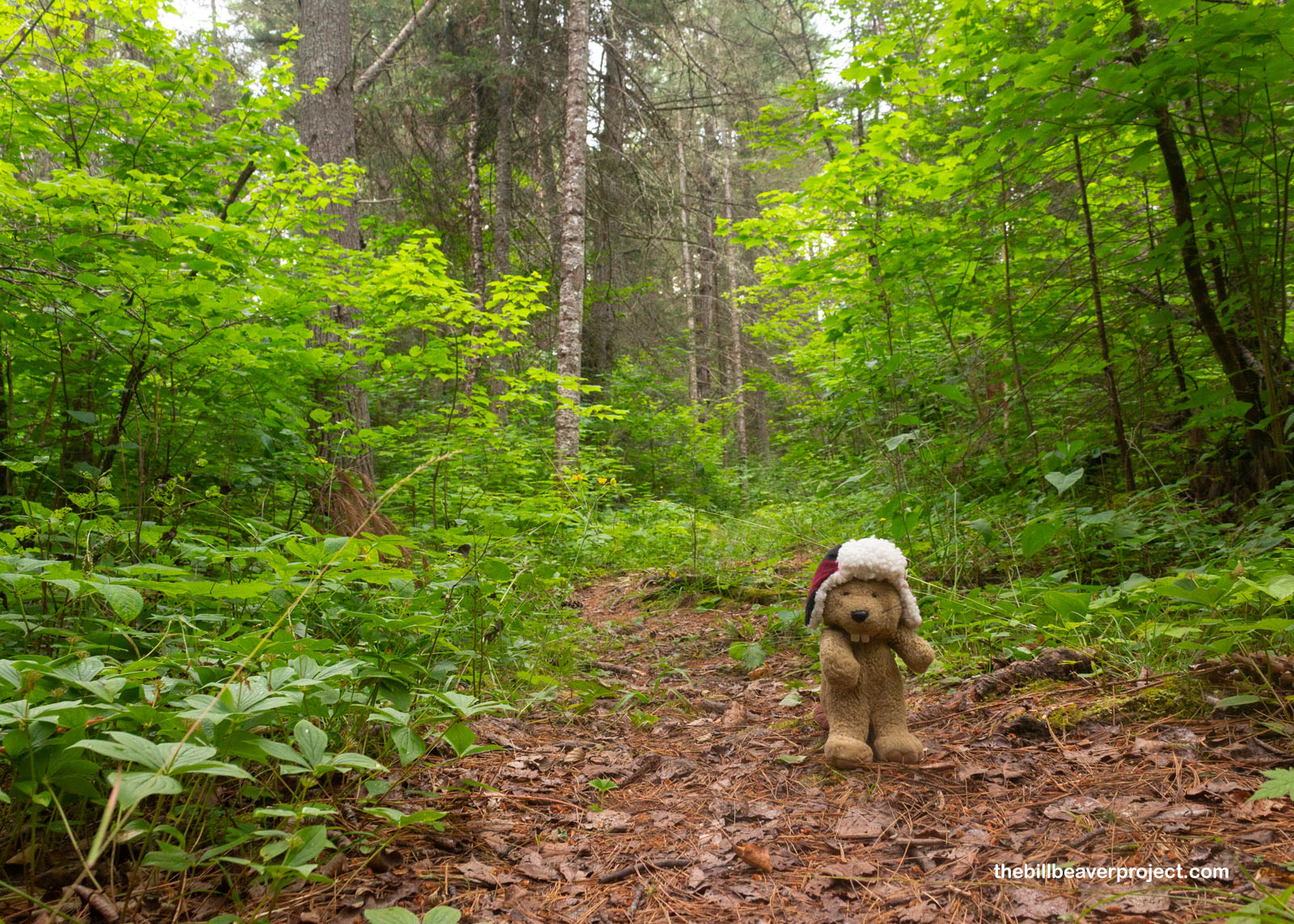
That led to a little extra clomping along the pavement, but I made it to the new trailhead, marked by a very informative sign about the route up ahead! Peak use of this trail was between 1731 and 1803, funneling wealth to the French stronghold of Montreal, but on this particular overcast day, I found myself very much alone and heading in the opposite direction of the capital of Quebec! Well, at least I did after missing the cutoff, reaching the road, getting confused, turning back, and then spotting the tiny trail marker leading north into the woods!
 |
 |
A little wooden bridge took me over my first body of water, Grand Portage Creek, which, on the one paw, was lovely and tranquil to look at, while on the other paw, it was a portent of things to come! In particular, things with wings, and biting mouthparts! Folks, I was here in the height of bug season, and at my first slowdown to enjoy this creek, I was immediately surrounded by mosquitoes! If this was any indication of how the rest of the trail would be, I’d need to keep a steady pace or be drained into a prune!
 |
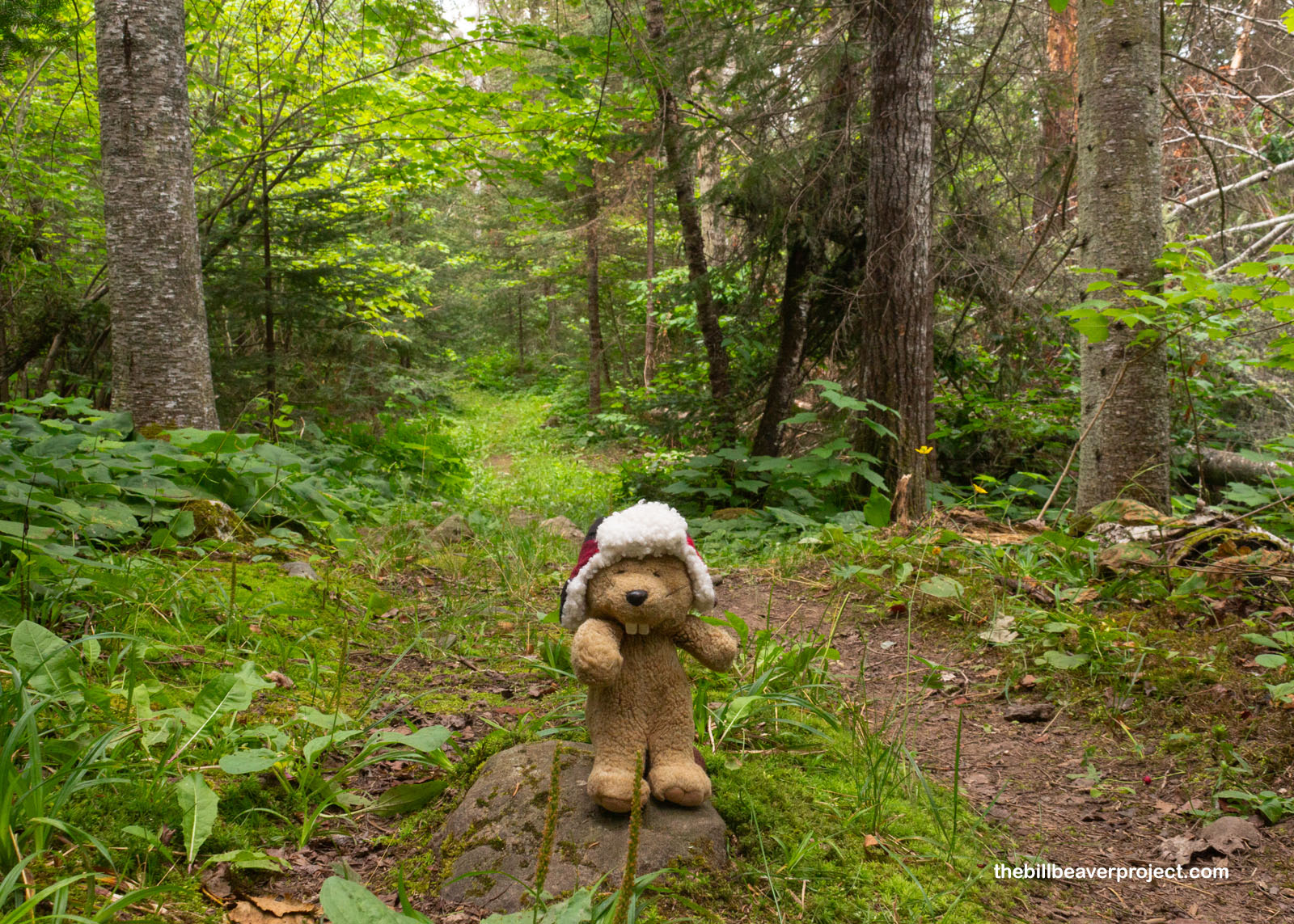
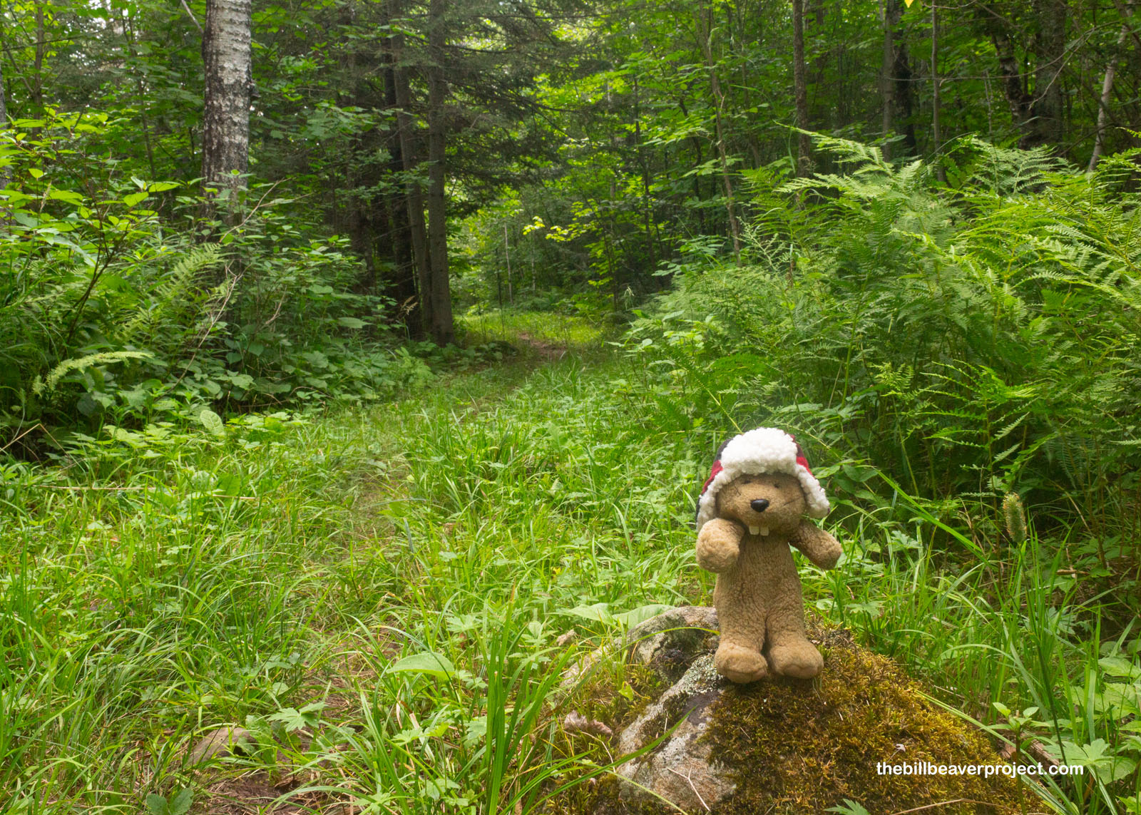
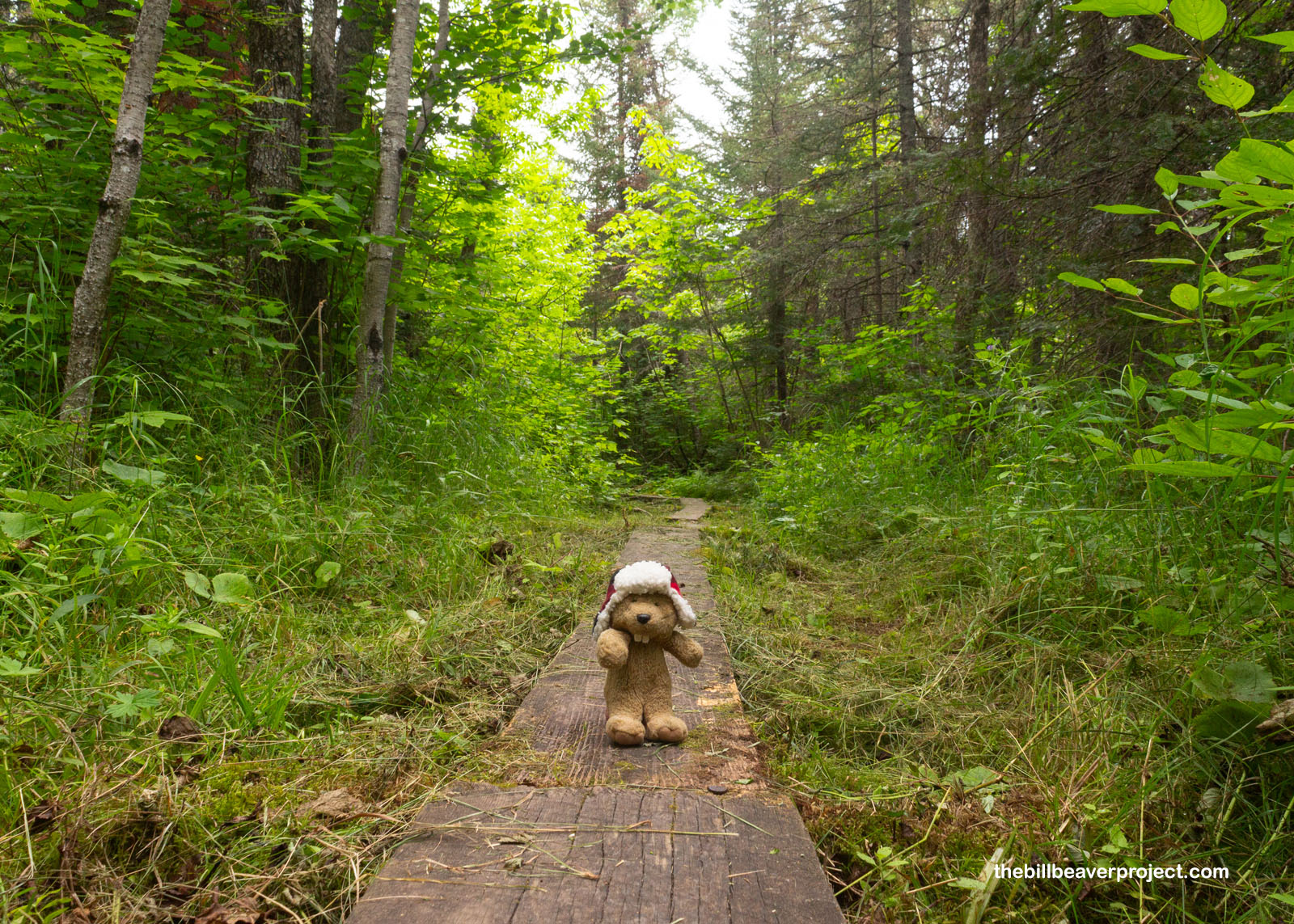
So long as I kept walking, the first few miles of the trail were pretty darn leisurely! The slope was so gentle and constant that it may as well have been flat ground. It was padded with grasses and moss, which were nice on the toes. It definitely seemed to me that this was not a super highly trafficked trail the way some national park trails are. All around, the forest was thick with sugar maple trees (aninaatig in Anishinaabe) and black spruces (zhingob gaawaandag), all in all super lush and wild!
 |
Of course, I had to stop when I spotted some wild mushrooms! These here are Boletus edulis, also called penny buns and porcini (in Anishiinabe, Ogimaawikwaan wazaashkwedoowin)! They’re not just edible but highly sought after for adding flavor to stews, pasta, risotto, and more! They usually need to be cooked to bring out the flavor, though, and since I hadn’t packed anything to cook with, I passed these delectable morsels by!
 |
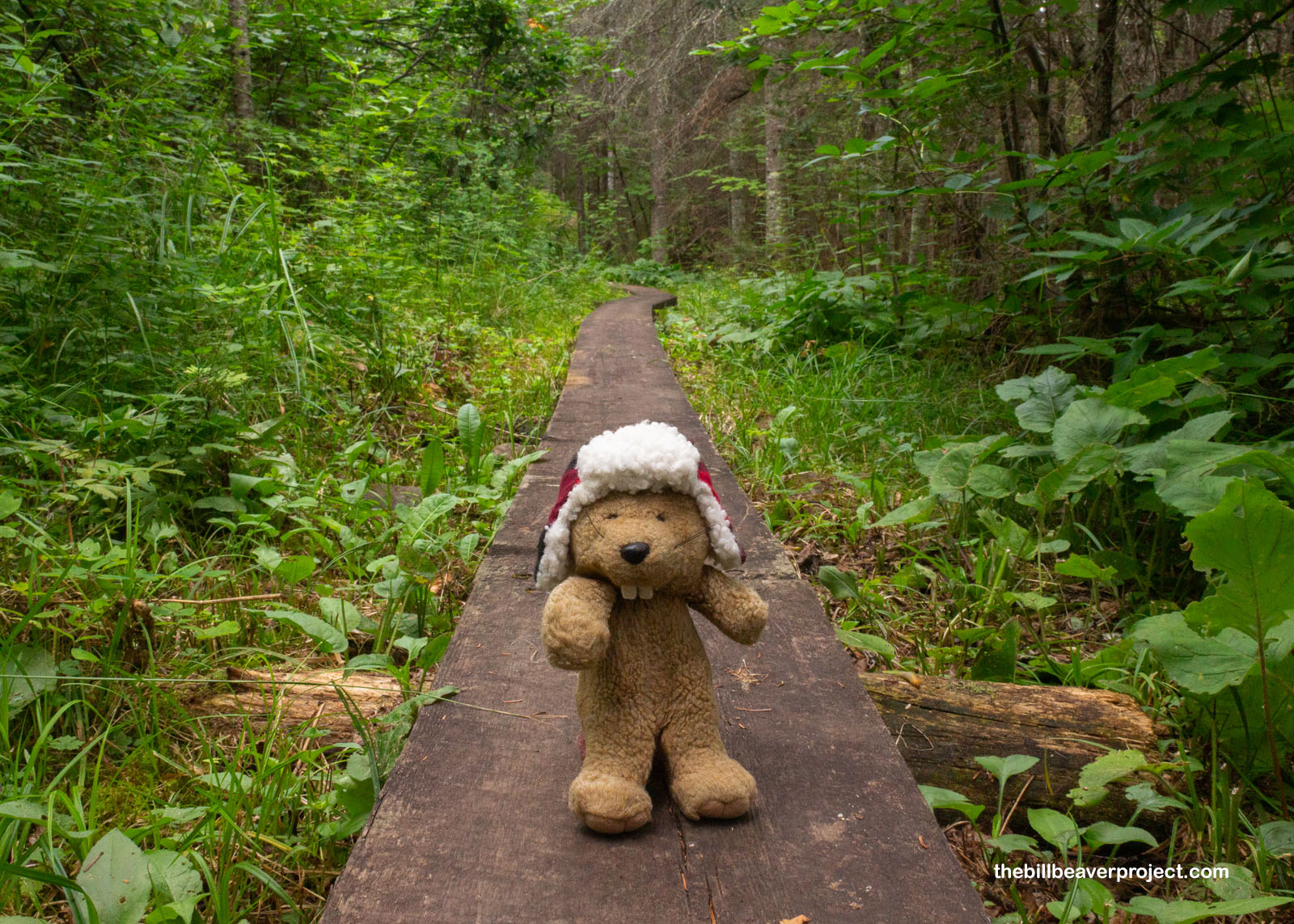
The trail continued in largely the same conditions for several miles, interrupted in patches by single-log boardwalks that took me over big patches of mud. These boards were also covered in bright orange slugs, a sure sign of moisture, and I sure did hope the forecasts of no rain were accurate!
 |
 |
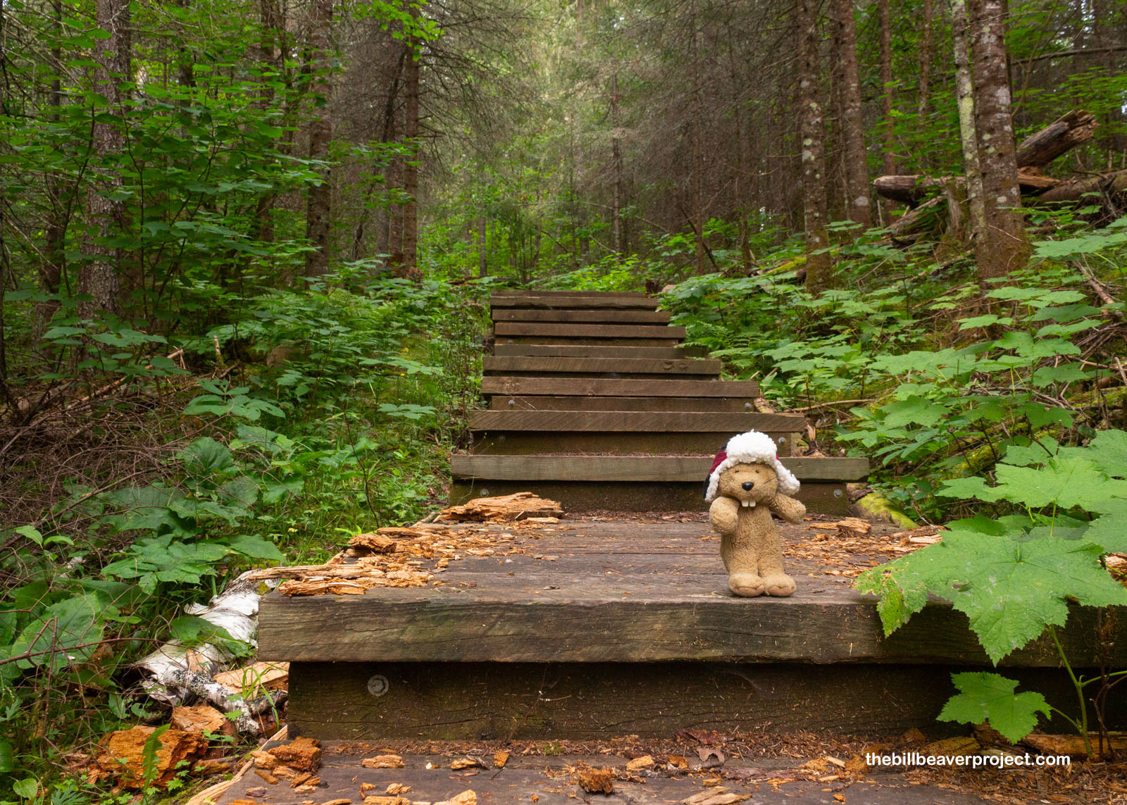
Then, about three miles in, things really got mixed up! There was a staircase going down a hill, lined by thick pines and birch trees, at least one of which had fallen across the stairs, meaning I had to be extra careful where I stepped. All along the way, the mosquitoes, sheltered by the shady trees, buzzed me relentlessly!
 |
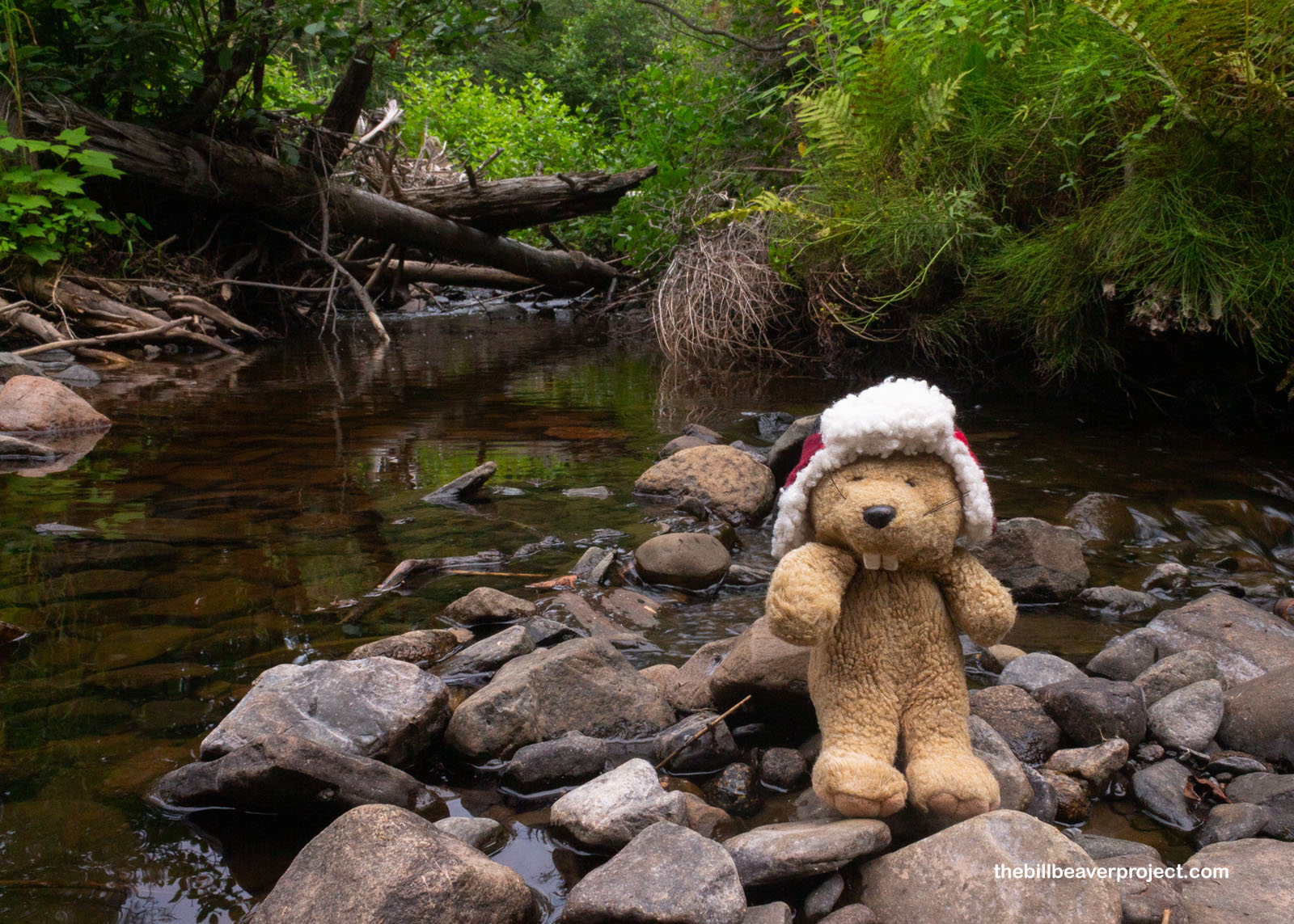
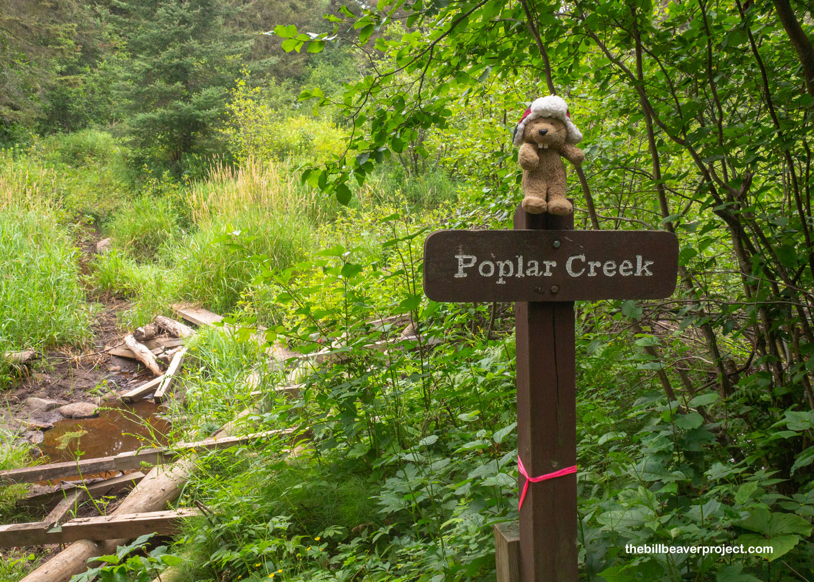
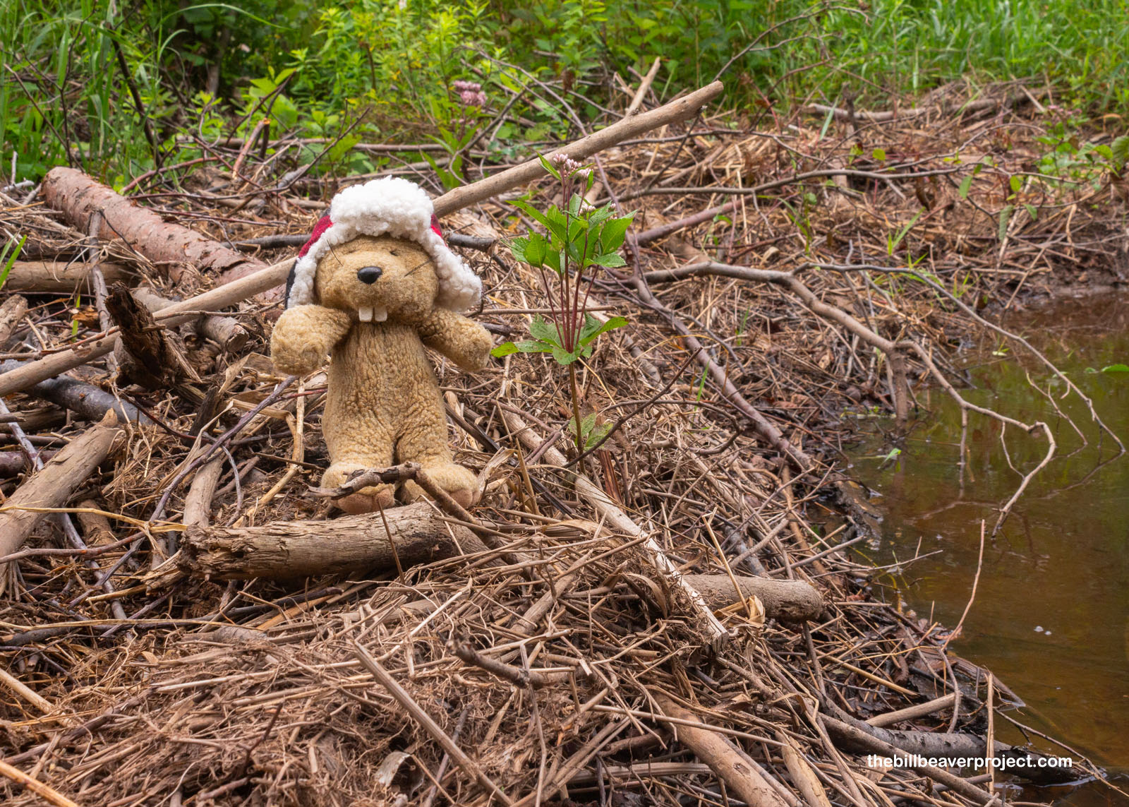
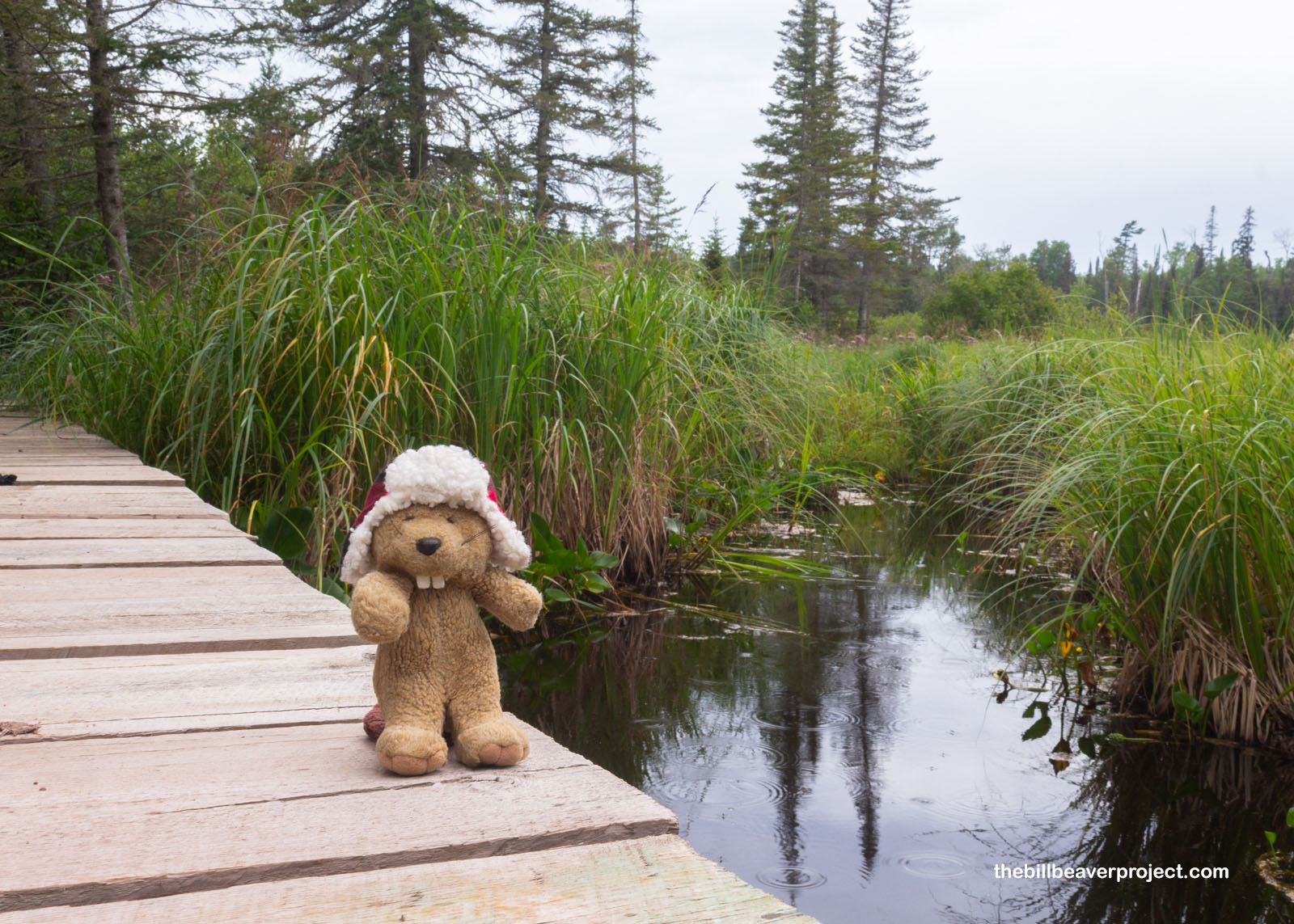
At the bottom of the stairs, I reached a spot on the trail I’d been really concerned about: Poplar Creek! The National Park Service website had reported that some beavers had moved in, damming up the creek and raising the water level! Combined with some heavy rains earlier in the year, the swollen creek had obliterated the bridge that had let hikers pass through with ease! The website hadn’t suggested a way around, so I had to put my thinking cap on.
 |
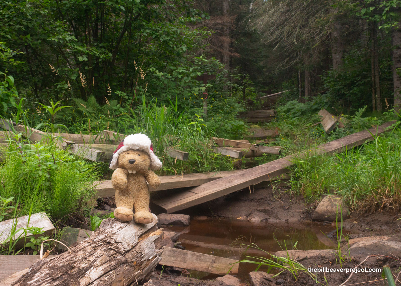 |
What might not have been clear to human hikers was obvious to me: beavers build really strong structures! While the human bridge had fallen to shambles, these mighty rodents had created a super sturdy dam that could withstand all kinds of pressures. This is what I used to cross Poplar Creek, shouting “Thank you!” through the layers of sticks and mud. I hope they heard me!
 |
The sun peeked in and out as I continued on, shoving through tall grass and short trees, up hills and down an increasingly overgrown trail. When walking so long on a straight trail like this, it’s easy to let the mind wander out of space and time, imagining what it must have been like for those French voyageurs to carry their two 90-pound packs of merchandise up and down this entire trail!
 |
I was so lost in thought that I hit a road out of nowhere, and not just any road, but the one marking the halfway point Holy toledo, I’d already gone four miles! I’d been super worried about conserving my energy and looking out for any foot pains, but I felt pretty darn great! Even the ever-building swarm of mosquitoes couldn’t get my spirits down! I pressed on toward Fort Charlotte!
 |
Of course, I wasn’t totally ignoring the needs of my tummy, and as soon as I spotted some thimbleberries (datgaagmin in Anishiinabe), I had to swipe a couple snacks. Mmm MMM! They’re super tasty up here in Minnesota!
 |
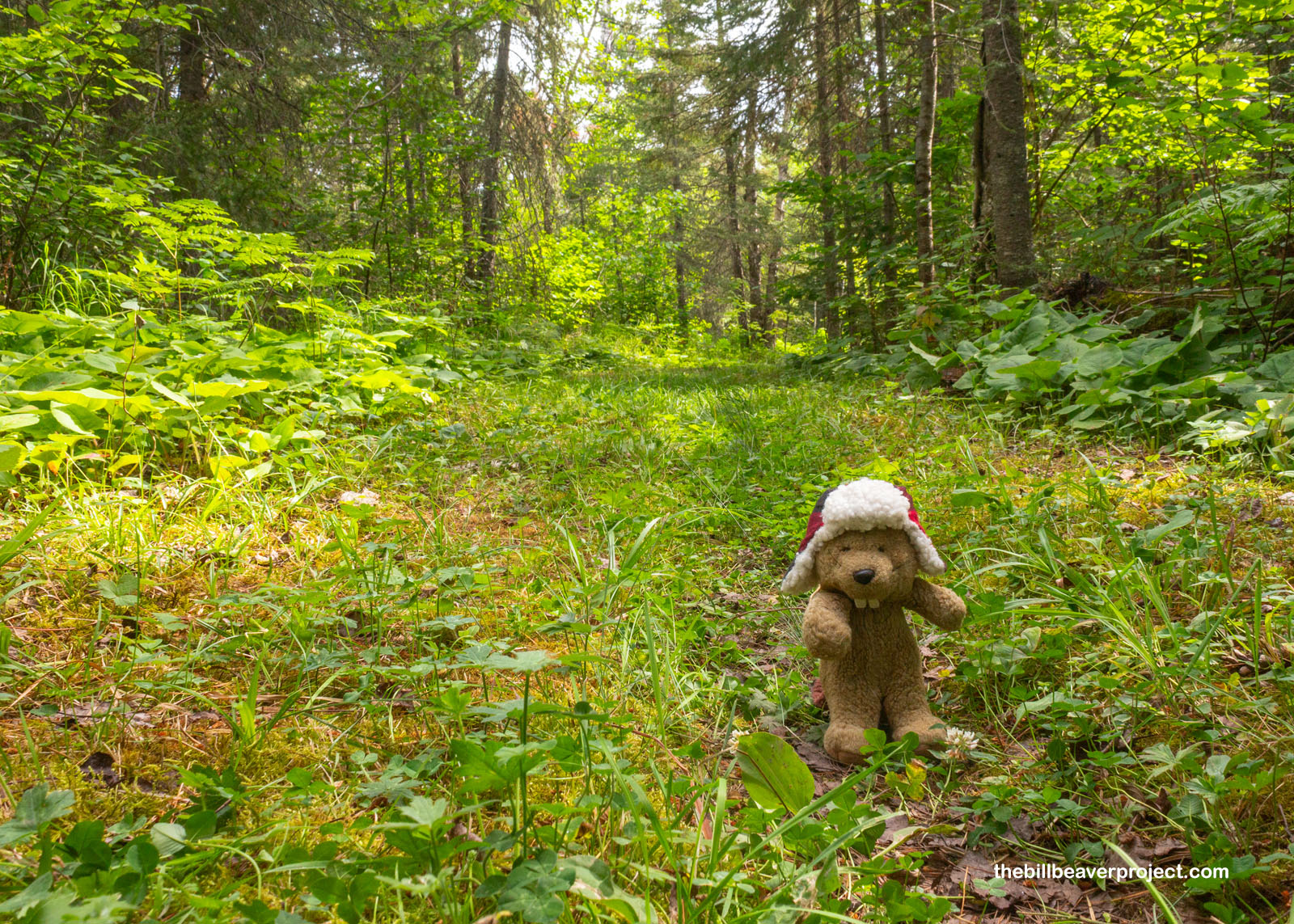
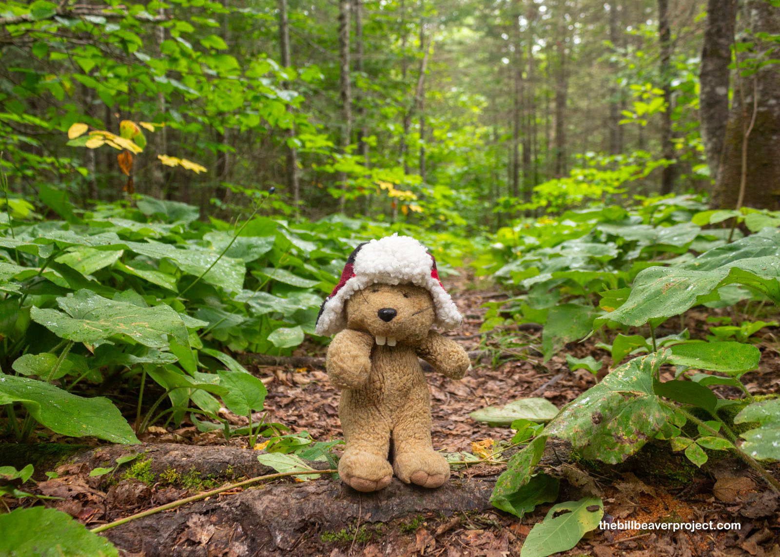
Over the next two miles, the path got even more overgrown until I was pretty much just walking on a long green carpet between the trees! Up until this point, I hadn’t seen any other hikers, but suddenly, up ahead, a group of gals appeared, carrying canoes on their heads, just like the voyageurs! I had no idea how they could see where they were going or how in the world they had the stamina to carry them eight and a half miles down to the lake! Plus, at about this point on the trail, deer flies started to join the mosquitoes, and for all the swatting I was doing with paw and tail alike, I couldn’t imagine trudging through these biting baddies while balancing a canoe on my head!
 |
 |
All those bugs crescendoed as the trees cleared up ahead and the trail turned to boardwalk, but I didn’t mind as much here. Why? Because I was witnessing more amazing work by beavers, an entire pond ecosystem created by their hard work! Without beavers, this national monument wouldn’t exist! On this side of the border, the North West Company featured a beaver on their crest, while on the other side of the border, beavers are downright revered! They’re an official symbol of Canada and were even featured on that nation’s very first postage stamp, circa 1851!
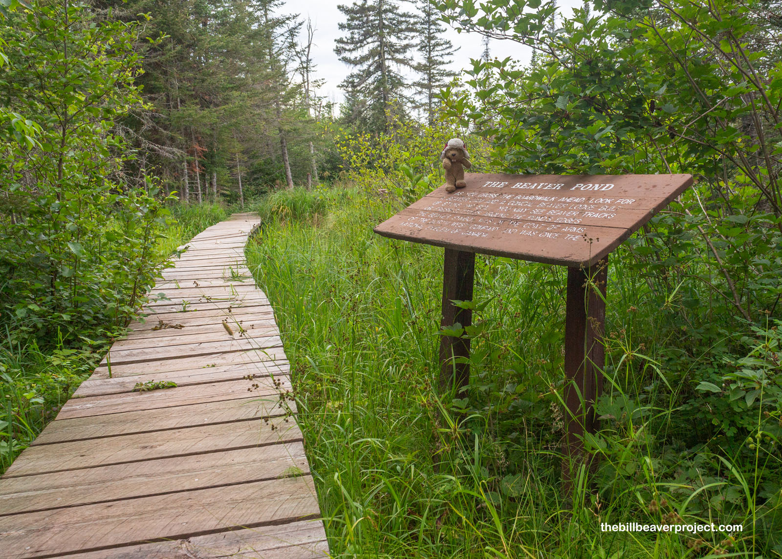 |
 |
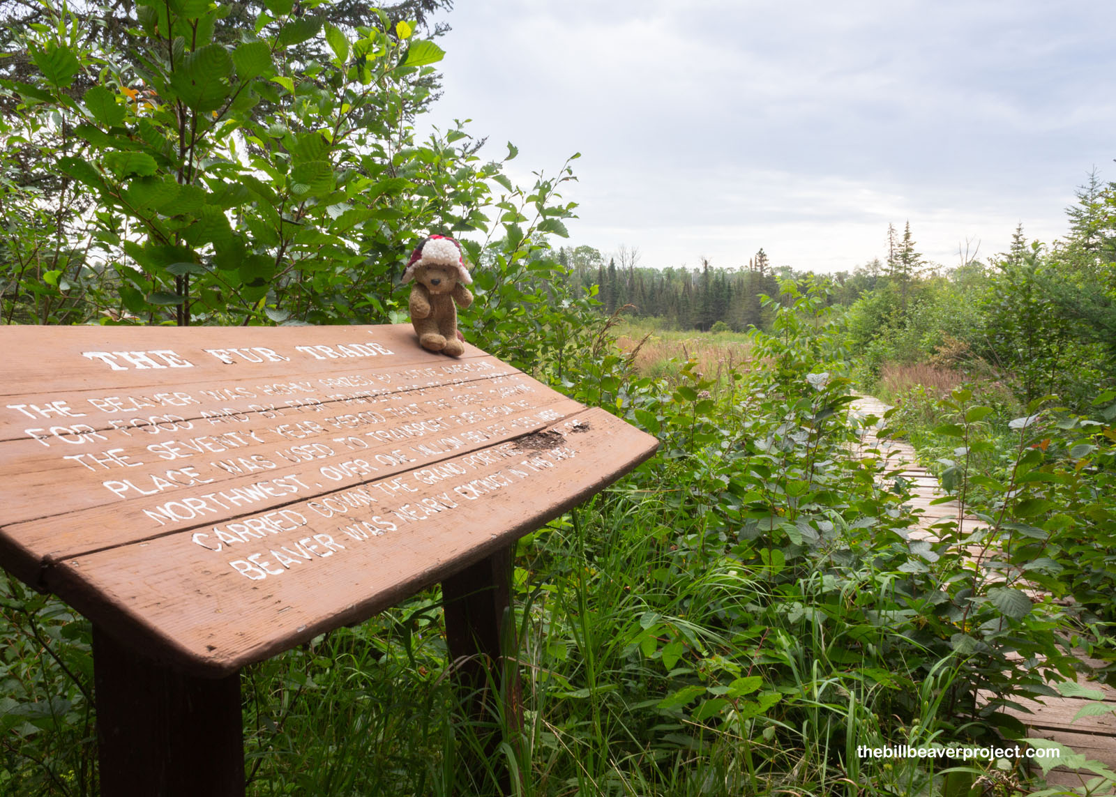
Unfortunately for the ancestors of these beavers, to live along the Grant Portage was practically a death sentence! Over a million beaver hides were carried down this path during the height of the fur trade, and it was only when fashion began to shift toward silk in the 1830s that beavers got a second shot! Today, it was very encouraging to see so many signs that, in the end, beavers prevailed over the beaver hunters!
 |
 |
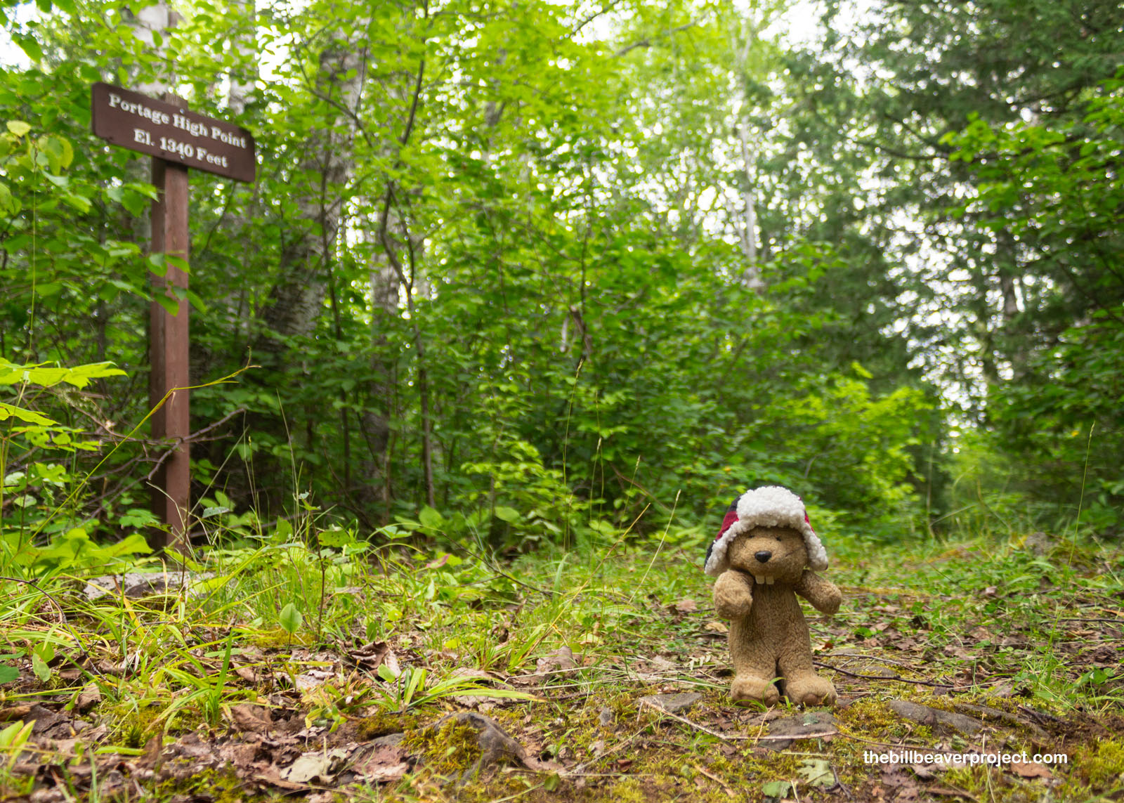
With two miles yet to go, I was really starting to feel the slog of the trail. The air was starting to get heavy and humid, and it was making me pretty concerned about what lay ahead. With about a mile to go to the site of Fort Charlotte, I passed a sign marking the highest point on the Grand Portage, only 1,340 feet above sea level! Strangely, the bugs started to ease up a bit here, as if they knew something I didn’t.
 |
 |
And what they knew was that the rain was coming after all! It started with a drizzle, which soaked the leaves of the plants, which closed in on all sides of the trail, which meant wet slapping all over my body with every step! In fact, I was getting more soaked from below than I was from above! I hopped up onto a bracket fungus for a bit, just to shake off some of the excess!
 |
 |
From there, I spotted a sign! It was a sign of success, of victory! It was the sign that I’d reached the end of the Grand Portage, all eight and a half miles of it! Wow! I’d even beaten my projected time of four hours! I shook off my trail rhythm and got to wandering about my destination.
 |
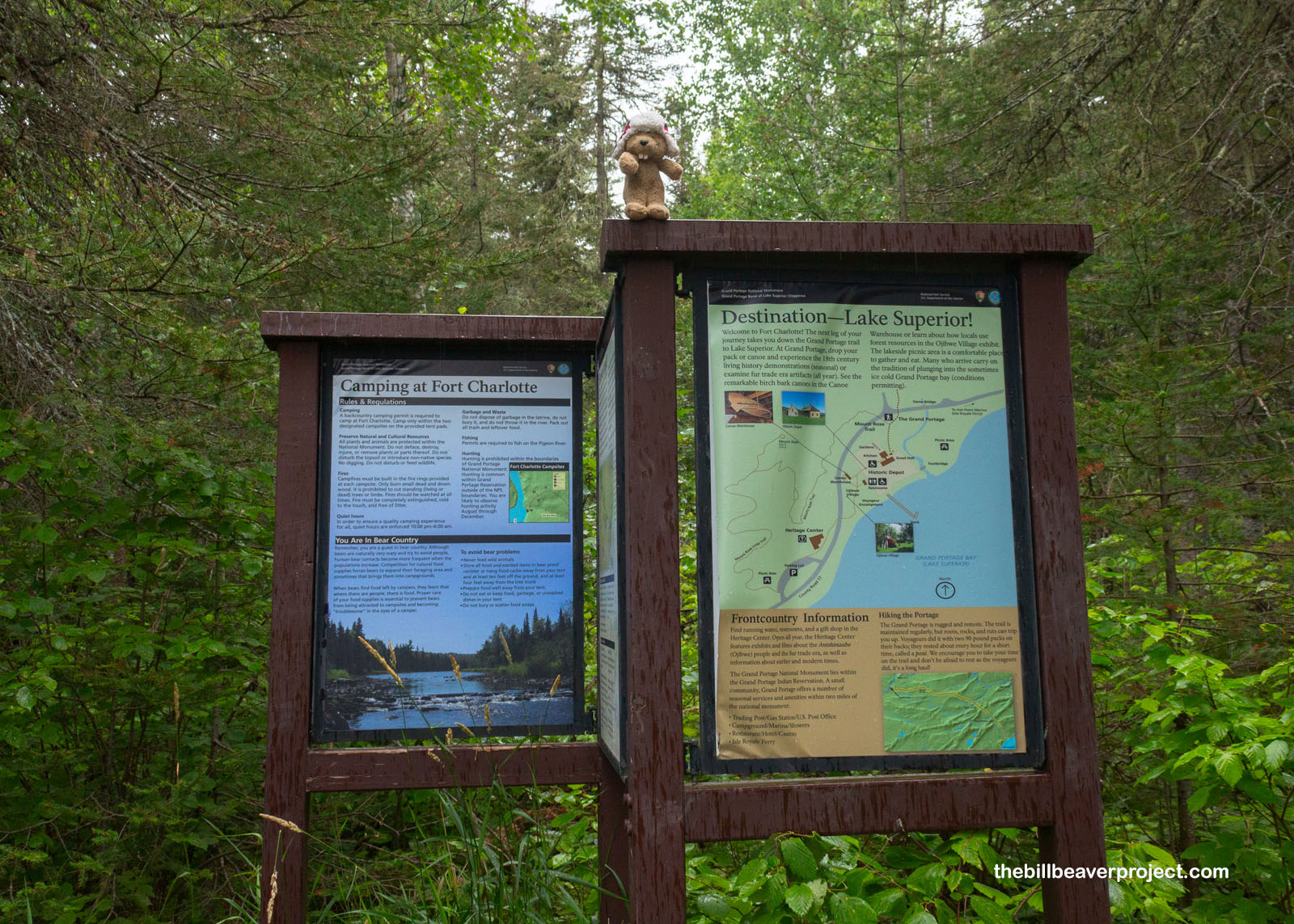
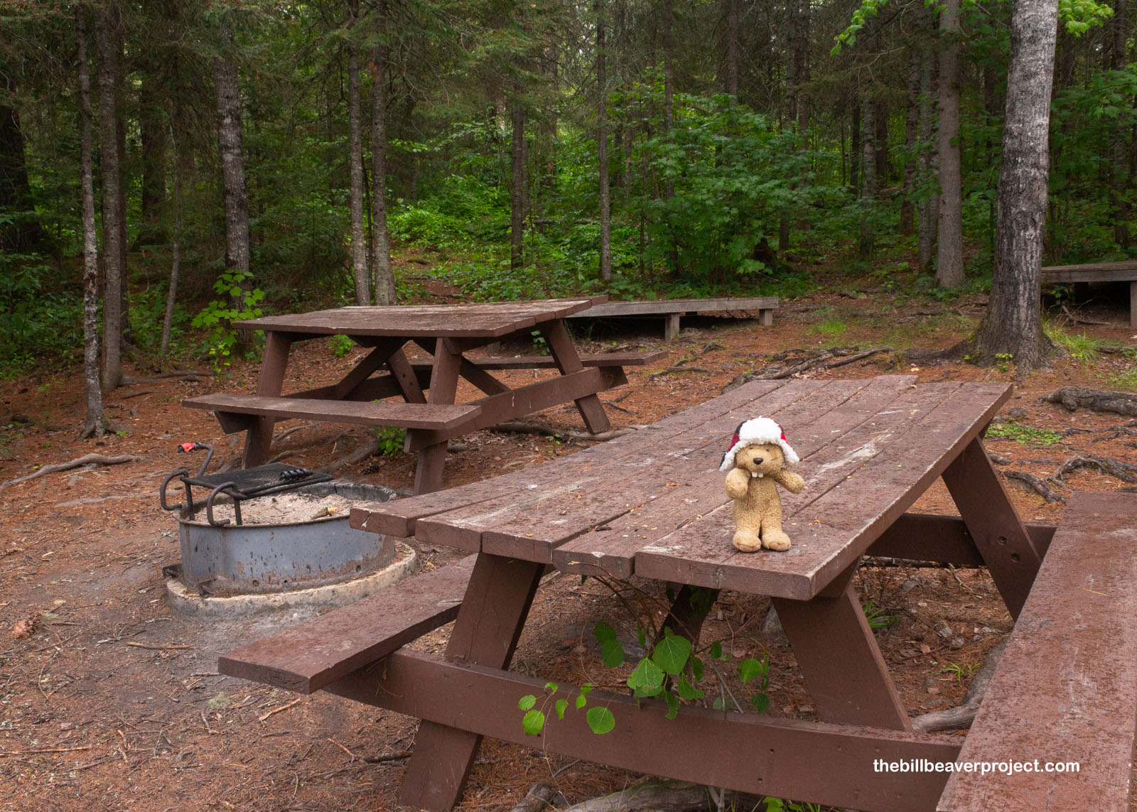
There wasn’t a lot to see here! There was a sign welcoming folks who had canoed here all the way from the Boundary Waters or as far as Voyageurs National Park, as well as a campground with picnic tables and fire pits. But back in 1789, this was a bustling British trading post called Fort Charlotte, the counterpart to Fort George at the opposite end of the Grand Portage. Even though the portage was made famous by the French voyageurs who’d traversed the Portage for thirty years, the Seven Years’ War had put all of Canada under British rule by 1763! At this fort, the plunder of the inland wilds arrived by canoe to be sorted and packed out on foot, but it didn’t survive long past the turn of the 19th Century!
 |
 |
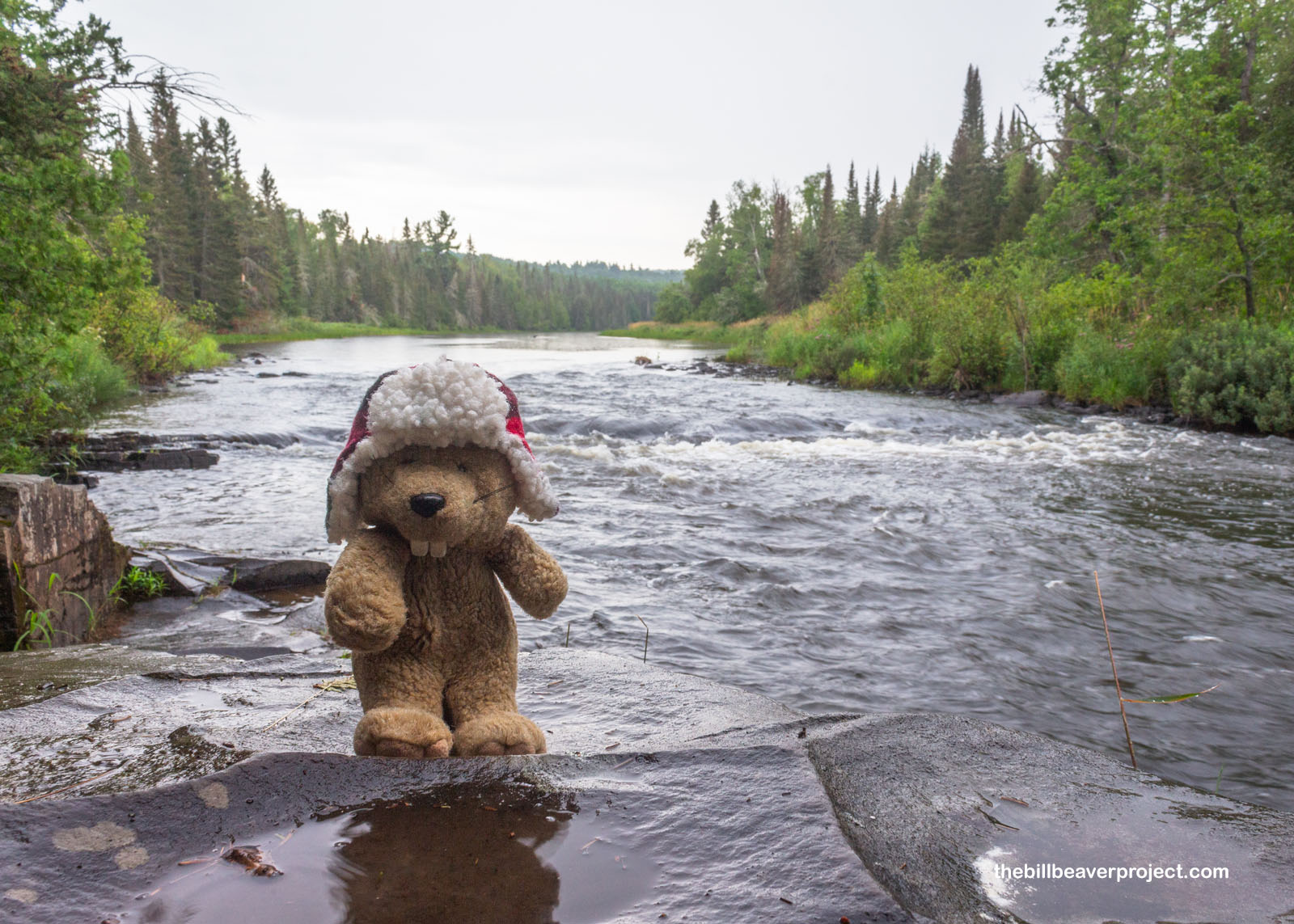
So there wasn’t a historic fort to explore at the end of the trail, but after resting a bit and having some snacks, I sauntered on down to the Pigeon River for a look across into Canada! It seemed so strange staring across this unguarded border in the wilderness. It made me think of how arbitrary borders could be sometimes, but I wasn’t going to put it to the test. While I didn’t see any cameras in the trees, I suspected if there were any, they already saw me!
 |
I enjoyed the views of the Pigeon River for a little while before realizing that I was only halfway done with my out-and-back hike and that the rain just wasn’t getting any lighter. So after kicking around the campground a little longer, I hit the trail once more, getting very thoroughly soaked by all the wet plants, all the while feeling glad that there wasn’t any thunder or lightning! I got back much faster than I arrived, speeding past the swarms of mosquitoes, and by the time I reached the trailhead once again, very much exhausted, I’d completed the 17-mile trek in six hours and fifty minutes!
 |
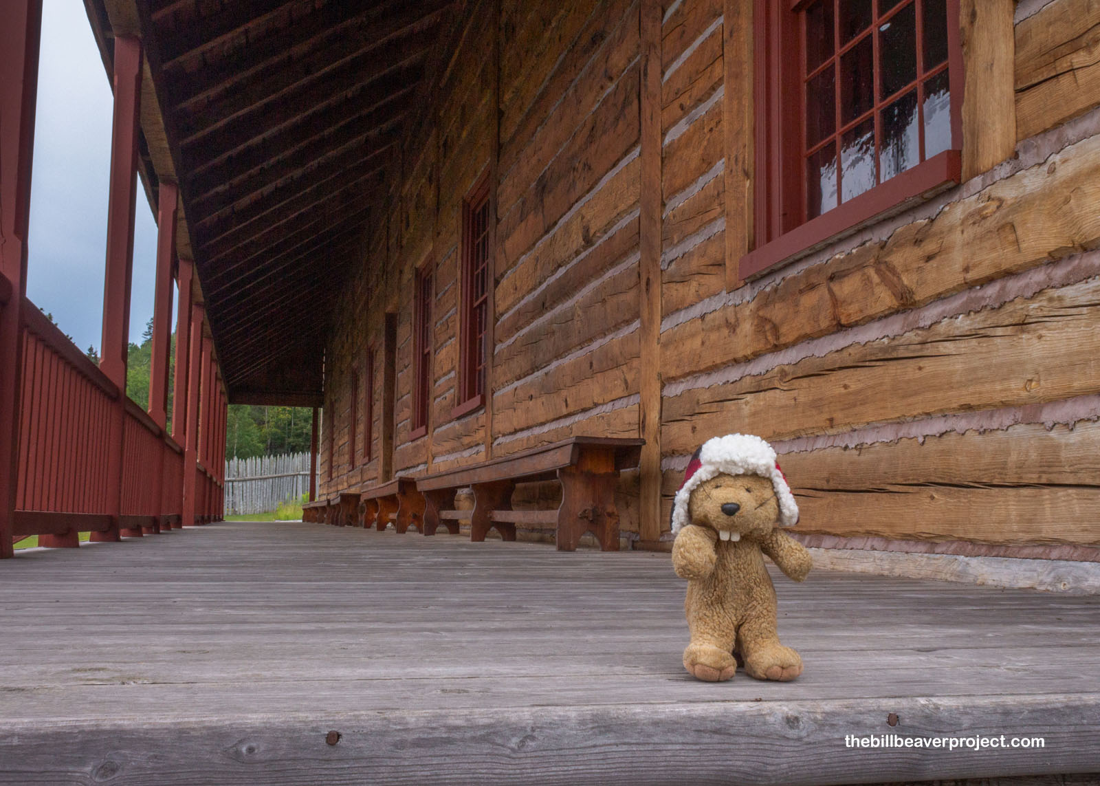
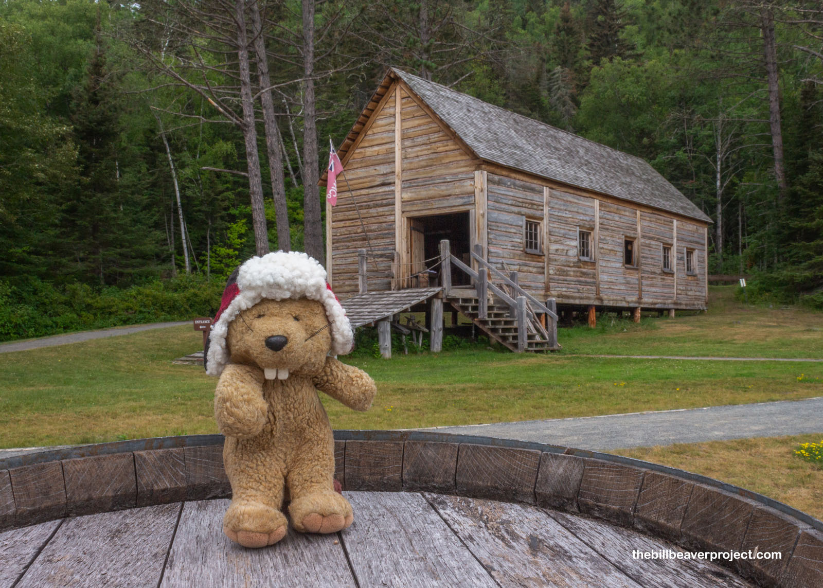
And that was where the real historic destination was, a reconstruction of the North West Company’s lakeside depot, built between 1936 and 1976 to capture the feel of life among the stockades at the tail end of the 1700s!
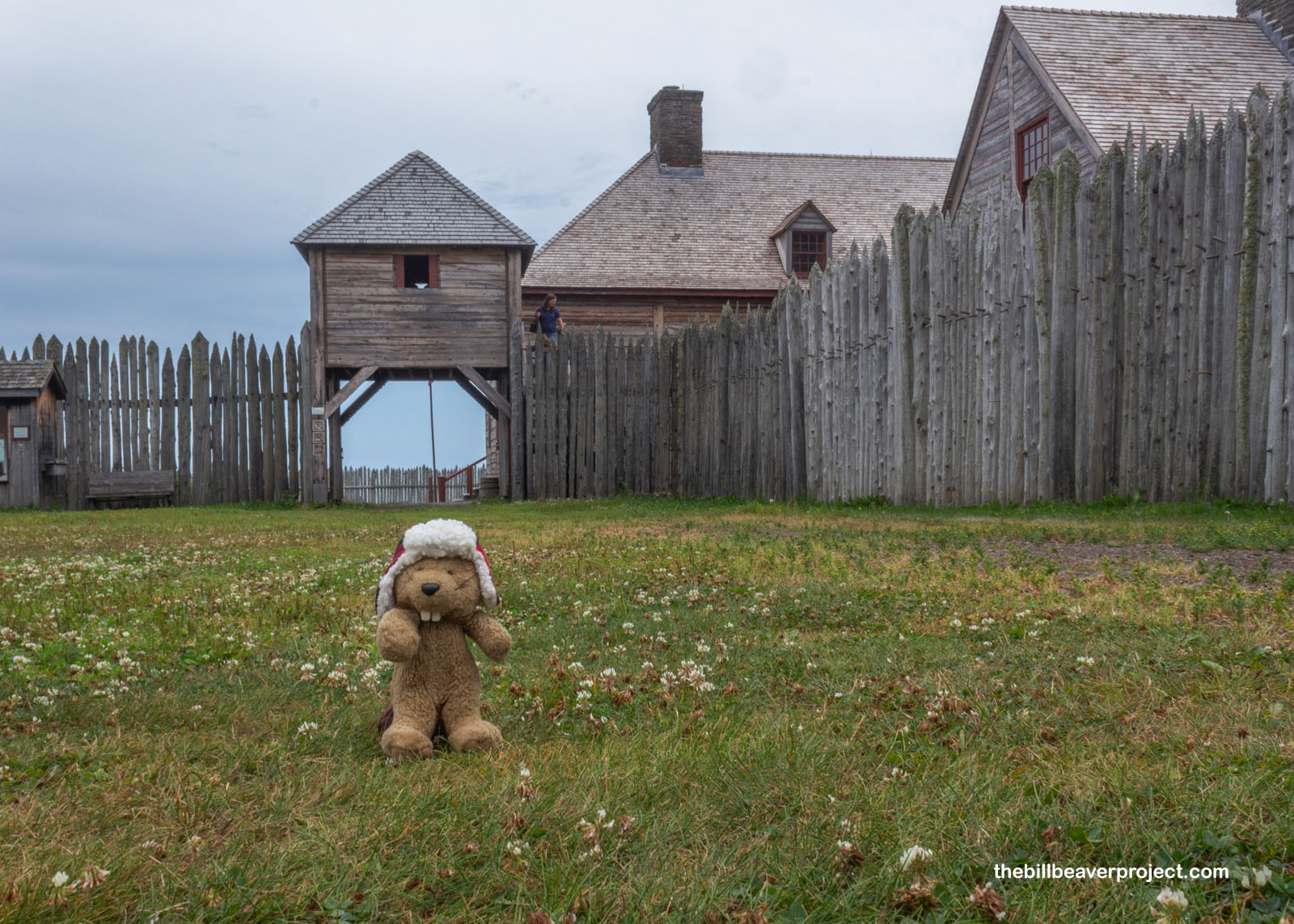 |
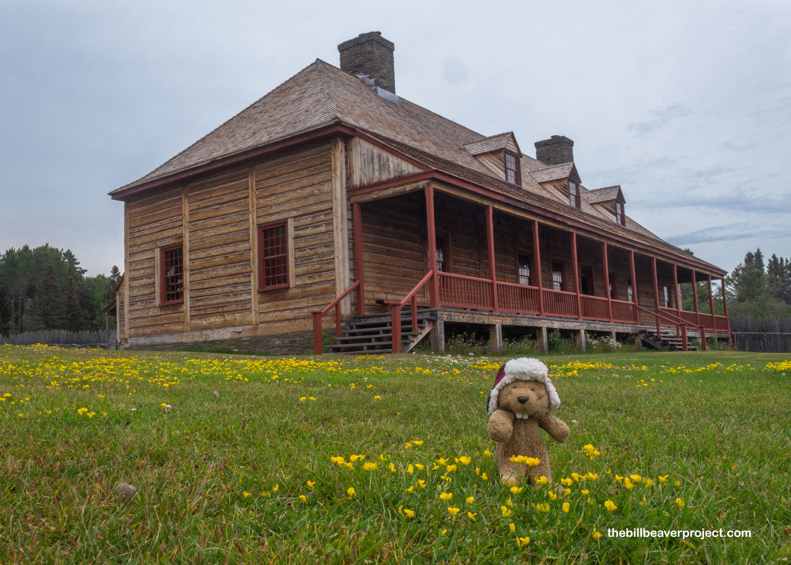
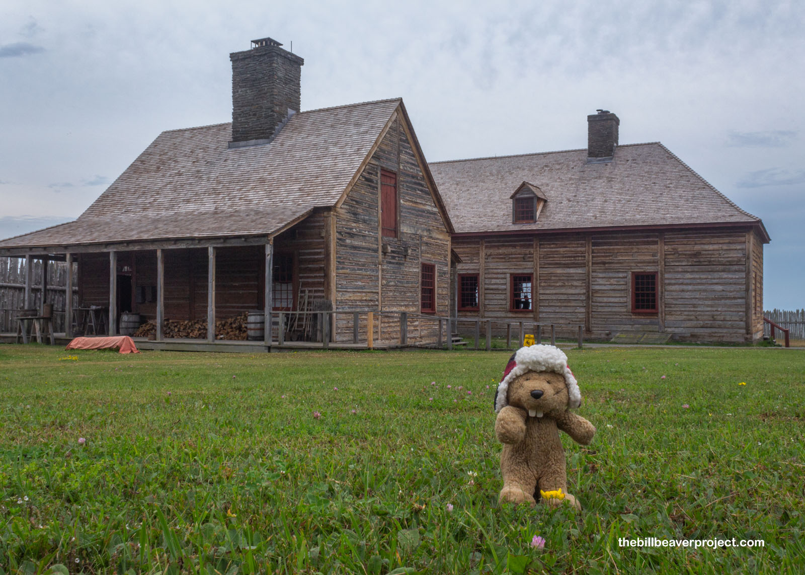
The Great Hall was originally built in 1780, a place for North West shareholders to meet and for hosting social events like the annual summer rendezvous in what was then a very remote place! Its foundation was rediscovered by archeologist, Ralph Brown, in 1937, and it was reconstructed by 1940 with lots of inaccurate parts, like a sandwich shop! That building burned down in a lightning storm in 1969 and was rebuilt again in 1973 with no sandwich shop but an authentic post-on-sill (pieces-sur-pieces) style!
 |
 |
Rebuilt along with the Great Hall was its adjacent kitchen, based on the remains of its fireplace and cooler, plus 14,500 artifacts! Naturally, this was where food was stored and prepared for functions in the Great Hall, food like scones, stews, and fresh fish!
 |
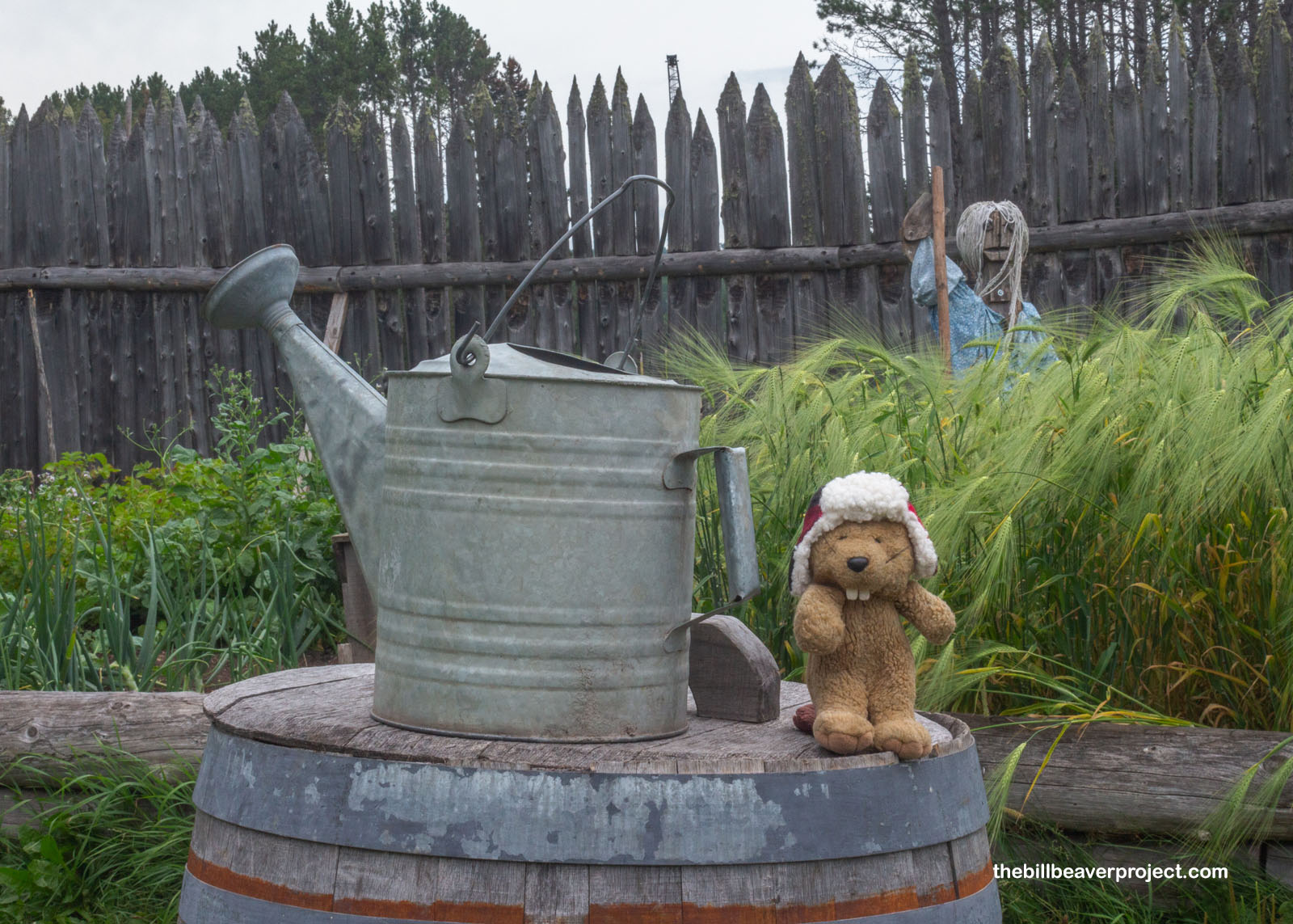
Folks at the depot supplemented their meals with veggies right out of the garden, like the three sisters of corn, beans, and squash, and plenty of potatoes for good measure! Today, there were two elevated display gardens with scarecrows to show off what homegrown goodies would have been like in the late 1700s!
 |
 |
By the gardens, I saw the canoe warehouse, a reconstruction of an 18.5 by 52-foot storage facility, built up from an old foundation. Inside, it showed off some of the different canoes used on either end of the Grand Portage, the 24-foot canot du nord for use north of the PIgeon River, and the 36-foot canot du maître for transporting merchandise out onto the dangerous Lake Superior! There were also recreated birchbark canoes, or jiimaan, as traditionally used by Anishinaabe folks!
 |
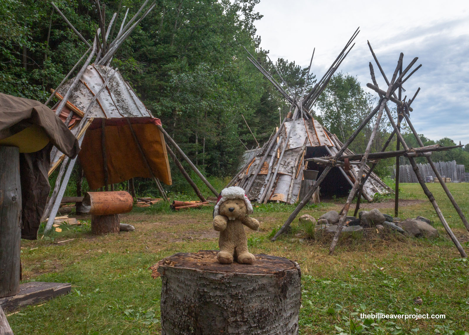
And lastly, speaking of the Anishinaabe and birch bark, a miniature Ojibwe/Anishinaabe village painted a picture of life among Lake Superior’s native folks before European traders arrived. Taking advantage of the birch tree’s waterproof, easy-to-harvest bark, they built boats and houses from it, using them to harvest the bountiful fish and wild rice found in the waters of Gichi-Gami!
 |
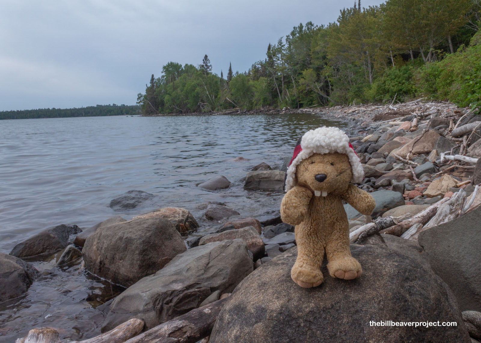
I had to turn down an offer to take a guided tour of this depot, because, to be frank, I was wet, muddy, bug-bit, and super exhausted. I took one last look out over Lake Superior, spotted a loon, which called back to me, and began my trudge back to the visitor center and south to Duluth in anticipation of my flight home tomorrow morning. Today’s journey through Grand Portage National Monument was more meditative than anything, but it sure did feel like an accomplishment to make this journey, even without a huge backpack!
 |
I stopped off at a street fair in Grand Marais and sampled some extremely scrumptious banana bread from a food truck, then pulled into my overnight stay at the Allyndale Motel. At that point, I got a good look at myself. Boy, oh boy, I’d been absolutely devoured by mosquitoes! I was swollen and itchy in places I had no business being swollen and itchy! I guess that’s the price that must be paid for adventure, but now I’m worried about my future plans for Alaska, which is famous for its mosquitoes. Maybe I’ll test those waters a little bit first. I got excited looking across the river into Canada, where I haven’t been in a long time. Maybe I’ll take a detour into the land of the beavers and see what I can see.
Cana-do it? We’ll find out!

Previous Day |
Total Ground Covered: 558.7 mi (898.3 km) |
More 2024 Adventures |