
 Previous Day |
Tamuning, GU → Humåtak, GU → Tamuning, GU 80.2 mi (129.0 km) |
 More 2025 Adventures |
Håfa adai, todos!
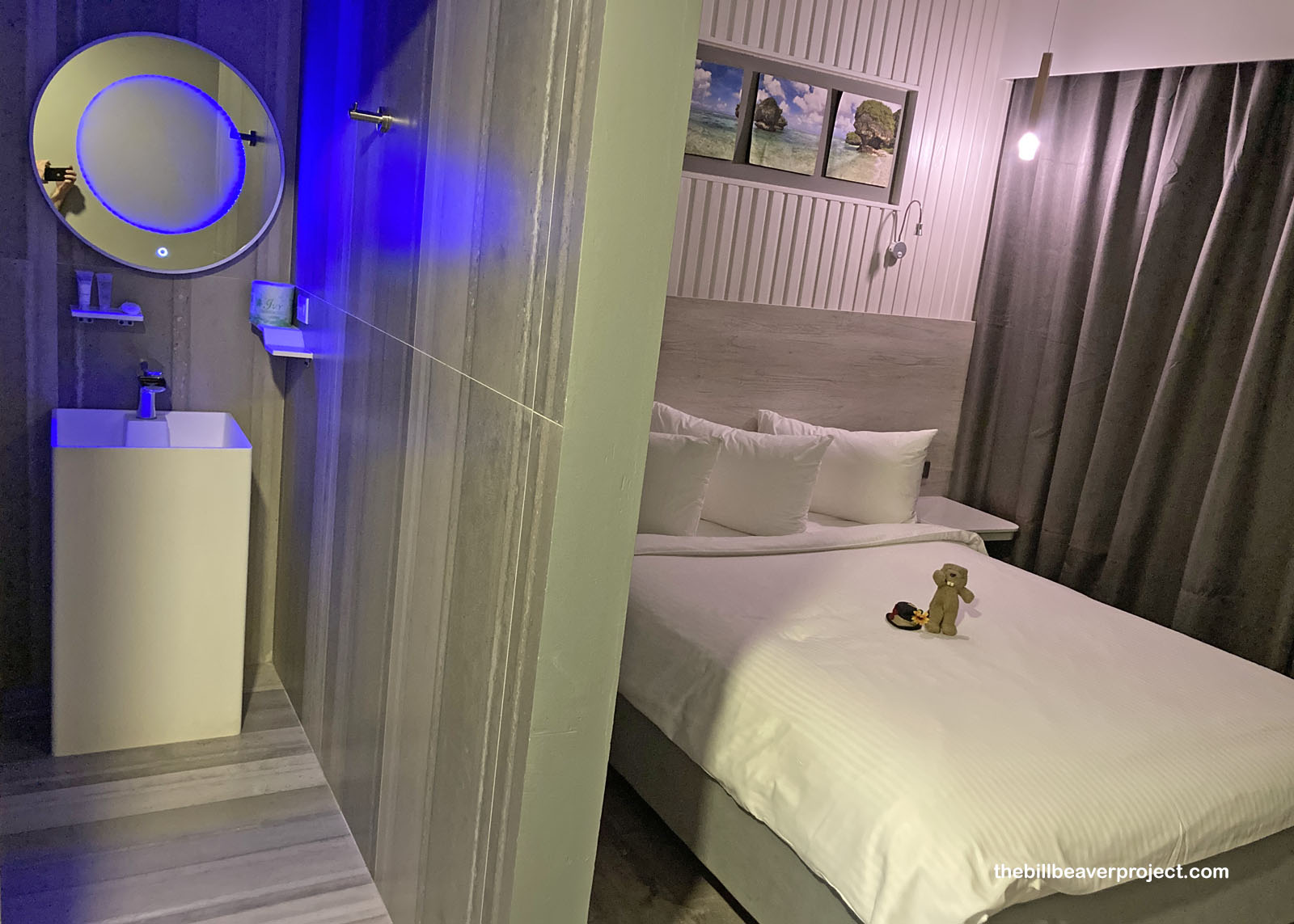
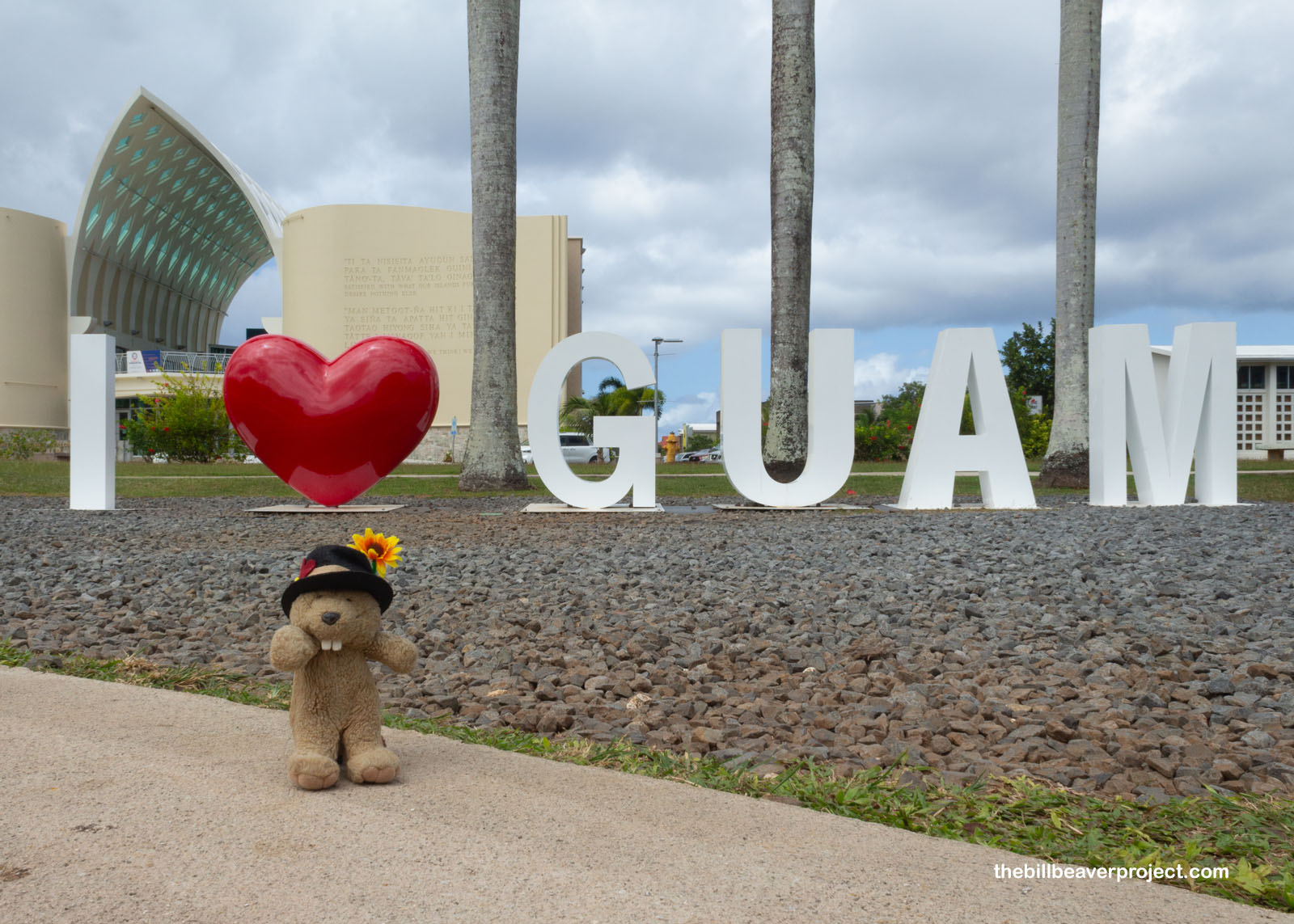
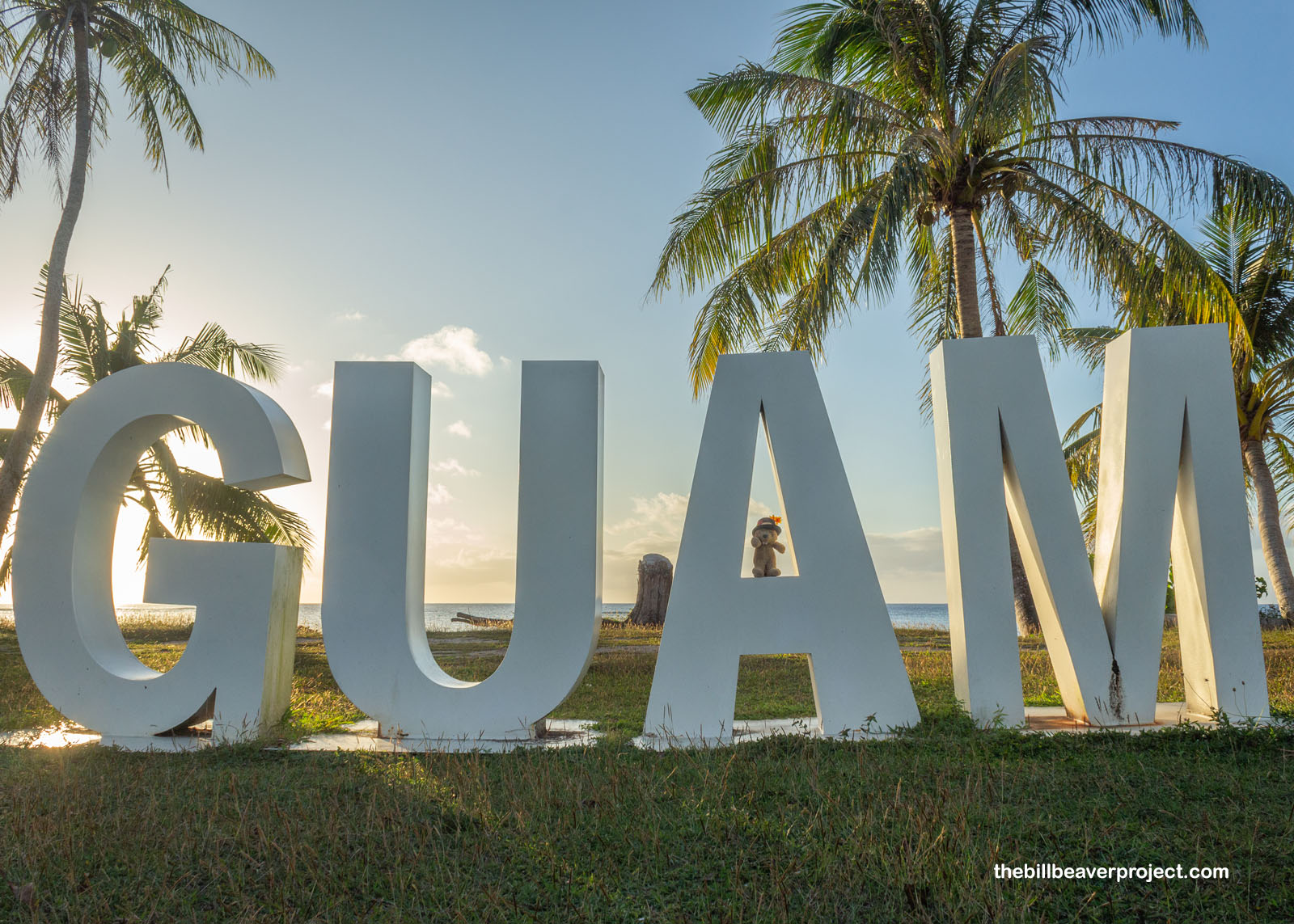
Another night, another island! I have crossed the International Date Line and landed in Guam, the oldest U.S. Territory since December 10, 1898! I was really lucky I landed when I did, because every Wednesday night in Guam’s capital, Hagåtña, there is a CHamoru night market! “CHamoru,” with both the C and H capitalized, is, of course, the demonym for Guam’s native folks and their language. I went straight to the market from the airport and was immediately enchanted! This little market was packed to the brim with food trucks, artists, dancing, and rides on the back of a mighty karabao, which is nothing like a reindeer and is in fact a water buffalo! Already, I could tell this place was way different from American Samoa, even in the hotel, with an infinity mirror, heated toilet seat, guest cot, and curtained wall where a window should be!
 |
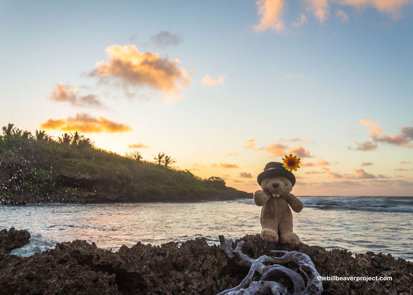
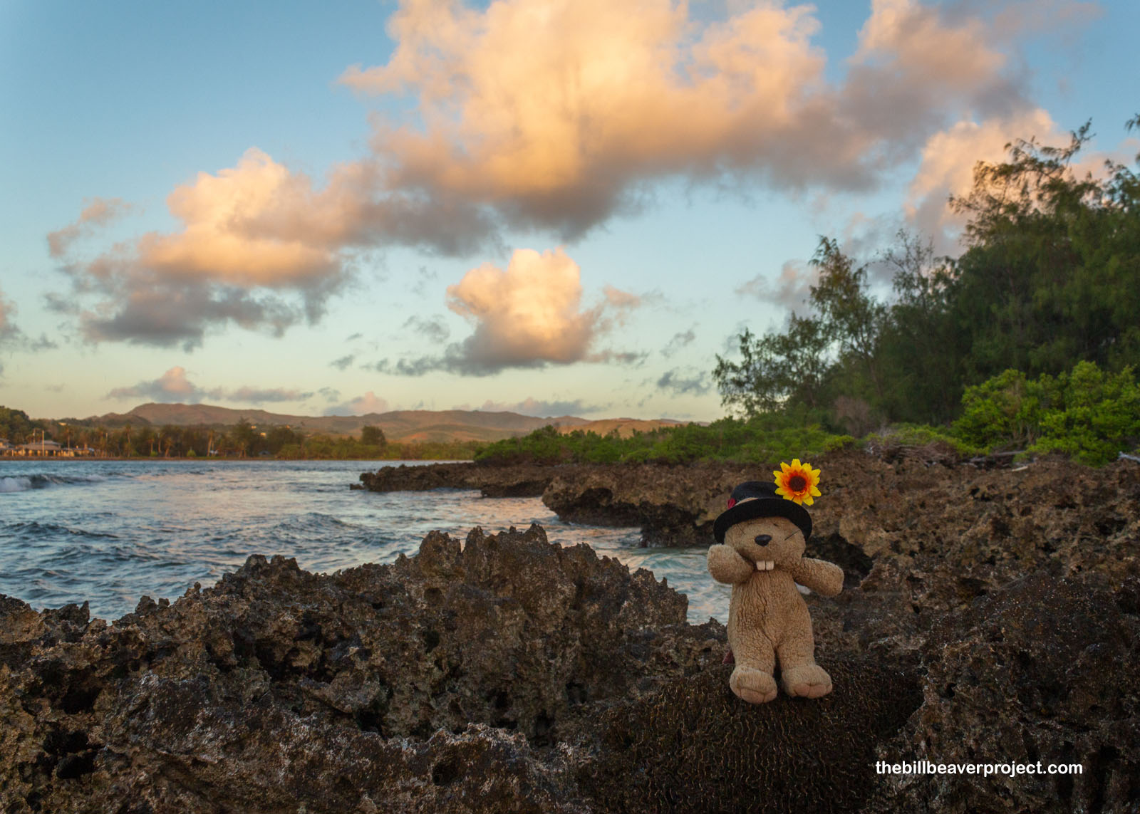
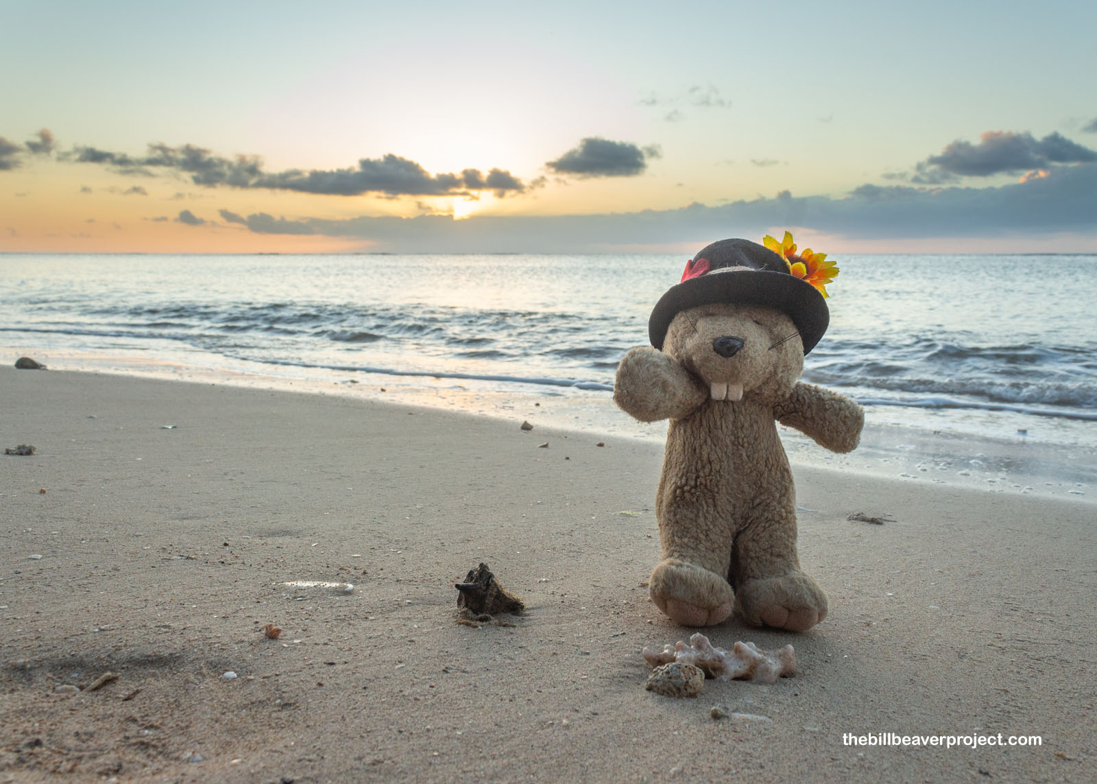
Time jump or no, I was up and at ’em really early in the morning, because I wanted to see the sun rise over the Land of the CHamoru, also known as “Where America’s Day Begins.” While American Samoa is the closest to the Date Line’s east side, Guam is closest to the west side, making it the first place in the whole U.S. domain to see the sun rise. I scrambled to get to the road leading to Gadao’s Cave but circled around a bunch, trying not to park in someone’s driveway before chancing it on the roadside and running down to the beach. The coral on the shore sure was jagged and sharp, but boy, was that first sunrise ever pretty!
 |
 |
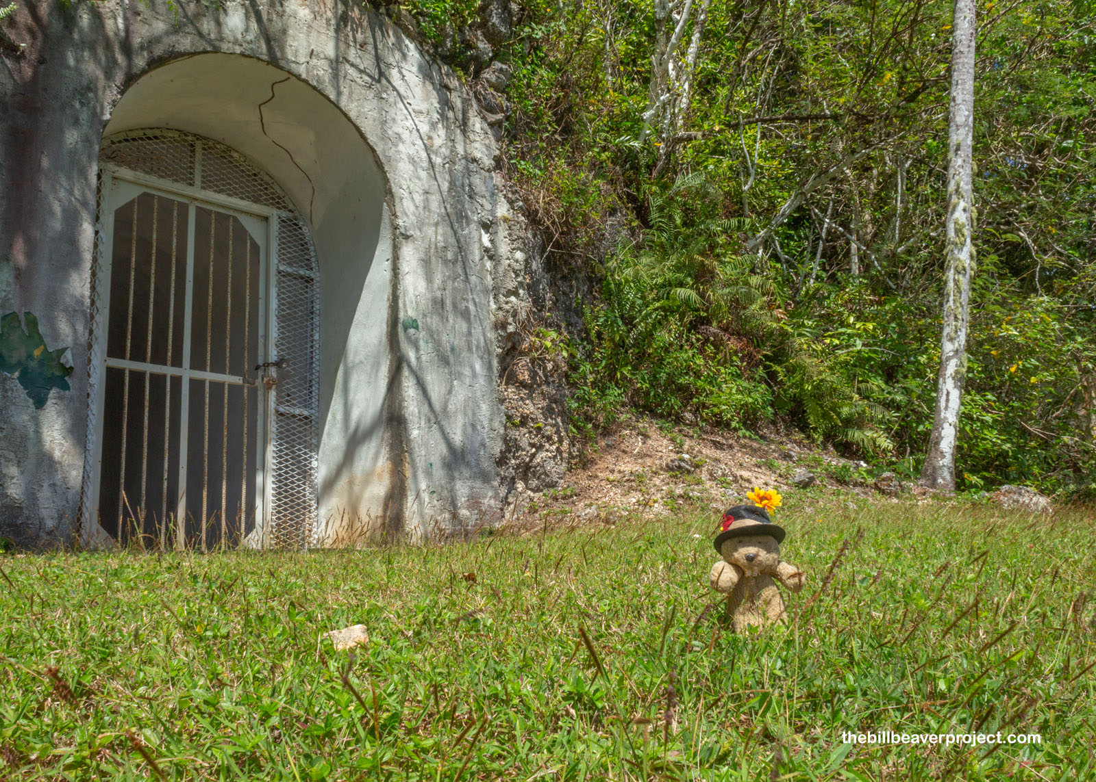
Oh right, I was so wrapped up in chasing the sunrise I forgot to explain Gadao’s Cave! Well, back in Leone, I’d gone looking for petroglyphs and found none because American Samoa didn’t have great directions. On Guam, I was determined to find some artistic traces of ancient folks, and while I did have to scramble, climb the wrong ladder, and backtrack a bit, I did ultimately find the cave named for the legendary maga’låhi of Inalåhan. As the only one on this beach on this particular morning, entering this tiny cave still felt like passing through a mystical portal into a magic pocket!
 |
And inside, I found those pictographs, said to have been painted by Gadao himself, which would place them in the 1500s on the cusp of Spanish conquest! It is said that the mighty chief was beaten by Spanish invaders, so with some evidence of Spanish crosses painted in the caves, it’s possible that the two human figures depict Gadao and his rival, Chief Malaguana! These pictographs are famous throughout the island!
 |
 |
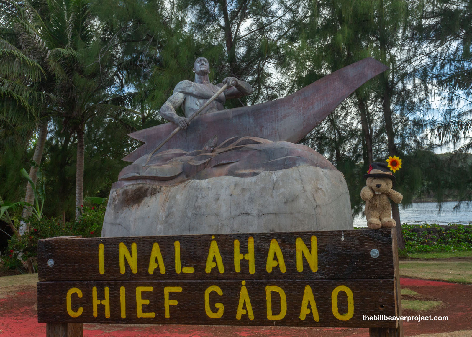
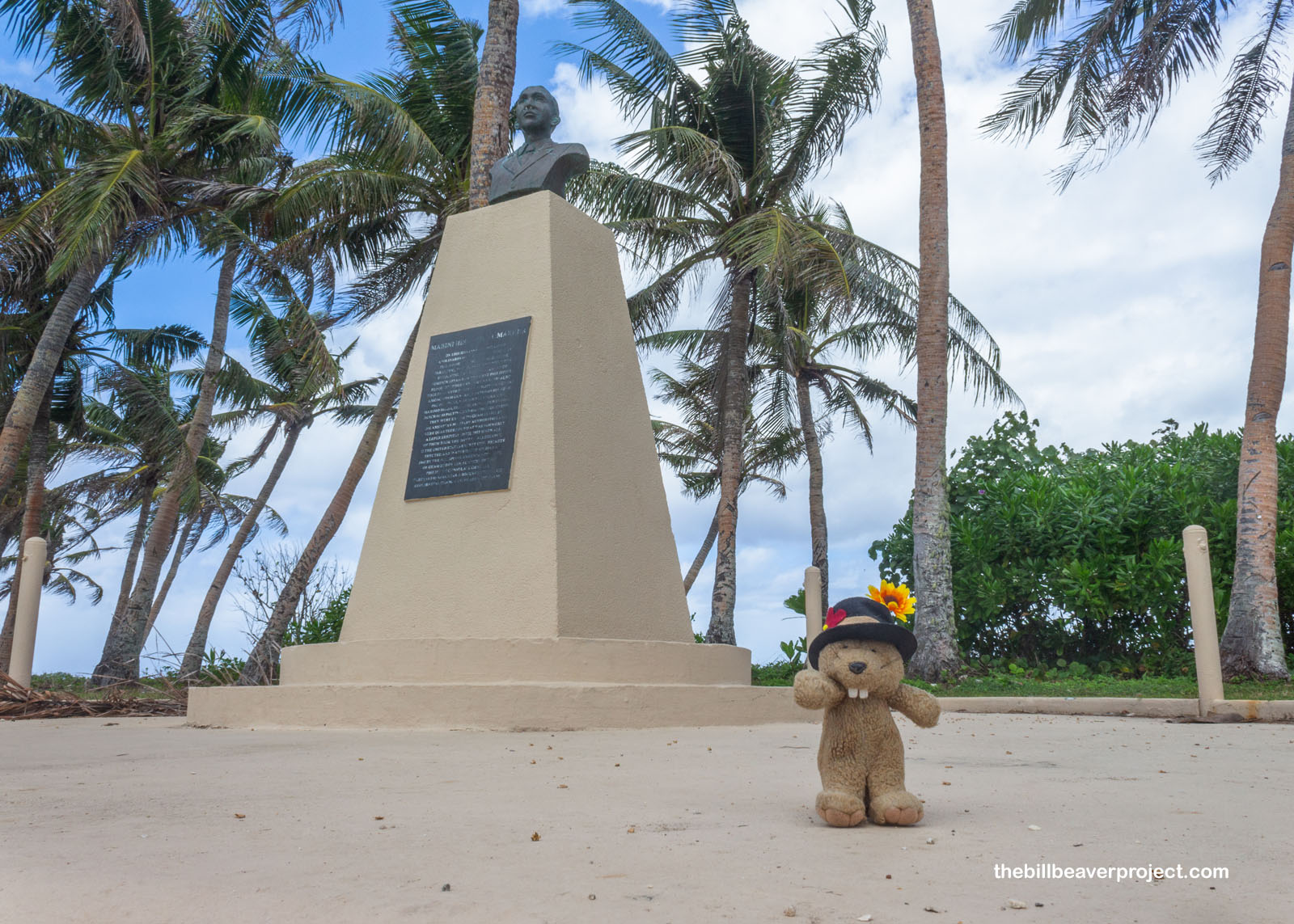
Gadao features in lots of local legends, but the story of his tangle with Malaguana is depicted with a stone statue in his home town of Inalåhan! Malaguana came to town to challenge Gadao’s strength, and meeting Gadao, but thinking him a farmer, he was super intimidated by this “farmer’s” ability to crack coconuts with his bare hands. Thinking Gadao would be even more powerful, Malaguana gave up and decided to go home. Gadao offered to take him, but they both got in the same canoe and rowed so hard in opposite directions that the canoe split in two! This statue shows Gadao’s broken half!
 |
With the sun up and the equatorial heat starting to set in, I continued my circuit of the lower half of the island—officially Guåhan in CHAmoru, which means “we have”—looking for more examples of history, like the Merizo Bell Tower! Completed in 1919, it was built by Father Cristobal de Canal to keep time for the village of Merizo, to which he also added a church and enhanced agricultural system! Today, it’s mostly a photo stop next to a Christmas tree of painted coconuts and a big old heart looking out over the water!
 |
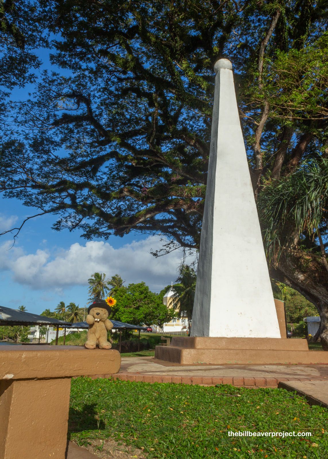
That tower was built after the Spanish lost Guam, but farther along the road, in the village of Humåtak, an obelisk stood on the spot that kicked off Spanish conquest in the first place. On this spot on March 6, 1521, Fernão de Magalhães (a.k.a. Ferdinand Magellan) landed during his famed sail around the world and claimed Guam for the Spanish crown! The village still celebrates Guam Discovery Day every March with reenactments, music, crafts, all the cool stuff I experienced at the CHamoru night market! Little did the famed captain know, just over a month after landing on Guam, he’d be killed by the people of Mactan in what are now the Philippines!
 |
Yes indeed, this region of the Pacific has seen plenty of conflict over the years, which is what brought me to Guam in the first place: my next national park site, and the farthest from the U.S. mainland: War in the Pacific National Historical Park! This multi-unit park preserves important sites in the battle for control of Guam during World War II! See, Guam is only 1,500 miles from Tokyo, much closer than Hawaii, so taking it back from Japan was a high priority for Admiral Chester Nimitz!
 |
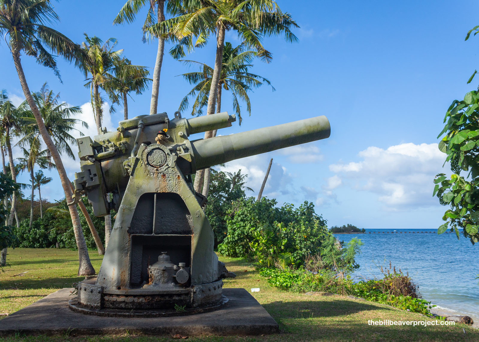
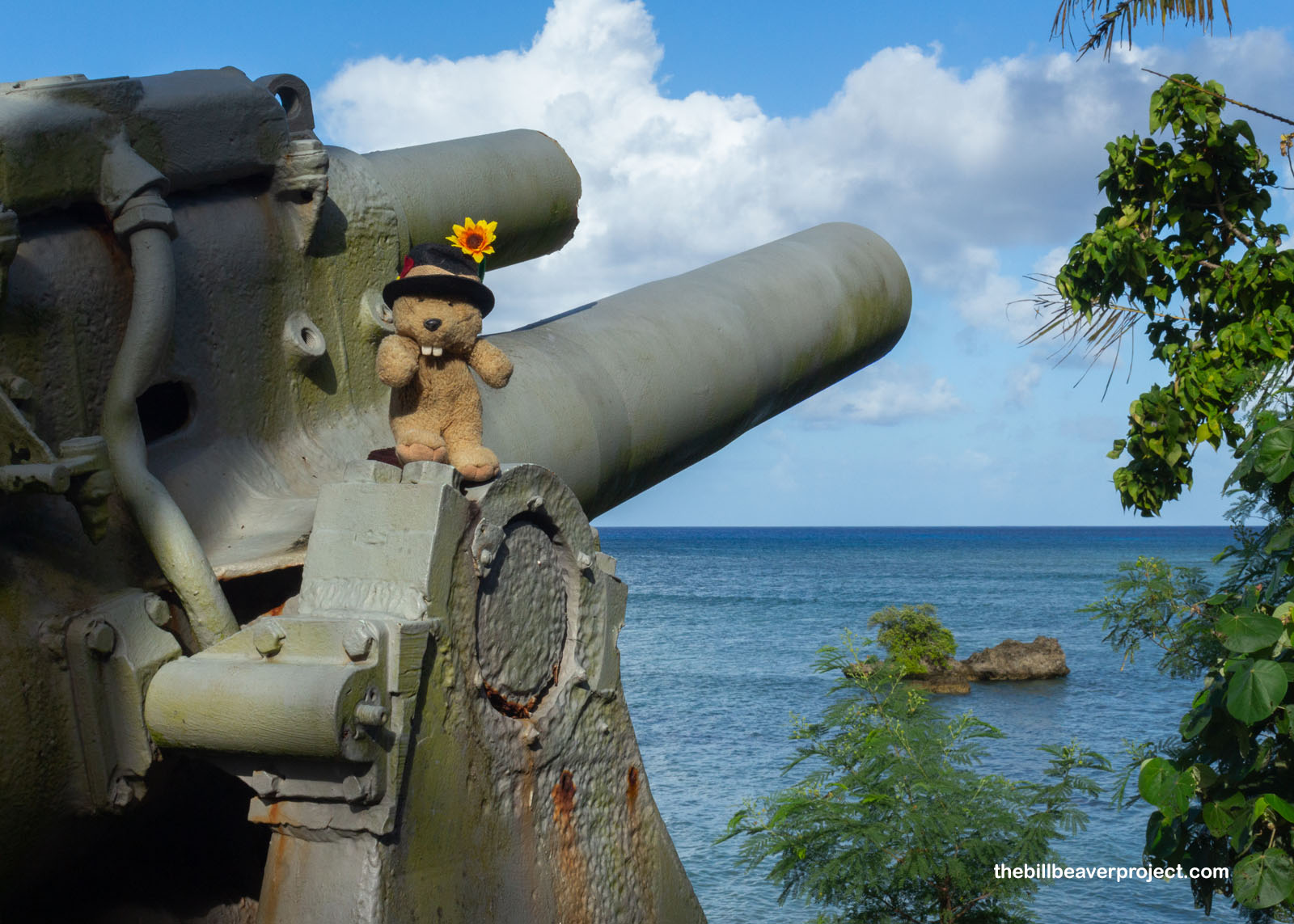
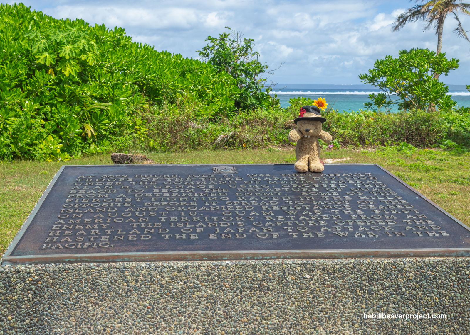
After two weeks of bombarding the coast and blowing holes in the coral reef, U.S. forces made their move on July 21, 1944. Coming ashore here at Ga’an Point to start unloading supplies, they faced some really intimidating opposition, like this 200mm short-barrel costal defense gun, shooting at ships and their own landing crafts!
 |
 |
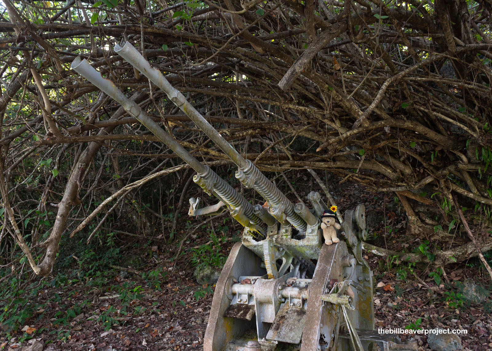
This smaller, but just as deadly, 25mm anti-aircraft gun was able to fire off 200 rounds of armor-piercing ammunition every minute! Just imagine slogging ashore through that kind of chaos!
 |
Even more resistance came from Japanese bunkers and pillboxes, like this Japanese Strongpoint, which covered the entire beach with a 75mm 94 type gun and a 37mm gun, killing 75 Marines, who had just waded ashore through chest-deep water!
 |
This was all in an attempt to capture the Orote Peninsula, barely visible on he horizon from this point! Capturing it would give U.S. forces access to both a large harbor and an airstrip on flat, easy ground. And so it was worth the four days of fierce fighting to claim it at last!
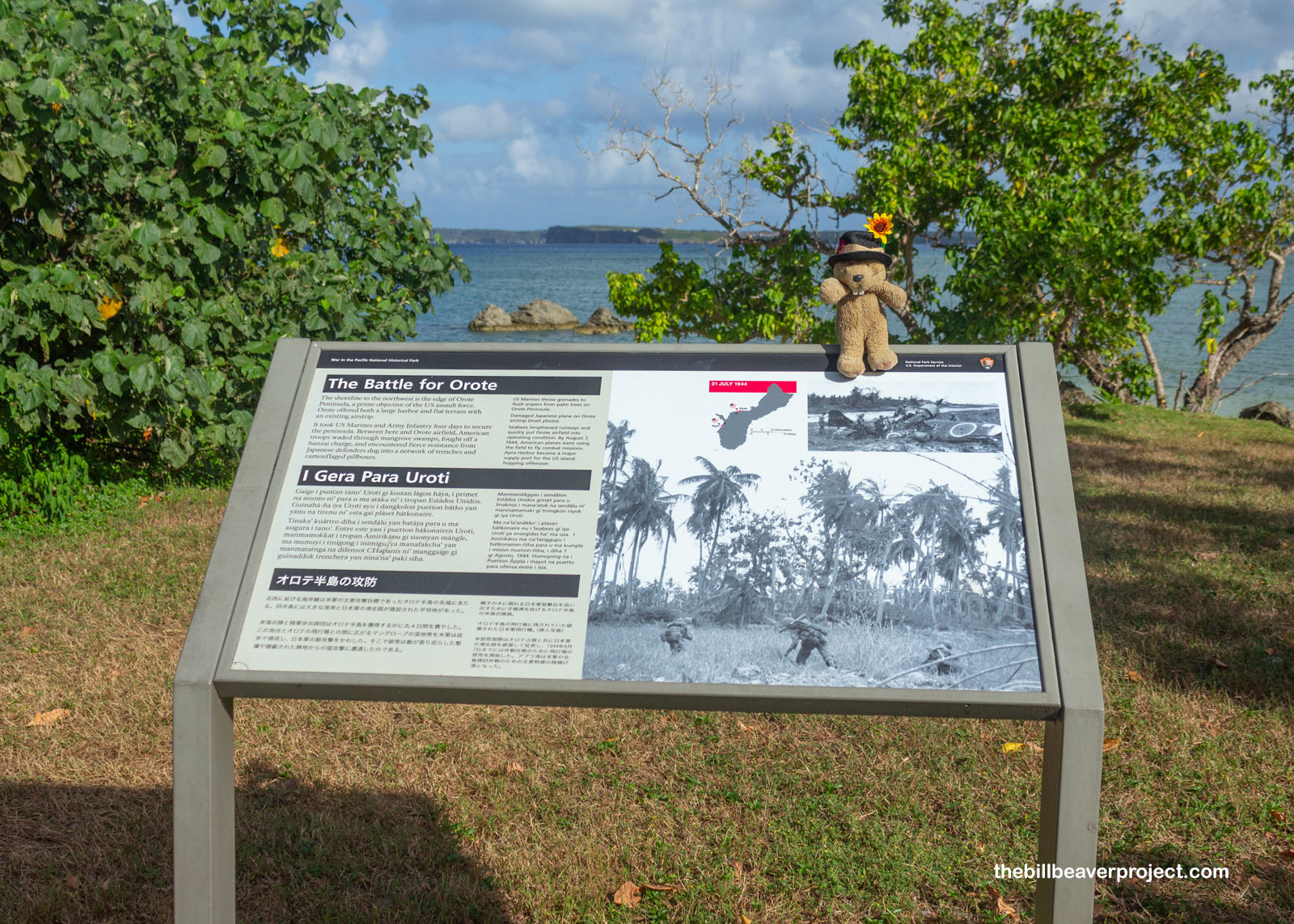 |
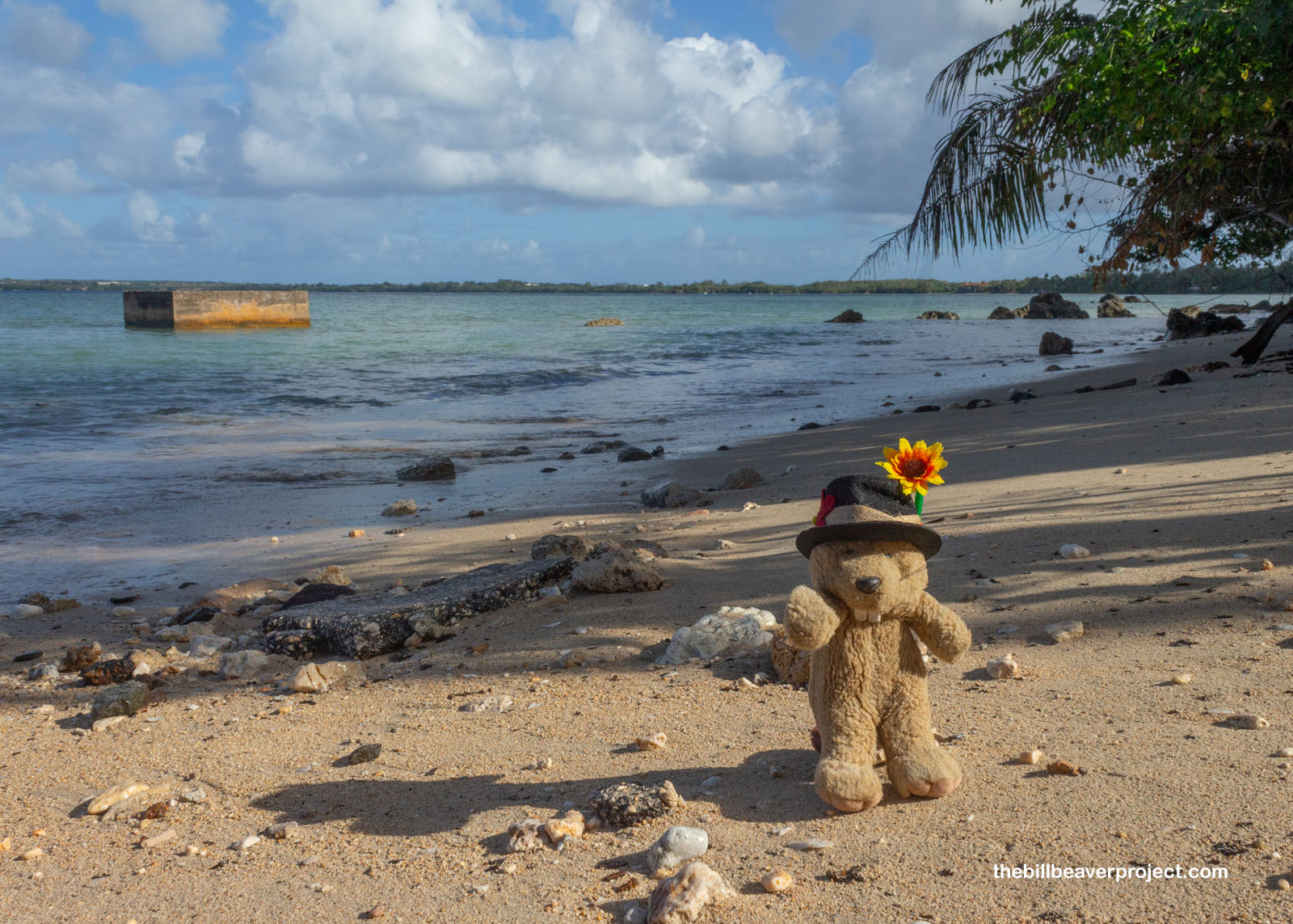
By July 24th, these beaches were securely in American hands, despite a ferocious banzai attack, the ground equivalent of a kamikaze attack, which was unbeatable during earlier wars but less effective with the onset of machine guns! Today, only small concrete remains give any indication of those bloody summer days!
 |
 |
My top concern was just staying dry, on account of a sudden wave that soaked my feet. It was a lovely place to be a wet beaver, though, and I took my small troubles to Infusion Coffee and Tea for a breakfast sandwich pick-me-up. The coffee shop happened to be next door to the park’s visitor center, which housed a really cool diorama of the Battle of Guam, using red and green laser lights to show the movements of U.S. and Japanese forces during the campaign! The rangers were also so impressed that I’d made the trip all the way out here to Guam that they gave me a certificate commemorating my 256th national park! Wow, 256 sure does feel like a lot!
 |
Though the rangers couldn’t give me an exact location to spot a critically endangered Guam rail (Hypotaenidia owstoni) today—a real pity—they did make me an itinerary for the next sites to visit within the park, starting with the park’s only hike, the trail to the Piti Guns!
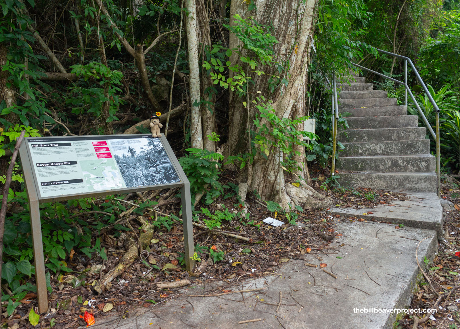 |
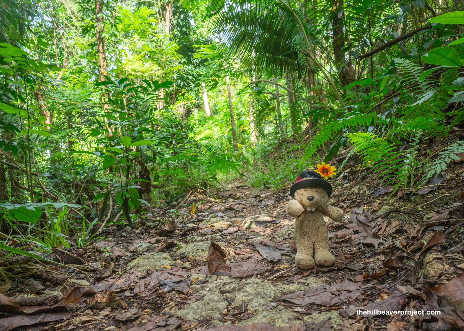 |
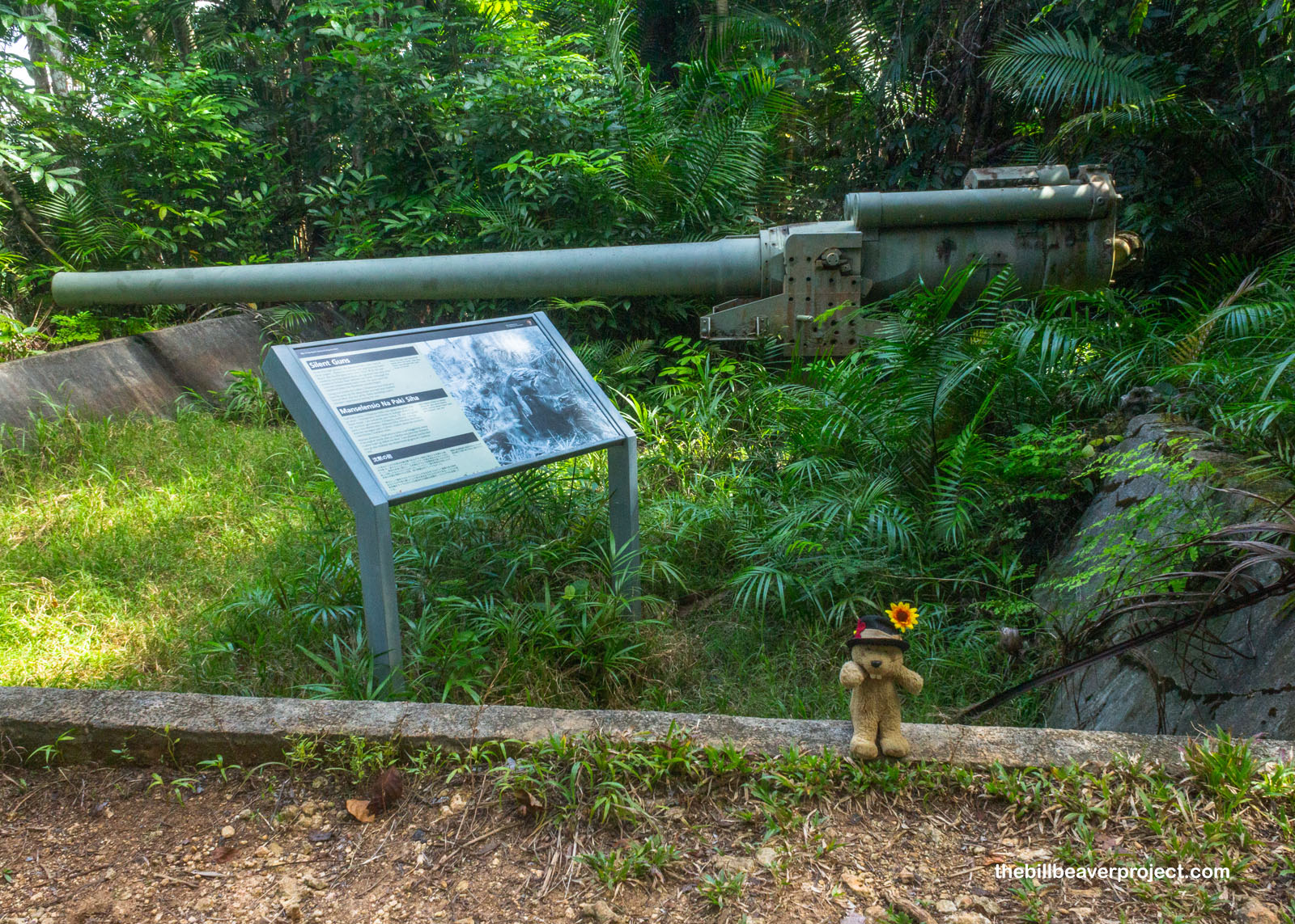
Now these were some serious kaboom-boom sticks! The guns installed here in the months before the U.S. invasion were Vickers-type Model 3 140mm coastal defense guns, each weighing more than six tons and capable of firing 6-10 rounds per minute over 10 miles! These could have caused some serious damage to the U.S. ships… if they’d ever been fired!
 |
It’s not entirely clear why these big bruisers were never fired, but one theory is sabotage! When the Imperial Japanese Army took over Guam in 1942, they started by subduing all the CHamoru, gradually funneling them into concentration camps and slave labor. It was a crew of CHamoru men who were forced to haul these enormous weapons up this heavily forested hill, and possibly several who made these guns inoperable. For 21 days in July 1944, nearly all CHamoru were in concentration camps, like Manenggon, the largest, which was liberated on July 31st!
 |
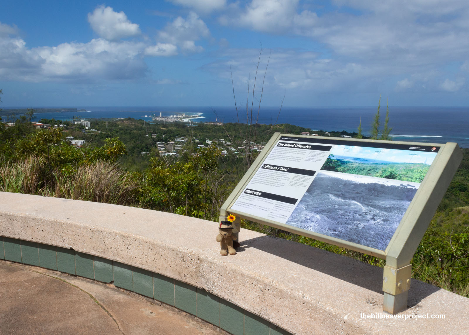
From the Piti Guns, my route took me to the Asan Bay Overlook, from which I could envision what Japanese commanders saw, legions of U.S. Marines wading ashore at Asan Beach, hailed by huge bursts of ammunition from the shore! This must have been a truly awe-inspiring site in 1944, though today, there was just a small group of history buffs clustered in the shade and some National Park Service workers tidying up the hillside!
 |
Those workers told me not to miss the nearby Fonte Plateau Unit, even if its parking lot was in the dug-up stage of refurbishing. Here, inside a concrete bunker, the Japanese navy kept their communications center, with no flashy antennas to give away their location, allowing them to keep communicating well into the battle! Ultimately, though, the whole facility was overrun as the tide turned against Japan as a whole!
 |
And then I descended from the plateau to the main entry point in the Battle of Guam: Asan Beach! Here, at 8:29 AM on July 21, 1944, the Third Marine Division under Alan Turnage came ashore and spent three agonizing days fighting to claim the cliffs, pillboxes, and caves around the beach that were sending nonstop ammunition their way! Like waves on the shore, they had to advance and retreat, advance and retreat.
 |
Because of their success, Asan Beach is a peaceful park with walking paths and many good dogs enjoying those paths. The coast is also lined with memorials honoring the acts of amazing bravery in the battle for Guam! Each Memorial Day, the park fills with 3,055 U.S. and Guam flags to commemorate a life lost in Guam during World War II.
 |
 |
One of the memorials was kind of surprising, because while it stood for liberation and defiance against foreign takeover, its story put the U.S. in the position of oppressor! Long before World War II, when the U.S. took the Philippines from Spain, Prime Minister Apolinario Mabini of the First Philippine Republic led a fierce war of independence, only to be subdued in March of 1899. He, and 47 other pro-independence figures were banished to Guam in 1901 after refusing to take an oath of allegiance to the United States, but most were allowed to return home after a few years. This monument to Mr. Mabini has stood here since 1961!
 |
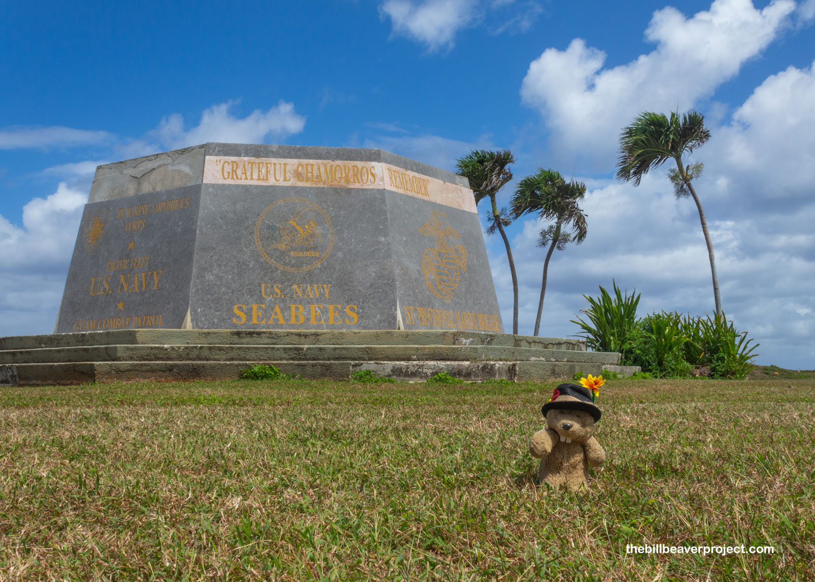
Generally speaking, though, the sentiment in this park is pro-American, given the liberation of the concentration camps! At the south end of the park, the hexagonal Liberators’ Memorial honors five U.S. divisions and the Guam Combat Patrol for their contributions to taking back the island from the Empire of Japan. It was installed here in 1994 to commemorate the 50th anniversary of the Liberation of Guam!
 |
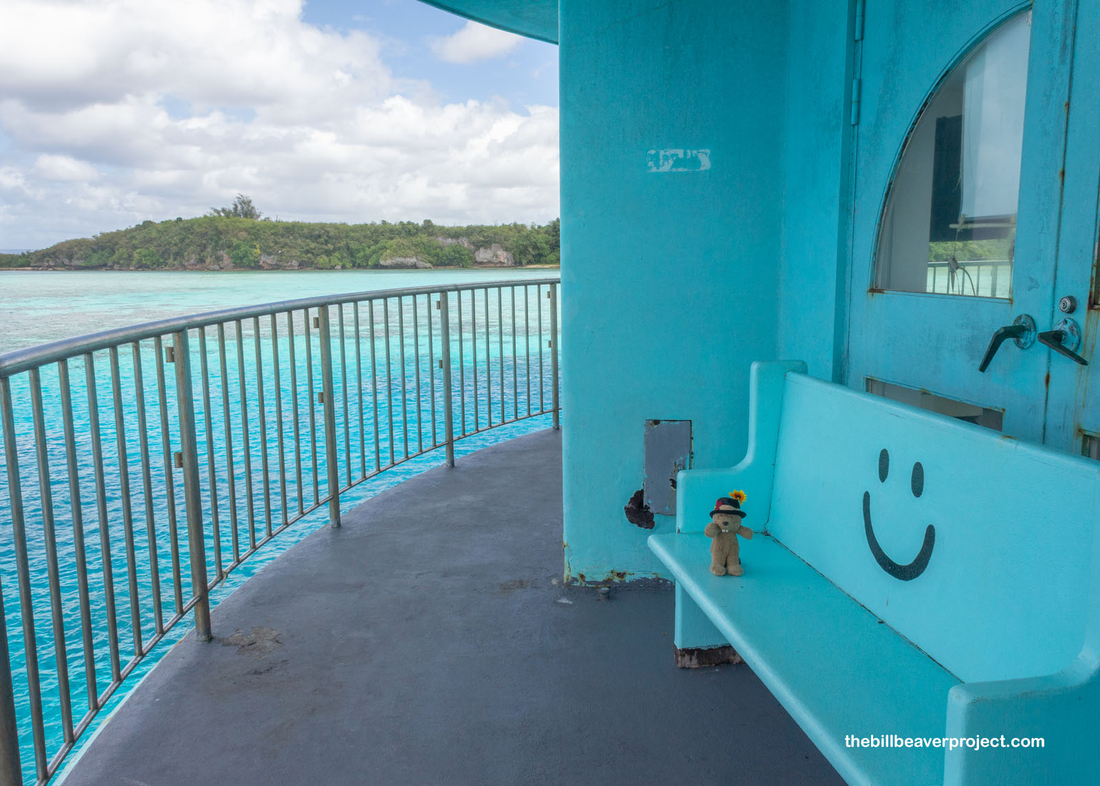
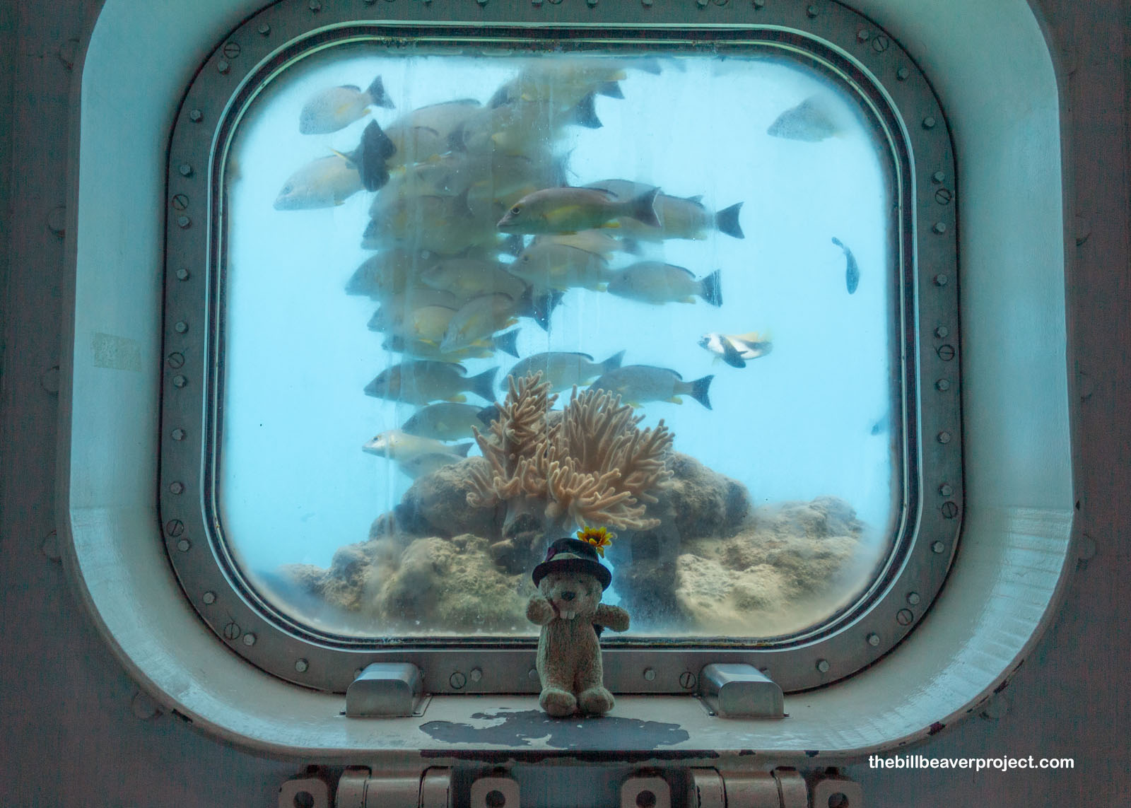
Whew! After a whole morning of absorbing local history, much of it pretty brutal, I needed to have at least a splash of vacation on my visit to post-war Guam. The splash was calling just south of Asan Beach at Fish Eye Marine Park, home to an underwater coral reef observatory! Watching fish go about their business in the tropical water sounded like the best possible way to spend the afternoon!
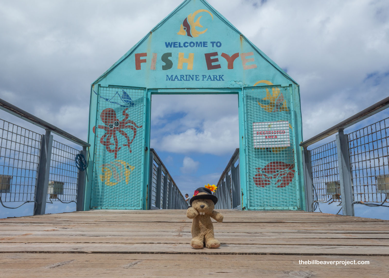 |
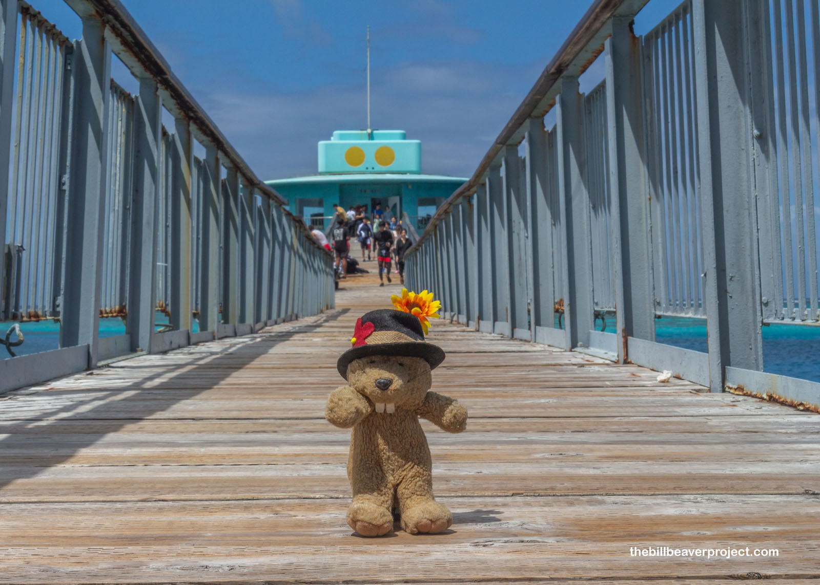
I wasn’t alone in this idea. Strolling down the long boardwalk, lots of folks were enjoying the crystal blue water of the Piti Marine Preserve from above and below, with the help of snorkels and rented SCUBA equipment. I once again kicked myself for not bringing my dive suit, but gosh, even just looking out over that brilliant blue did my heart some good!
 |
 |
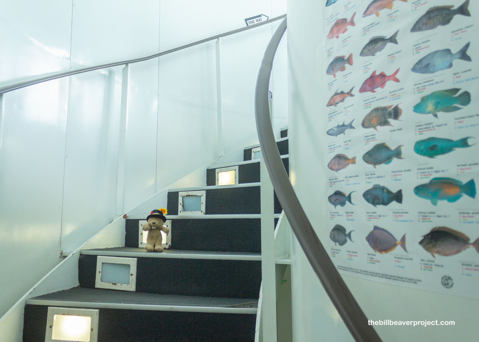
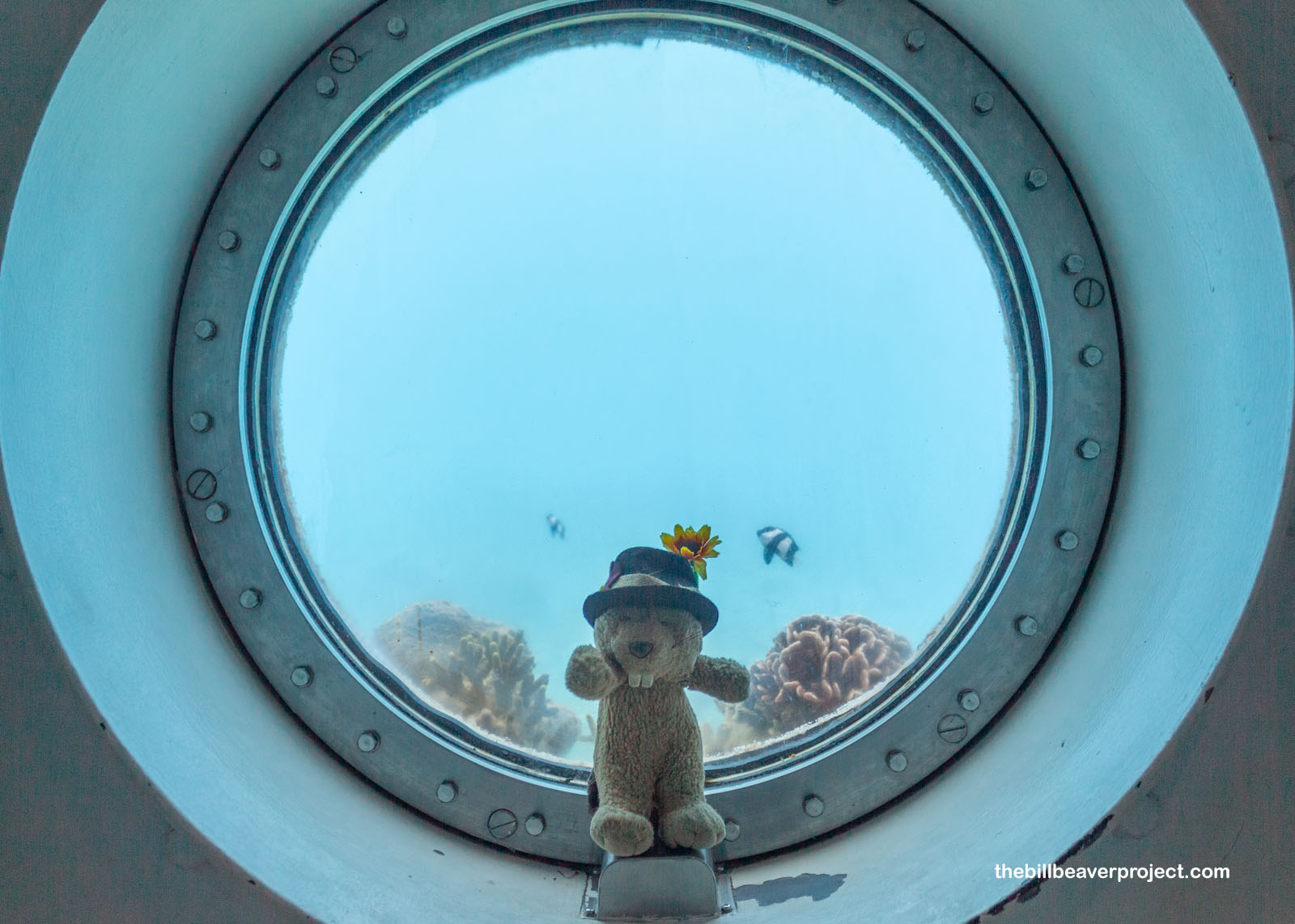
Once inside, two staircases spiraled past each other, one going down and another going up to maintain the flow of visitors. Lucky for me, most everyone was enjoying the water outside, which gave me some time to enjoy the observatory alone. A chart of reef fish gave me a clue as to what I could be looking for, including the humphead wrasse, known to science as Cheilinus undulatus and Tåsen guåguan to the CHamoru, but farther north in the Marianas Islands, they’re simply known as Máám! These were just some of the 200 species of fish that call this bay home!
 |
There were differently shaped windows all around the observatory, and luckily, some of the bay’s 80 species of coral were growing right up against them. Whether the windows were dirty or the water was murky, I wasn’t able to see too far out in the reef, but there a few cute damselfish fluttering in easy view against the glass!
 |
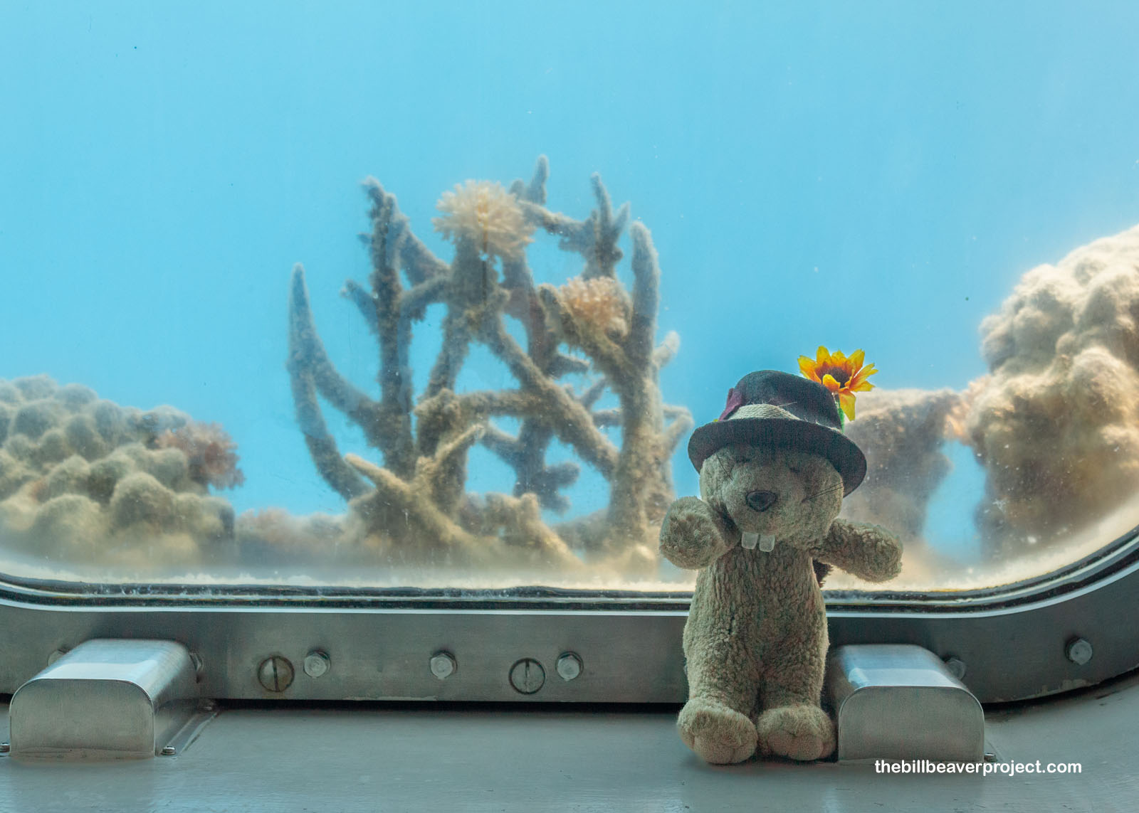 |
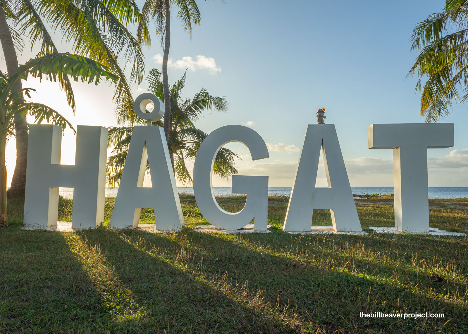
One window was simply swarming with blacktail snappers (Lutjanus fulvus), a versatile species that can live in salt, fresh, and brackish water! They, alongside so many other fish species, have found sanctuary and abundance here in Piti Bay because it was directly between the bombed-out reefs of Asan and Hågat!
 |
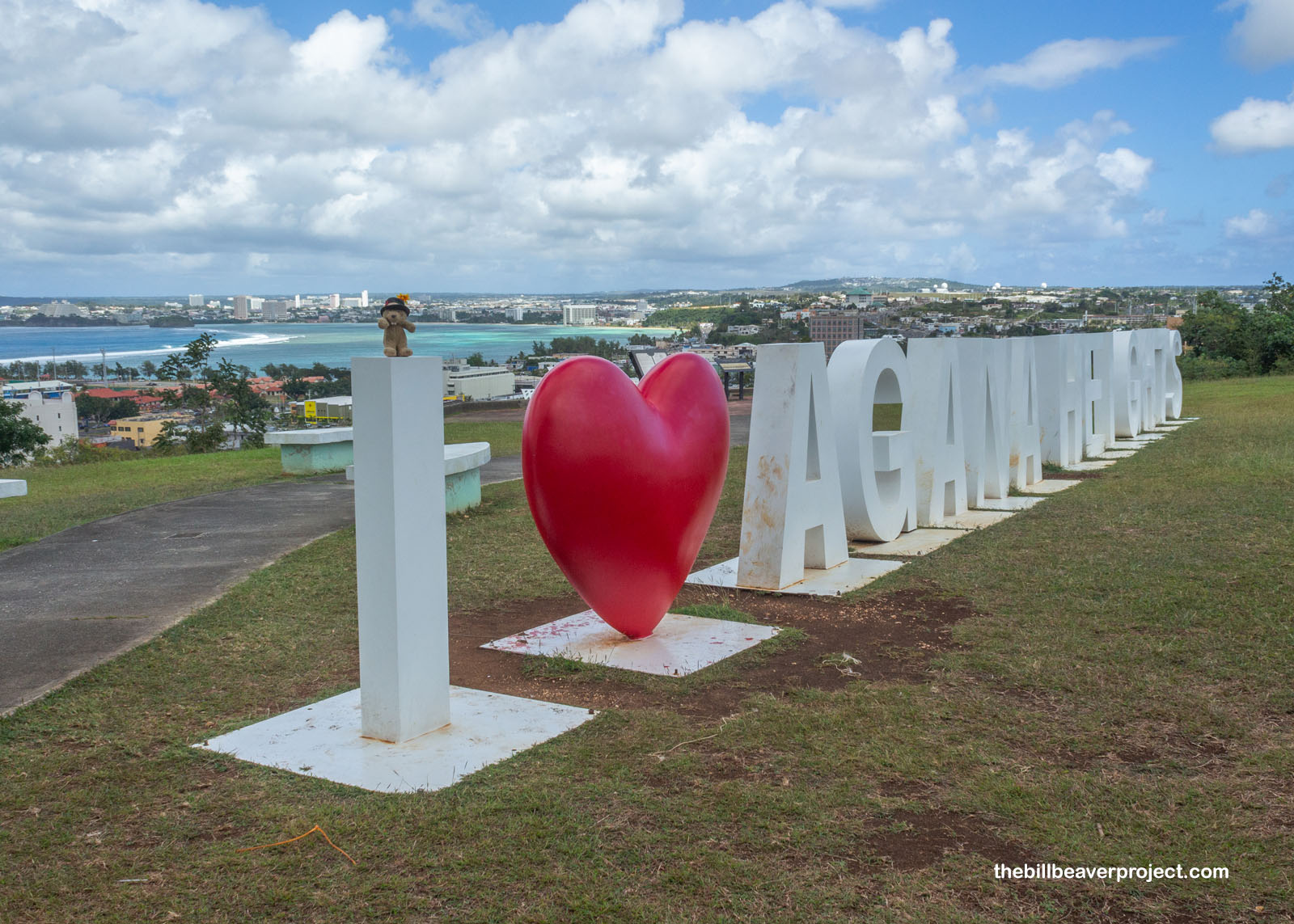
Incidentally, the village name of Hågat is derived from the CHamoru word for “blood,” and north of here is the capital of Hågatña, which means “his or her blood,” drawing from the many bloodlines that made this city so important! Spelled “Agana” by the Spanish, which is still retained in Agana Heights, the original CHamoru spelling was reinstated as recently as 1998!
 |
Here in the heights stands another relic of Spanish influence, their last standing fort, Santa Agueda! It was built in 1800 under orders of Governor Manuel Muro and named for his wife, María Agueda del Camino, as a defense against British privateers. Built from rubble, in a technique called mampostería, and outfitted with ten cannons, it looked over the Governor’s Palace for just under two decades when Spain stopped using galleons to transport treasure, making piracy less lucrative!
 |
 |
Then after descending from the hill, I found myself in the heart of Hågatña, outside the Guam Congress Building. The capitol building of Guam starting in 1949, this was a key venue in the fight to end U.S. military dominance in the 1950s. It took a break from being a capitol between 1989 and 2017, but today, this Modern Movement-style government building is retrofitted, fully functional, and stocked once more with legislators!
 |
 |
And as you might expect in any formerly Spanish city, like Los Angeles or Santa Fe, the core of Hågatña centered around its old Spanish plaza! A park and shared space today, this Nationally Registered plaza was the core of Spanish, and later American, power on Guam for 208 years!
 |
 |
When constructed in 1736, this was called the Plaza de Magalhaes (a.k.a. Magellan) and occupied by Governor Francisco Cardenas Pacheco. In short, this was the Governor’s Palace that Fort Santa Agueda was built to protect! Alas, most of its original buildings were flattened by the bombardments of 1944!
 |
But multiple buildings have been rebuilt, like the Chocolate House, where Spanish and American administrators alike shared morning coffee and pastries. The Azotea, or terrace porch, is the last remnant of the Governor’s Palace, which was expanded by Governor Don Enrique Solano in 1855 but reduced to a foundation in 99 years later. What was left to explore today were reconstructions from between 1933 and 1970, but still in line with the compound’s original layout.
 |
 |
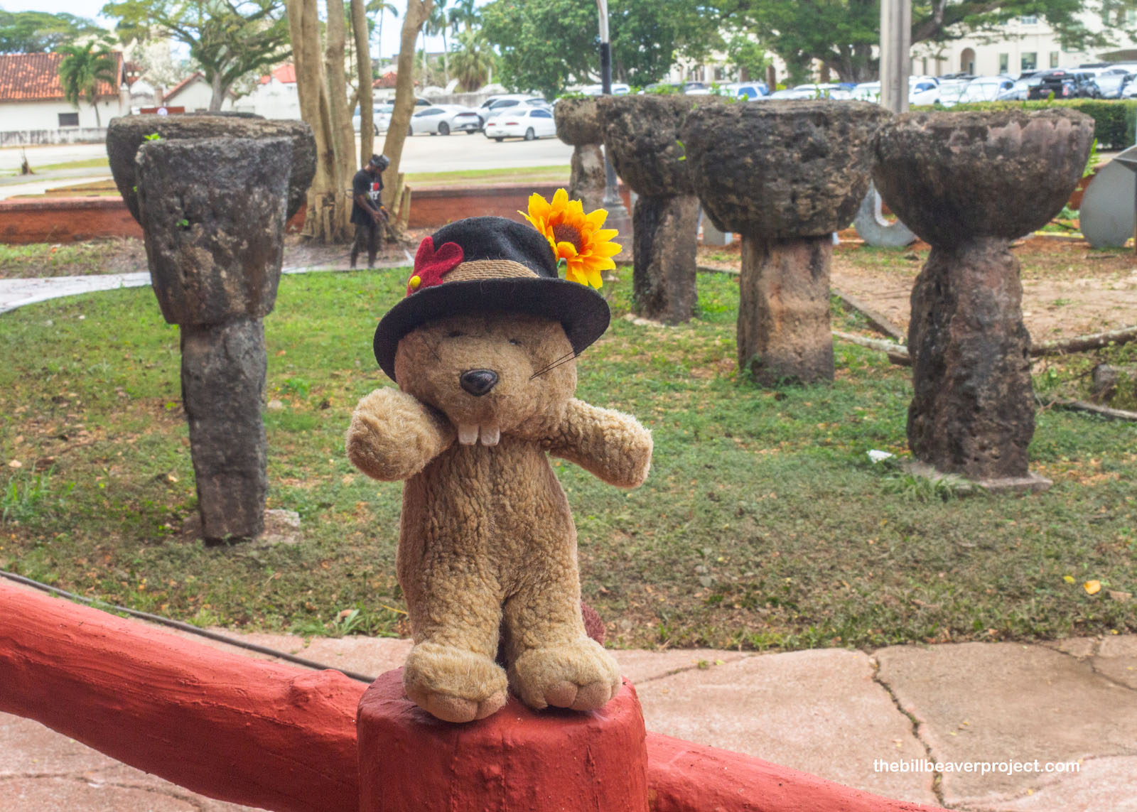
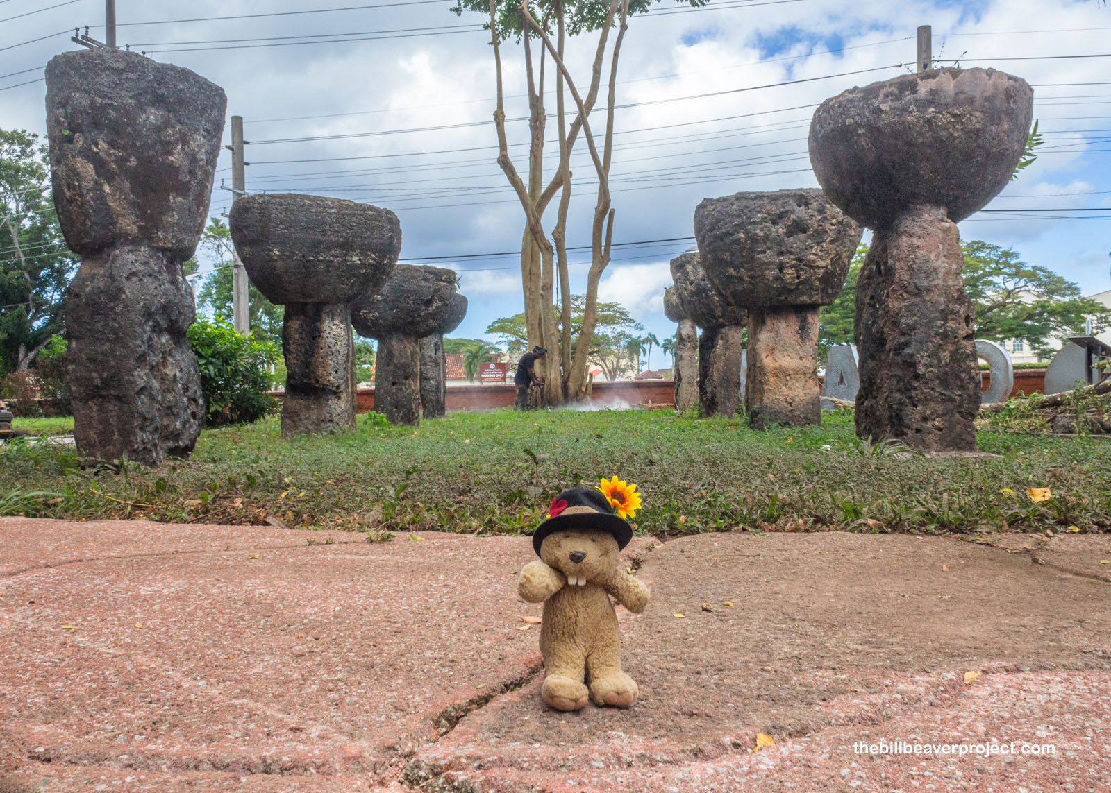
Adjacent to the Plaza de España was a park rich with symbolism for the island of Guam, home to examples of its most famous symbols, the latte stones. Having nothing to do with coffee, these huge goblet-shaped megaliths were used as supports for houses throughout the Marianas Islands from around 900 AD until the arrival of the Spanish! Though the park’s eight historic latte stones are hundred of years old, this site in particular has been super important in the story of modern Guam!
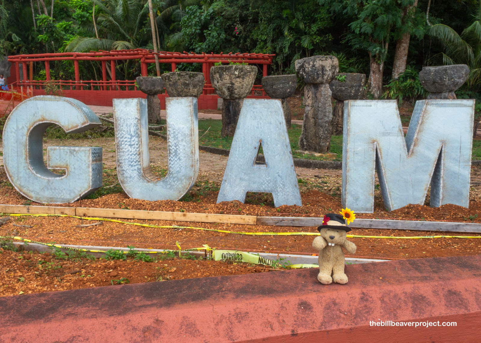 |
First created in 1953, the park was intended to be a collection of Guam’s cultural symbols, including these eight stones moved here from the village of Mepo. In 1991, it became an important meeting space for Chamorro Nation, founded by Angel Leon Guerrero Santos, whose name is on the park today! Their mission was to attain Guam’s independence, which it hadn’t known in over 400 years! The group also protested outside the Naval Air Station, and Mr. Santos was arrested. These protests put the independence movement in the spotlight in a way that hadn’t been done in centuries, but even today, there isn’t a ton of momentum behind it.
 |
 |
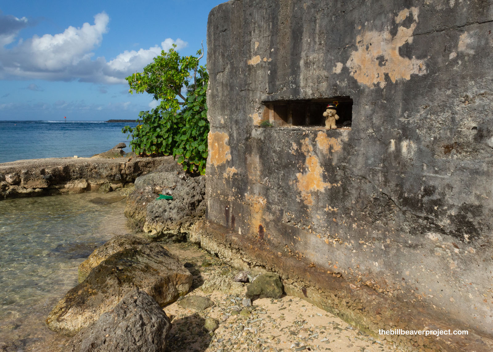
See, Guam has changed hands a lot over the centuries, and while some are ready for it to stop changing hands, others fully expect they’ll be in someone else’s hands the moment they break away from the US. The Japanese pillbox here in Hågatña is an unmistakable reminder of that! Today, with the naval base on the island, there’s a lot of US money flowing into Guam, but at the same time, it’s highly unlikely the island will ever make it to statehood with the rights and privileges that would bring. So for now, Guam must stay in a sort of limbo, though as a visitor, I liked it a latte.
 |
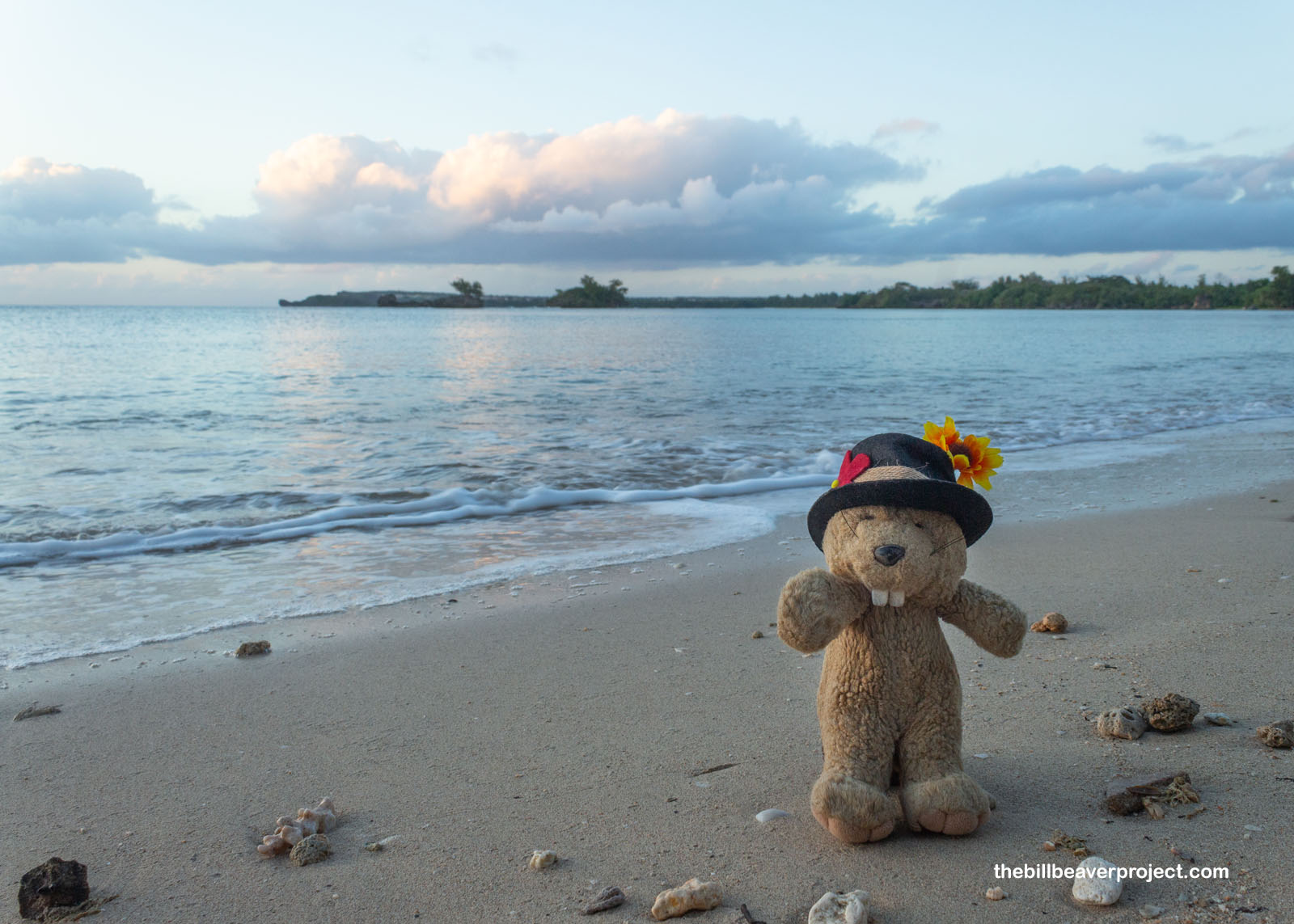
After a solid day of running around, it was time to wrap up my circuit of Guam. I’d started with the sunrise, so I figured I should end with a sunset. After accidentally getting routed to the gates of the naval base while thinking I could get to Gab Gab Beach (I couldn’t), I returned south to Hågat and settled onto the beach to watch the sun go down. It was very peaceful watching hermit crabs play and picking through sea shells.
 |
 |
I chatted a while with a nice lady who pointed out certain special shells that could normally only be found far out in the reef, which had made it all this way to shore. She also found and gave me a marble! As it turned out, she’d been a survivor of some awful violence, which left her with some brain damage, but nevertheless, she continued to walk 12 miles to work and back each day, stopping each time to clean the beach and convene with the ocean, which she said was angry. I gave her some of my shells, which made her happy, and she, along with my explorations of Guam, went on into the night.
 |
 |
So, my farthest flung national park adventure came to a close. My quest is getting into the nitty gritty right now, and as I turn eastward to fly back over the Date Line, I’m looking at my most challenging adventures to date. Cost and logistics could make this year the least adventurous one I’ve had on my quests, but even if the adventures are fewer, you can bet I’m going to pack them full of exploration! I’ll see you in a few months on the other side of the world!
Asta i sigiente na adbentura!

Previous Day |
Total Ground Covered: 116.7 mi (187.8 km) |
Next Day |