 Previous Day |
McCarthy, AK → Kennecott, AK → McCarthy, AK 7.6 mi (12.2 km) |
 Next Day |
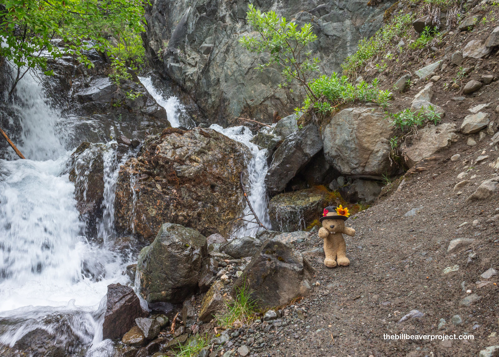
Good moraine, everyone!
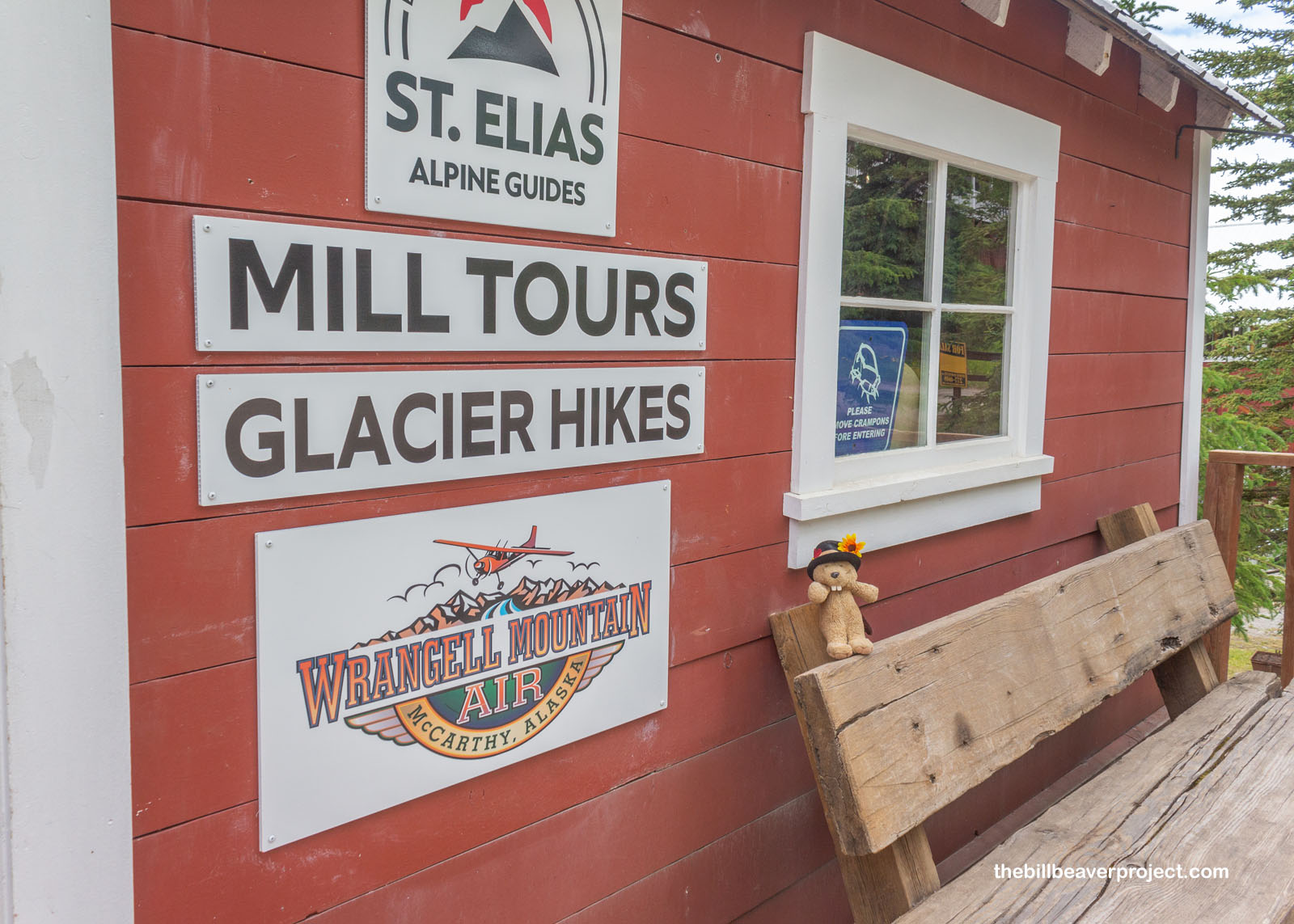
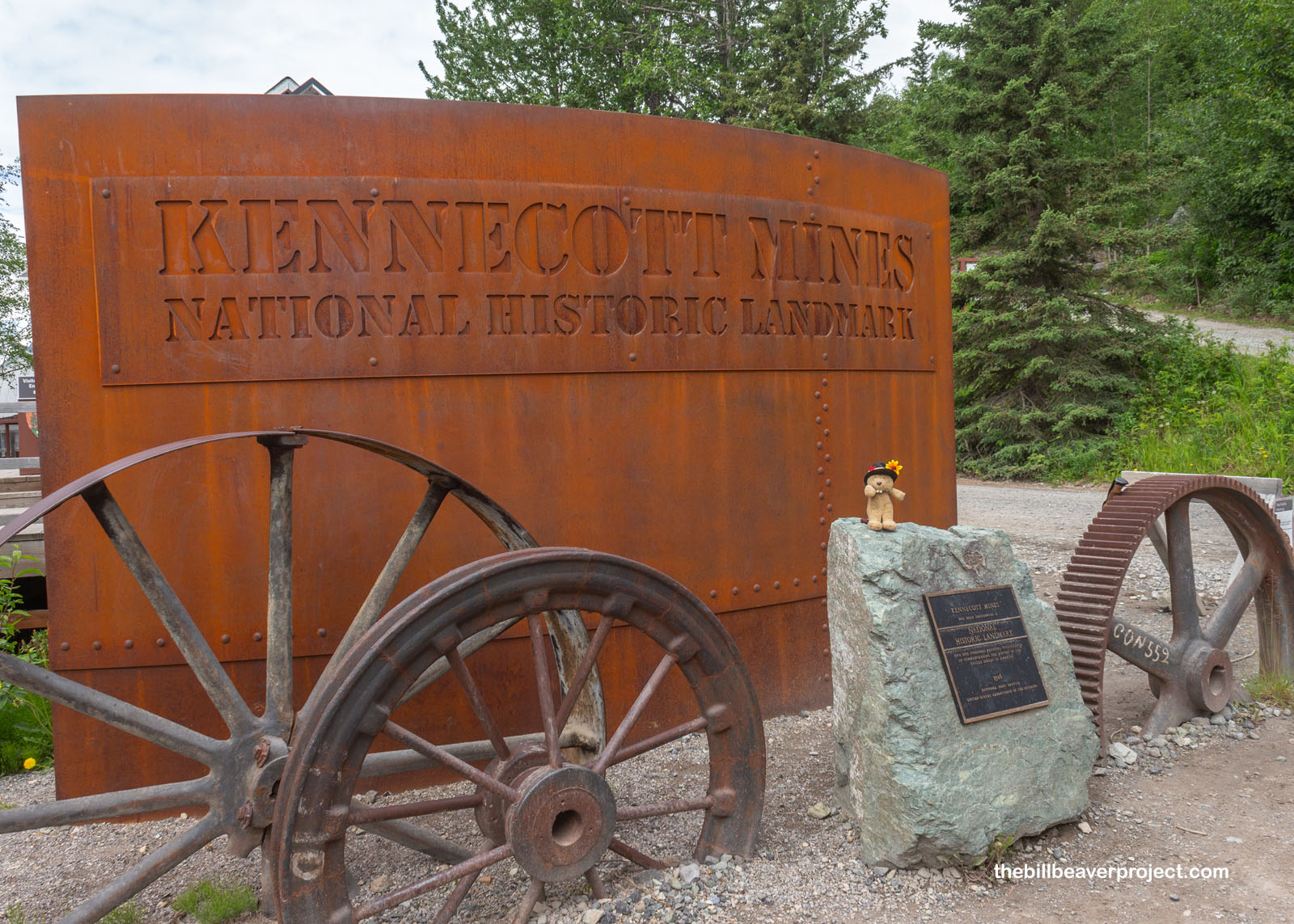
Clouds be dammed, I was up and at ’em for a full day of adventuring just north of McCarthy in the historic mining district of Kennecott. Since 1900, when “Tarantula” Jack Smith and Clarence L. Warner spotted copper ore in these mountains, this place has been famous for its record breaking copper deposits, and because of the development that came with those finds, this remote part of Alaska is well equipped to give city-dwellers like myself a real taste of adventure, while dodging the perils of old mining towns. Today, my double-whammy tour with St. Elias Alpine Guides would first take me up onto the beautiful blue of Root Glacier, then into the depths of the incredible, 14-story Kennecott Mill! I was charged up on tiny cabin granola and ready to meet with guide, Edward, to begin our hike at 9:00 AM sharp!
 |
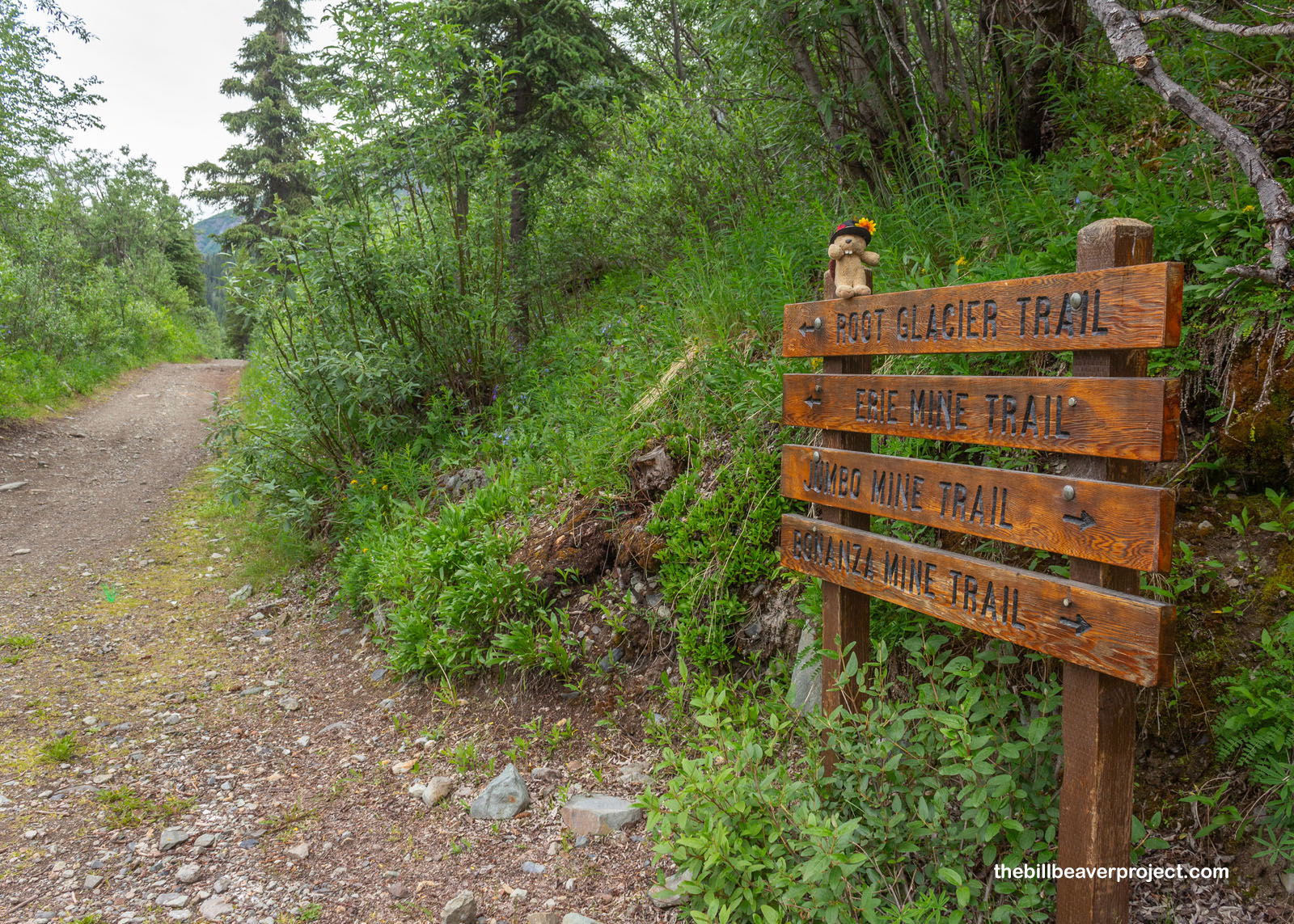
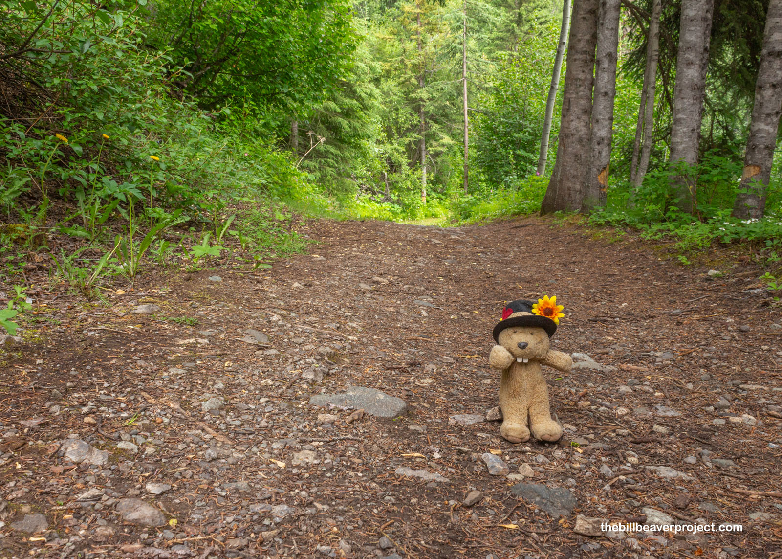
Passing through Kennecott, which we’d see in more detail later, our group of six came to a big jumping-off spot for adventure: four different trails leading up into the mountains! While we waited for some folks to make the most of this last bathroom stop, Edward pointed out the many bluebells blooming on the side of the trail and invited everyone to taste one! To most, they just taste like veggies, but to some, like me, they taste like fish! Wild!
 |
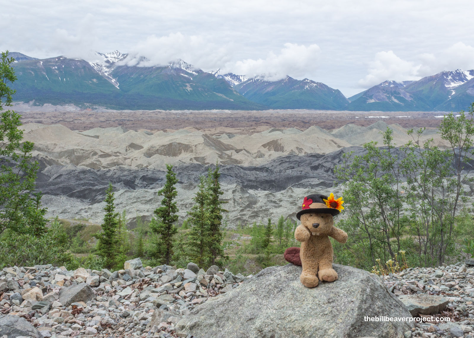
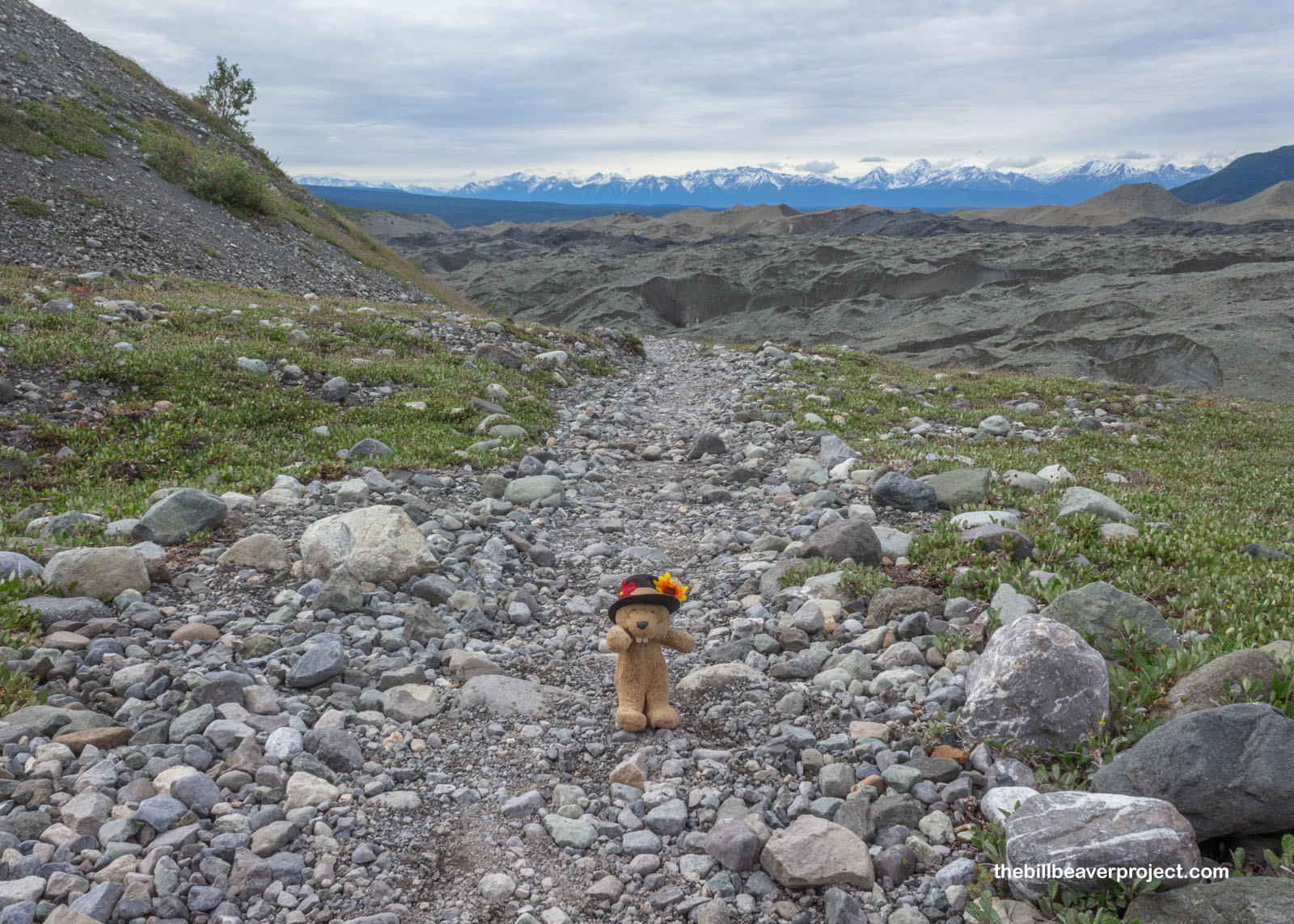
The trail was pretty flat for the first mile and had sweeping views of the valley and the Wrangell Mountains. In the middle were what looked to me like sand dunes, but Edward explained these were all part of the glacier, just covered in a coat of dirt and rocks collectively called supraglacial moraine! This is an unusual feature in that, the more of it there is, the better it is for the glacier. When the moraine is thin, it speeds up glacial melt, but when the moraine is thick, it acts as insulation, keeping the cool in and the heat out!
 |
Plenty of melt was happening above us as we crossed the rip-roaring Bonanza Creek, flowing down from just below the Bonanza Mine, where ol’ Clarence and “Tarantula” Jack staked that first famous claim 125 years ago! We weren’t going to be rough and tough like them today, crossing the creek on an easy bridge, but they must have had a wild time fording such a rip-roaring current!
 |
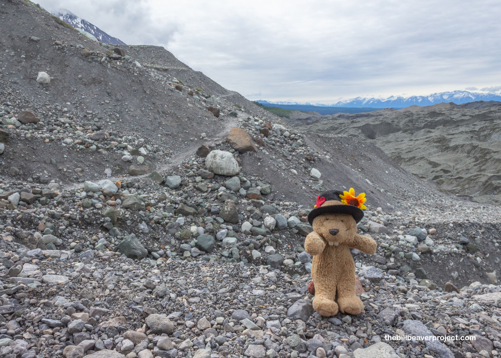
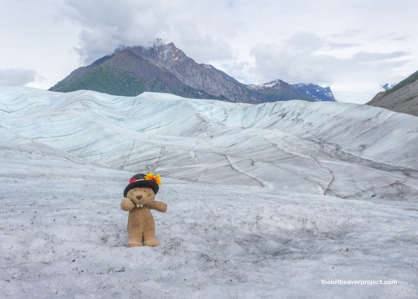
At our first overlook, we spotted the moraine-free part of Root Glacier where we would be exploring today. Behind it stood Donoho Peak, delineating the line between Preserve and Park, and beyond that, shrouded in clouds, was imposing Mount Blackburn, almost ten thousand feet higher than Donoho Peak, and almost two thousand higher than Mount Whitney! In fact, most of the Wrangell Mountains are 13,000 feet or higher, no easy day jaunts by any means! Their height is great for preserving glaciers, so much so that the park is 35% covered in them, 5,000 square mies of ice!
 |
After the overlook, the trail turned thin and rocky as it switchbacked down past the line of nitrogen-fixing mountain avens plants and into pure, unaltered, glacial moraine. When a trail descends as steeply as this one, it’s hard not to worry about the return trip!
 |
 |
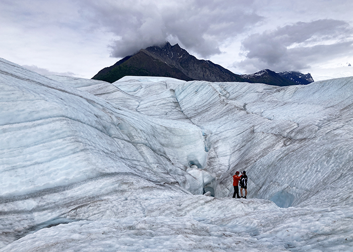
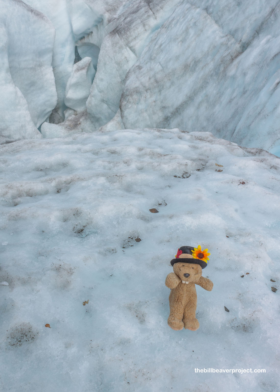
As we reached the base of the Root Glacier, I got to experience the weird sensation of supraglacial moraine up close and personal. This huge pile should have been squishy mud, but that was not the case! Instead, brushing away a tiny patch of sand revealed a structure of solid ice! This was way different from the last glacier I’d walked on, but it did also make me think back to the Grand Pacific Glacier back in Glacier Bay National Park!
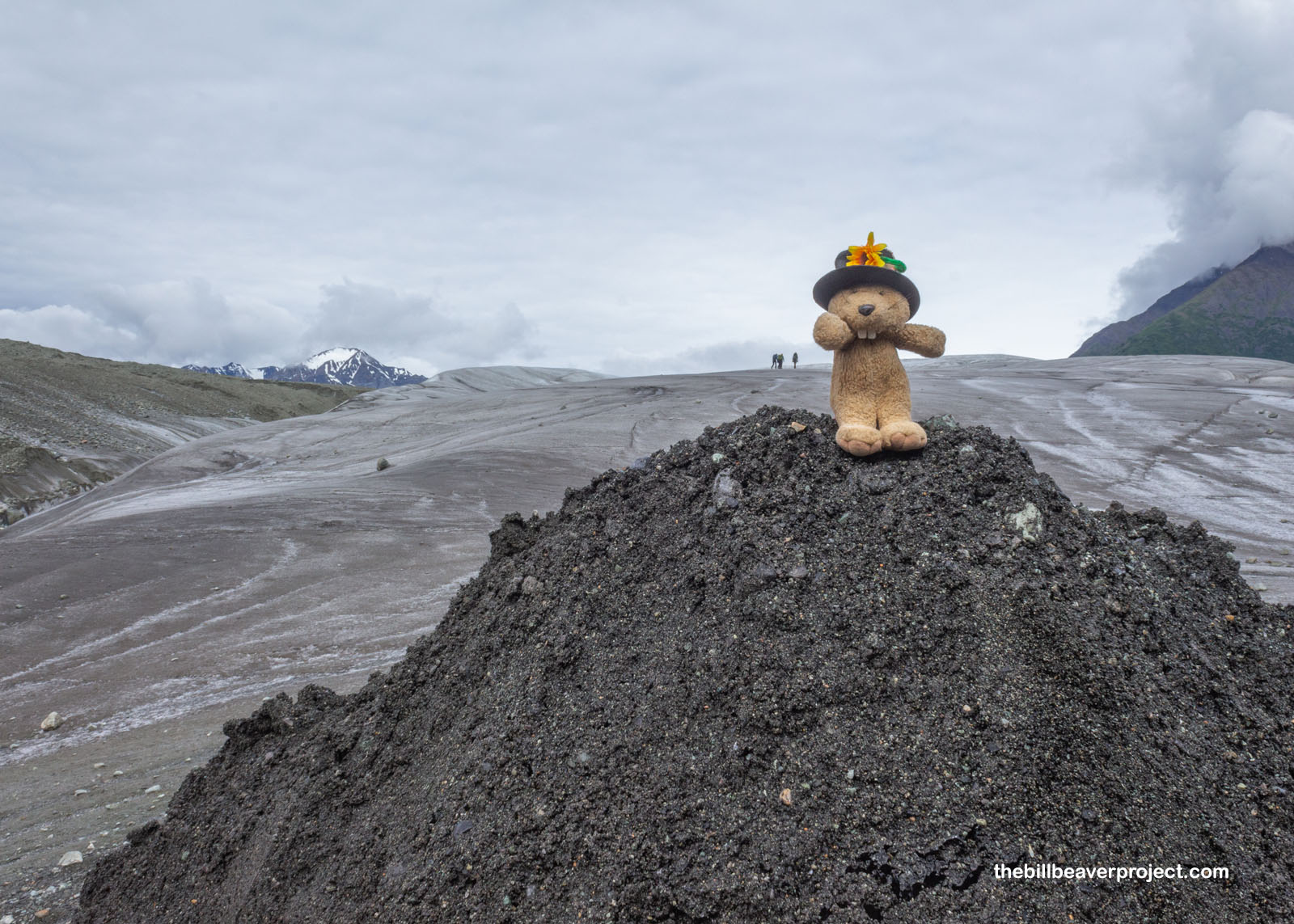 |
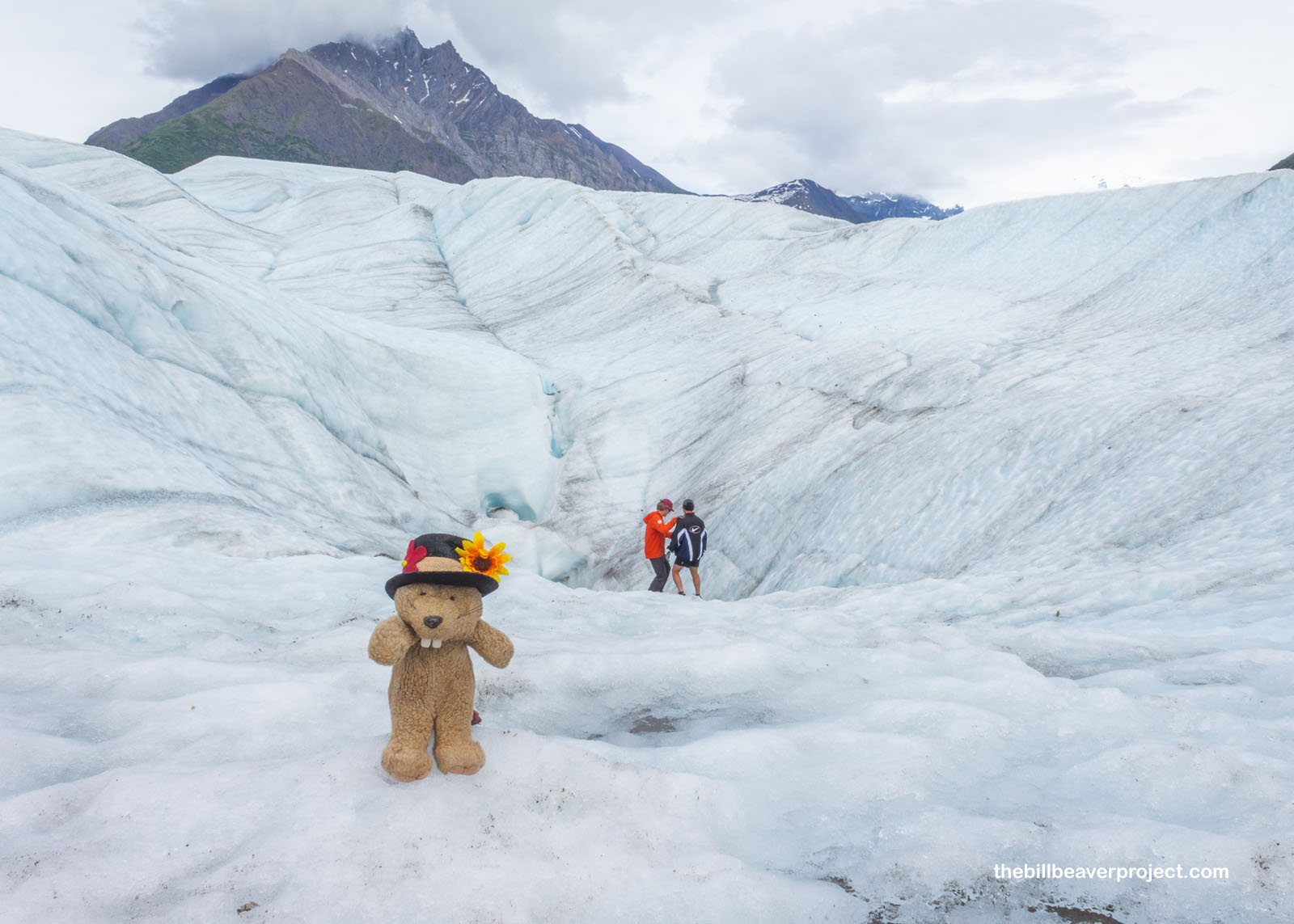
And gosh, this ice was rough! They advised everyone to wear good shoes and strap on crampons, but they did not have any in my size! Good thing I’ve been doing to much adventuring, because my feet are tough, maybe the toughest of all beaver kind! Anyway, it did not take long to get from the muddy orientation area onto the ice, and I was reminded immediately why I love glaciers so much: those stunning shades of blue, textured with dark foliation lines. These lines form as new snow gradually compresses into layers of glacial ice, and with 800 inches of snow falling here each year, these layers have created a real wonderland!
 |
 |
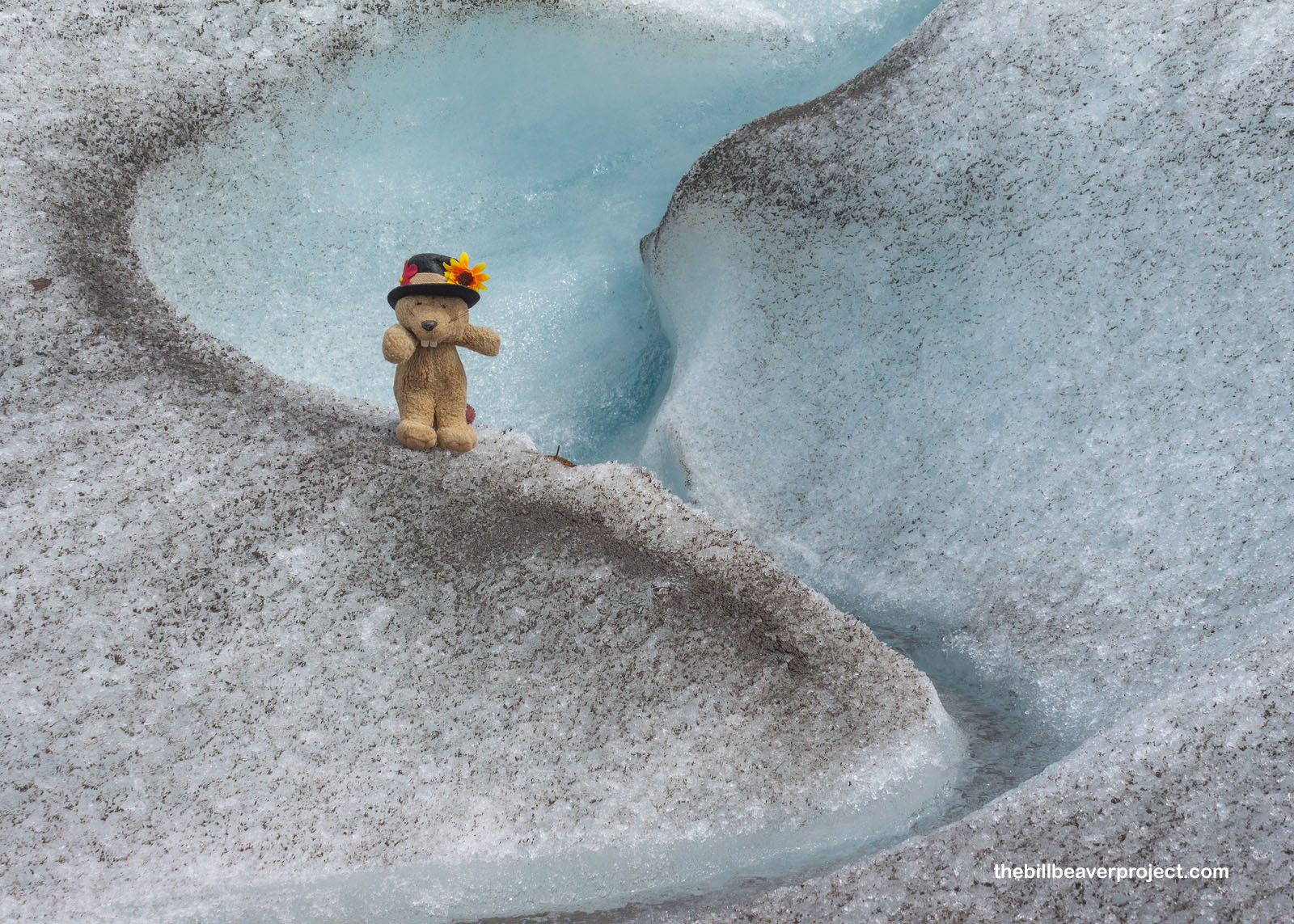
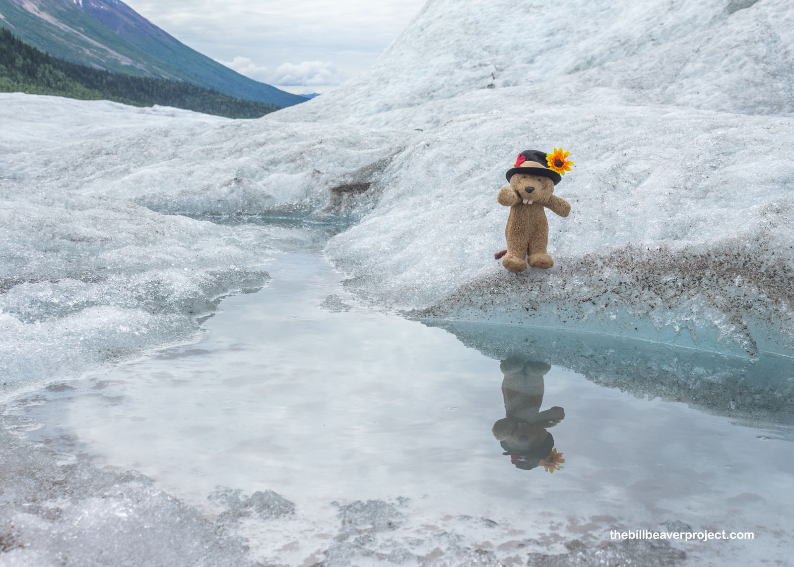
But it’s summer, and summer means melting. Water is constantly flowing off Root Glacier in trickles, streams, and rivers, forming amazing swirls and deep canyons as it makes its way down into the drinking water supply of McCarthy! At this elevation, while there is dirt on the snow, it’s so unlikely for animals to walk up here that this water can easily be sipped straight from the source! More on that later!
 |
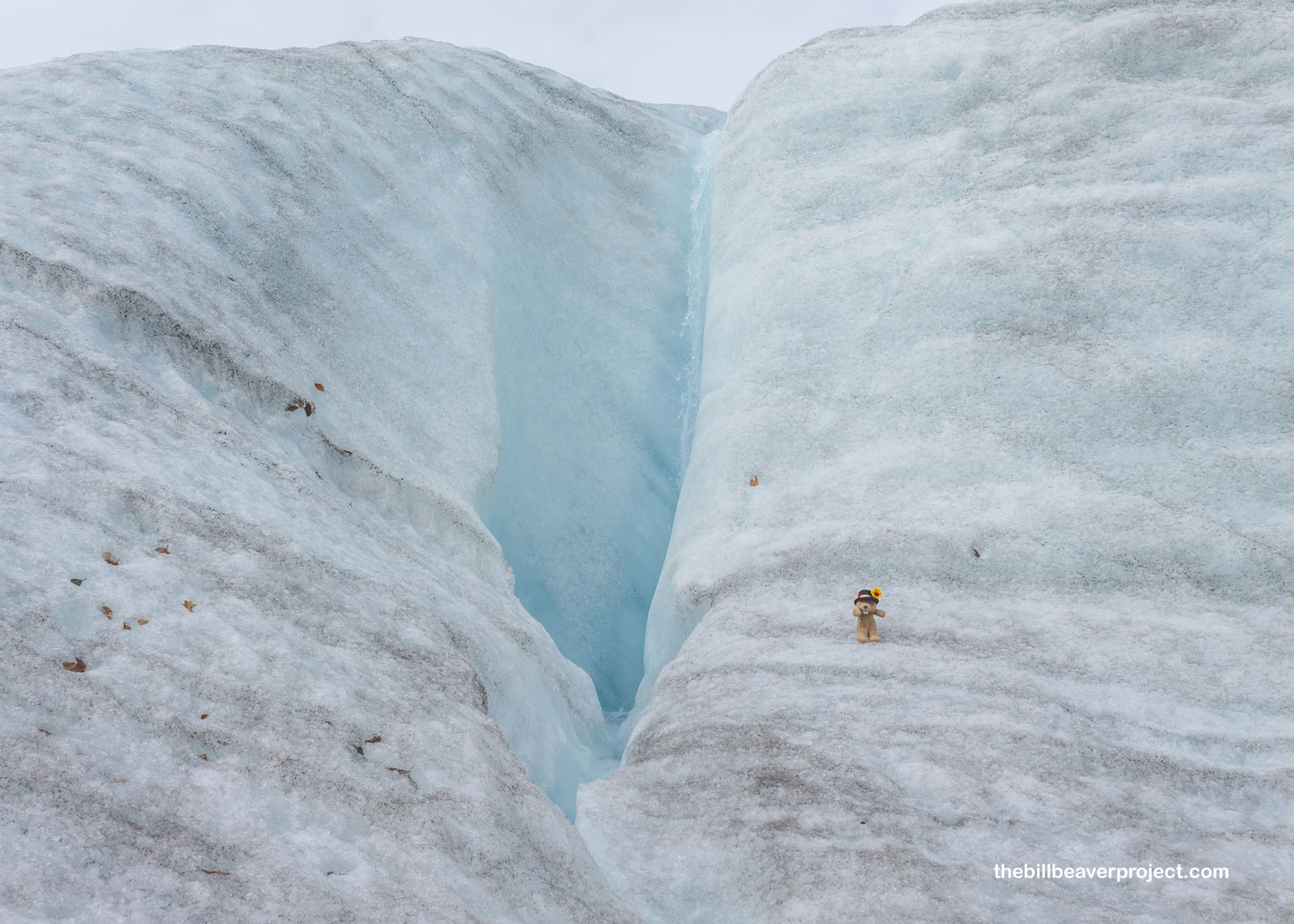 |
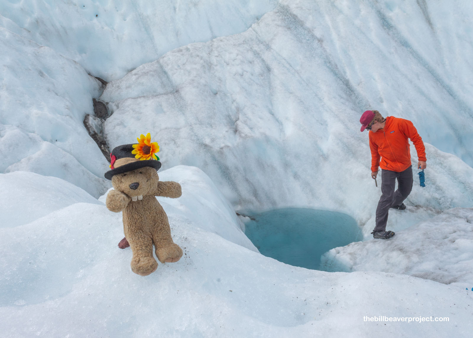
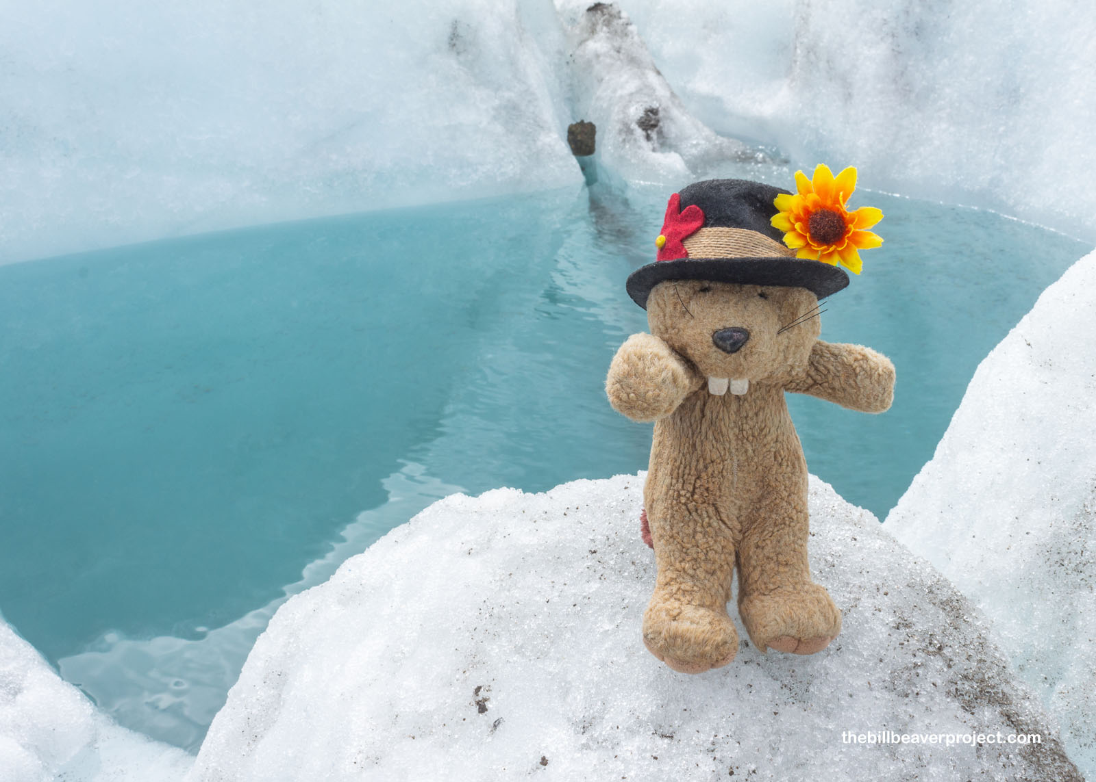
But this flowing water can also create danger for glacial explorers. If it hits a weakness in the ice, bringing abrasive sand or pebbles with it, it can bore a deep hole into the glacier, sometimes to the bottom, where the water can help lubricate the base of the glacier and keep it moving! These holes are named for the spinning motion the water as it rushes into the growing shaft, so they’re called moulins, after the French word for “mill!” But unlike the Moulin Rouge, if you fall in the Moulin Bleu, you’re not coming out again, ever!
 |
So naturally, we all wanted to see the pit of death up close. Since we didn’t have ropes, Edward had to be with us at all times to make sure none of us slipped down our last rabbit hole. The moulin doesn’t look like much from this vantage point, but a few steps farther, and I’ve had slid my way to my very last adventure blog! Good thing the day was still as can be!
 |
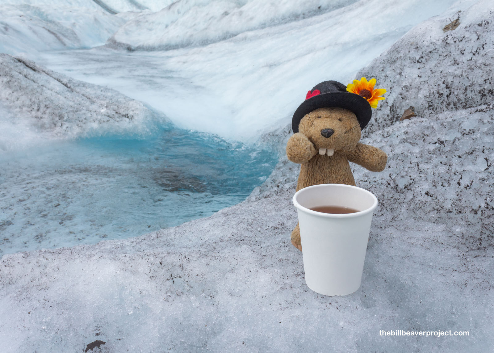
Around noon, we took a break to eat our snacks, and Edward whipped out a small stove. Offering up coffee, tea, and cider packets, he filled up his pot with glacier water and gave everyone a cup. Oowee! Just like hot spring beer, this cider tasted way more refreshing than city cider! I even dipped my face in the stream just to test that clean water theory! It was super refreshing!
 |
 |
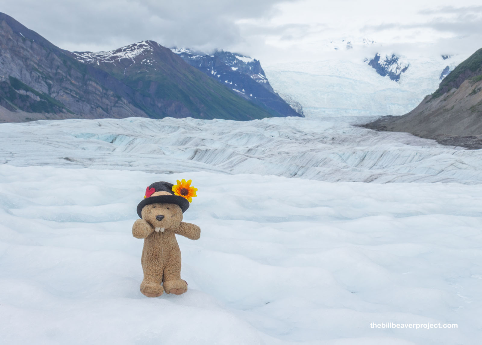
Behind where we paused to snack and sip, we had a view of the mother of the Root Glacier: the Stairway Icefall! It might not look like much from here, but that tiny wall of ice in the back right of the frame is six miles away and more than a mile tall, the largest outside of the Himalayas! Gravity makes it move ten times faster than the glacier below, a difference of ten feet per day to one foot per day! It’s possible to climb this whole icefall, but we certainly didn’t have time for all that today!
 |
Instead, Edward invited everyone to take a dip in a blue pool, so named because it’s a pool and it’s blue! Several folks in the group were from Singapore and had never been in water under 80˚F, but they were all on board to leap into water barely above 32˚! To do so, Edward laid down a mat to prevent scrapes on the sharp ice while getting back out, and made sure everyone was holding onto a rope. No one had brought a swimsuit, so some folks went in their underwear while others went buck naked!
 |
 |
As for me, I spent enough time cold and wet in Katmai, so I just watched them have their experience while trying my best to be like these pebbles whose heat was causing them to melt pits into the ice. In fact, it’s this little bit of extra heat that gives rise to an unusual sight, the “glacier mouse!” Not mice at all, these start off as pebbles with moss growing on them, and because the glacier is constantly moving, those pebbles roll along, allowing the moss to grow in a ball shape and host all kinds of critters from springtails to nematodes to tardigrades! I was hoping to spot one of these mini rolling gardens, but alas, with the final splash in a blue pool, it was time for us to get rolling back to headquarters and for me to start my next tour!
 |
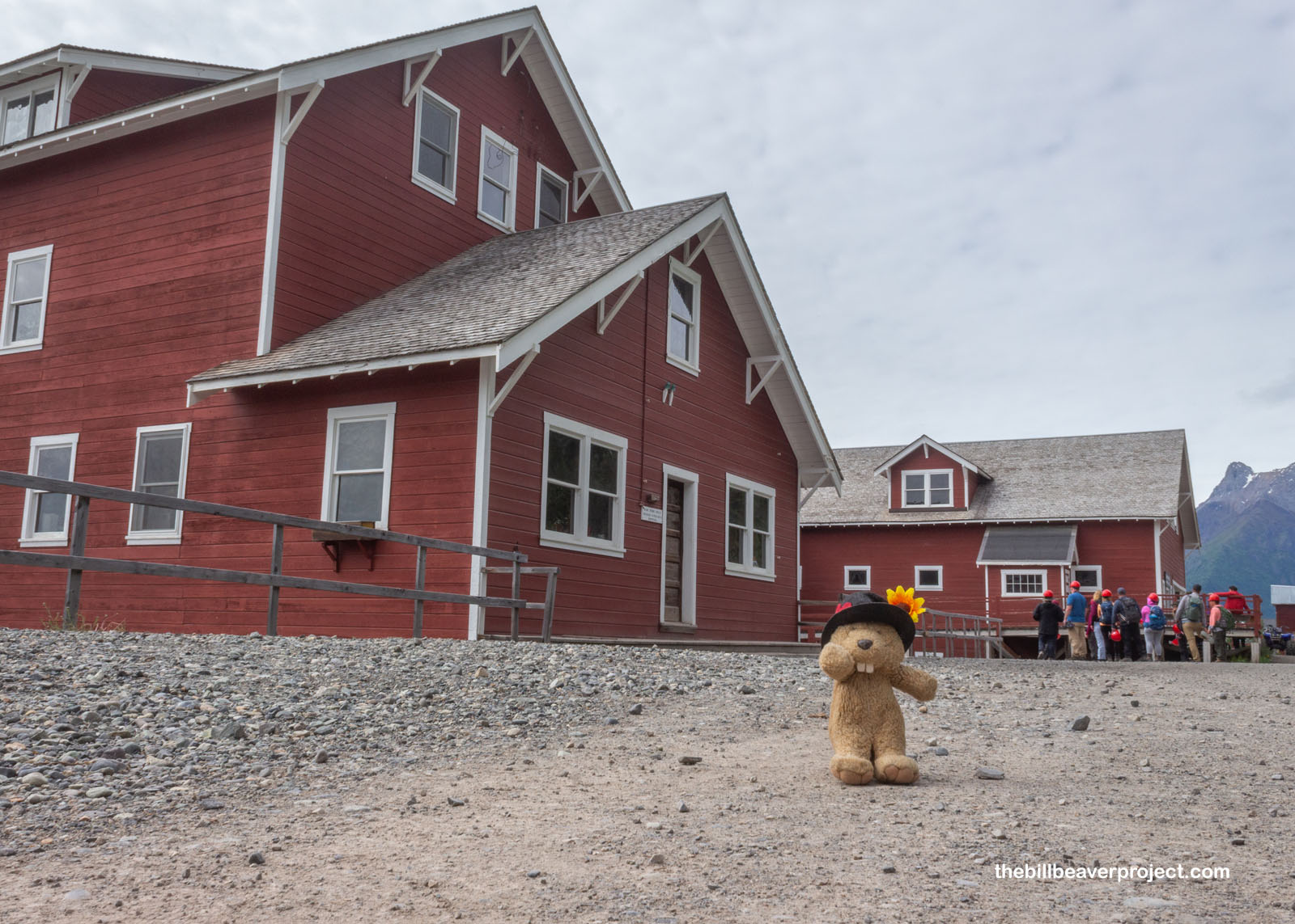
After sampling some tasty Thai soup from the Meatza Wagon food truck (food trucks have been in the most remote places so far), I headed back to the St. Elias Alpine Guides headquarters to check in for my 3:00 tour of the Kennecott Mill, one of the tallest of its kind in the world and centerpiece of a national historic landmark! It was a large group of all different folks, but surprisingly, Edward was once again the guide! So for a second time today we started our walk down the road through Kennecott toward the giant mill.
 |
Along the way, we passed some of the outlying buildings, like the school, which was surprisingly geared more toward adults than kids! At its height in 1920, there were 126 adult students from 23 countries enrolled here, compared to the largest class of kids numbering 20! From this view, where you can see the last vestiges of the moraine-covered glacier below, it’s surreal to think that, when Kennecott was an active mining town, the Kennecott Glacier came right up to the edge of what is now a pretty steep cliff! Despite this, the town used compressed ammonia, not glacial ice, to refrigerate their food!
 |
Next to the school was the bunkhouse where two men at a time shared a room and board for $1.25 a day while working the mines. However, many of the miners actually preferred to sleep inside the mines because they were actually warmer in winter than the rickety bunkhouse! Even though accommodations were lacking, the town’s founders still wanted their workers to keep working, so they installed a recreation hall nearby with movie nights and dances, not to mention a company baseball field, tennis court, and ice skating rink!
 |
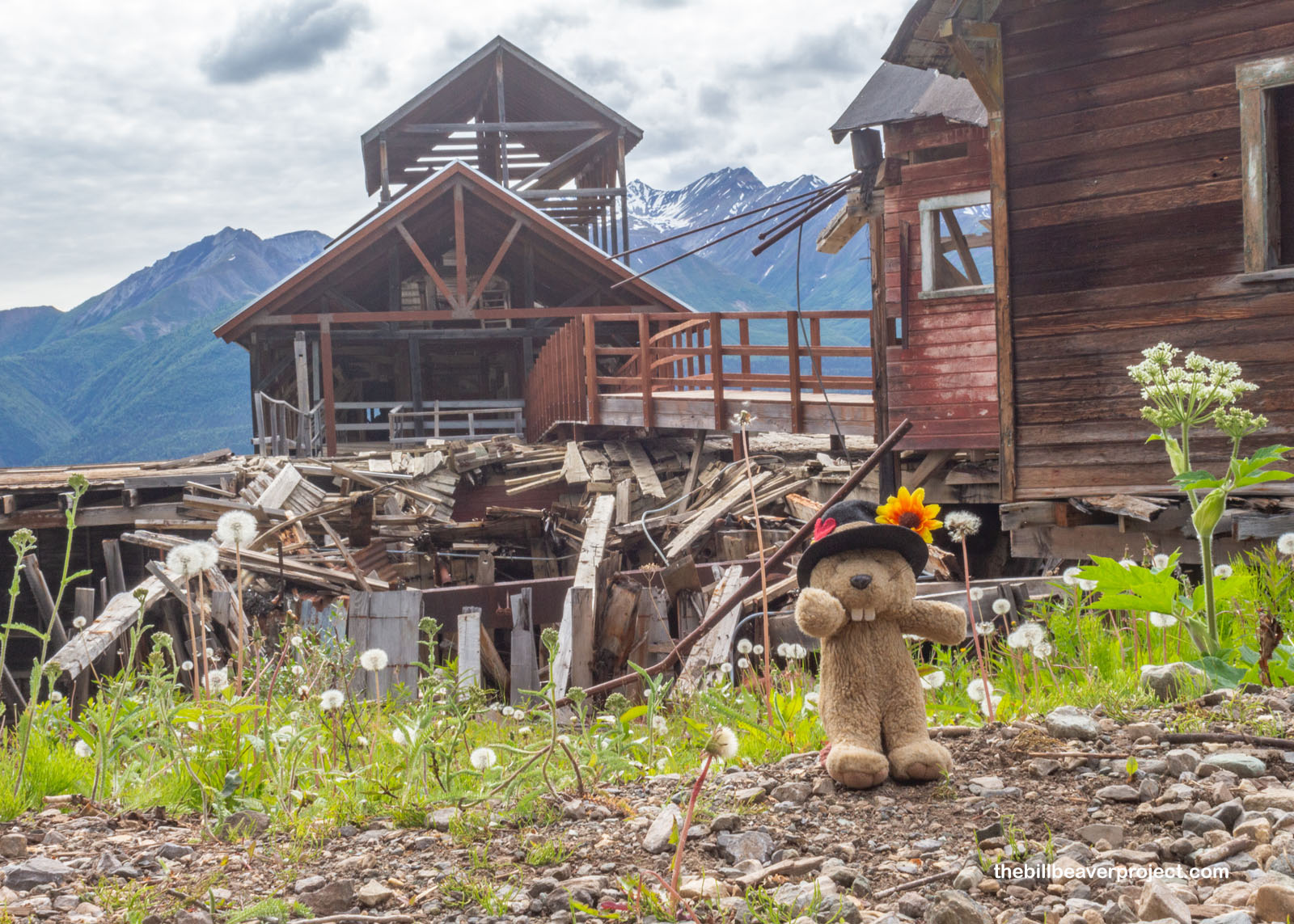
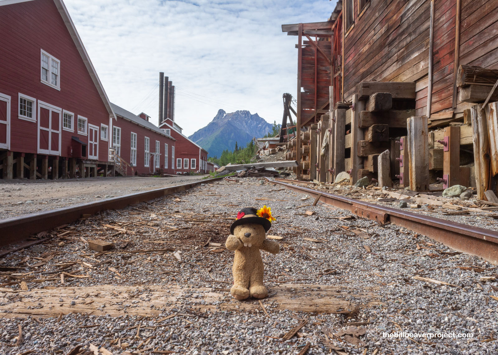
Crossing the National Creek bridge, it was easy to see the difference in preservation between buildings. Due to limited funding, some buildings here, like the staff quarters and bunkhouse on the right, are regularly maintained so they look the way they did in historic times. Others, like the hospital on the left, are not, and so they are all eventually going to collapse! With this came up the most asked question of the group: how often did folks have health problems from working in these mines? And the answer was, we don’t know! Kennecott was vacated rapidly in 1938, so all the medical records were left in the hospital and later lost in a flood!
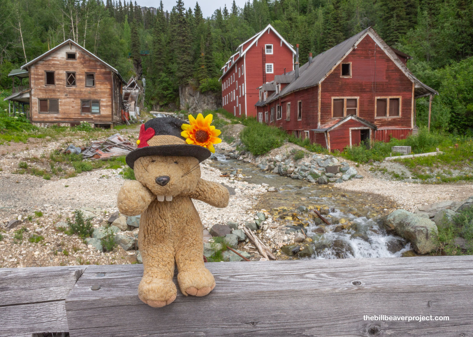 |
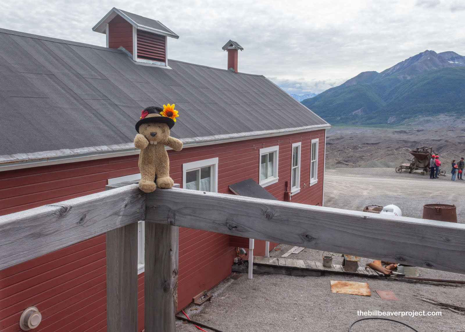
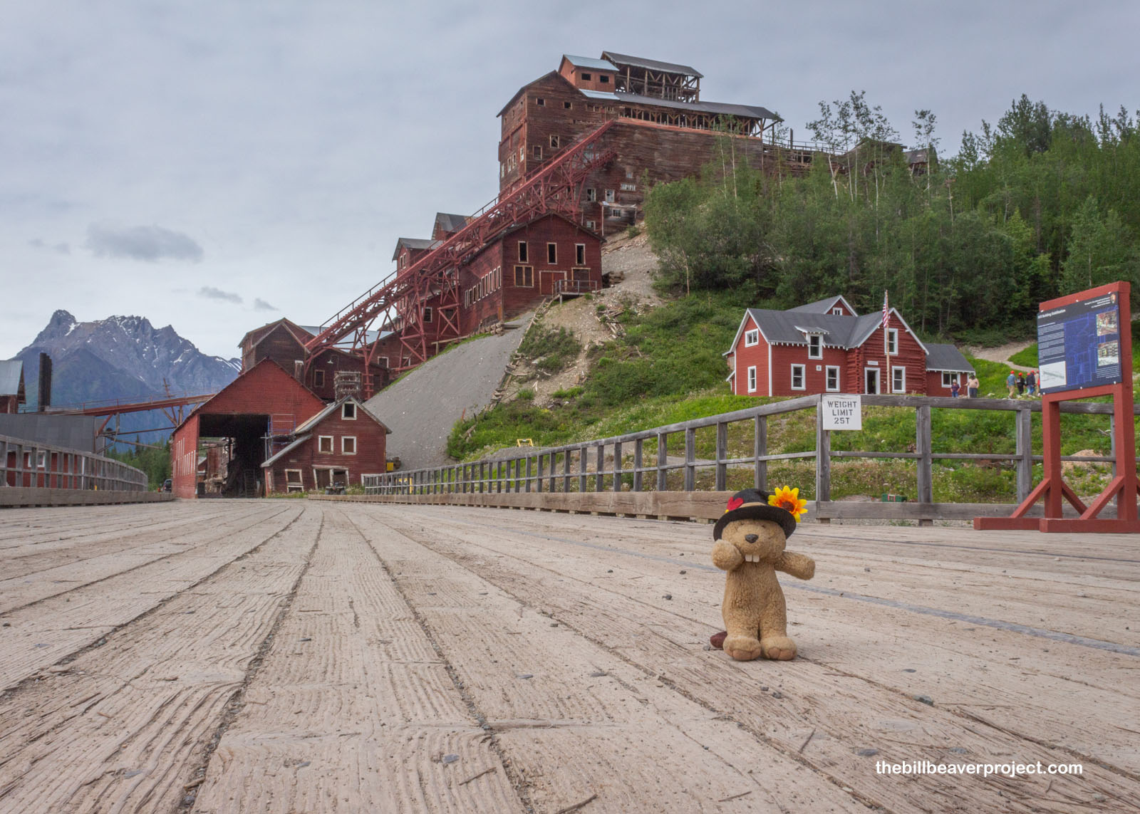
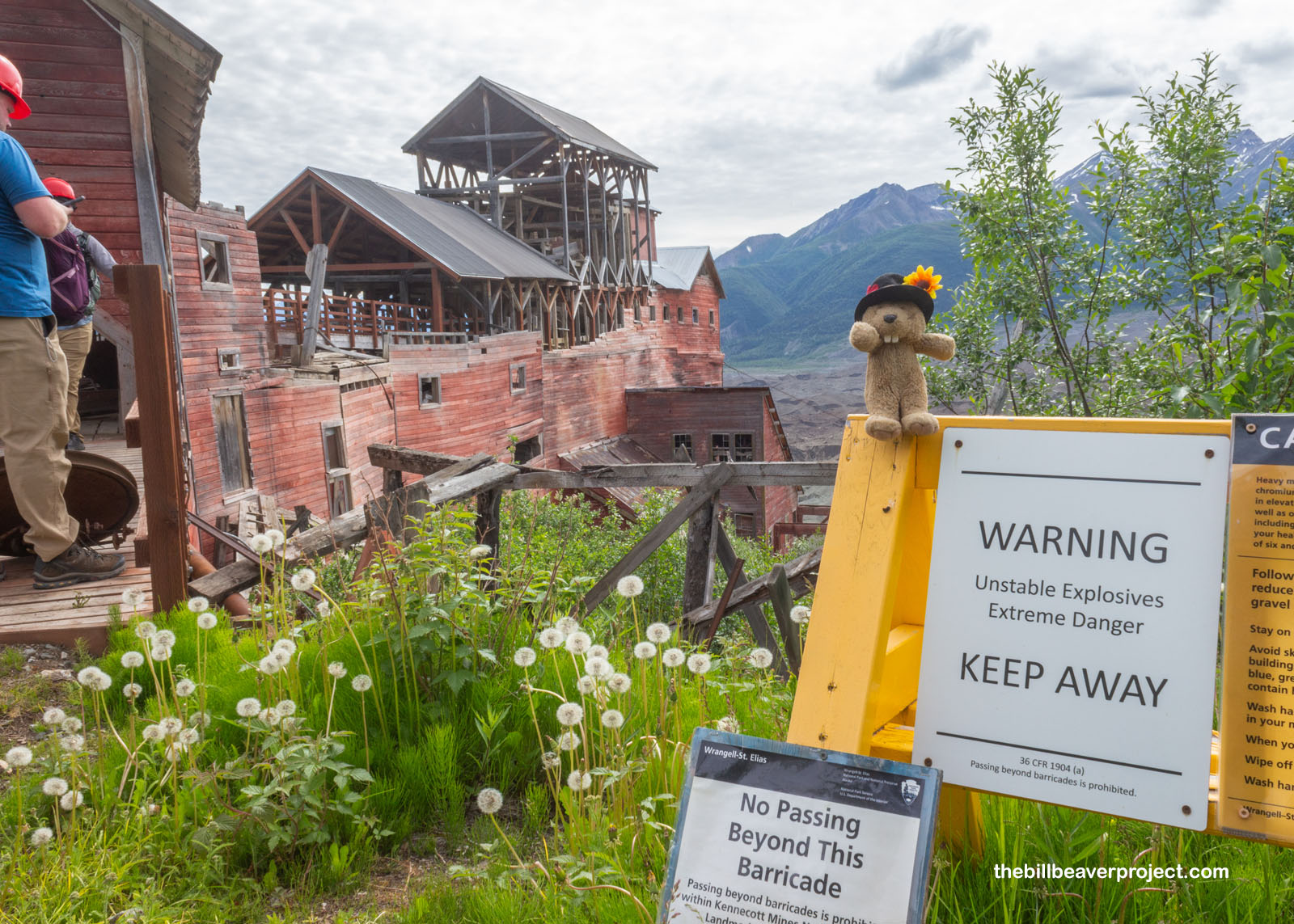
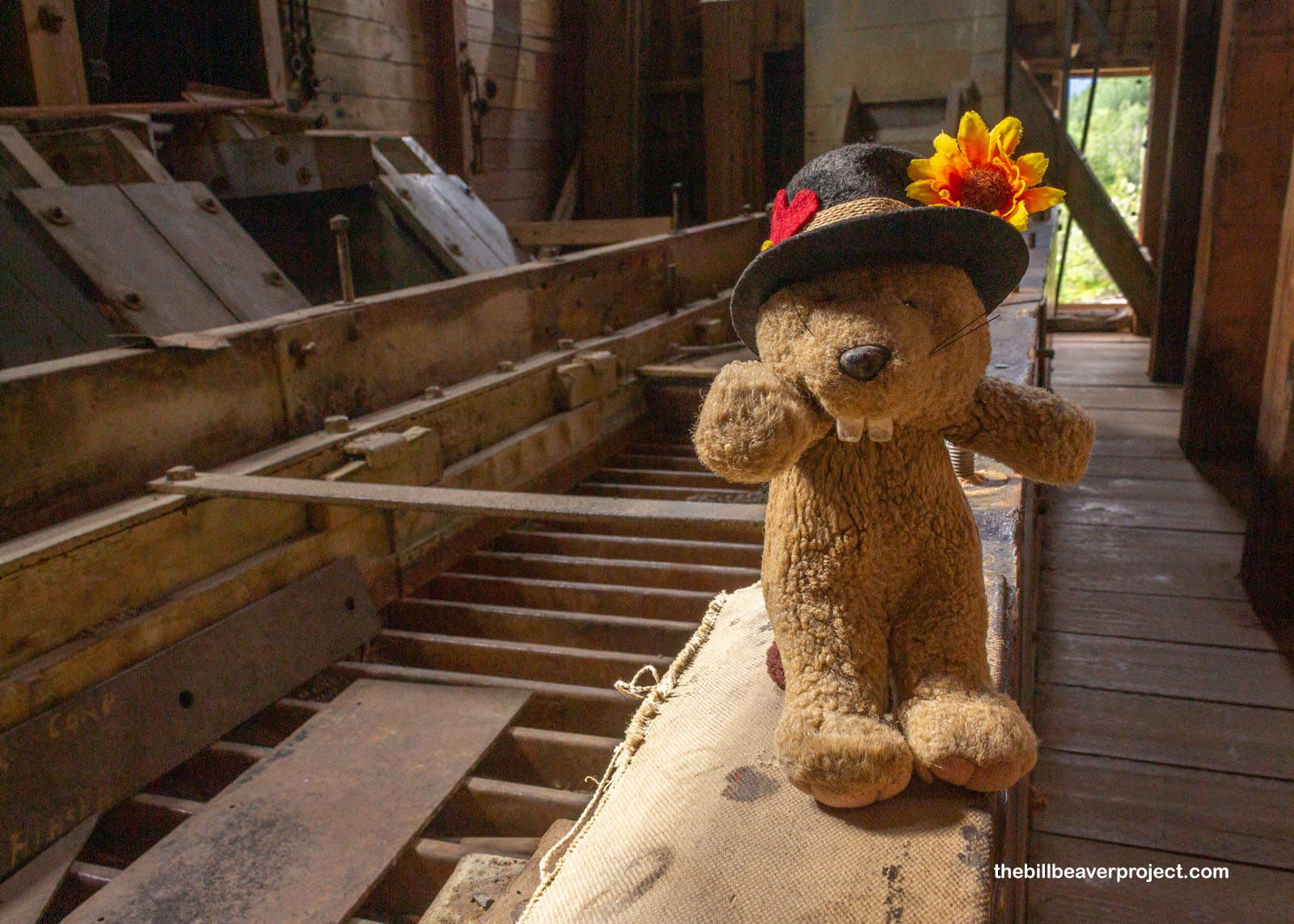
But you can’t enter Kennecott without observing the tallest wooden building in the USA: the 14-story concentration mill at its center! Built over the course of 20 years under the supervision of different folks and with different techniques, this ramshackle-looking edifice was nonetheless created to wield the power of gravity and squeeze the maximum amount of copper out of Wrangell Mountain ore!
 |
 |
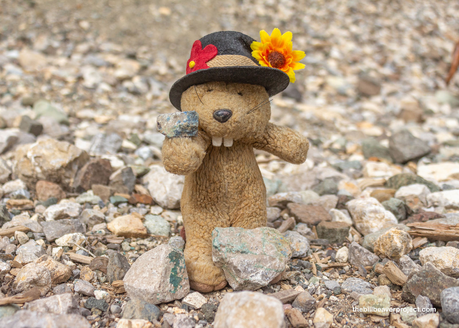
While I thought for sure we were going to enter the mill from the bottom and ride a lift to the top, that was not the case! Instead, just past the creek, we hooked right onto a trail leading up behind the mill. This gave us a good first look at the traces of green malachite and blue azurite on some of the tailings. When you spot either of these carbonate minerals on the ground, it’s a good indicator that you’re in copper country!
 |
 |
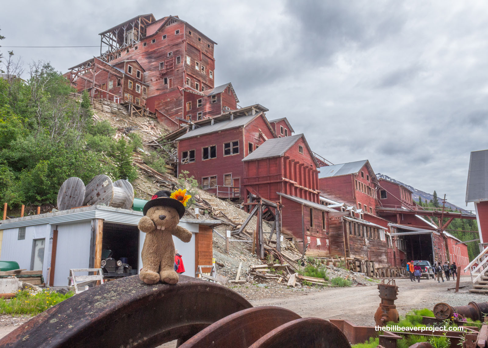
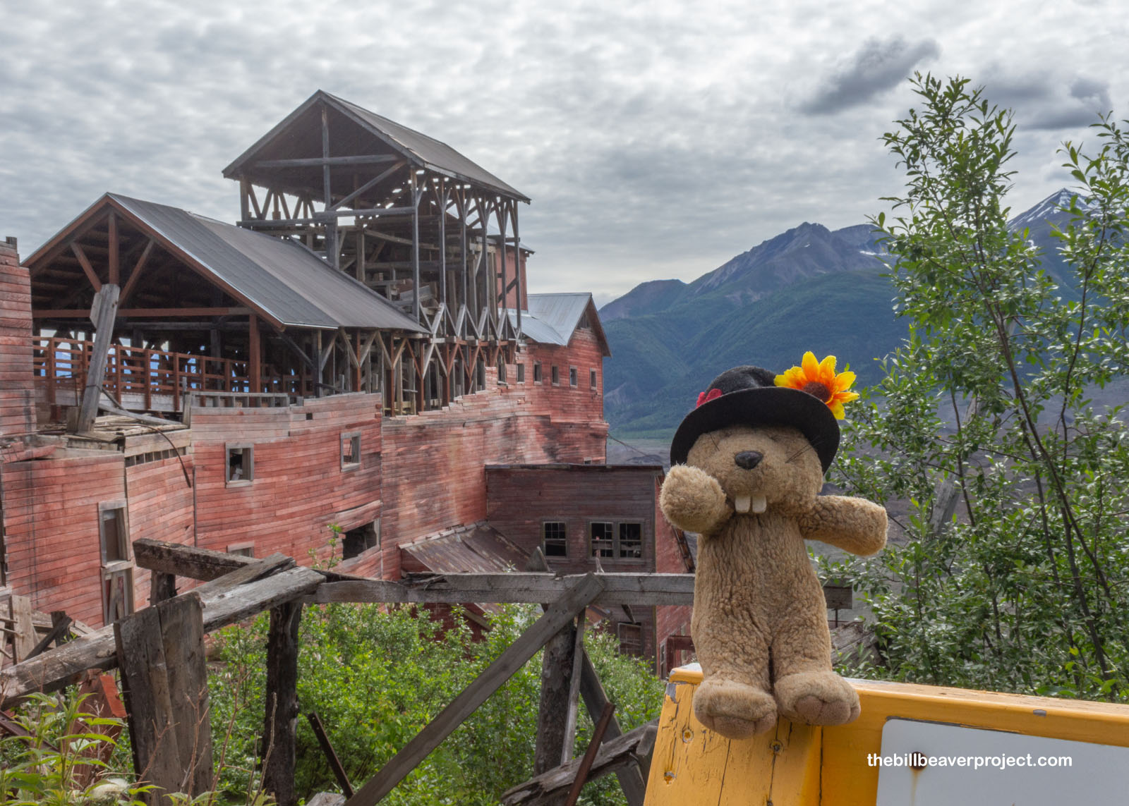
At last, we reached the top of the mill with its stunning views of the surrounding mountains! I won’t lie, it made me a little nervous to behold, especially on the left side of the entrance where the entire floor appeared to be gone! Maintaining a building this huge is a monumental effort, but Edward assured us that the parts that counted were very well reinforced with the most modern of techniques!
 |
 |
One of those techniques was a very important sign—Warning! Unstable Explosives! Extreme Danger! KEEP AWAY!—and a full list of the hazardous heavy metals still found inside these buildings! With good ventilation, there was little risk of breathing in too much bad stuff, but washing hands after the tour was non-negotiable! It really made everyone annoyed that all those medical records had been lost to history!
 |
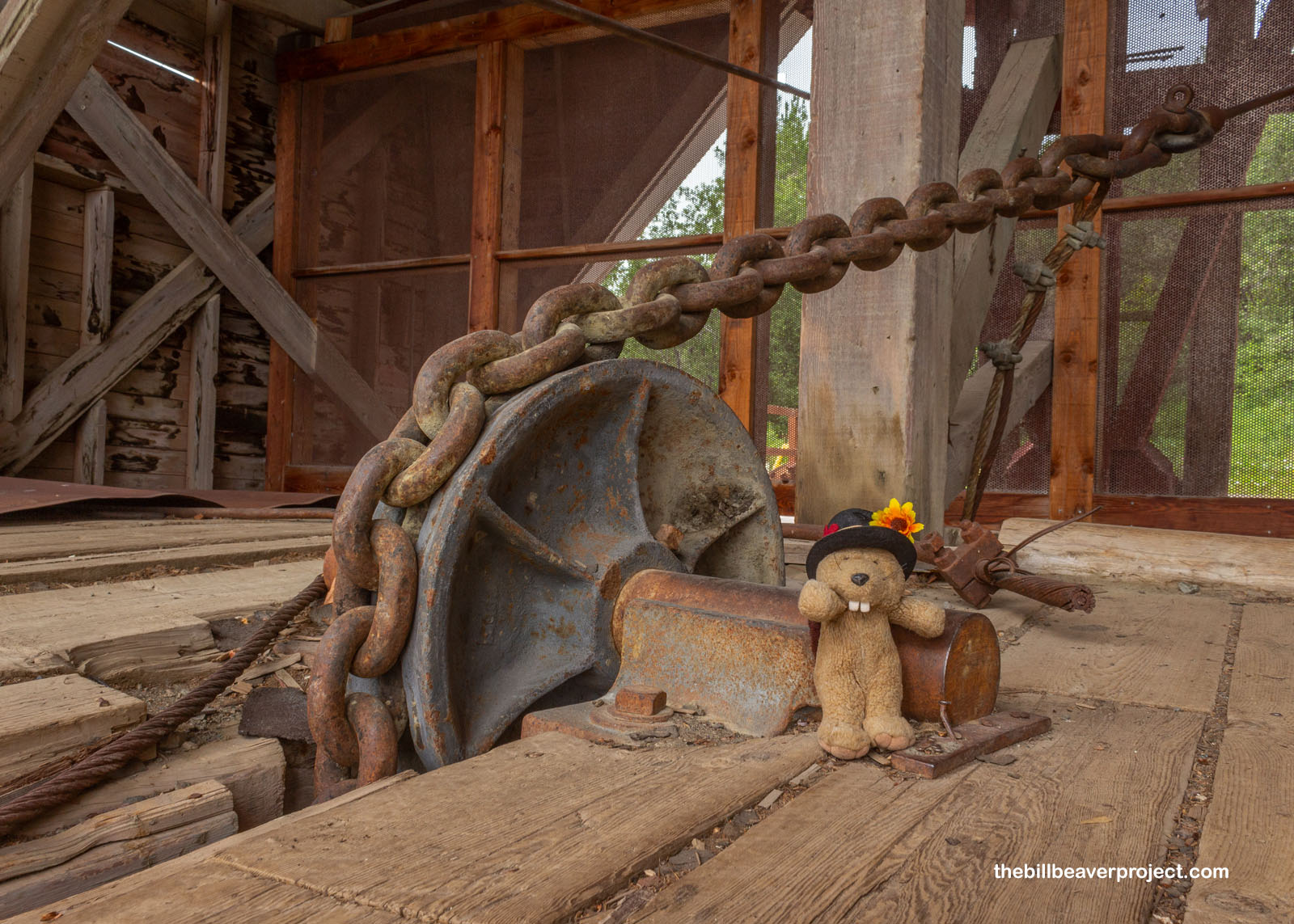
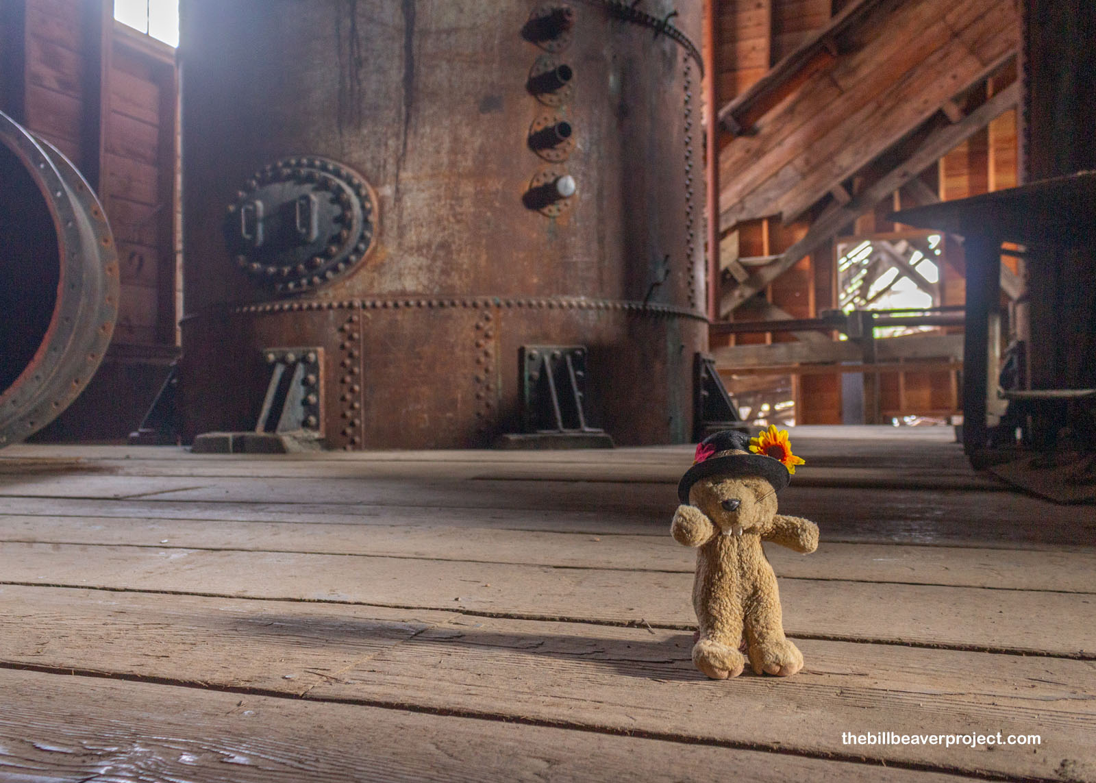
Where we were entering was called the tramway terminus, and just inside the metal fence was a huge chain on a pulley system. This was part of the mill’s incredible aerial tramway leading to its high-mountain mines! The first was completed in 1909 and ran three miles up to the Bonanza Mine, circulating 300-pound ore buckets—and certain adventurous miners—between the mine and the mill every day! The second, to the Jumbo Mine, was completed in 1914, and between the two of them, they doubled the mill’s production from 81,000 tons of ore per year to 180,000 tons by 1915!
 |
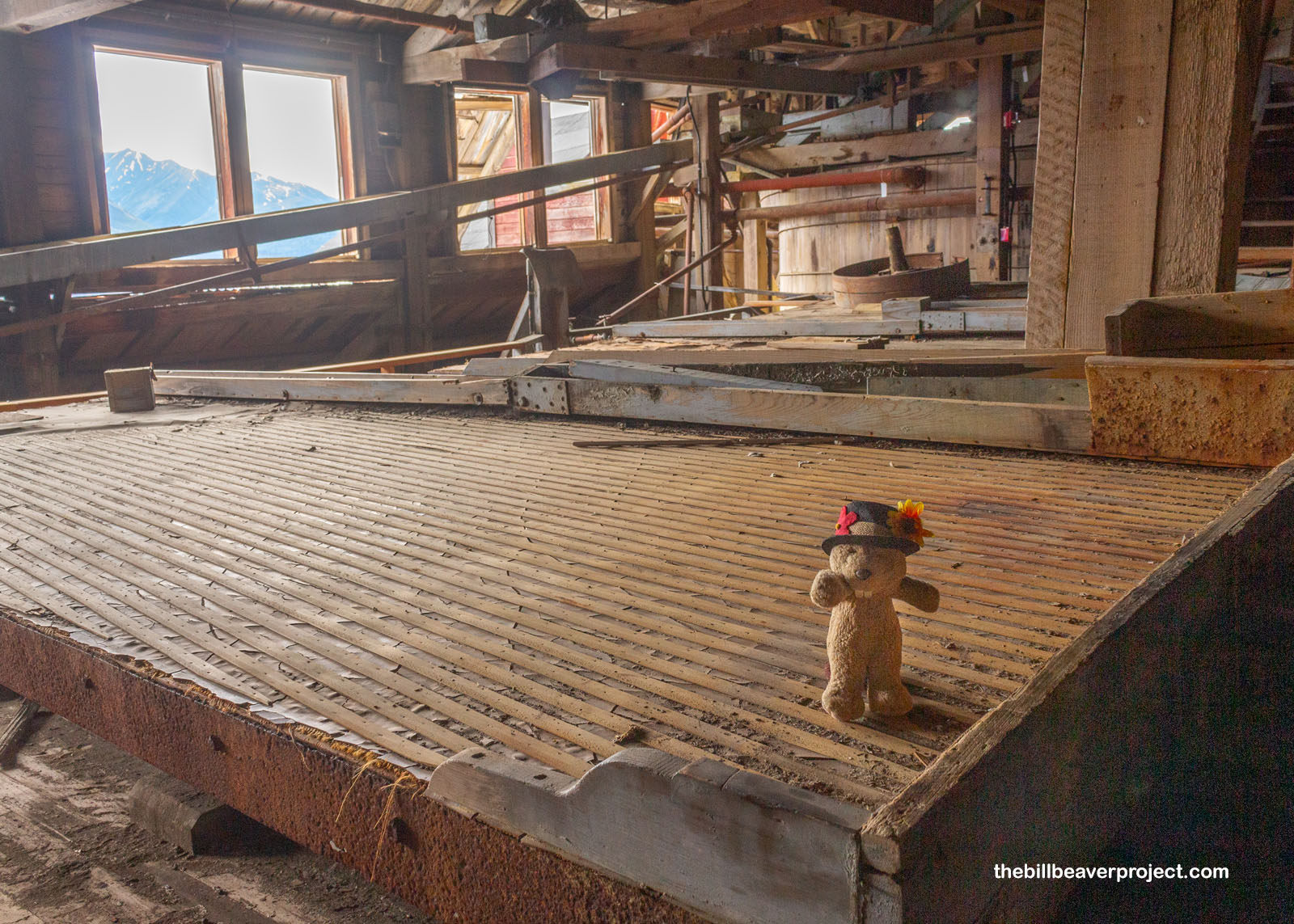
So, because this mill was so far from anywhere that could make use of copper, the folks at Kennecott had to extract every possible ounce of metal from the ore. Starting at the top of the mill, “grizzly men,” pounded the rocks with hammers until they could fit through a grate and fell down to the next level. Famously, said Edward, 15-year old George Sullivan worked here as a grizzly man, nearly getting himself killed at Kennecott but instead going on to serve as 26th mayor of Anchorage!
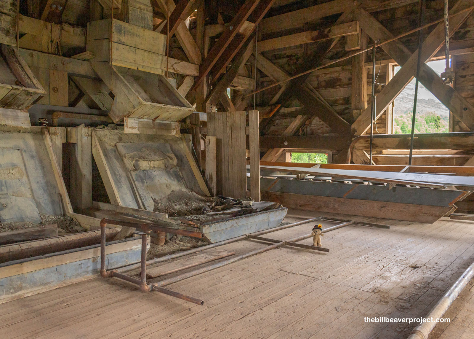 |
With each passing story of the mill, the rocks got smaller and smaller, kept in a cold, wet slurry to pass through each stage more easily and to clean the bigger rocks faster. And this was no easy place to work! Only 27 workers at a time operated the mill, which was kept at a steady 33˚F to cut costs. It was also incredible loud and vibrated so intensely that at least one worker had to be on standby with a 150-pound wrench and periodically twist the giant turnbuckle that held the whole mill together! Surprisingly—or not—it was the rise of labor standards that ultimately brought this massive operation to its end!
 |
 |
After being pounded and cracked and swished and washed, the boulders of ore reached the bottom of the mill as marble-sized pebbles, but they weren’t ready for shipping just yet! The Kennecott Company was very invested in new technology, and so across the road from the mill, they set up an ammonia leaching plant to get just a little more copper out of the ore. While high grade ore could be pretty well shipped to the smelter as-is, low-grade ore (25-30% of all of it) was dumped into huge vats of ammonia, which dissolved the copper out of the rock, then evaporated and condensed for reuse! Even then, the process wasn’t done, because then the flour grains of silt would be floated in eucalyptus oil, and the copper foam could be skimmed off the top. That meant that the Kennecott operation was able to extract an astonishing 98% of available copper from the ore!
 |
Once they’d nitpicked all the copper they could, workers loaded the copper onto a train, bound via the 196-mile long Copper River & Northwestern Railway to Cordova, and then on to Tacoma for final processing. By the time the operation closed in 1938, it had generated $300 million (almost $7 billion by 2025 standards) in copper and silver! And then the jig was up! The mine was shuttered, and all miners, even as far as the remote Erie Mine, had an hour and a half to drop what they were doing and get to the one train out of Kennecott. Breakfasts were left on the table, documents were left in place, and in practically the blink of an eye, this massive copper operation went silent!
 |
Around 5:00, the tour wrapped up, and we, too, left Kennecott to history. Thanking—and tipping—Edward for his hard work, I returned to McCarthy to relax at the end of a long day of exploring. Ever a happening place in the summertime, this little community was hosting an open mic night at the Golden Saloon, and that was there I parked my keester a while, listening to some tunes as local dogs wandered about inside and out, and folks still found ways to have themselves a good time in this remote region of Alaska! Tomorrow, I’ll journey beyond the mill to one of its more remote mines. I’ll share more about that in my next blog!
Copper-tunity’s knocking!

Previous Day |
Total Ground Covered: 356.1 mi (574.7 km) |
Next Day |