
 |
| Landmark #826 | Inyo County | Visited: January 2, 2012 | Plaque? YES! 🙂 |
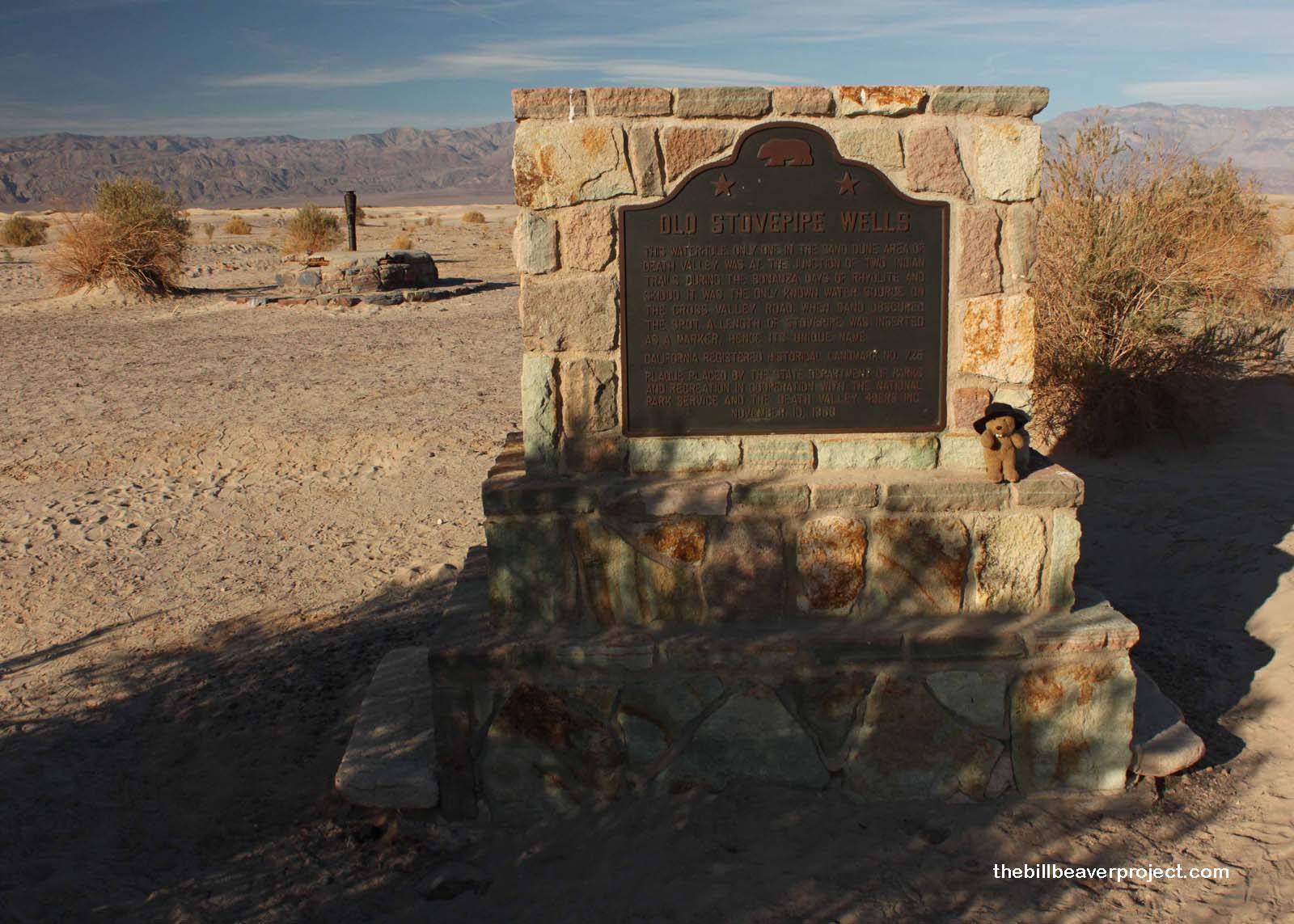
| What is it? | A plaque and stovepipe marking an important water source from the Death Valley mining days! |
| What makes it historical? | THE GUIDE SAYS: This waterhole, the only one in the sand dune area of Death Valley, was at the junction of the two Indian trails. During the bonanza days of Rhyolite and Skidoo, it was the only known water source on the cross-valley road. When sand obscured the spot, a length of stovepipe was inserted as a marker.
OTHER TIDBITS: That pretty well sums it up! |
| How can I Help the Helpers? | HERE’S HOW:
|
| Where is this place? | LISTED DIRECTIONS: Death Valley National Monument From State Hwy 190 (P.M. 92.1) go N 2.8 mi on (unpaved) Sand Dunes Access Rd 6.1 mi E of Stovepipe Wells, CA 92328 ANNOTATIONS: From Los Angeles: ~272mi (438km) — 4.6hrs |
| When should I go? | Whenever the mood strikes you! |