 |
| Landmark #PL0050.13 | Platte County | Visited: June 10, 2017 | Plaque? YES! 🙂 |
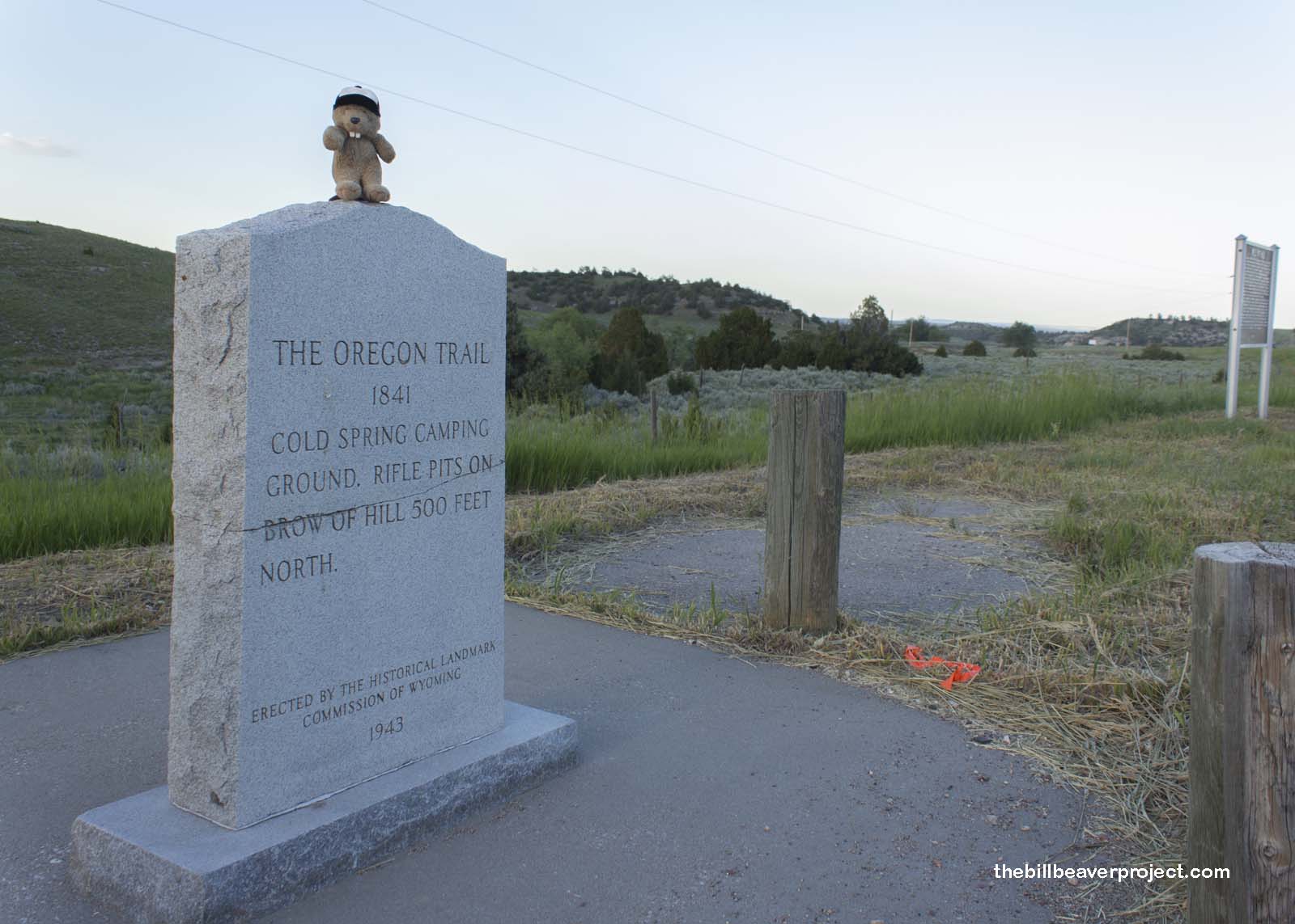
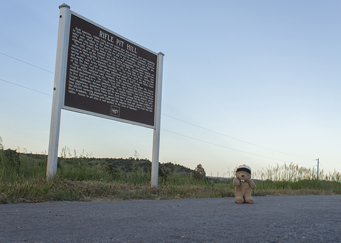
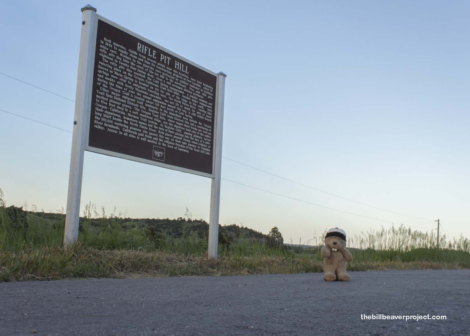
| What is it? | A sign and a stone monument by the side of the road! |
| What makes it historical? | THE SIGN SAYS: Rock quarries, visible from several points near this location, were used beginning in 1849 to supply stone and lime for construction projects at Fort Laramie, about 15 miles east. Workers in the quarries were protected by soldiers stationed in fortified rifle pits dug into the crest of the low hill to the northeast. Five such rifle pits, eighteen to twenty four inches deep, form a well arranged defense perimeter.
The rifle pits also overlook the Cold Springs campground, a popular camping and watering place on the Oregon-California Trail (1841-1868). Another major campground, known as Warm Spring is located on the far side of the ridge to the south. Such springs were vital to emigrants traveling west. The North Platte River, running high and muddy with Rocky Mountain snowmelt, was not fit to drink for man or beast during the time of year the annual emigration passed this way. A still visible branch of the Oregon Trail is located about 500 feet north of Cold Spring. Other major emigrant trail landmarks in the immediate area include the Oregon Trail Ruts National Historic Site, Register Cliff State Historic Site and a scattering of marked pioneer graves. The Oregon Trail Ruts, where wagon wheel tracks are worn up to five feet deep in a soft sandstone ridge, are the signature trail ruts of the entire Oregon-California-Mormon Trail system. At Register Cliff, passing pioneers carved their signatures, hometown names and the date of their passage into the face of a mile-long bluff beside the North Platte River. Both places present strong visual evidence of the 500,000 westering pioneers who passed this way on their epic journey to Columbia River farmlands, California gold fields and the religious freedom of the Great Salt Lake valley. Access to all sites is well marked in the town of Guernsey. OTHER TIDBITS: That pretty well sums it up! |
| How can I Help the Helpers? | HERE’S HOW:
|
| How do I find it? | Listed Directions: North side of US-26, 0.2 miles east of Wendover Road Hartville, WY 82215 Annotations: From Casper: ~108mi (174km) — 1.8hrs |
| When should I go? | Whenever the mood strikes you! |