 |
| Landmark #919 | Los Angeles County | Visited: July 4, 2011 | Plaque? YES! 🙂 |
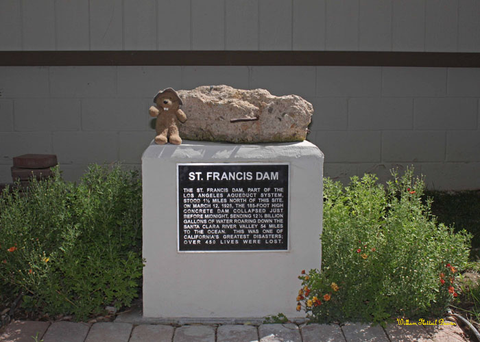
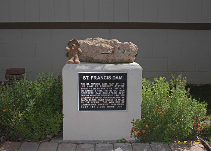
| What is it? | A plaque marking the site of the St. Francis Dam, a dark spot in the otherwise amazing career of William Mulholland! |
| What makes it historical? | THE GUIDE SAYS: The 185-foot concrete St. Francis Dam, part of the Los Angeles aqueduct system, stood a mile and a half north of this spot. On March 12, 1928, just before midnight, it collapsed and sent over twelve billion gallons of water roaring down the valley of the Santa Clara River. Over 450 lives were lost in this, one of California’s greatest disasters.
OTHER TIDBITS: To give a better idea of the size of this tidal wave, it roared all the way from Saugus to Ventura, destroying 1200 homes and countless livestock and orchards in addition to the 450 people killed! Considering this took place in the middle of the night, this would have been absolutely terrifying! I’ll take an earthquake any day! Update: Eight years after I visited, this became the Saint Francis Dam Disaster National Memorial! |
| How can I Help the Helpers? | HERE’S HOW:
|
| Where is this place? | LISTED DIRECTIONS: San Francisquito Power Plant No. 2 32300 N San Francisquito Canyon Rd 9.2 mi N of Saugus ANNOTATIONS: From Los Angeles: ~46mi (75km) — 0.8hrs |
| When should I go? | Whenever the mood strikes you! |
Landmark #919 is 500 feet north of the plaque in the photo.
Landmark #919 is 500 feet north of the plaque in the photo. Both have a piece of concrete from the dam.