 |
| Landmark #673 | San Diego County | Visited: December 15, 2013 | Plaque? YES! 🙂 |
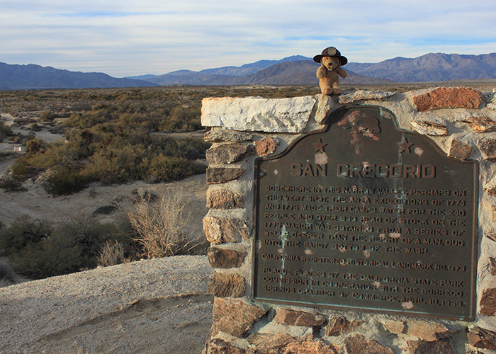
| What is it? | A plaque marking the site of one of Juan Bautista de Anza’s campsites! |
| What makes it historical? | THE GUIDE SAYS: Somewhere in this narrow valley, perhaps on this very spot, the Anza Expeditions of 1774 and 1775 made their camps. Water for the 240 people and over 800 head of stock on the 1775 march was obtained from a series of wells, deeper than the height of a man, dug into the sandy bottom of the wash.
OTHER TIDBITS: That pretty well sums it up! |
| How can I Help the Helpers? | HERE’S HOW:
|
| Where is this place? | LISTED DIRECTIONS: Borrego Sink 3 mi SE of Palm Canyon and Peg Leg Rds Anza -Borrego Desert State Park (Ask at Visitor Center) ANNOTATIONS: From Los Angeles: ~169mi (272km) — 2.9hrs |
| When should I go? | Whenever the mood strikes you! |