 |
| Landmark #428 | Lake County | Visited: July 13, 2014 | Plaque? NO. 🙁 |
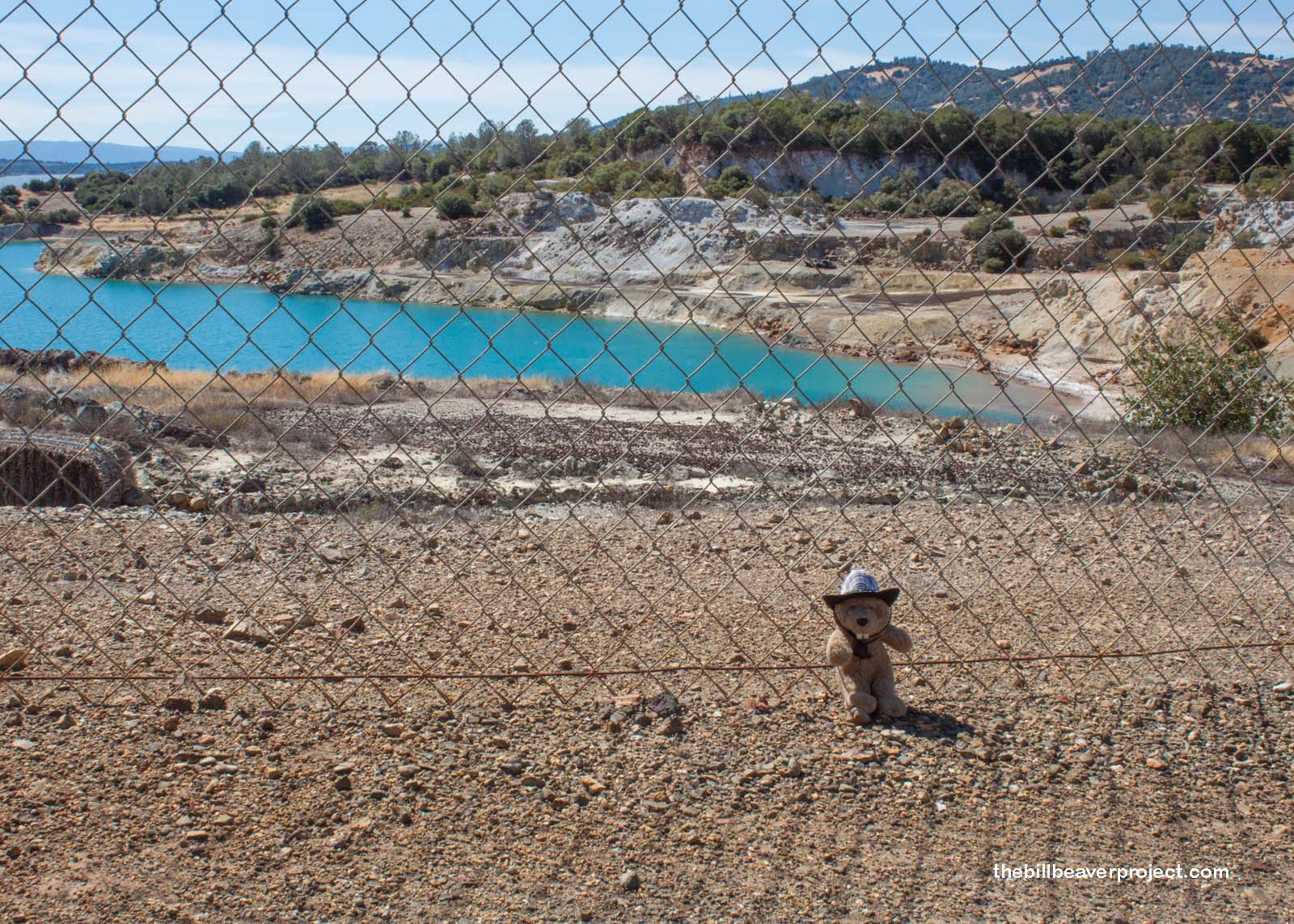
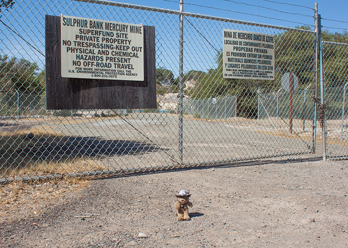
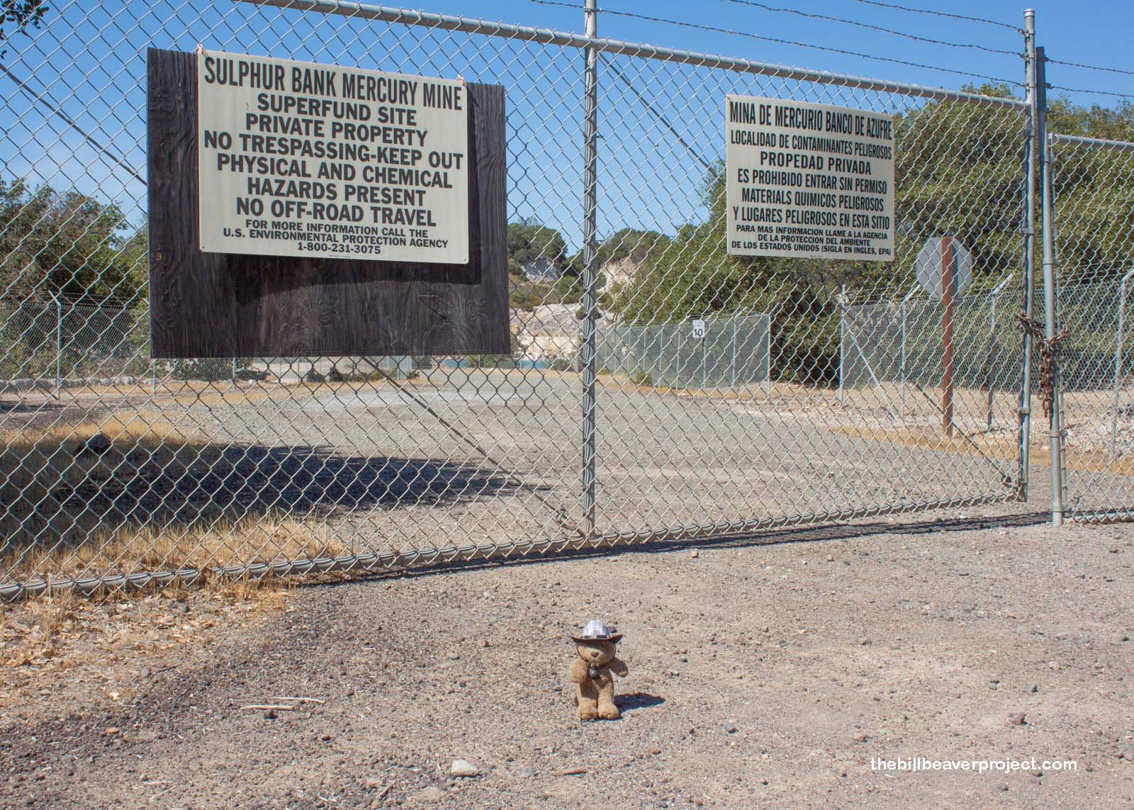
| What is it? | Formerly California’s largest mercury mine, now out of operation! |
| What makes it historical? | THE GUIDE SAYS: This sulphur mine also became one of the most noted quicksilver producers in world. First worked for sulphur in 1865, in four years it produced a total of 2,000,000 pounds – reopened and developed for quicksilver in 1873, it is credited with total output of 92,400 flasks, and was an important producer in World Wars I and II.
OTHER TIDBITS: Even though the mine ceased operations in 1957, it has left behind deadly residue! Since it is located on the shore of Clear Lake, California’s largest freshwater lake, the mercury and arsenic from the mine’s operations have infiltrated the entire ecosystem, meaning both the fish and drinking water have varying traces of mercury in them! Now, it is one of the EPA’s superfund sites, and the Agency has put a lot of work into cleaning up the area! Levels are much lower now, but the site is an excellent cautionary tale about irresponsible mining! |
| How can I Help the Helpers? | HERE’S HOW:
|
| Where is this place? | LISTED DIRECTIONS: Intersection of State Hwy 20 (P.M. 29.5) and Sulphur Bank Rd 1.5 mi S of Clearlake Oaks, CA 95423 ANNOTATIONS: From Los Angeles: ~482mi (776km) — 8.1hrs |
| When should I go? | Whenever the mood strikes you! |