 |
| Landmark #281 | Calaveras County | Visited: June 27, 2015 | Plaque? YES! 🙂 |
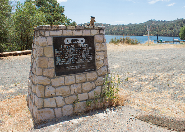
| What is it? | A stone marker describing the O’Byrne Ferry! |
| What makes it historical? | THE GUIDE SAYS: In 1852, a chain cable bridge replaced the ferries that once crossed here, to be supplanted in its turn by a covered truss structure in 1862. Some writers claimed this was the locale of Bret Harte’s Poker Flat. In late ’49 there was a large camp here, with miners washing gold out on both banks of the Stanislaus River.
OTHER TIDBITS: Patrick O’Byrne’s bridge had a hard time staying above water! After being weakened by heavy rains, it collapsed under the weight of an ox team and was later washed away by the flood of 1862! It was an important route between Stockton and Sonora, so it was rebuilt, but in the 1950s, the Tri-Dam Project created the Tulloch Reservoir, which drowned the bridge for the last time! |
| How can I Help the Helpers? | HERE’S HOW:
|
| Where is this place? | LISTED DIRECTIONS: On County Hwy 48 (P.M. 0.3) O’Byrne Ferry Rd 7.1 mi SE of Copperopolis, CA 95228 ANNOTATIONS: From Los Angeles: ~331mi (533km) — 5.6hrs |
| When should I go? | Whenever the mood strikes you! |