 |
| Not numbered. | Philadelphia County | Visited: December 21, 2017 | Plaque? YES! 🙂 |
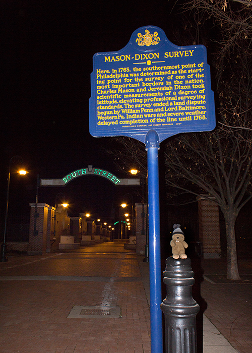
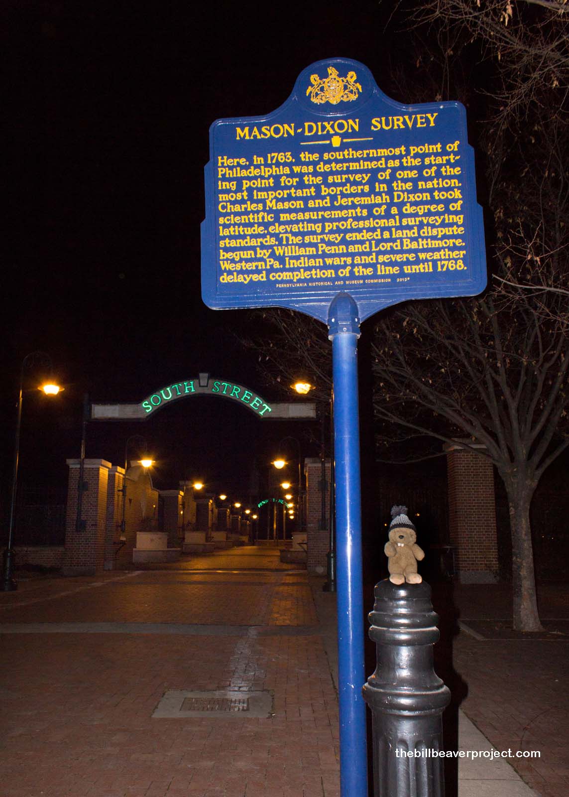
| What is it? | A blue and yellow plaque at the end of Philadelphia’s South Street! |
| What makes it historical? | THE PLAQUE SAYS: Here, in 1763, the southernmost point of Philadelphia was determined as the starting point for the survey of one of the most important borders in the nation. Charles Mason and Jeremiah Dixon took scientific measurements of a degree of latitude, elevating professional surveying standards. The survey ended a land dispute begun by William Penn and Lord Baltimore. Western Pa. Indian wars and severe weather delayed completion of the line until 1768.
OTHER TIDBITS: The Penn-Calvert conflict was a conflict between two stages of English colonization. First, in 1632, George Calvert, the first Lord Baltimore, received land from the Atlantic west to the headwaters of the Potomac, and from the Virginia boundary north to the 40th parallel. That land grant came to be known as Maryland! 49 years later, as thanks for his service in the wars to capture the Dutch colonies here, Charles II gave William Penn, Jr. a swath of land between the 40th and 43rd parallels, and five degrees west of the Delaware River. This came to be known as Pennsylvania! The start of the conflict between the two landowning families came about when Mr. Penn leased the “three lower counties of Pennsylvania” that became Delaware, and which shared the Delmarva Peninsula with Maryland. They disagreed on how exactly to measure that boundary and eventually had the lines drawn by the Commission for Trade and Plantations. Now that they had figured out the north-south boundary they still had to determine the east-west one. Unfortunately, that’s about when William of Orange took over the English throne, and both the Penns and Calverts had their land holdings suspended! Once both families had returned to their respective colonies, they resumed their border explorations while farmers occasionally attacked each other along the fuzzy boundaries! To figure this out, royal astronomer, James Bradley hired Charles Mason and Jeremiah Dixon to finalize these lines. They arrived at the tail end of the French and Indian Wars when conflicts still abounded and set to work with telescopes and quadrants. Starting with a house at South Street and Second Street in Philadelphia, they spent the next five years finalizing the boundaries between Pennsylvania and Maryland! More than just a territorial frontier, their Mason-Dixon Line would go on to delineate freedom and slavery following the Missouri Compromise of 1820! It was the most critical line to cross for slaves traveling on the Underground Railroad, and even after the Civil War, it was a de facto line between states that supported segregation and those that did not! |
| How can I Help the Helpers? | HERE’S HOW:
|
| How do I find it? | Listed Directions: South St & S Front St Philadelphia, PA 19147 Annotations: From Harrisburg: ~110mi (178km) — 1.9hrs |
| When should I go? | Whenever the mood strikes you! |