 Previous Day |
Jackson, MS → Arkansas Post NM → Monroe, LA 397.0 mi (638.9 km) |
 Next Day |
Raindrops keep fallin’ on my head, everyone!
There’s a real Southern frog strangler brewing, but no storm is going to stand in the way of today’s adventure! There are three parks to see along the Mississippi Delta, and a few extra stops along the way, so let’s get going!
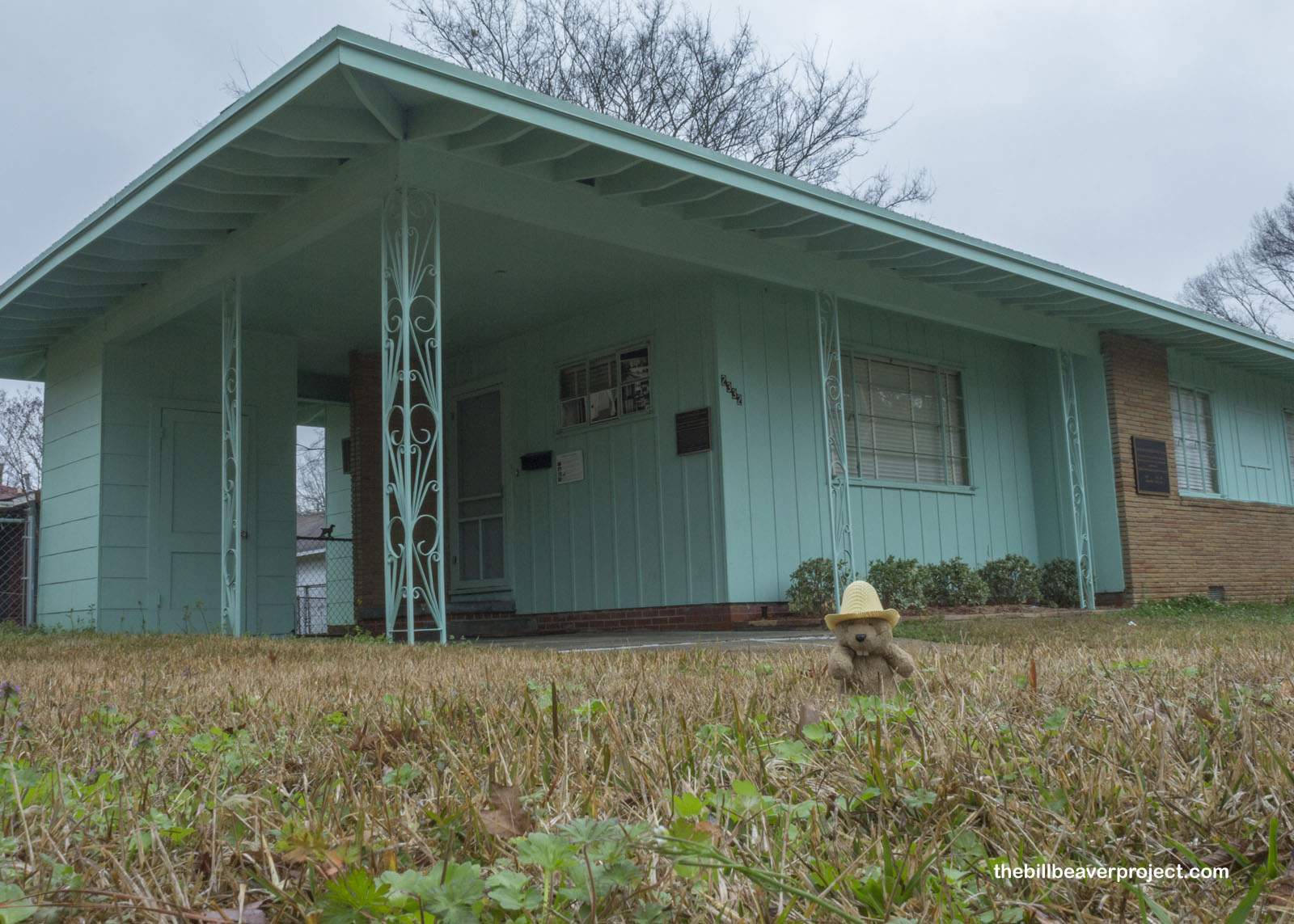
Right in the heart of Jackson is a national monument waiting to be born, pending the passing of Senate Bill 70. Now it’s known as the Medgar Evers Home, but soon, it will be known as Medgar and Myrlie Evers Home National Monument!
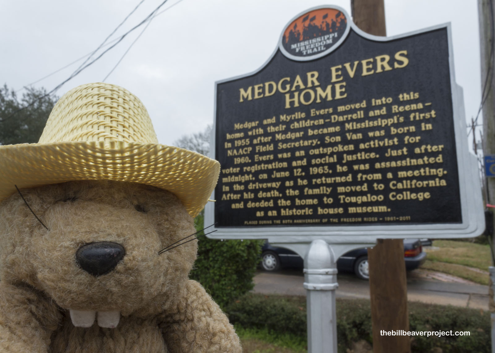 |
Mr. Evers’ fate was deeply entwined in the push for civil rights. Originally an insurance salesman, he was so inspired by the ruling on Brown vs. Board of Education in 1954 that he quit insurance and applied to the University of Mississippi to practice law. When they denied him because of his race, he fought to end their discriminatory practices, and though he did not succeed, his efforts earned the attention of the NAACP, who appointed him their first field secretary in the state of Mississippi!
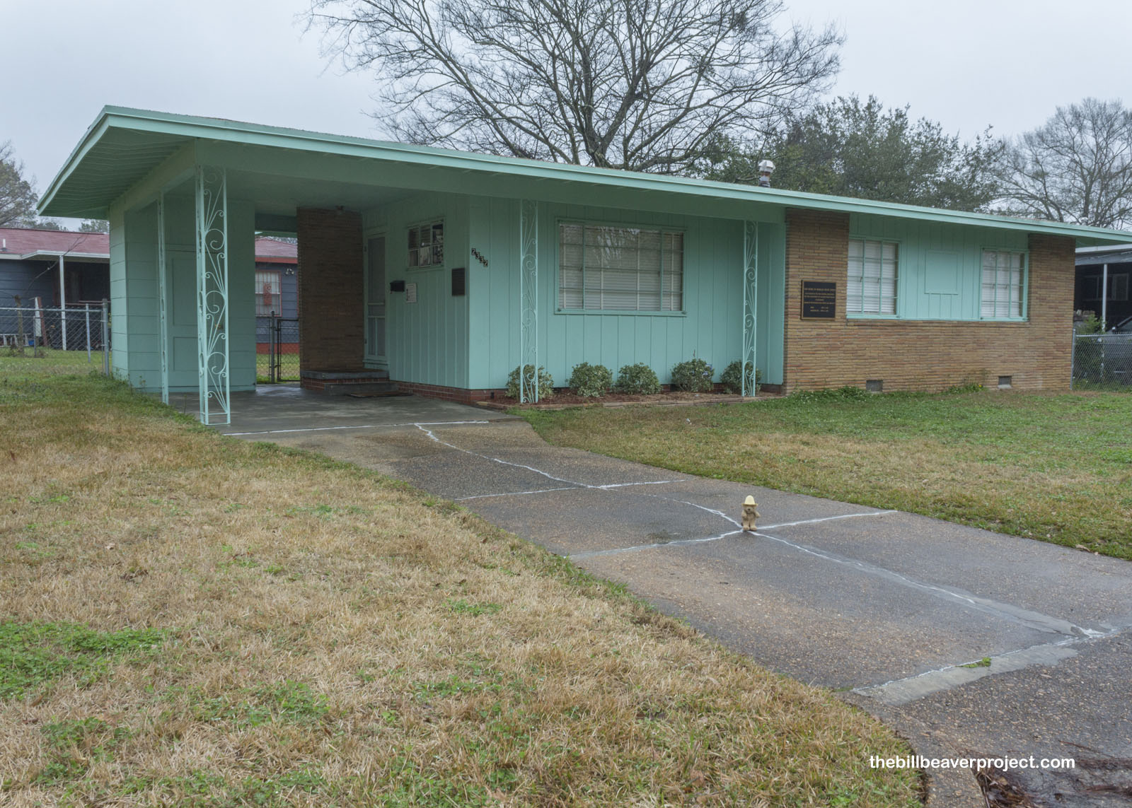 |
As field secretary, his job was to promote voter registration, organize boycotts of discriminatory businesses, and investigate what would later be called hate crimes, like the murder of 14-year old Emmett Till. Sadly, his tireless work earned him many enemies, like Byron de la Beckwith, who shot Mr. Evers in the back in this carport in 1963. Today, the Evers home still stands as a reminder of not only his hard work, but also the work that remains to be done!
 |
The museum was not open when I visited, so I moved on down the road to take a look at the city of Clinton, home town of the Perritt family, who gave me a neat travel stone yesterday at Vicksburg. They said I’d really like their home town, and when I get a local’s recommendation, it’s a good idea to pay attention!
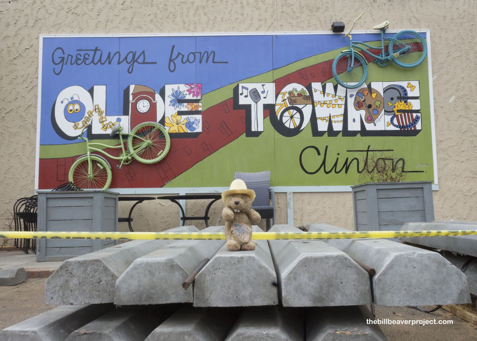 |
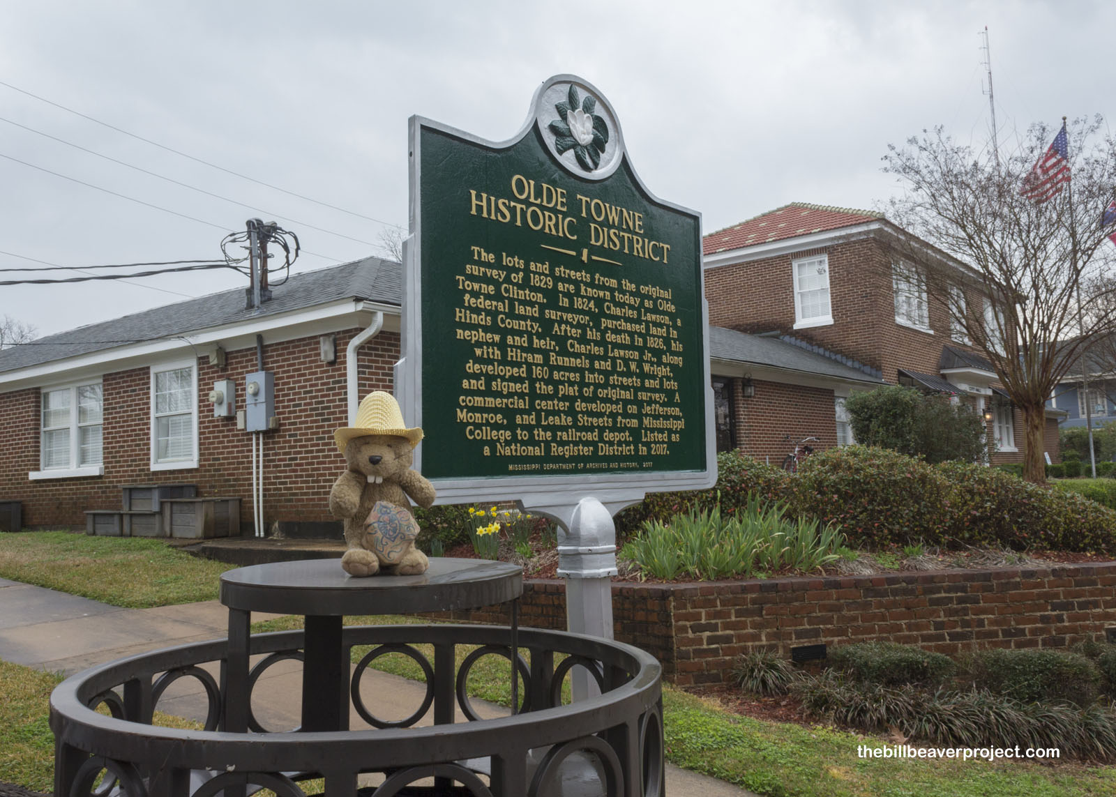
It turns out that Olde Towne Clinton is a National Historic District! Founded as Mt. Salus in 1805, this city was well known among travelers for its many healing springs, and it became a major cotton producing center with one of the largest cotton gins of the era! In fact, it was so successful that it submitted a bid to become the capital of Mississippi in 1828, becoming the City of Clinton along the way!
 |
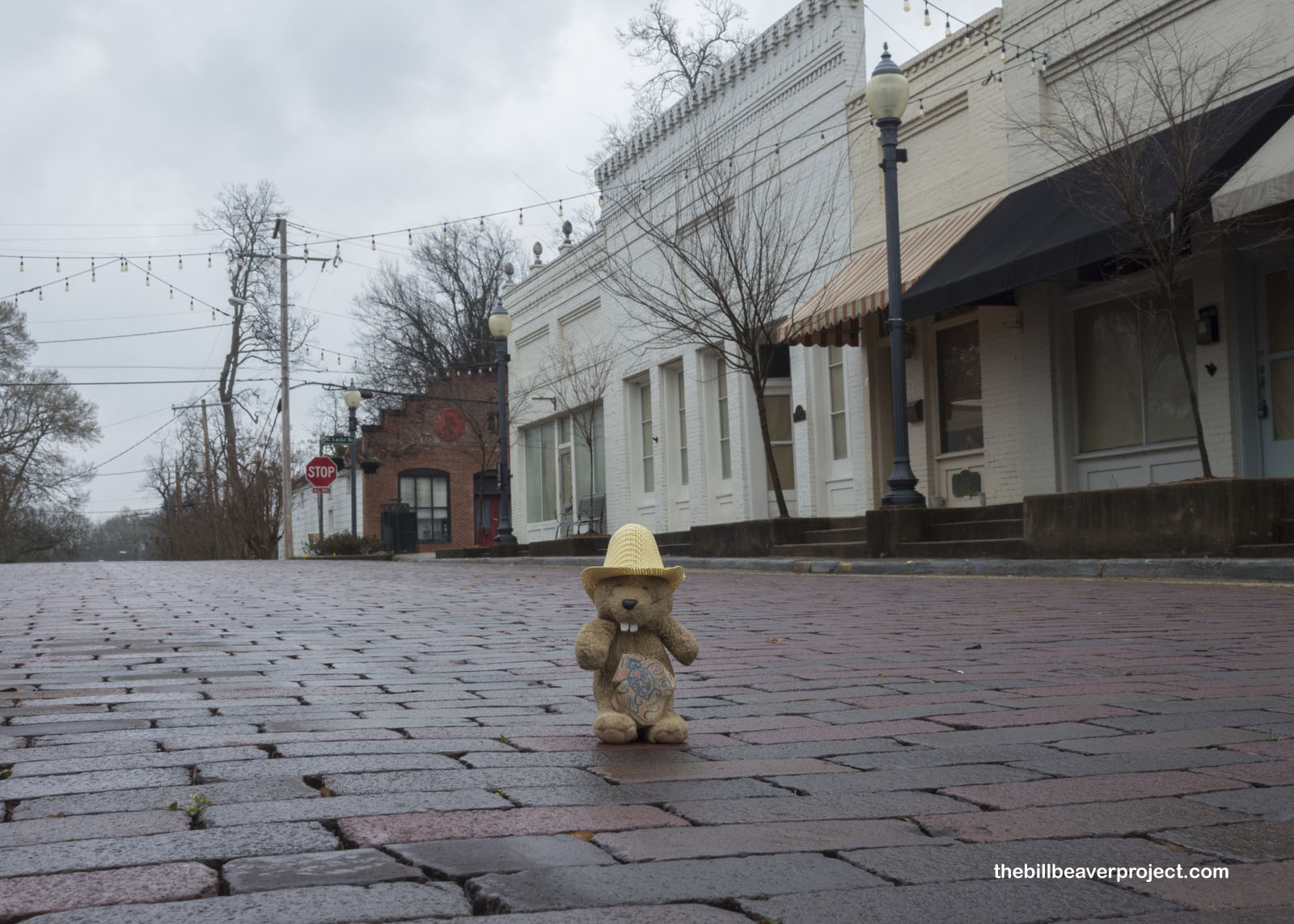 |
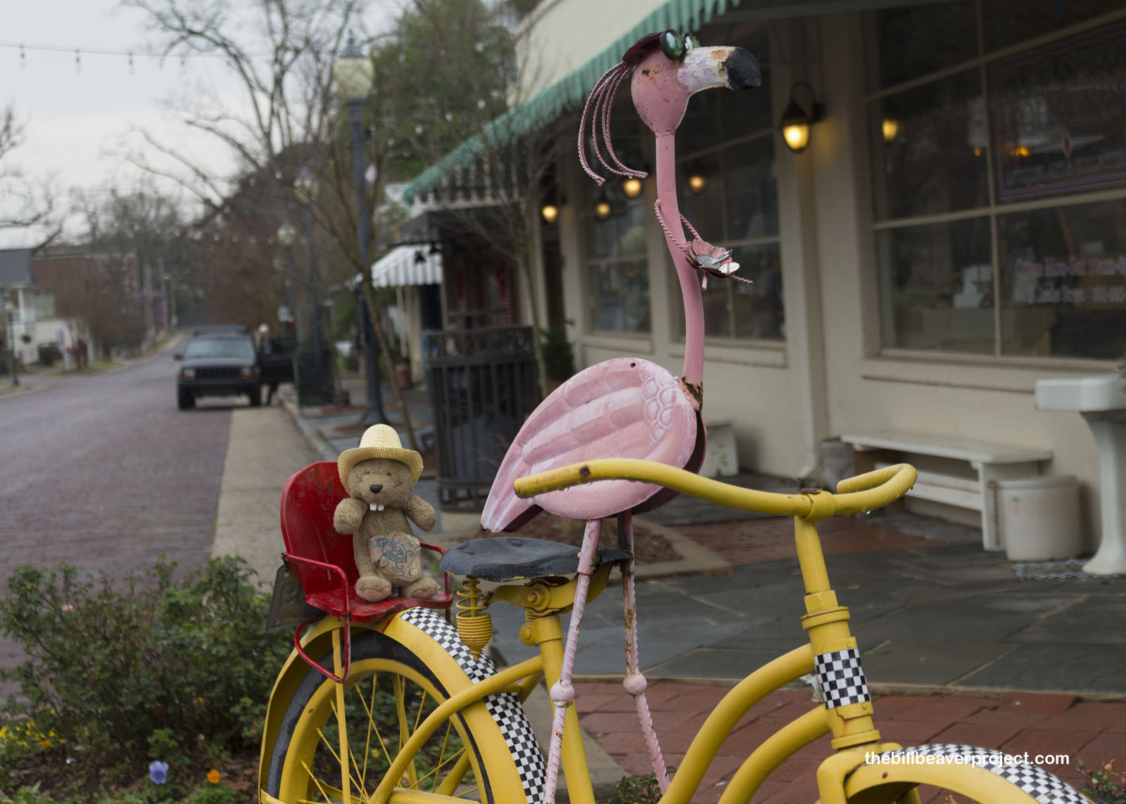
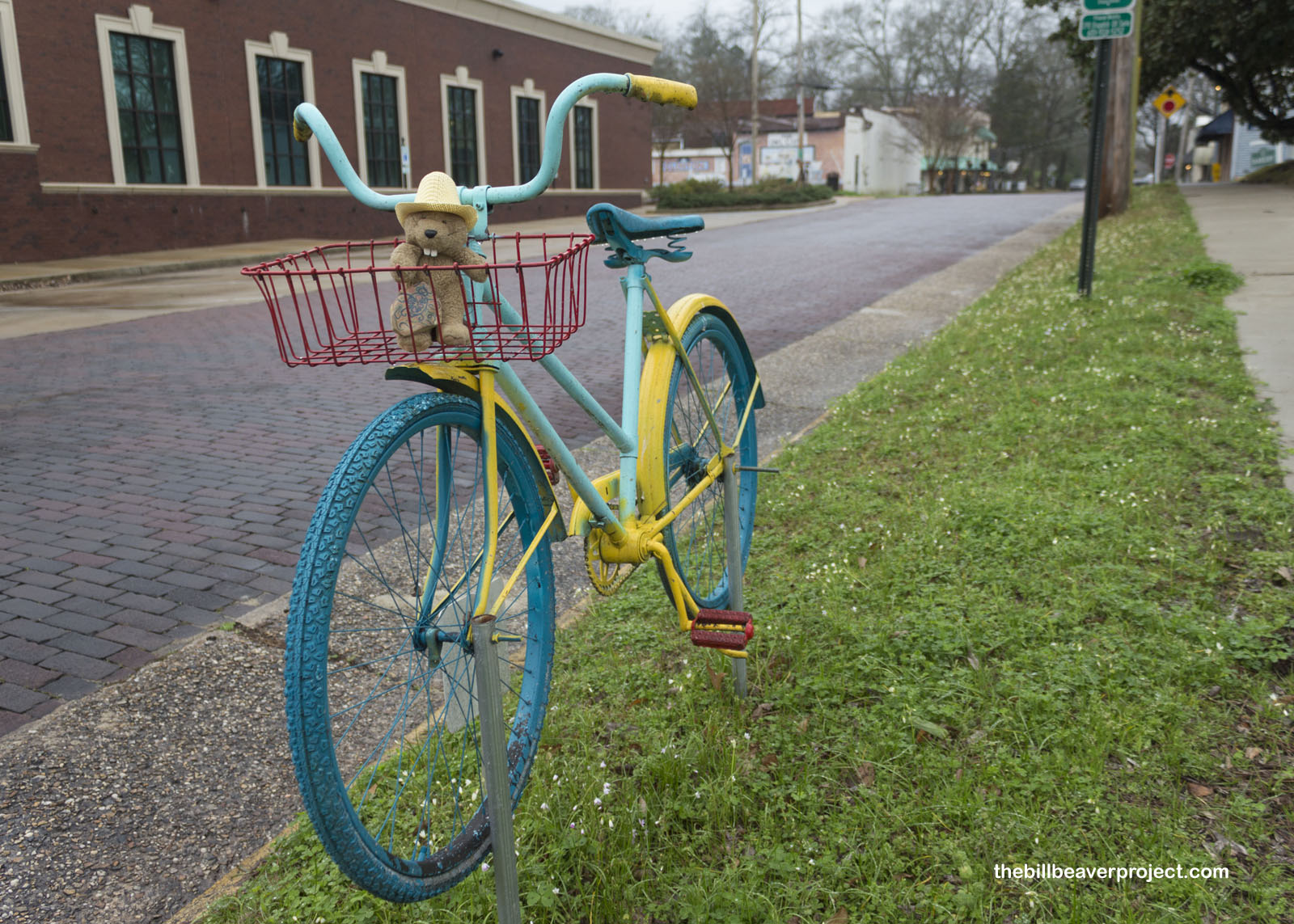
Today, with brick roads installed in 1929, Clinton has lots to say about its history from the 1875 assassination of State Senator, Charles Caldwell, at the Chilton Store, to Charles Lindberg’s 1925 stopover at the Lewis Livery Stable. Today, though, its Olde Town district is super charming with shops and cafes and the colorful creations of the Bike Art Project, a beautiful reminder that history is always moving forward!
 |
 |
Speaking of moving forward, the day was getting on, and the clouds were starting to open up! I had a long drive ahead, and sure enough, as I crossed the Mississippi into Louisiana, the rain started to hammer on the windshield. I could tell that my next stop, Poverty Point National Monument and World Heritage Site, was going to be soggy!
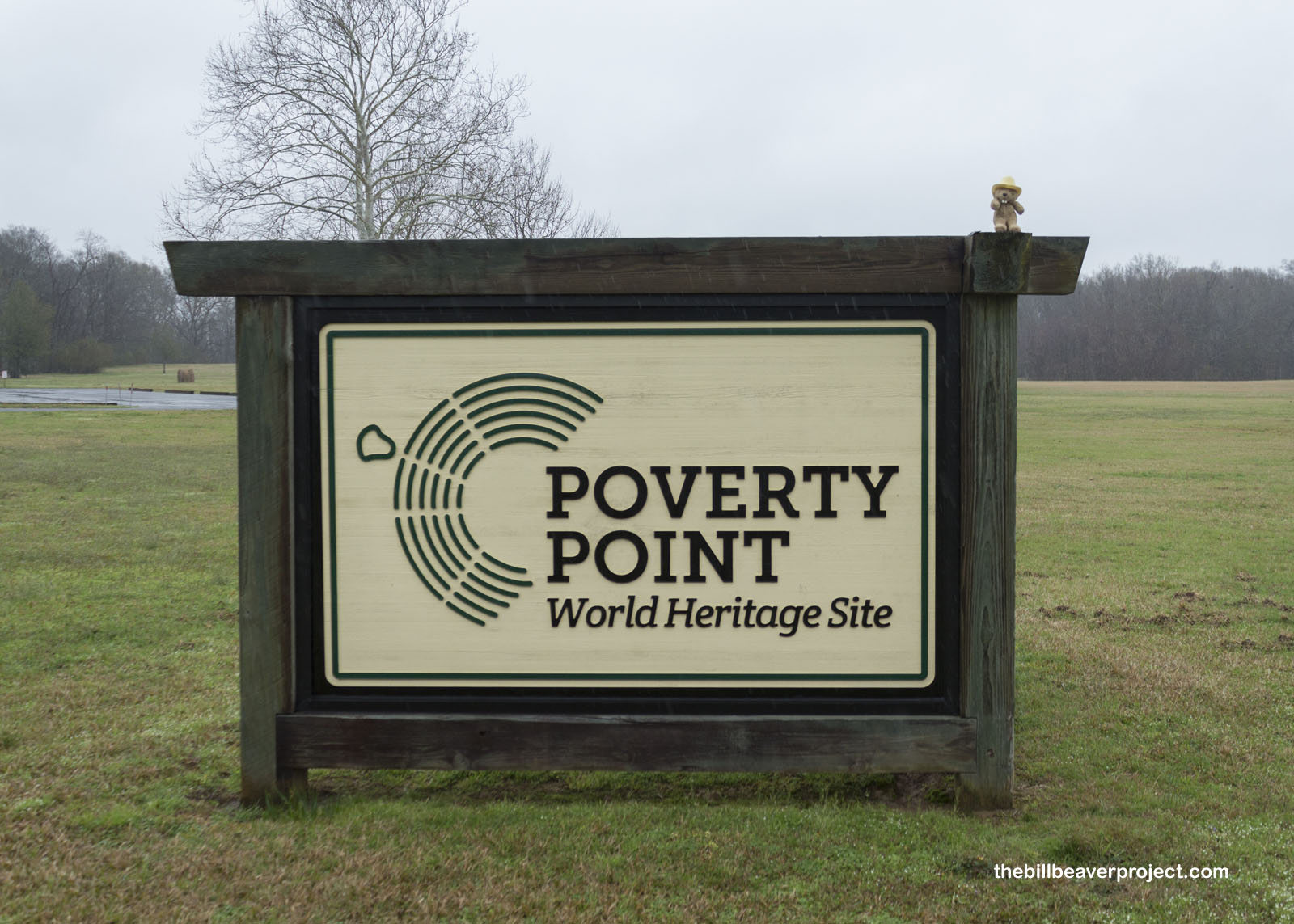 |
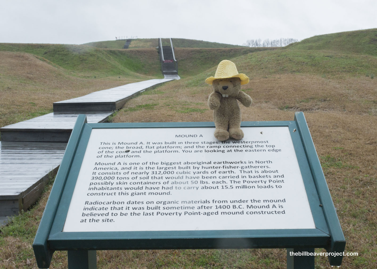
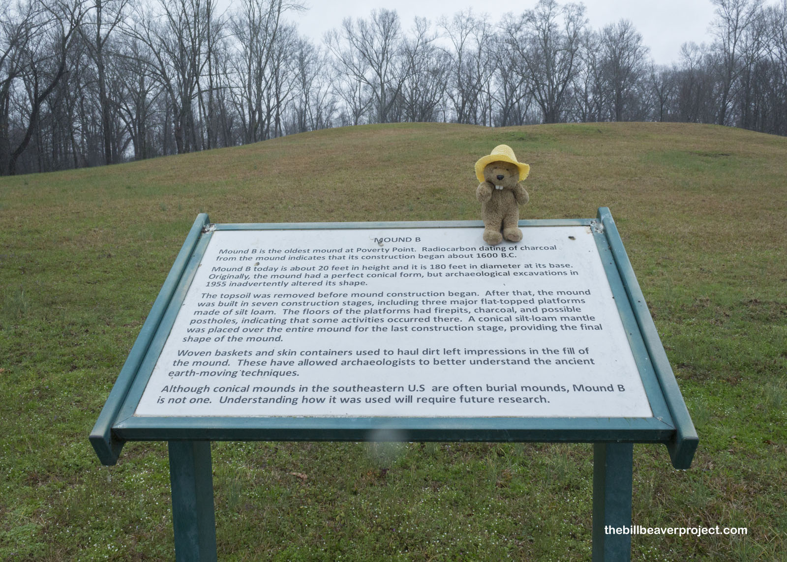
This site is important on so many levels: a state park, a national monument, and a UNESCO World Heritage Site! To the untrained eye, one might very well ask “What’s so great about it? It’s just a mound,” but it’s how that mound got to be in this flatland, which makes it so neat! See, from 4,000 BC until around 1400 AD, native folks were building mounds all across Louisiana, and by 1400 BC, this one was the largest mound complex in all of North America!
 |
While impossible to take in at ground level, from above, this complex resembles a vast amphitheater, with its C-shape opening to the east. It’s not clear what the complex was used for, whether civil or ceremonial purposes, but archaeologists have uncovered thousands of artifacts here from spear points to clay figurines!
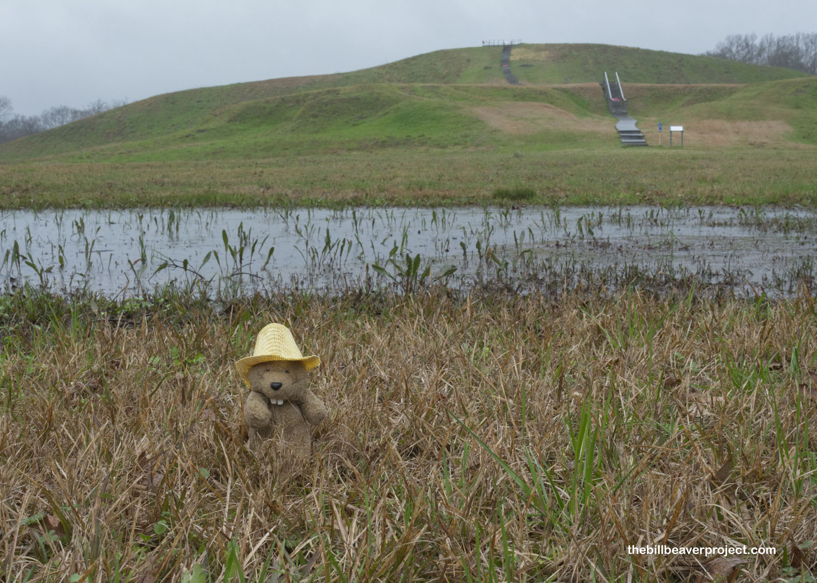 |
By the time I reached the bottom of Mound A, the main mound, 390,000 tons of hand-piled dirt, I was completely soaked, and my hat had begun to warp from the rain, just like when I fell off the Mission Dam in San Diego. Nevertheless, I had to get a closer look at this remarkable achievement. At current estimates, it took 15.5 million loads of soil to build up this mound!
 |
Though the thunder was starting to rumble, and I was more or less wading through an inch of standing water, I could not resist the temptation to climb this 72-foot mountain and look out on the complex from above. So I did. While I couldn’t see the full shape of the complex, the ponds forming from the downpour had filled in the troughs between ridges, giving a better sense of where they were!
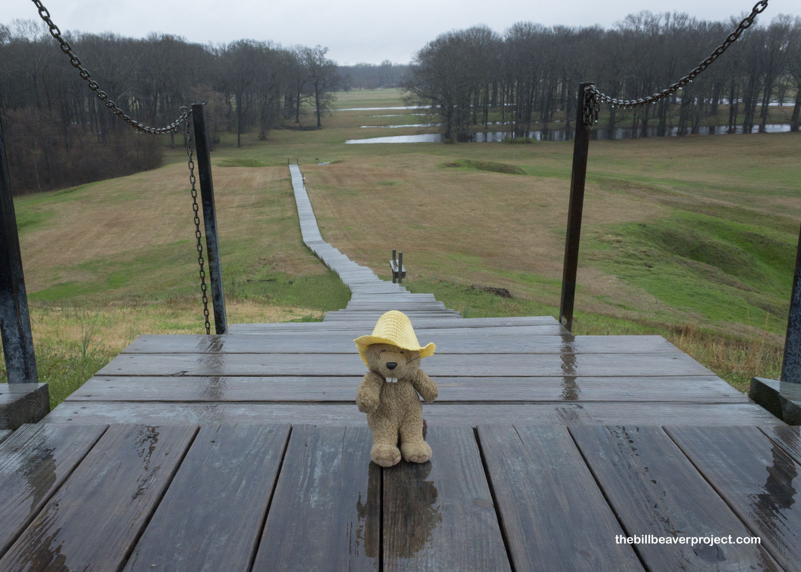 |
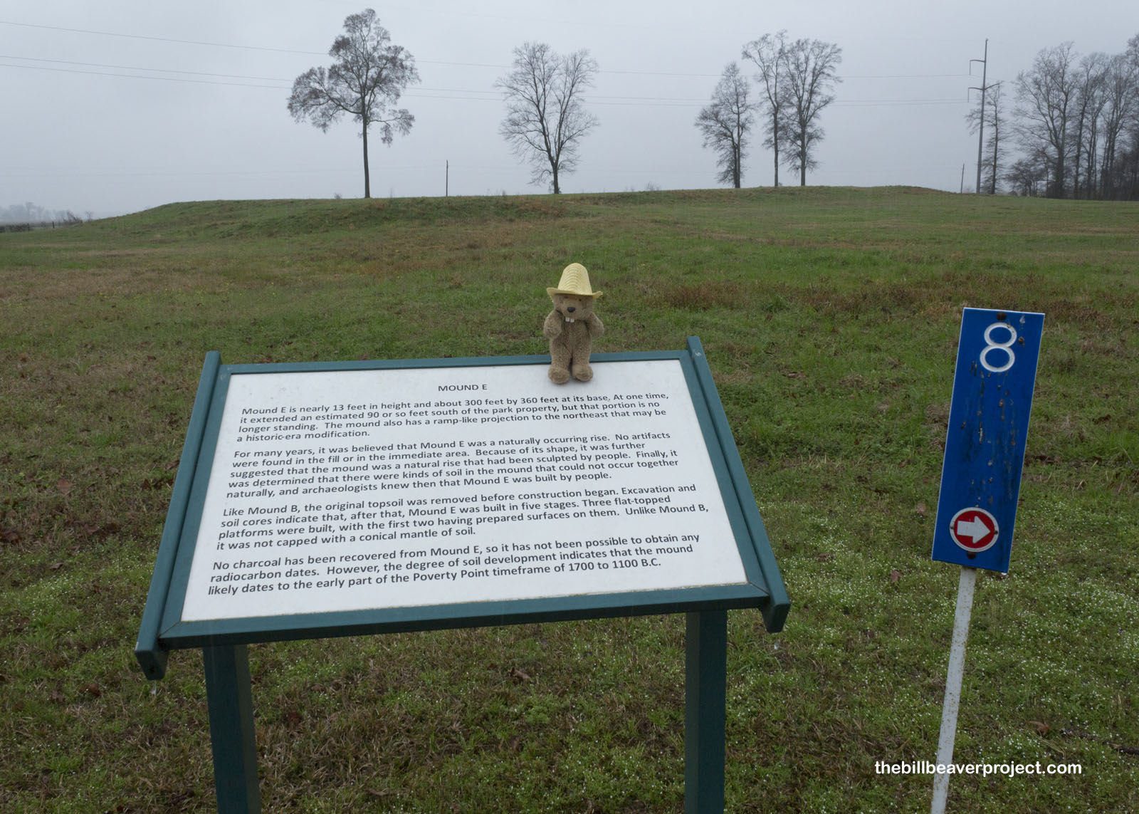
I probably could have spent more time at Poverty Point, walked the full trail, seen all the mounds from A to E, but by the time I got back down to the bottom, I was ready to spend some time drying off. With the heater cranked up, and my hat set to dry, I set off to my next stop back across the mighty Mississippi!
 |
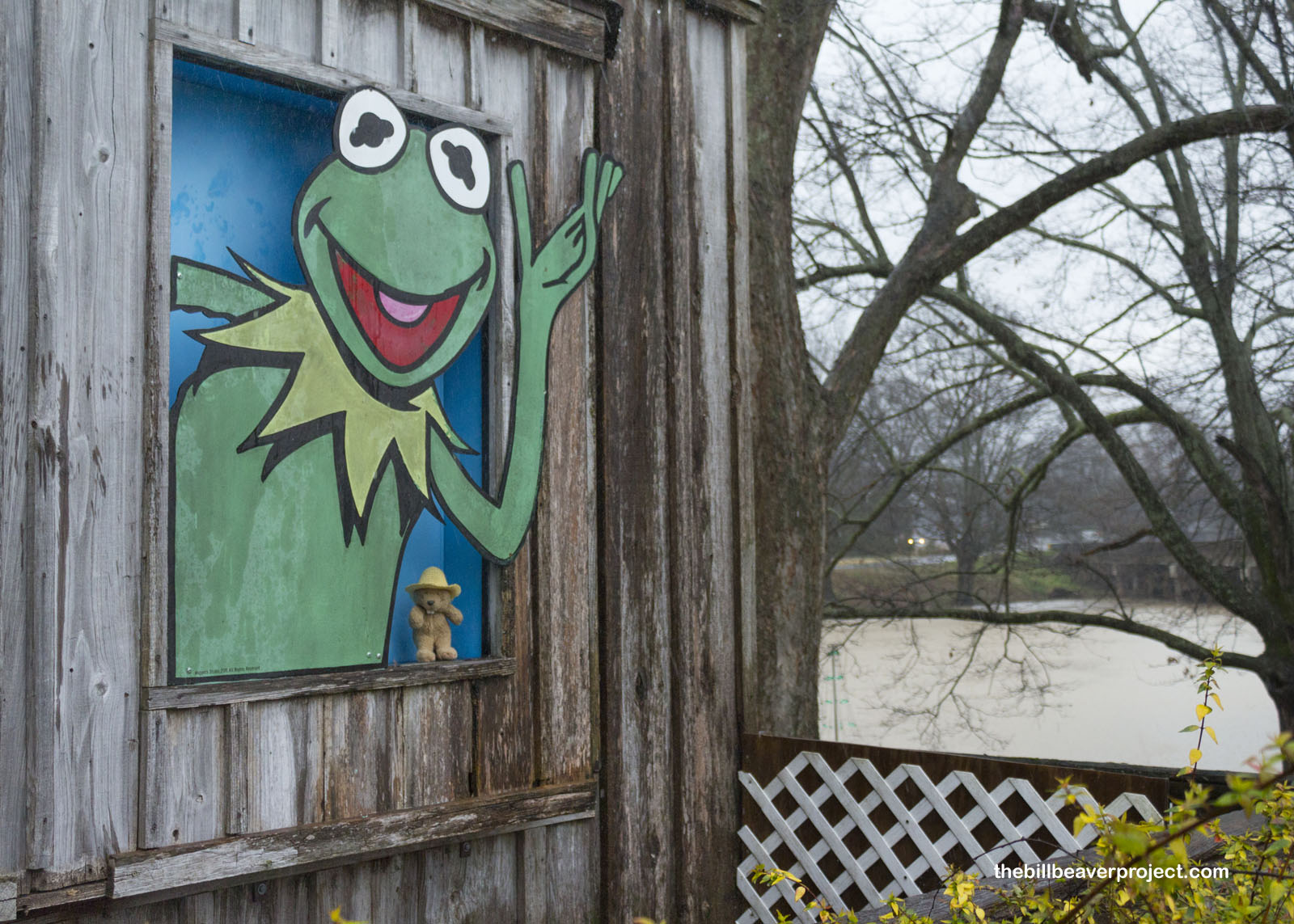
About an hour and a half later, I pulled into Leland, home to a very important animal celebrity, who really knew how to turn rain into rainbows! This, of course, is Kermit the Frog, who owes his origins to the memories Jim Henson made here on the banks of Deer Creek from 1936 until 1948!
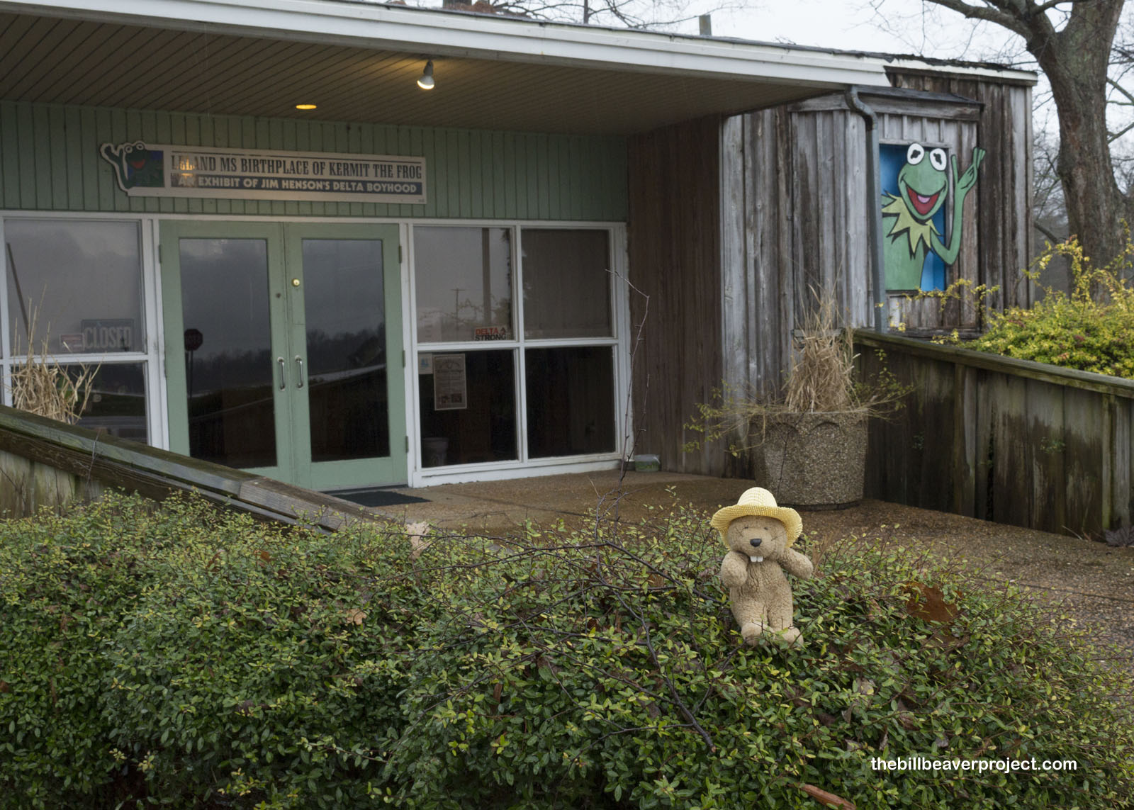 |
While the signs in Leland claim that Mr. the Frog was named for Mr. Henson’ childhood friend, Kermit Scott, that’s a matter of some debate! It’s equally claimed that he was named for Kermit Cohen, sound engineer at WBAL-TV, where the famous frog debuted on the show Sam and Friends. However he got his name, the banjo-playing amphibian had roots in imaginative romps along this Mississippi creek!
 |
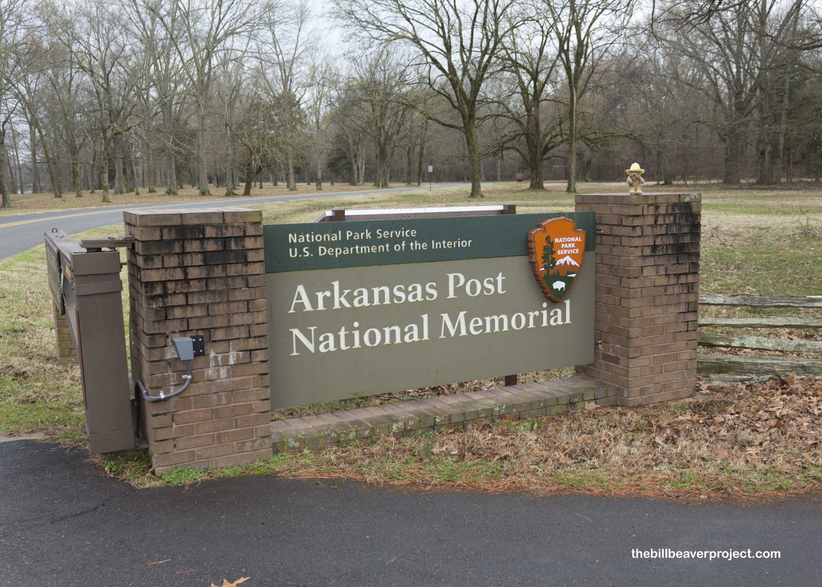
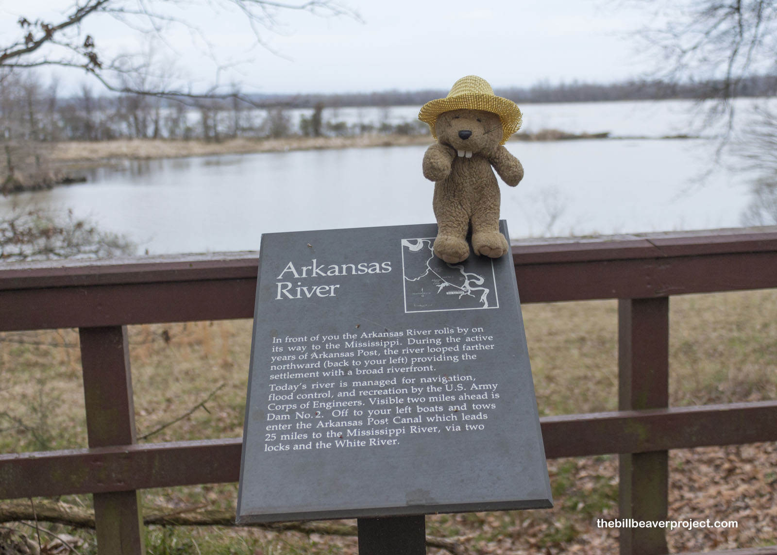
Since this museum turned out to be closed on Sundays, and an ominous siren that made me think of tornadoes overpowered the pounding of the rain, I had to get out of here without much looking around. That meant I could add one more stop, and one more state, to my itinerary. I headed back across the Mississippi once more and into Arkansas to visit Arkansas Post National Memorial!
 |
 |
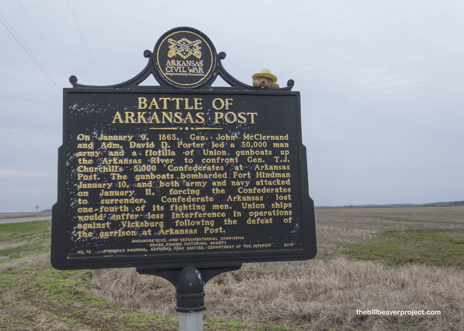
Arkansas Post was the first European settlement in what is now the Natural State, set up in 1686 in a negotiation between French trapper, Henri de Tonti, and the local Quapaw (sometimes called “Arkansea”) tribe. It was only through the support of the Quapaw that the Post lasted as long as it did, but it was a war with a different tribe, the Chickasaw, that saw the post move in 1749 from this site to where the national memorial is today!
 |
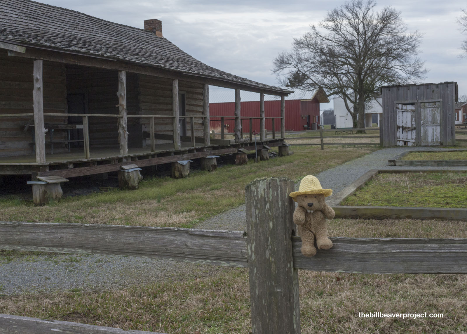
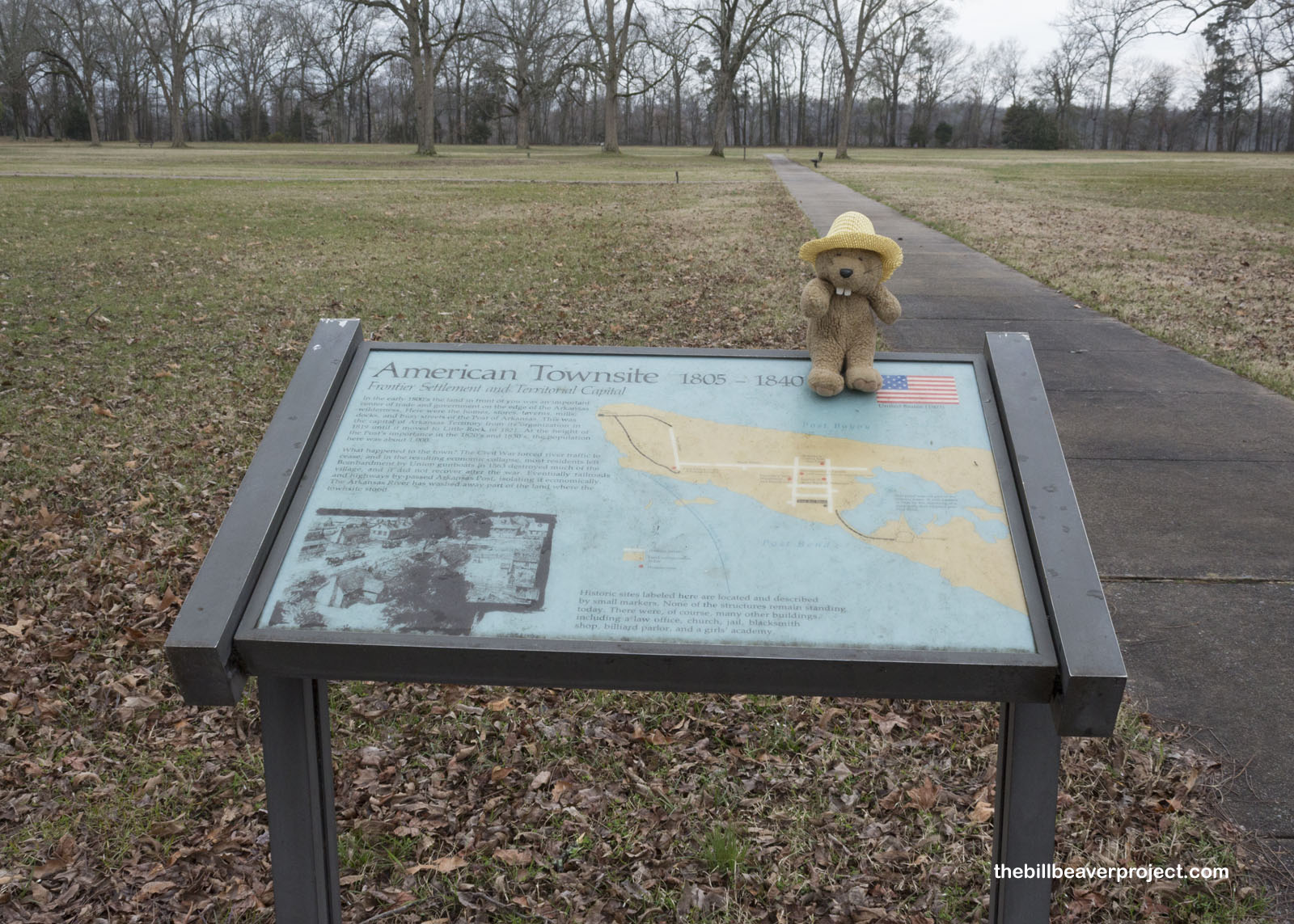
The Post changed hands from French to Spanish in 1783, back to French in 1800, and then into US hands in 1804. Arkansas Post grew into the budding territory’s largest city and capital, but today, much to my surprise, there wasn’t much left to see of this important city!
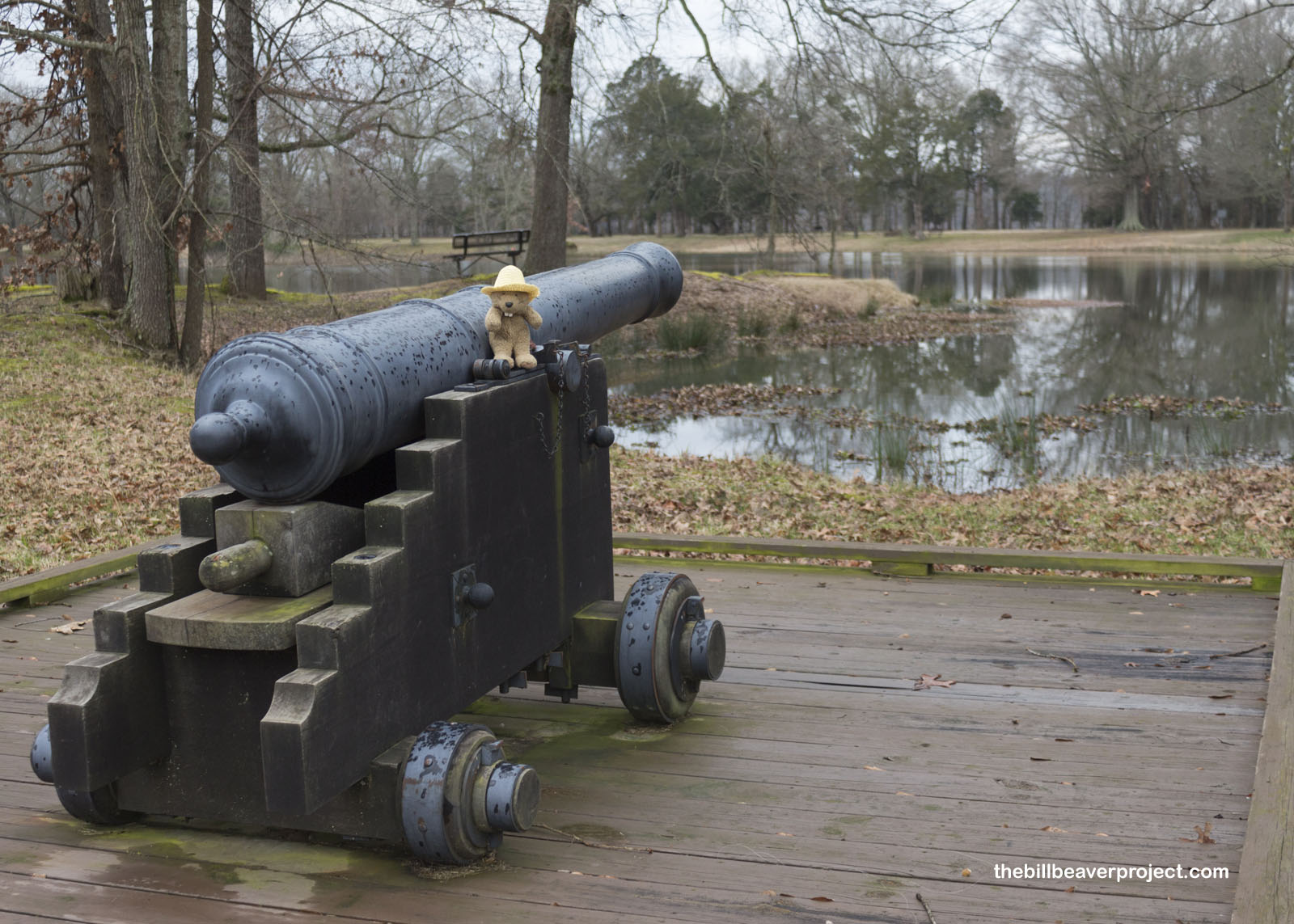 |
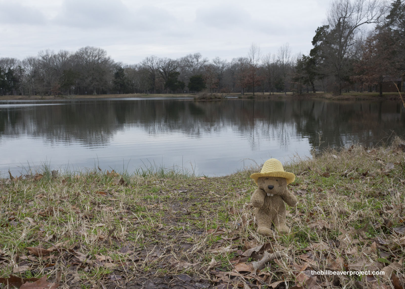
That’s because this was the site of the Confederate Fort Hindman in 1862. This was a strategic location close to the Mississippi, which was particularly good at disrupting Union communication lines. For that reason, the Union Army attacked Arkansas Post on January 11, 1863 and obliterated it so completely that all traces of buildings would be impossible to see if it weren’t for the heavy rain filling in the foundations!
 |
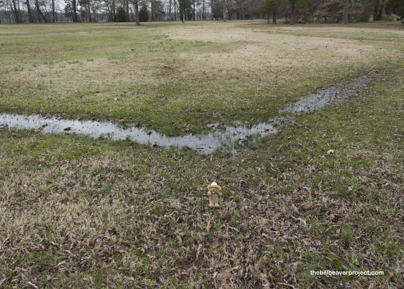 |
Luckily, the National Park Service has installed plenty of signs to mark out this historic town, like where the bank and law office stood. Visitors can imagine where the girls academy and blacksmith parlor resided, though today, there is not much to see of either.
 |
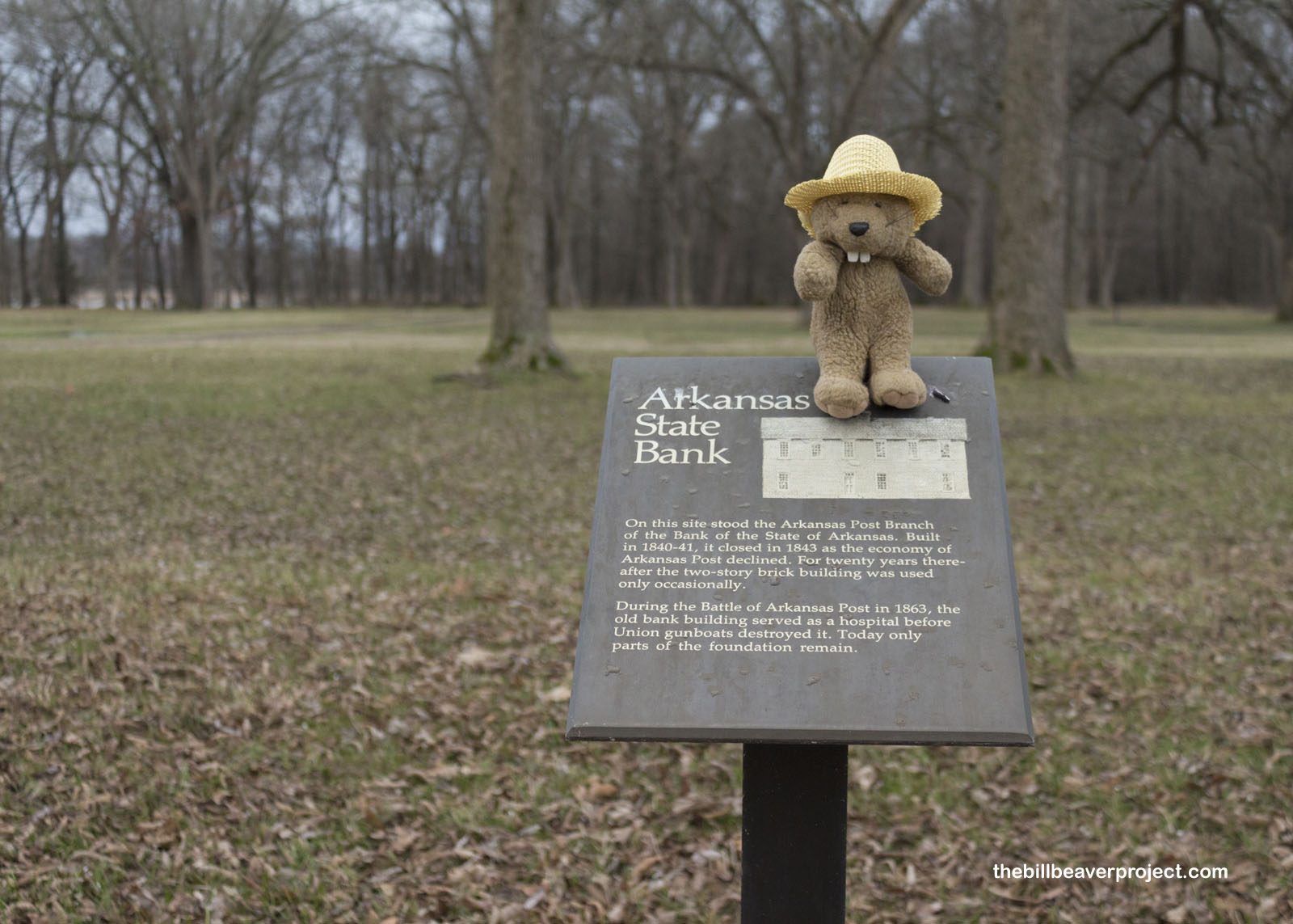 |
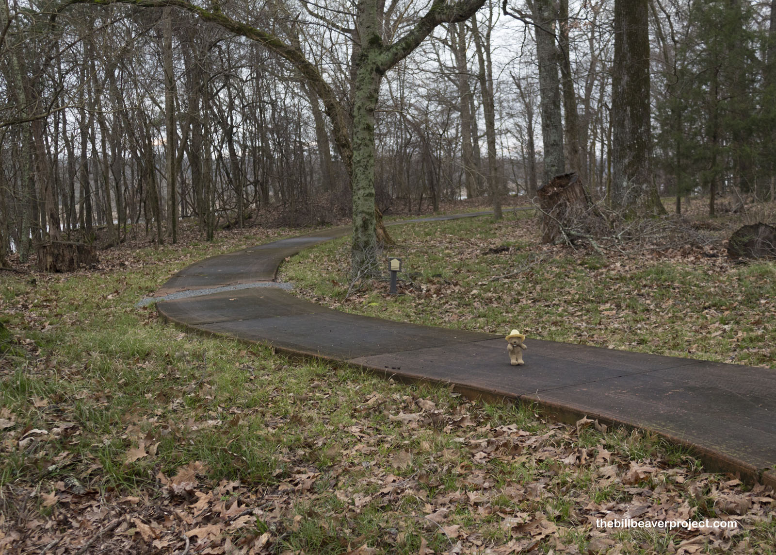
To be honest, I had hustled all the way up here for not much to see, but since the rain had subsided, I decided to take a stroll down the nature path, where I spotted some really neat shelf fungi growing on a stump. I do love some wild mushrooms!
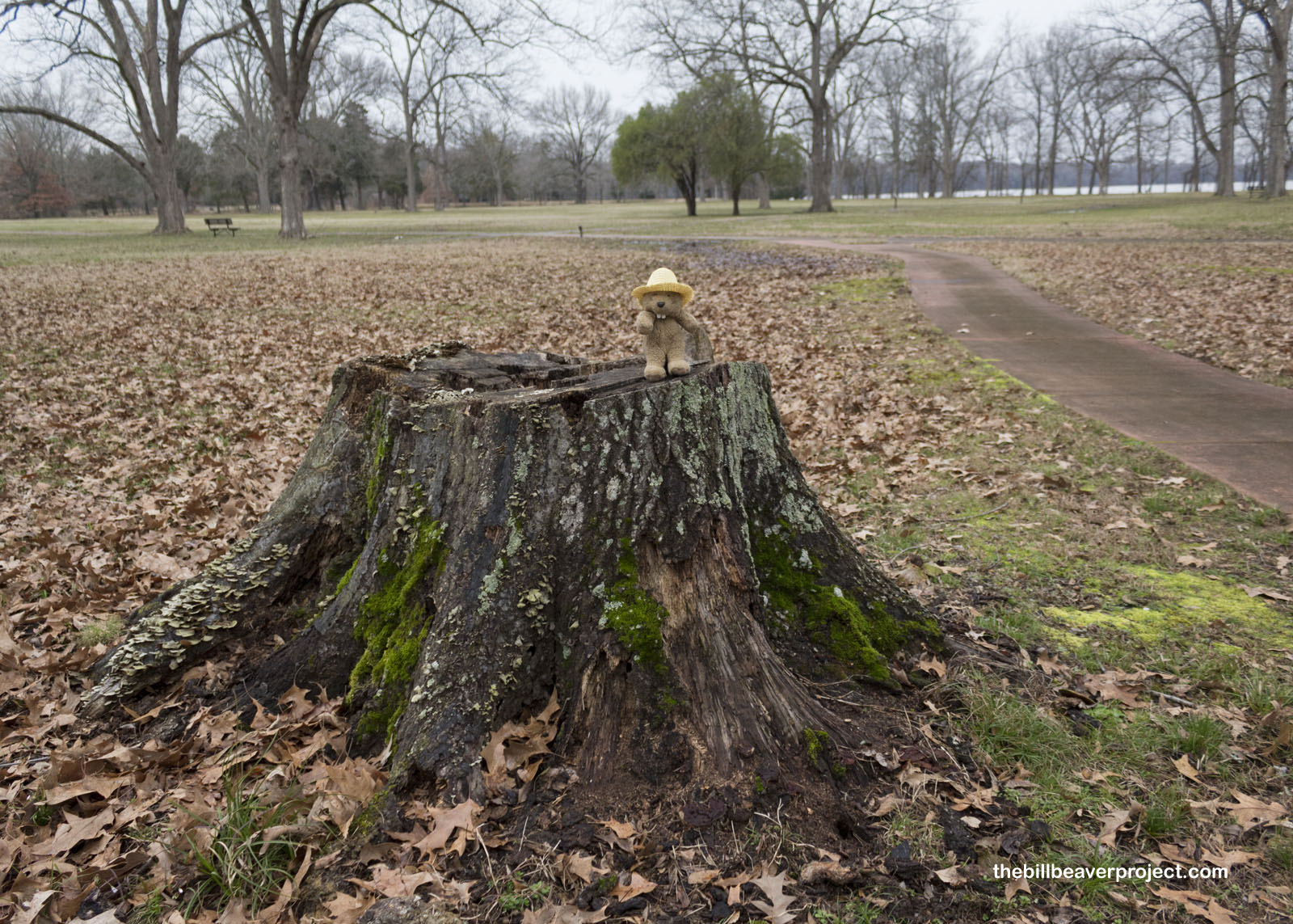 |
 |
Further down the tranquil trail, a sign talked about the healing properties of stump water, as told by Tom Sawyer, who believed a ritual with stump water could cure warts!
 |
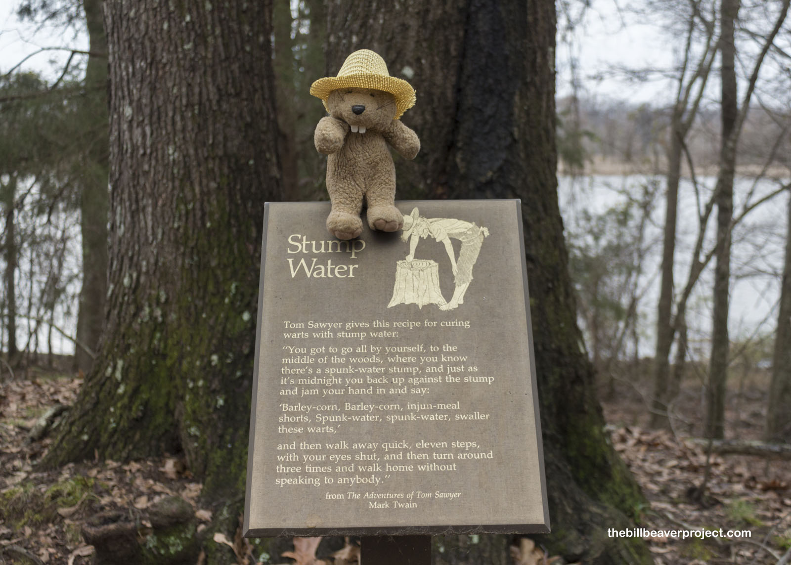 |
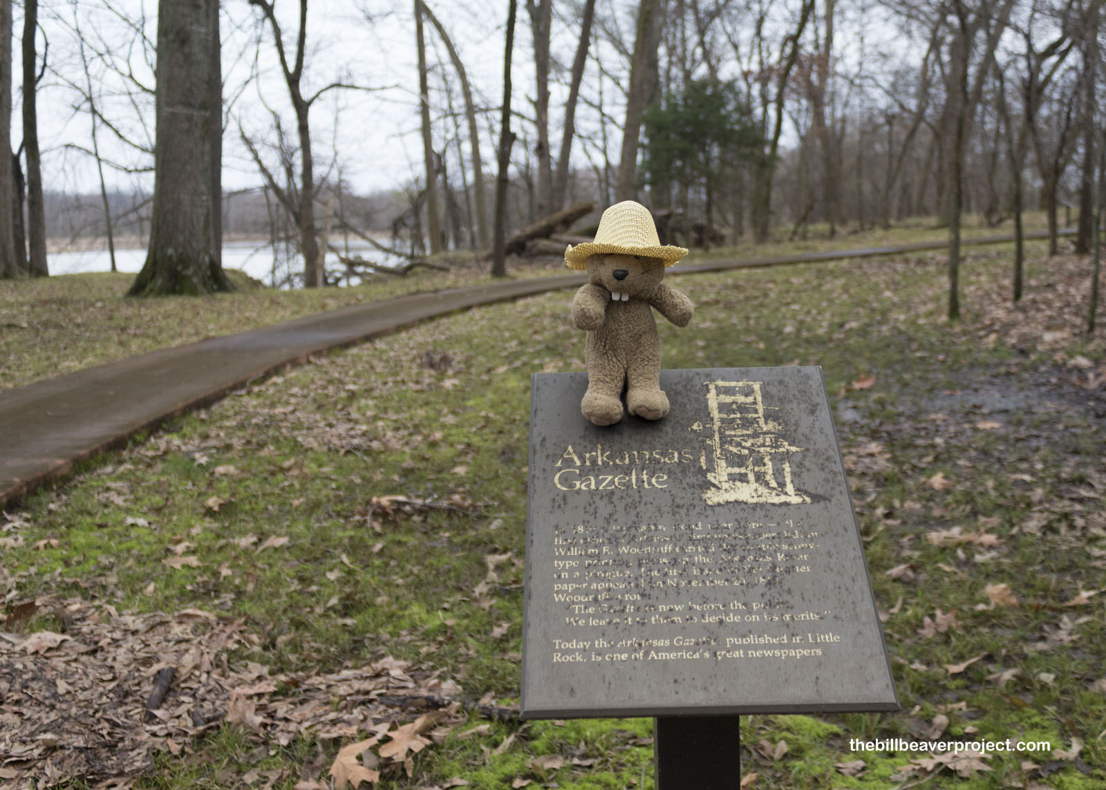
The apex of the trail overlooked the Arkansas River, which had swallowed up much of the town site, including Fort Hindman, but not the stories. I learned from another sign that this was where the Arkansas Gazette, “oldest paper west of the Mississippi,” got its start on November 20, 1819! The paper became famous for reporting Arkansas’ statehood in 1836 and infamous for encouraging school segregation as the Little Rock Nine started at Central High School in 1957!
 |
 |
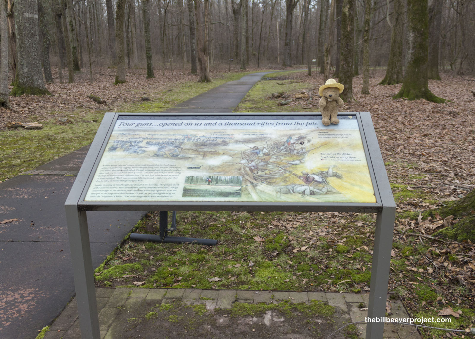
I wrapped up my visit to Arkansas Post at the remains of the original Confederate Rifle Pits. Here, in the January chill, the soldiers had to tear down their huts to convert into defensive structures as the Union attacked. After a two-hour military barrage, they threw up the white flag, and the Union army took nearly 5,000 prisoners!
 |
 |
Experiencing just a taste of Arkansas winter, I sure was glad to have a warm hotel waiting for me once the sun set. Though the February clouds had made the landscape drab and dull, the stories of this patch of Mississippi Delta made it well worth a visit.
I returned south to the Louisiana Boot and enjoyed a fried blackberry pie à la mode at the River Grille in Monroe. After all the stories I’d learned today, I could not help but notice a wall separating black and white patrons. Whether this was intentional or just coincidence, it was a hard reminder that the South has a complicated history that still has its echoes today.
See you downriver!

Previous Day |
Total Ground Covered: 874.0 mi (1,406.6 km) |
Next Day |