 Previous Day |
Omaha, NE → Des Moines, IA 220.0 mi (354.1 km) |
 Next Day |
Oma-howdy, everyone!
Yesterday, I visited a museum to the Wizard of Oz, and today I’m in the wizard’s hometown of Omaha! Nebraska’s largest city has been a major crossroads for wagons and trains alike, earning it the nickname “Gateway to the West!” I’m going to spend today exploring the city’s history while working my way east to a third state capitol! I’ll start with Boys Town!
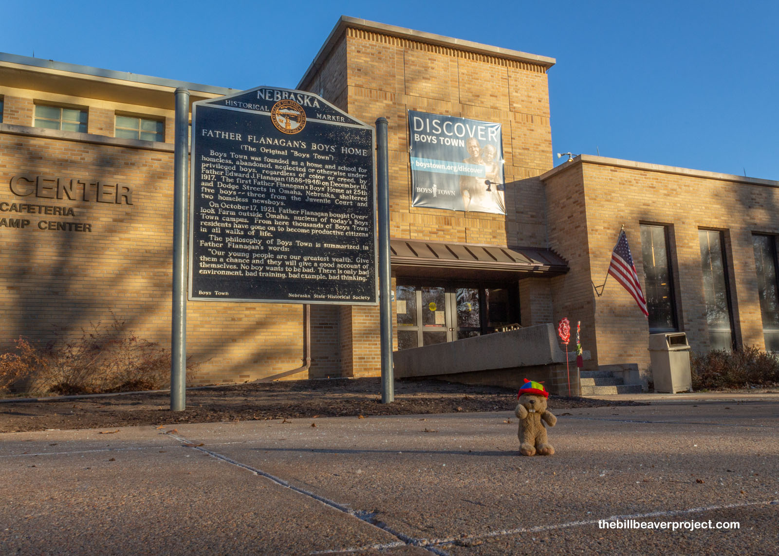 |
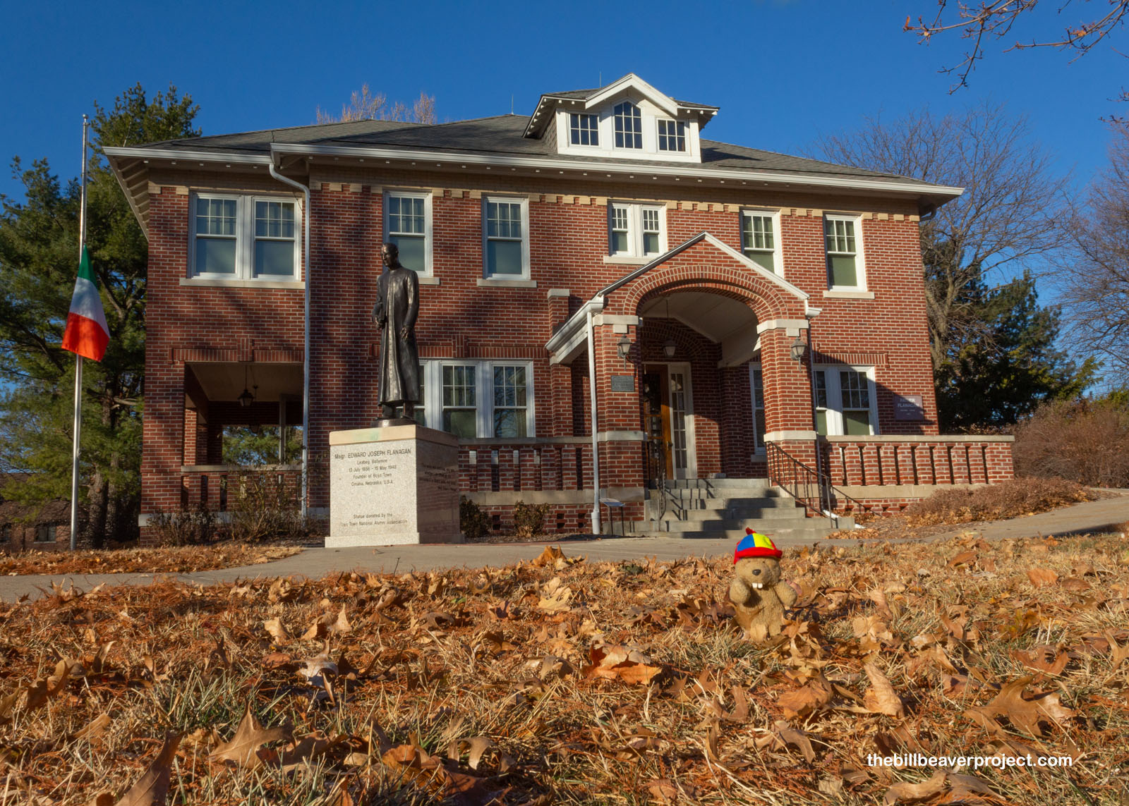
Boys Town opened in 1921 as a place where kids who had fallen on hard times could get treatment, rehabilitation support, and education! Today, it’s a full-on village with its own town hall, post office, and fire department!
 |
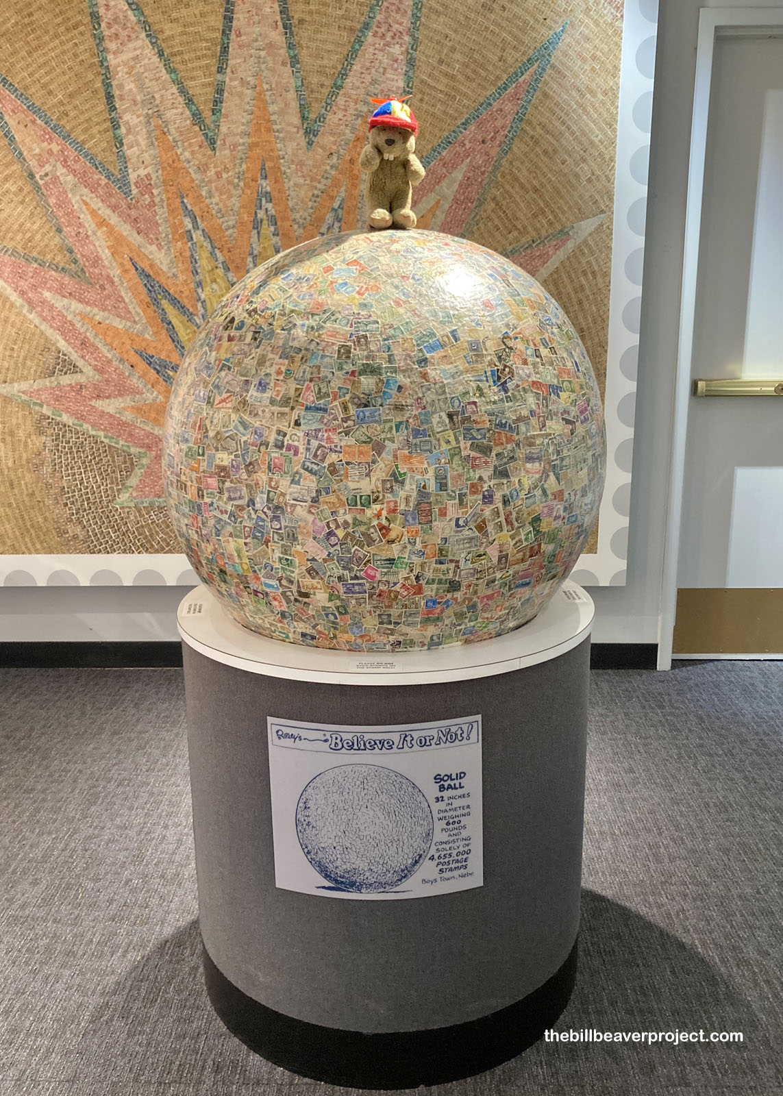
It’s also home to the world’s largest ball of stamps, started around a golf ball in 1953 by the Boys Town Stamp Collecting Club! Today, this 32-inch ball is made up of over 4 million stamps!
 |
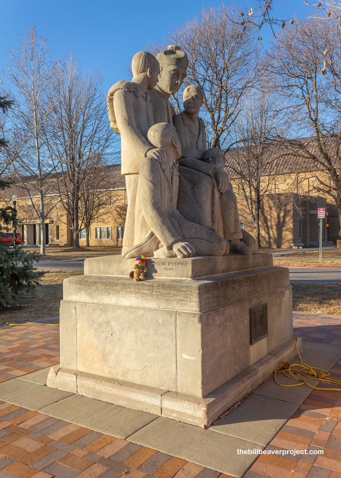
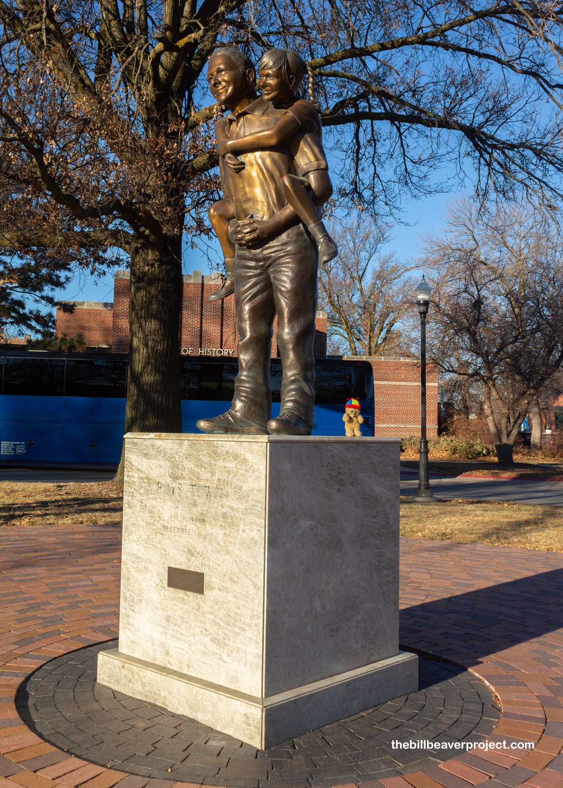
But the main focus of Boys Town is in helping youngsters, about 2 million of them nationwide! There are two statues on the campus that commemorate these efforts, from the Variety Club Statue, which depicts founder, Father Flanagan, with boys of different races, to the one called “The Work Continues.” The latter one was installed at the centennial of Boys Town, commemorating the inclusion of girls in the program in 1978!
 |
 |
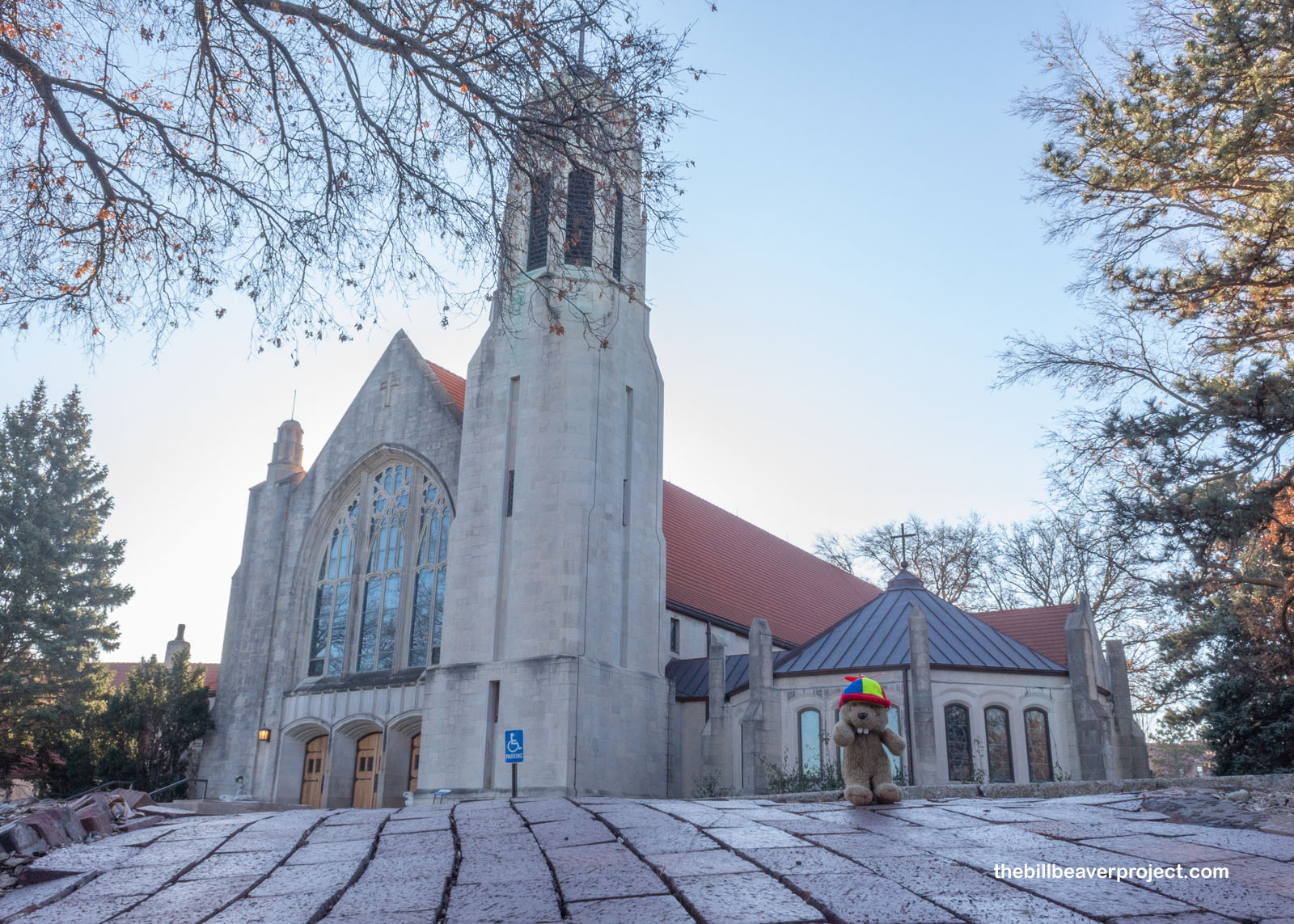
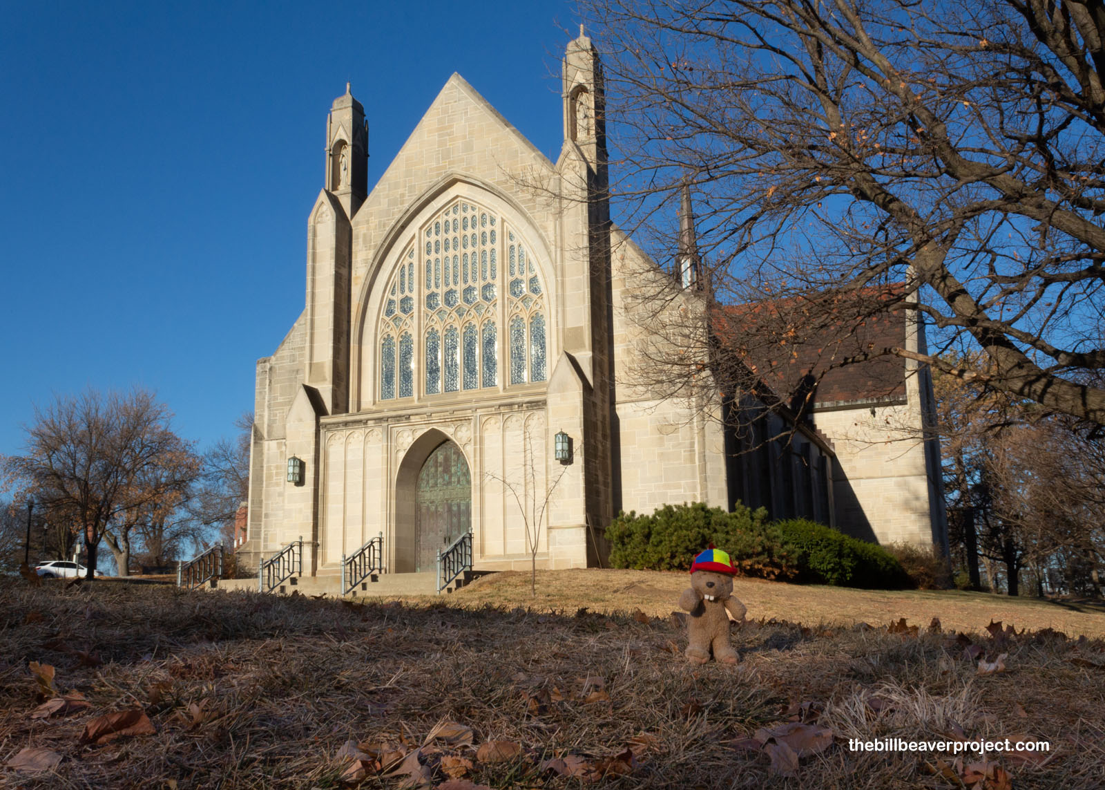
Religious in nature, the Boys Town campus has two main chapels: the Catholic Dowd Chapel, where Father Flanagan is buried, and the Protestant Chambers Chapel! Since Father Flanagan was a priest himself, he believed it was important for kids to learn how to pray, but that they should decide how they prayed!
 |
 |
That Father Edward Flanagan set up his first Home for Boys in 1917 after getting discouraged working with homeless adults. He expanded his work by purchasing Overlook Farm in 1921, that site now being the campus on which I was walking and freezing my tuchus off! I walked past his home, where he lived from 1927 until 1941, noticing the Irish flag (Father Flanagan was Irish) held at half mast for Pearl Harbor Day.
 |
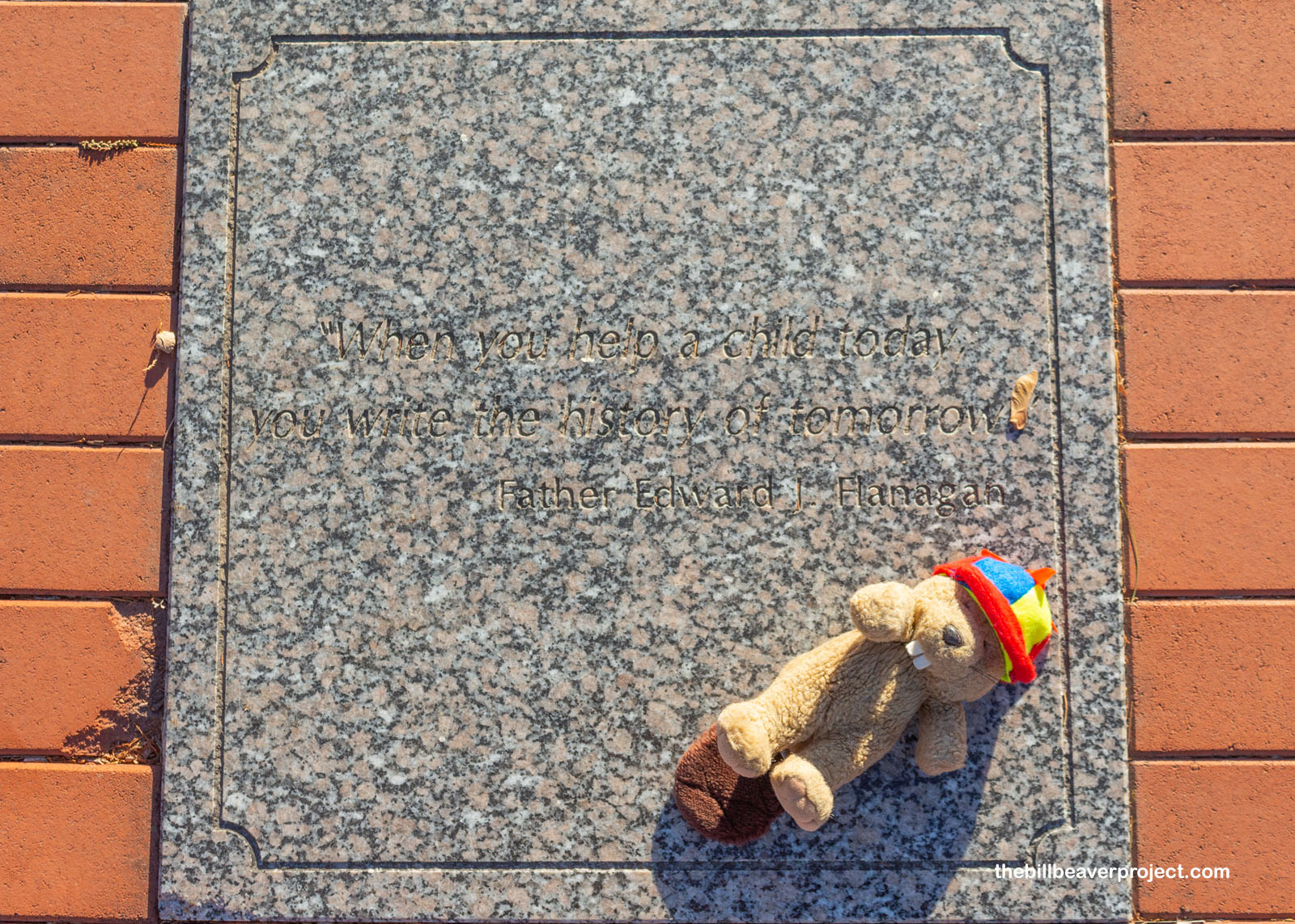
Before I left Boys Town, I noticed a plaque with an important quote from Father Flanagan himself: “When you help a child today, you write the history of tomorrow!”
 |
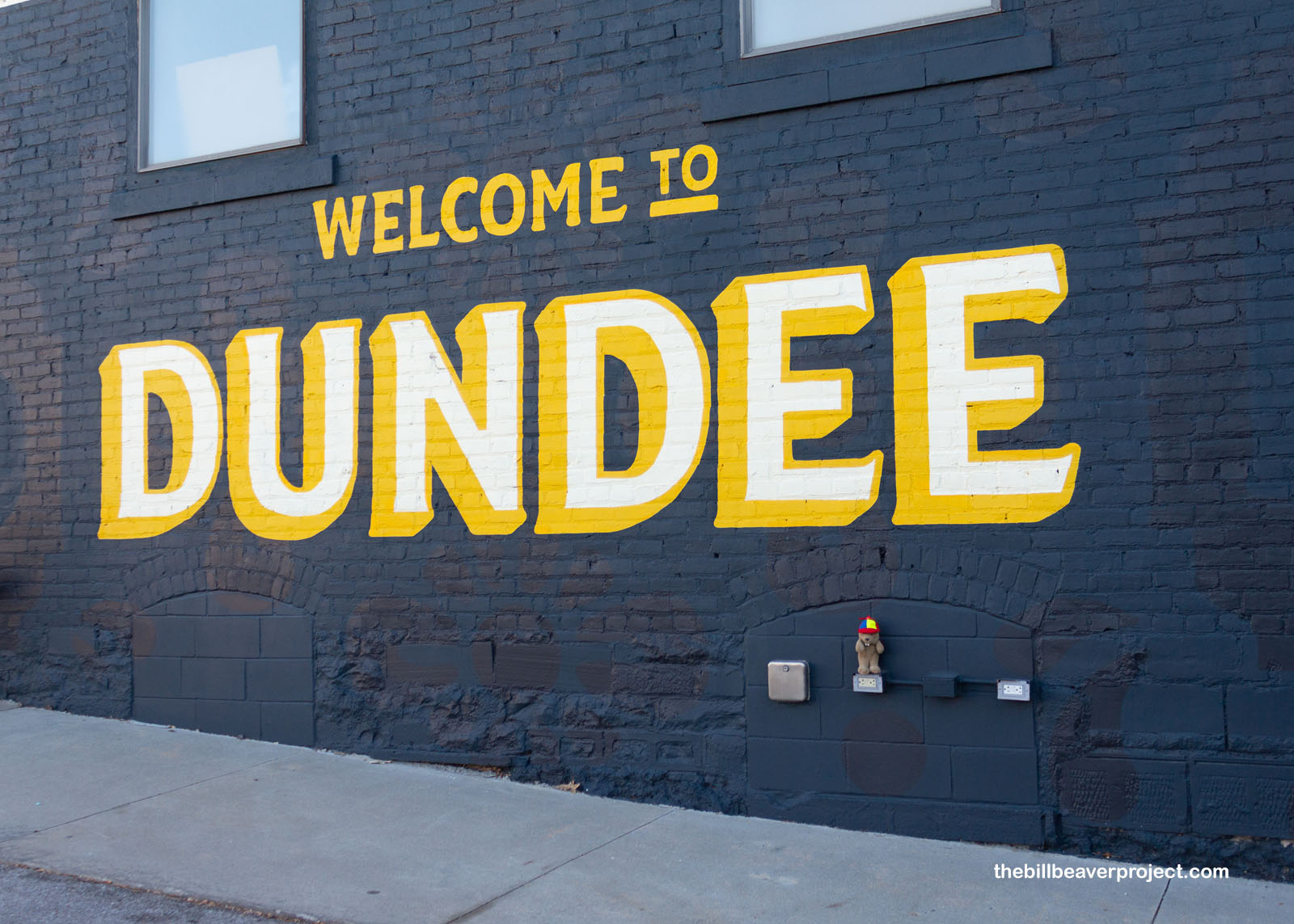
From there, I journeyed east into the neighborhood of Dundee, where something truly strange happened April 18, 1945! Today being Pearl Harbor Day, I’d thought the only time the US got attacked was on Oahu, but boy was I mistaken! Japan had devised balloon bombs, which it launched into the air across the US! One of them exploded over Dundee, Nebraska! Even though it didn’t cause any damage, it was hushed up until the end of the war!
 |
 |
Continuing east was a trip even further back in time! Omaha was founded on July 4, 1854 on land taken from the Omaha tribe when Congress passed the Kansas-Nebraska Act. That brought folks streaming across the Missouri River from Iowa to settle Nebraska territory and beyond! The Mormon Trail passed through here, as did branches of the California, Oregon, and Denver Trails!
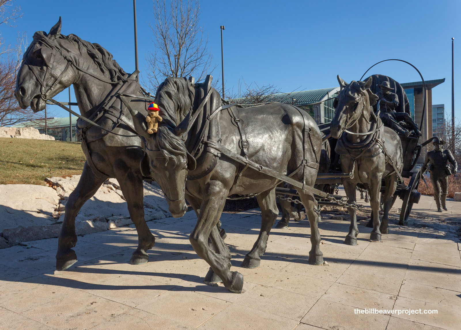 |
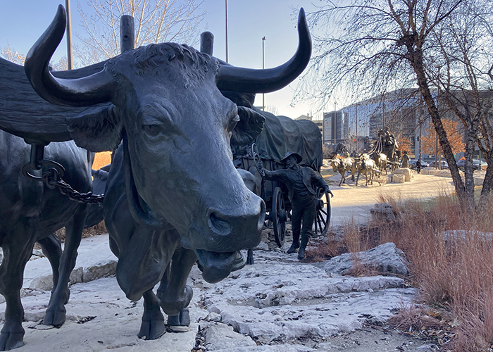
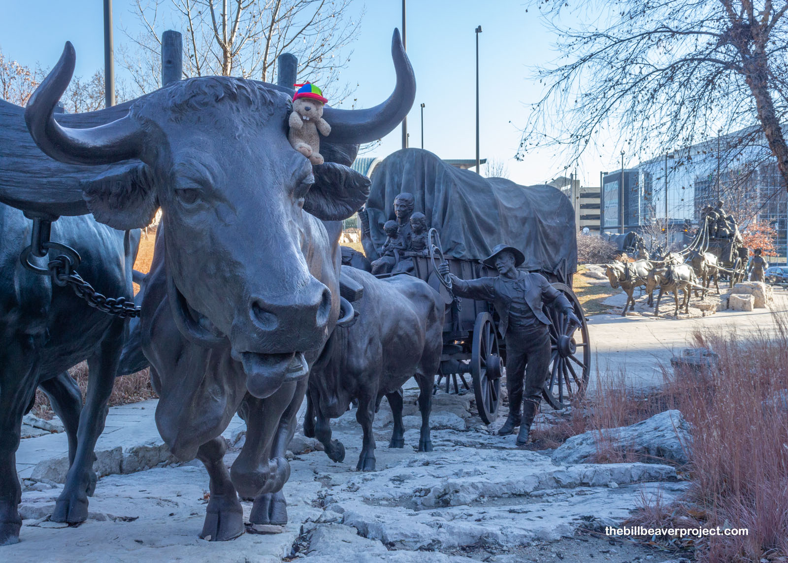
In commemoration of Omaha’s status as “Gateway of the West,” the city and First National Bank teamed up and commissioned two Utah sculptors, Blair Buswell and Edward Fraughton, to create one of the world’s largest installations of bronze and steel sculptures! Pioneer Courage Park features four huge wagons, pulled by mighty, panting oxen or Belgian draft horses, all surrounded by native Nebraskan plants! Completed in 2003, Pioneer Courage Park and neighboring Spirit of Nebraska’s Wilderness Park fill seven city blocks with art and history!
 |
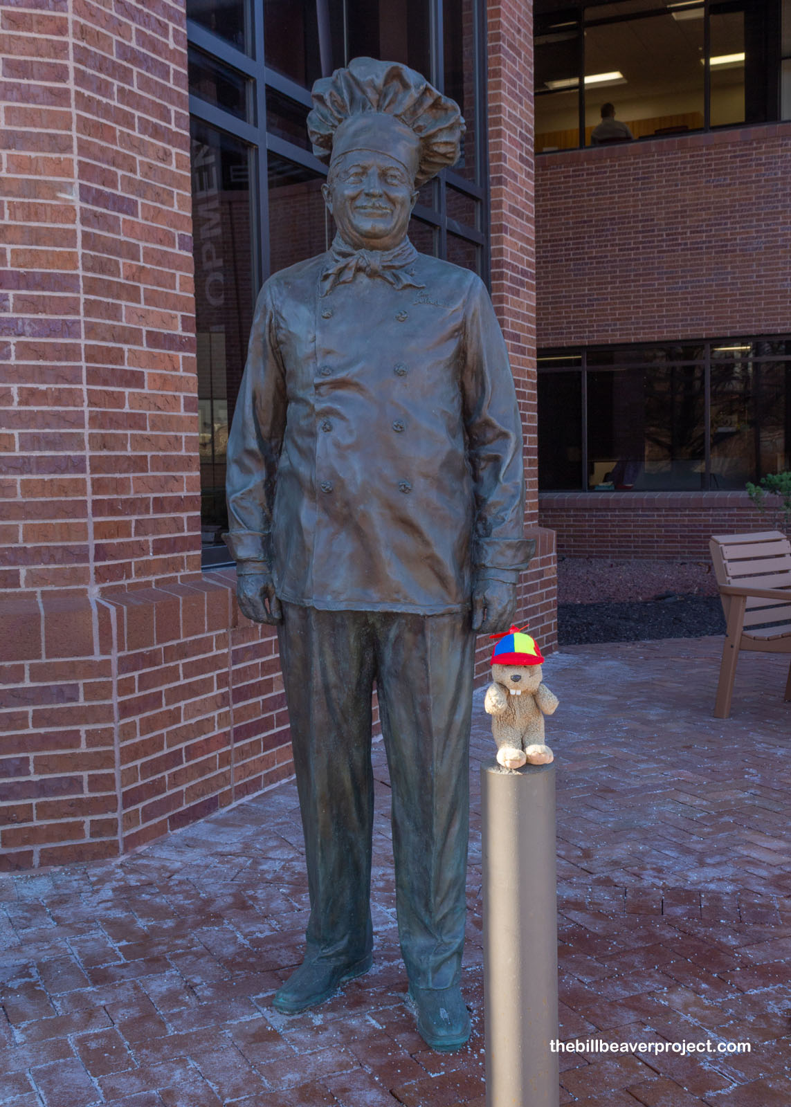
Not far away, I found a more recent, more whimsical statue of Chef Ettore Boiardi, also known as Chef Boyardee! While this famous Italian chef never made it to Omaha, his canned pastas are still in production by ConAgra Brands, which bought his brand in 2000. ConAgra is notorious for having demolished one of the largest historic sites on the National Register in 1989, Jobbers Canyon Historic District! They convinced the city to tear down all the 19th Century warehouses to build their own headquarters, which they then moved to Chicago in 2015!
 |
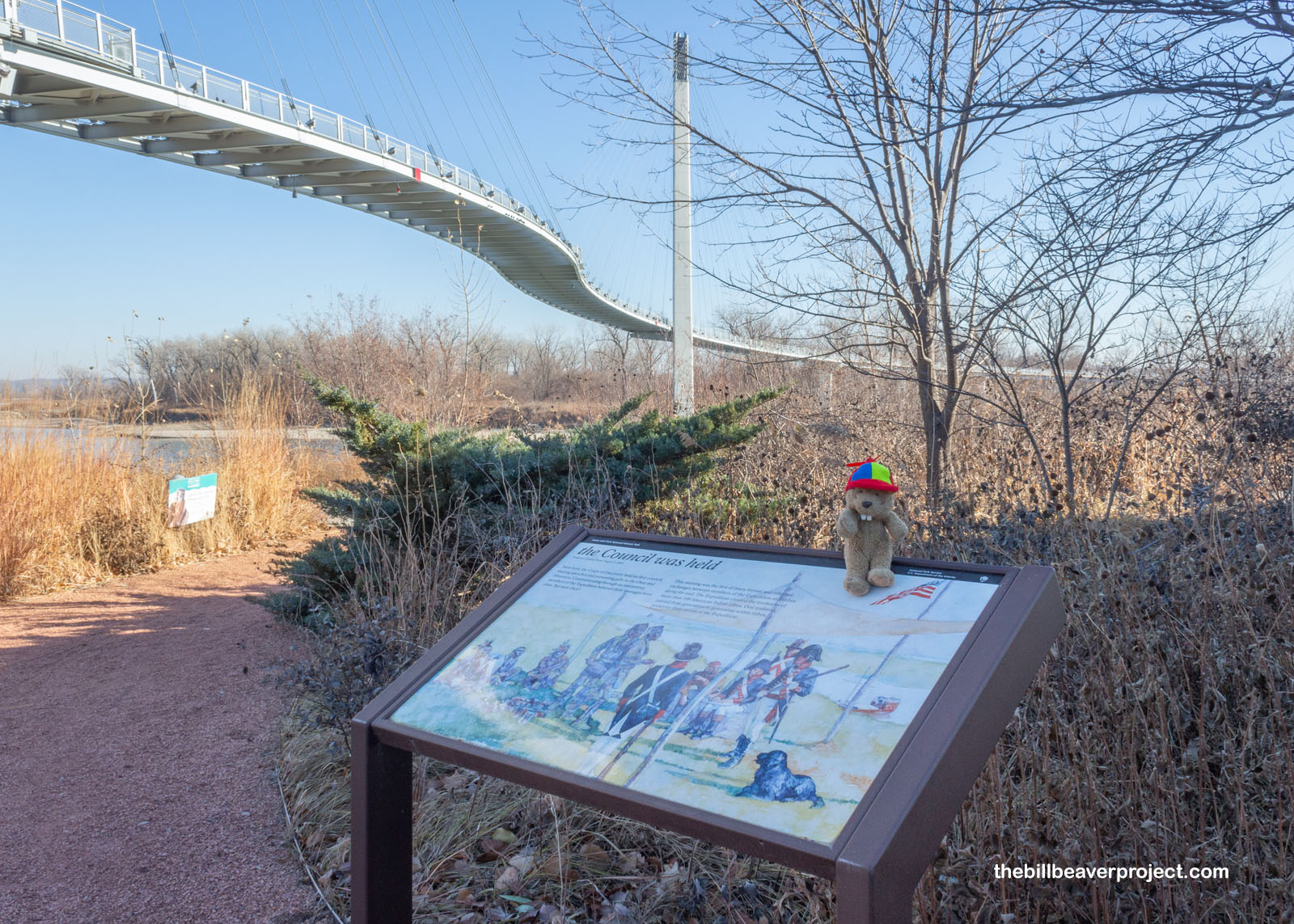
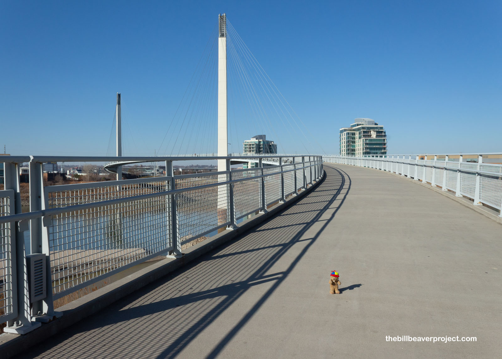
Indeed, folks, Omaha is a bridge between many eras of history! The famous Bob Kerrey Pedestrian Bridge, or Bob for short, has joined two sides of the Missouri since 2008! It spans the area where, two centuries earlier, Lewis and Clark held their journey’s first council with local tribes, a practice that would ultimately guarantee their success!
 |
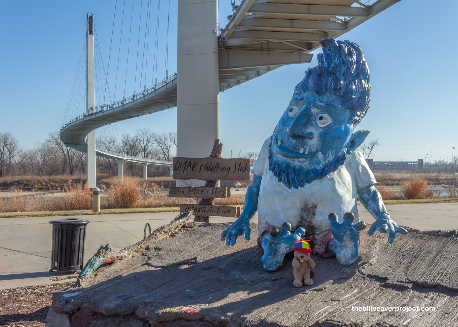
Under it, a troll named Omar had taken up residence! Like many modern influencers, Omar had his website ready for selfies, but his mission is really to promote kindness, openness, and interest in the city of Omaha! Already, I’d learned so much that whatever he was doing, it was working!
 |
While the underside of bridges may be a great place for trolls, the upper side is better for beavers! Besides, I wanted to see what was on the other side of the river in Council Bluffs, Iowa! I’d heard the city’s name mentioned a bunch of times on past adventures, so naturally I had to check it out!
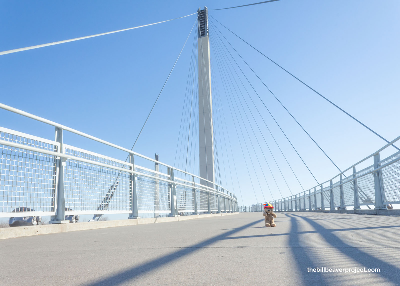 |
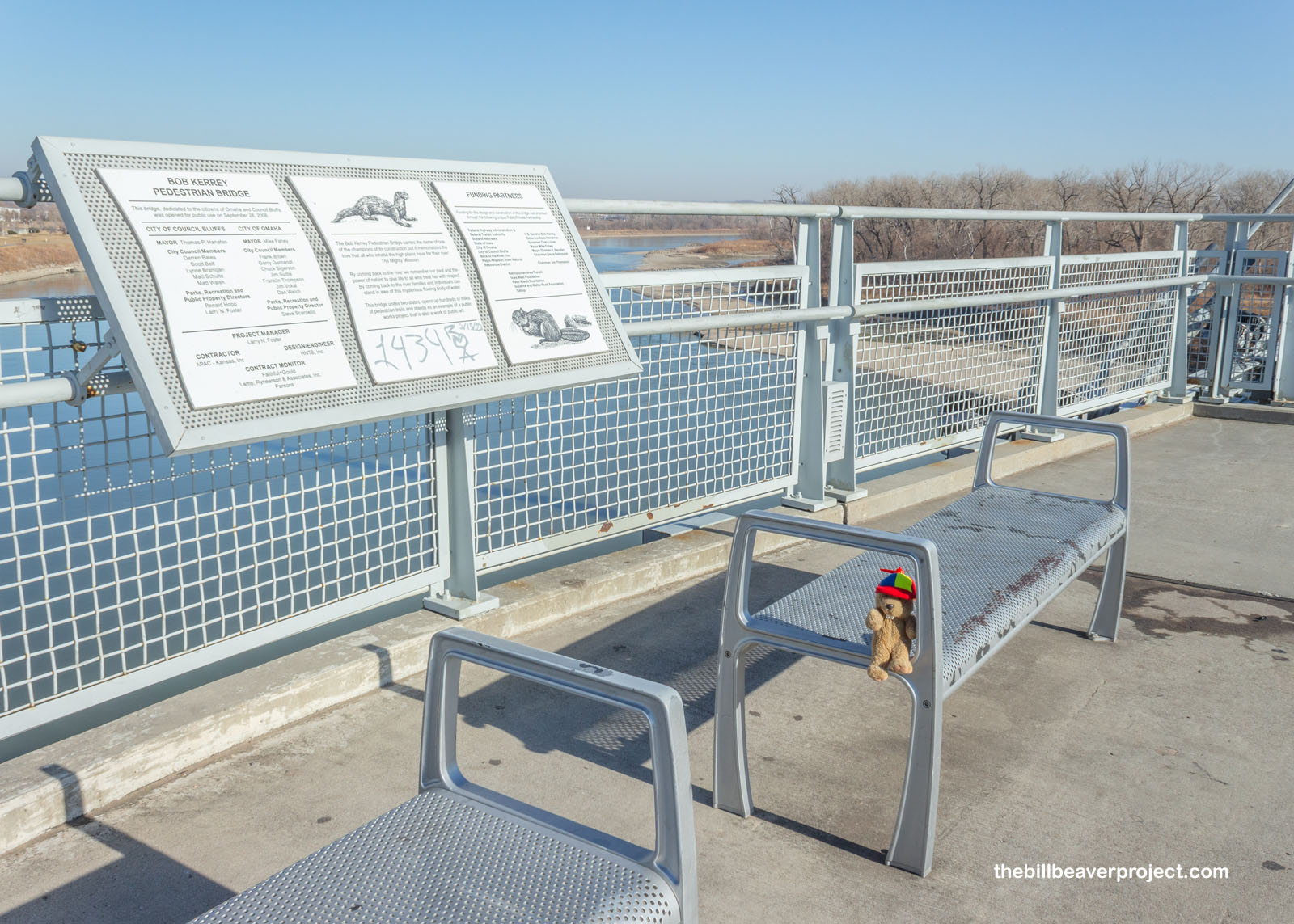
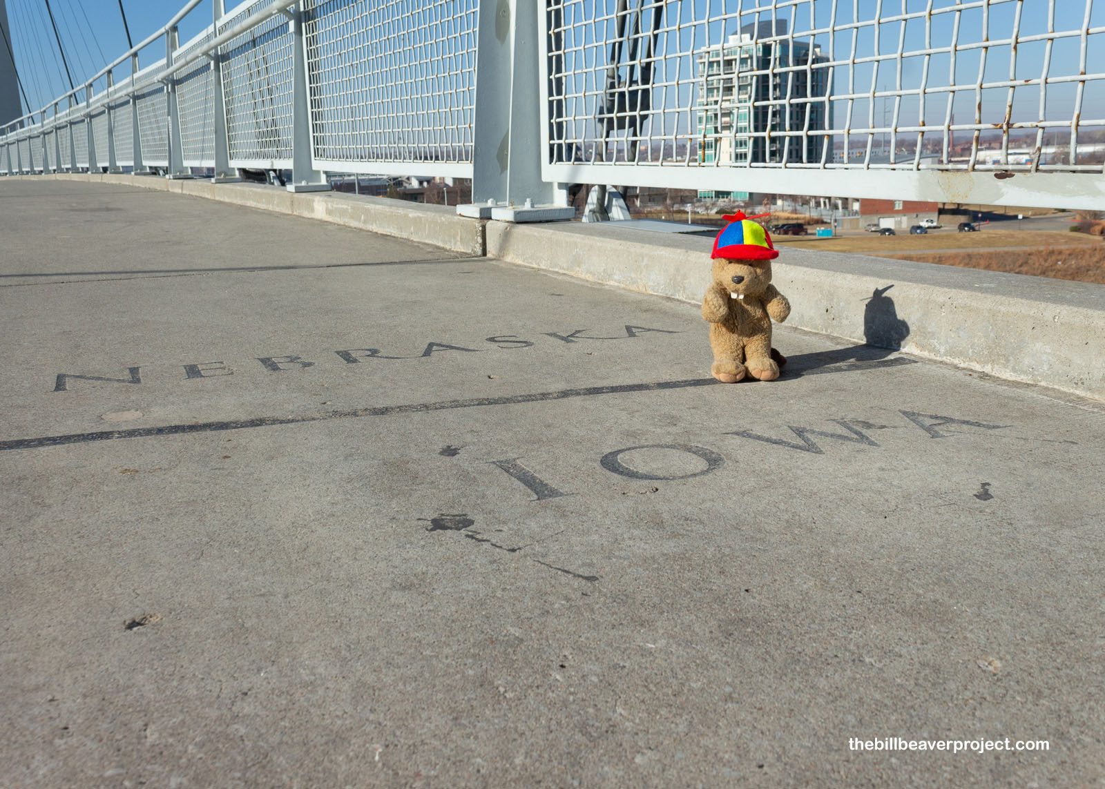
This 3,000-foot bridge was named for former governor and senator, Bob Kerrey, and connects more than 150 miles of nature trails spanning two states! On my stroll, I marveled at the views of the Missouri River, though it was pretty darn chilly, and wondered if the beaver on the commemorative signs was anywhere to be seen! After searching a while, I decided the time had come to cross into the state of Iowa for the first time! Apparently posing on this state line is called Bobbing!
 |
 |
Bob was a pretty easygoing bridge, and soon I was across the mighty Missouri and headed into Council Bluffs, Iowa, famed birthplace of many historic trails!
 |
This giant golden spike monument has been a city attraction since it was set up in 1939 to celebrate the movie Union Pacific! That railroad’s eastern terminus was here in Council Bluffs, connecting this Iowa city to sunny California with the driving of the golden spike at Promontory Point in 1869!
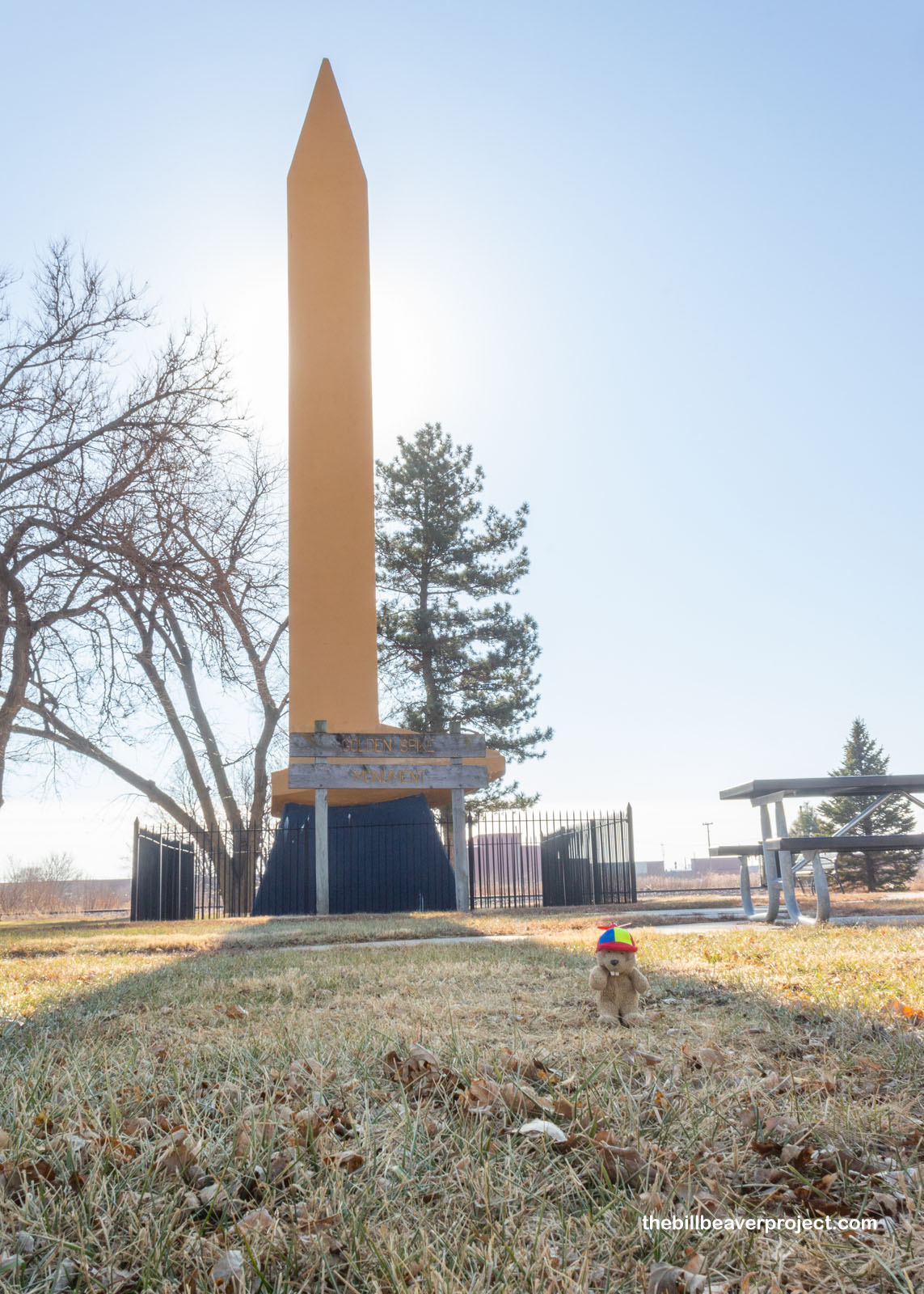 |
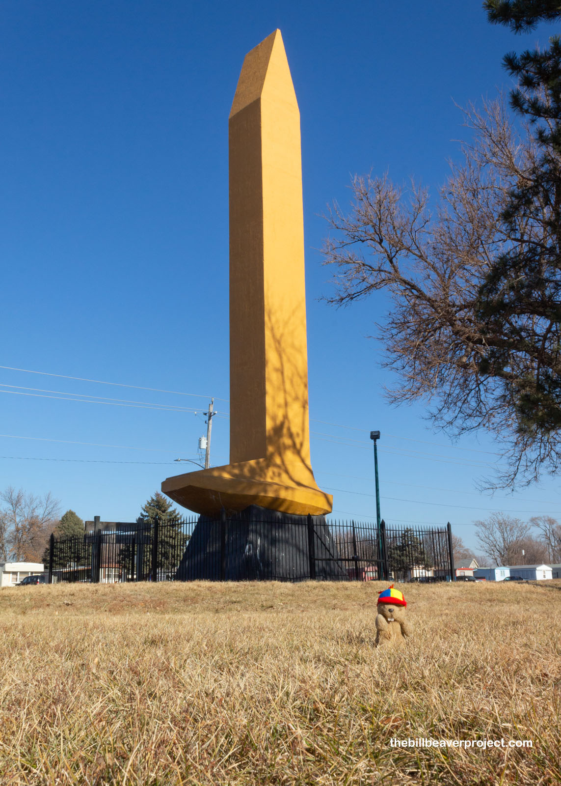 |
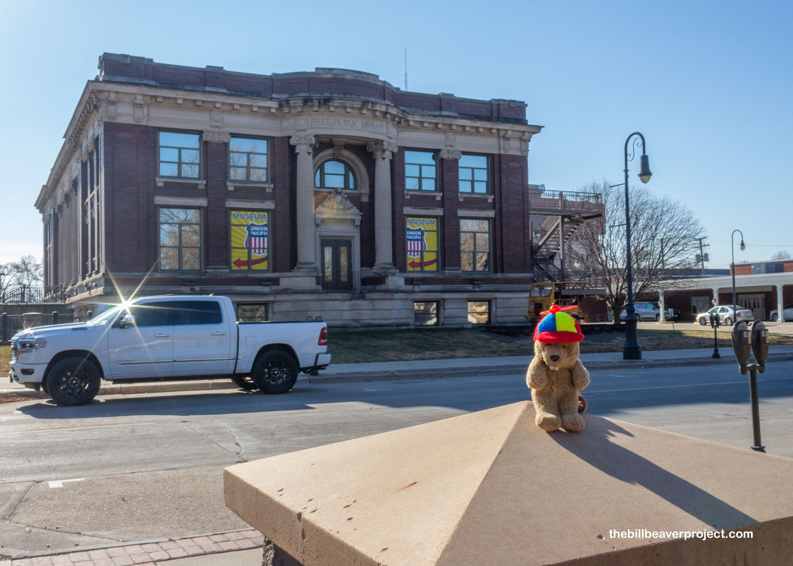
Nowadays, there’s a Union Pacific Museum in town, built into the Nationally Registered, Carnegie-sponsored, Free Public Library! It was closed when I visited, because it was a Tuesday, but inside, I would have seen exhibits on the Transcontinental Railroad, leisure and war on the rails, and the involvement of Abraham Lincoln in the railroads! In fact, it was Mr. Lincoln who confirmed that the railroad would end here, in Council Bluffs!
 |
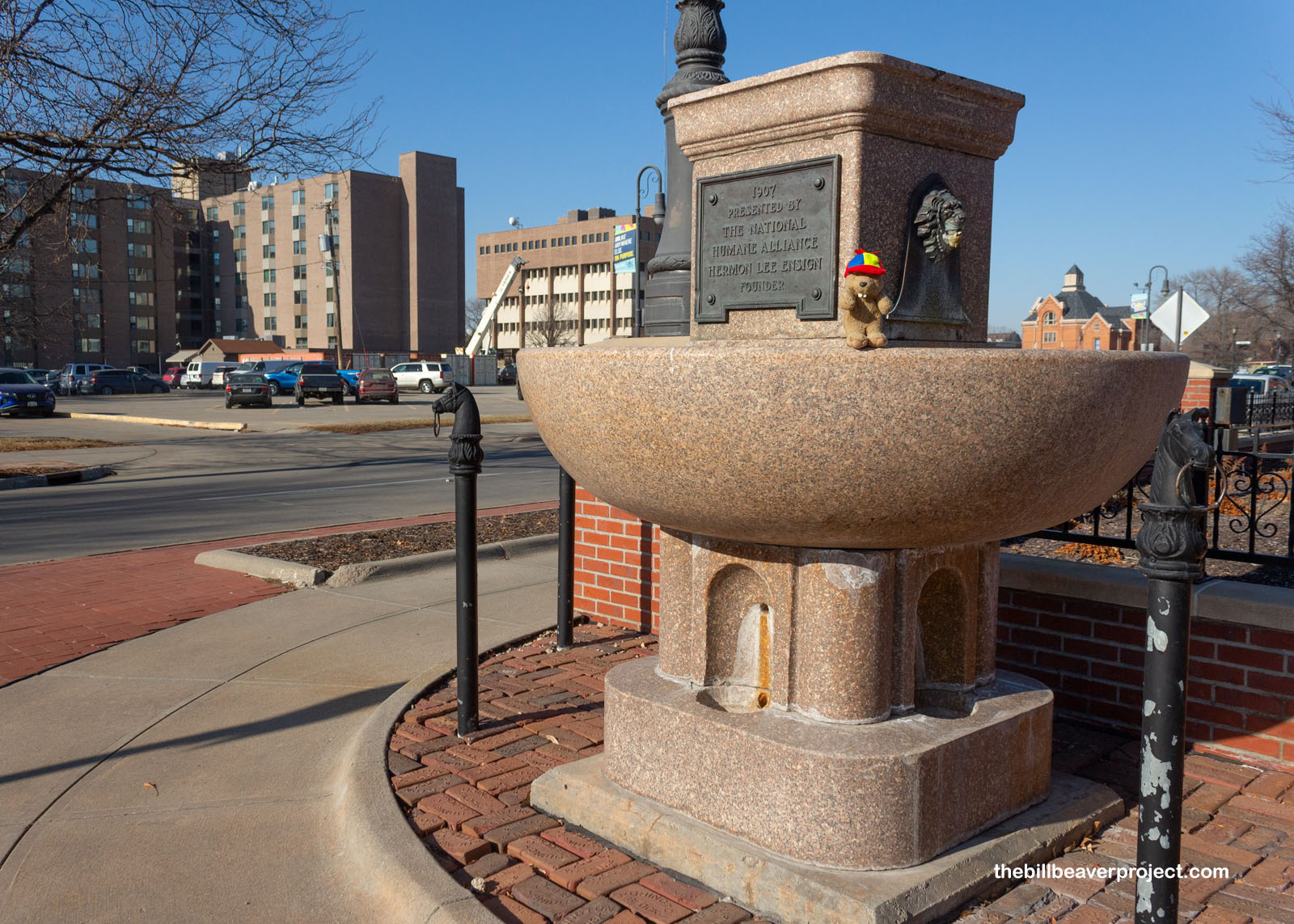
On my way to see the monument in Mr. Lincoln’s honor, I spotted something super familiar! Council Bluffs has a National Humane Alliance Fountain, just like the one I saw in Albuquerque back in February! This one arrived on July 16, 1907 and satisfied the needs of thirsty animals until cars became the main method of transportation. Those cars wrecked the fountain a couple of times, making it ineligible for the National Register, but it was still super neat to spot another of these fountains by chance!
 |
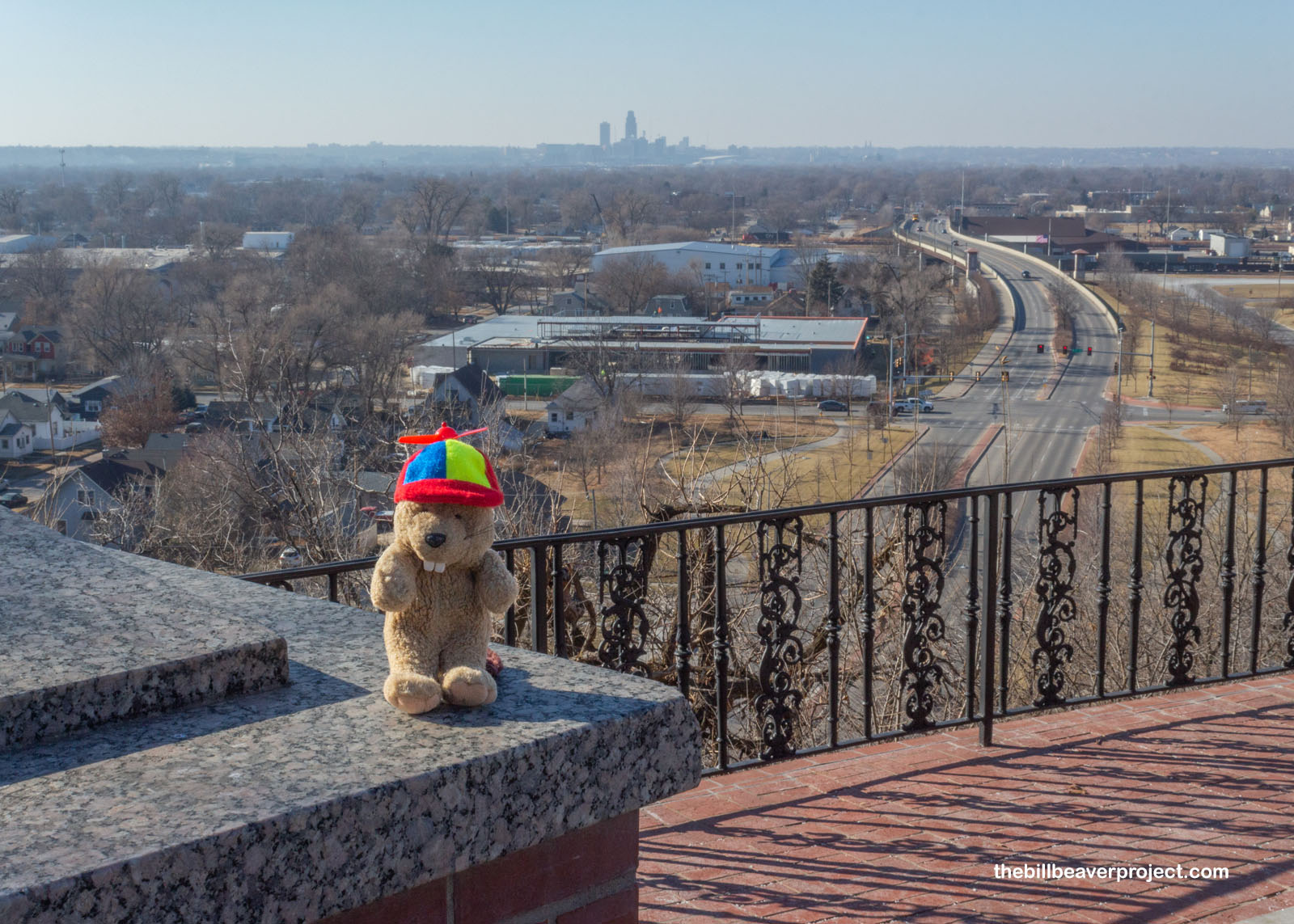
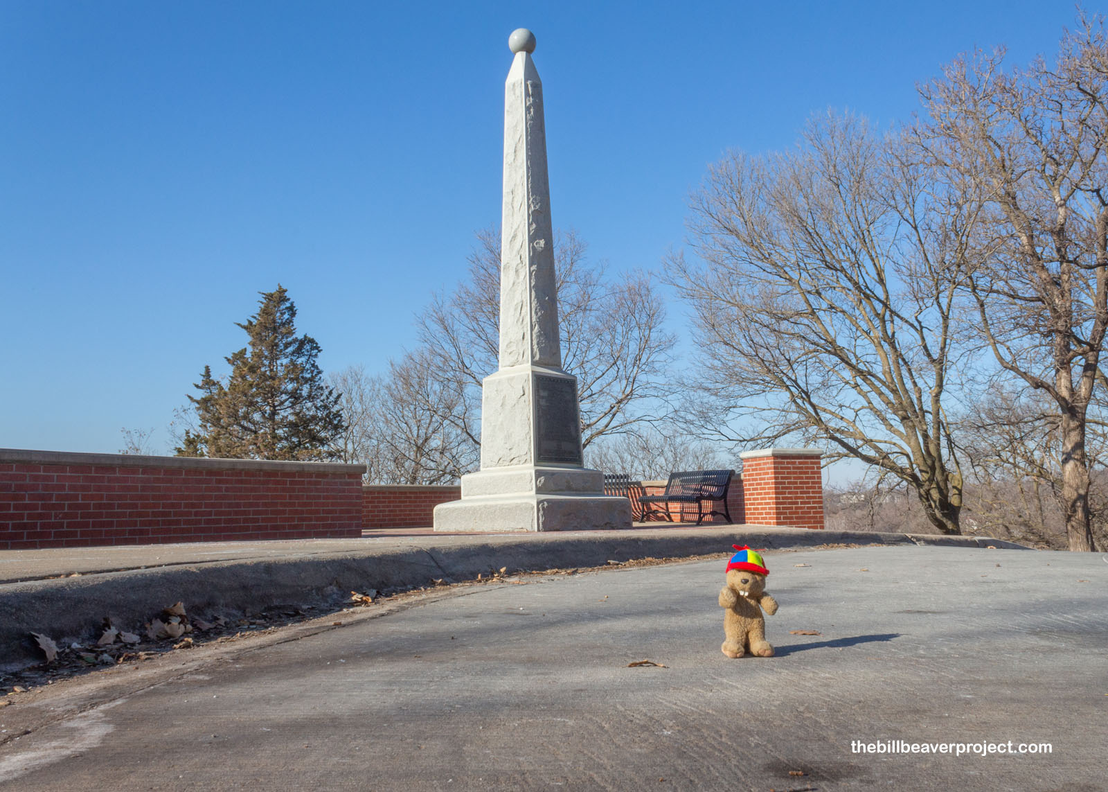
Anyway, up the hill, I reached the Lincoln Monument with its view of Council Bluffs and the Omaha skyline! This obelisk was erected in 1911 to commemorate the spot and moment when President Lincoln picked Council Bluffs to be the railroad’s terminus, so it makes sense that it had such far-reaching views into the west!
 |
 |
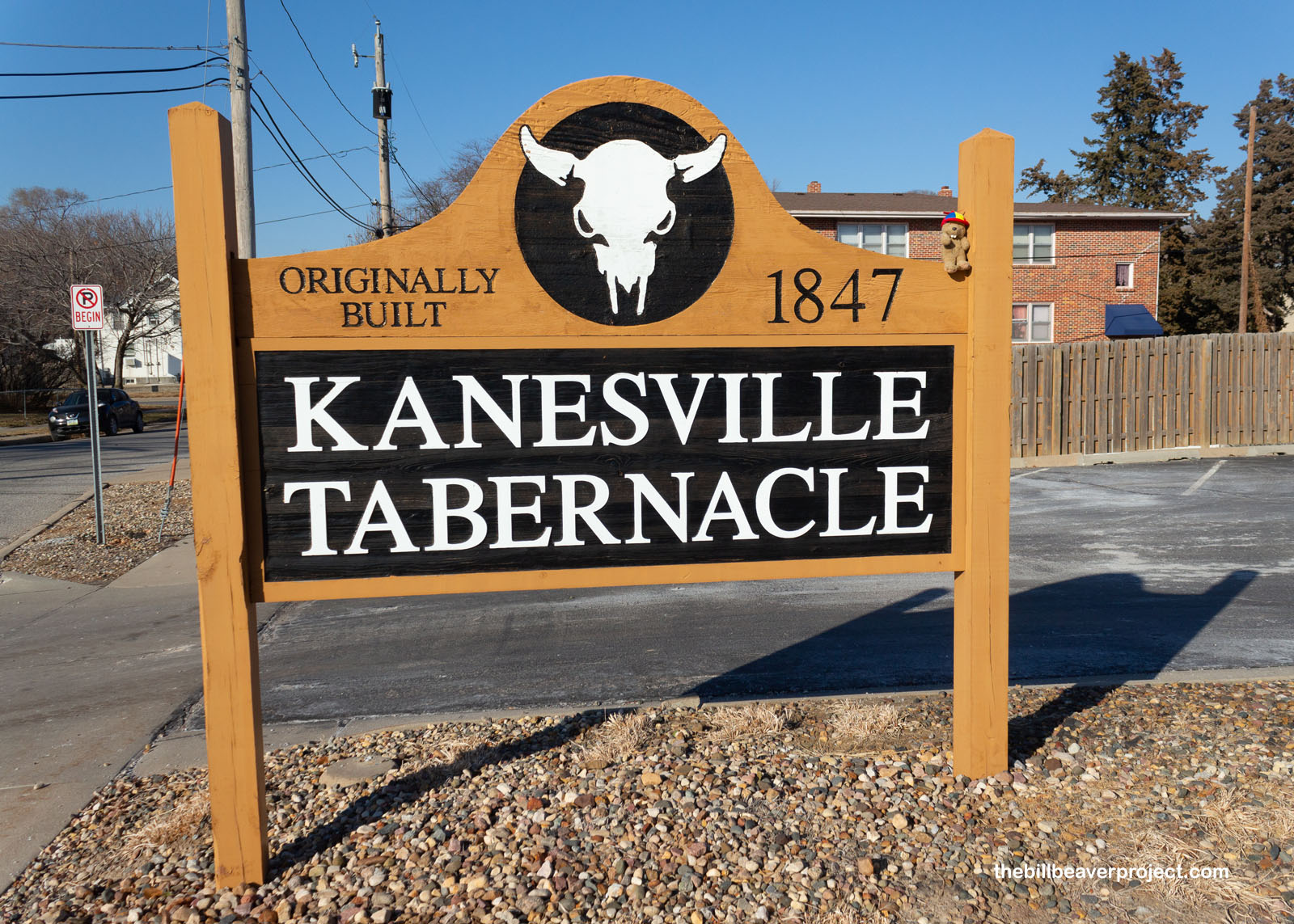
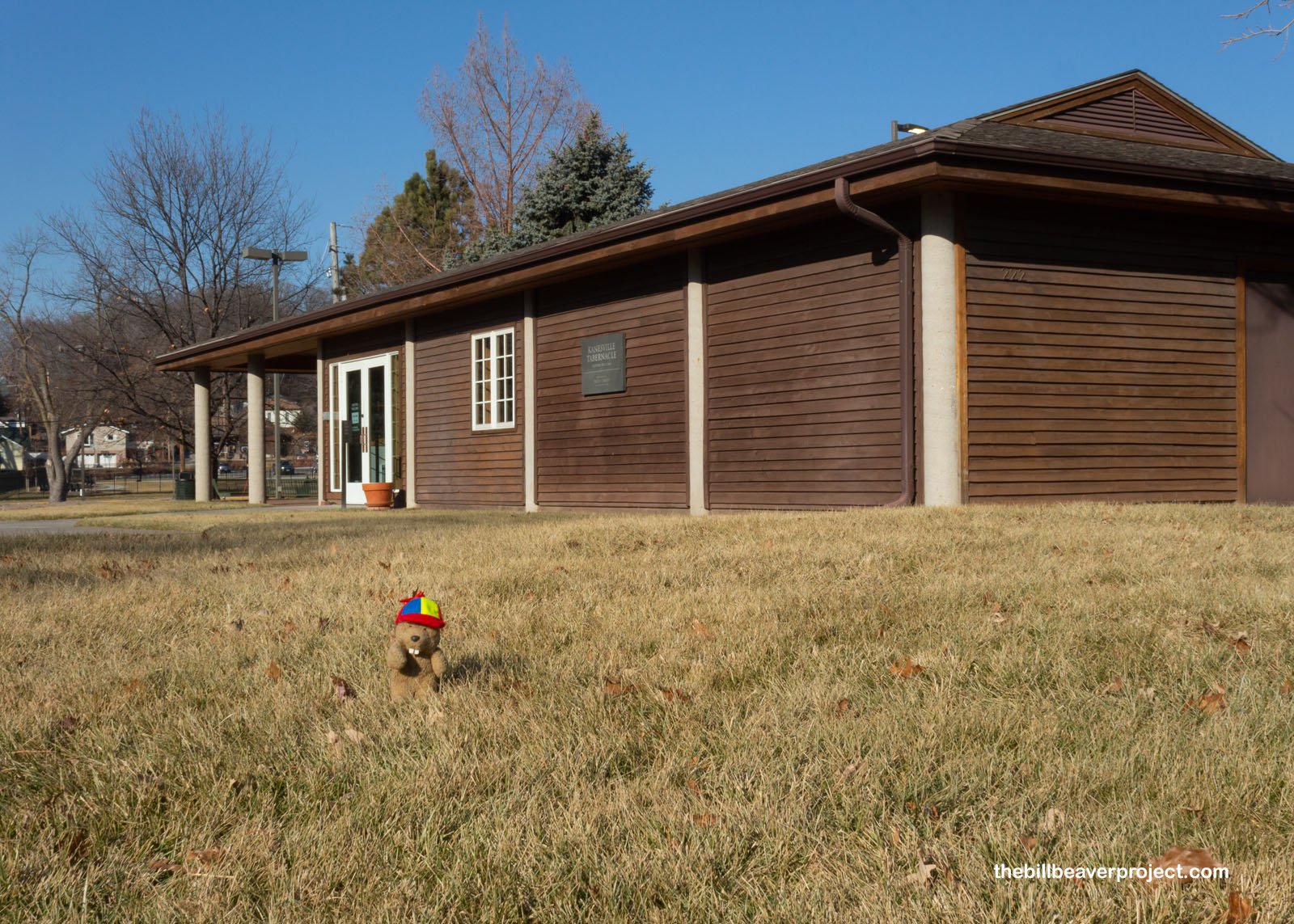
But Council Bluffs was sending folks west long before it was even called Council Bluffs! First called Traders Point in 1824, it became Kanesville after Iowa became a state in 1846! That was because of Thomas Kane, who negotiated with the government for the Mormons, exiled from Nauvoo, Illinois, to camp here before beginning their fateful journey west to what’s now Utah! They set up a tabernacle in two weeks, the start of the Mormon Trail, but they’d mostly moved west on that trail by 1852! The town would later come to be called Council Bluffs, named for a different, distant site upriver, but one I was sure I could see before the sun set!
 |
 |
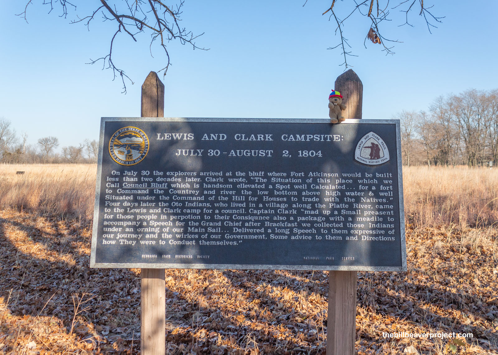
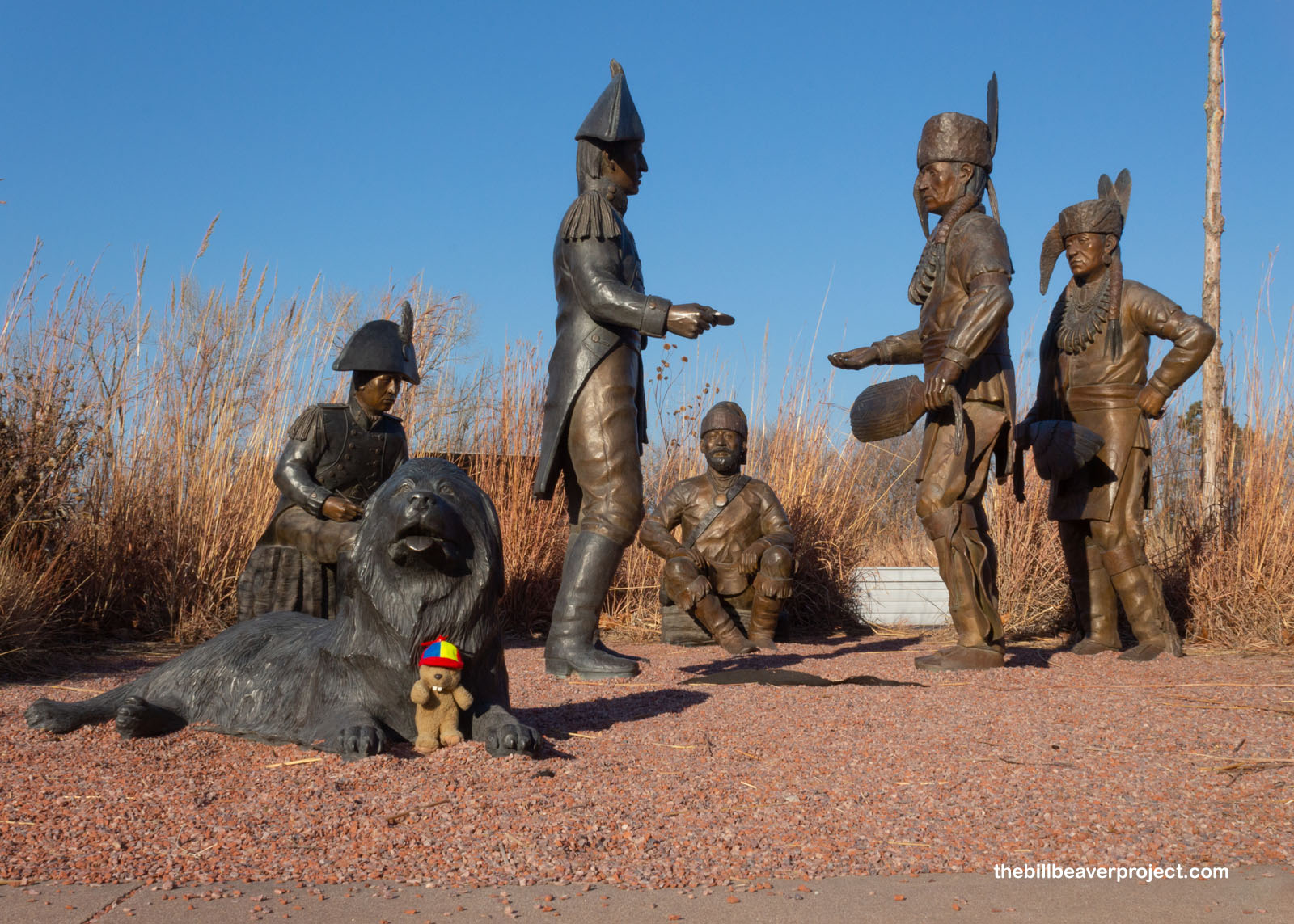
About 17 miles north of Omaha are the actual Council Bluffs! Here in late July, early August of 1804, the Corps of Discovery and their big Newfoundland, Seaman, camped and met the Otoe tribe. Mr. Clark remarked in his journal that it would make a great place for a fort, and his notes did not go unnoticed!
 |
 |
In 1820, the US Army set up Fort Atkinson at the site of the original Council Bluff in order to guard shipments of animal pelts and furs coming down the Missouri River! Named for Colonel Henry Atkinson, this 1000-person strong fort was the largest and most westerly military post, housing almost a quarter of the entire army!
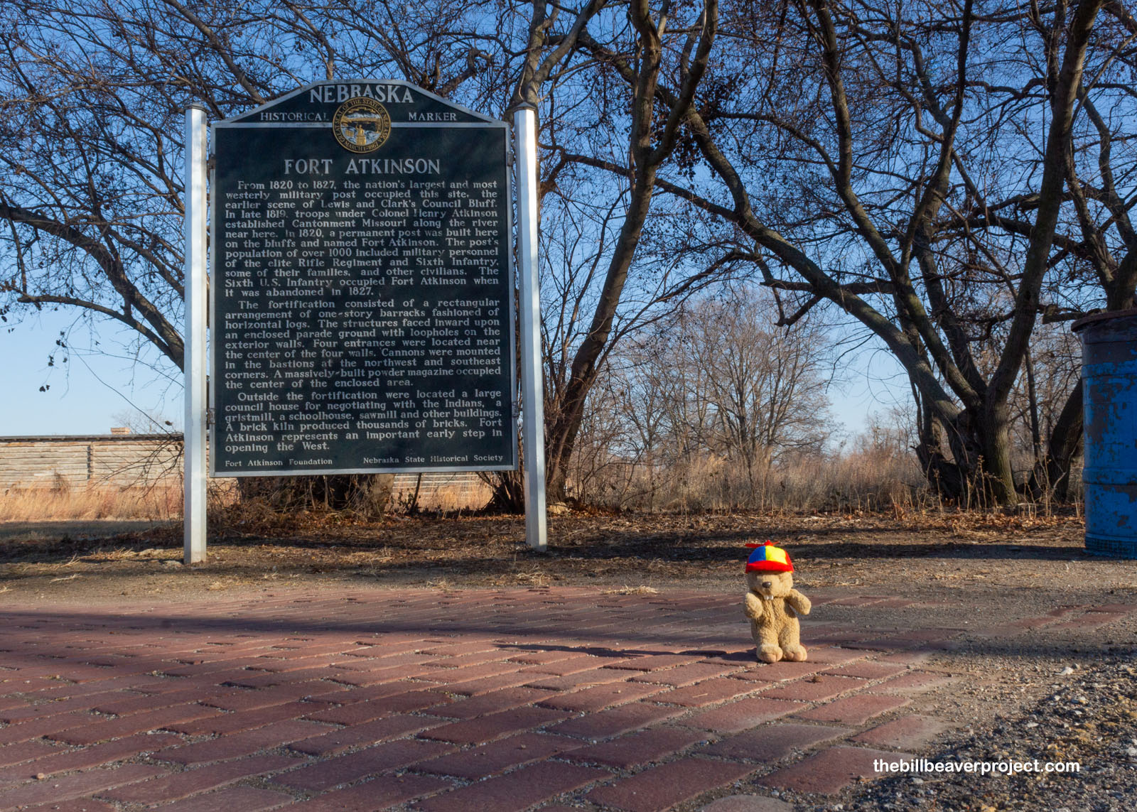 |
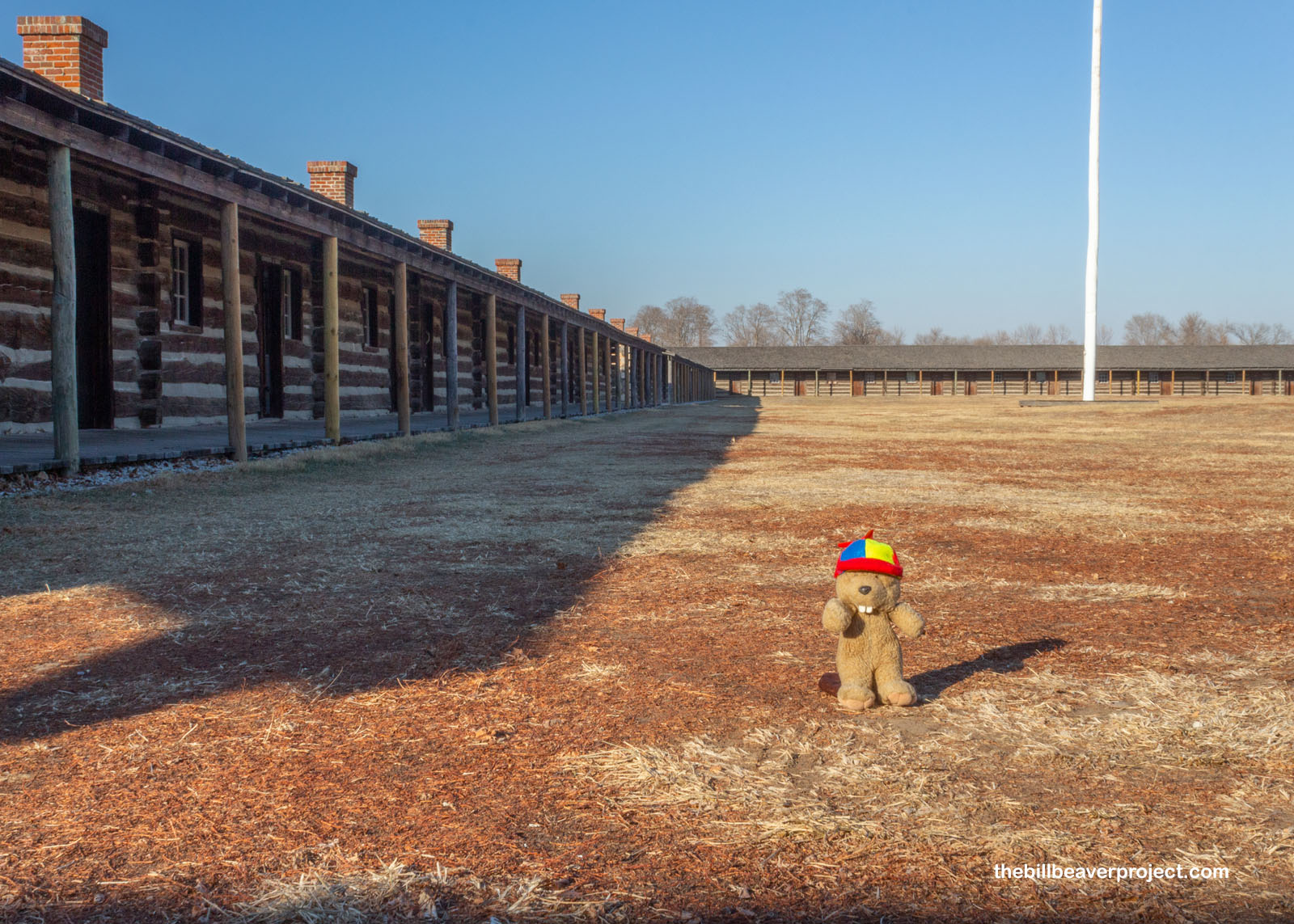
After a catastrophic bout of scurvy and a battle with the Arikara tribe in 1823, the Army reallocated their forces south to Fort Leavenworth, completely abandoning Fort Atkinson by 1827! In the early ’60s though, interest in the fort reawakened, and the Nebraska Game and Parks Commission reconstructed the fort, a process that took 20 years!
 |
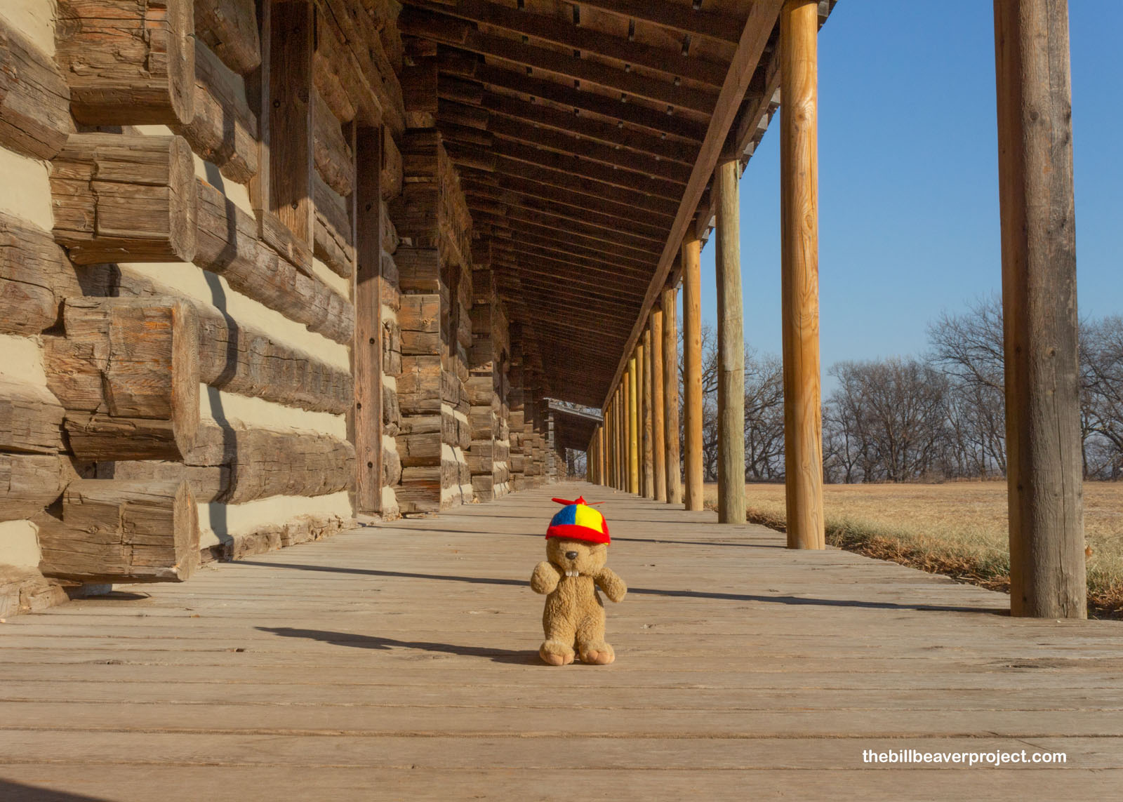 |
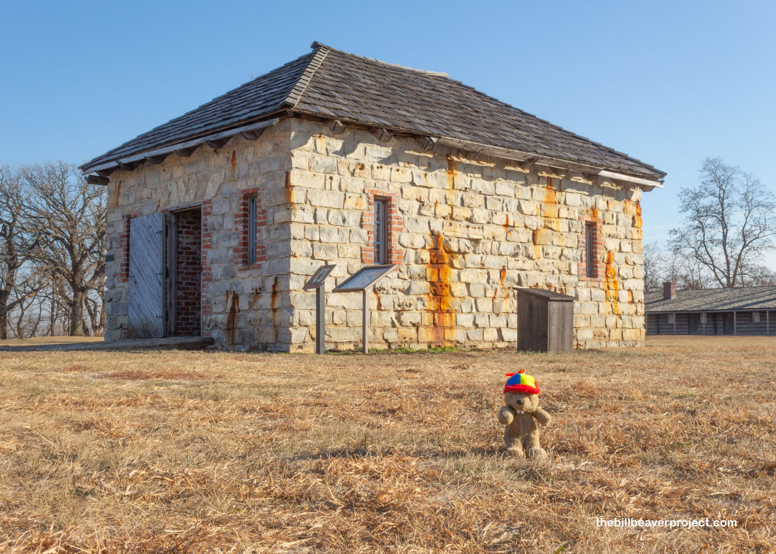
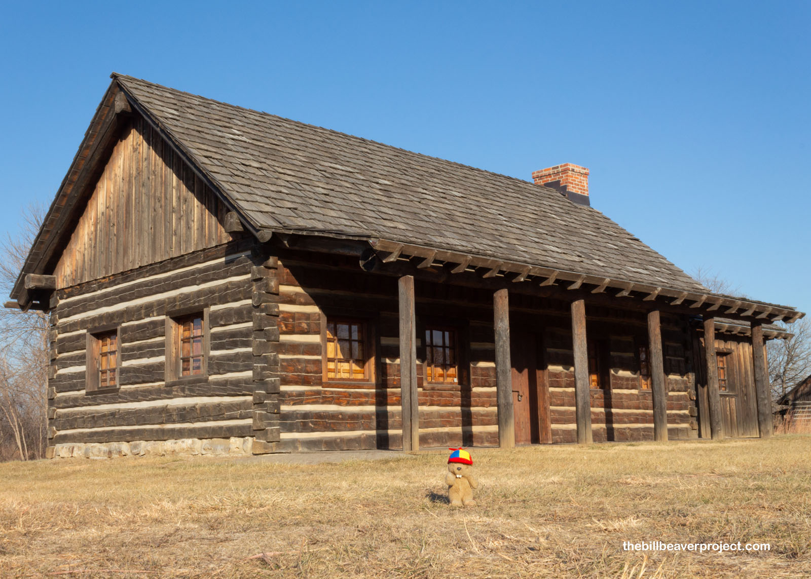
Some of those reconstructions included the powder magazine in the center of the fort, the last building to fall because of its thick stone walls. Folks weren’t allowed inside with their shoes on for fear that the nails in their soles would create sparks and blow the place to smithereens! There was also a reconstructed sutler’s shop, which I learned from Camp Nelson was the go-to place for basic supplies and the simple pleasures for folks stationed in a far-flung frontier outpost!
 |
 |
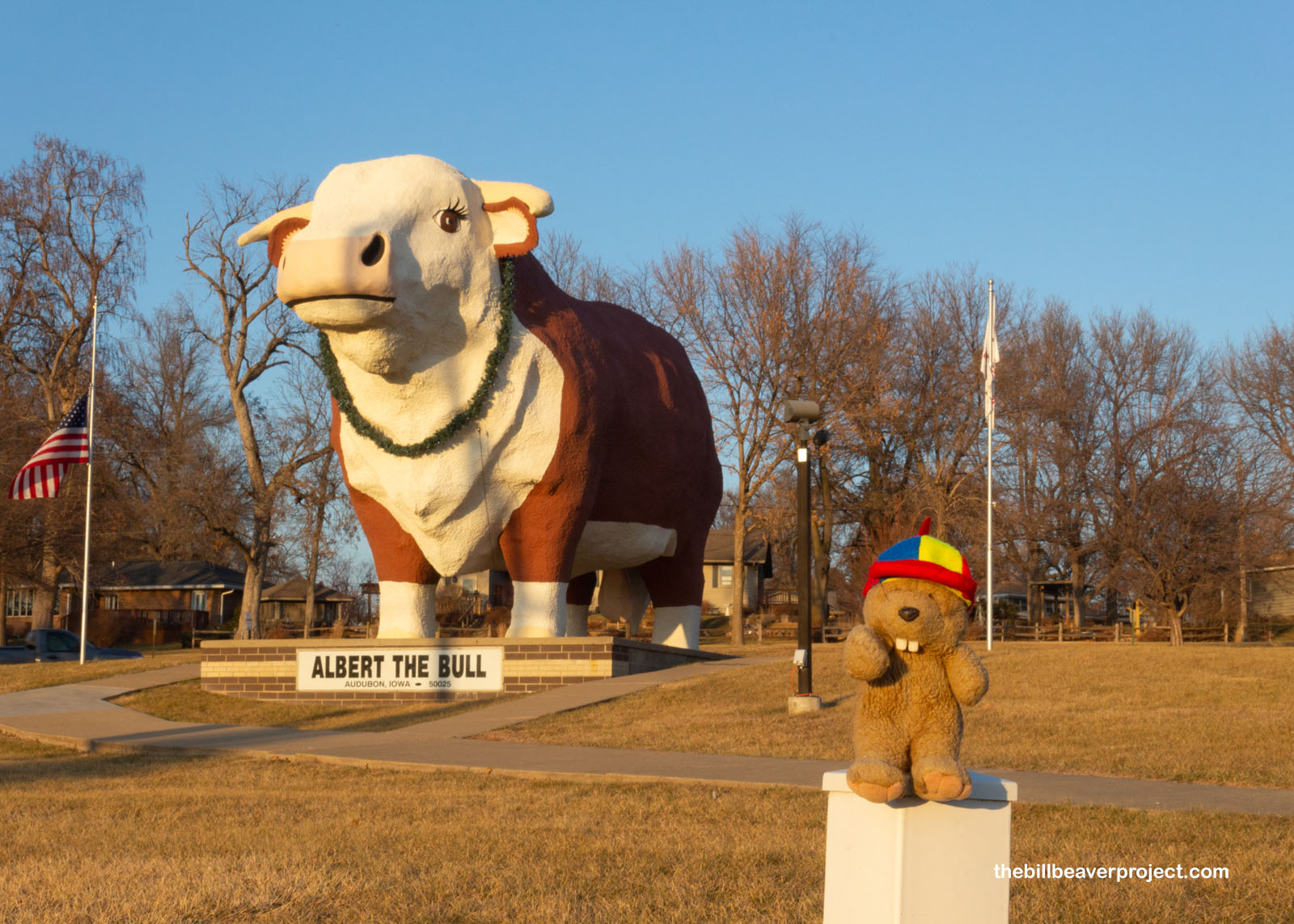
Speaking of far-flung, I’d been hoping to get to Des Moines before sundown! That sure wasn’t going to happen, with over two hours between here and there. So I cut a couple of things out of my itinerary and focused on what I really wanted to see, namely Albert the Bull! He was originally part of a beef promotion in 1964 called Operation T-Bone, led by Albert Kruse, who gave his name to the bull. At 28 feet in height, weighing 45 tons, this jumbo Hereford is the main attraction in Audubon, Iowa and the world’s largest bull!
 |
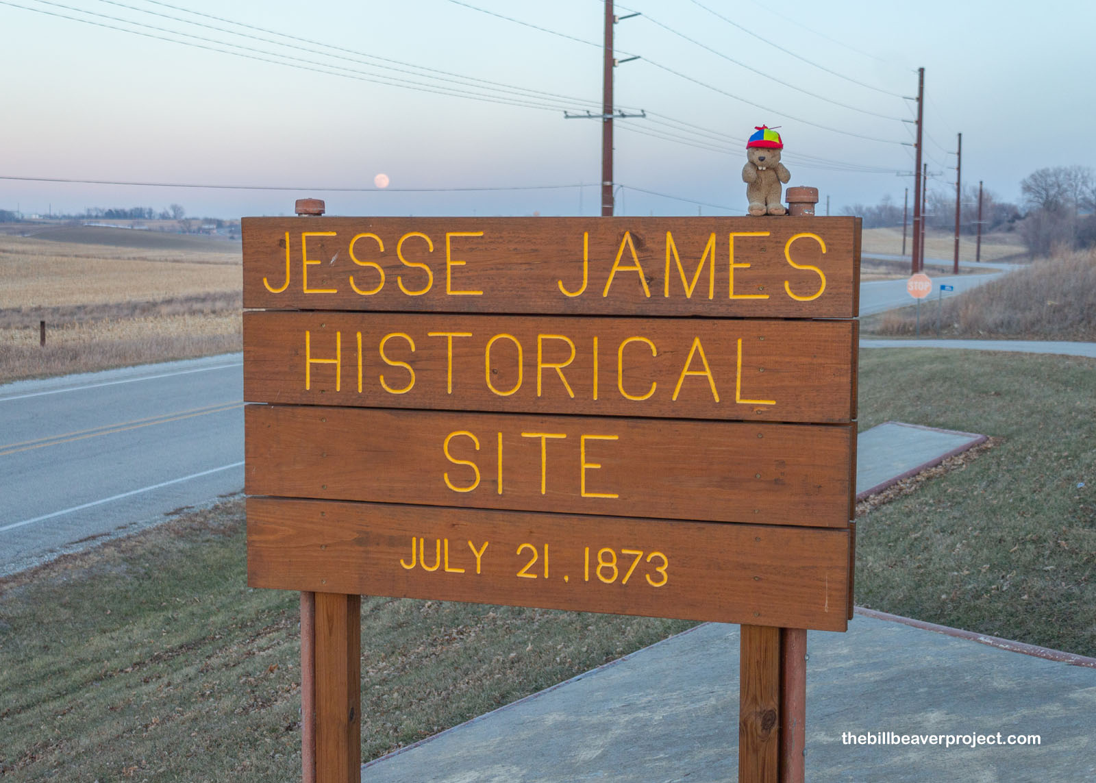
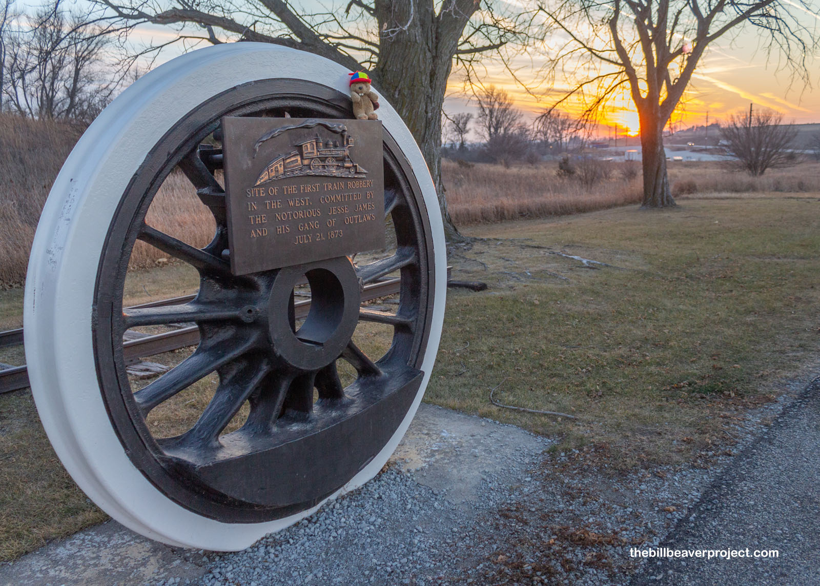
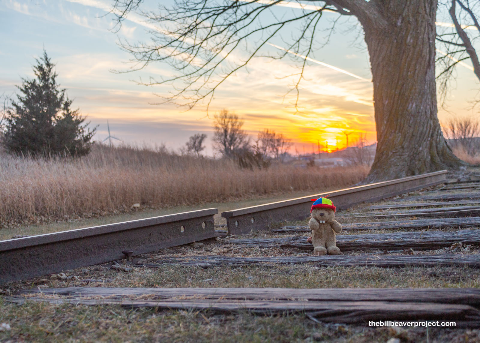
Then lastly, just down the road, as the sun was setting and the moon was rising, I made my last stop for the night at the Jesse James Historical Site, where the first train robbery in the west took place on July 21, 1873. Intent on getting $75,000 in gold from Cheyenne, the bandits derailed the engine, killing the engineer and fireman, and made the guard open the safe to reveal… only $2,000. The real shipment was late! It goes to show that, no matter how many roads and rails criss-crossed this part of the country, travelers made their journeys with great peril!
 |
 |
Whew! I feel like I’ve been chug-chug-chugging all over the place! As the temperature dropped, I took a moment to enjoy the Iowa sunset and think back on all the neat journeys I’d learned about today: wagons and canoes, bridges and railroads, even the journey to adulthood at Boys Town!
 |
I decided to turn in from today’s journey a little earlier without braving the icy night air, unlike last night in Lincoln, but I think that will make tomorrow’s early start much easier. I’ll be exploring some more of Des Moines then heading south to catch my plane and some more amazing places along the way!
Catch choo-choo later!

Previous Day |
Total Ground Covered: 528.0 mi (849.8 km) |
Next Day |