 Previous Day |
Columbia, SC → Blacksburg, SC → Charleston, SC 365.5 mi (588.2 km) |
 More 2023 Adventures |
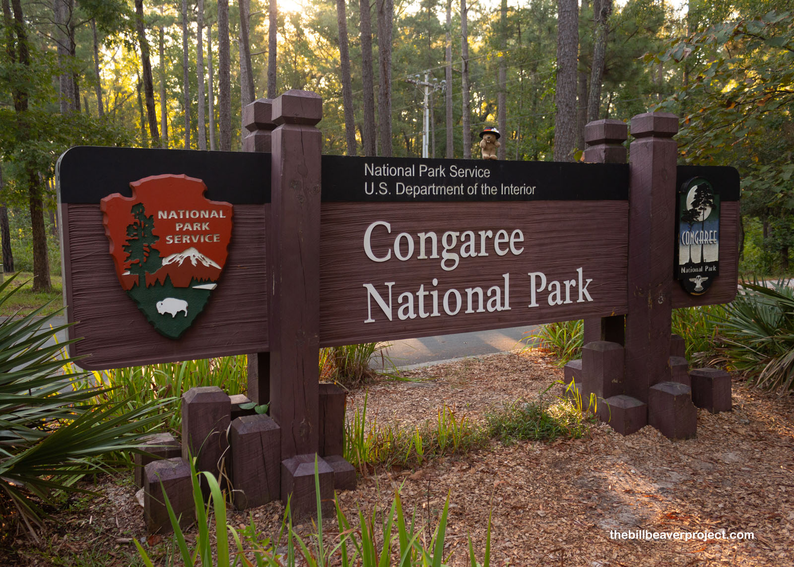
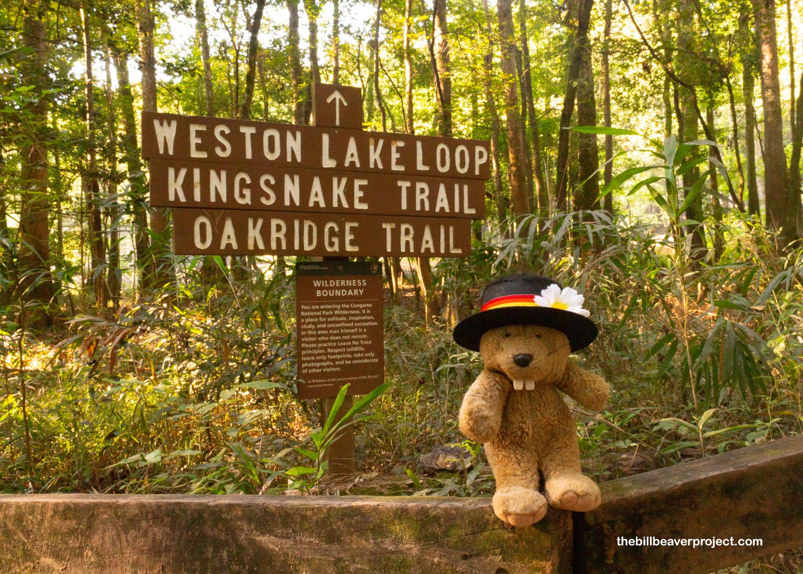
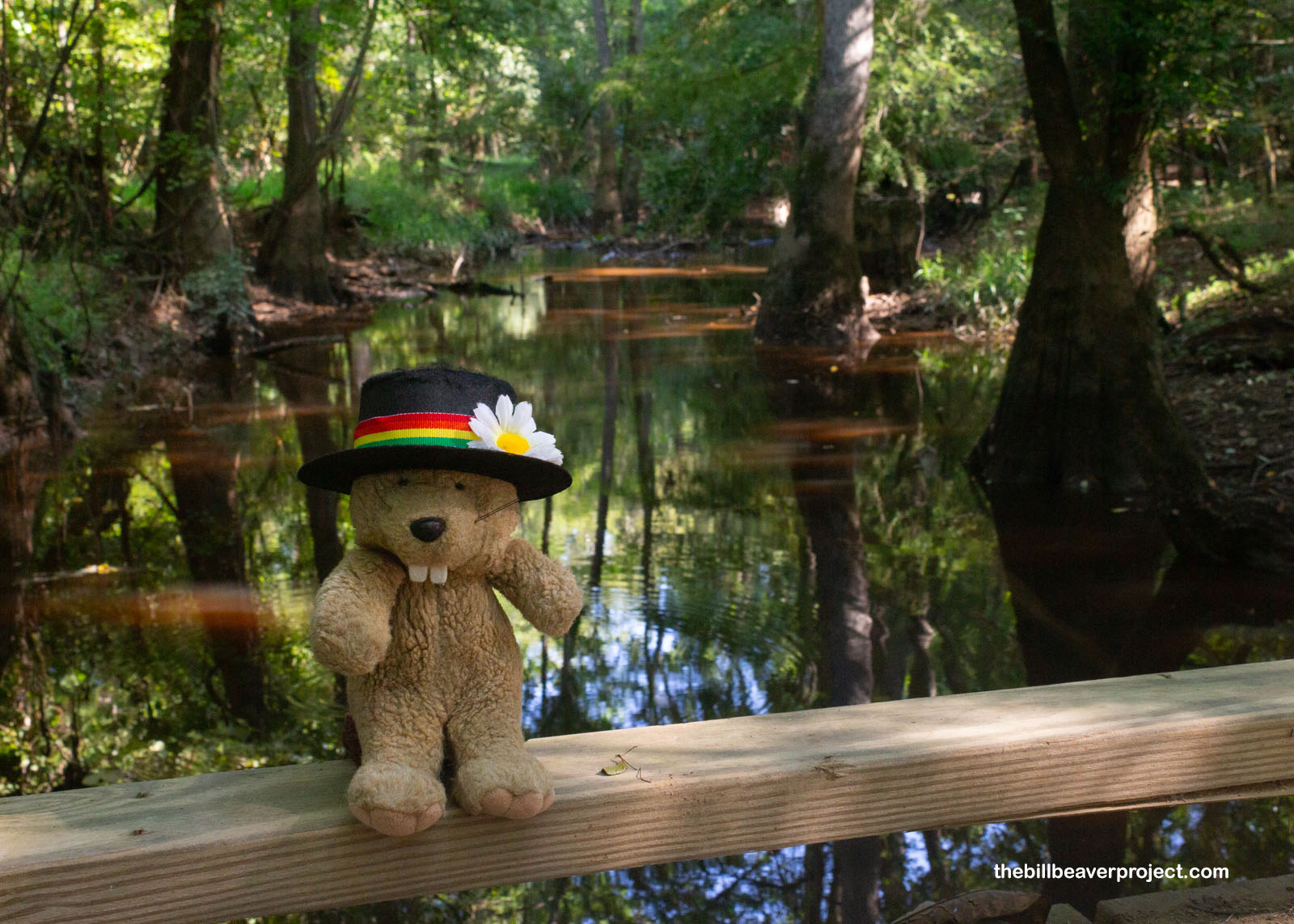
Let’s conga to Congaree, everyone!
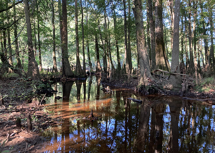
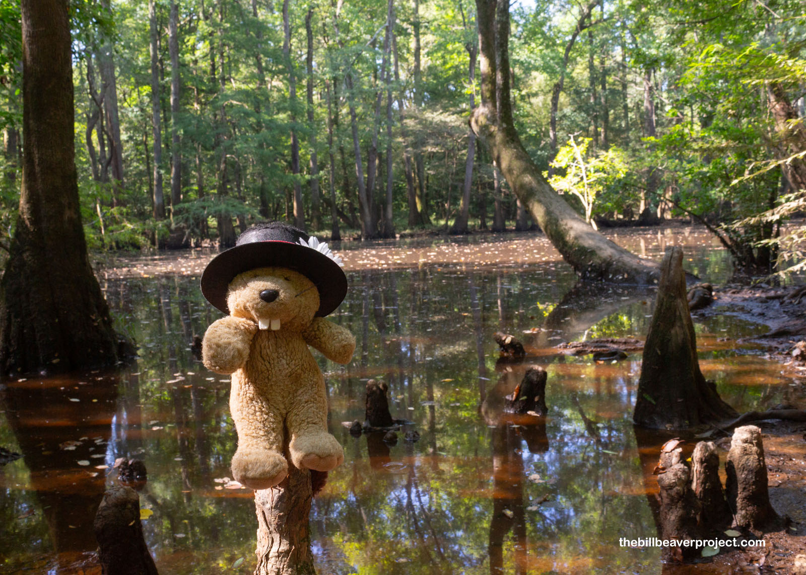
Just east of Columbia is America’s largest, intact, old growth bottomland hardwood forest! What the heck is that? Bottomland is a low-lying area along a river that’s subject to flooding. Hardwood describes broad-leafed trees like oaks, ash, and beech, and that this is intact and old growth means many of the trees in Congaree National Park are still growing in the same place where they sprouted, surviving centuries of logging. In fact, this forest is so perfect and diverse that it’s been recognized by UNESCO as a biosphere reserve!
 |
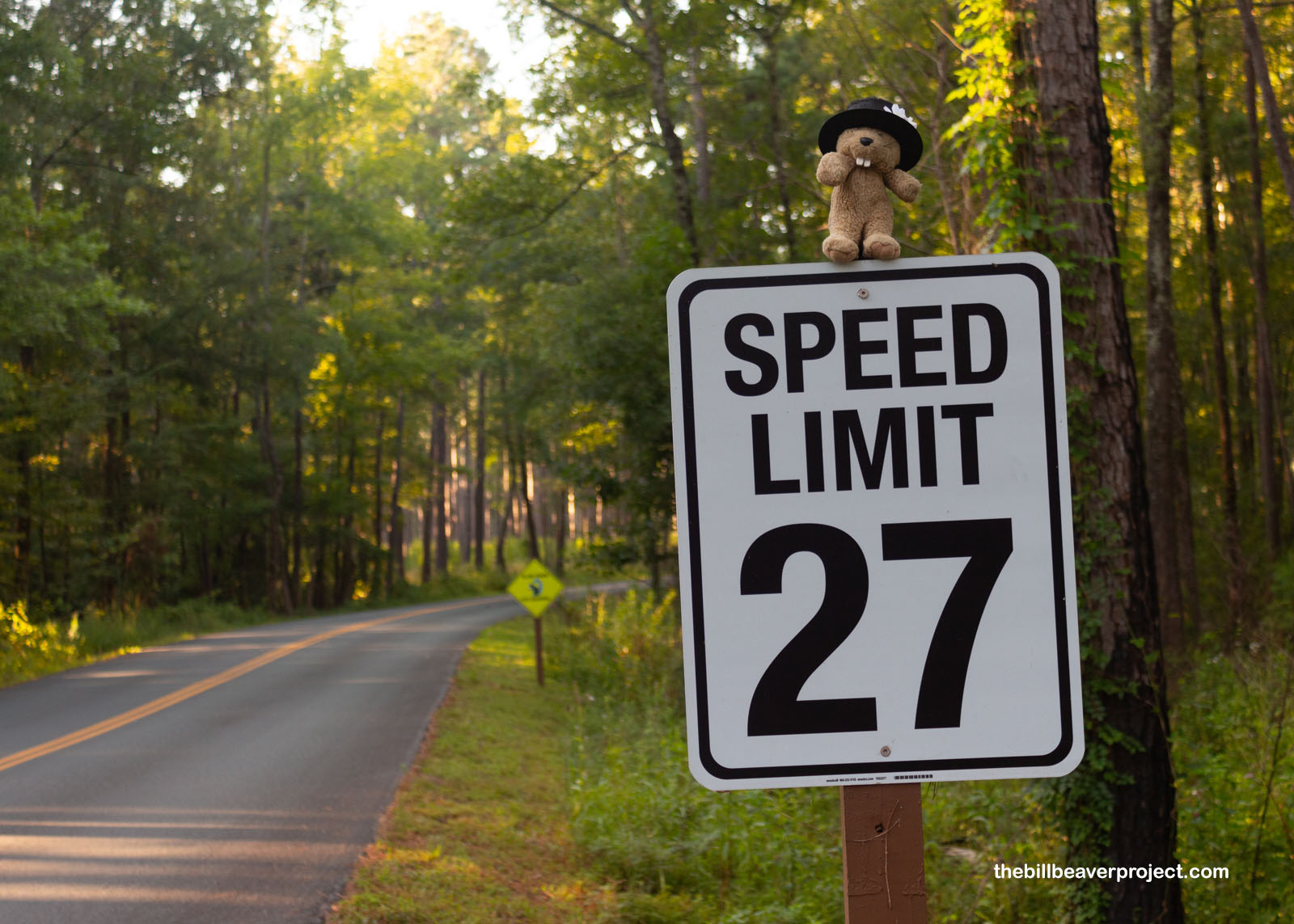
Right off the bat, I noticed something unusual about Congaree National Park: the speed limits were wonky! Usually, national parks set their speed limits at 25 miles per hour, but these were set to 27! This is to get folks to pay better attention and slow down on park roads!
 |
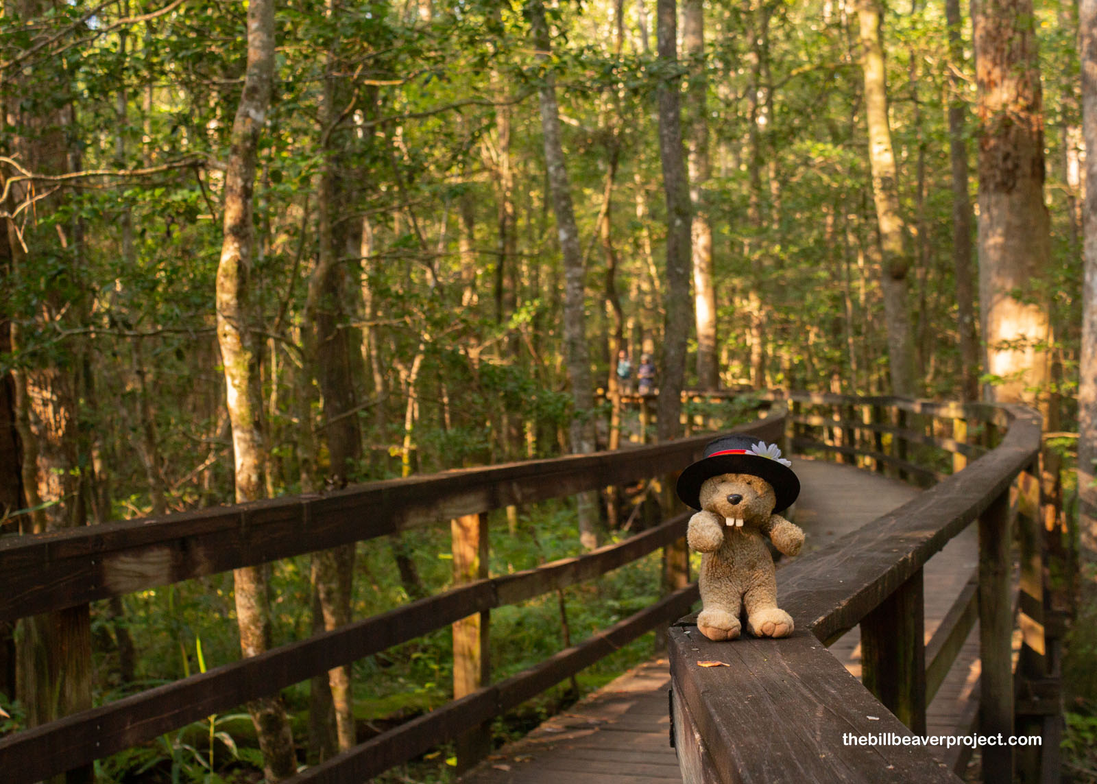
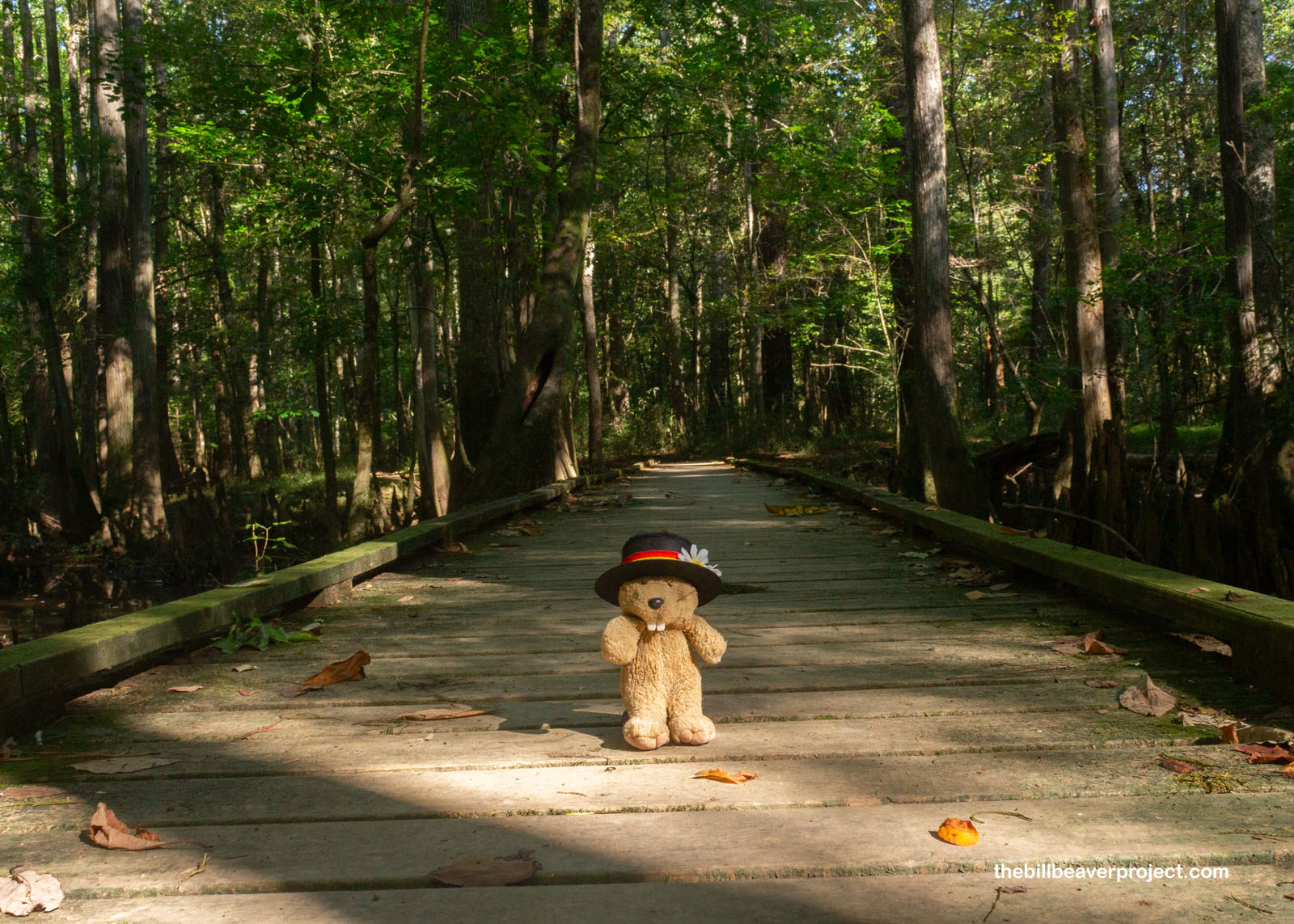
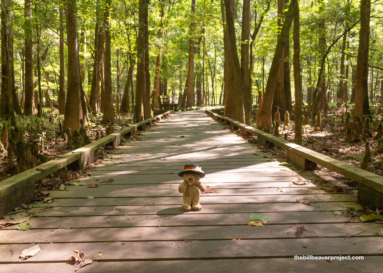
When I arrived, the visitor center was still closed, but the orb weaving spiders were already hard at work, high overhead, eating as many mosquitoes as they could trap. In my opinion, it wasn’t enough, so I set off onto the park’s famous boardwalk right away. The forest here was super thick, so thick the morning light could barely squeeze through. At least 15 of the trees here are called champion trees, which means they’re the largest known examples of their kind! Congaree is home to the nation’s tallest common persimmon (127 feet), American elm (135 feet), and loblolly pine (167 feet) just to name a few!
 |
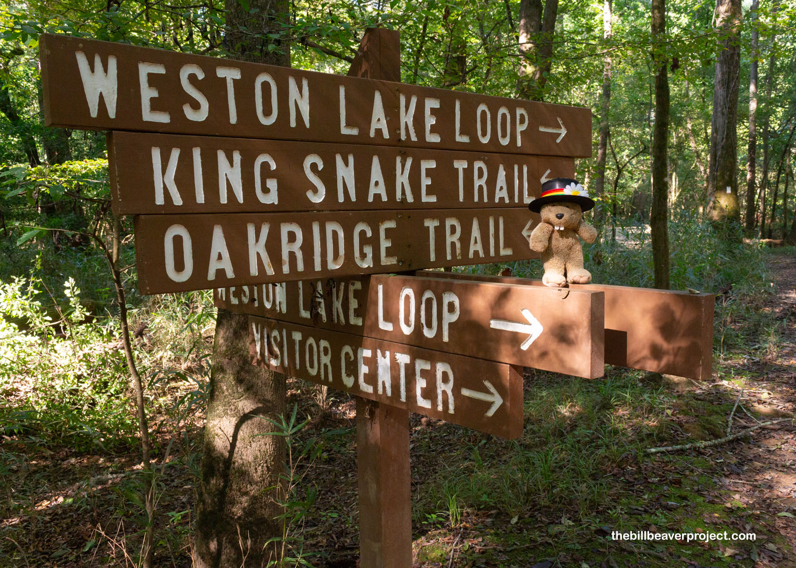
But I didn’t want to stay up high on a boardwalk all day. I wanted to get down and dirty (but not too dirty). Just over a mile down the boardwalk loop, the trail split off on the Weston Lake Trail. Though I wasn’t able to see much of Weston Lake through the trees, getting down here was going to give me a much more up-close look, through the heavy shade, at Congaree’s natural wonders.
 |
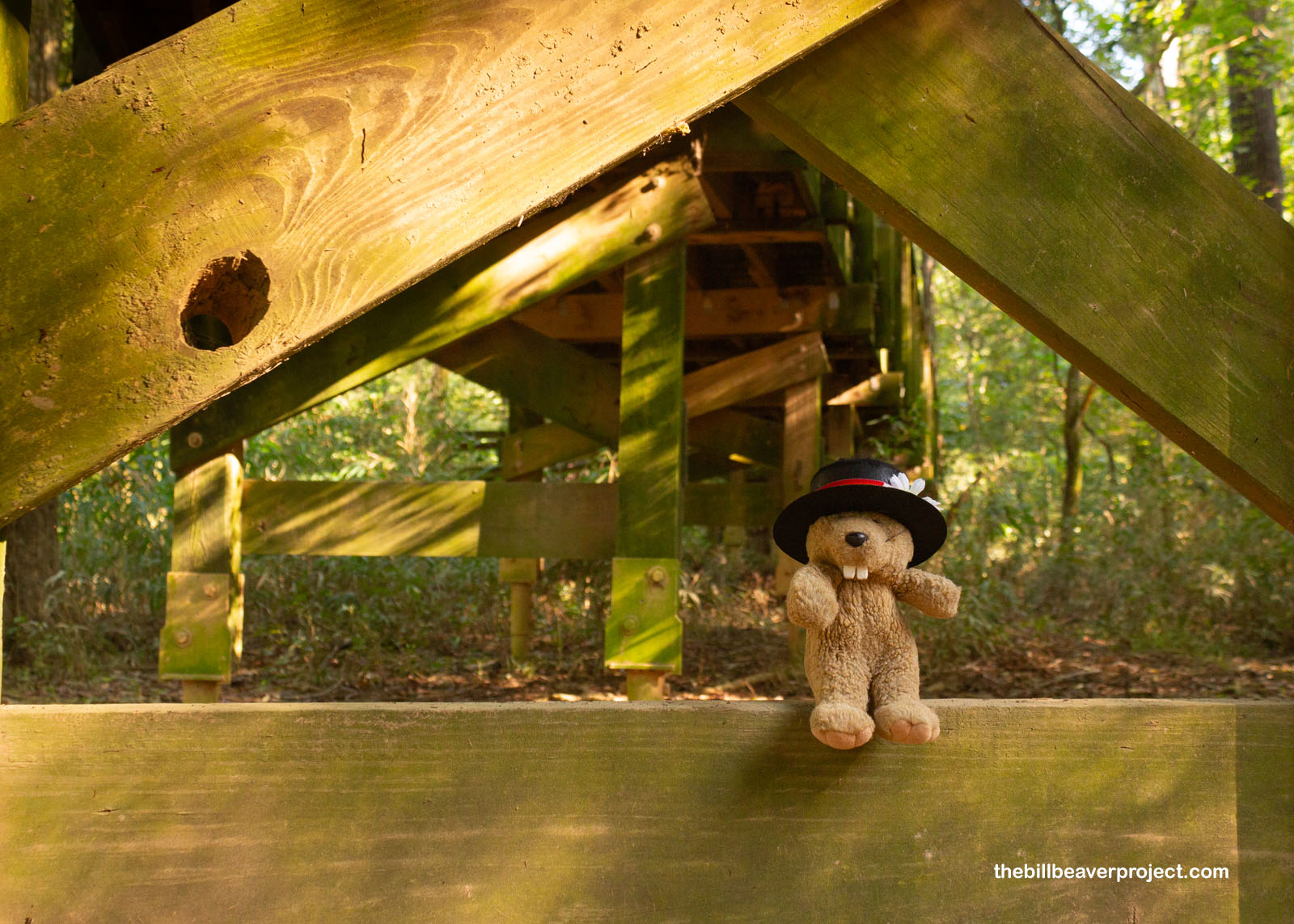
The forest may be old growth, but the boardwalk isn’t. That’s because this area has only had federal protection since October 18, 1976, when it was declared Congaree Swamp National Monument! The original boardwalk went up between that date and the re-designation as national park on November 10, 2003, but much of it was destroyed by Hurricane Hugo! As sad as that was, rebuilding the boardwalk in 2015 gave the National Park Service the opportunity to make it friendlier to folks with disabilities, and so today, this 2.4-mile boardwalk is fully compliant with the Americans with Disabilities Act!
 |
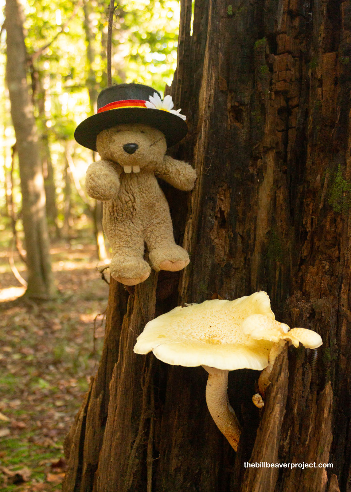
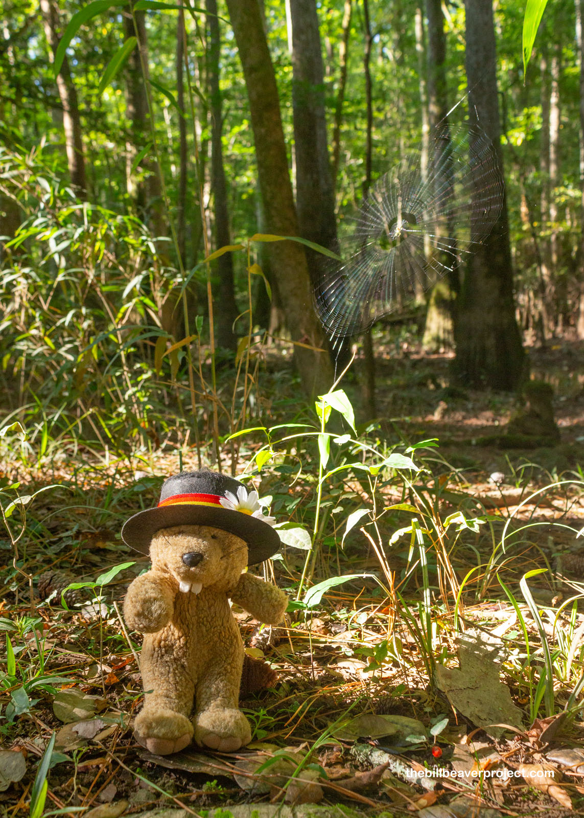
But I was off to a much less compliant part of the trail, riddled with roots, puddles, and spider webs. Being so low to the ground gave me a chance to take in some of the smaller wonders, like these oyster mushrooms! Edible for mushroom gatherers, they’re also carnivorous themselves! Oyster mushrooms actually kill and absorb nematodes! In some ways, they’re just like the many, many spiders spinning webs here. I wasn’t able to get high enough to photograph the magnificent golden silk spiders like the ones I saw at the Natural History Museum back in 2012, but there were plenty more at my level, like the filmy dome spider, Arabesque orbweaver, and tuft-legged orbweaver! As web weavers, they just wanted to be left alone to catch critters, and I was happy to let them do their job. The mosquitoes were still buzzin’!
 |
 |
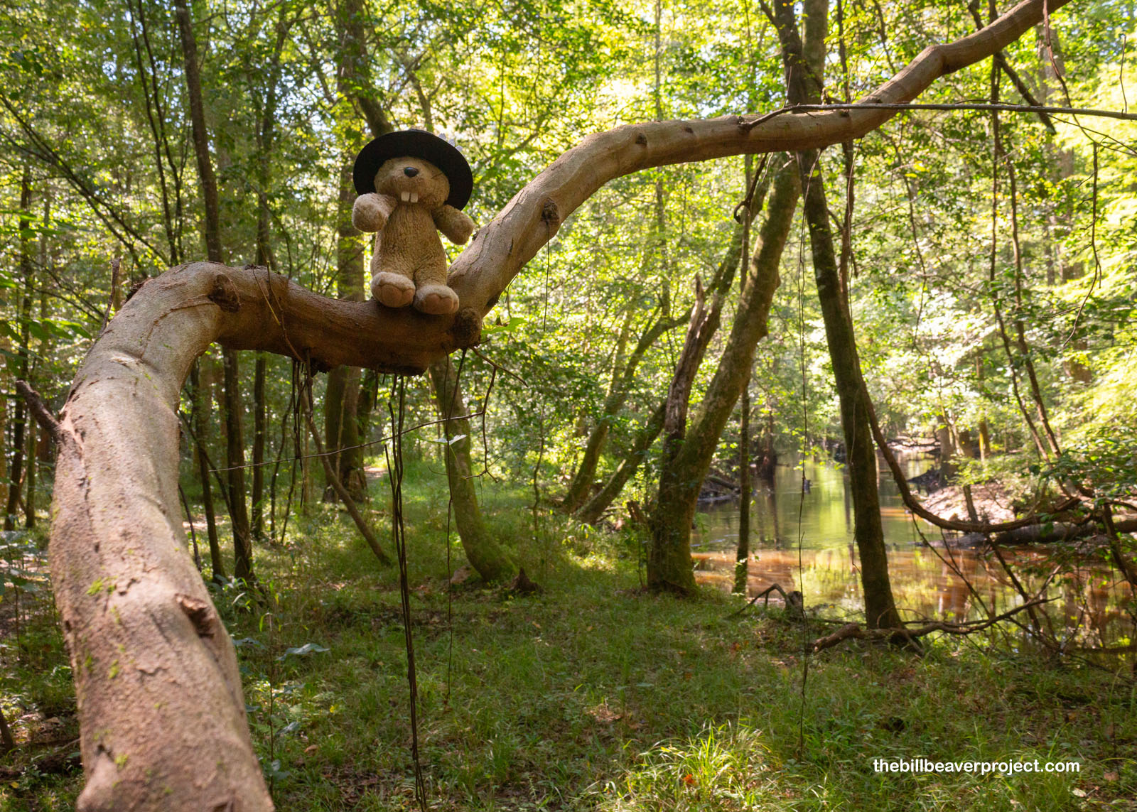
In places along the trail, bridges passed over sloughs left behind by the flooding of the Congaree River, the ideal environment for trees like the water tupelo (Nyssa aquatica). Called ito opilwa (“swamp tree”) by the Muskogee, these trees have long been important sources of fruit for wild critters, and tasty twigs for us beavers! It’s said that honey made from tupelo flowers is the finest to be found anywhere!
 |
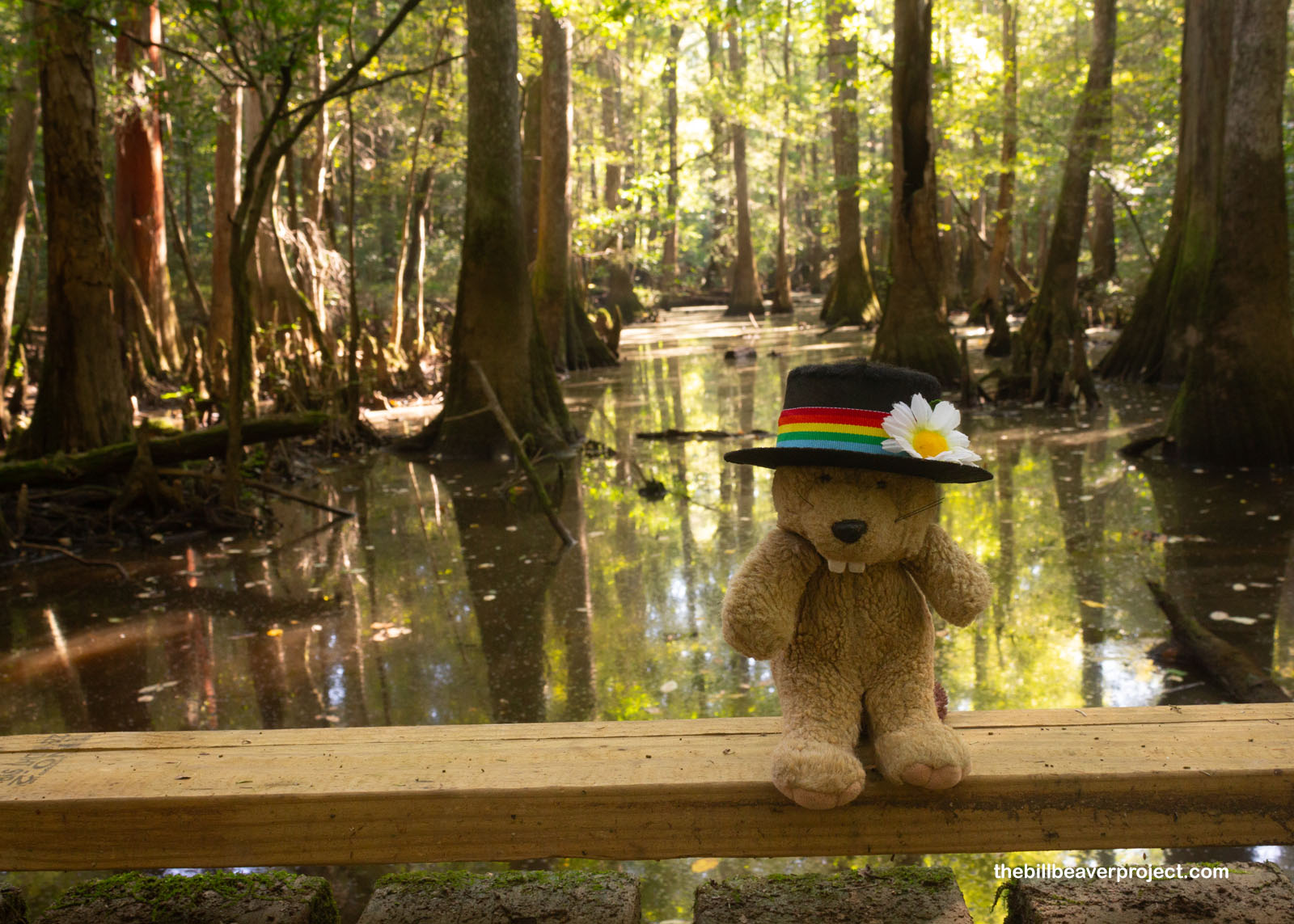 |
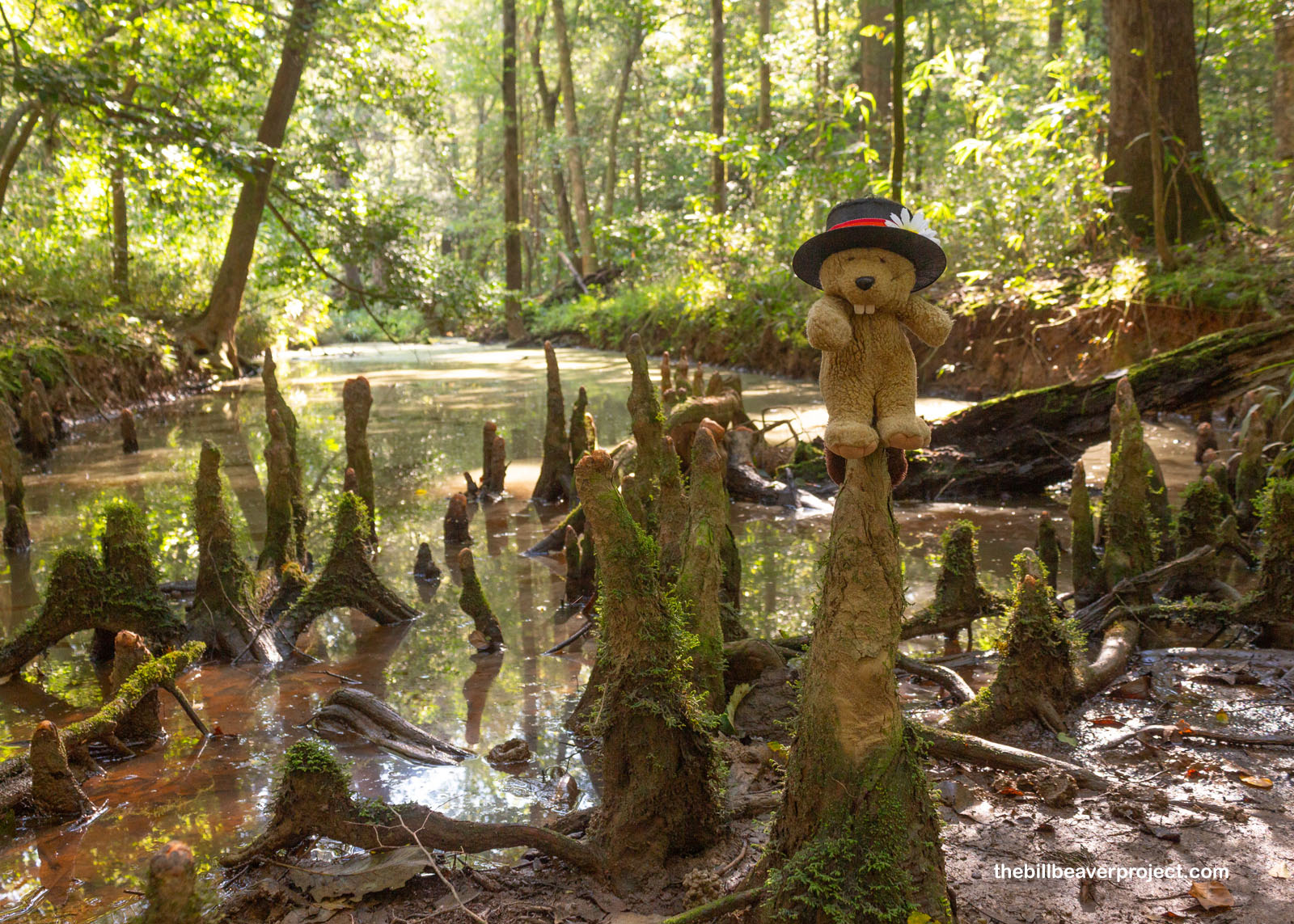
Growing alongside these tupelos were bald cypress, just like the ones I’d seen in Louisiana and Mississippi! These ancient trees have super unusual roots called “knees” that stick up above the water, and they’re famous for their resistance to wood rot. Protecting the last of these enormous trees from hungry loggers was a major reason for setting aside Congaree as a national monument and park!
 |
Just under a mile’s stroll from the end of the boardwalk, the Weston Lake Loop turned to the right along Cedar Creek, turning into a dry and kind of bland trail. But that didn’t mean there wasn’t neat stuff to see off in the distance! In fact, I looked up to find an endangered indigo snake relaxing in high in some branches, and I looked down the trail to see a big old wild boar sniffing through the undergrowth! Many of the critters found here were once widespread across South Carolina, but now, Congaree National Park is the main place they call home.
 |
 |
And that’s really the most special part of Congaree National Park. It’s not home to sweeping vistas or stunning landforms like some national parks, but it’s home to an incredible assortment of plant and animal species, from big ol’ alligators to the tiniest frogs I’ve ever seen! Luckily for me, I did not see any gators on my trips down to the water.
 |
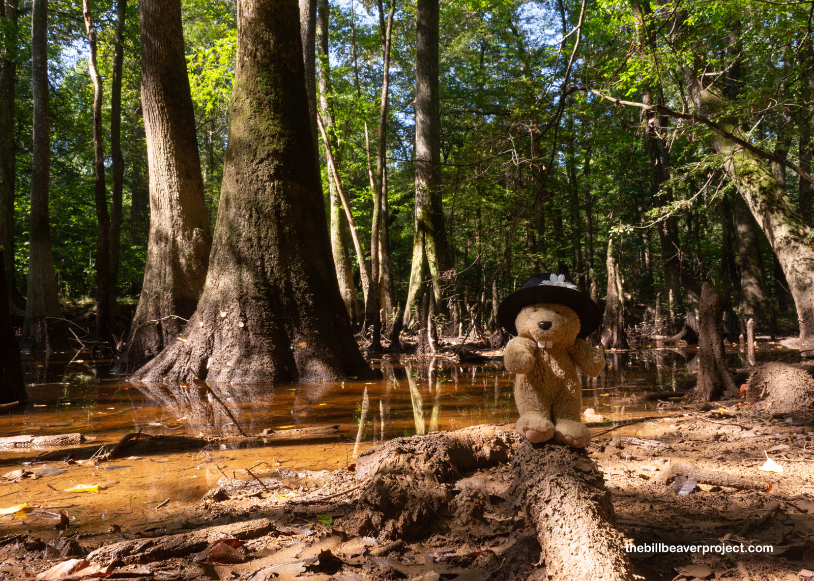 |
The last half of this 4.5-mile route was kind of a slog, as the summer heat started to rise, the mosquitoes continued to buzz, and the sights faded into woodland, but I figured it would be a wise decision to detour over to Wise Lake before I finished my loop.
 |
Wise Lake, like Weston Lake, was once part of the Congaree River, which changed course many times over the centuries, much like the Rio Grande! As the main flow faded away from this area, it left behind an oxbow lake that’s now named for English merchant, Samuel Wise. It was here where I made the very unwise decision to climb up on a cypress knee for a photo, and moments later got blown off into the mucky water!
 |
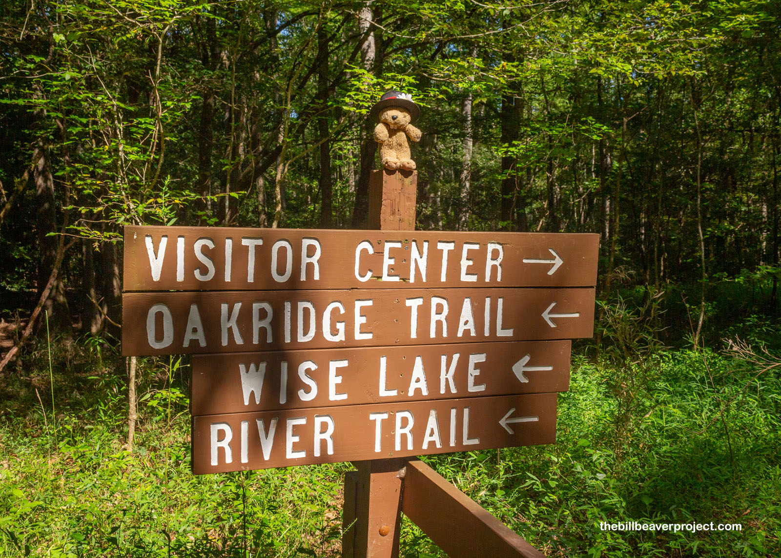
I finished up my boardwalk loop dripping with muddy water, not exactly how I hoped I’d finish my visit to Congaree National Park, but at least it cooled me off as the Southern heat built up. I paused my grumpy trek just long enough to help an aspiring photographer learn manual focus on her first DSLR and sent her on her way to explore the forest. Then, I had a decision to make: I could take it easy and explore nearby Columbia in depth, or I could schlep two hours east to see another national park site, even though I knew the visitor center was closed and would not have a passport stamp for me. If you’ve been reading my blog at all before now, my afternoon plans should be obvious!
 |
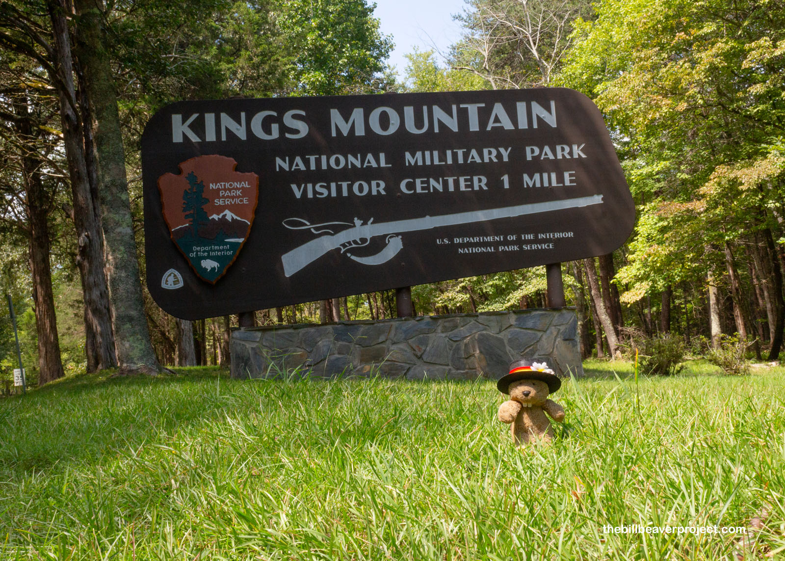
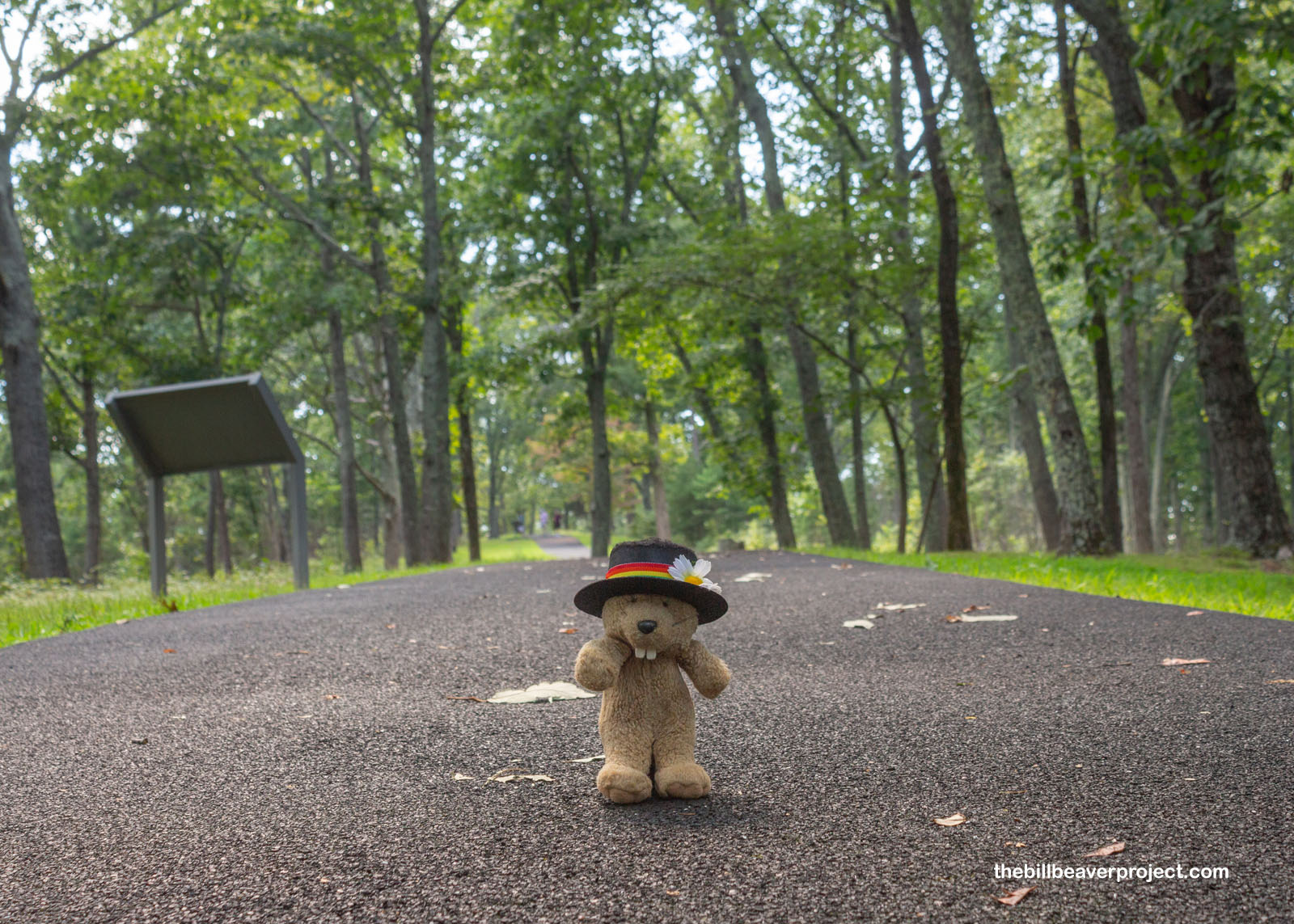
A long, hot slog later, and I pulled up at Kings Mountain National Military Park, site of a very unusual battle on October 7th, 1780. What made it unusual? Well, even though this was the midst of the American Revolution, not a single British soldier fought here! This was a battle of Americans vs. Americans!
 |
In the style of other military parks like Guilford Courthouse, Kings Mountain is a collection of monuments, set up in a 1.5-mile loop around the “mountain,” which is really more of a ridge. Also like Guilford Courthouse, this battle was part of General Clinton’s Plan B: abandoning the North where there’d been defeat after defeat, and instead rallying loyalists in the South! So it was here, long this trail, that Patriot troops converged upon a line of 1,000 loyalists and 100 Provincials on October 7, 1780.
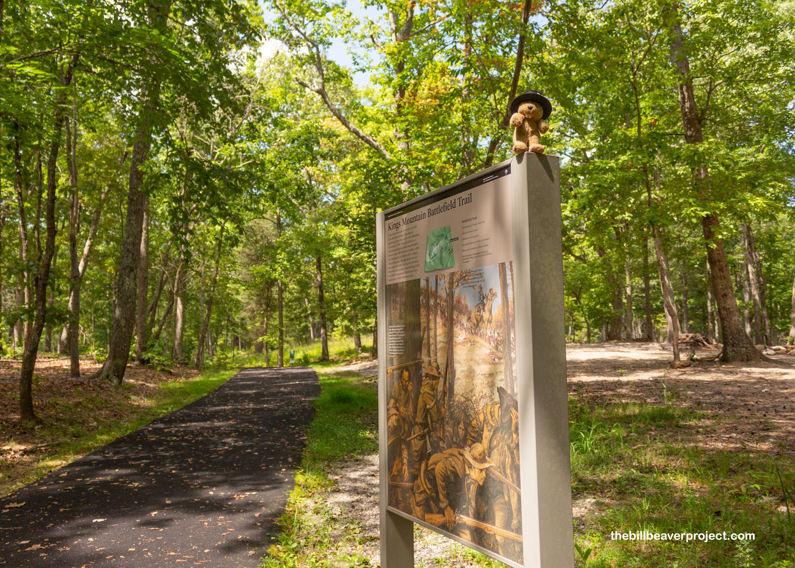 |
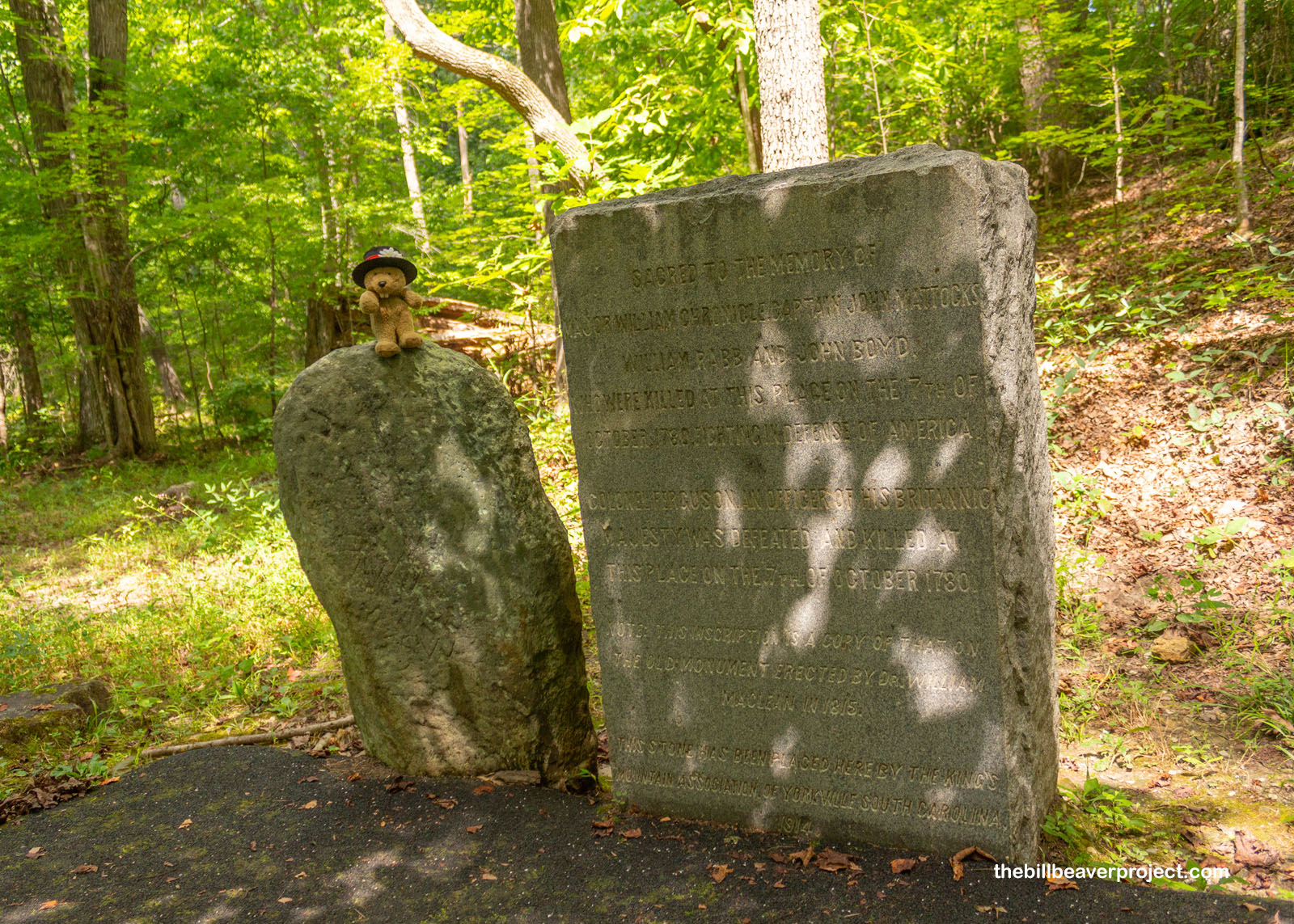
It was about 90 degrees and humid as I explored between patches of shade on this paved trail. The first monument I reached dated back to 1914, remembering four Patriot soldiers who died attacking the ridge from the east: Major William Chronicle, Captain John Mattocks, William Rabb, and John Boyd.
 |
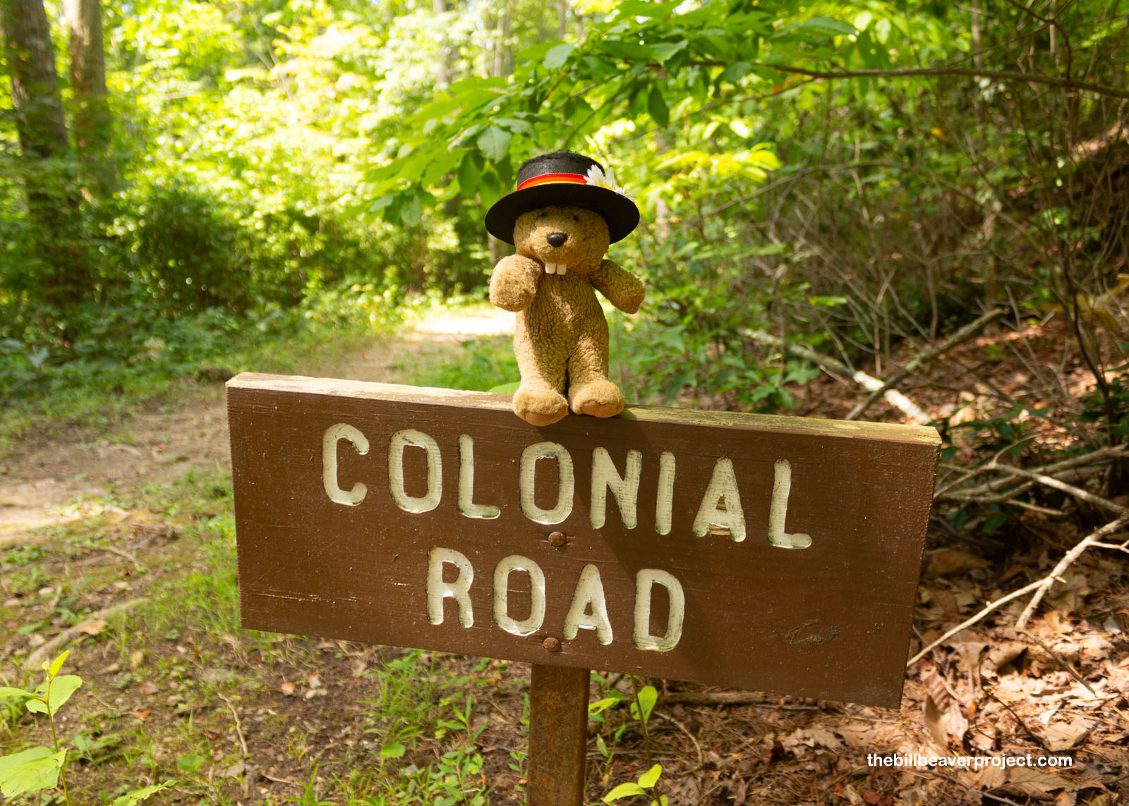
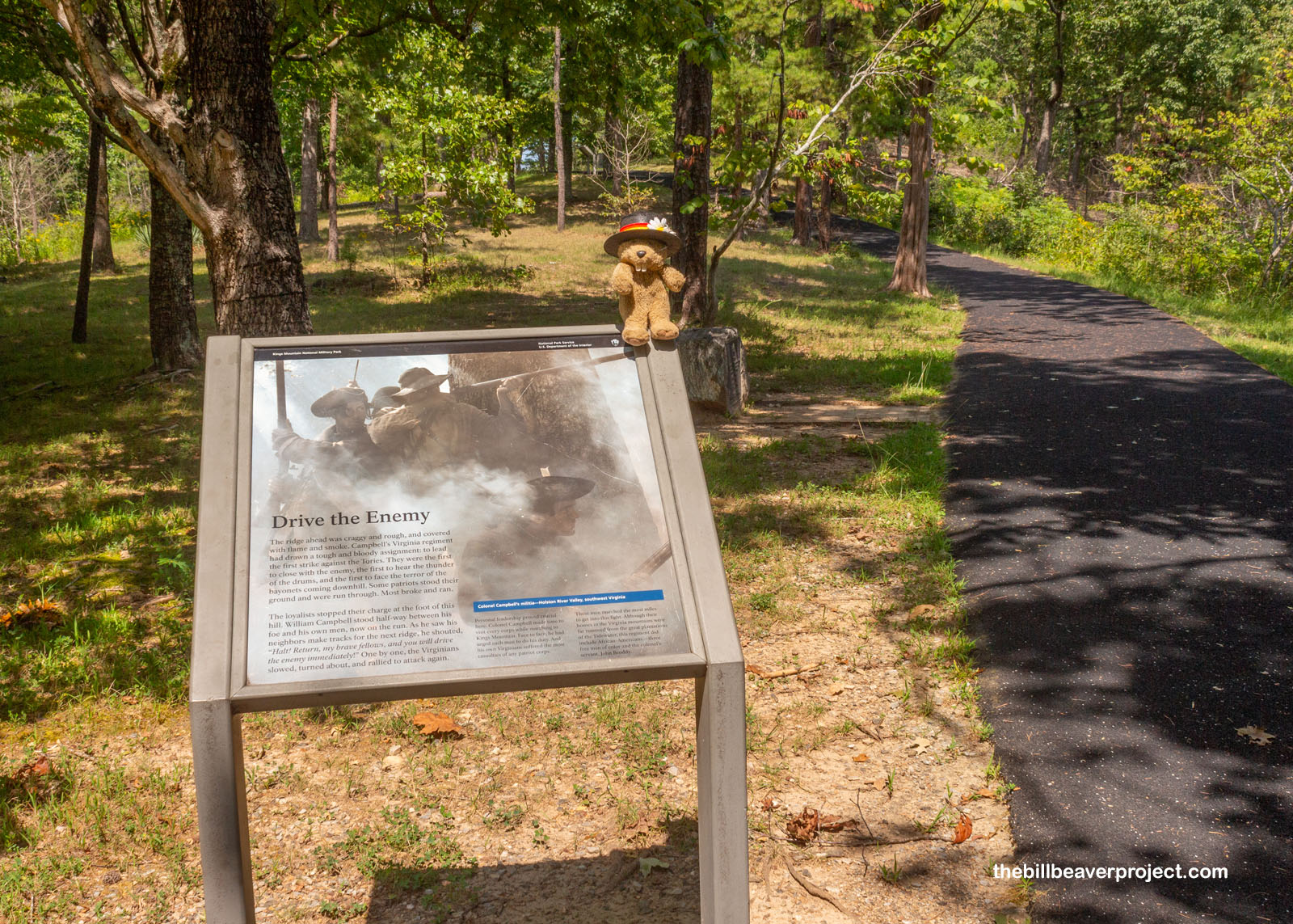
A road had run past Kings Mountain since early colonial times, but the Patriot forces didn’t use it. Instead, they marched all night through rain with their rifles covered in blankets, which gave them the element of surprise as they surrounded Kings Mountain and opened fire around 3:00 PM!
 |
Yup, the pro-British forces sure had 150 feet of high ground, but the Patriot side, led by Colonel William Campbell, had them completely surrounded. The top of the hill was pretty much cleared of trees, but down below, the forest was thick, just like today, which was a great shield! It was a solid hour of battle!
 |
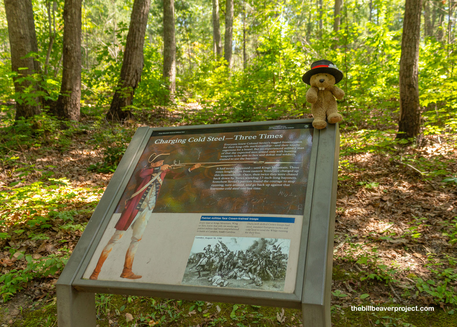
The Battle of Kings Mountain was also unique because of the weapons used. The loyalists brought muskets, which were not very accurate but could be reloaded more quickly. The Patriots brought hunting rifles, which were slow to load but super accurate, up to 300 yards versus the musket’s 75! Because they were so accurate from so far, it was easy for the Patriot forces to shoot the top of the hill, and there was no chance for the high grounders to use their bayonets. This was the only battle in the Revolution where this was the case!
 |
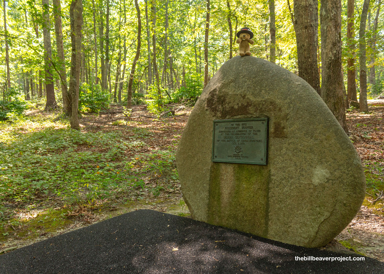
Though this battle cost Lord Cornwallis his left flank and was a turning point in the Southern campaign, the Battle of Kings Mountain faded out of interest for a long time. Dr. William McLean led the first preservation efforts in 1815, reburying remains and setting up early monuments, but it wasn’t until 1930, the Sesquicentennial, that Kings Mountain got its national recognition. On October 7th of that year, President Herbert Hoover gave a speech to 70,000 attendees, right where this boulder sits today, which paved the way for its National Military Park designation the following year!
 |
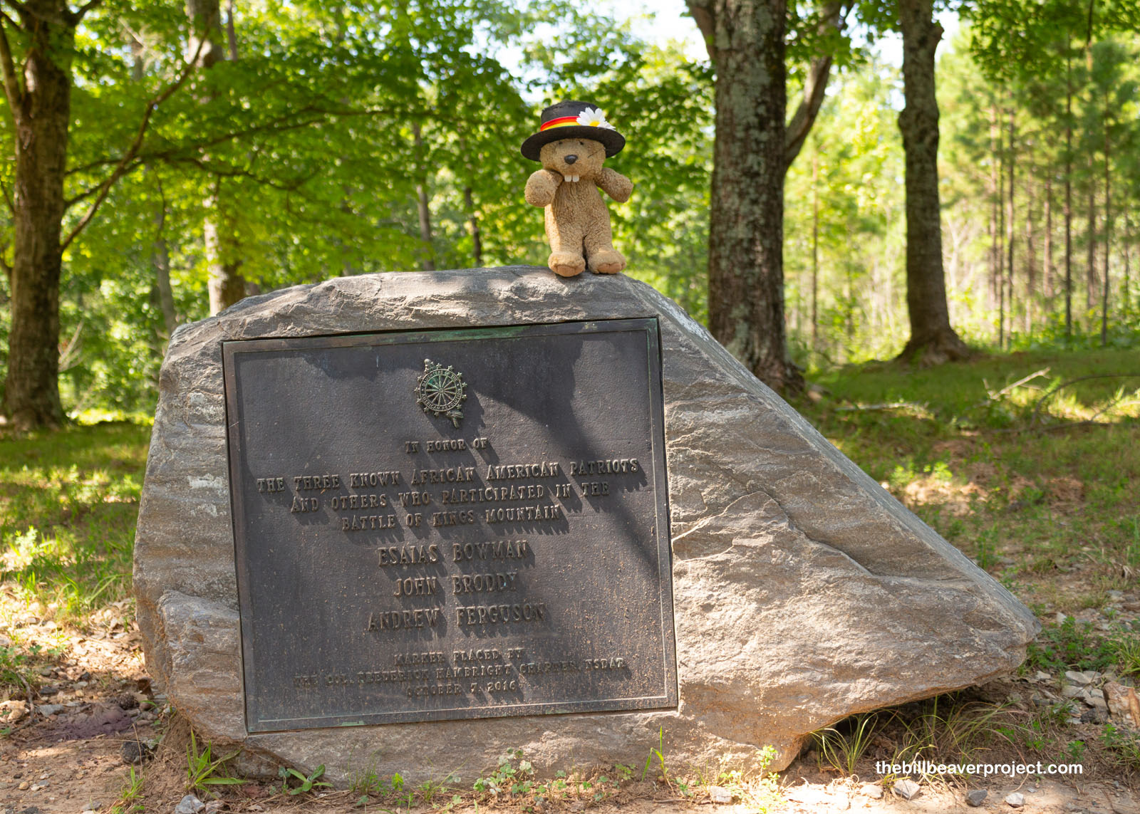
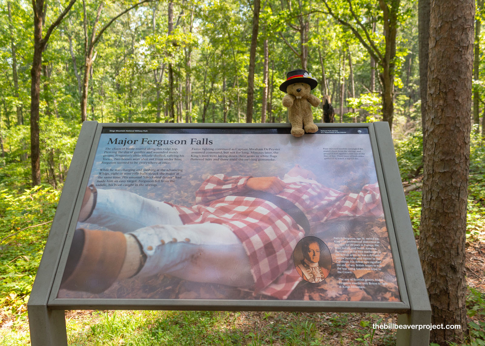
From the site of President Hoover’s speech, the trail curved uphill, into the heat of the sun and the majority of the park’s monuments. Here, the Patriots led the first charge uphill, and here I found a small monument to the three known Black patriots who took part in the Battle of Kings Mountain: Esaias Bowman, John Broddy, and Andrew Ferguson. The first of these was credited with shooting the leader of the loyalist forces, Major Patrick Ferguson, a renowned sharpshooter and the only actual person from Britain to take part in this battle!
 |
 |
The first major monument I reached was the Centennial Monument, a 28-foot granite pylon dedicated on October 7, 1880. 12,000 folks attended the dedication ceremony, which kicked off with a Howitzer salute, songs, and speeches! The monument itself was never really finished, though. It ran out of funds to add the bronze figure of a soldier loading his rifle!
 |
A cloud covered the sun while I strolled the ridge of Kings Mountain between monuments. This was where the fighting was fiercest, with rifles firing and bayonets slicing! Today, it was super quiet, with only the heat causing any discomfort.
 |
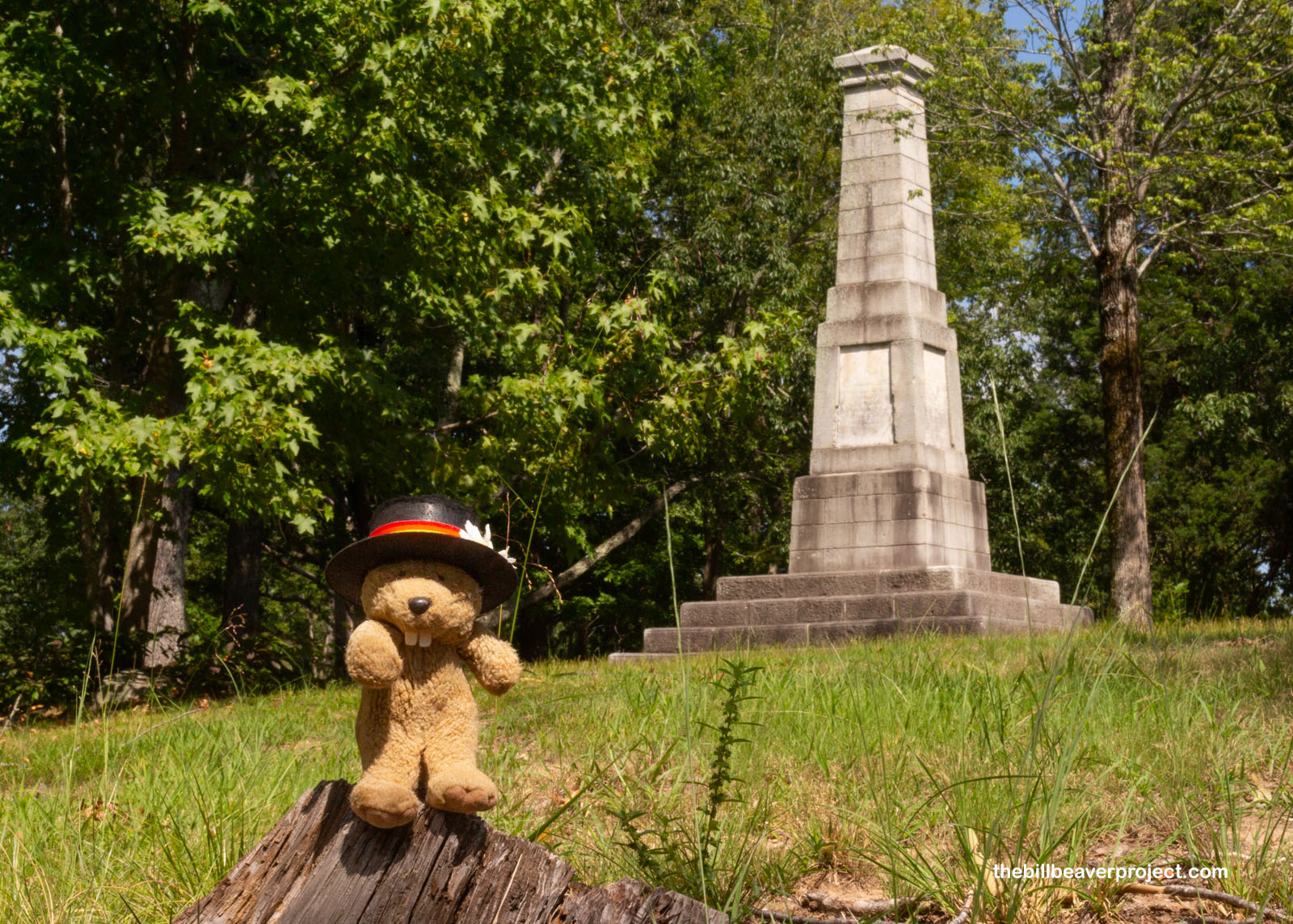
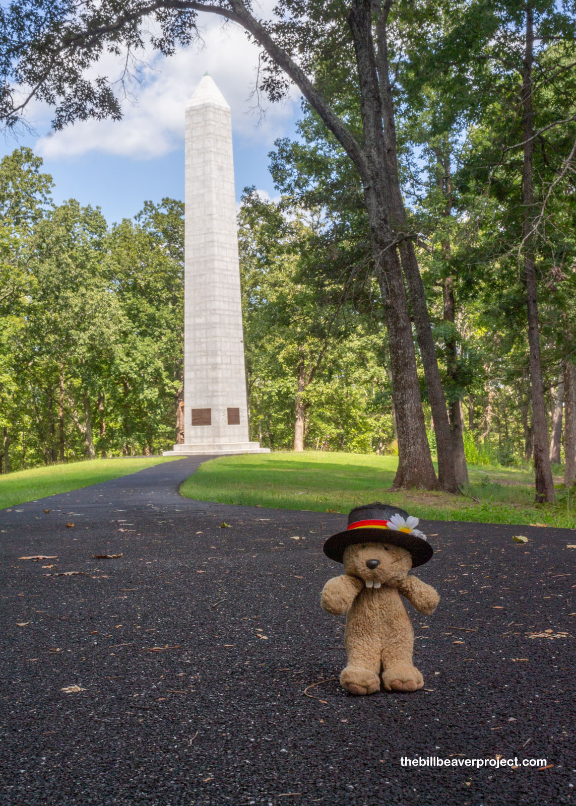
This path led to the park’s tallest obelisk, the 83-foot U.S. Monument! This one had its bronze intact, commemorating the Patriots who fought here, but they weren’t ready by the dedication date of June 12, 1909. Instead, they had to be installed the next year! The dedication ceremony was even bigger than the last one, with three and a half hours of speeches and a reenactment of the battle the following morning! Like the Centennial Monument, this one was designed as an Egyptian obelisk, since the world had become fascinated by Egypt in the years after Napoleon’s 1798 invasion!
 |
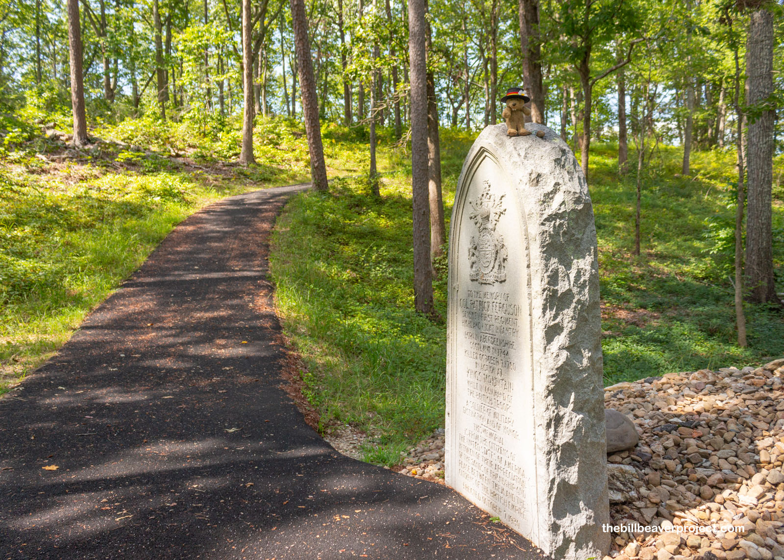
But there can be no victory without defeat! The most notorious event of the Battle of Kings Mountain was the killing of Major Ferguson, the man who had warned Patriot forces to lay down their arms or else he’d “Lay waste to their country with fire and sword.” Flamboyantly dressed in what we might compare to a picnic blanket today, the whistling sharpshooter was an easy target to spot, and after having two horses shot out from under him, he was hit by eight rifle balls at once! His toppling led to a flash of white flags, fierce revenge by the Patriots, and an end to British hopes of retaking the colonies through loyalists alone!
 |
 |
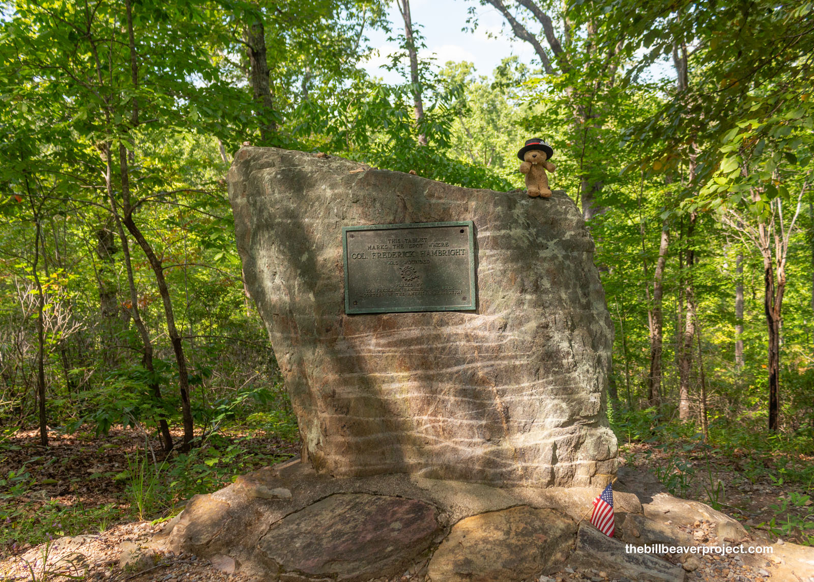
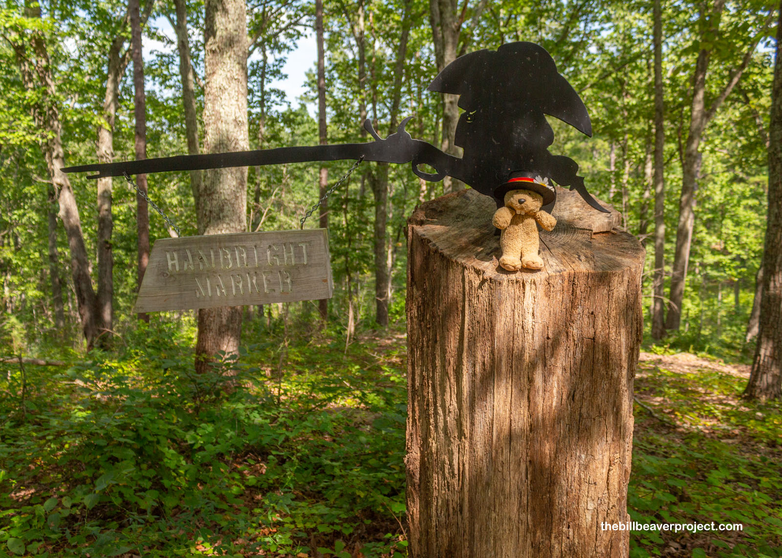
Nearby, another monument honored Colonel Frederick Hambright, a Bavarian immigrant who’d suddenly been put in charge of one of the militias in the absence of Colonel William Graham! Severely wounded in the thigh by a musket ball, he nonetheless kept fighting through the battle, though the injury forced him into retirement afterward.
 |
 |
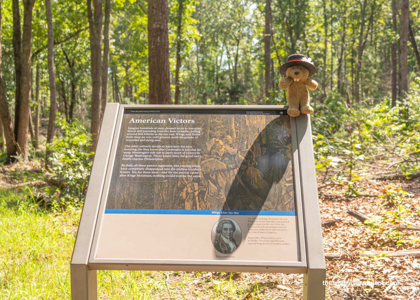
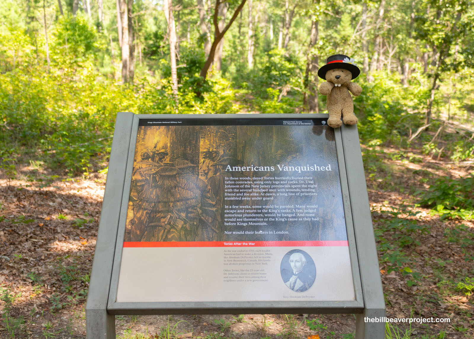
And so the Battle of Kings Mountain came to its bittersweet conclusion: Americans won and Americans lost, 80 years before the Civil War. It took three weeks for the news of victory to reach Philadelphia, and it marked great political futures for the leaders in the campaign. For the loyalists who lost, especially those prisoners who escaped capture, they had to make some tough decisions: adapt to a new government or abandon their home and property for a crown that largely abandoned them after this battle.
 |
 |
And then it was time for me to abandon this park and work my way back to the airport in Charleston. First, though, I had to stop and see my 42nd state capitol building in Columbia! This city took the capital title from Charleston in 1786 because it was a more central location, but like many other capital cities, it went through a series of capitols.
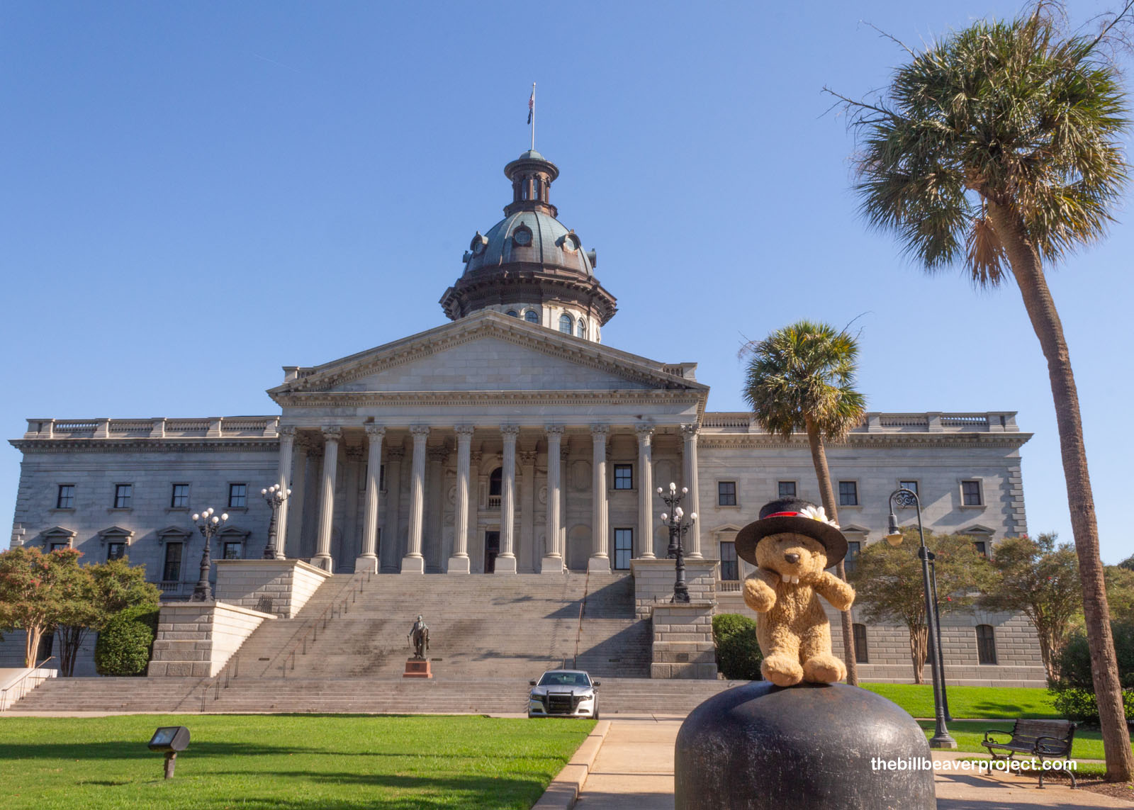 |
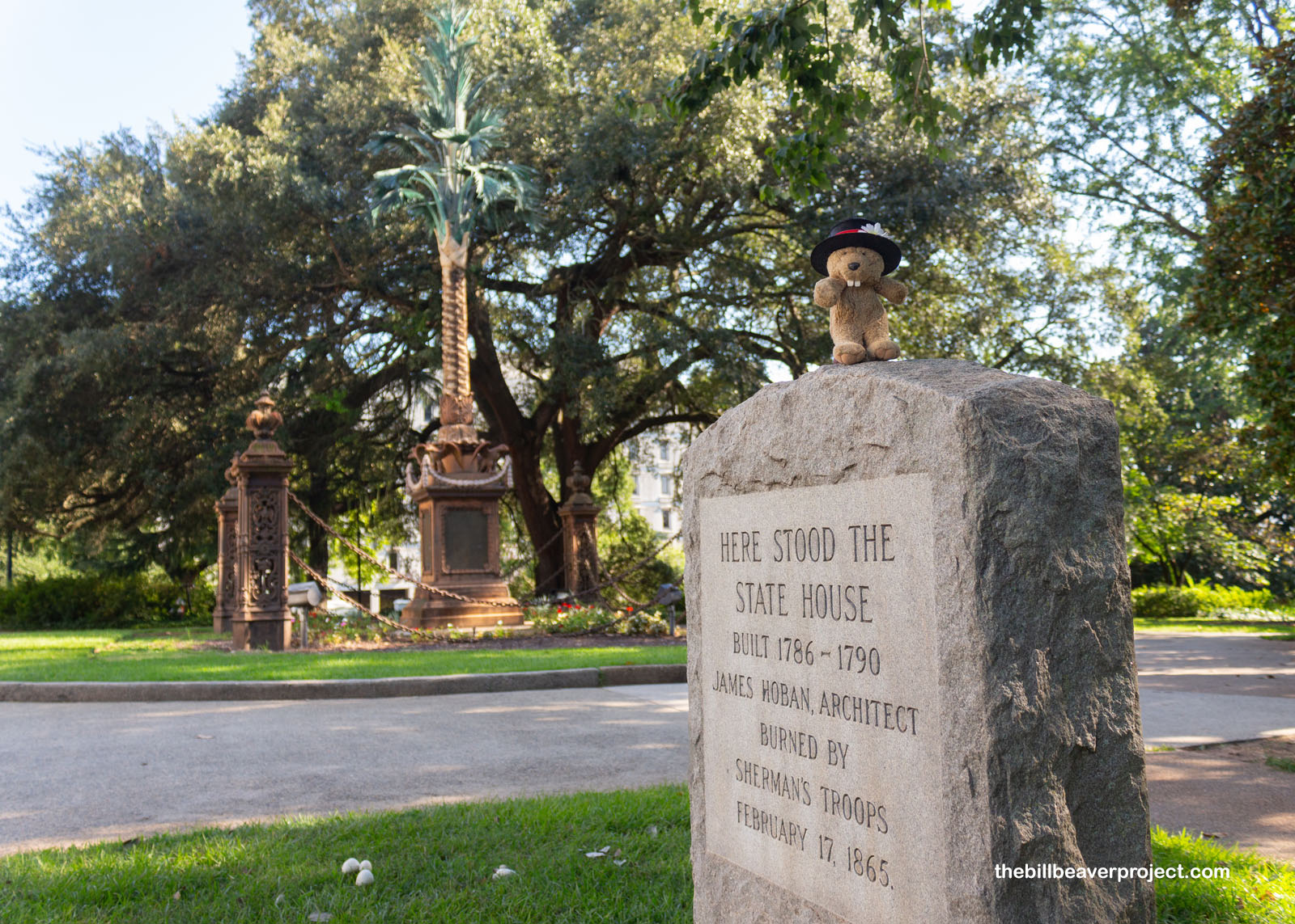
The first built in Columbia, designed by James Hoban, burned in General Sherman’s March to the Sea on February 17, 1865, and because South Carolina was left in poverty after the war, the state house would not be rebuilt for almost forty years! The original architect, John R. Niernsee, who lost 25 years’ worth of work in the capitol burning, was reappointed in 1885 but died shortly afterward. His son, Frank, was tasked with rebuilding, but budget constraints pushed construction back through two other architects! At last, the present state house opened its doors in 1903.
 |
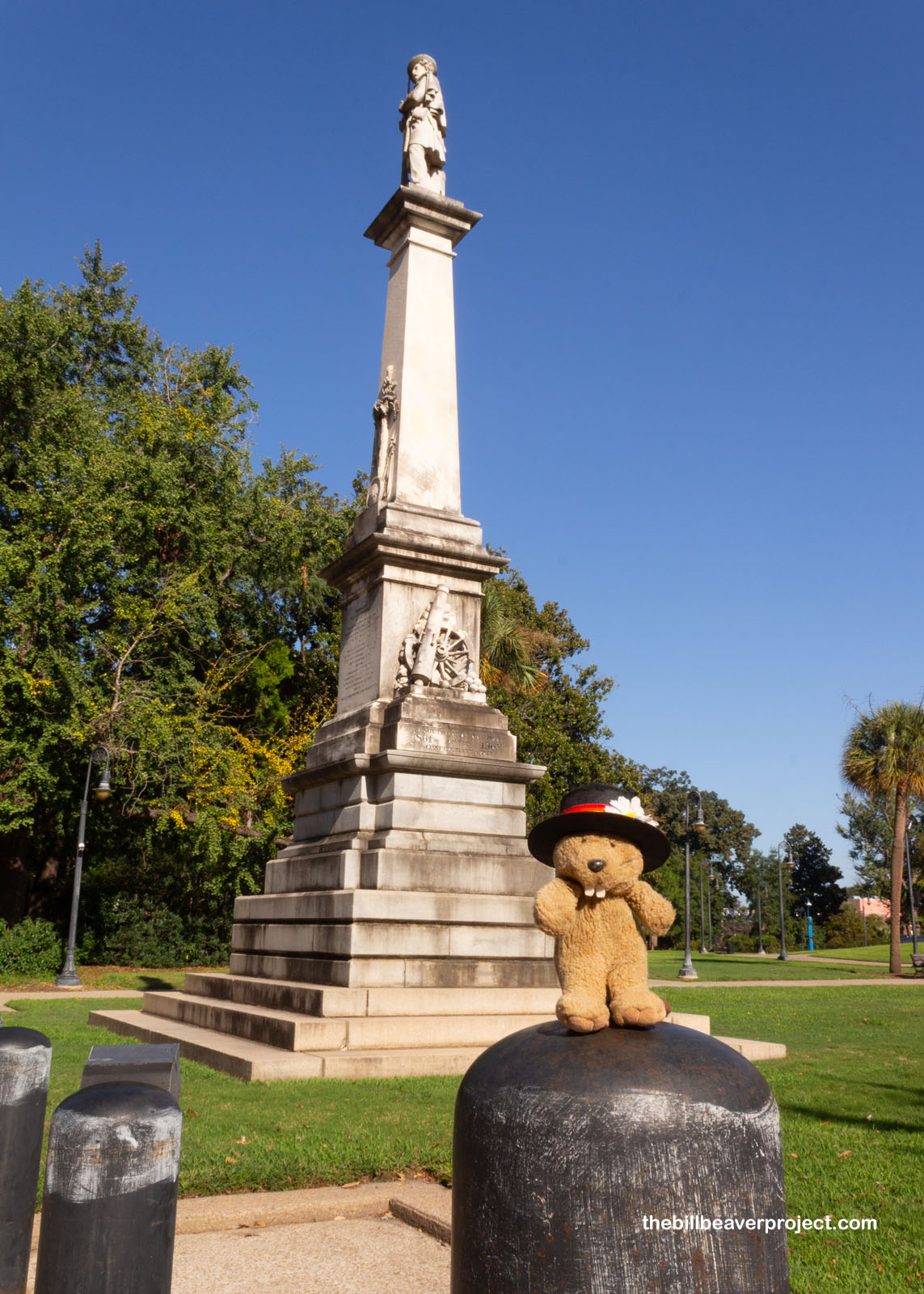
Also resurrected in the aftermath of the Civil War were the war memorials to the Confederacy. South Carolina was, of course, the first state to secede on December 20, 1860, and today, the capitol grounds are still home to two Confederate monuments from the later days of Reconstruction. This one, the Confederate Dead Monument, was installed in 1882, struck by lightning, then replaced in 1884. From this monument, the Confederate flag flew from 2000 until 2015, after it had been taken down from the capitol, then was removed completely after nine Black folks were murdered at the Mother Emanuel AME Church in Charleston that year.
 |
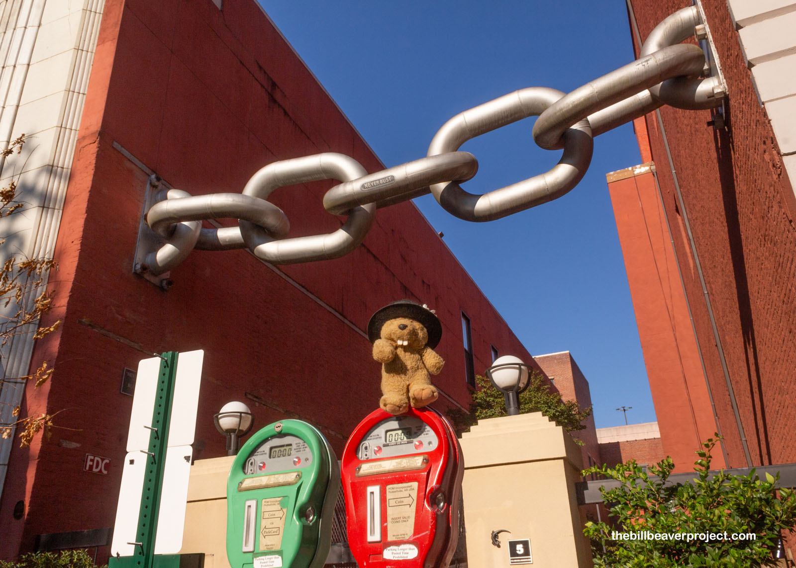
You might say it’s taken a Herculean effort to hold South Carolina together in the years from 1860 until 2023! Nothing showcases this more than the Neverbust Chain, installed the same year the Confederate flag was taken off the capitol. This installation by artist, Blue Sky, was set up without the city knowing or approving it, but once it was in place, the 25-foot steel chain was very much in place! Luckily, the city thought it was okay afterward.
 |
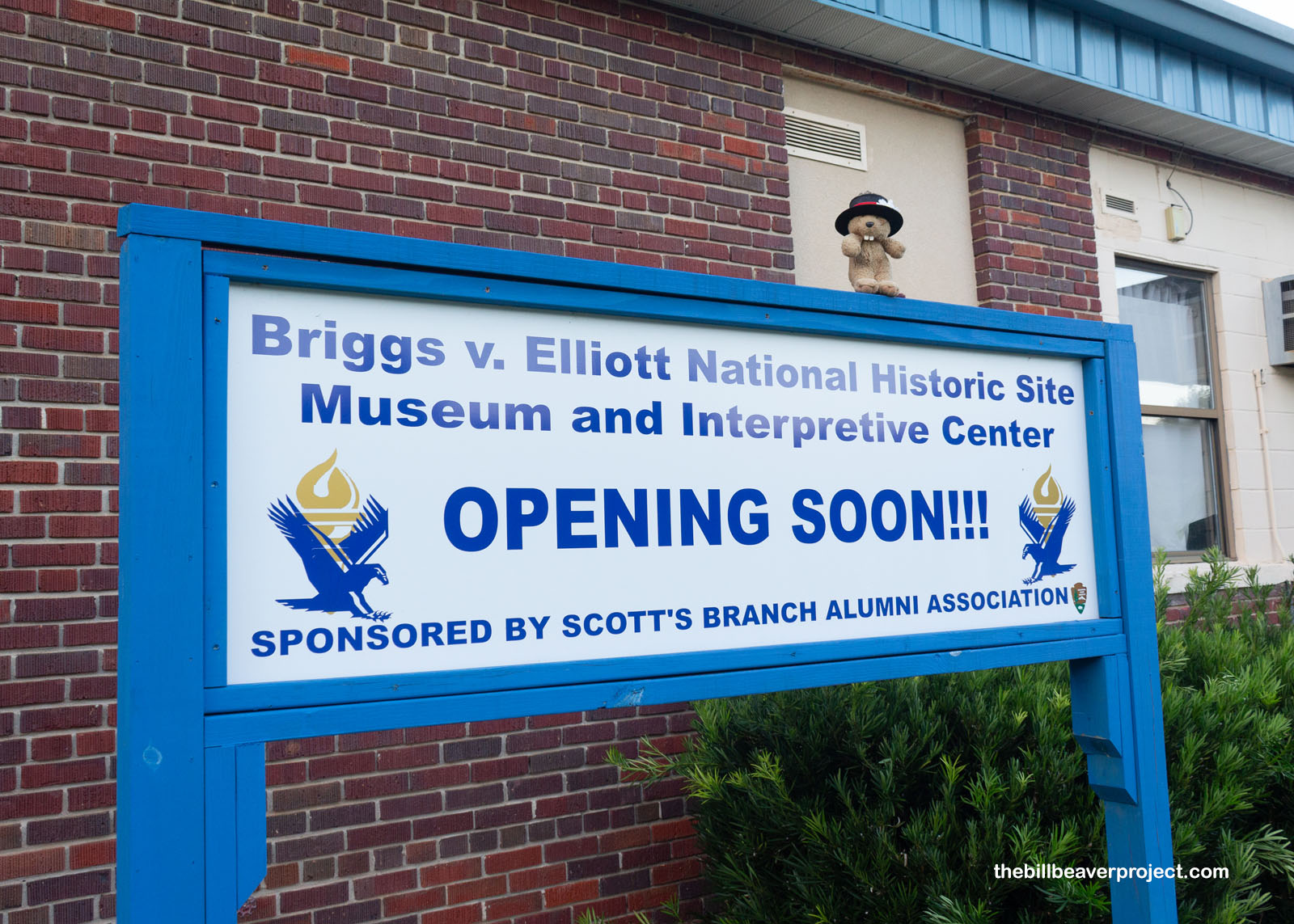
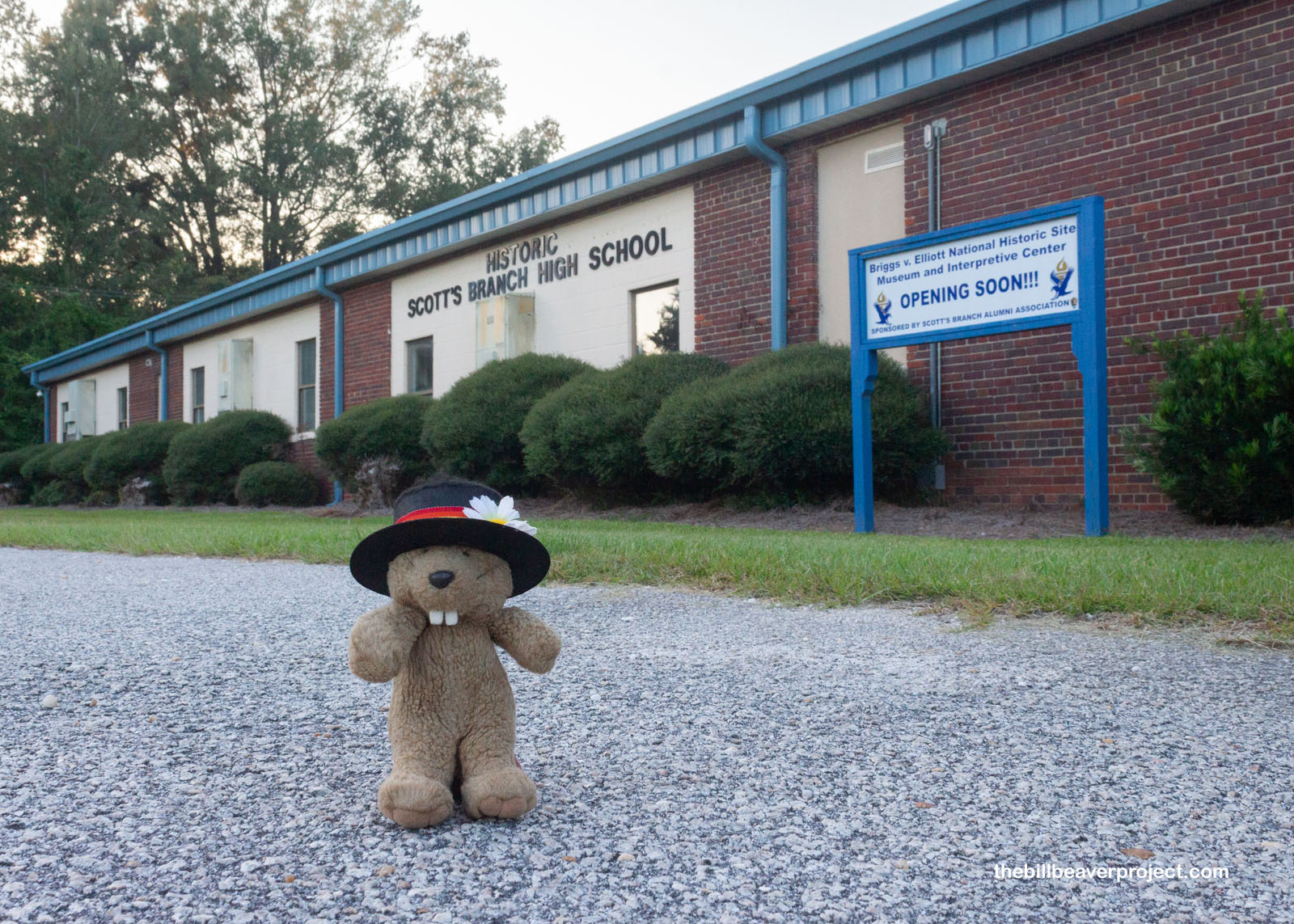
My last stop of the evening was much further east, but I wanted to stop by an important historic site in the making. Scotts Branch High School was the epicenter of the Briggs v. Elliott court case, which was the first of five that combined with Brown v. Board of Education to end racial segregation in public schools! This case was over bussing, since superintendent, Roderick Elliott, wouldn’t designate any buses for Black students, some of whom lived 9 miles from their school! Though the case eventually did lead to more equality, it cost the plaintiffs, Harry and Eliza Briggs, their jobs, and opponents to desegregation tried to assassinate Black community leader, Reverend Joseph DeLaine, and burned his church. That’s real courage, folks, and it had a big impact!
 |
 |
And just like that, the sun went down on another adventure. The biting gnats were still swarming, and it was time for me to make tracks back to Charleston. What a wild ride this was, three days to see six national park sites spanning two centuries of history! One day, I might come back to the Palmetto State, since there’s still so much to explore, but maybe in a season with fewer bugs.
Headin’ West from South!

Previous Day |
Total Ground Covered: 893.3 mi (1,437.6 km) |
More 2023 Adventures |