 More 2025 Adventures |
Bellingham, WA → Sourdough Mountain Lookout → Bellingham, WA 208.9 mi (336.2 km) |
 More 2025 Adventures |
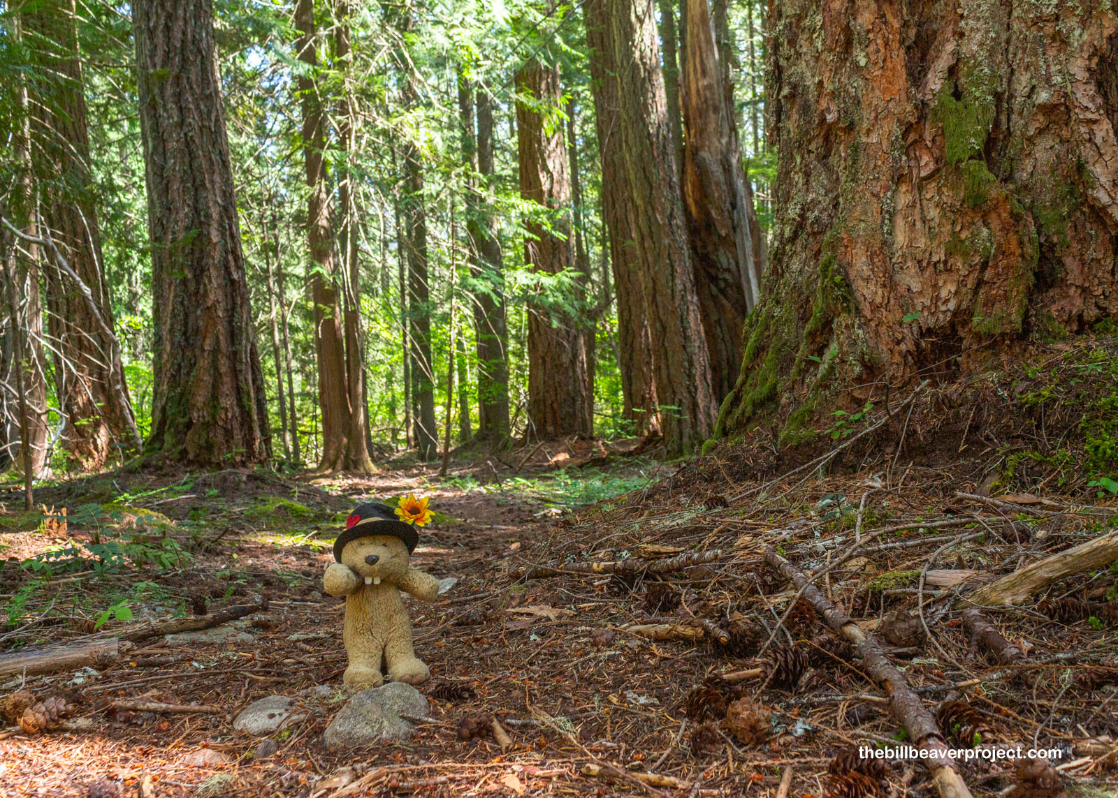
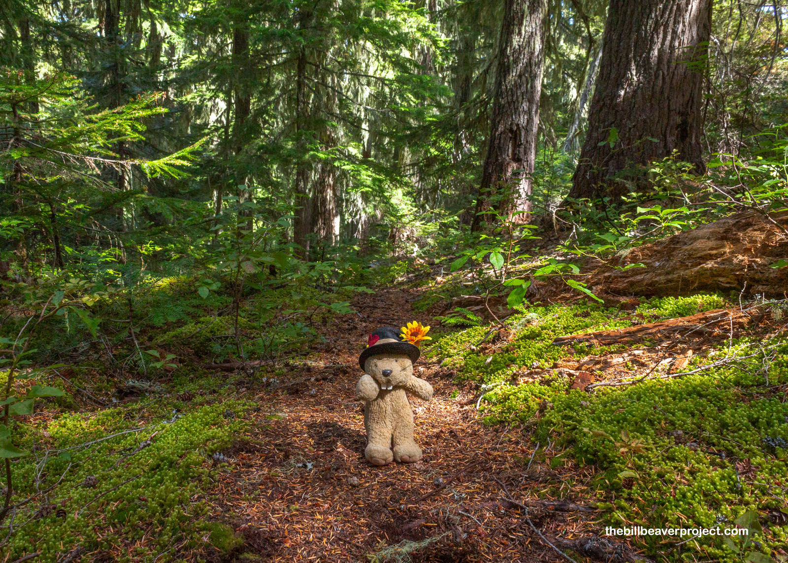
Let’s go, Sourdough!
This weekend, I took a flight I’ve been eyeing for years—LAX to BLI—and launched a new national park adventure in northern Washington! My goal was to do as much hiking as possible in North Cascades National Park, and I even brought my camping gear, because my trip with Alaska Alpine Adventures had really gotten me in a camping mood! There’s a lot of backcountry in the park, which requires permits, and I found out early on that all the spots I could book online were full while the rest were first-come, first-served, in-person!
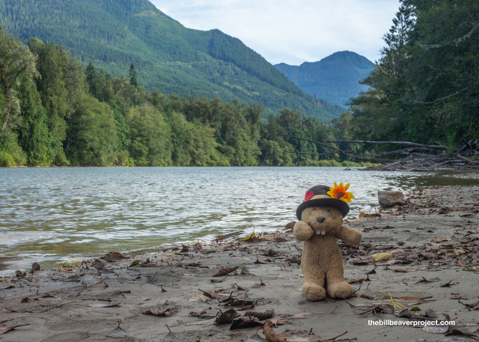 |
So, after seeing some sights up in Bellingham, and weaving my way down past the Skagitsquatch Museum, where a team of Bigfoot seekers were gearing up to go into the wild, I arrived at the Wilderness Information Station in Marblemount just ahead of their closing time! Thornton Lakes Campground was completely full, so I would not be camping up there tonight as I’d hoped, but I did score a permit for the next night at Pierce Mountain Campground, en route to a historic lookout! Looking at the glass half full, I pitched tent at my backup location, Glacier Peak Resort, RV Park, and Winery, where I awaited adventure while gorging on wild blackberries and sampling their vintages!
 |
 |
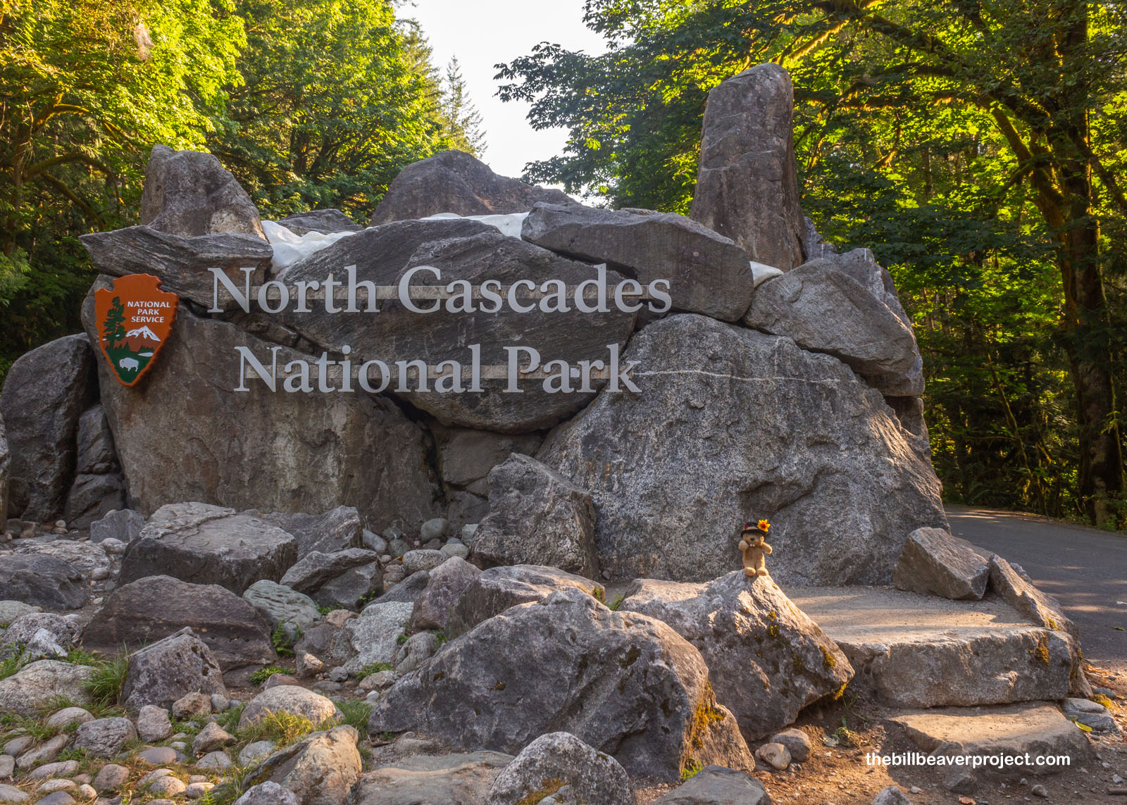
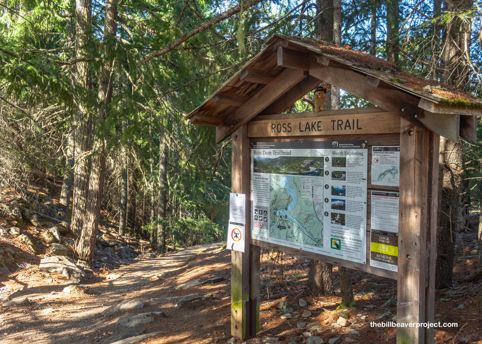
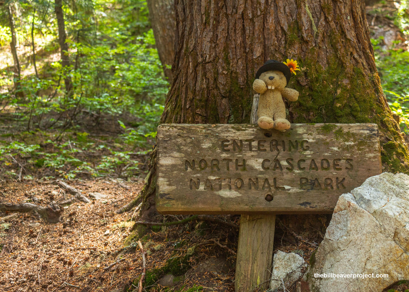
Bright and early, I was up and at ’em! In some ways, I was kind of glad not to be hiking five miles down just to get to another trailhead. Instead, I stopped in Marblemount for breakfast and moseyed over to the coolest of all the national park signs, faux snow and all, and into… almost the national park. Like in Lake Clark National Park & Preserve, it was going to require effort to set foot in the national park. First, Highway 20 never touches North Cascades National Park; park-goers have to trek a way through Ross Lake National Recreation Area to reach the park’s boundaries!
 |
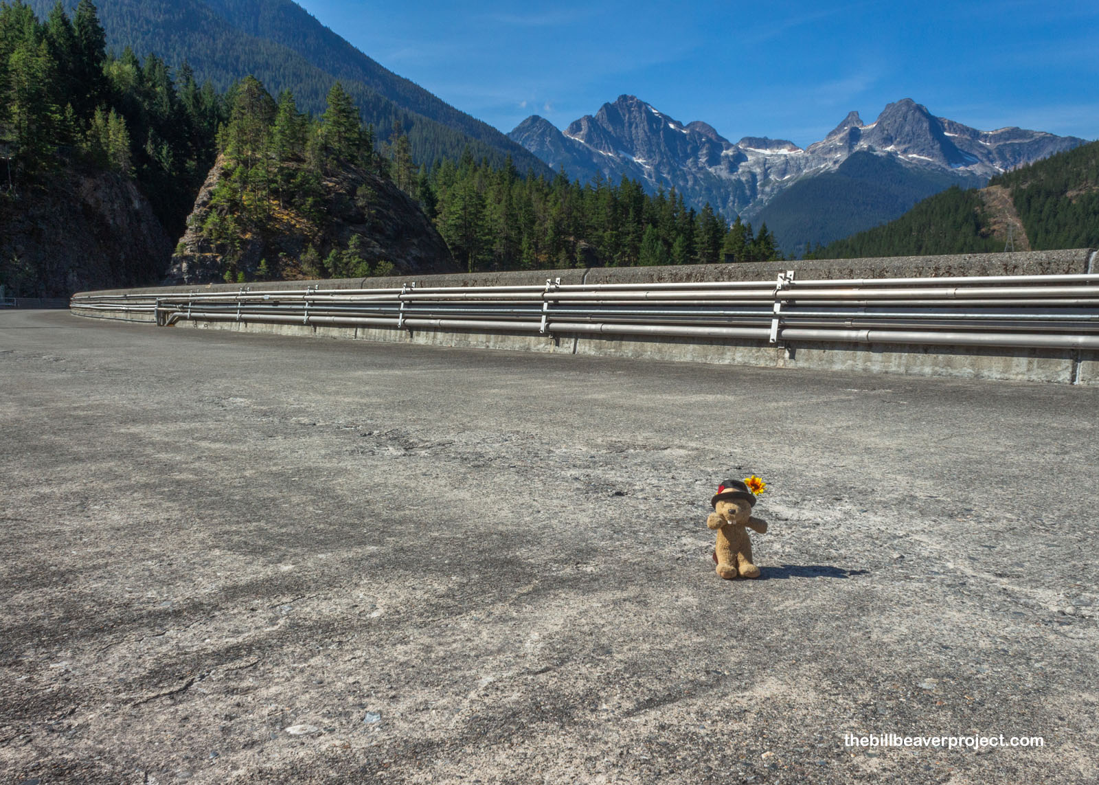
Second, the Sourdough Mountain Trail and Campground were still closed after a big wildfire in July 2023, meaning I would need to take a detour that would double my hiking distance in order to get there! So, pulling off the road next to the already-full parking lot, I gathered my stuff at the Ross Lake Trailhead, checked the time, and at 9:37 AM, kicked off on the first leg of my workaround trek!
 |
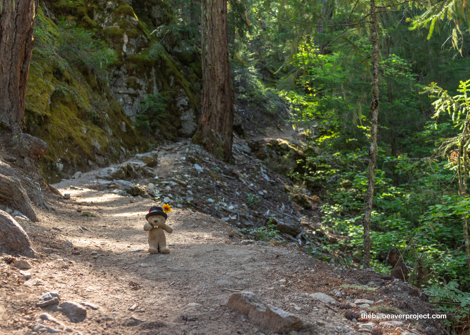
The trail began as a dusty, winding downhill slope, which I knew would be a pain on the way back tomorrow morning, but now was not tomorrow morning, and I had plenty of stamina stored up! Most of the other hikers had already begun their day, so I had most of this 3/4-mile leg to myself, except for one kayak-loaded truck on the maintenance road leading to the dam and at least one hiker completing five full days in the wilderness!
 |
 |
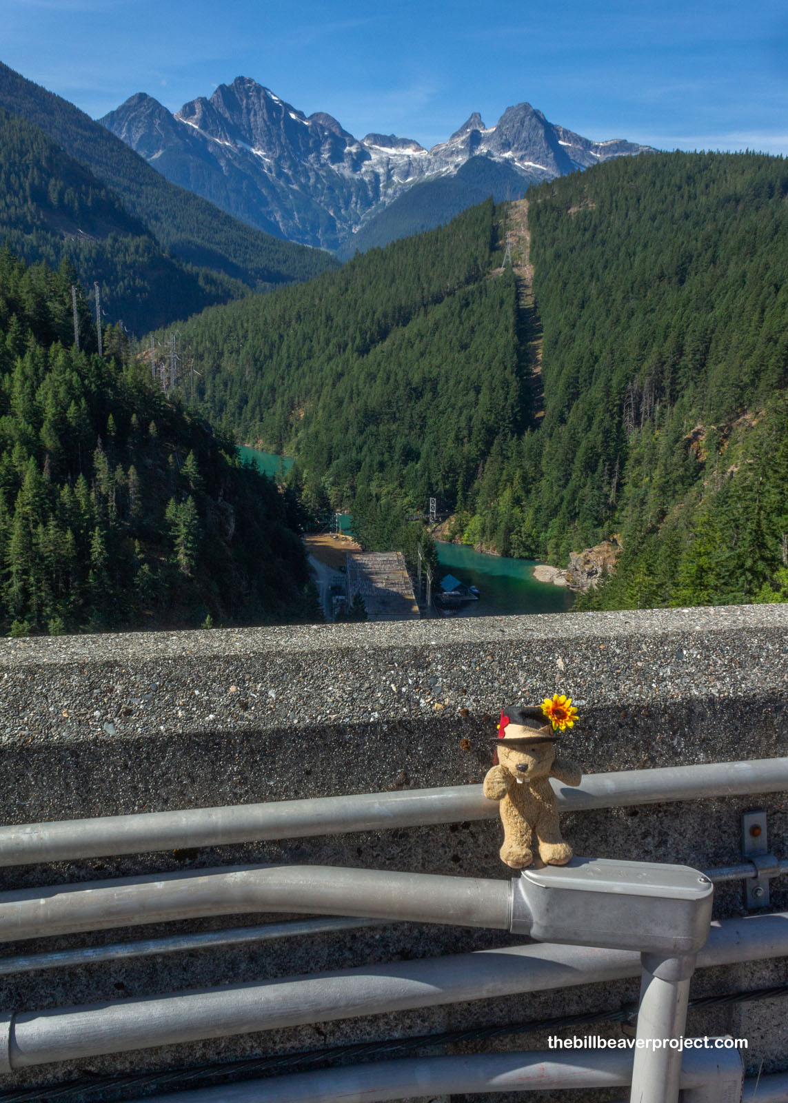
Well, that was the easy part, and barely twenty minutes into the hike, I was standing at Ross Dam, the highest of three hydroelectric dams built on the Skagit River by Seattle City Light between 1921 and 1953! Last built because of treaty complications with Canada, it was also renamed from Ruby Dam midway through construction when Superintendant James Delmage Ross died suddenly after an operation! As early as 1928, though, the Skagit dams were open for tourists, which made for an easy-breezy crossing of the end of Ross Lake!
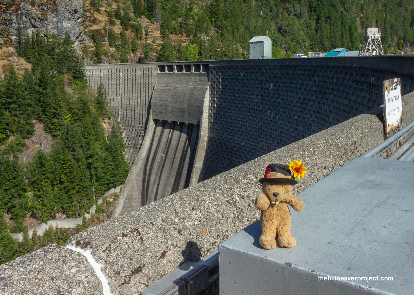 |
 |
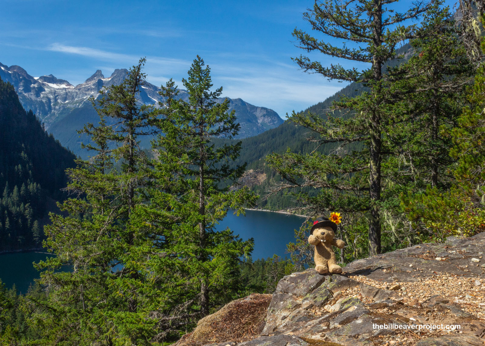
From here, I could really see why Seattle City Light chose this river for their dams. From the Canadian border, it drops a thousand feet in elevation! Just beyond the edge, I could see the top of the historic powerhouse and the brilliant green water leading to the Diablo then Gorge Dams, which collectively generate 20% of Seattle’s power! At least one of these dams, as part of a relicensing agreement, could potentially be decommissioned or demolished to bring back salmon habitat, like what happened with the Klamath Dam back in California! There isn’t really an estimated on that though.
 |
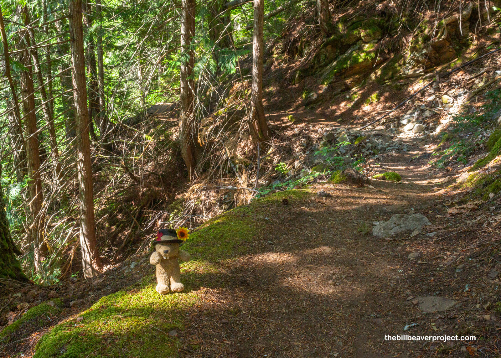
Crossing the dam, I was back in the shade and very surprised at the terrain! When I saw on the map that I’d be circling the lake, I thought for sure I’d be tromping through marshes and cattails. Not so! The trail was high above the water on a steep slope and very dry, which was just fine by me. My last hike up in Alaska had left my feet very wet indeed!
 |
 |
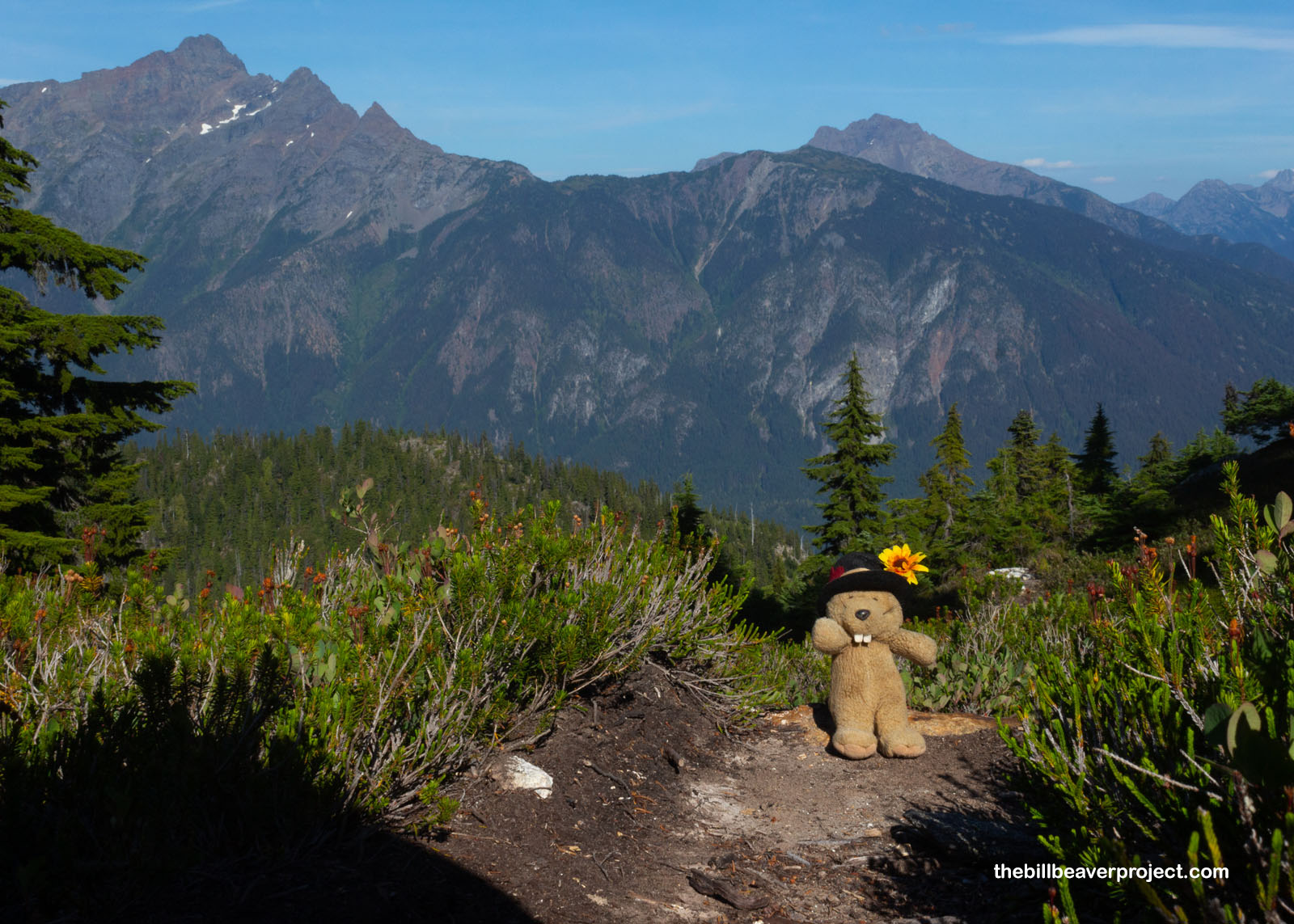
Sporadically, the trees would clear enough to get a view of the lake and the surrounding mountains, and these were the spots where I chose to take my breaks. It wasn’t super hot, but it was sunny August, and I was in the process of trekking four miles to the midpoint. A beaver can use a break once in a while!
 |
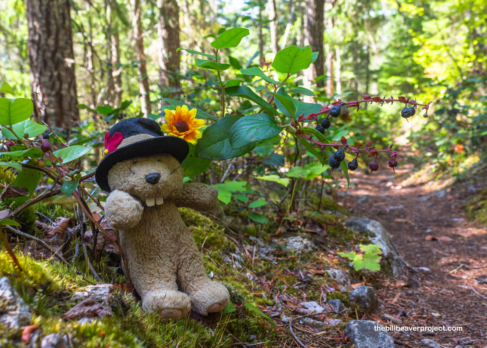
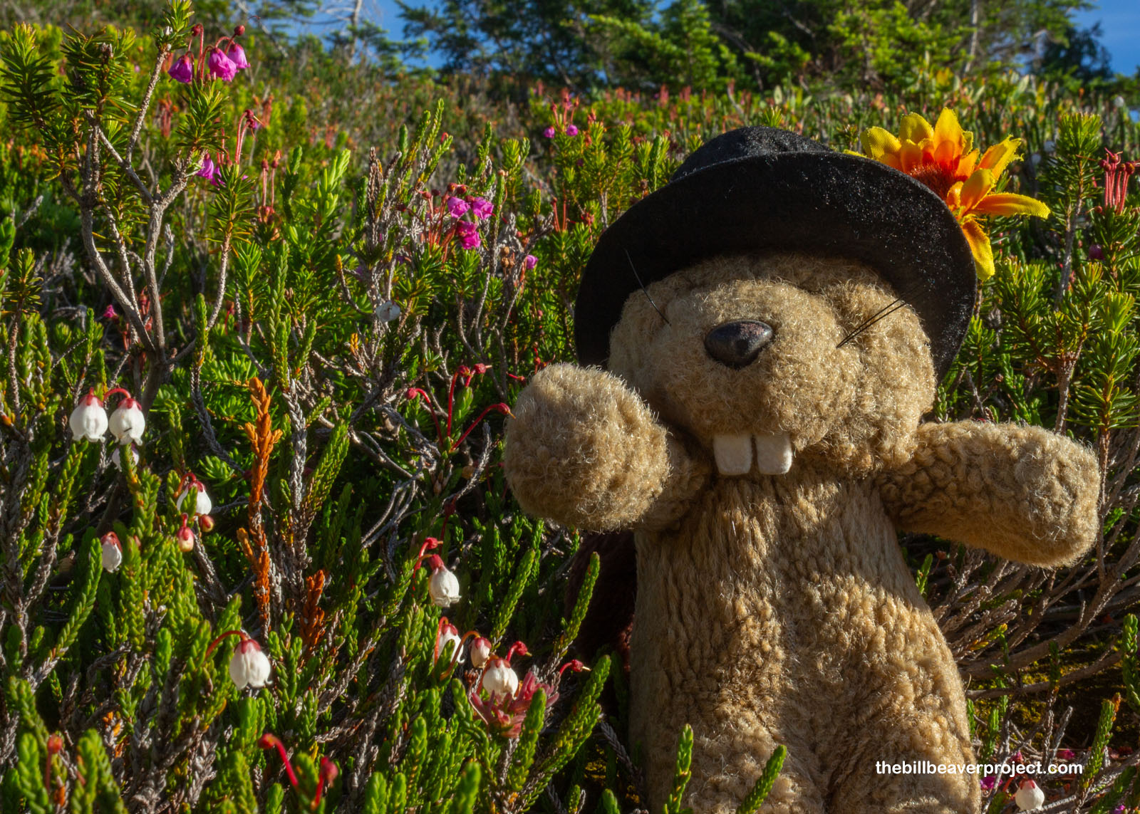
And speaking of breaks, you know how much of a sucker I am for wild berries! I was super surprised to see tons of juicy, ripe salal berries (Gaultheria shallon) lining the trail, because after trying them in Olympic National Park, I thought they were limited to the coasts! Fun fact: in the Lushootseed language of Puget Sound, what we call August is named pədt̕aqaʔ, the “time of the salal!” As soon as I recognized them as safe berries, I just had to stuff my face, at least a little bit, maybe a few berries every dozen steps or so. After all, even though I was tempted to eat them all up, I’m just a visitor here, and other critters won’t make it through the winter if they don’t eat enough berries!
 |
 |
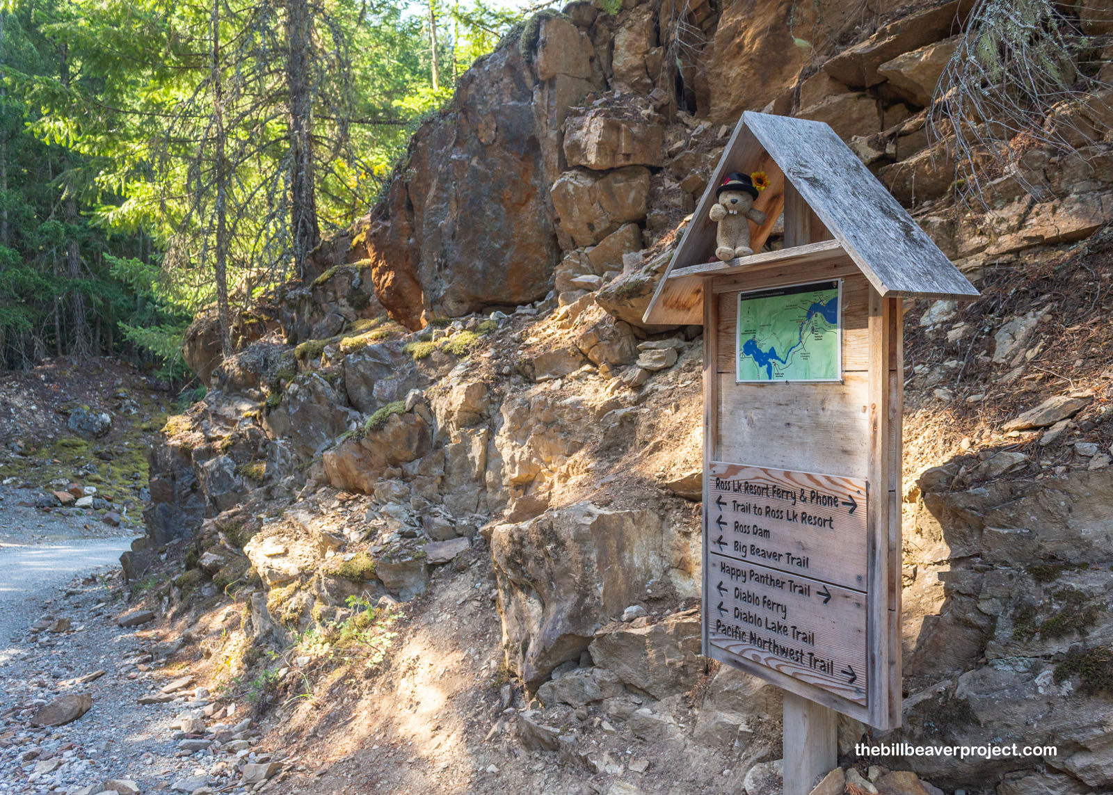
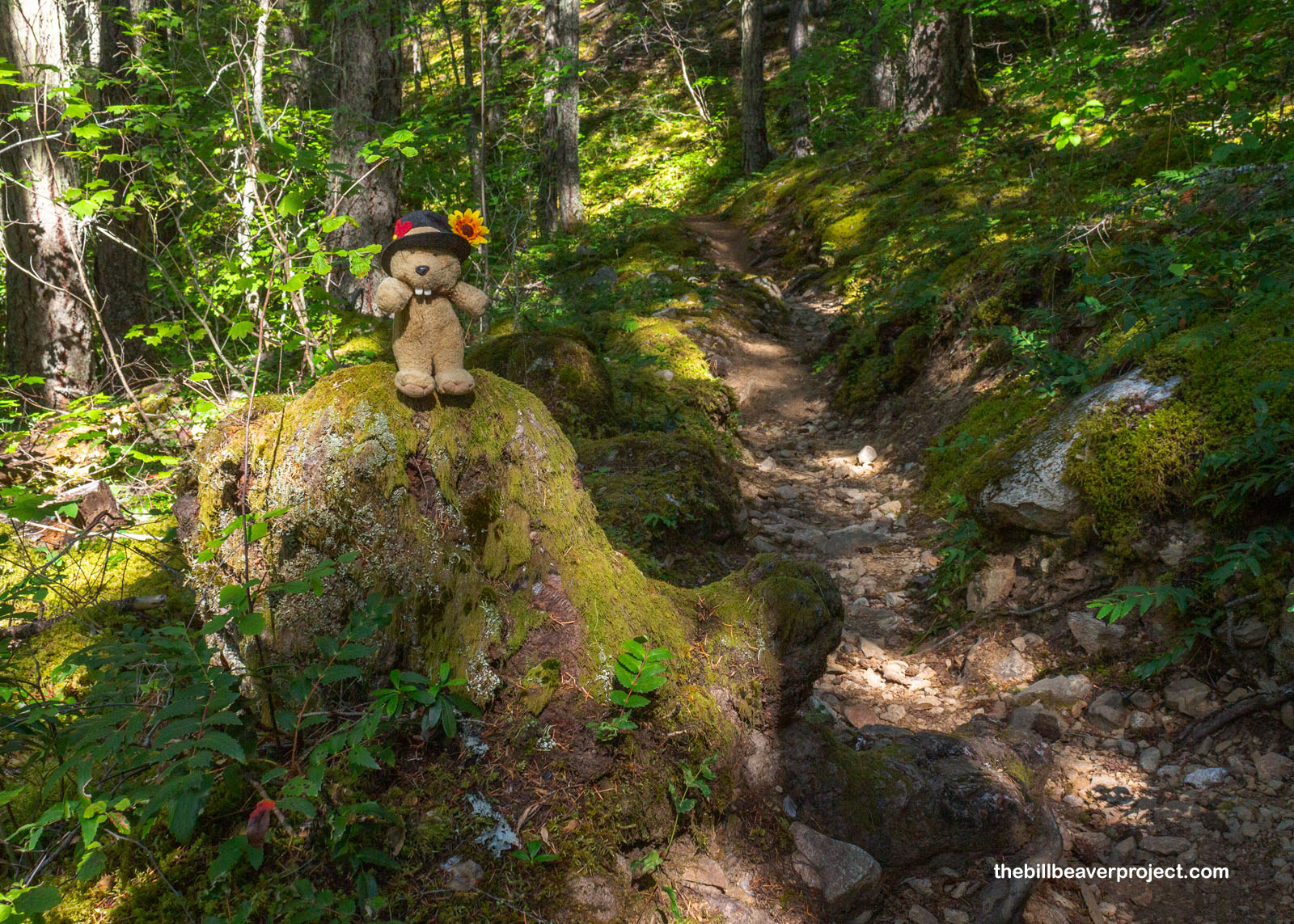
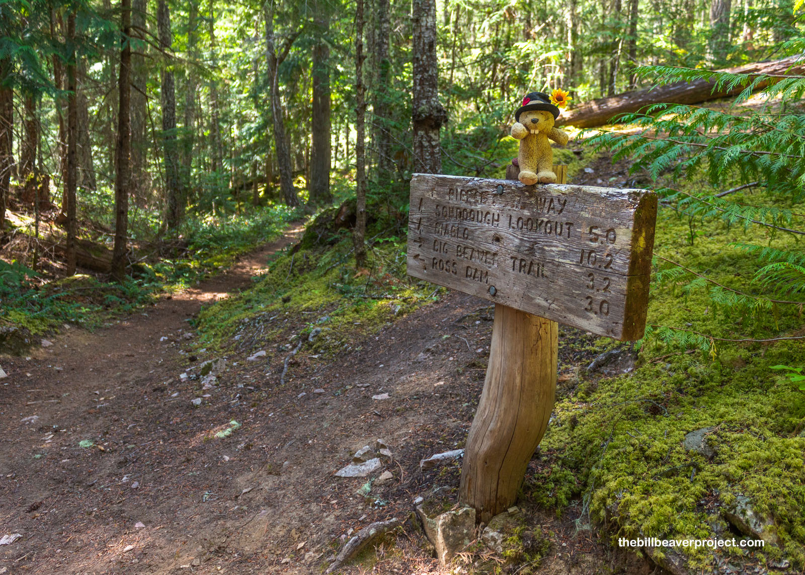
And then, wow! Before I knew it, it was 11:30 and I was already at the junction where the Pierce Mountain Trail turned upward into the heights! There were some cut logs here where I could rest a minute, but honestly, the trail getting here hadn’t taken much out of me. I was still feeling pretty fresh, if a little sweaty and even wondered if I could day hike this route! That felt ambitious, but it did cross my mind, along with the signs at the trailhead that said car break-ins were not uncommon. Boy oh boy, does that make a hiker wonder what they’ll come back to!
 |
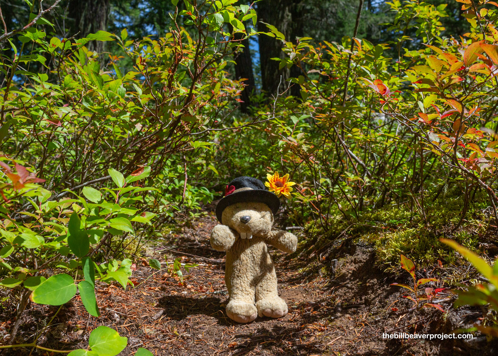
The Pierce Mountain route was steep from the start, gently winding up through a grove of huge Douglas fir trees, which kept things nice and shaded. All around, I kept my eyes peeled for signs of wild critters, but the whole hike, there was nary a twig snapped that I hadn’t done myself!
 |
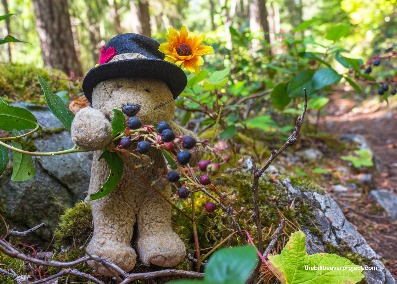
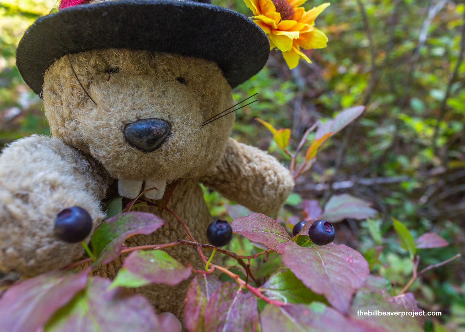
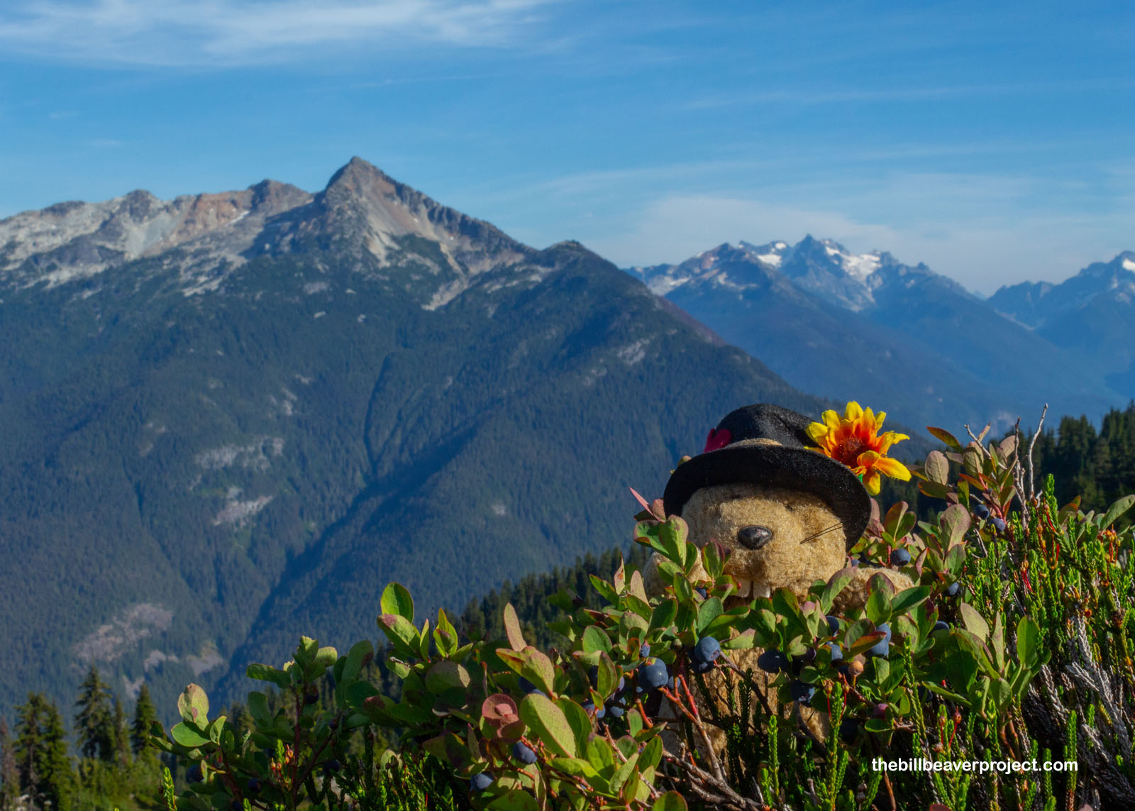
I started to see plants that looked kind of familiar, but they were so far from Glacier National Park that I second-guessed myself all the way until I got a good, close look at their big, purple fruits: Vaccinium membranaceum, the thinleaf huckleberry! Before long, these hucks were undeniable and unavoidable! Berry shrubs lined the trail in big clusters all the way up, and I could not help but snagging a few as they dangled in my path. This trail was turning into a real smorgasbord!
 |
 |
It was also a really, really long trail! Switchbacking slowly through the thick forest, with no view of the surrounding mountains, it was hard to get any sense of progress at all! Besides, I was practically paralleling the route I’d taken from the dam, just in reverse! On top of it all, the ranger had told me yesterday that the sign for the Pierce Mountain Campground was so small that some folks walk right past it without stopping! Well, that sure made me double-think every step I was taking! What would I do if I walked all the way past the campground?
 |
 |
Just shy of 2:00, I did spot a small sign: at last, after more than four hours hiking, I was leaving Ross Lake National Recreation Area and finally setting foot in North Cascades National Park! I couldn’t help but compare this tiny wayside sign with its magnificent highway counterpart, but I understood how much easier it would have been to get this one up here. Ironically, this tiny sign was also a harbinger of trail to come!
 |
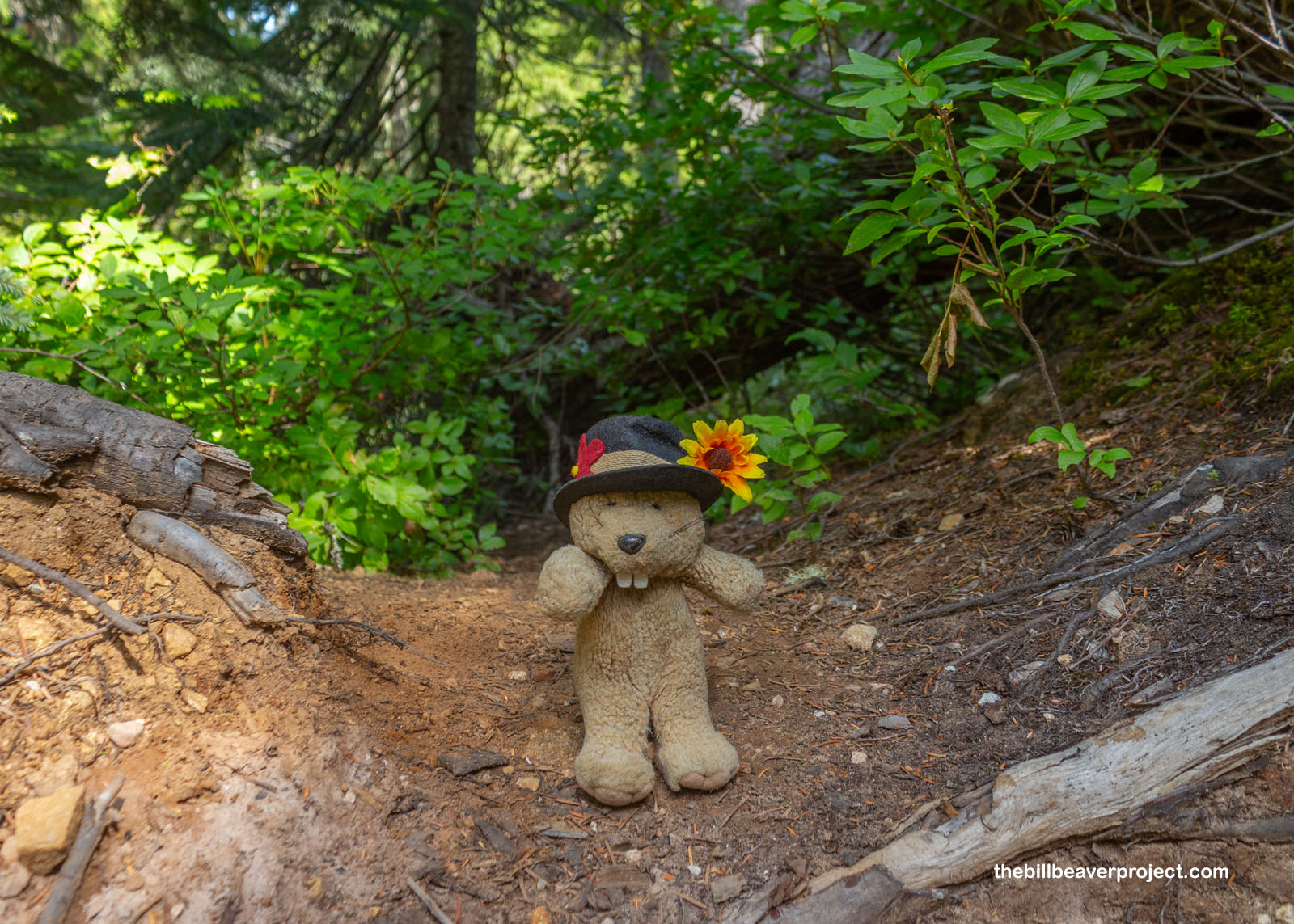
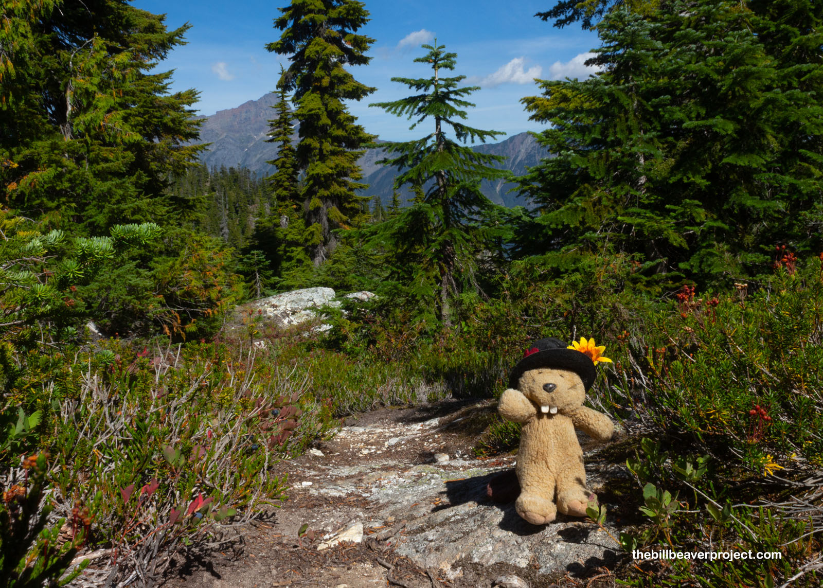
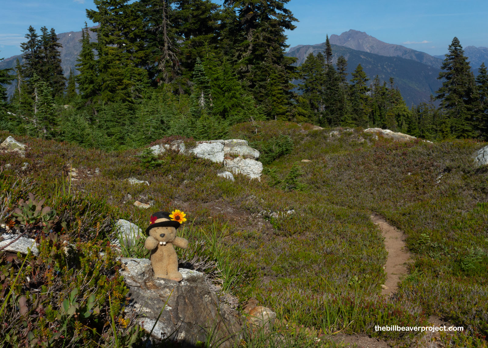
Once I’d crossed into the national park, the trail took a turn for the terrible! If you look behind me in this photo, that’s the trail! It was almost as bad as the Mount ‘Alava trail back in February: thin, steep, and very overgrown. I actually went a half mile past the park sign, thought about what the ranger had said, and went all the way back to see if I had missed something! Being altogether unsure whether I was still en route to Sourdough Mountain or an offshoot up Pierce Mountain, I was super lucky to encounter the one other hiker I’d meet on this schlep, who confirmed for me that I was indeed on the right path and had not missed the campground!
 |
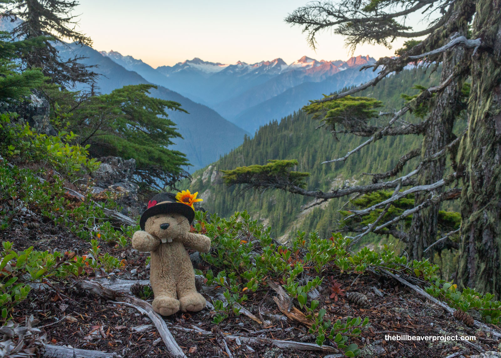
Set back, but not discouraged, I continued my climb up the steep trail, shoving through pine boughs and huckleberry shrubs now sporting berries the size of marbles! At last, the foliage started to thin just enough that I could take a break and enjoy the amazing view of Ross Lake and the valley beyond! I was starting to feel like I was making progress!
 |
But gosh, the trail wore on, and I saw what must have been Pierce Mountain, now well behind me. Had I missed the turn-off for the campground? Up here, though the trees were thinner, the barely visible trail was starting to look a lot like the many dry stream beds leading into dry pools! I was backtracking periodically thinking that, at best, I hadn’t missed the campground sign, and at worst, I was almost to the top of Sourdough Mountain and could look for the campground again on my way down, or even set up a tent in an emergency location if I had to. That is a big perk of traveling with camping gear!
 |
 |
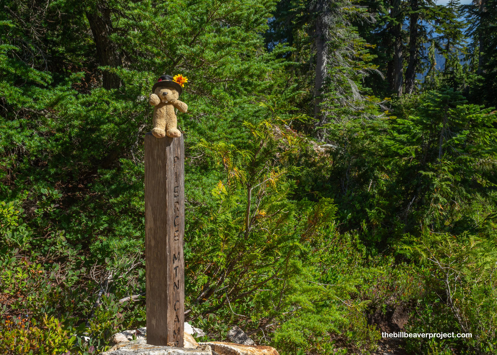
And then, as my feet were starting to feel really heavy, my back really sore, the most wonderful sight emerged out of the pine branches at 4:12 PM: the post marking the campground! It was a post, not a sign! I was looking for a post, dang it! Gosh, I wish the ranger and that hiker had been more specific that I was looking for a post on the left of the trail that said “Pierce Mtn Camp” on it! That would have spared me all kinds of worry!
 |
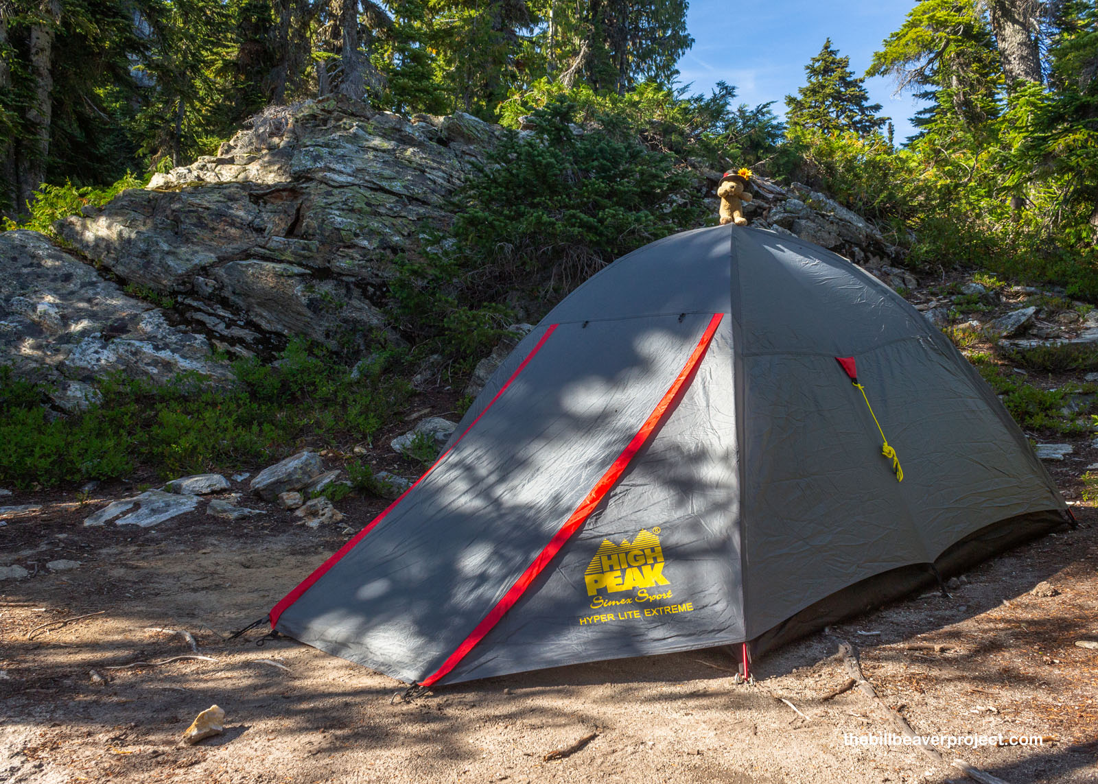
Anyway, I was encouraged, so I hustled down the offshoot trail, following little signs with tent images on them, past a tarn (seasonal pool) that made me worry about mosquitoes, until I reached a lovely, sandy spot, backed by a rock outcropping, with lovely views and a short path to a wide open pit toilet facing the peaks across the valley! Plus, the whole campground was overflowing with huckleberries! For a high mountain campsite, this was downright luxurious, and with a maximum capacity of four campers, I really lucked out. For better or worse, there was not another (human) soul around!
 |
Having shed all my gear and with complete confidence in where I was going to sleep tonight, I headed back to the post and resumed my journey to the summit. As the trees began to thin around me, the views of the North Cascades began to expand to my absolute amazement!
 |
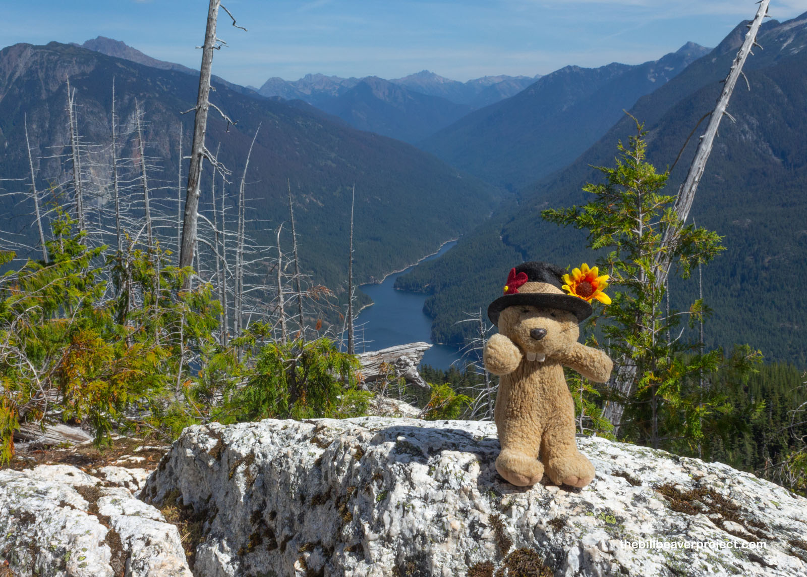
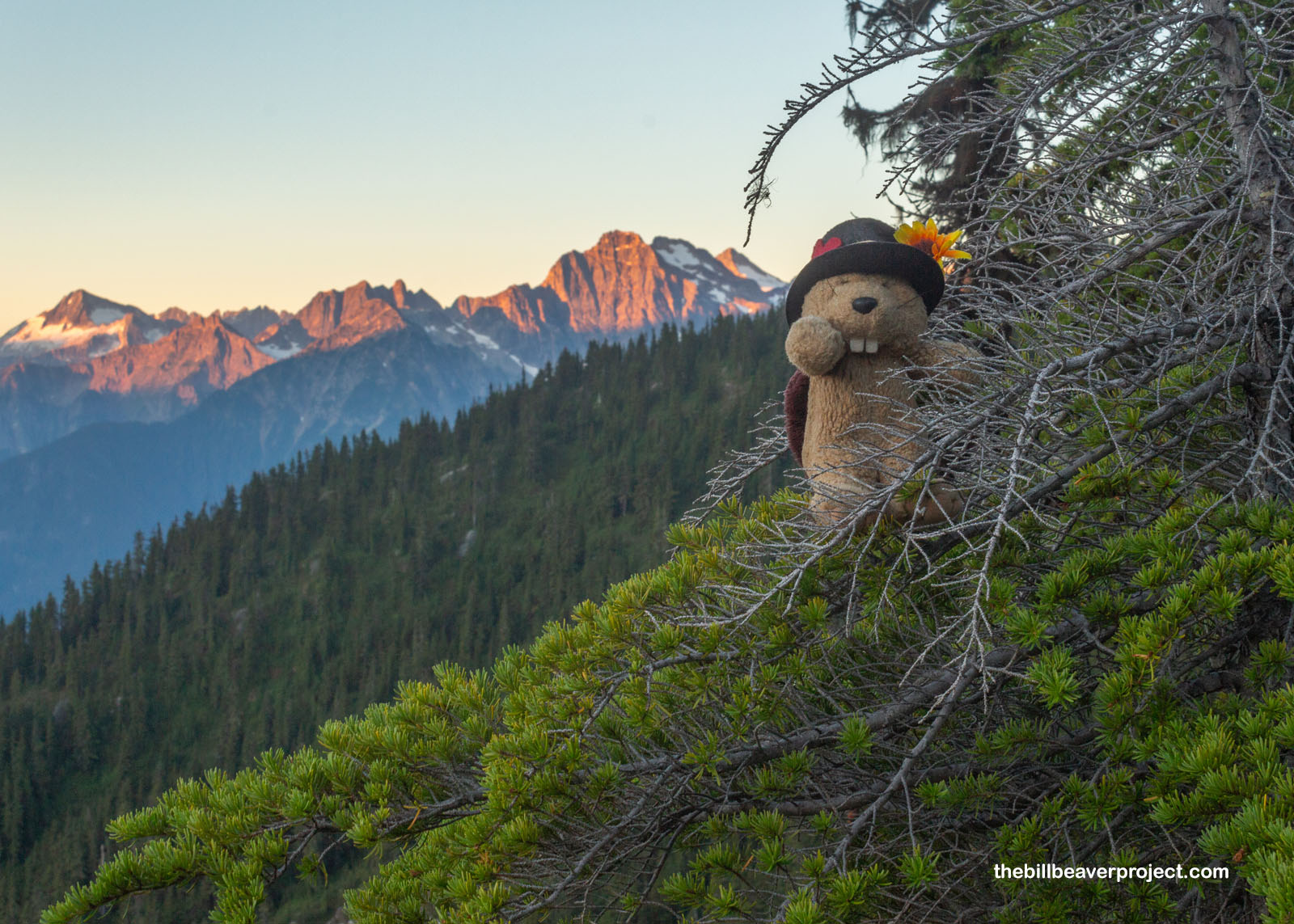
From one rocky perch, I looked north as Ross Lake stretched toward the border with British Columbia, where I was adventuring just last year! Right below, the Big Beaver Creek and Trail ran up into the mountains, while beyond, jagged Hozomeen Peak was the closest marker I could see to the spot where Washington ended and Canada began!
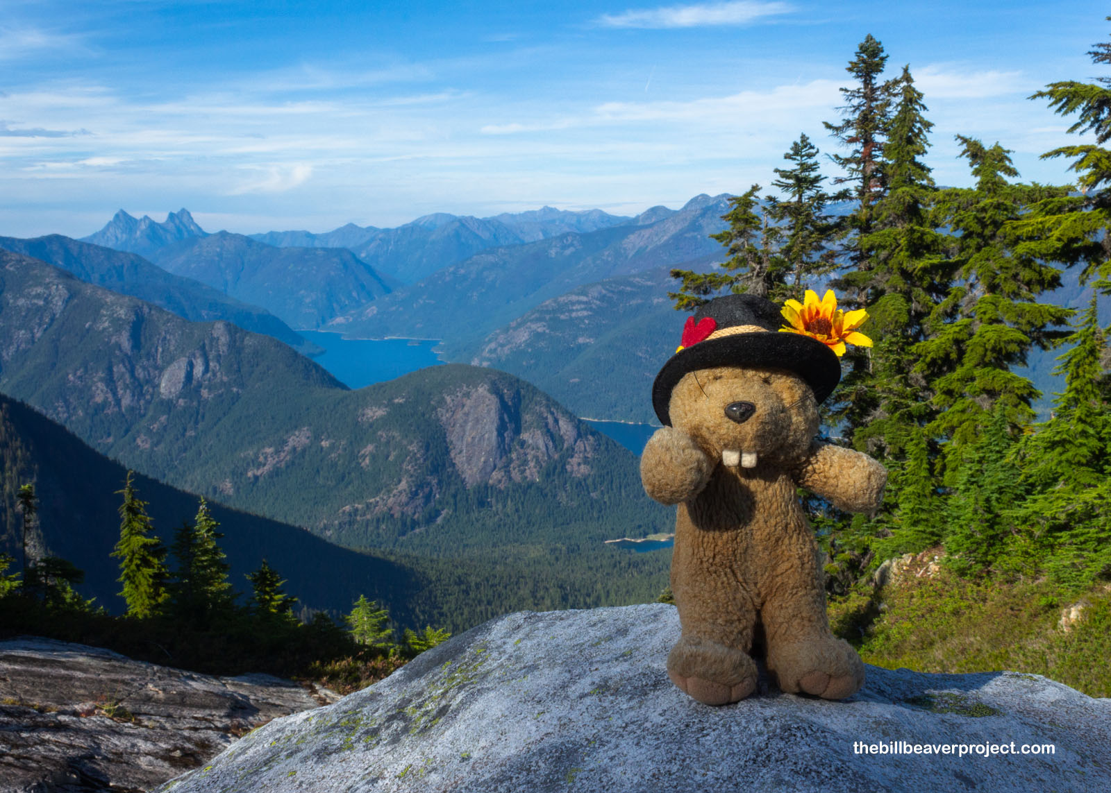 |
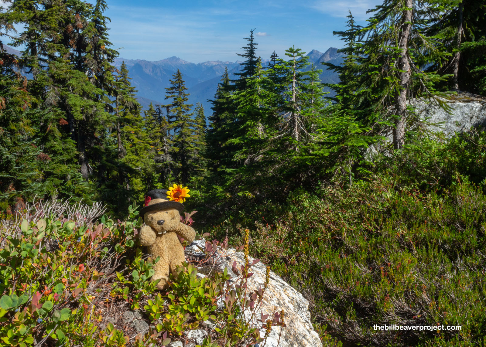
Soon after, the trees ended abruptly, giving way to alpine tundra, which felt super familiar to me after my immersion in Alaska!I always find it funny when tree lines are strict like this, as if there were some rule they were all privy to, which said they couldn’t set root anywhere past this line. I didn’t mind, because it cleared my view of the summit, and opened the way for one more tasty treat!
 |
This entire slope was covered in Cascade bilberries (Vaccinium deliciosum), the kind I had encountered last year at Mount Rainier, bursting with juice and a fragrant green apple tang. Gosh, they were good. They alone make a trip to the Cascades worthwhile, even if it were so cloudy you couldn’t see the amazing mountain views! I’m sure the fall colors up here are just lovely, but I can’t imagine they’d be as great without a paw full of these berries! Yum!
 |
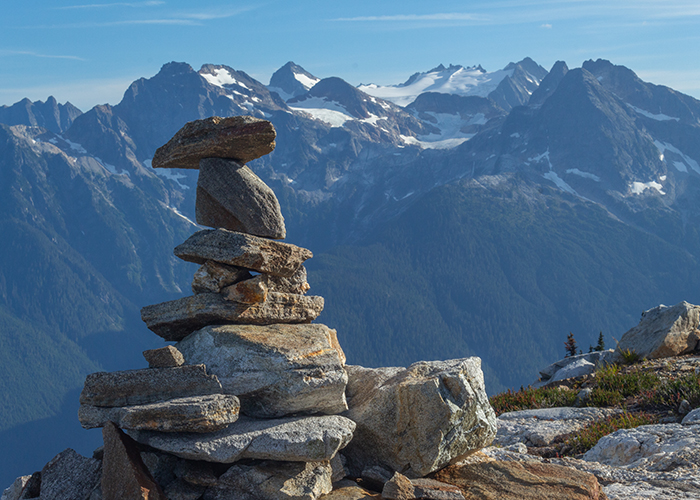
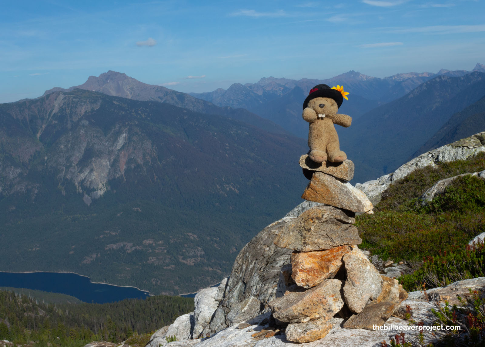
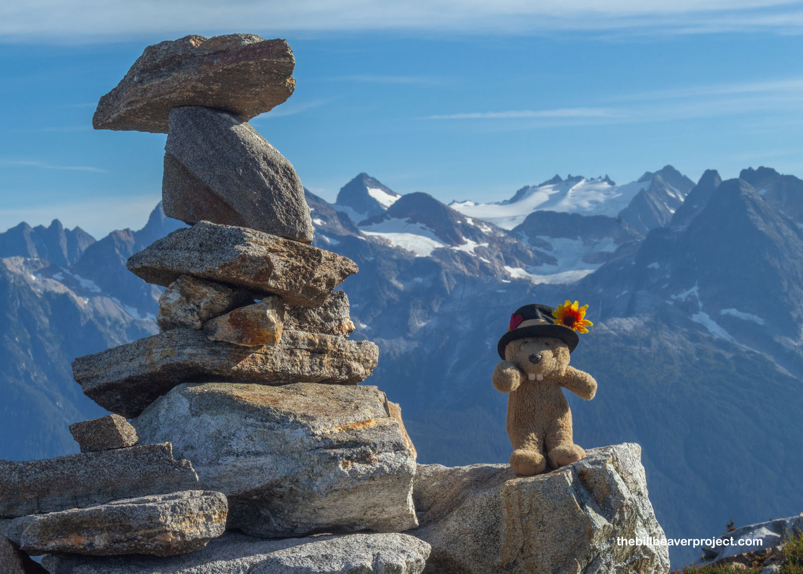
With the trees gone, the trail took some liberties with its original path, and so I had to rely on my old cairn-spotting skills, just like in Canyonlands National Park! While cairns might not be ideal everywhere, I thought these ones really lent themselves to the ruggedness of the landscape, especially looking across to the edge of the Colonial Glacier, a far more treacherous trek than this one!
 |
 |
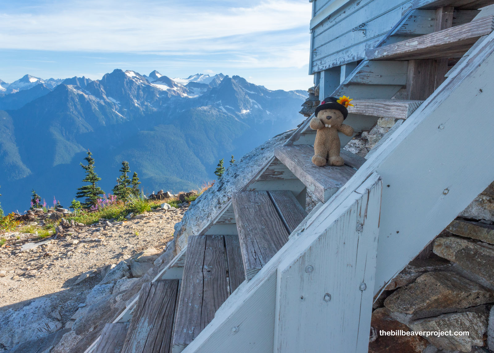
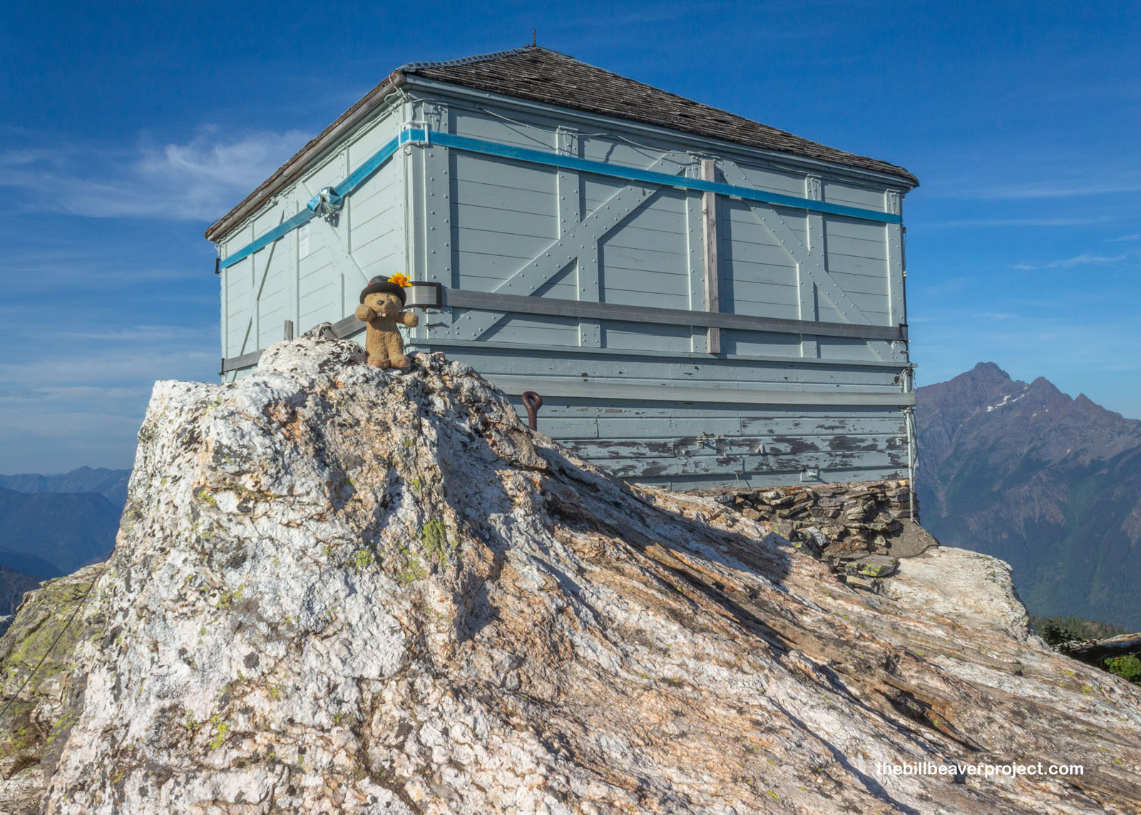
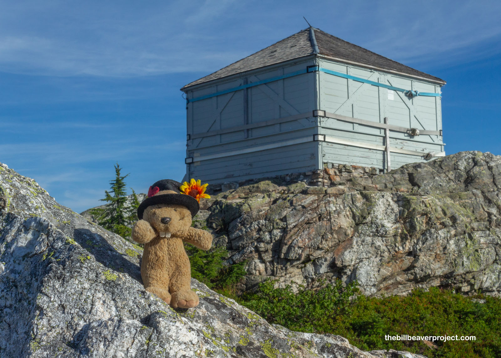
And then at 6:00 sharp, almost eight and a half hours from the parking lot, I reached the steps of my destination, the Sourdough Mountain Lookout. Normally, the Lookout is closed to the public, but today, it was still locked up even tighter with tension straps after it was threatened by the 2023 wildfire. As I have learned the hard way over the years, history can be burned away in a flash, so I was very glad to have made it here while the Lookout was still standing!
 |
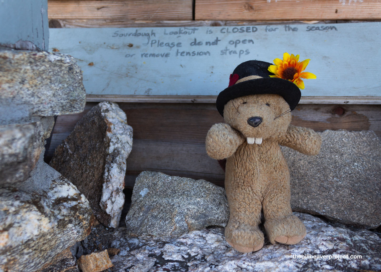 |
So why did I want to see the Lookout in the first place? Well, it’s on the National Register of Historic Places as one of the nation’s first fire lookouts! The original was built by Glee Davis in 1917, but it was replaced by the current building in 1933! Here, “Bush” Osborne’s fire finding technology was tested, combining viewfinders with a topographic map to pinpoint a fire’s location. It would go on to become the standard tool for fire lookouts across the country!
 |
 |
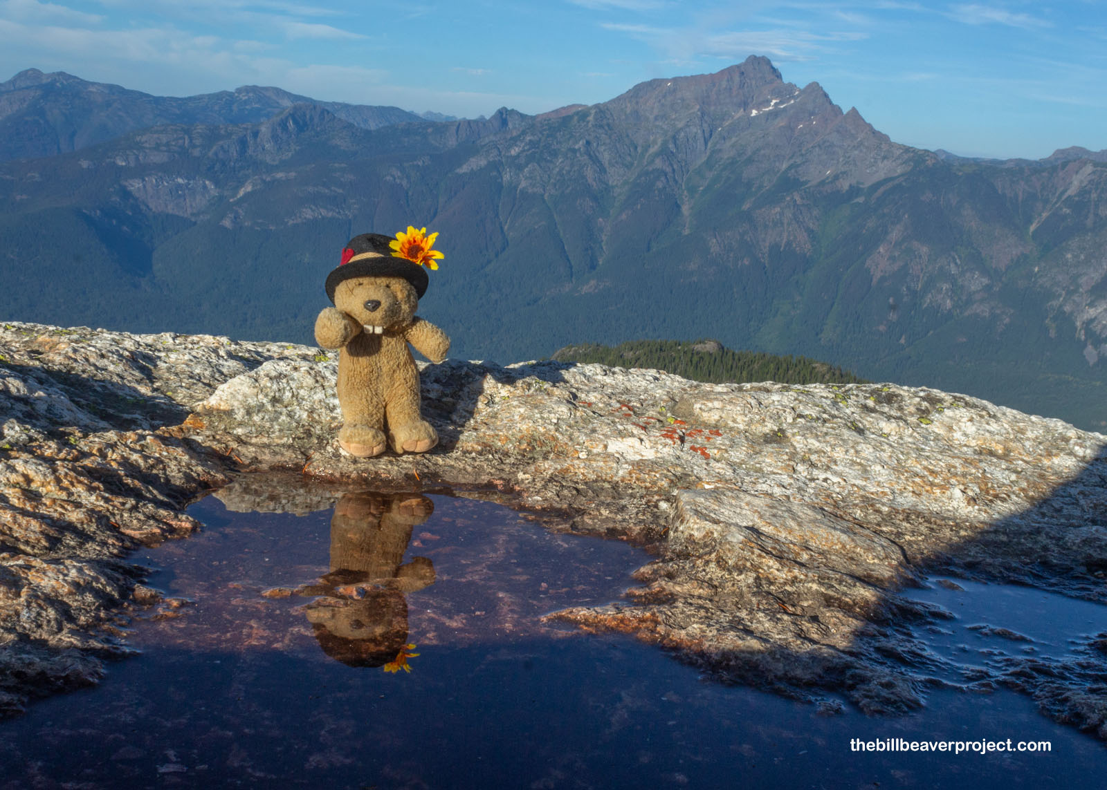
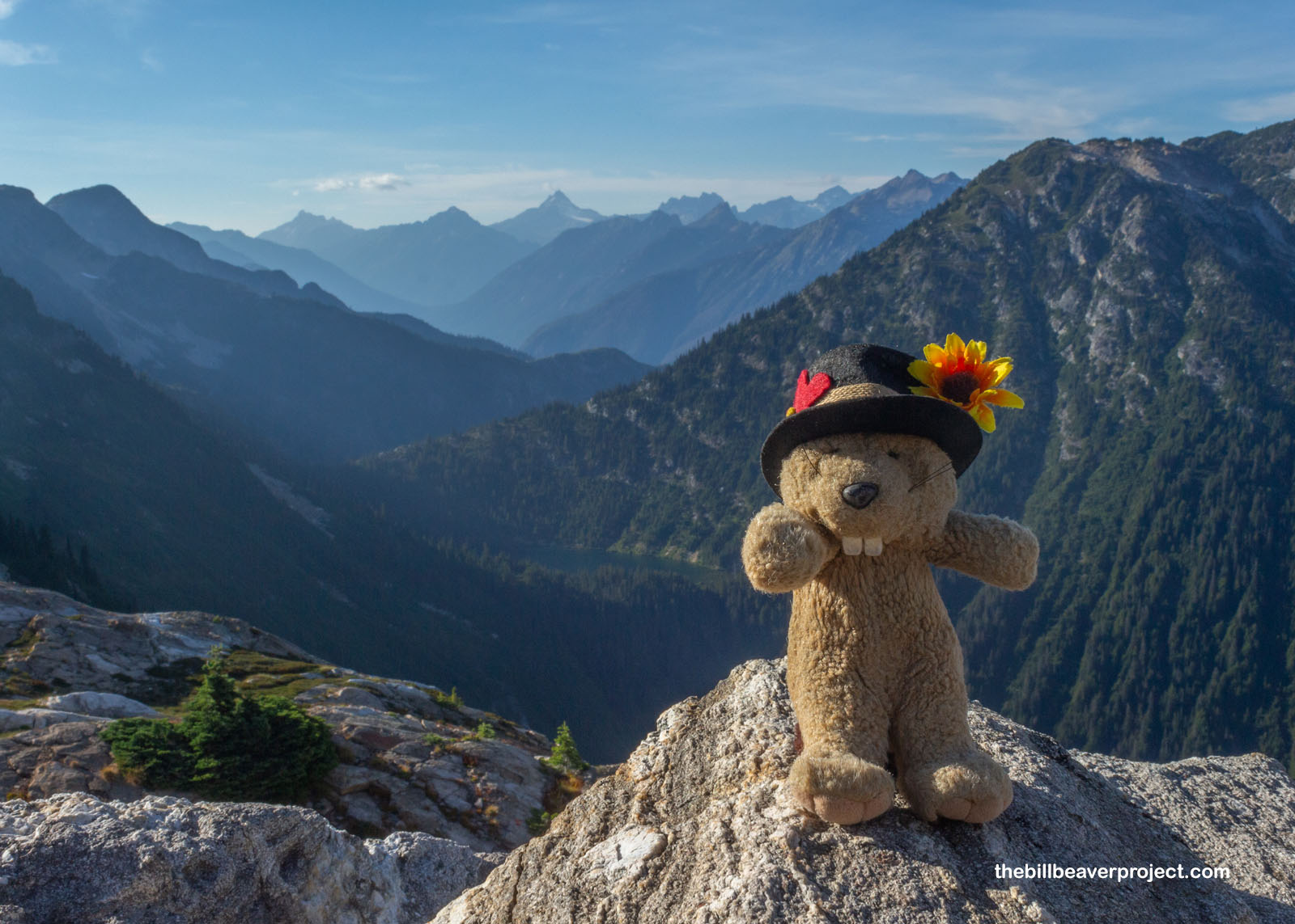
And it sure was seated on a lovely throne! The Sourdough Mountain hike really serves up a reward for anyone plucky enough to trek all the way up here. The views were fantastic on all sides, from the late afternoon lighting on the eastern peaks to the smoky shadows of those peaks in the west. It was the perfect spot to sit, snack, and be totally absorbed in the solitude of the high mountains!
 |
 |
As if that weren’t great enough, the summit of Sourdough Mountain was covered in my favorite tundra flower from Alaska, that cute little bellheather (Harrimanella stelleriana)! It’s been super cool seeing how widespread plants like these have gotten over the millennia, given how far away Katmai is from here!
 |
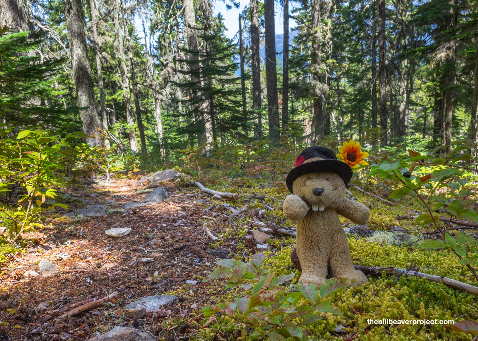
After a good long while of enjoying the summit, I remembered I should be back at camp before dark. Amazingly, I was not beset by mosquitoes and spent the twilight hour watching moths and listening to a gossiping pika in the talus field behind the campground. I slept really well, got up with the sunrise, and spent a good hour just grazing the many huckleberries and bilberries that surrounded the camp, leaving just enough for future campers and critters to enjoy, though it took every last ounce of my willpower to do so!
 |
 |
I packed up and started my descent at 7:24, making much better time with the help of gravity and a firm knowledge of where I was going. I reached the national park sign by 8:08, the trail junction by 9:11, and the parking lot, where the rental car had not been pillaged by vagabonds, by 10:45! A sweaty mess, I high-tailed it back to Bellingham for my 3:08 return to Los Angeles, a lot of adventure crammed into a small space, which, as we all know by now, is what I do best! I have a few more mountains to climb as summer turns into autumn, so stay tuned!
Huck to ya later!

More 2025 Adventures |
Total Ground Covered: 208.9 mi (336.2 km) |
More 2025 Adventures |