 |
| Landmark #57 | San Diego County | Visited: April 21, 2013 | Plaque? YES! 🙂 |
| What is it? | A small plaque at Seaport Village! |
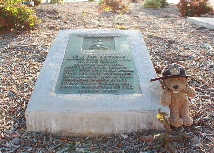
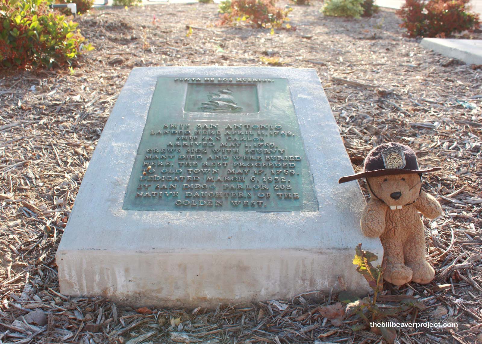
| What makes it historical? | THE GUIDE SAYS: Sailors and marines were buried here in 1782, when San Diego Bay was surveyed and charted by Don Juan Pantoja y Arriaga, pilot, and Don José Továr, mate, of the royal frigates La Princesa and La Favorita under command of Don Augustín de Echeverria.
OTHER TIDBITS: What is known today as Seaport Village was formerly the spot where the crews of the aforementioned ships came ashore and began dropping dead from scurvy! One, two, three sailors at a time, and they were all buried under where shoppers now wander trinket shops and snack on goodies! |
| How can I Help the Helpers? | HERE’S HOW:
|
| Where is this place? | LISTED DIRECTIONS: SE corner of Market St and Pacific Hwy (State Hwy 163) San Diego, CA 92101 ANNOTATIONS: From Los Angeles: ~121mi (195km) — 2.1hrs |
| When should I go? | Whenever the mood strikes you! |