 |
| Landmark #37 | Amador County | Visited: May 9, 2015 | Plaque? YES! 🙂 |
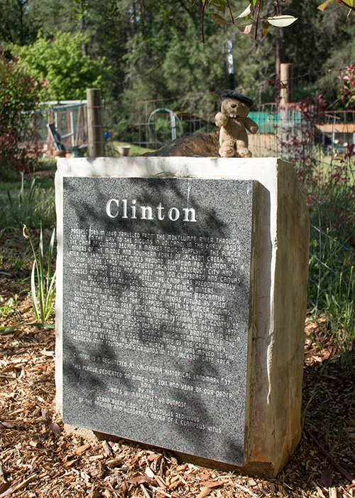
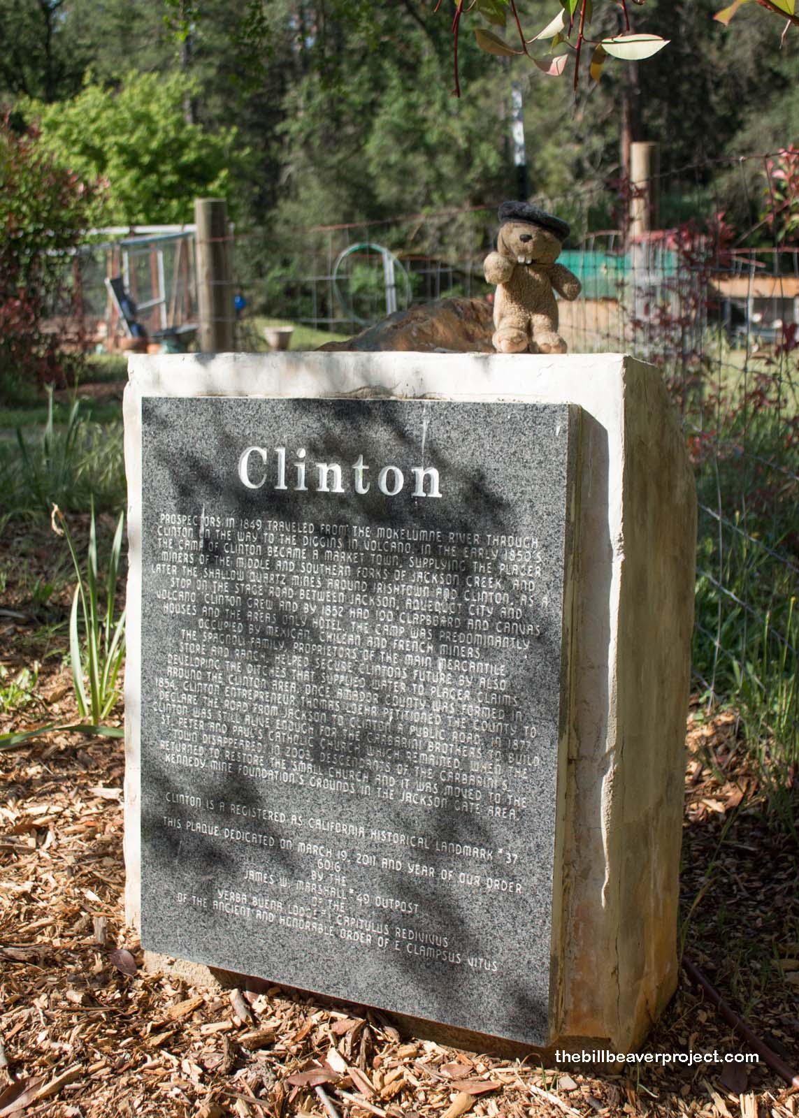
| What is it? | An engraved stone marker by the side of the road! |
| What makes it historical? | THE GUIDE SAYS: Clinton was the center of a placer mining community during the 1850s and of quartz mining as late as the 1880s. This town once decided Amador County elections as its votes were always counted last.
OTHER TIDBITS: That pretty well sums it up! |
| How can I Help the Helpers? | HERE’S HOW:
|
| Where is this place? | LISTED DIRECTIONS: Intersection of E Clinton and Clinton Rd 1.0 mi SE of State Hwy 88 3.2 mi SW of Pine Grove, CA 95642 ANNOTATIONS: From Los Angeles: ~390mi (628km) — 6.5hrs |
| When should I go? | Whenever the mood strikes you! |