 More 2020 Adventures |
Portland, OR → Astoria, OR → Redmond, OR 369.0 mi (593.8 km) |
 Next Day |
Drizzly Morning, everyone!
You may as well call me Waldorf, because today I’m in Astoria! I braved a Monday night flight from Burbank to Portland, and it turns out that week nights are perfect for flying during the coronavirus pandemic. That’s because very few other people do it.
 |
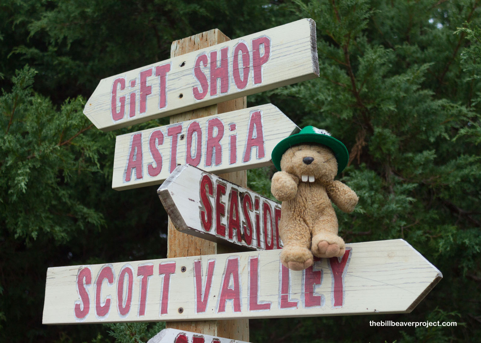
Anyway, my mission on what will probably be the last adventure of 2020 is to visit the end point of the grand Lewis & Clark Expedition! Since the national historical park wasn’t scheduled to open until 9:00, I took a soggy stroll about town to see what neat historical sites I could find!
 |
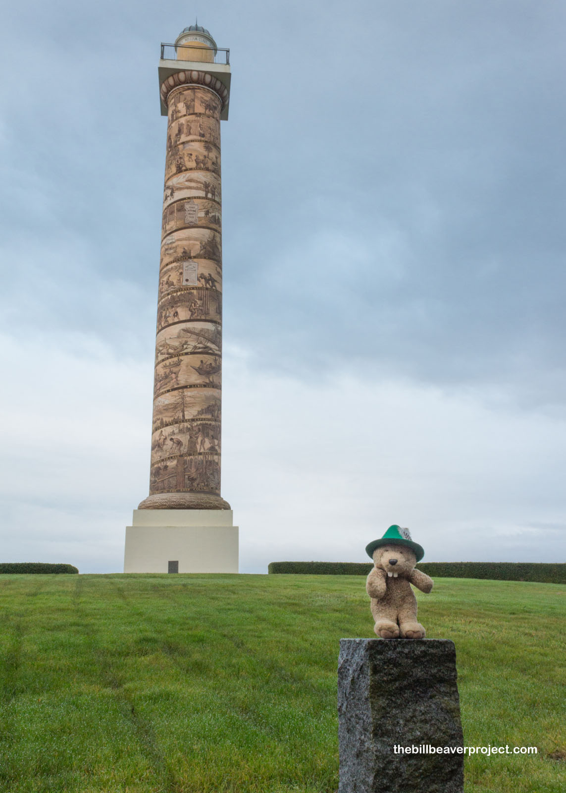
The first site, high on Coxcomb Hill overlooking the Columbia River, was the Astoria Column! Built in 1926 and partly funded by the great grandson of Astoria’s founder, John Jacob Astor, this magnificent, 125-foot tall column is painted from top to bottom in a spiral illustration of Lewis & Clark’s voyage!
 |
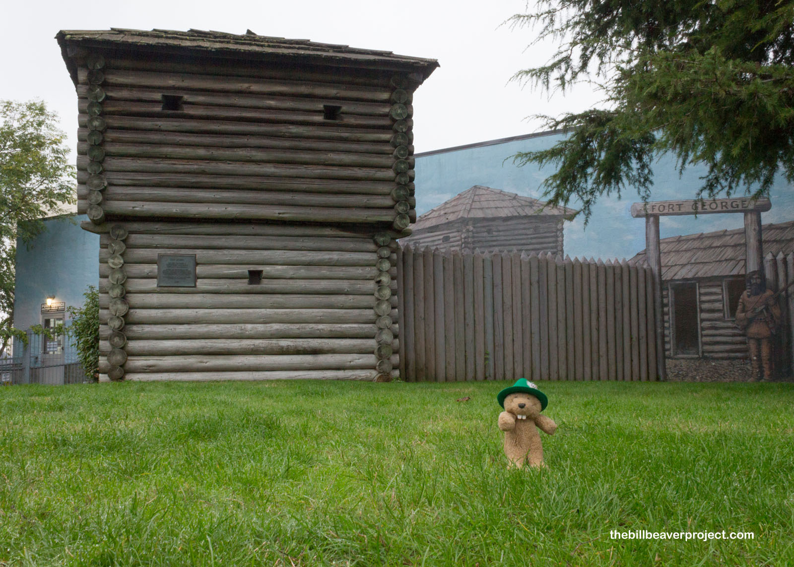
At the bottom of the hill, there’s a reconstructed block house commemorating Fort Astoria, which was founded in 1811 by John Jacob Astor as a base for the Pacific Fur Company. It was the first American-owned settlement on the Pacific Coast and hosted folks from a wide range of backgrounds and trades until the War of 1812 caused the company to collapse and the fort to change names to George!
 |
 |
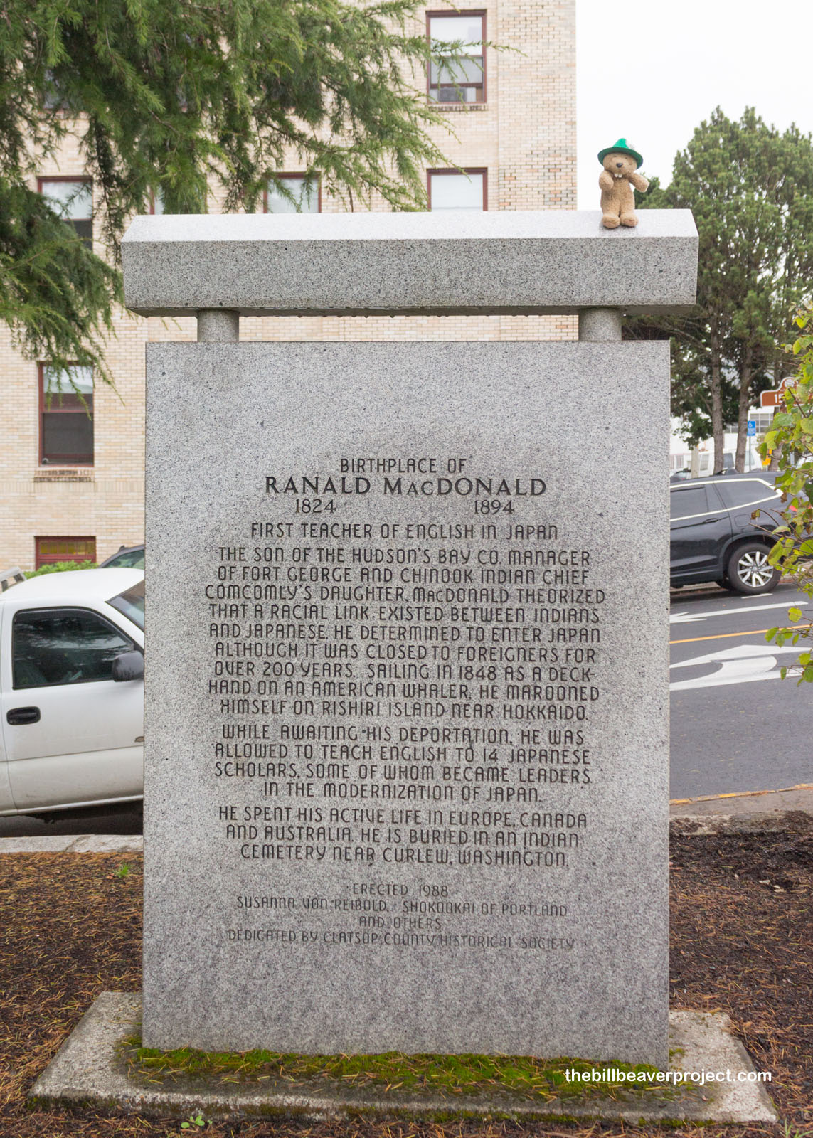
This little patch of grass also had a unique monument that caught my eye, in honor of Ranald MacDonald! This fellow was no clown. In fact, he was the first person to teach English in Japan while its borders were closed! It all happened with a shipwreck and making the most of his time while waiting to be deported!
 |
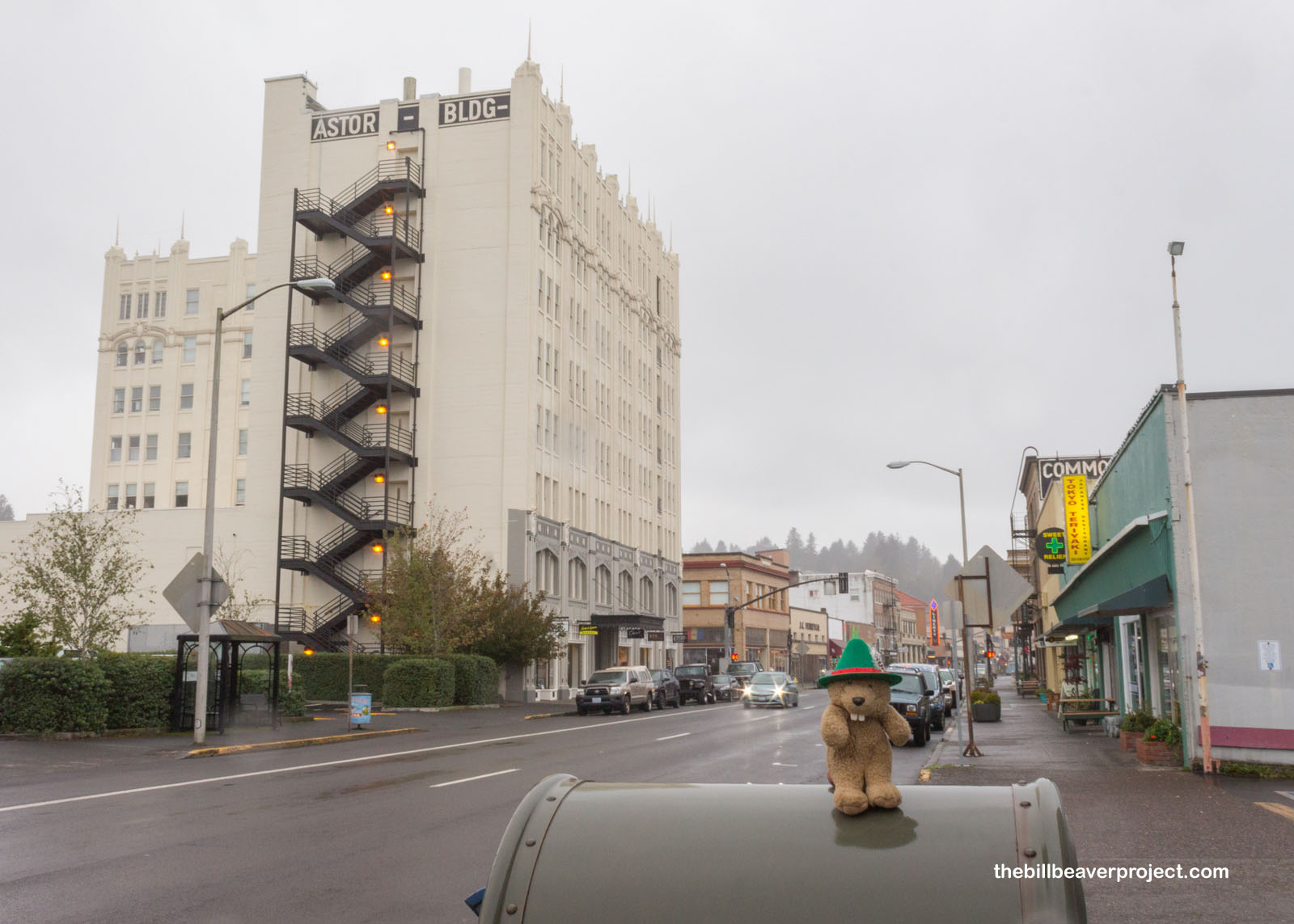
The rain continued as I beheld the Astor Building, or John Jacob Astor Hotel, one of the tallest buildings on the Oregon Coast! It opened its doors on January 1, 1924 and housed guests until 1968 when it was condemned for safety violations. After about twenty years of sitting vacant, it got renovated and is now an apartment complex! Fun fact! The world’s first cable television system was set up here in 1948 when an antenna was installed on the roof of this hotel!
 |
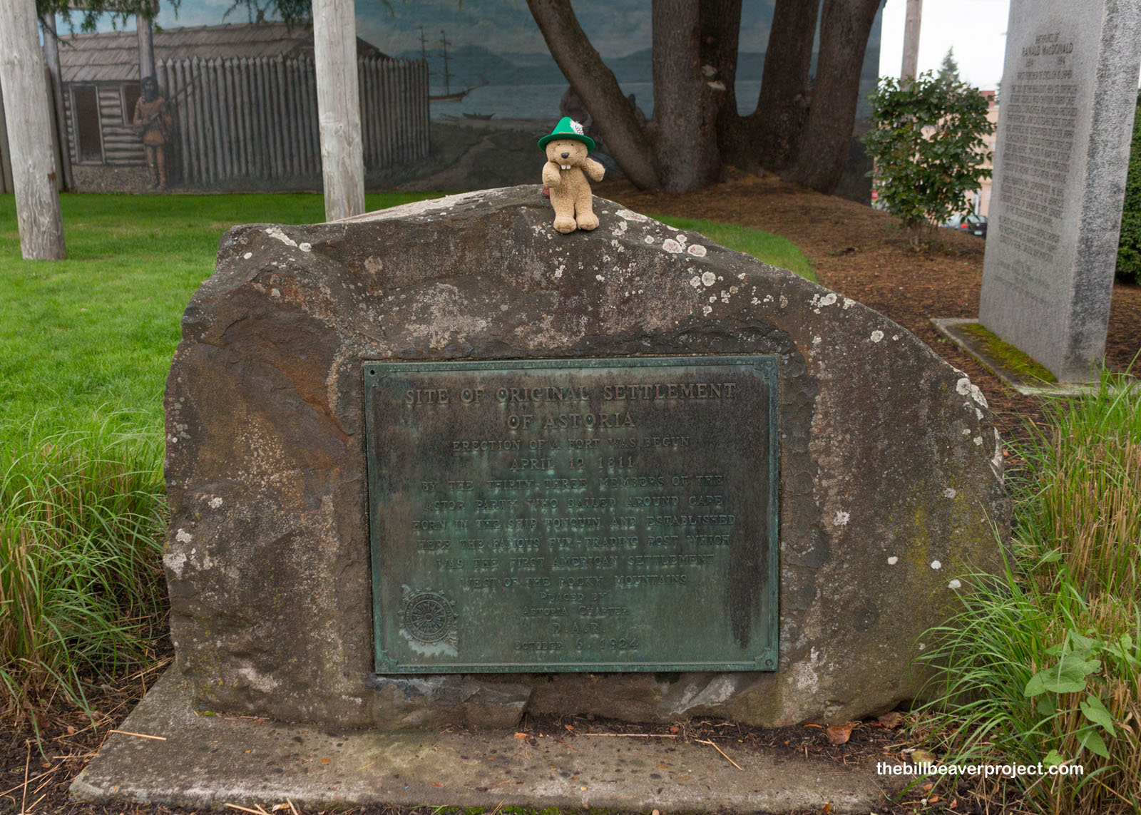
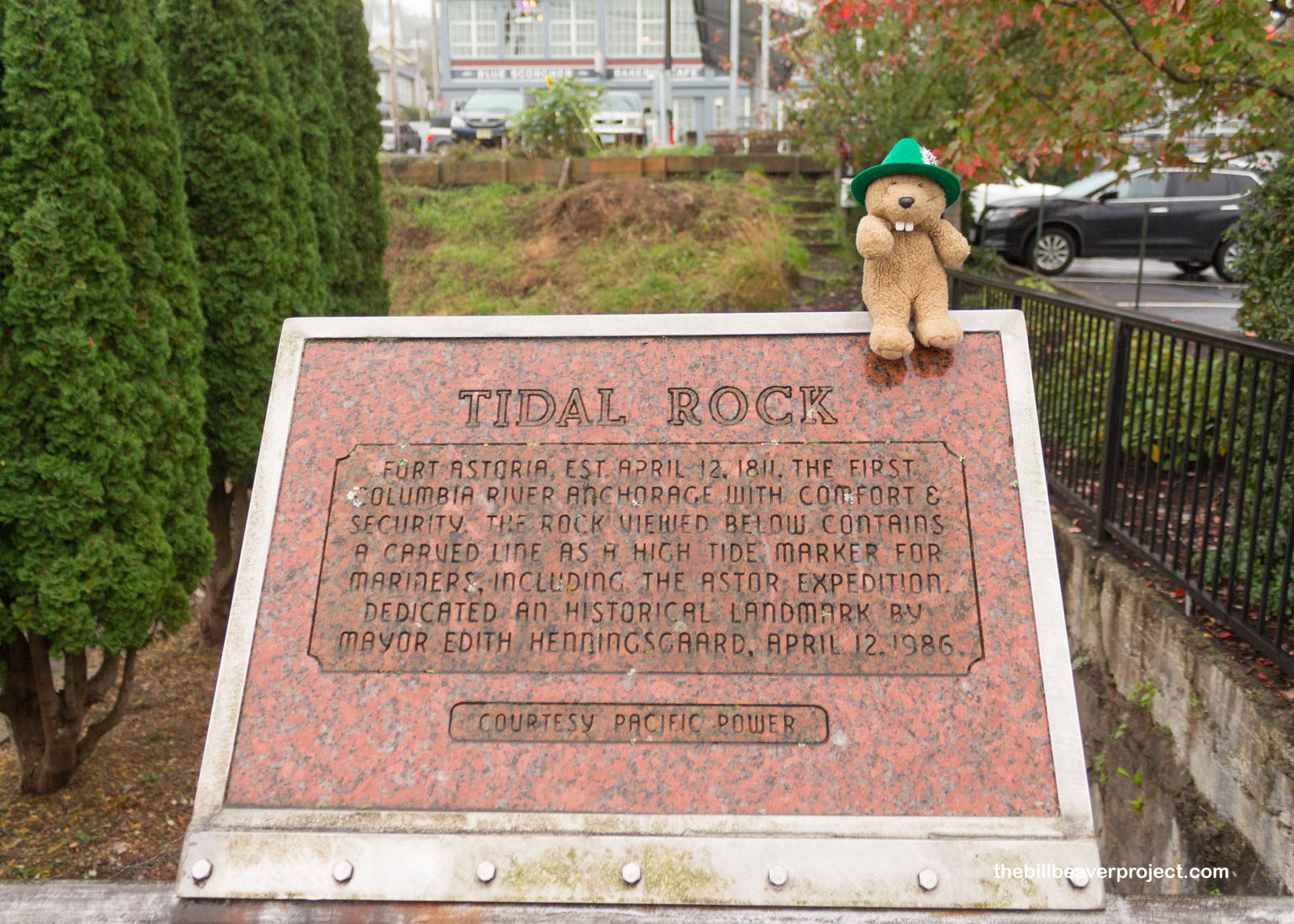
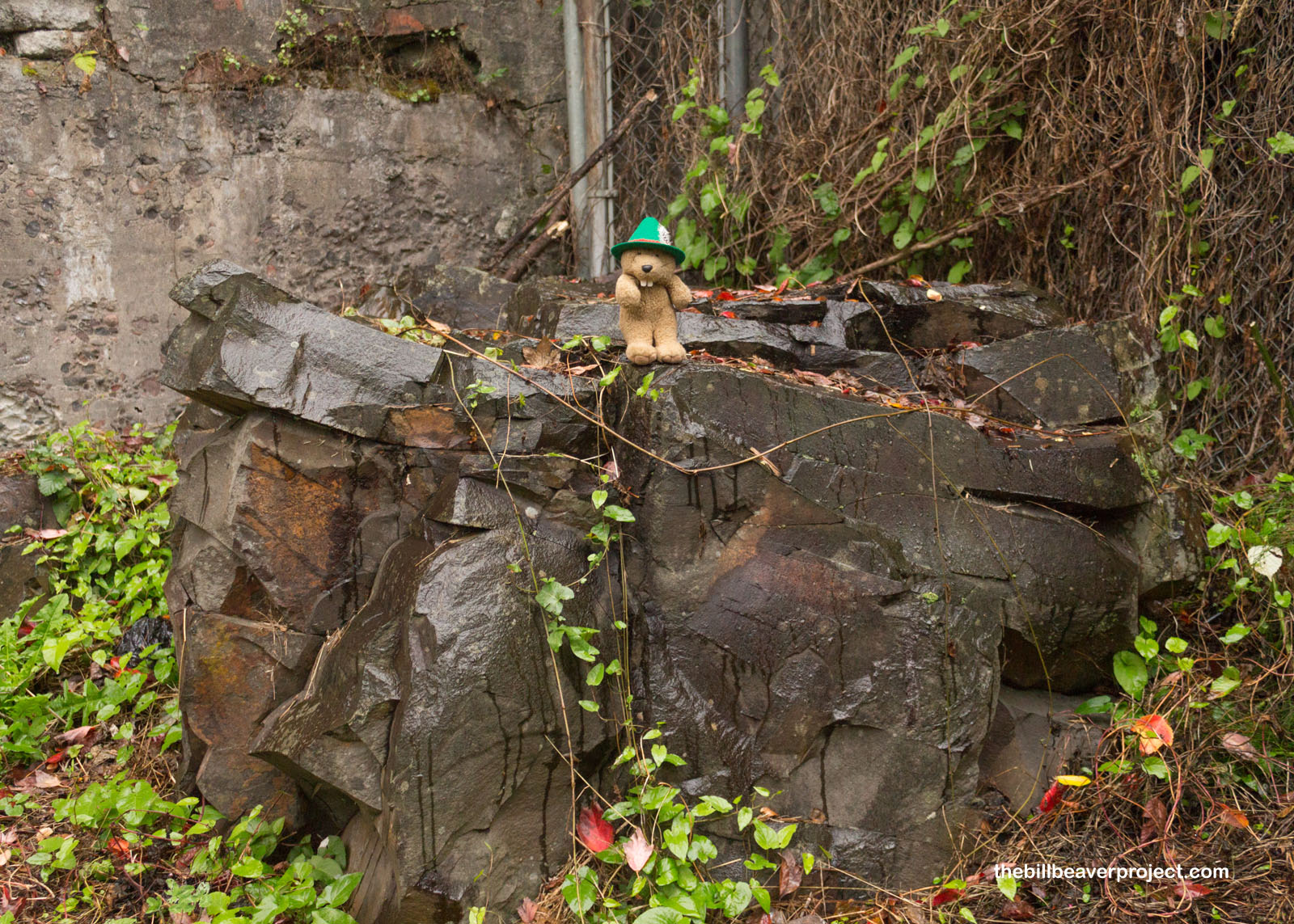
A carefully hidden rock also marked the formed high tide line when this area was first settled. While the ocean was a bit further away today, in a few more years, there just might be waves lapping at this rock again!
 |
 |
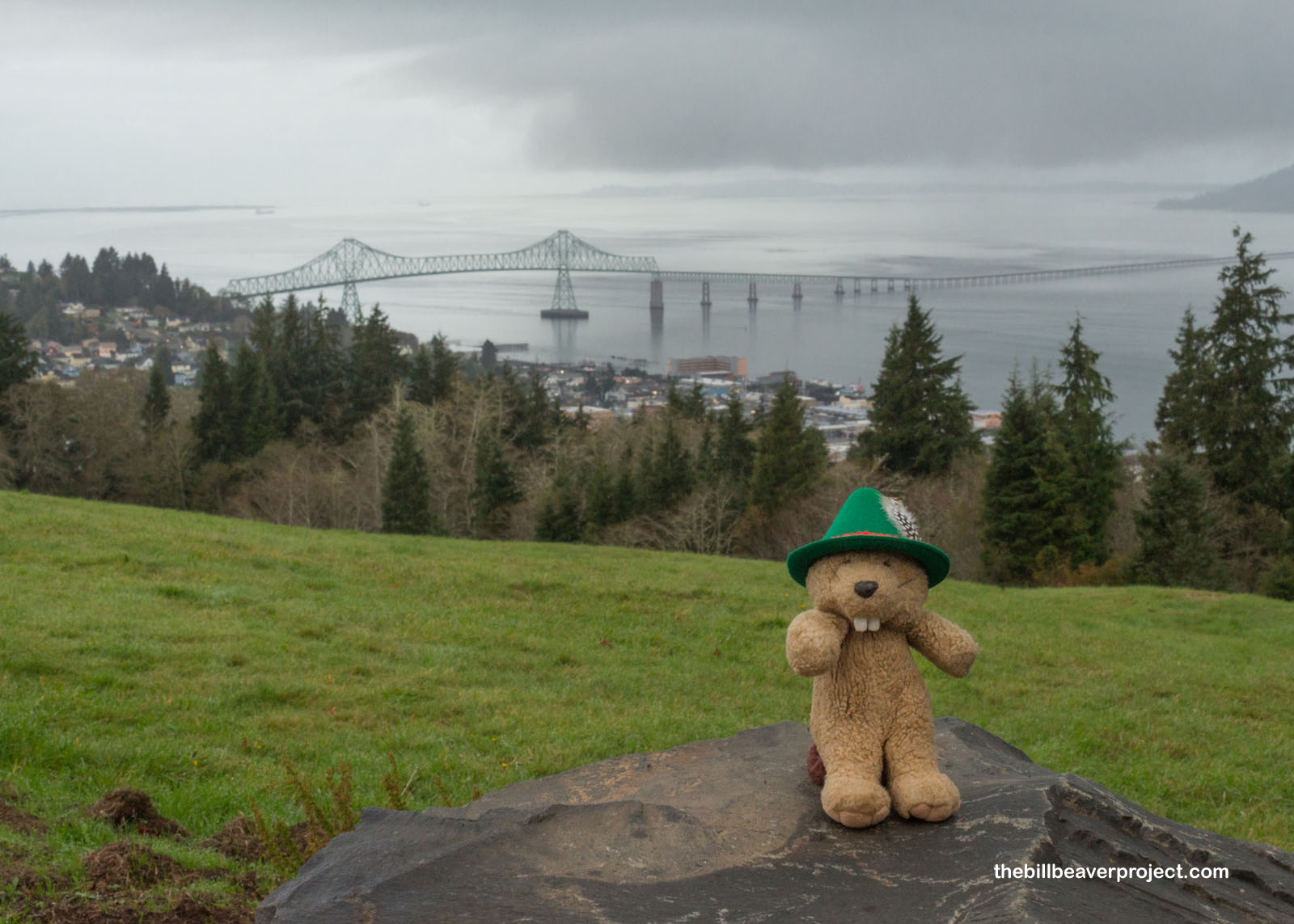
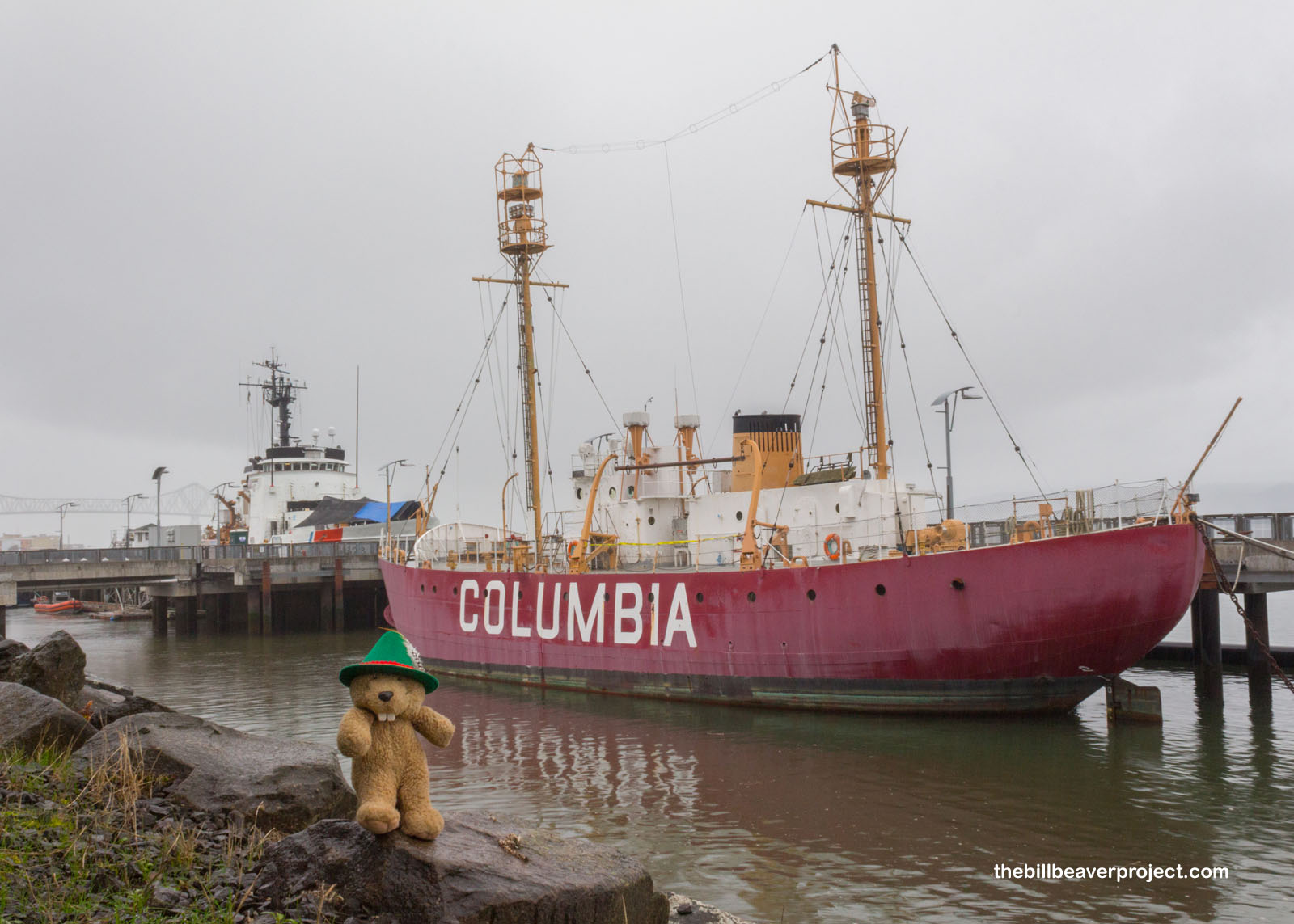
At this point, I was getting really, really soaked, so I decided to make one last stop before moving on to Lewis & Clark National Historical Park. Like the WLV 605 in California, the lightship Columbia (WLV 604) guided ships through treacherous waters in a spot where it was very difficult to build a full lighthouse! Running for 86 years, the Columbia, named for the Columbia River, was both the first active lightship on the West Coast and the last to retire!
 |
I went to dry off with an almond croissant for breakfast then headed south across Young’s Bay to the main unit of Lewis & Clark National Historical Park: Fort Clatsop.
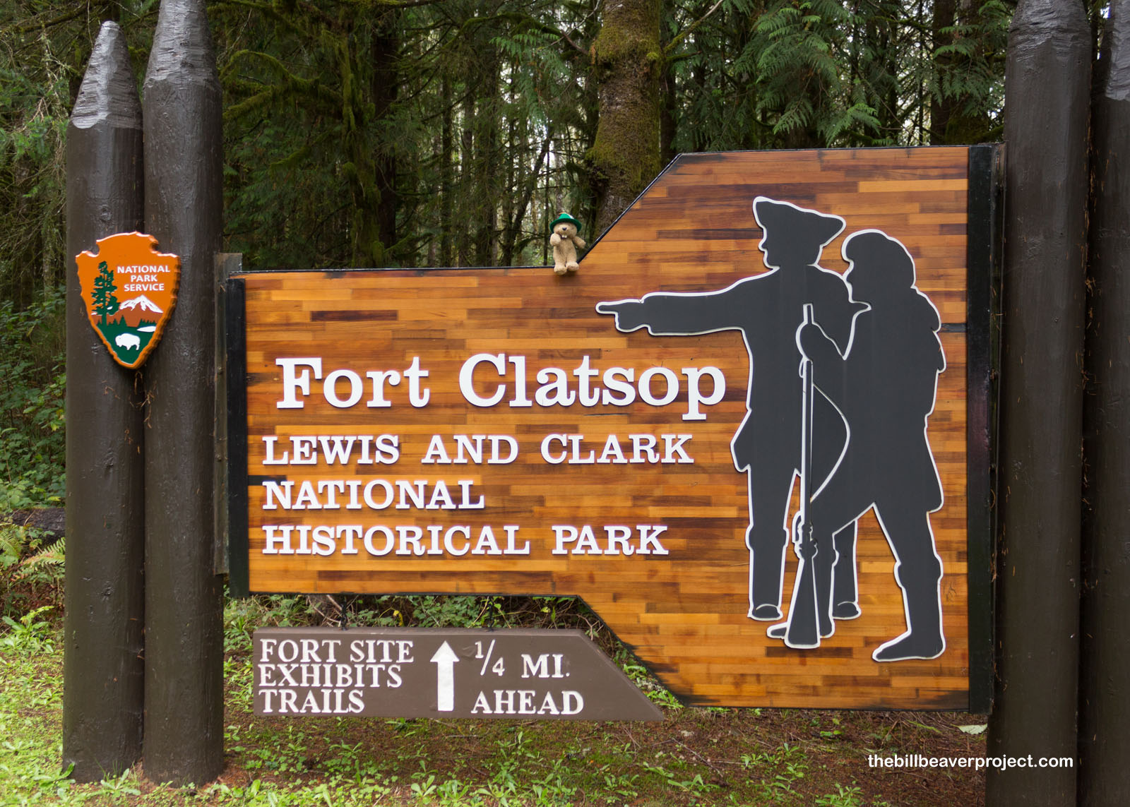 |
Here, the Corps of Discovery concluded their grand voyage from Pittsburgh to the Pacific Northwest, guided from North Dakota onward by Sacagawea, a member of the Lemhi Shoshone, who helped them gather food and negotiate for supplies with other tribes. The whole time, she was carrying her two-month old son, Jean Baptiste, on her back!
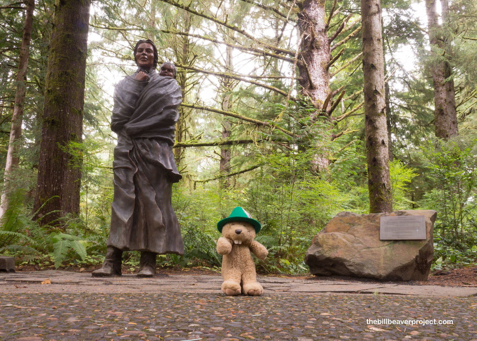 |
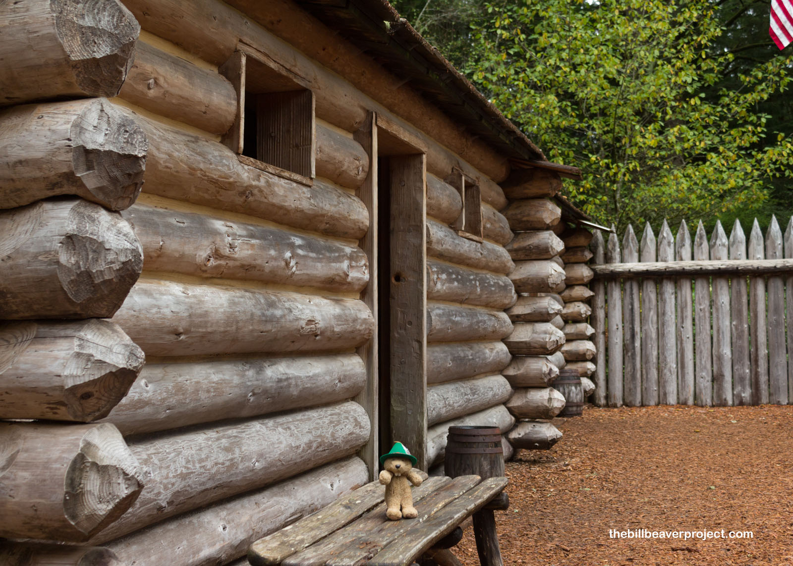
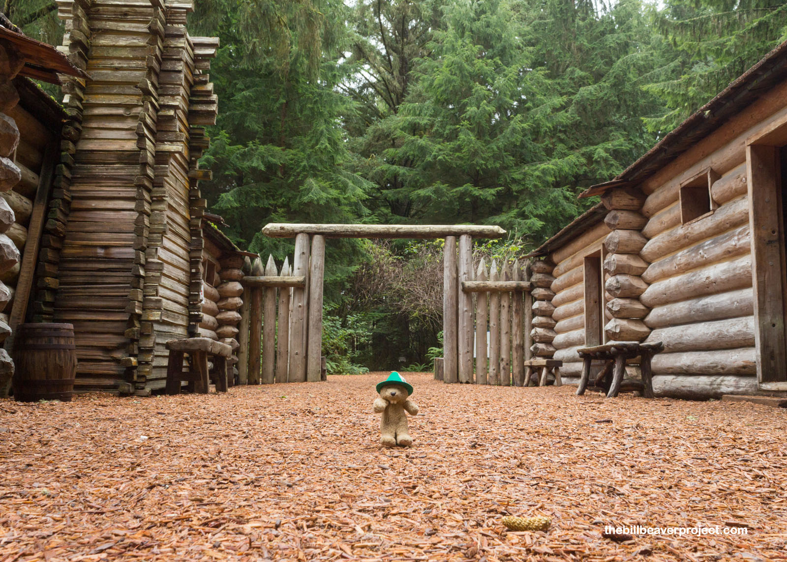
This park showcases a reconstruction of Fort Clatsop where the Corps of Discovery camped in the winter of 1805-06. Named for the local Clatsop people, the fort’s location turned out to be super significant! That’s because of the vote held among the Corps members on where to camp. In a time when only white men were allowed to vote in American society, both Sacagawea and an enslaved man named York (who had already saved half the expedition from a flash flood) got equal weight to their votes! Despite all this, York was still denied his freedom upon their return.
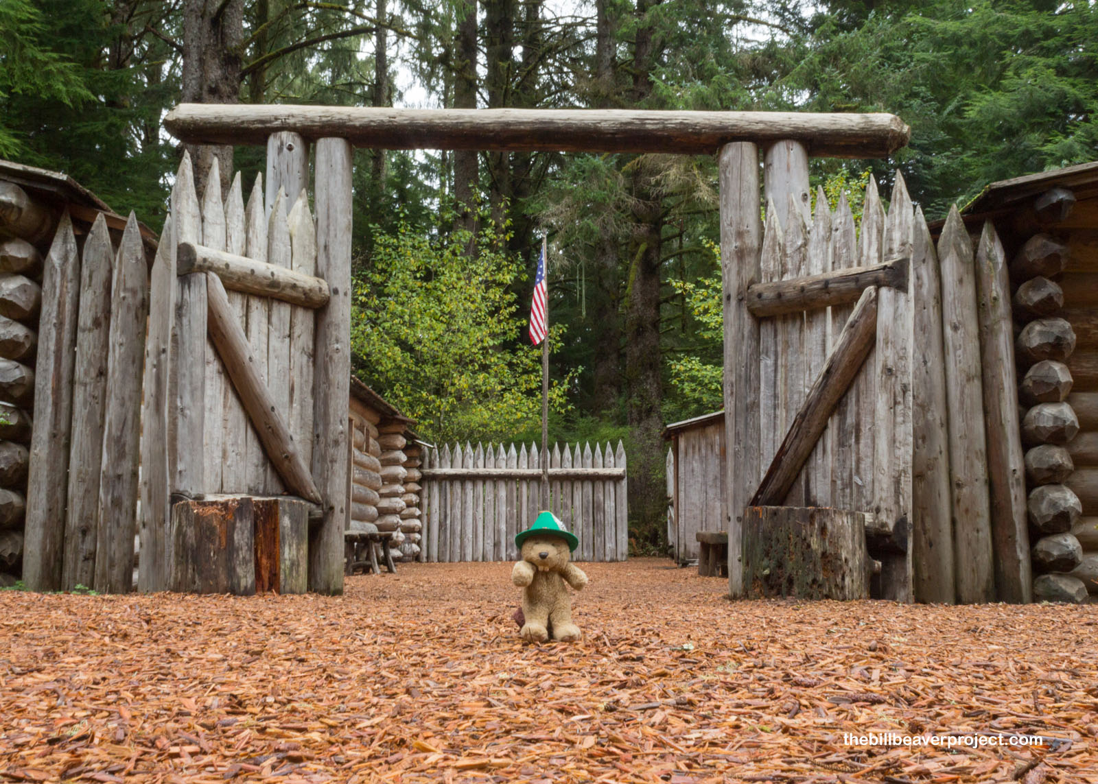 |
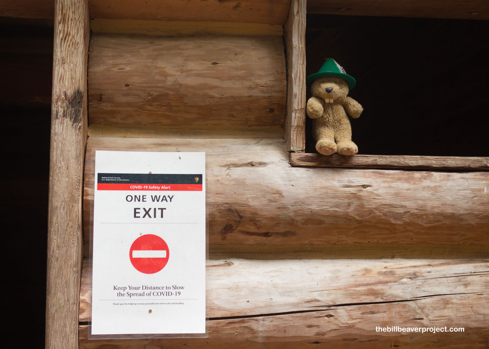
The fort, which was reconstructed on the hunch of homesteader, William Smith, was pretty empty today, partly because of the weather, partly because it was a weekday, and partly because there’s still a pandemic raging! The doors were carefully marked with one-way arrows to ensure no one clustered inside for too long.
 |
 |
The Corps of Discovery only stayed here for the winter season and by March 23, 1806, they were more than ready to head back east! It had taken over a year to get here but only five months to arrive in the familiar territory of St. Louis. Their entire expedition had taken two year, four months, and ten days, and spanned 8,000 miles! Meriwether Lewis then went on to become governor of Upper Louisiana, and William Clark became Agent for Indian Affairs in the Louisiana Territory.
 |
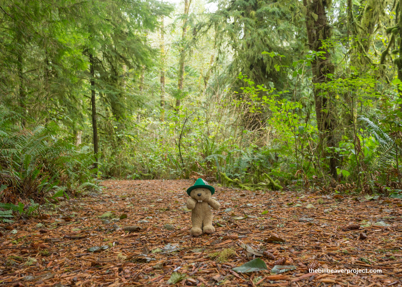
I couldn’t help but appreciate the lushness up here, because southern California is so dry and also on fire! The rain of the Oregon Coast, though cold and miserable for both the Corps of Discovery and on this particular day, sure does create some beautiful plant life!
 |
 |
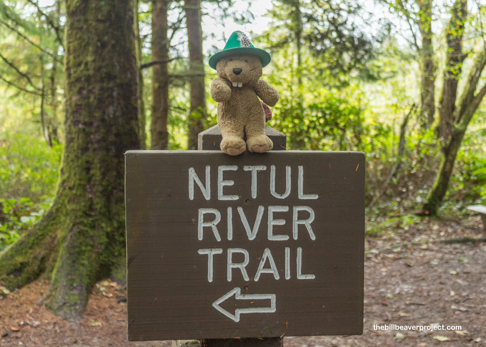
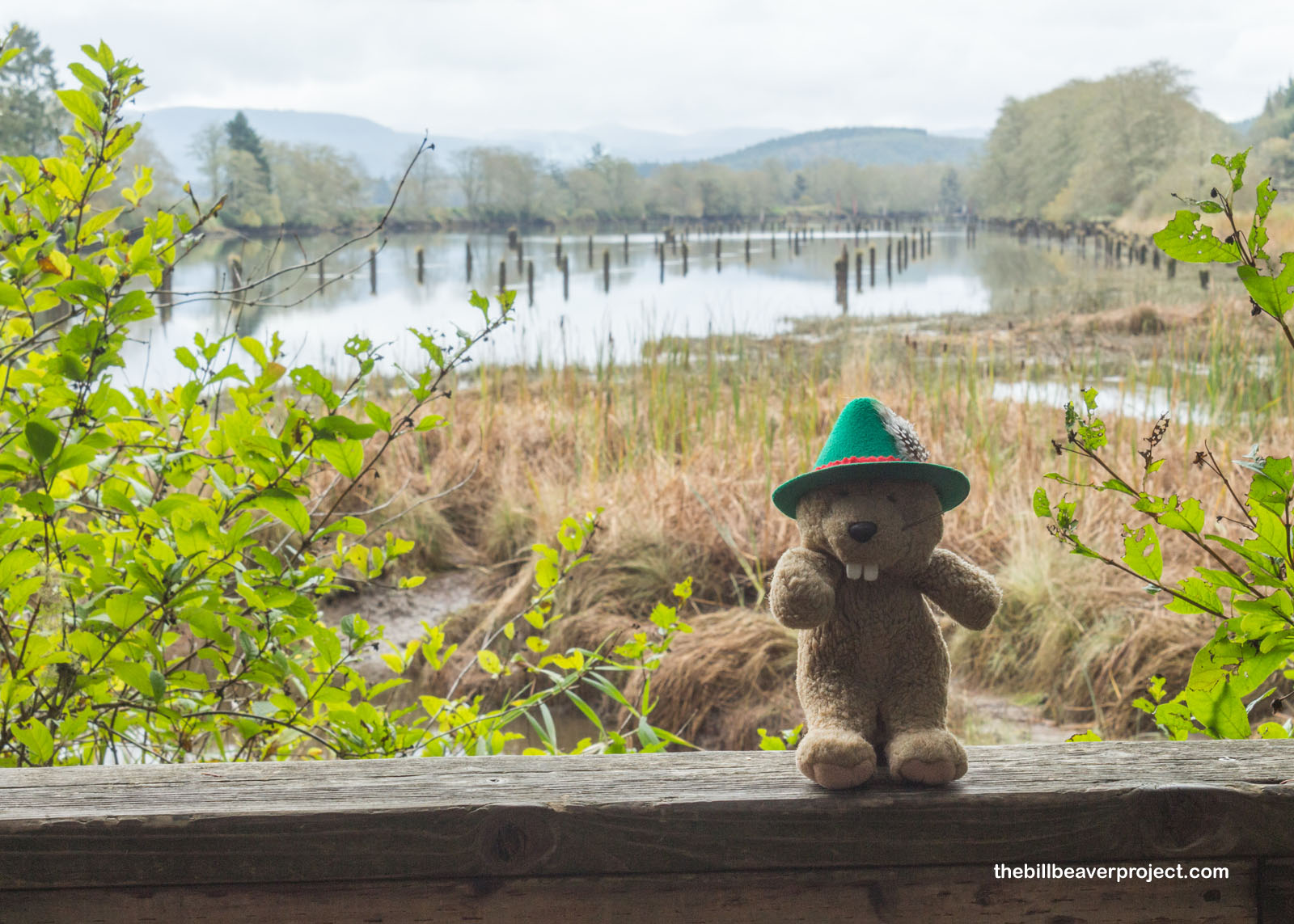
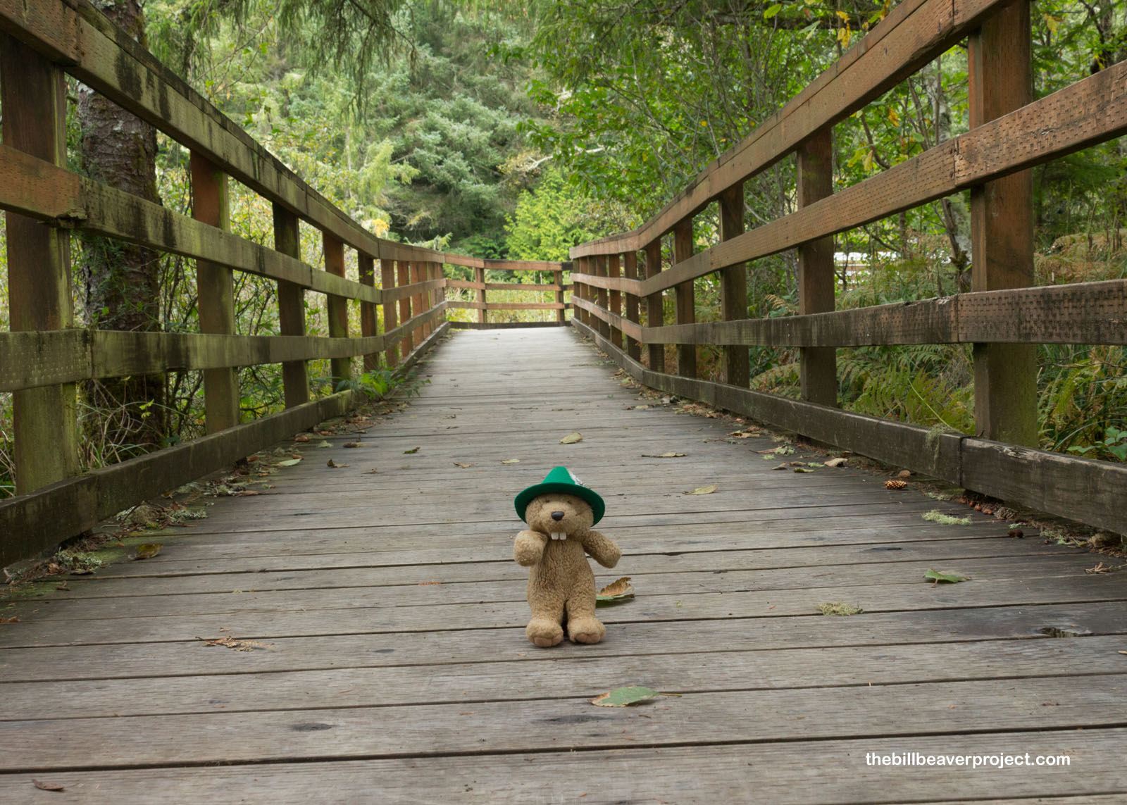
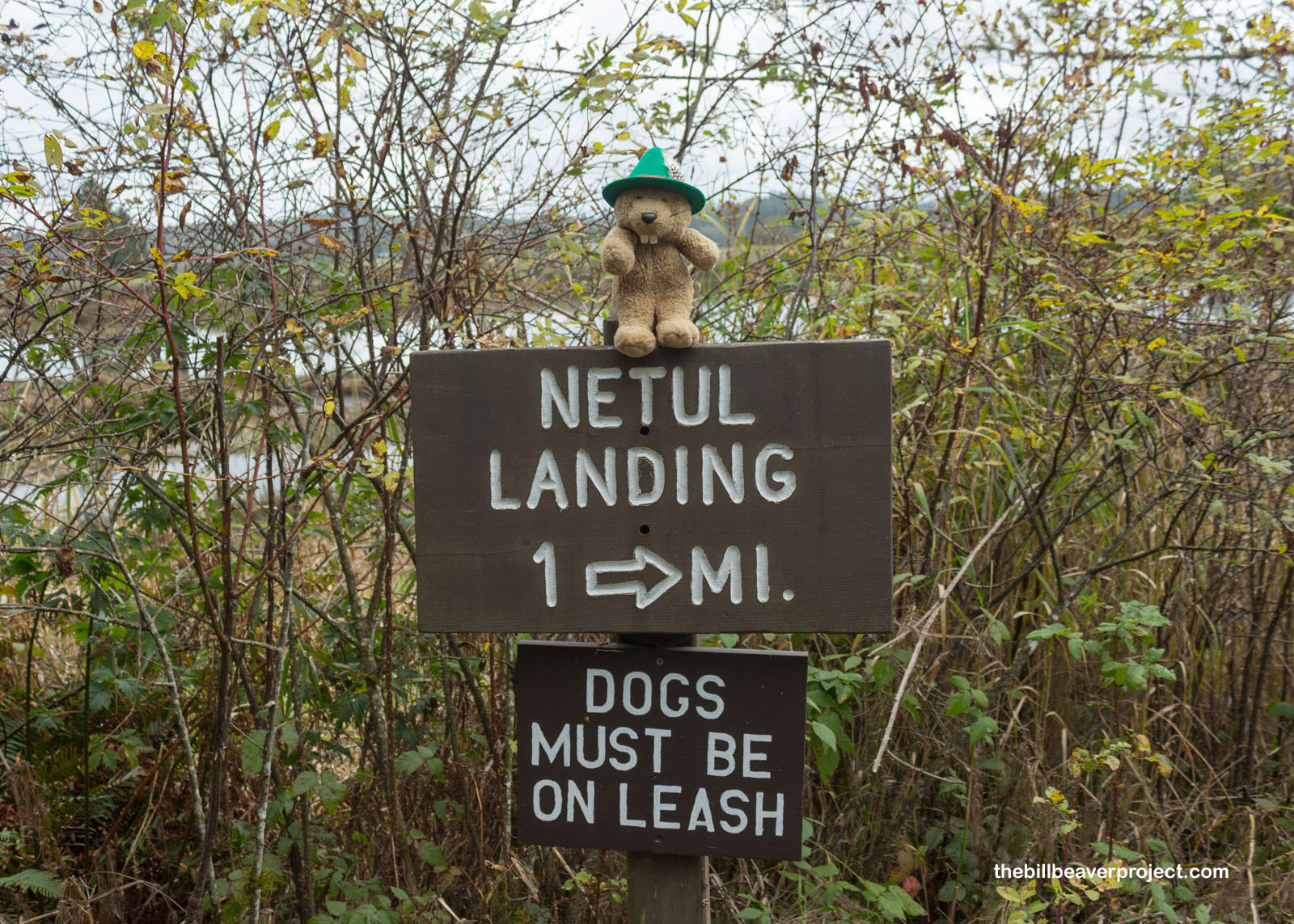
The rain did start to lighten up a bit, so I strolled a little further down the 1.5-mile Netul River Trail. Though today, the river is called the Lewis and Clark River, when they first pulled up here in their canoes, it was known as Netul!
 |
 |
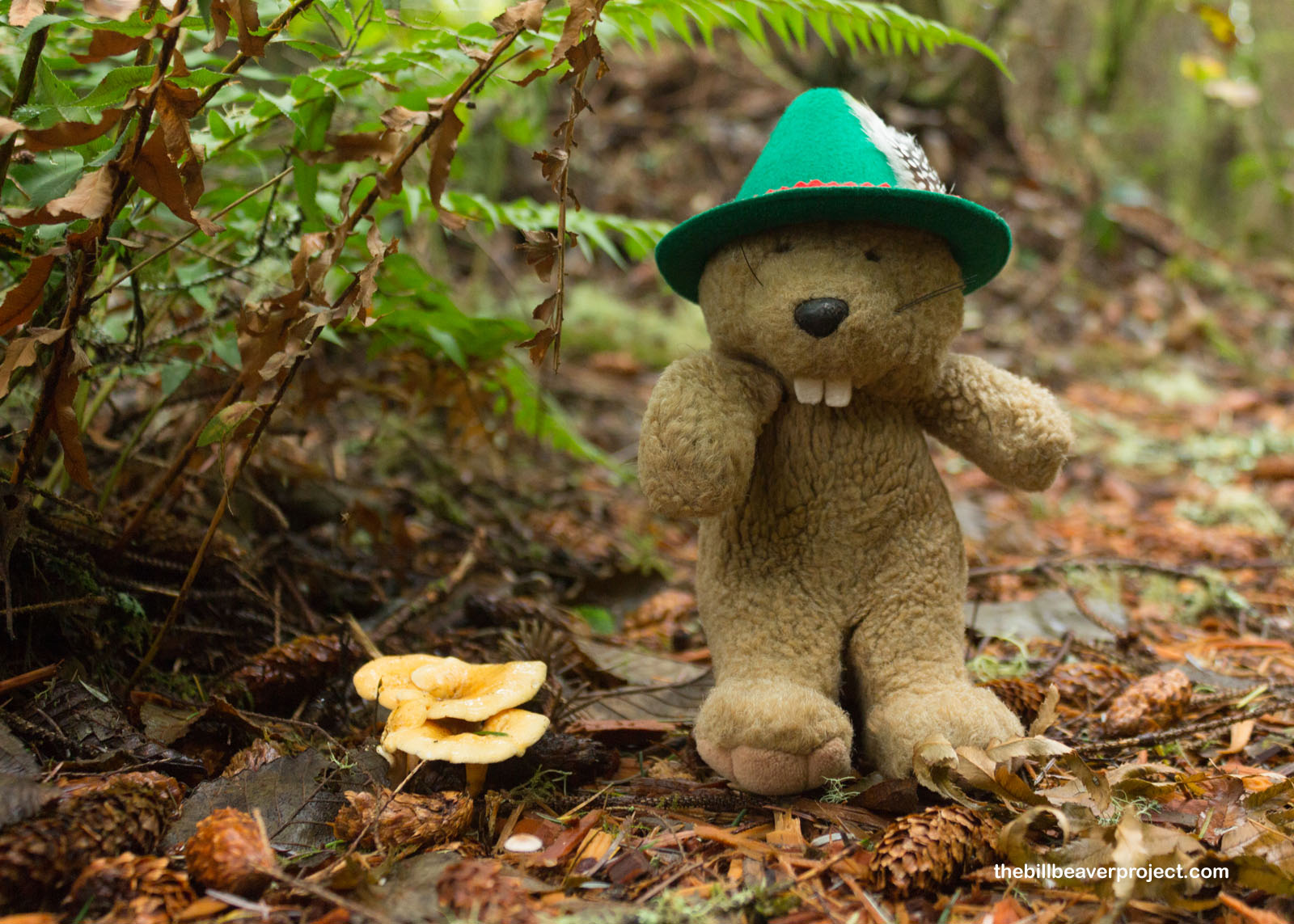
This was a nice, flat trail with informational signs about local medicinal and food plants like huckleberries! It switched between soft dirt and boardwalk at different moments, and while it was not a crowded trail by any means, quite a few other folks were out enjoying the cool temperatures and river views!
 |
 |
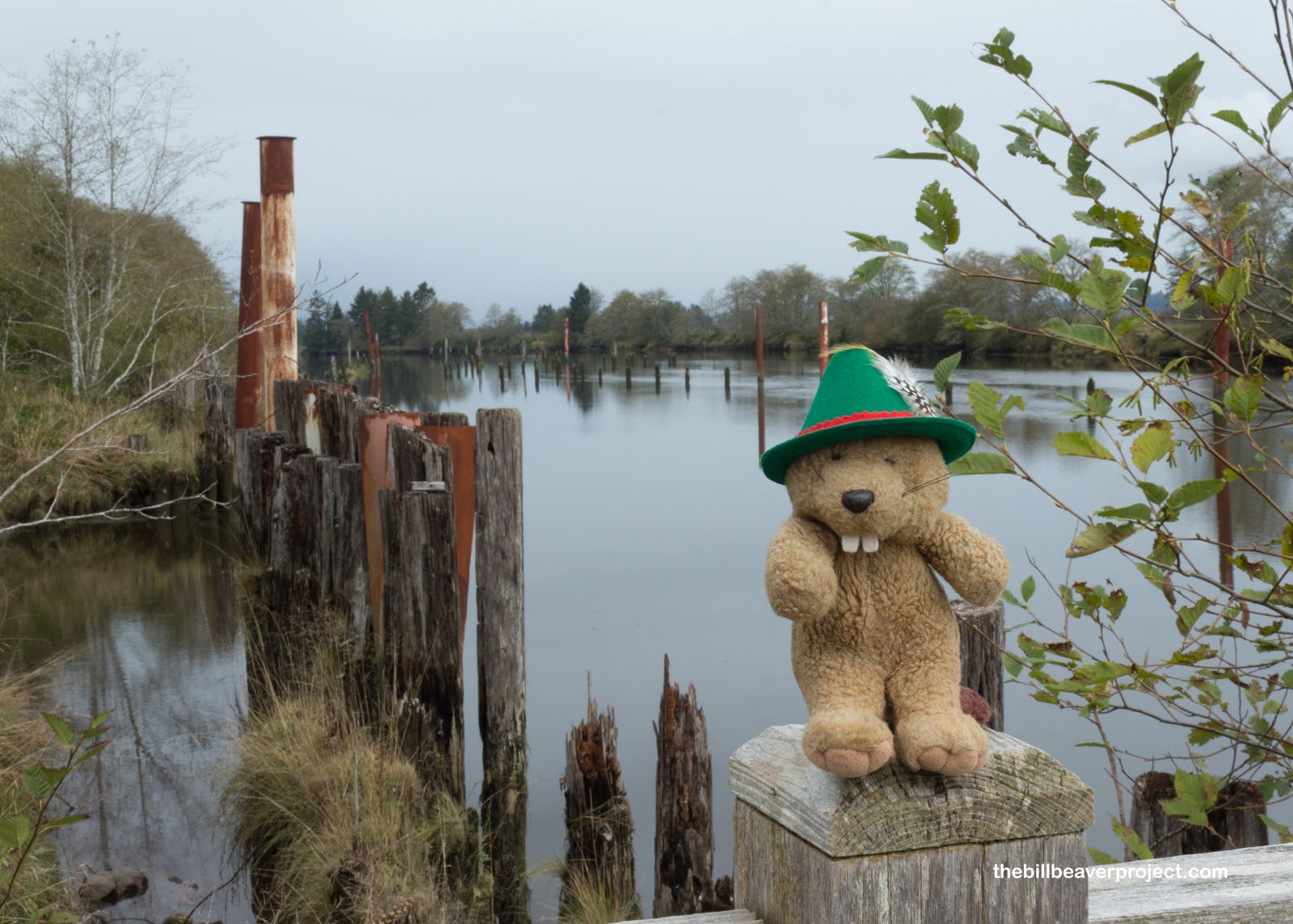
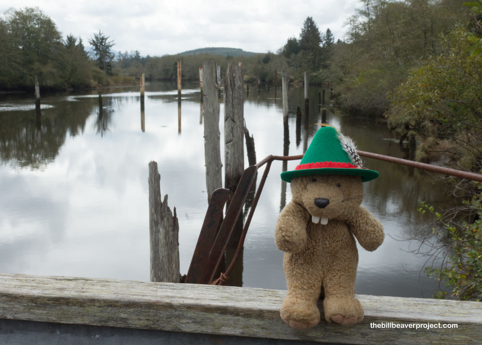
At the end of the trail, huge pylons stuck out of the water, relics from the Lewis and Clark Boom. Here, logs from timber operations would float down to be sorted and sent to plywood and pulp mills. This site was run by the Crown Zellerbach Company from 1944 until the 1980s.
 |
 |
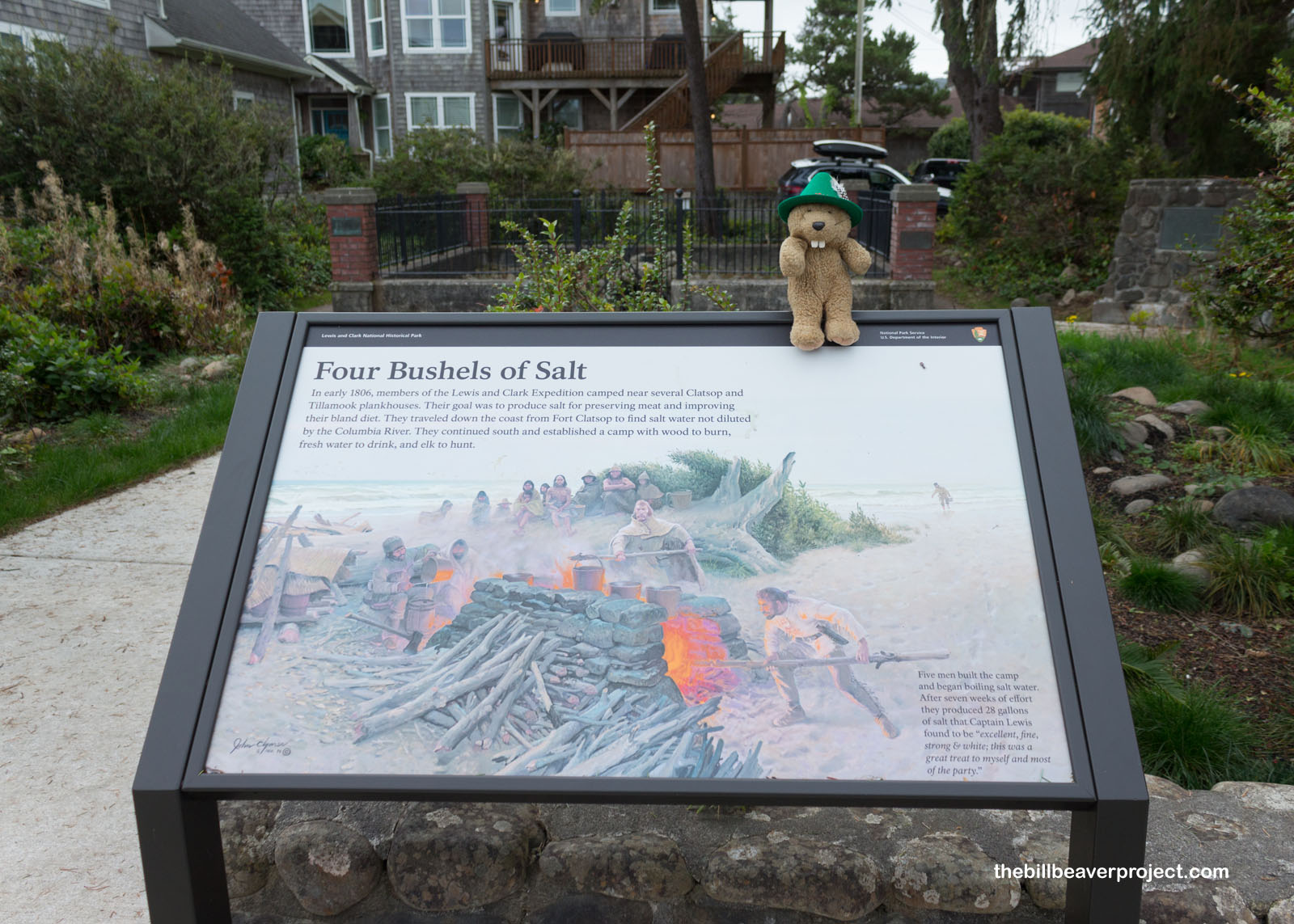
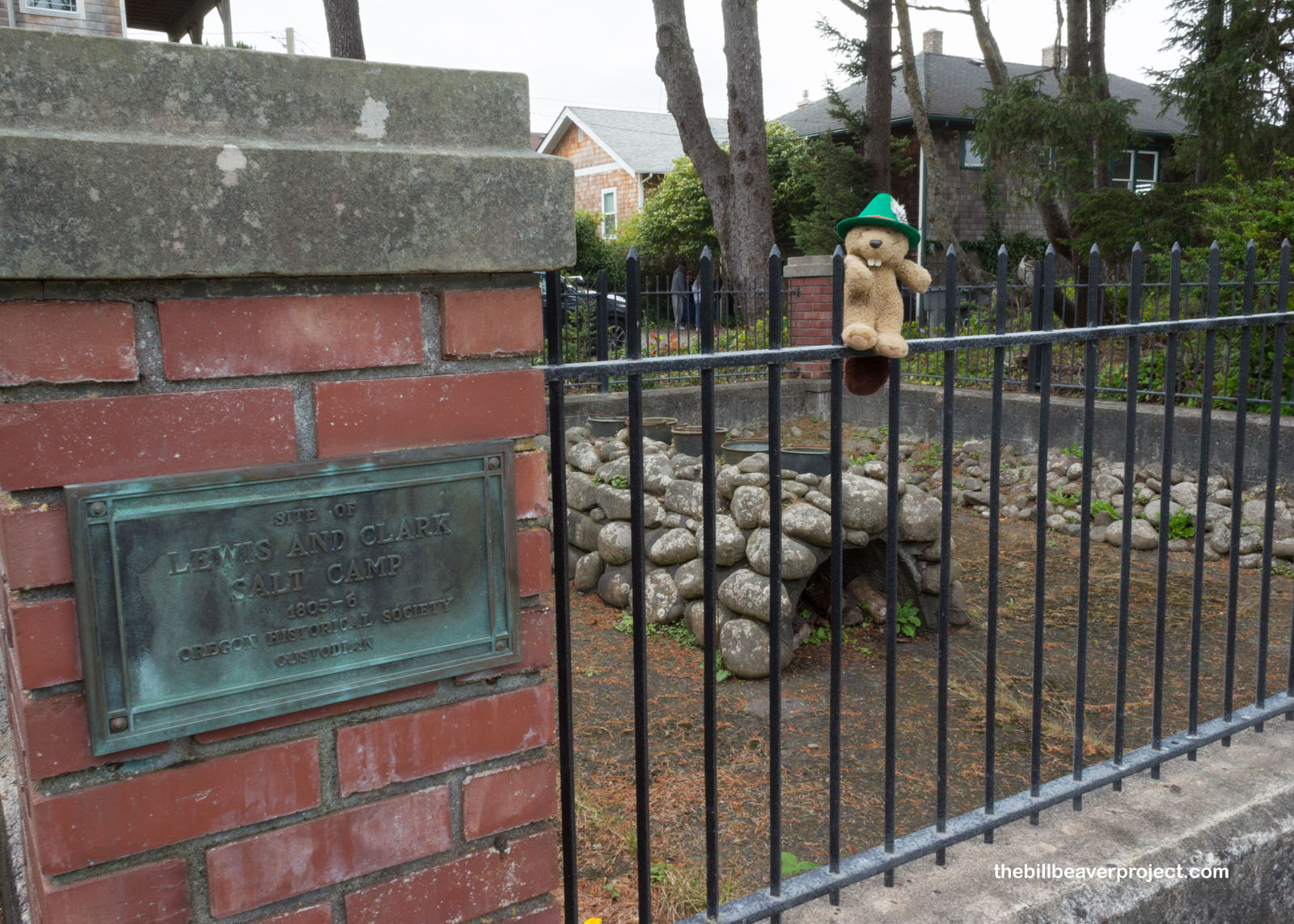
A surprise call from the hotel asking about dinner reservations reminded me that I couldn’t stay here all day long! I continued further south to Seaside, where the Corps of Discovery built their salt works! Salt was super important during the winter, both for flavoring and preserving food. Here, with the help of the local Clatsop and Tillamook, they boiled ocean water in five kettles, 24 hours a day and produced about 28 gallons of salt to take back with them on their return trip!
 |
 |
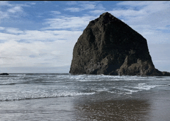
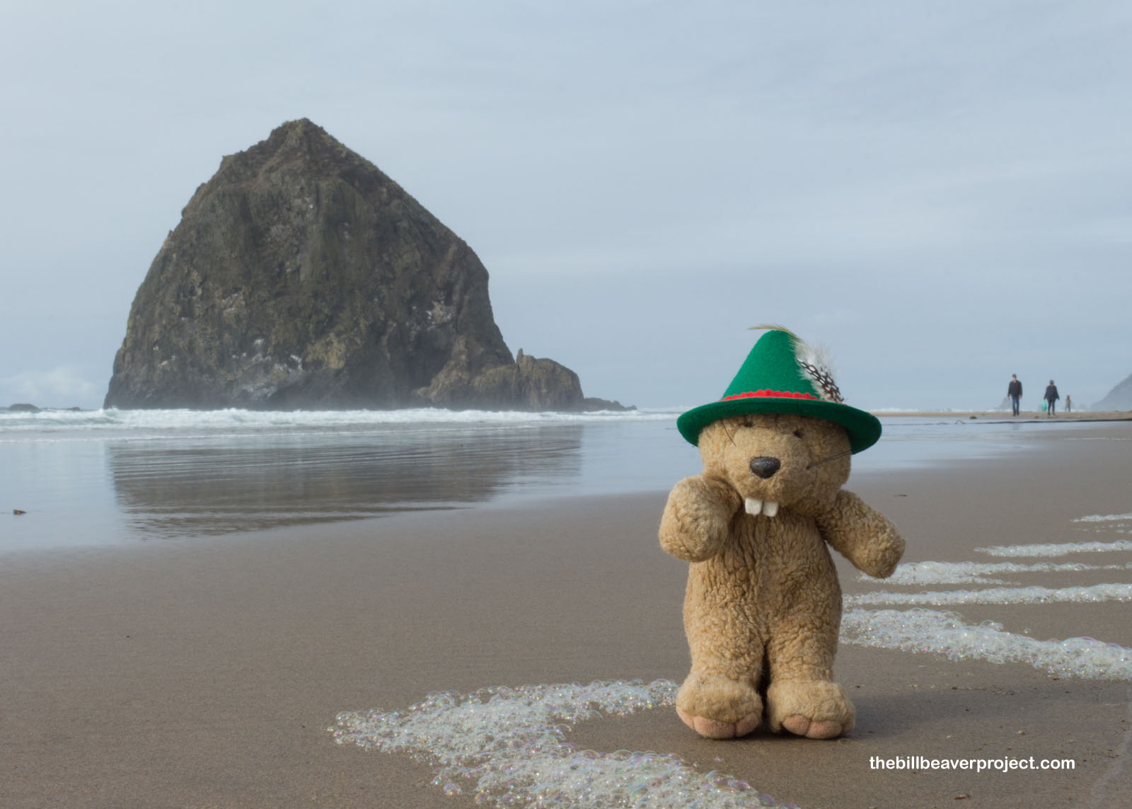
I had meant to see a lot more today, but the reality is, like on any adventure, there can be unforeseen obstacles. In this case, I locked my keys in the trunk of the rental car! Oh no! I made the most of the wait for roadside assistance, though, and spent a lot of time enjoying the views of Haystack Rock, the most famous landmark on the Oregon Coast! Here, the tides fluctuate so much that it’s possible to walk out to see the tide pools and tufted puffins up close! Today, the tide was not quite so low, though.
 |
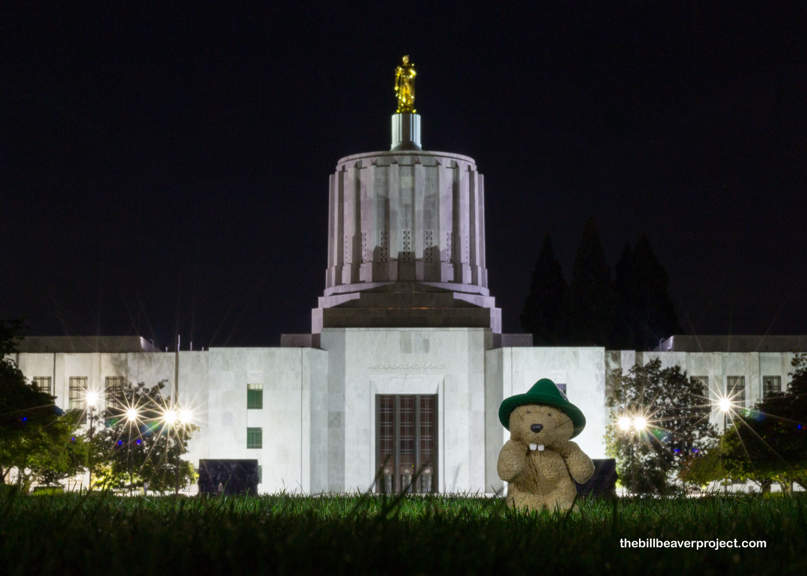
After getting my keys out of the trunk, I had to give up a few spots to see, like the Tillamook Cheese Factory, and instead head east to the hotel in Redmond. Along the way, I stopped in Salem to see Oregon’s Art Deco State Capitol in the dark of night.
 |
There’s still a bit of a drive to go before I sleep, but it’s still early enough for me to plan tomorrow better and find new ways to keep track of my keys!
Journey on!

More 2020 Adventures |
Total Ground Covered: 369.0 mi (593.8 km) |
Next Day |