 Previous Day |
St. Robert, MO → Hartford, IL → St. Louis, MO 183.0 mi (294.5 km) |
 More 2021 Adventures |
This history is hot, everyone!
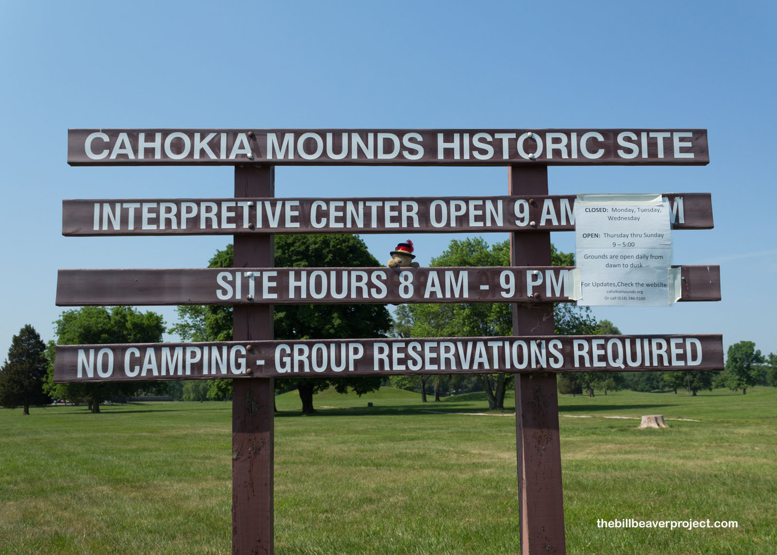
With a heat advisory in effect across greater St. Louis, I was nevertheless out on the trail exploring first thing in the morning. Temperatures were already pushing into the high 90s as I arrived at Cahokia Mounds Historic Site, and expected to exceed 100, so my visit to one of the world’s largest cities, circa 1250 CE, would have to be done cautiously and with lots of hydration!
 |
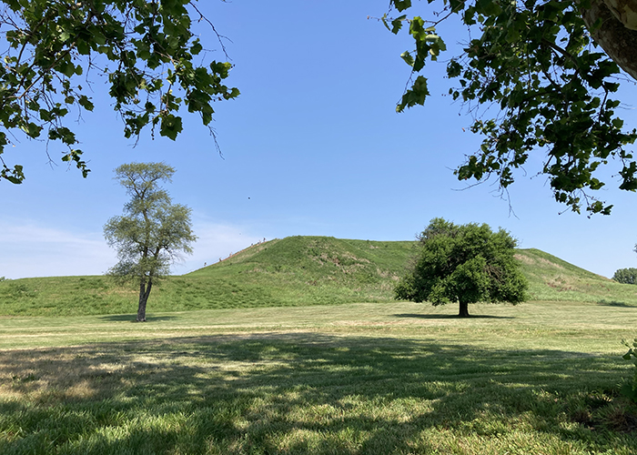
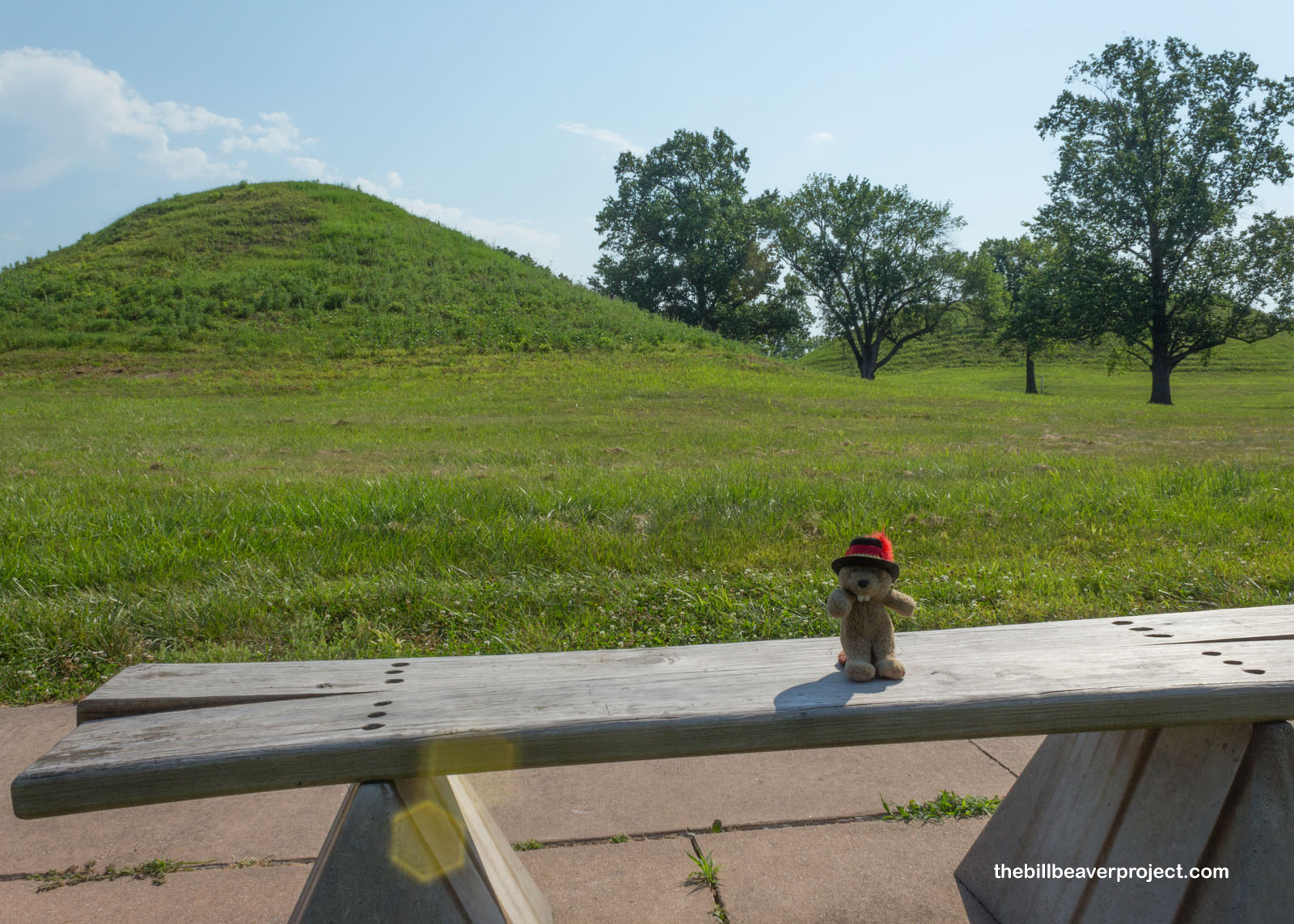
Just like Poverty Point in Louisiana, this mound complex comes from the Mississippian culture and was most likely first settled around 700 CE. Over 900 years, this grew to be a massive city of 104 known mounds, bigger than London at the time, but the name we have for it today comes from one of the last cultures to inhabit it: the Cahokia sub-tribe of the Illiniwek (Illinois) Confederacy!
 |
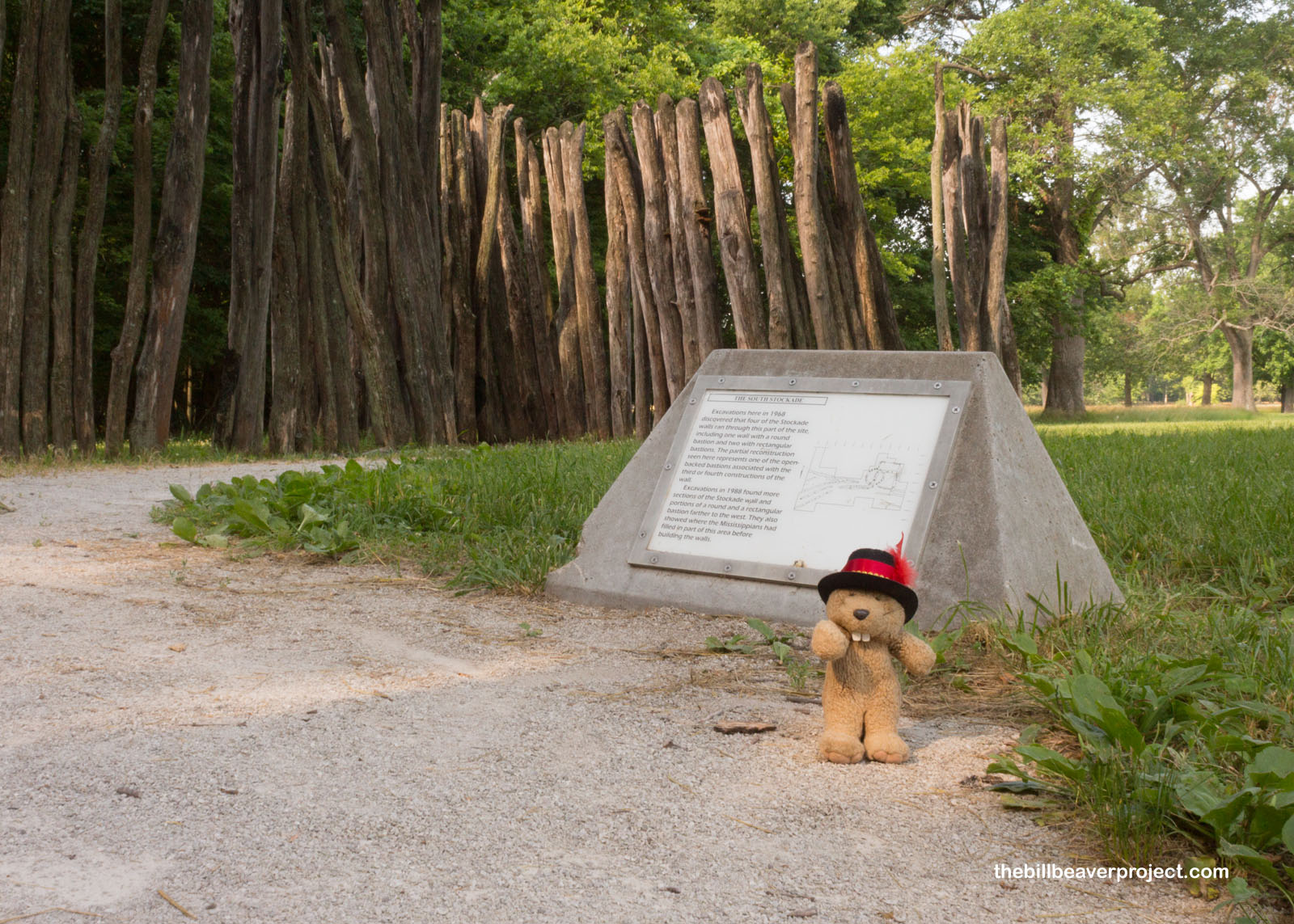
It sure doesn’t look like it now, but at its height, the core of the city was surrounded by a 2-mile long stockade of logs, interspersed with guard towers! This was discovered through excavations between 1968 and 1988, along with traces of “woodhenges,” circles of red cedar logs that tracked the seasons as they aligned with the sun at various times of year!
 |
At its height, the mound city could have been home to 20,000 residents, fueled by the kind of agriculture we don’t see much anymore: marsh elder, goosefoot, and erect knotweed, for example. Of the classic three sisters, squash was the first to be cultivated here, since at least 3,000 BCE, while corn didn’t show up until 800 CE, beans around 1200! But archaeological evidence shows that life in the big city has been a struggle for a long time, with excavated bones showing signs of stress from smoke pollution, disease, and malnutrition!
 |
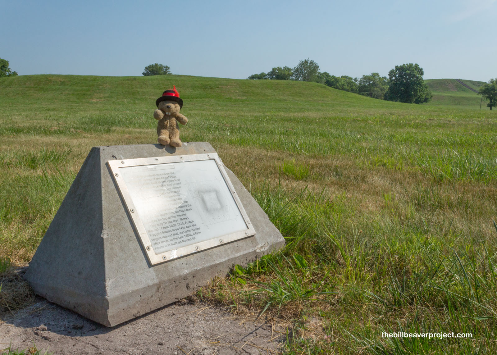 |
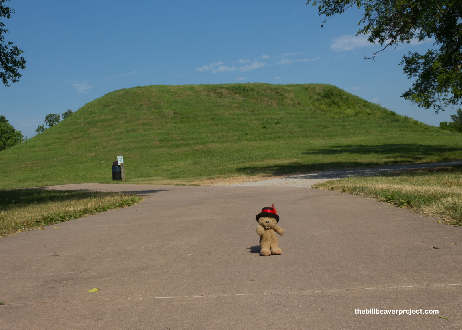
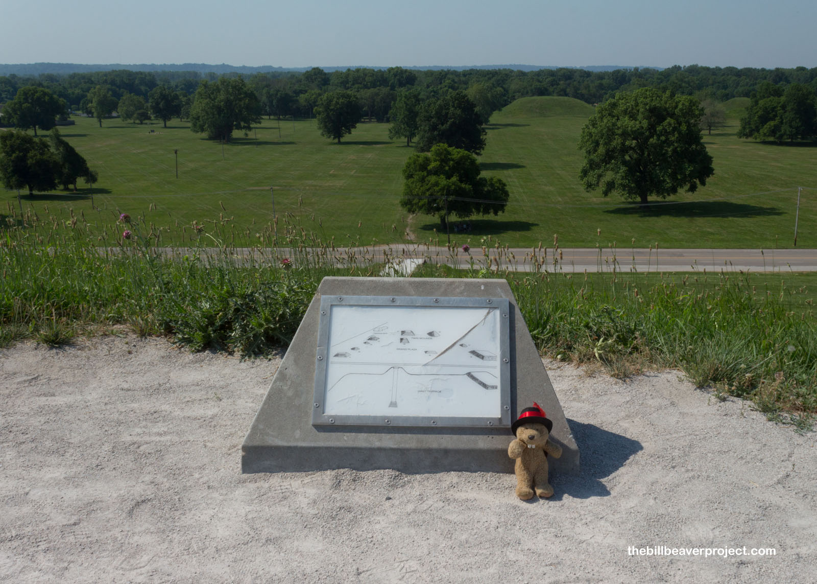
But what these many, many folks left behind was the largest human-made earthen mound in North America: Monks Mound! We don’t know exactly what it was called while in use, so instead, Monks Mound refers to a group of Trappist monks, who lived here and farmed the first terrace of the mound from 1809 until 1813! But boy, what an accomplishment it was in the years before those monks arrived. This mound was piled up 55-pound basket load by 55-pound basket load, equalling 22 million cubic feet of earth or nearly 14.6 million basket loads! For scale, its base is roughly the same size as the Great Pyramid of Giza and larger than the Pyramid of the Sun in Teotihuacan!
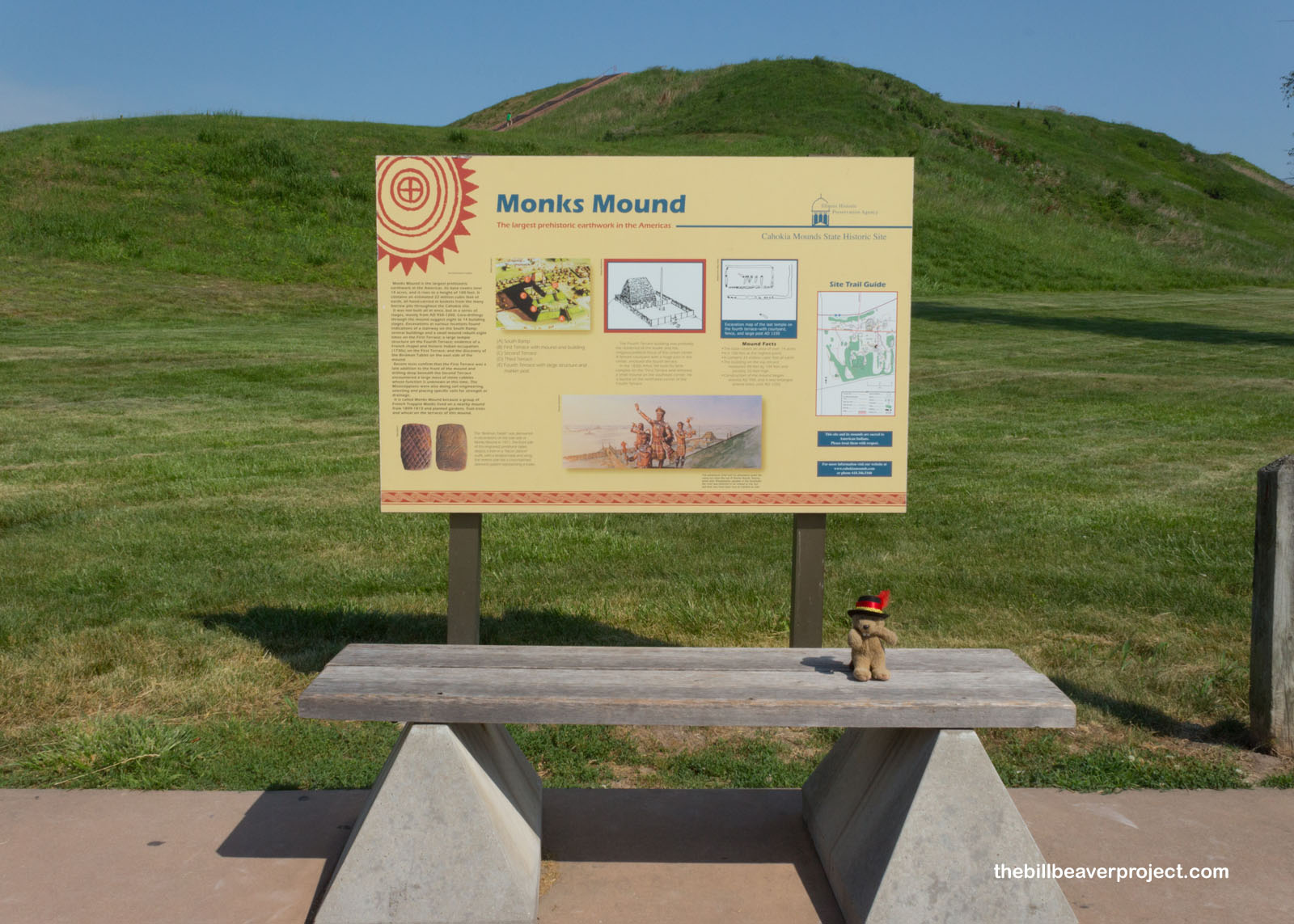 |
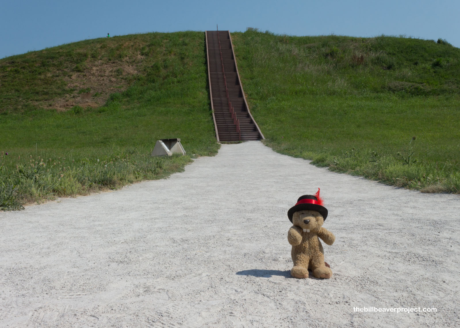
Today, a staircase goes all the way up to the top of Monks Mound, which has four whole terraces stretching over 100 feet up! It was a bit of a knee-burner, but nowhere near as much as in Bukhansan National Park. I won’t kid ya though, it was so much hotter! Whew! Maybe now’s a good time to tell you that beavers have sweat glands, but they’re mostly covered by our thick fur. Only the ones on our paws and tail really do much to cool us down, so we do best when wet! In fact, it’s for exactly that reason why the Cahokia tribe consider beavers extra special! We live in both the Middle World (land) and the Lower World (water), and, for our size, we can topple the mightiest trees for our lodges! Maybe I was feeling warm with pride, but maybe it was early onset sunstroke.
 |
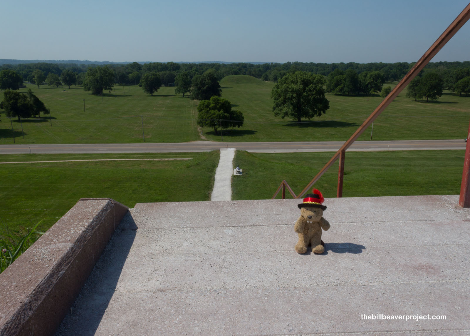 |
But once I reached the top of Monks Mound, what a view! Beyond, looking south across the Grand Plaza gave a real sense of scale for how huge this place was, something hard to gauge when viewing from below. Without a written record, it’s hard to say for sure what the mound was meant for, though artifacts and human bones have all been dug out of it. It was probably the centerpiece of ceremonies, a pilgrimage spot where all angles and all degrees of the sun could be viewed! Speaking of the sun, it was melting me into goo, and it was time for me to head down to the water!
 |
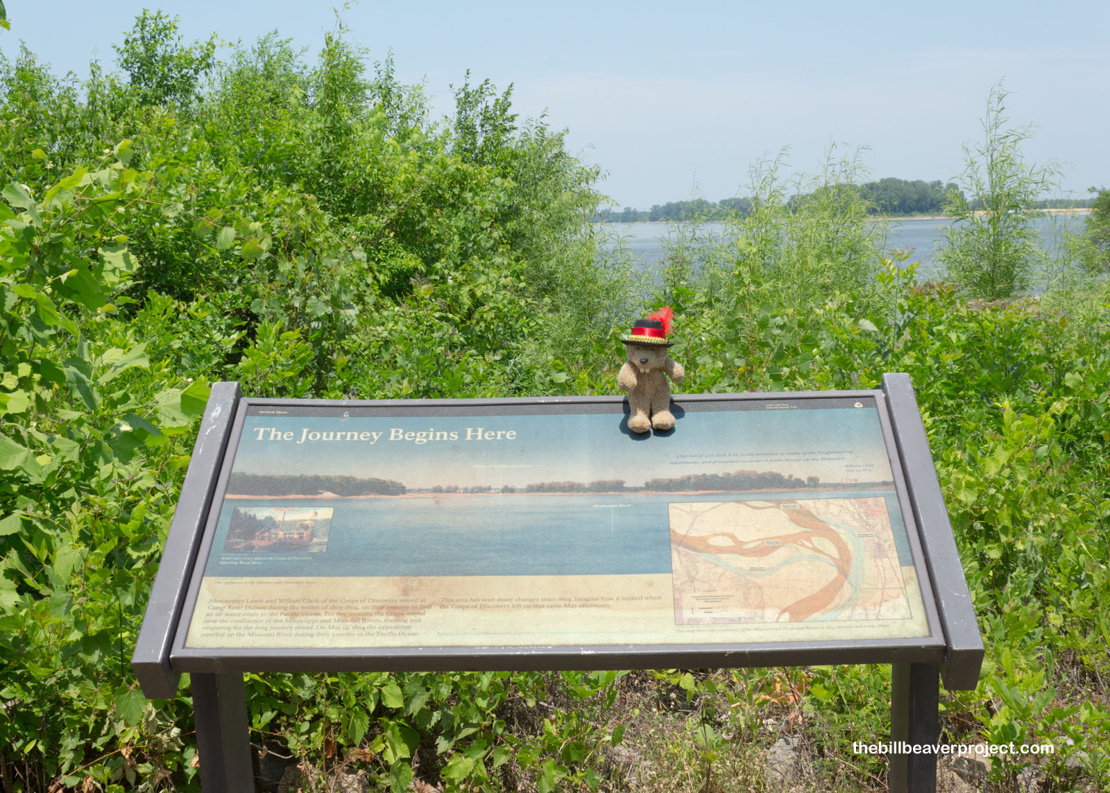
As Cahokia was a destination, just upriver was the opposite: a starting point for the epic, 2-year journey of Meriwether Lewis and William Clark to explore the lands west of the Mississippi! This was it! This was the Mississippi, and I was looking west of it!
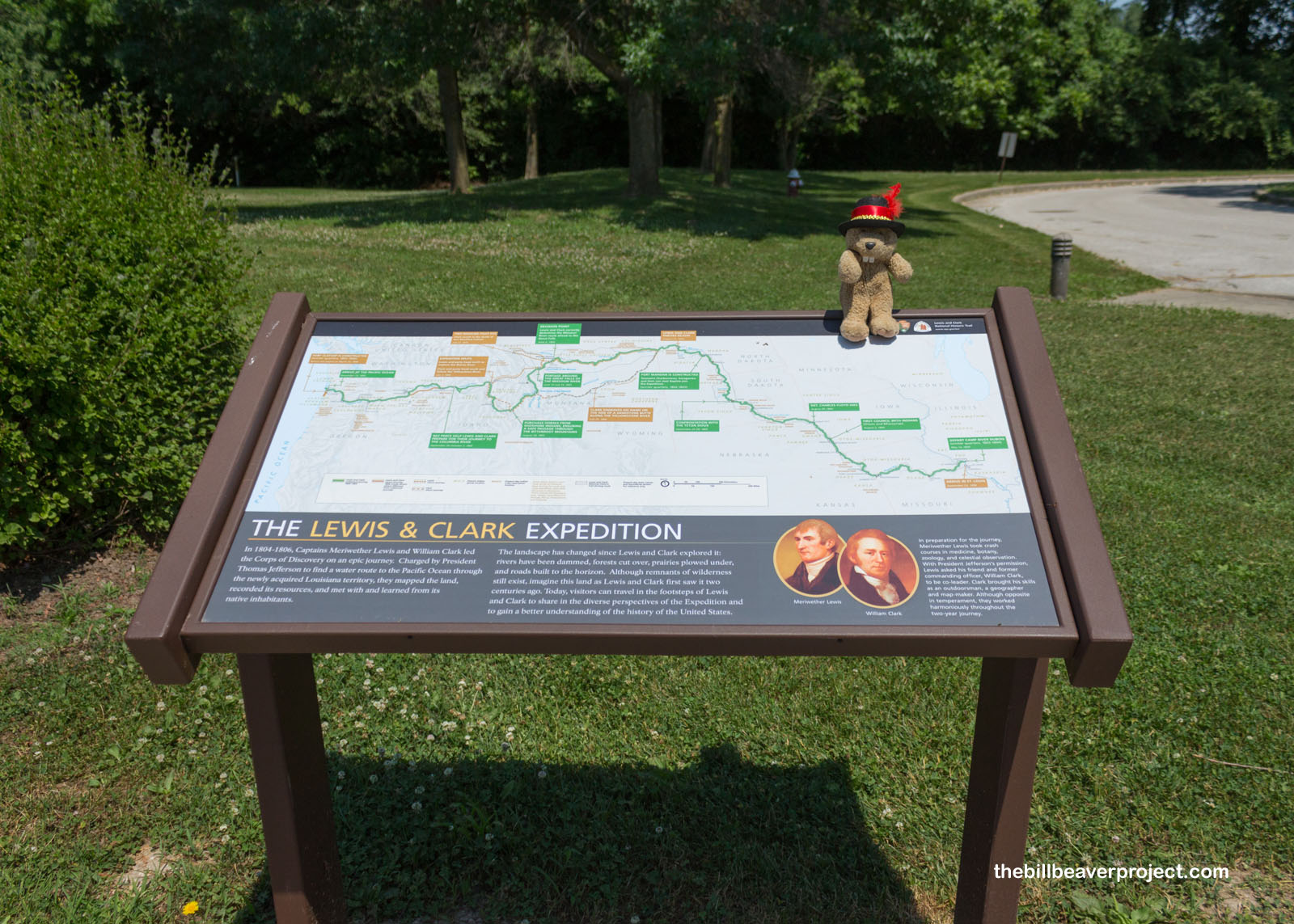 |
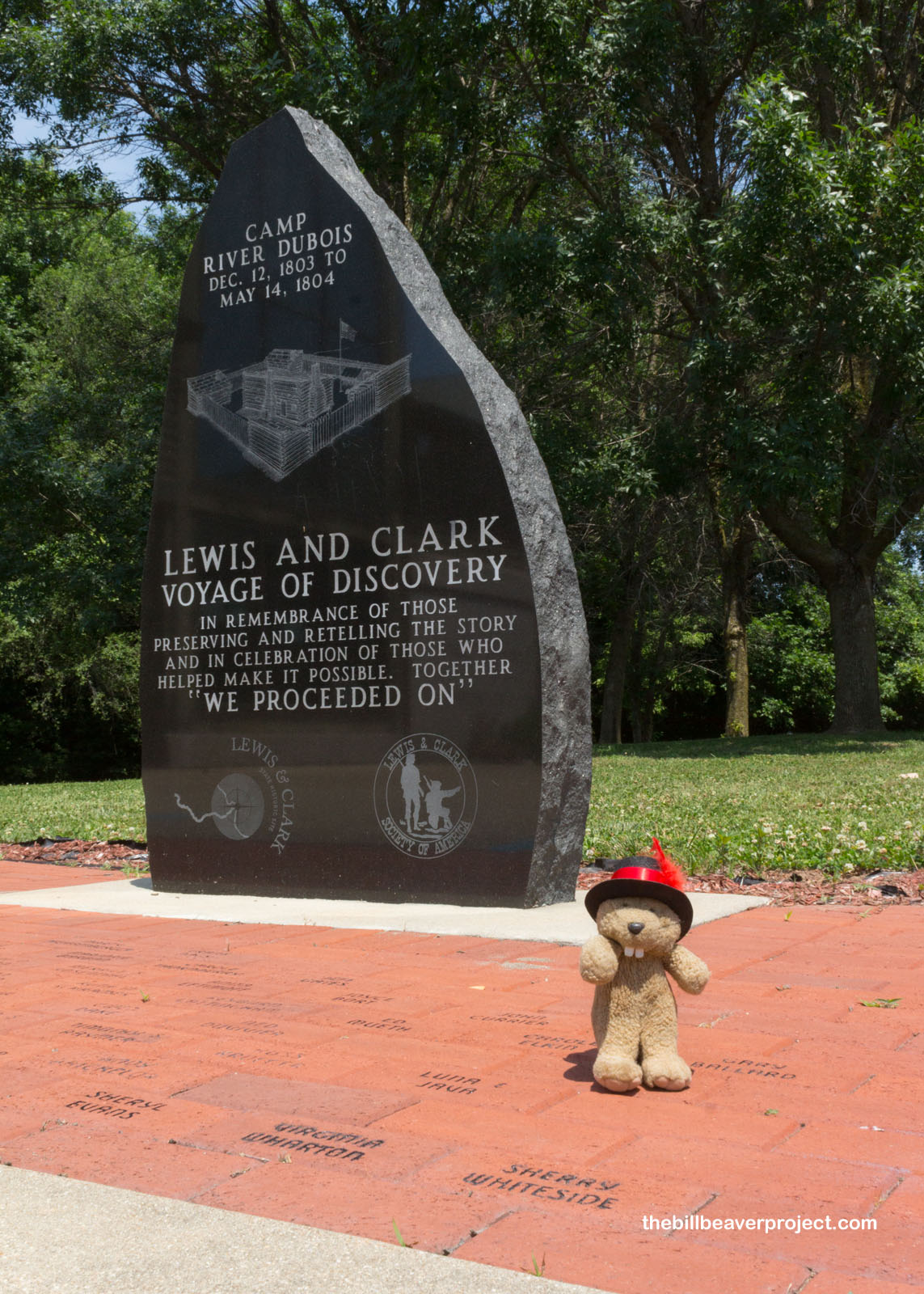
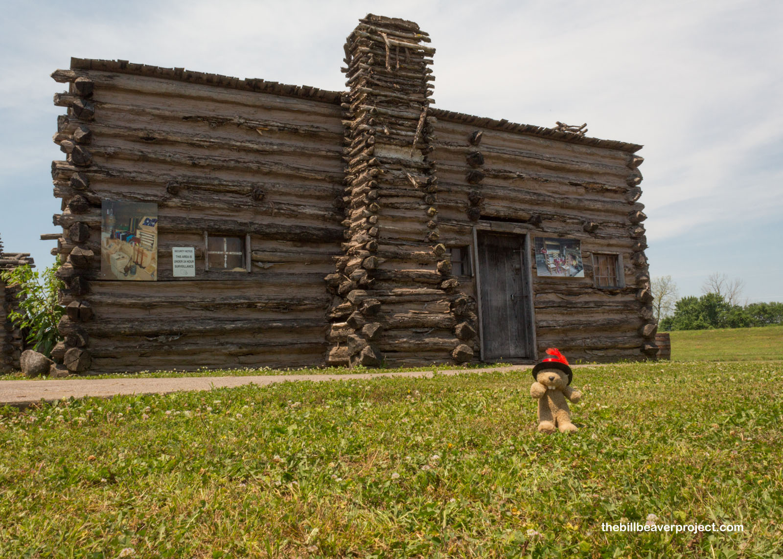
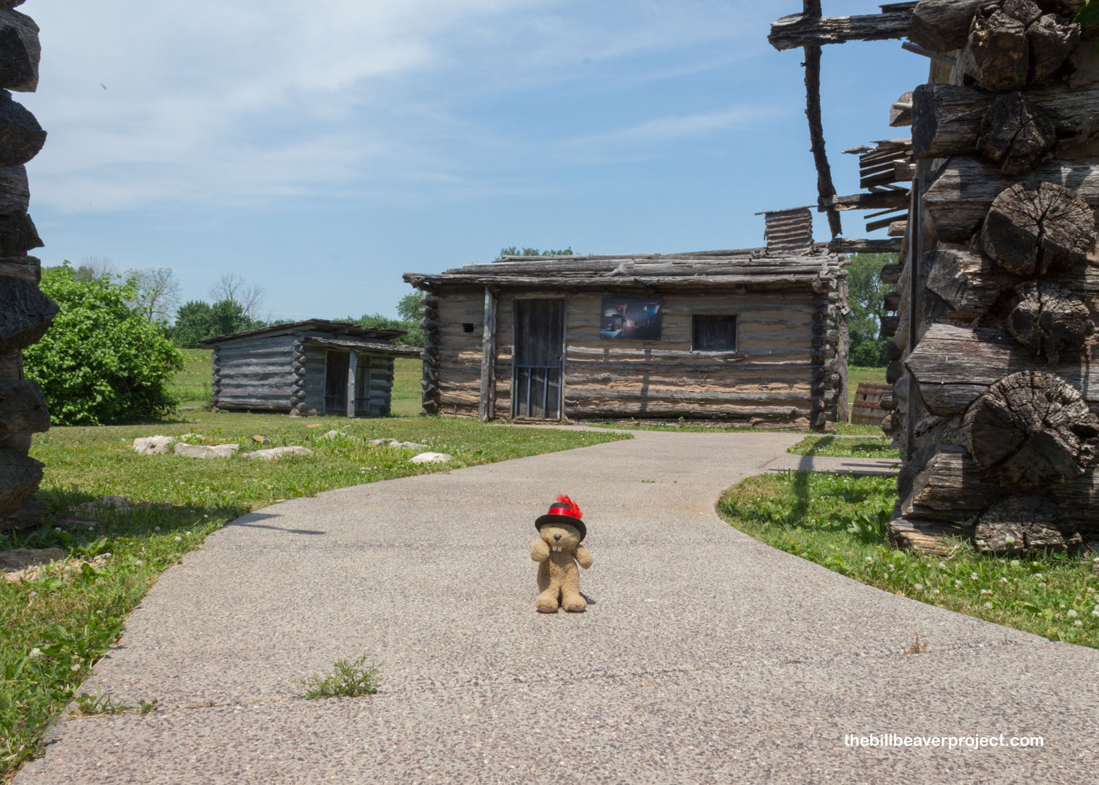
With the Louisiana Purchase not yet complete, Messrs. Lewis and Clark were determined be completely ready to embark as soon as the paperwork was signed. So on the US side of the Mississippi River, the Corps of Discovery constructed a frontier fort, which they called Camp River Dubois (after the nearby Wood River, Rivière du Bois)! Here, they ran through military training, made plans, and practiced diplomacy with Spanish and Native folks from December 12, 1803 until their departure date of May 14, 1804!
 |
The museum at Camp Dubois had displays on the route, challenges, and equipment brought along on this epic journey, including recreations of the main boat that set out from here! A far cry from the dugout canoes they’d be using later, this was a 55-foot long keelboat or barge, which had already made the nightmarish eight-week, 981-mile trip from Pittsburgh down the Ohio River, which was super low that year! This barge was at the head of two 6-person rowboats called pirogues, but it only made it as far as Fort Mandan in North Dakota, where it was sent back to St. Louis with Corporal Richard Warfington and lost to history.
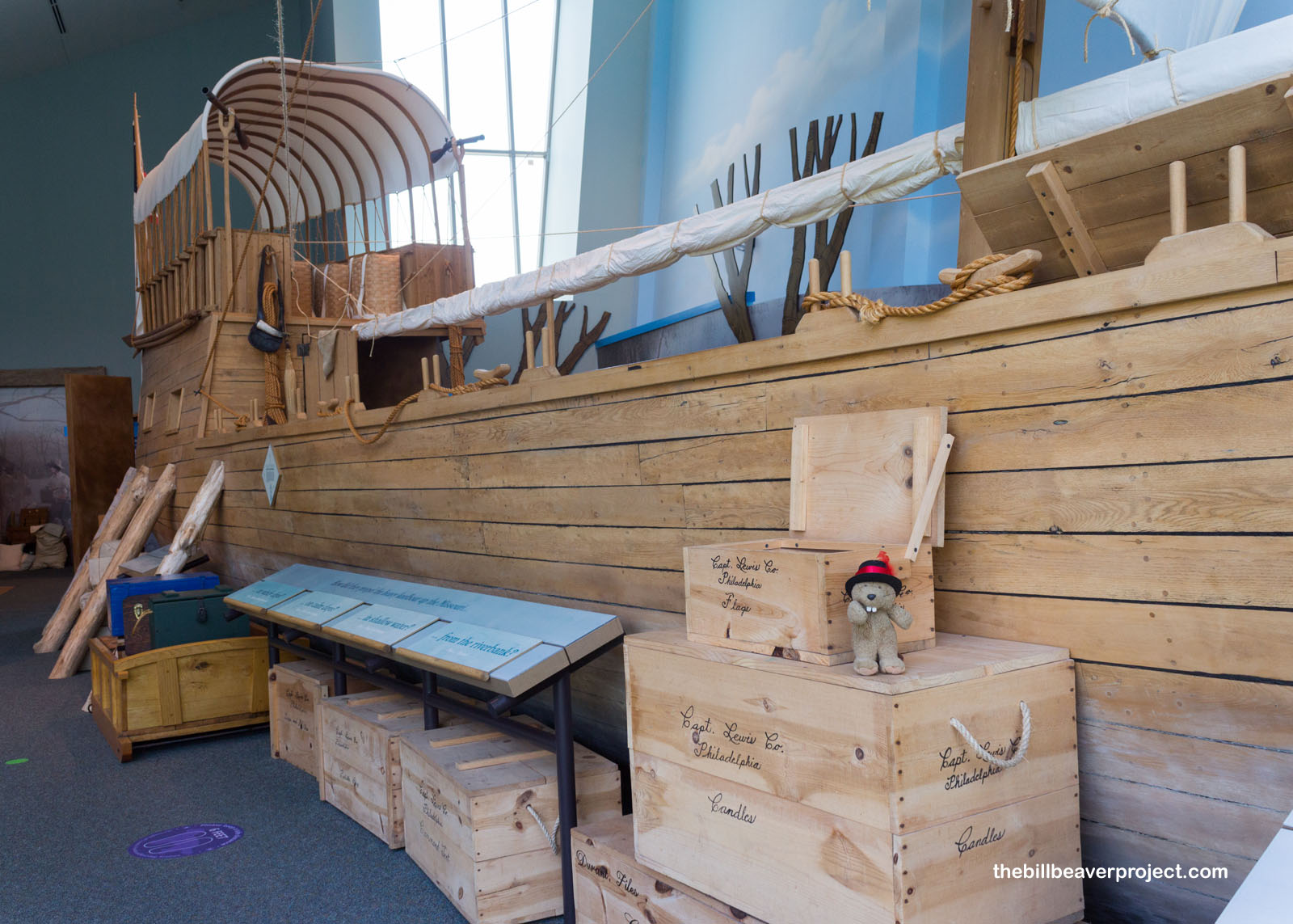 |
The fort itself was completed on Christmas Eve, 1803. While Mr. Lewis spent time across the river gathering information about the path ahead, Mr. Clark took the lead in training the over 45 recruits! They worked on loading and unloading the boats, hunting (with prizes for marksmanship), and maintaining all their equipment, because most of them would not see a hotel or mercantile for another two and a half years! Their lives would all depend on each person’s ability to pull their own weight, and discipline for insubordination was swift and effective!
 |
 |
Just up the road from the fort, but not far from the visitor center, a stone monument marked the spot where the boats of the Corps of Discovery first shoved off on May 14, 1804, cheered on by a huge crowd! Journals from the expedition recount it being a toasty day as well, but luckily for me on this visit, there were not nearly as many bugs!
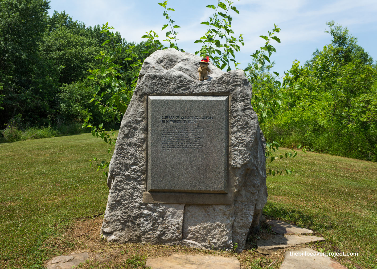 |
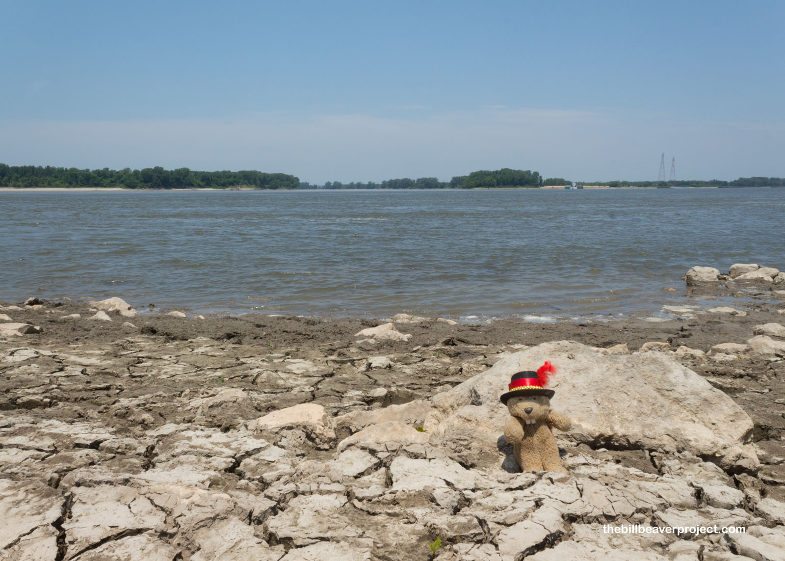
Down on the sun-baked shore, I looked out on the confluence of the Missouri and Mississippi Rivers, not much to see from this altitude, but boy, what a starting line! From here, the mighty Missouri runs 2,341 miles (3,767 km) back to its headwaters near Three Forks, Montana, crossing what are now six states! En route to the Pacific Coast, the Corps interacted with two dozen Native American tribes and gathered hundreds of plant and animal samples to bring back for science! Their journals also showed there was an overland route to the Pacific, and laid the groundwork for westward expansion via the Oregon Trail!
 |
 |
On a day like this one, a dip in the Mississippi sure was tempting, but I’d read it’s one of the most polluted rivers in America, taking in ten states’ worth of agricultural runoff, industrial waste, and sewage. Blech! I’d have to settle for the air conditioning at the airport, which was my final destination on this adventure. Summer travel presents its own unique challenges, but when the history is this hot, you’ve got to keep paddling forward!
See you out west!

Previous Day |
Total Ground Covered: 1,199.0 mi (1,929.6 km) |
More 2021 Adventures |