 Previous Day |
Columbia, KY → Middlesboro, KY → Columbia, KY 323.0 mi (519.8 km) |
 Next Day |
How d’ya do, everyone?!
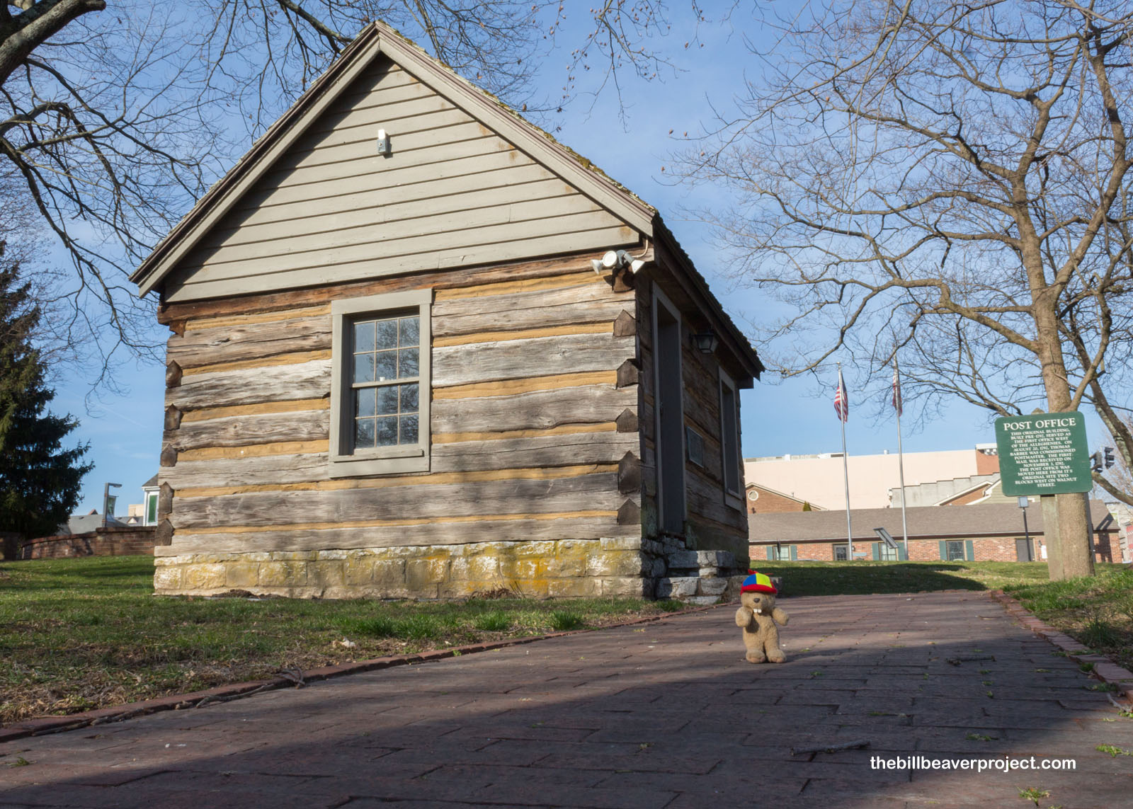
It’s a fine Kentucky Friday, and I am once again on the path of history! Where better to begin than Boyle County and Constitution Square in Danville, hailed as the Birthplace of Kentucky!
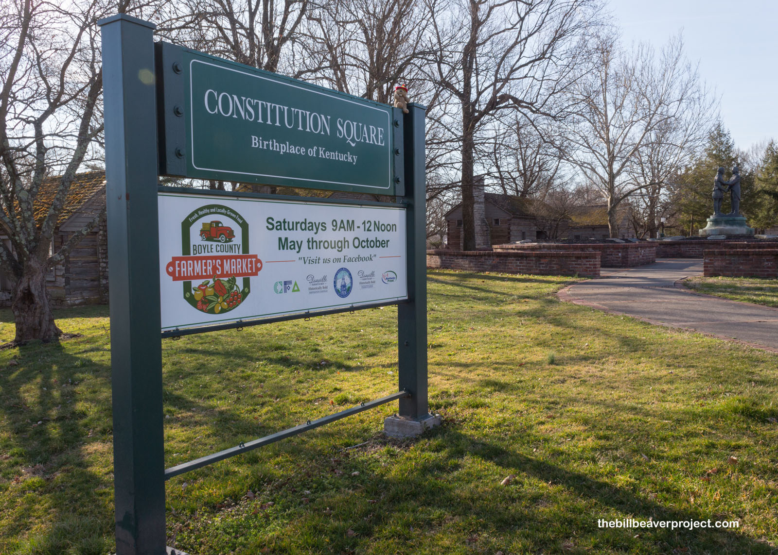 |
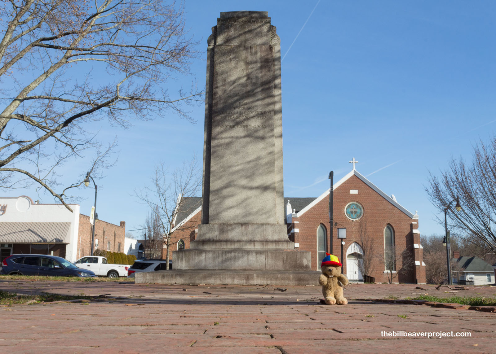
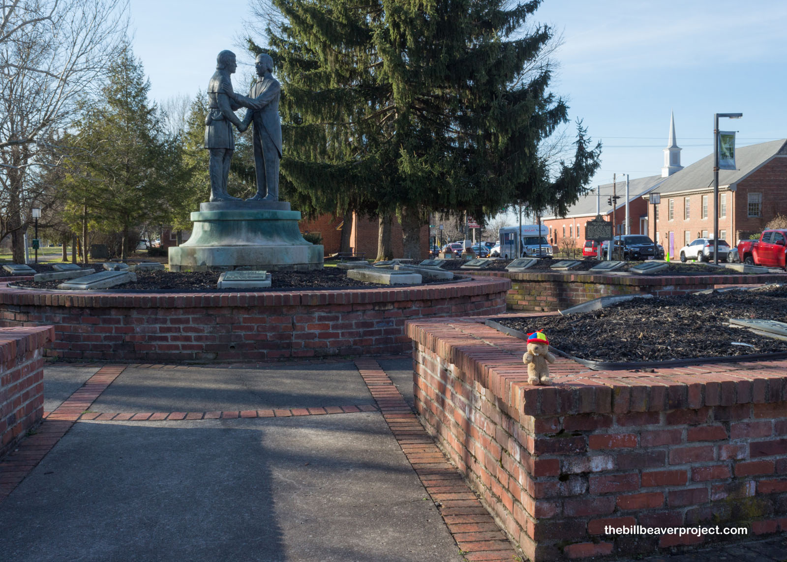
So what, you ask, made this the birthplace of Kentucky? Well, for starters, the city formerly known as Crow’s Station was Kentucky’s first capital where the state’s first constitution was written and, over the course of ten conventions, signed right here in 1792! The statue set up in the park represents Kentucky’s state seal: two friends embracing to represent the idea that “United we stand, divided we fall!”
 |
 |
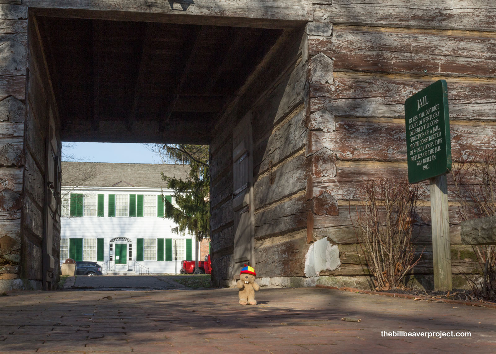
Danville happened to be conveniently located on the Wilderness Road, blazed by Daniel Boone in the 1770s, which made it a good spot for folks to gather and talk politics. And you’d think it got its name from the famed trailblazer, but Danville was actually named for Walker Daniel, who first surveyed the area in 1783! While still part of Virginia, the residents of Danville set up a meetinghouse, courthouse, and jail at this site to administer their new seat of government!
 |
 |
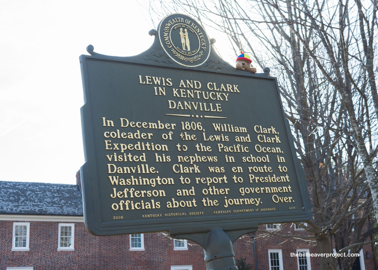
Some historical markers onsite showed a few other important stories that crossed paths here in Danville, such as William Clark of the the Lewis & Clark Expedition stopping here to visit his nephews en route back to Washington! Another plaque told of the cruel treatment received by 250 Black folks as they walked through Danville on their way to enlist in the US Army on May 23, 1864. In fact, this used to be a thriving Black commercial district, but was leveled in the 1960s to create Constitution Square park! In any case, I was going to be following in the footsteps of these soldiers-to-be to my next destination: Camp Nelson National Monument!
 |
 |
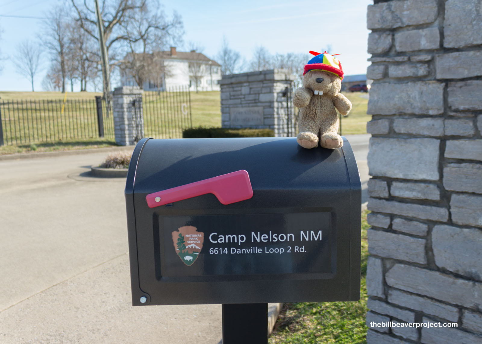
A national monument so new (2018) its sign was still just a sticker on a mailbox, Camp Nelson was a super important outpost for the Union Army of the Ohio. Named for Major General William “Bull” Nelson, from 1863 to 1866, it was a supply depot, a recruitment camp, a hospital, and a refugee center, safely tucked into northern Kentucky!
 |
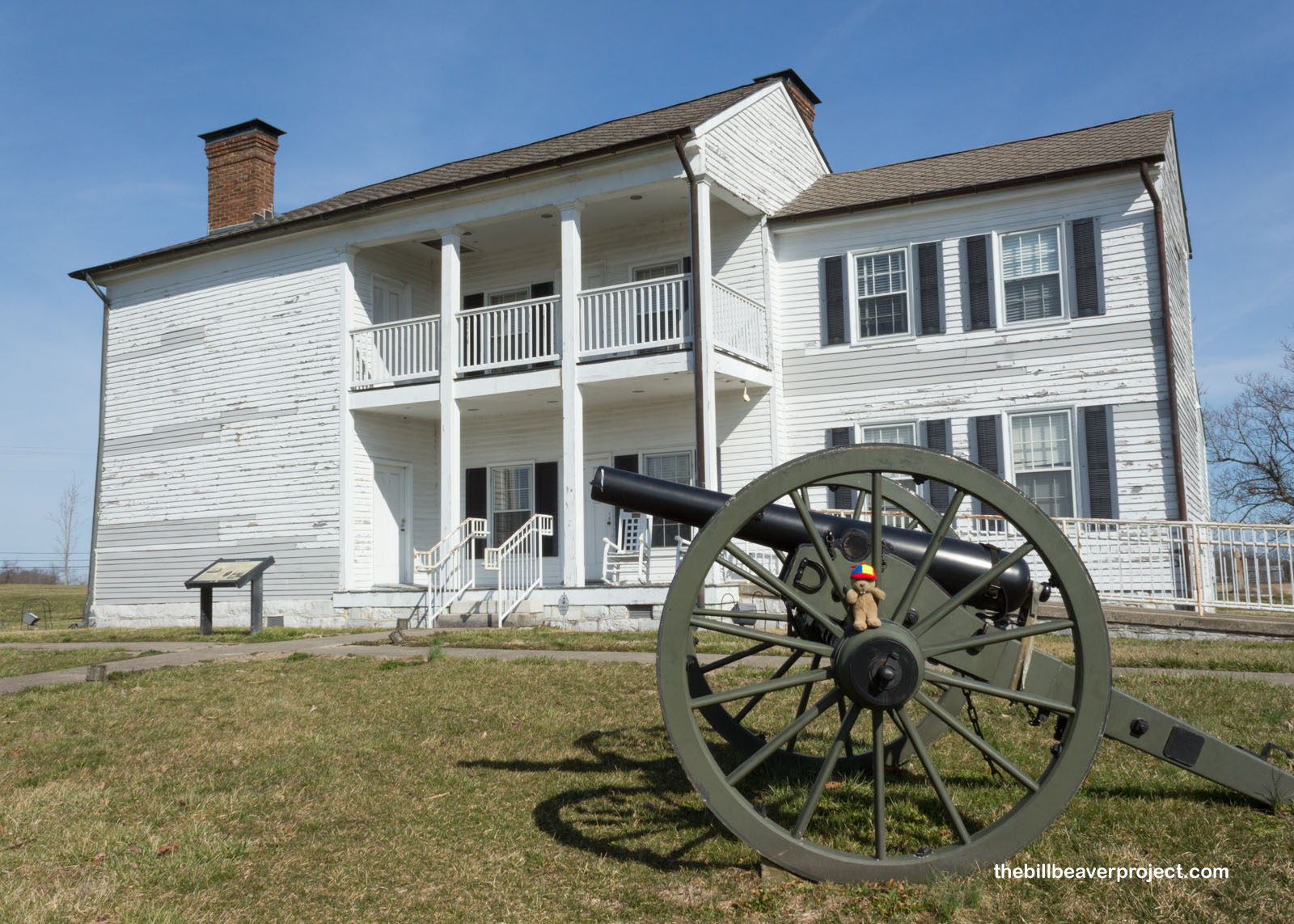
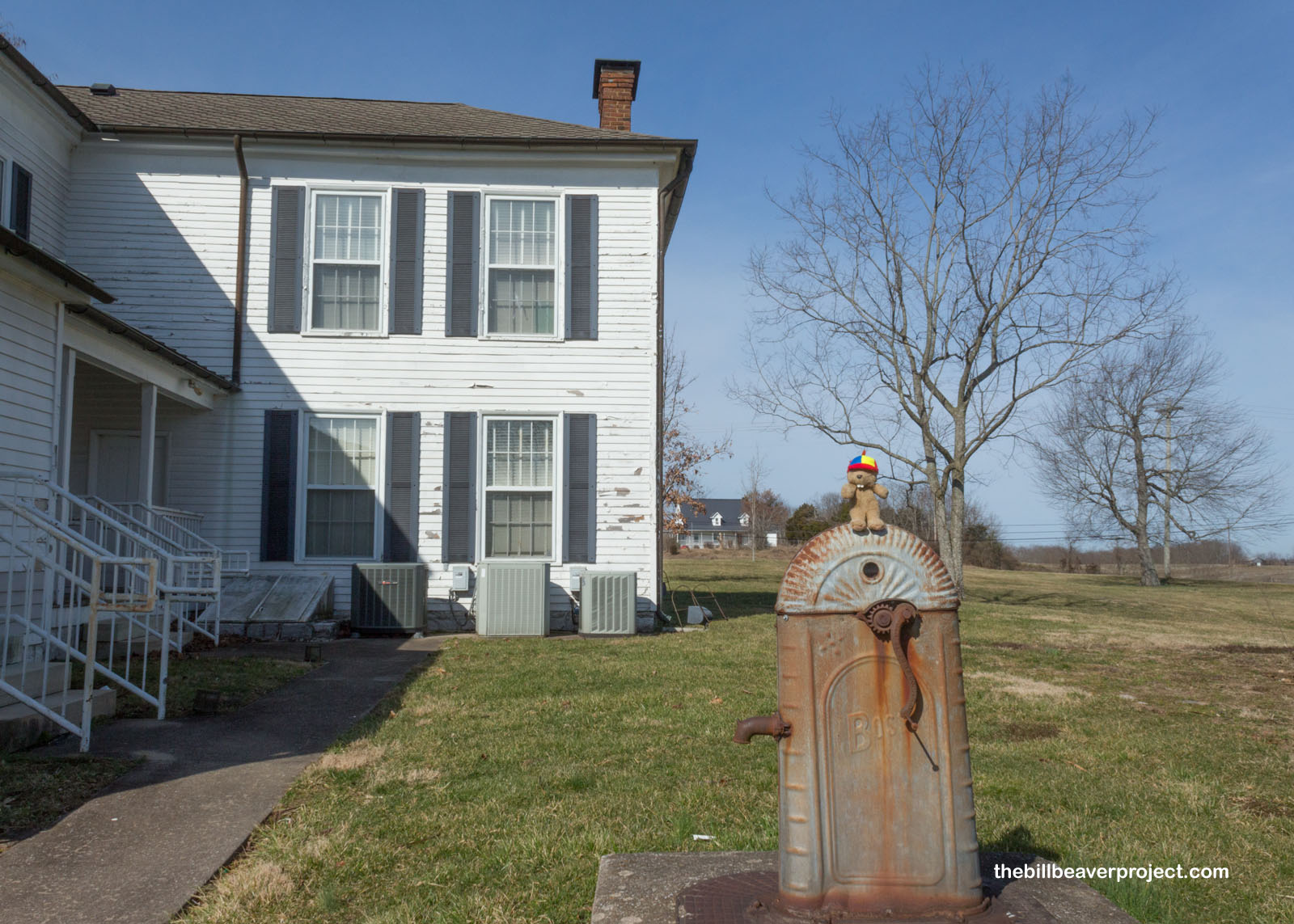
At the monument’s entrance stands the Greek Revival home of Oliver (not this Oliver) and Fannie Perry, which the military commandeered to house officers in 1863! From here, Major General George L. Hartsuff planned out his East Tennessee campaign, and later in the war, it housed Commissary officers, who managed the food, and the US Army Quartermaster, who managed all other supplies and logistics! Though the army accidentally burnt down the kitchen, after the war, the home was returned to the Perry family!
 |
 |
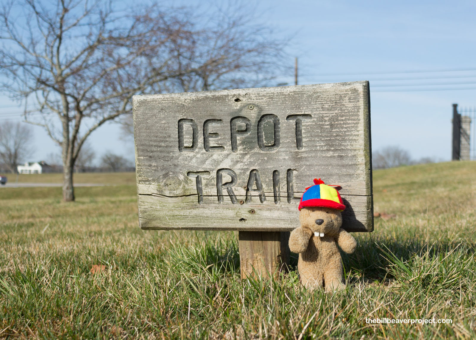
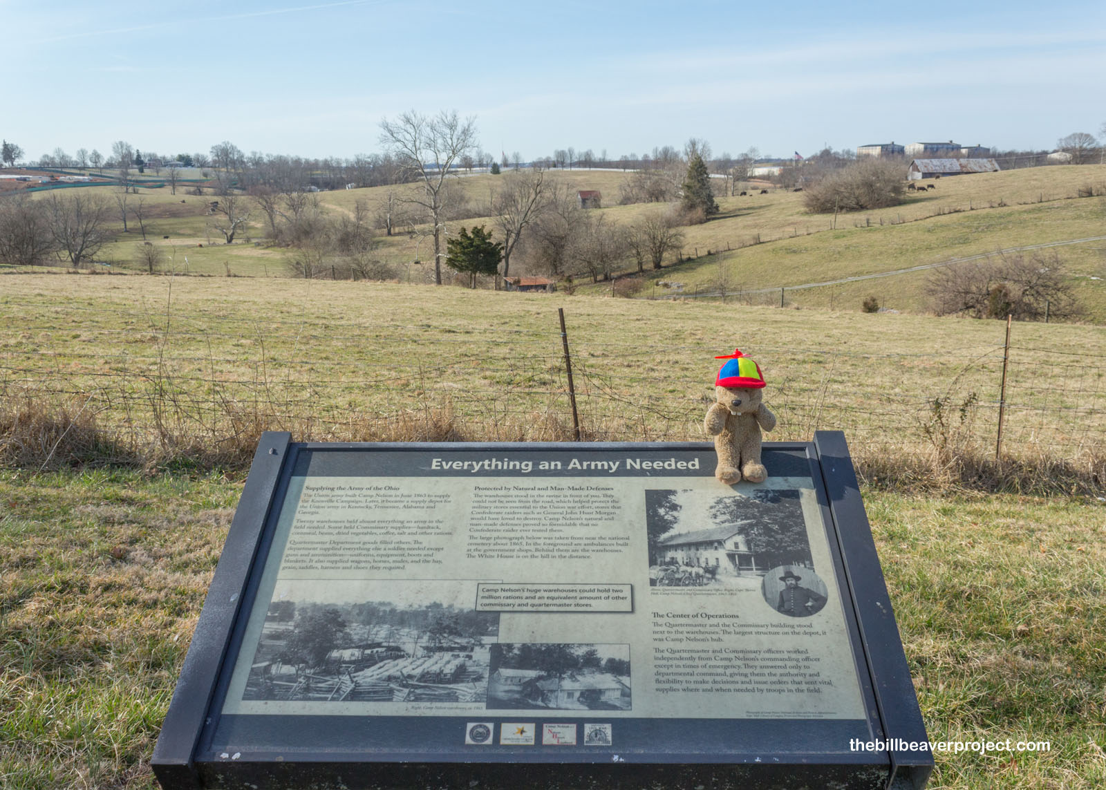
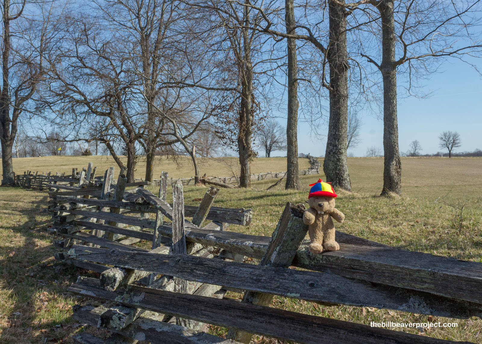
Heading out in a big loop from here was the Depot Trail! Though the Perry House is the only surviving structure at Camp Nelson, there were interpretive signs set up along this trail mowed into the grass that told the story of the different enterprises at Camp Nelson, which supplied the campaigns of Knoxville, Atlanta, and Saltville, VA!
 |
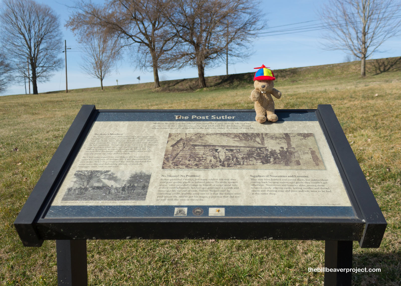
Across what is now U.S. 27 was the Camp Nelson commercial district, home to restaurants, grocery shops, a billiard, a photo studio, and all sorts of amenities to cater to every budget (wine and fine cuts on china plates for the officers, beer and pigs feet for the soldiers). One position at Camp Nelson that’s faded with history was the sutler, who ran the general mercantile. William Berkely was the sutler here, and he sold soldiers the kinds of stuff the army didn’t already provide them: tobacco, candy, soap, pens, and more! Only getting paid once a month and running up lines of credit, the soldiers weren’t always pleased with the sutler’s prices, but he was a necessary evil on camp!
 |
 |
The officers at Camp Nelson had some additional luxuries at their disposal, like control of this spring. For reasons never recorded, General Speed Fry (actually his name, not a way to cook chicken), ordered that this spring be reserved for officers only! We don’t know if people or horses drank from it, but during the years of Camp Nelson, it was fortified with a limestone wall to create a reservoir!
 |
 |
It’s really hard to tell today, now that all the buildings have rotted away, but this was a truly massive supply depot! There were twenty warehouses here, fully stocked with food, weapons, wagons, clothing, and just about anything a Civil War soldier could need on the field of battle!
 |
 |
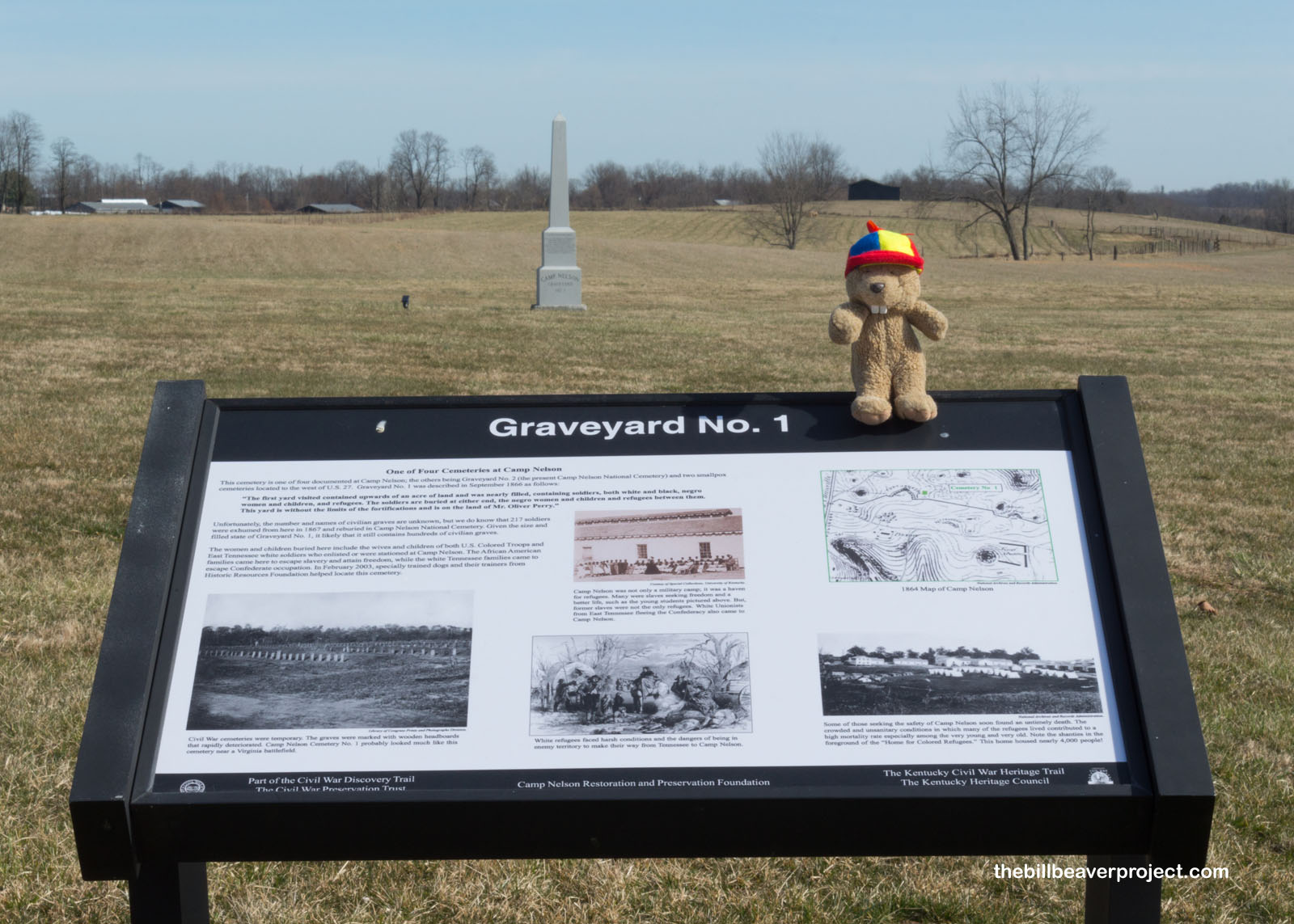
Camp Nelson was also a final resting place for folks who came to Camp Nelson seeking refuge, Black folks escaping slavery and pro-Union white folks escaping Tennessee! Sadly, the living conditions here were not up to par, and today, Camp Nelson has four known graveyards with an unknown number of bodies. Why unknown? They were buried with wooden grave markers, which have since rotted away, so while we know that 217 soldiers were exhumed and moved to the Camp Nelson National Cemetery, we don’t know how many died of sickness and the elements!
 |
East of the first cemetery was the first fort to protect the camp. This was Fort Putnam, named for Colonel Haldimand Putnam, who led the doomed attack on Fort Wagner, South Carolina! Ironically, though that disastrous battle resulted in more officer deaths than any other, the fort named for its leader was one of the camp’s impenetrable defenses! During construction, it also served as a teaching fort where the Army Corps of Engineers could study fort building to employ elsewhere!
 |
 |
Humans weren’t the only ones to benefit from Camp Nelson either! Almost 4,000 animals lived here, including 1,337 horses and 2,529 mules, fed by 50,000 pounds of hay kept here! For the Battle of Atlanta, Camp Nelson managed to source and supply 10,000 horses! But the real benefit for the animals here was that Camp Nelson was a place to rest and recover, where exhausted horses could get rest, grooming, exercise, and a special diet to get fit as a fiddle once more!
 |
 |
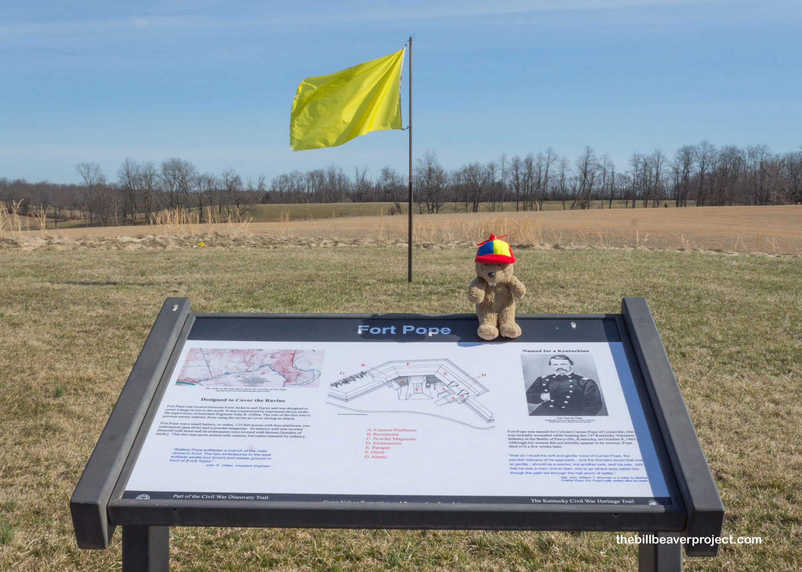
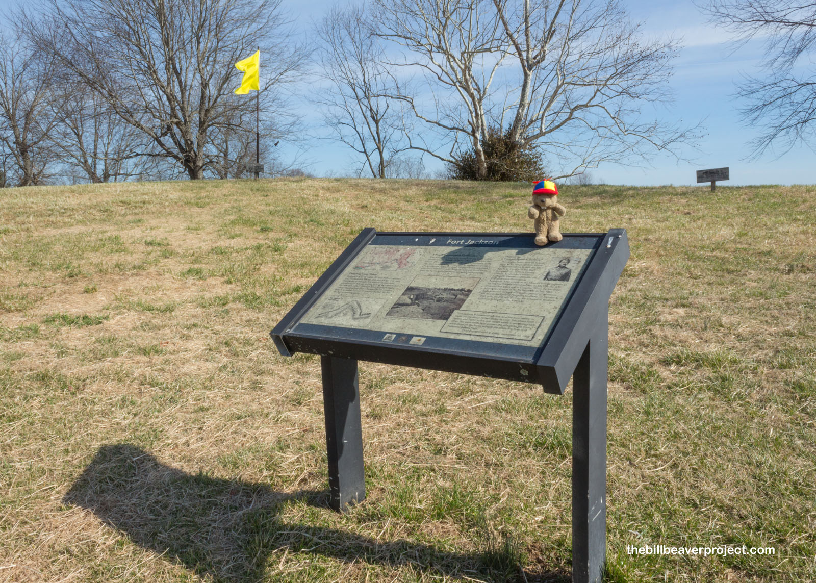
As I finished my loop around Camp Nelson, I encountered two more forts that better explained how this camp thrived throughout the war. Camp Nelson was situated just north of the Kentucky River and Hickman Creek, which had carved out 400–500 foot cliffs, protecting the camp on all sides but the north! Human defenses like Fort Pope and Fort Jackson filled in the gaps, and although the Confederate Army would have loved to destroy this depot, it just wasn’t worth the effort. Camp Nelson was never attacked during the Civil War!
 |
 |
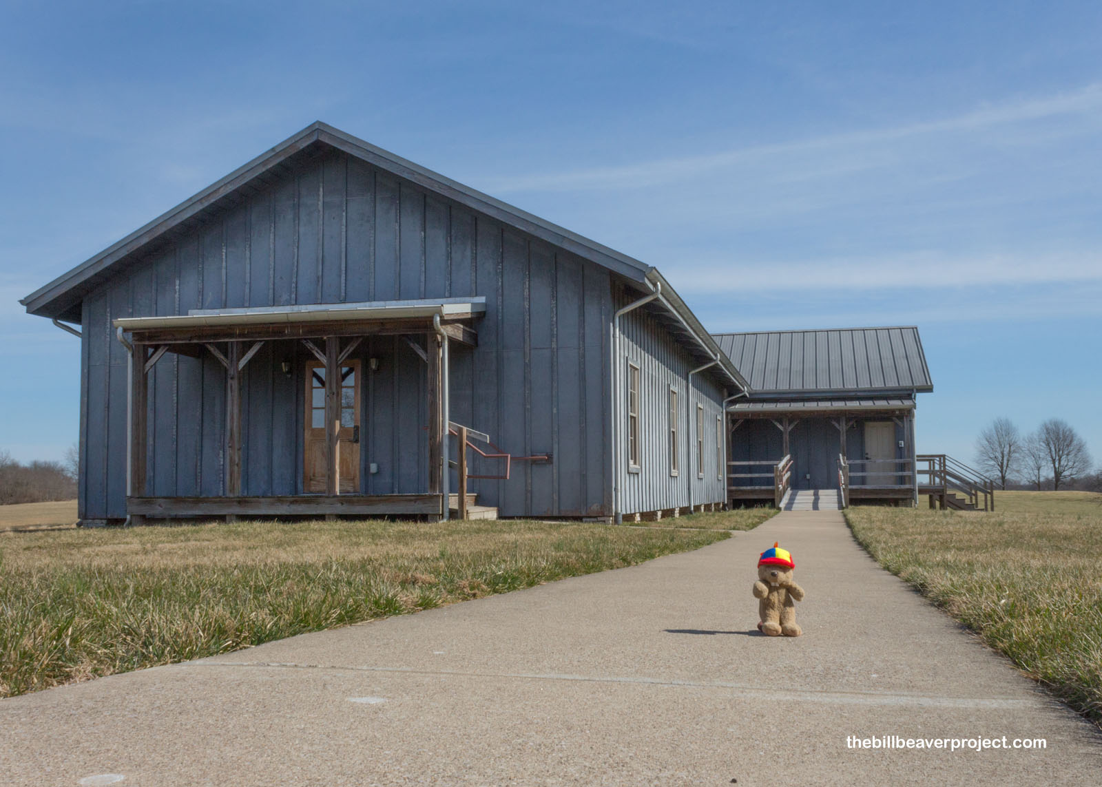
To wrap up my circuit of Camp Nelson, I stopped by the reconstructed barracks building, which told more about the troops stationed here. Camp Nelson trained 10,000 Black soldiers, offering them emancipation in exchange for service even though Kentucky officially had not adopted the Emancipation Proclamation, a special condition to keep the Bluegrass State loyal to the Union. In fact, Kentucky didn’t ratify the 13th Amendment, outlawing slavery, until 1976! For this reason, General Fry, under pressure of local slaveowners, expelled refugees en masse in the cold of an 1864 winter, even the families of the soldiers who had fought in the battles of Saltville and Appomattox Courthouse! Over 100 people died from exposure! Public outcry led to General Fry getting overruled and a more permanent Home for Colored Refugees getting established here, making Camp Nelson a major registration center for escaped and emancipated slaves in otherwise dubious territory!
 |
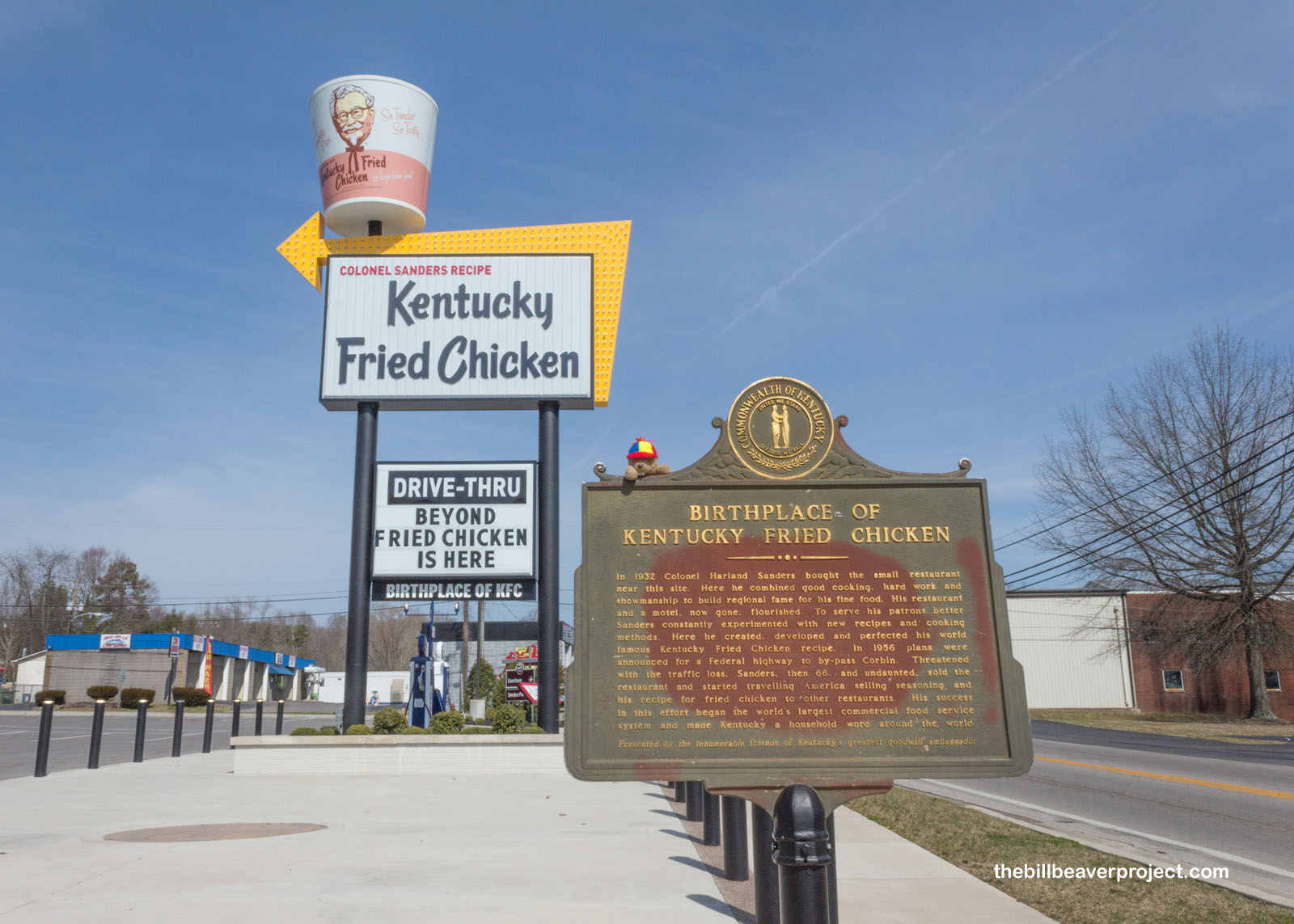
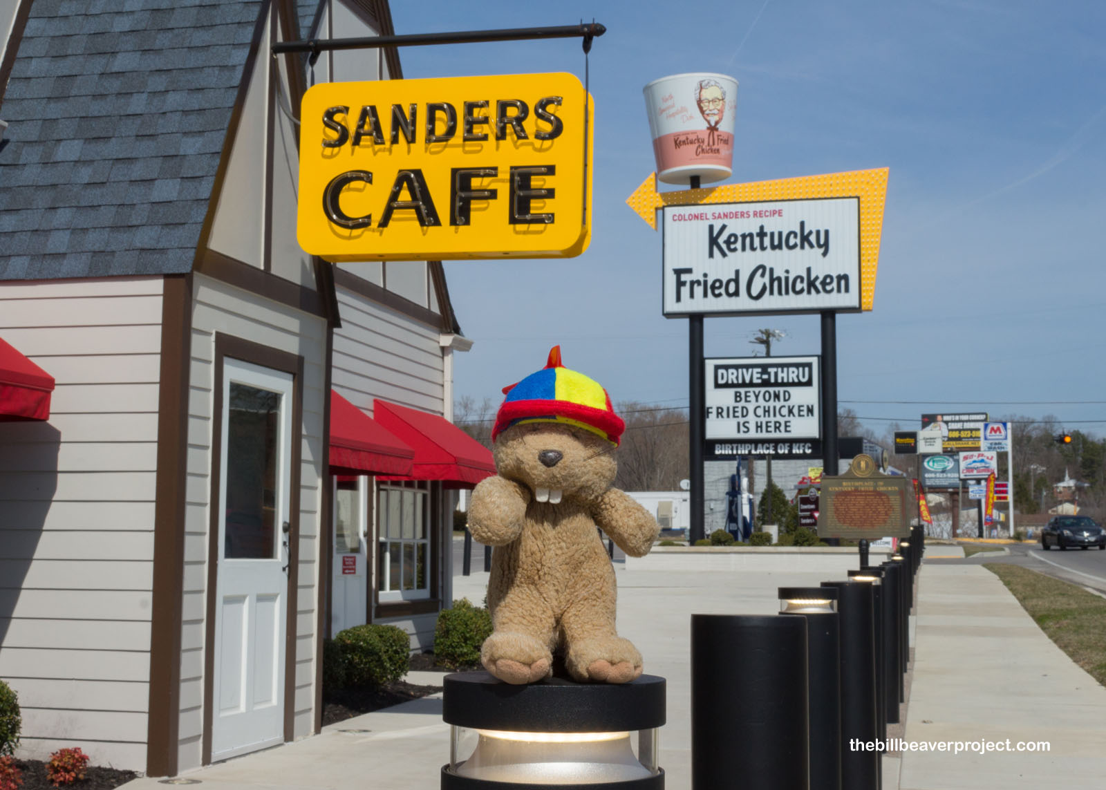
Having finished my visit to Camp Nelson National Monument, it was time to head south to see one more Kentucky national park site. But first, when in Kentucky on a Friday, I couldn’t resist a stop in the city of Corbin, home to the world’s first Kentucky Fried Chicken! Here, in 1932, Harland Sanders started selling fried chicken from his Shell service station, which grew into the global brand we know as Kentucky Fried Chicken! Widely remembered as Colonel Sanders, his only military service was a year as an Army teamster in Cuba in 1906! His title comes from a special Kentucky tradition dating back when Kentucky was a county of Virginia! Officially, a Kentucky colonel is “a goodwill ambassador of the Kentucky state, culture, folklore, traditions and values!”
 |
 |
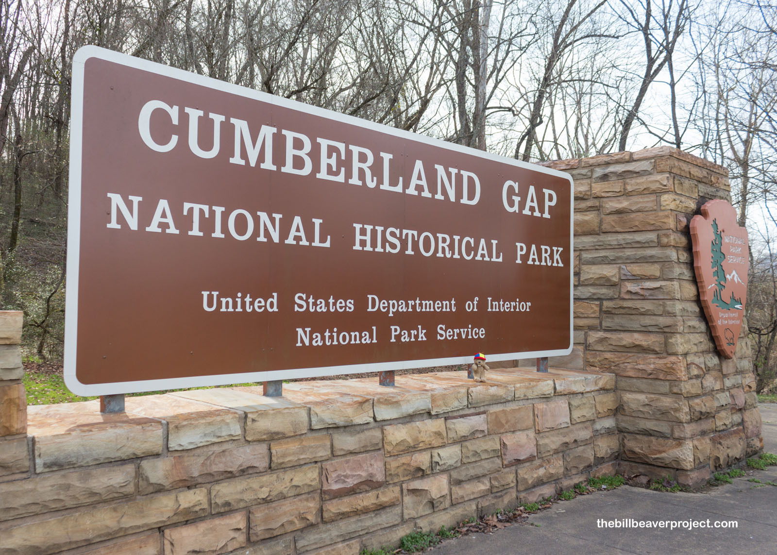
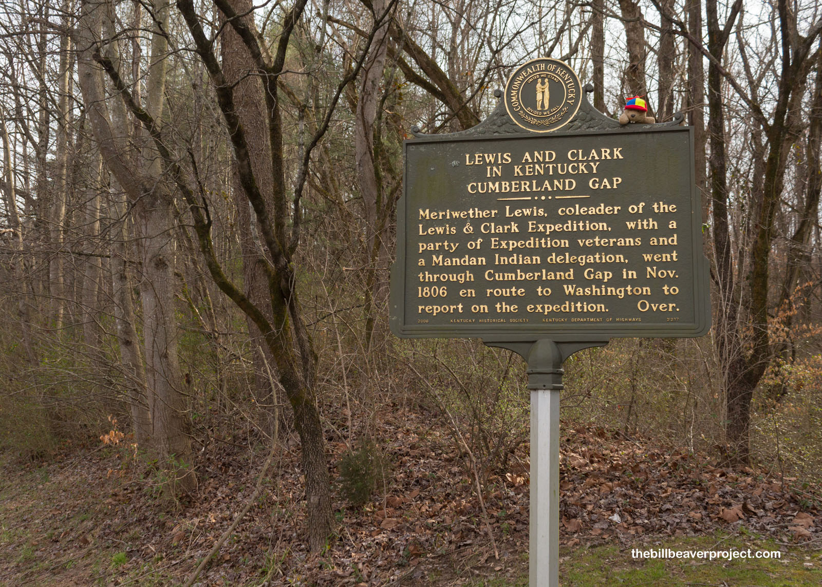
Unable to taste the history here, being a vegetarian and sometimes pescatarian, I continued my journey to arguably the most historic mountain pass in US history: the Cumberland Gap! Since the times of prehistoric buffalo herds, this has been a critical crossing between the modern states of Virginia and Kentucky. Over 300,000 settlers, including the Lincoln family and the Lewis & Clark Expedition, passed through here to settle the West before 1810! Today, it’s a national historical park!
 |
 |
To get to the gap, I had to bypass Fort McCook, one of the Civil War era fortifications that guarded the Gap. Originally in Confederate hands, General Ambrose Burnside took control in September of 1863 and kept the Gap for the rest of the war! Pretty much impossible to take by force, they’d turned the rugged landscape to their advantage, cutting off the water supply and blustering that they had enough troops to take the Gap by force! After the Confederates surrendered, the Union took control, but General Grant later decided it wasn’t worth defending too strongly; the landscape would do the job just fine.
 |
 |
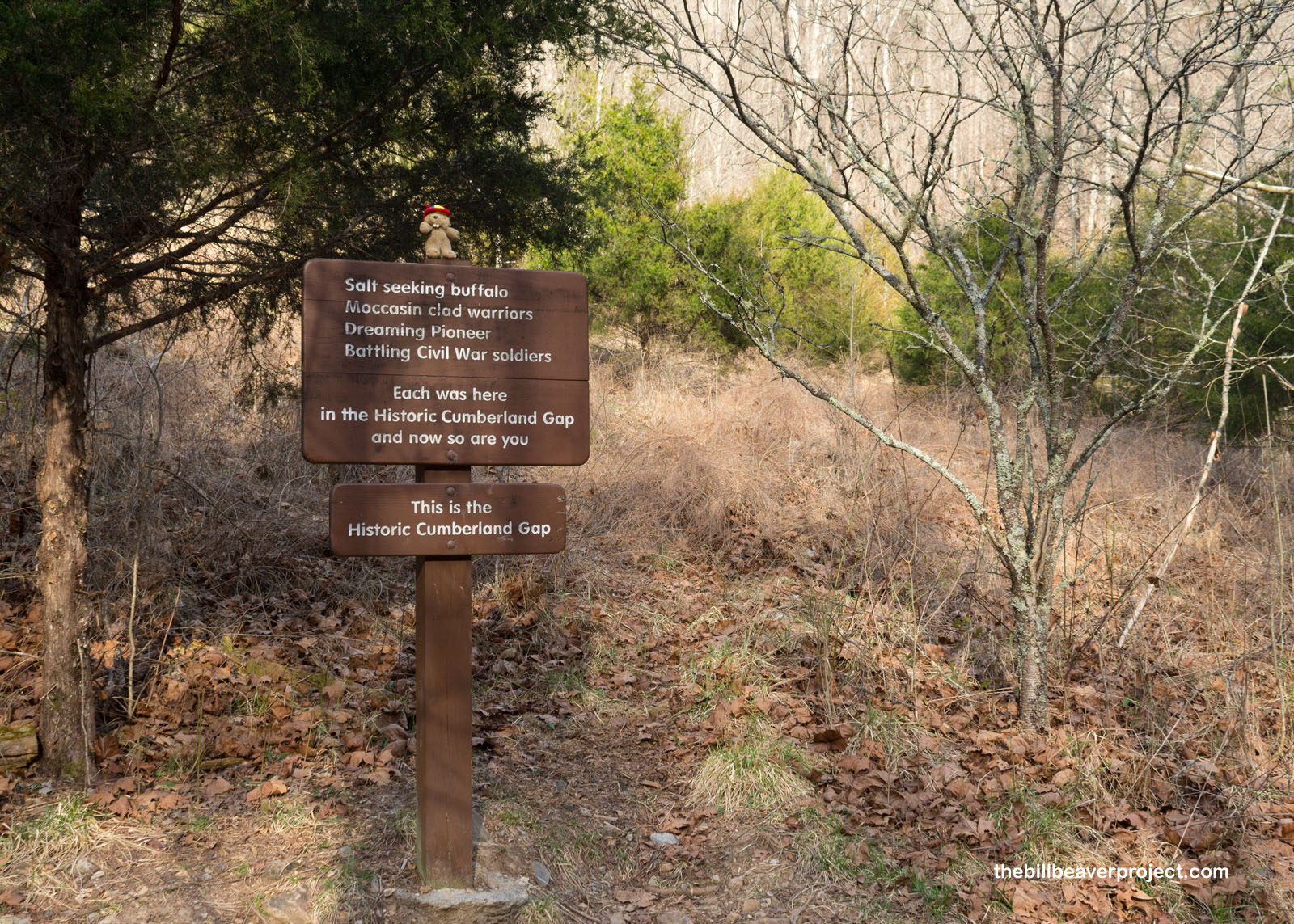
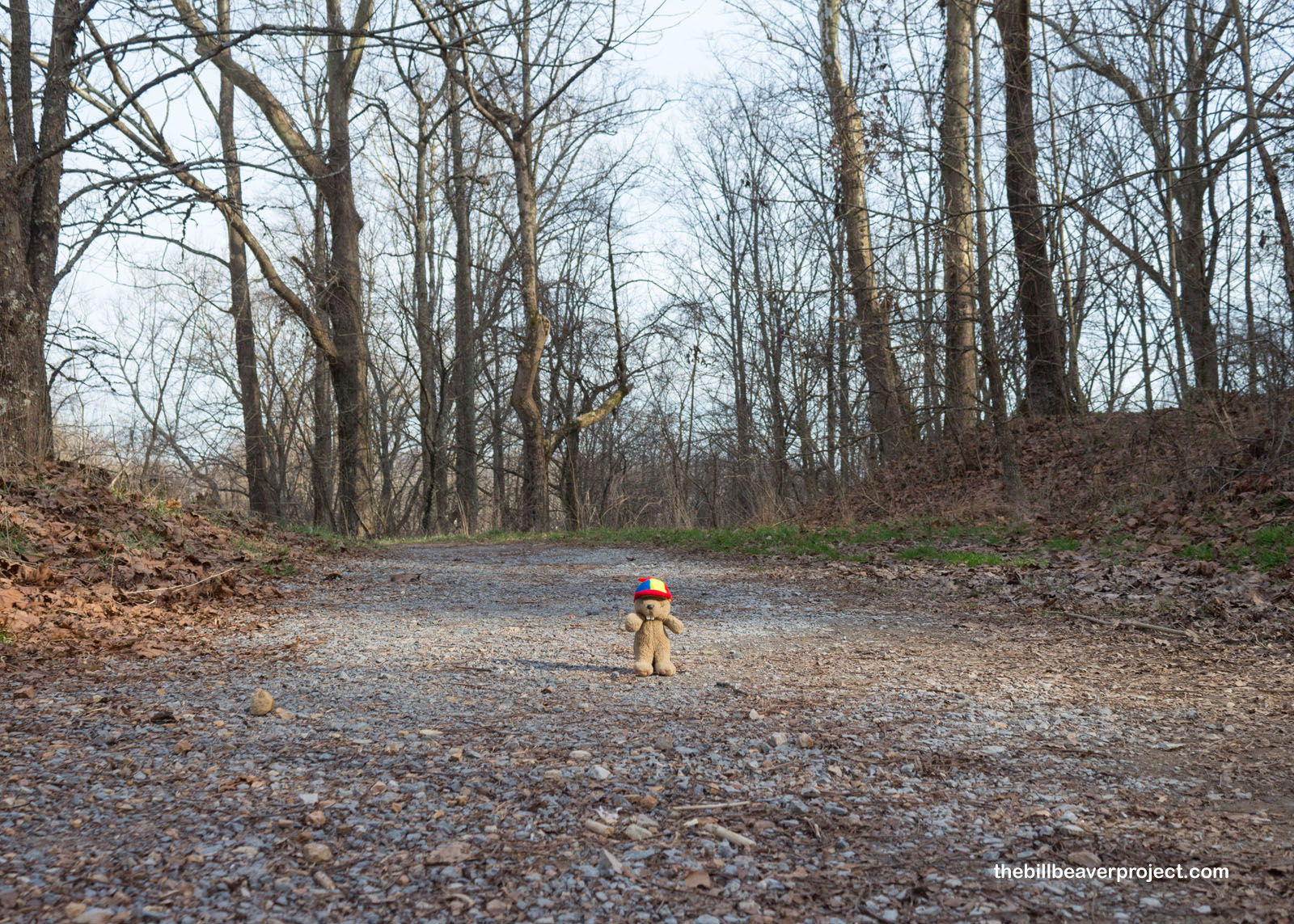
To see this up close and firsthand, I hopped onto a merger of three trails to get myself smack dab in the middle of the famed Cumberland Gap. It was a gradual slope downward, nothing too fancy or technical, with lots of leaves from last season to crunch under my toes! There wasn’t much in the way of advertising for the park’s namesake spot, so suddenly, without warning, I was there!
 |
 |
This little sign marked the middle of the Cumberland Gap, which is just what it sounds like: a gap in the Cumberland Mountains! Known for generations by bison and the Shawnee & Cherokee tribes, the name we now use for this area came from Thomas Walker, surveyor of the Loyal Land Company, who in 1750 gave a toast to Prince William, Duke of Cumberland at a spring in the Gap, putting the prince’s name on the Cumberland Gap, River, Mountains, and Plateau!
 |
 |
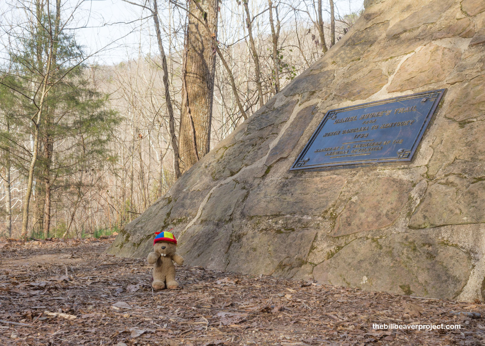
With the Gap now well known in the northeast, the Transylvania Company hired Daniel Boone in 1775 to expand the route leading through the Gap and make settlement of Kentucky and Tennessee easier! A plaque commemorates this route, later called the Wilderness Road (you know, the one that led through Danville), which by the 1790s was wide enough for wagons to pass through the Gap and stretched as far as modern Louisville!
 |
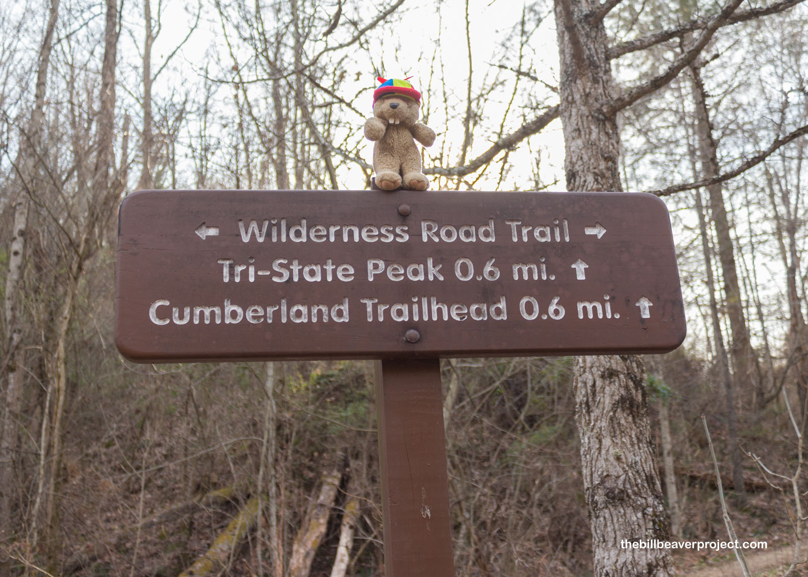
While standing in the Gap was pretty neat, it was so thick with trees that it didn’t afford much of a view! So I branched off the old Wilderness Road to ascend Tri-State Peak. After all, I’m a sucker for state intersections!
Like the way down, the way up the peak wasn’t too difficult, just a gentle slope through the late winter/early spring greenery!
 |
 |
Before reaching the summit, I paused at a plaque, commemorating the original Royal Colonial Boundary survey line of 1665! Originally King Charles II’s idea, this survey line was supposed to set the boundaries between the provinces of Virginia and Carolina from Atlantic to Pacific, but it ultimately just reached the Mississippi River. Nonetheless, this survey, which involved Peter Jefferson, father of Thomas, in its early stages, set future state boundaries as far west as the Oklahoma Panhandle and was a defining line for the Missouri Compromise!
 |
Then, I reached the pavilion atop Tri-State Peak and had to get out my Flutter Phone to properly capture the views looking into Kentucky, Tennessee, and Virginia from above! Enjoy!
There was lots more to see, miles and miles of trails through the park, but I only had an hour before sunset. That was going to give me just enough time to wind down into Virginia and see a historic furnace and at least part of a cave!
 |
This iron furnace marks the spring where Thomas Walker toasted to the Duke of Cumberland and thought it would make a fine spot for a mill. It wasn’t until 1819 that Newlee’s Iron Furnace opened here, using water from that spring, limestone from the surrounding mountains, and charcoal from the forest to process 3 tons of locally mined iron ore every day through the 1800s! Some of the ore was sold to local blacksmiths, while more was sent downriver to Chattanooga for further refinement!
 |
Though the furnace is no longer burning, the spring is still flowing! I found that out the hard way when I backtracked and wound up the hill to see Gap Cave! The trail was flooded, and the bridge was blocked by construction cones, so I did what any self-respecting beaver would do and hopped rocks across!
 |
At last, looking back from this trail, I could get a better glimpse of the Cumberland Gap, surrounded on both sides by mountains. I couldn’t look long, though, because I was pushing the edge of sunset, and this hill was steeper than it looked. Whew!
 |
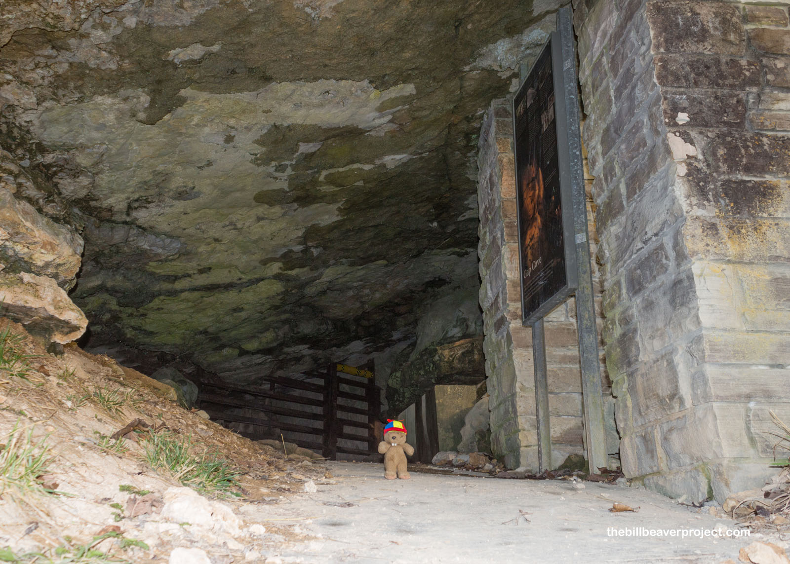
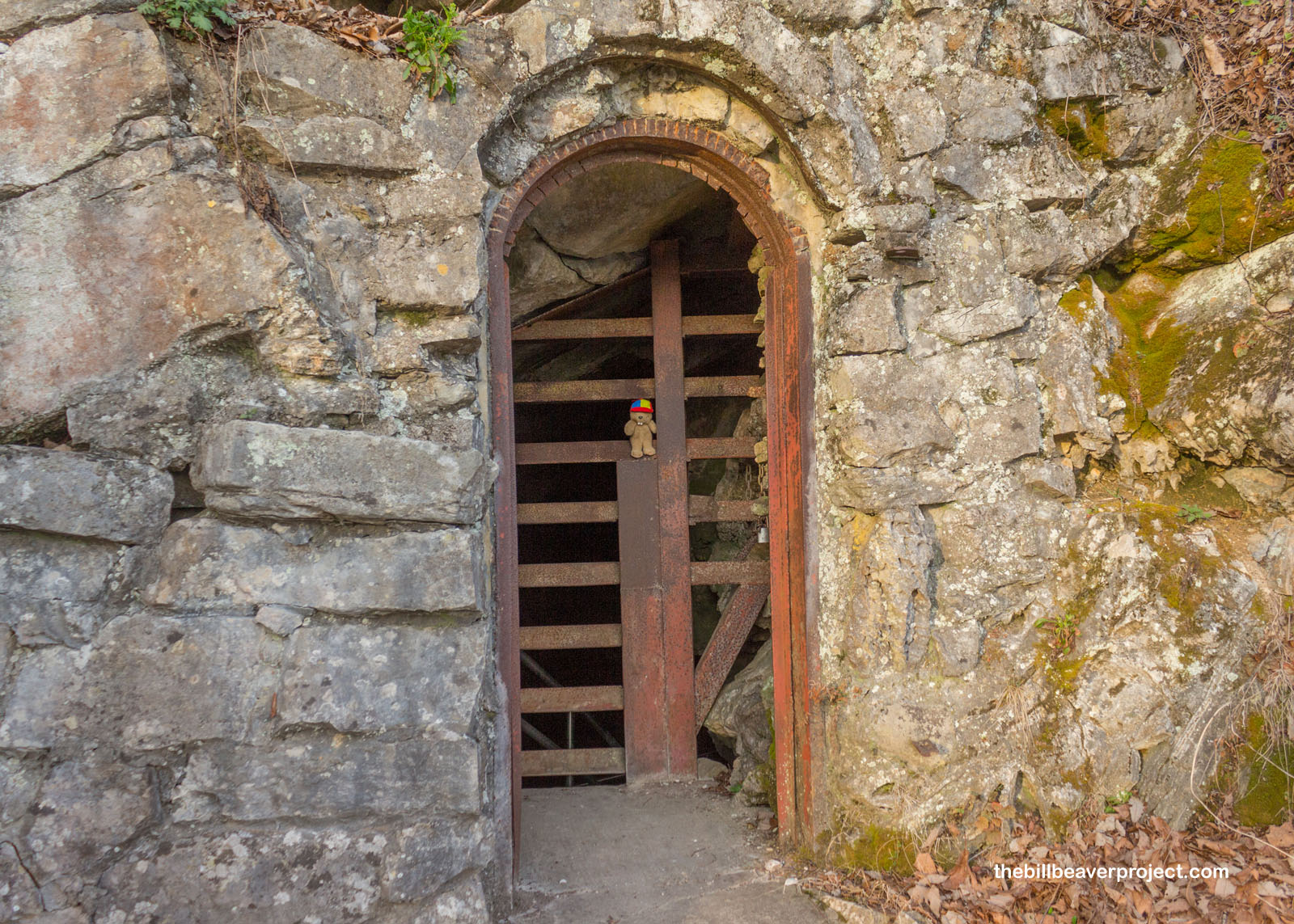
At last, I reached Gap Cave, which is only accessible by tour. Eroded out of the Newman formation of limestone, this cave is a remnant of an ancient sea, stretching 14 known miles underground! Soldiers stationed here during the Civil War would explore the cave during their downtime, though it was also used to dump ammunition and treat/quarantine soldiers who were sick!
 |
 |
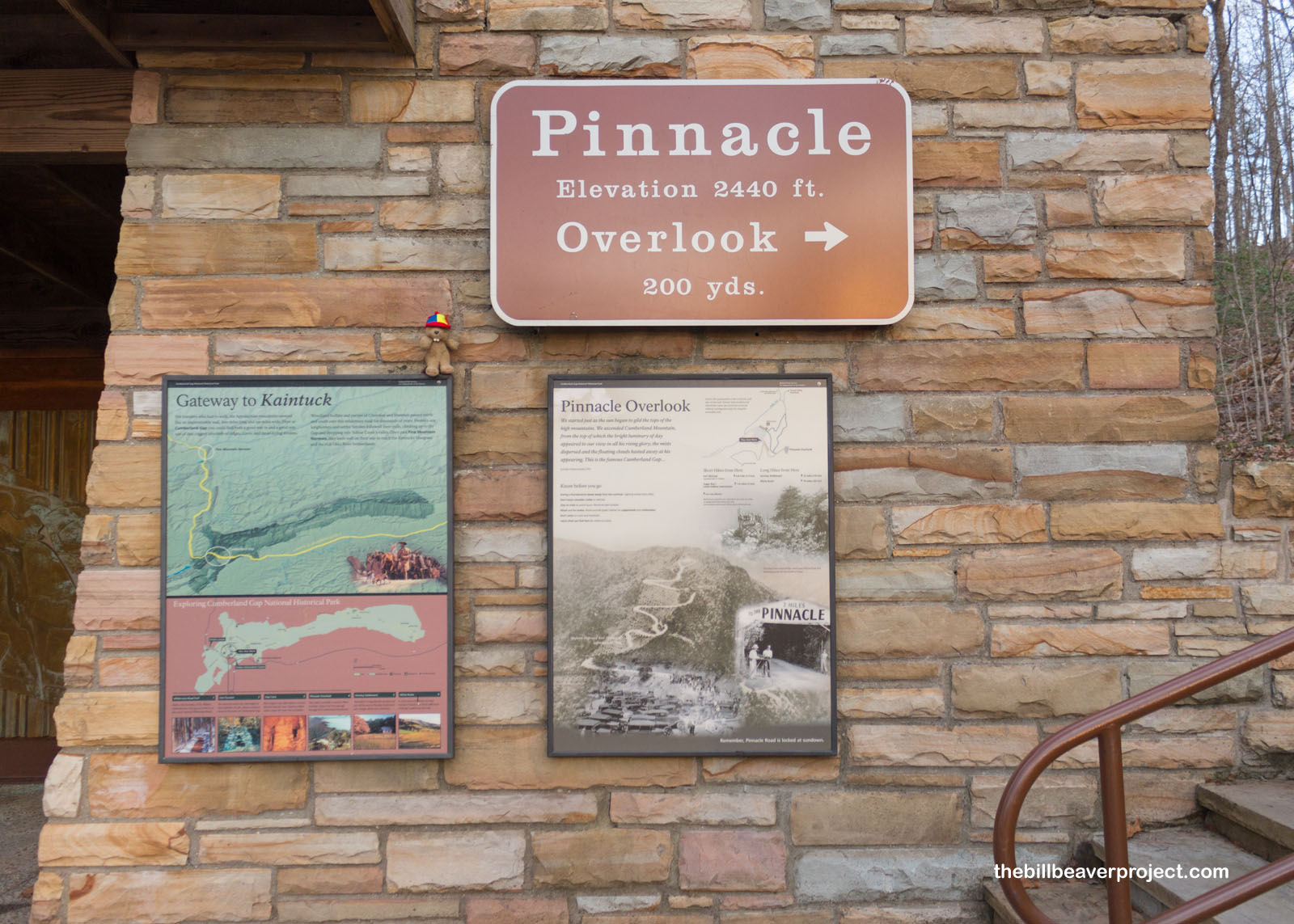
But, as Plato would have it, I wasn’t going to finish the day inside a cave, so I hustled back the way I came, through the Cumberland Gap, back up to the Fort McCook parking lot, and up to the Pinnacle Overlook for a final sunset view!
 |
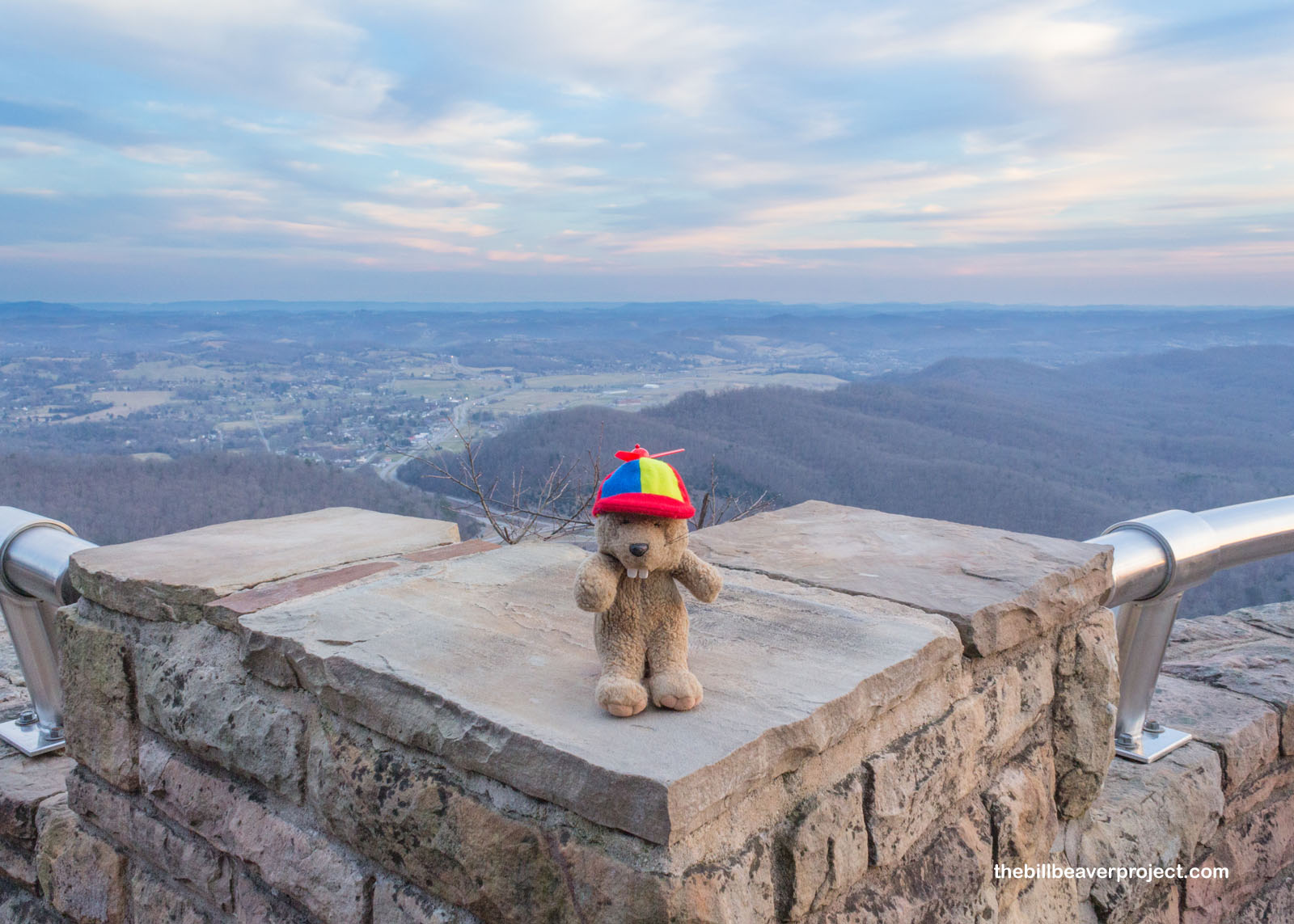 |
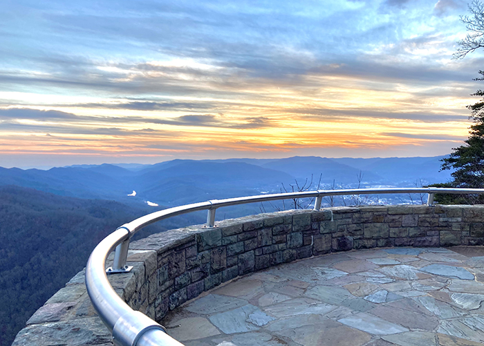
I was just in time, and while the clouds made for a very subtle sunset, it was worth getting out my Flutter Phone a second time and sending it up to capture some of the amazing views overlooking the Gap and three states!
And just like that, the sun had set, and I had a two-and-a-half hour drive to get back to my hotel. This was a heck of a way to spend a Kentucky Friday, and I sure did learn a lot and see a lot! I won’t be running around as much tomorrow, but I will be back in a cave, the world’s longest, actually! Stay tuned for my last Kentucky national park and in fact, my 200th national park site!
Stay extra crispy, my friends!

Previous Day |
Total Ground Covered: 1,102.8 mi (1,774.8 km) |
Next Day |