 More 2022 Adventures |
Bismarck, ND → Washburn, ND → Dickinson, ND 165.0 mi (265.5 km) |
 Next Day |
Hello ta Dakota, everyone!
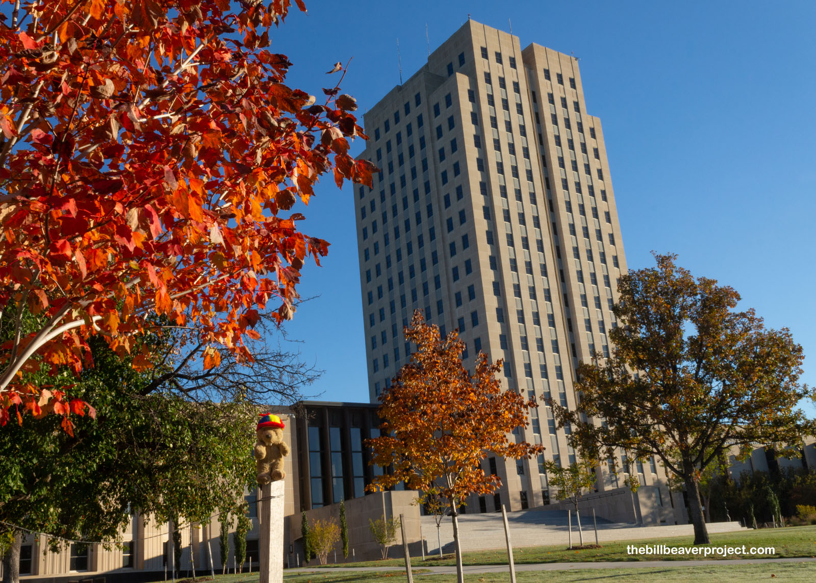
My national park quest has taken me to a brand new state in the Heartland, North Dakota! And it is indeed the heartiest, because North Dakota happens to be the home of the exact belly button of the North American continent! I’ll get to that later, but first, on this frosty morning, I went to take in Bismarck’s Art Deco capitol building, sometimes called the Skyscraper on the Prairie!
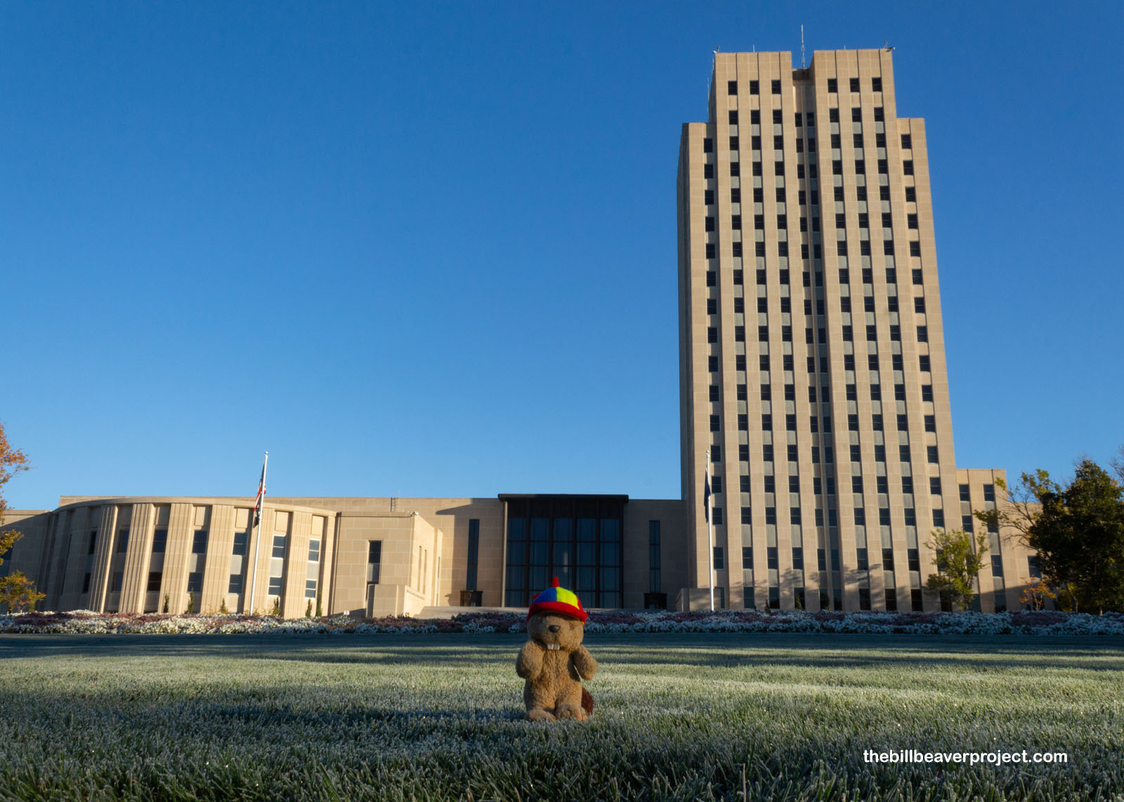 |
Towering over the autumn leaves that I thought were going to give me a chance to celebrate Lastleaf, but were already on their way out, this huge building was the product of disaster! Fire had taken out the original capitol building on December 28, 1930, so costs had to be cut in its reconstruction! Ornamentation: out! 160 acres of capitol grounds: sold! Construction workers: on strike! Yup, to cut costs, the state paid workers 30 cents an hour, then declared martial law when they went on strike to get 50 cents an hour!
 |
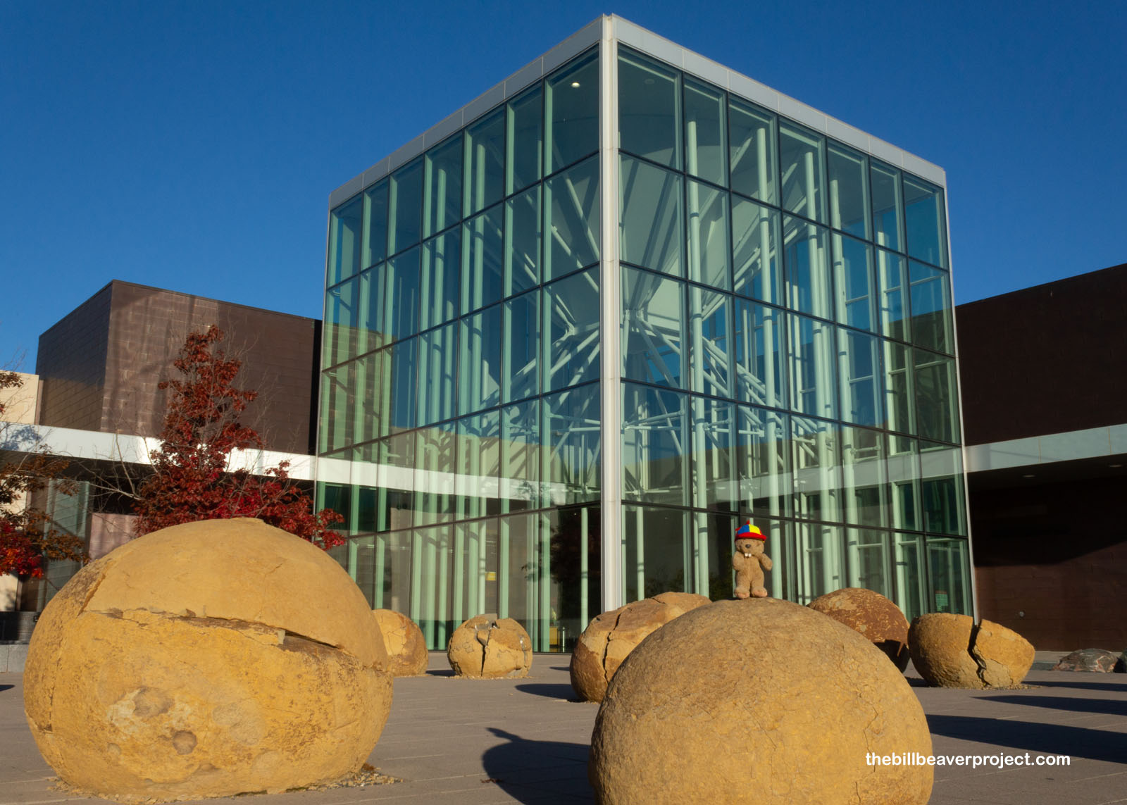
It was a raucous start to this historical tour, and I was ready to be surprised even more when I strolled over to the North Dakota Heritage Center & State Museum to see what was on display! Outside, I got a preview of some amazing cannonball concretions that the National Park Service promised I would encounter when I got to my next national park site!
 |
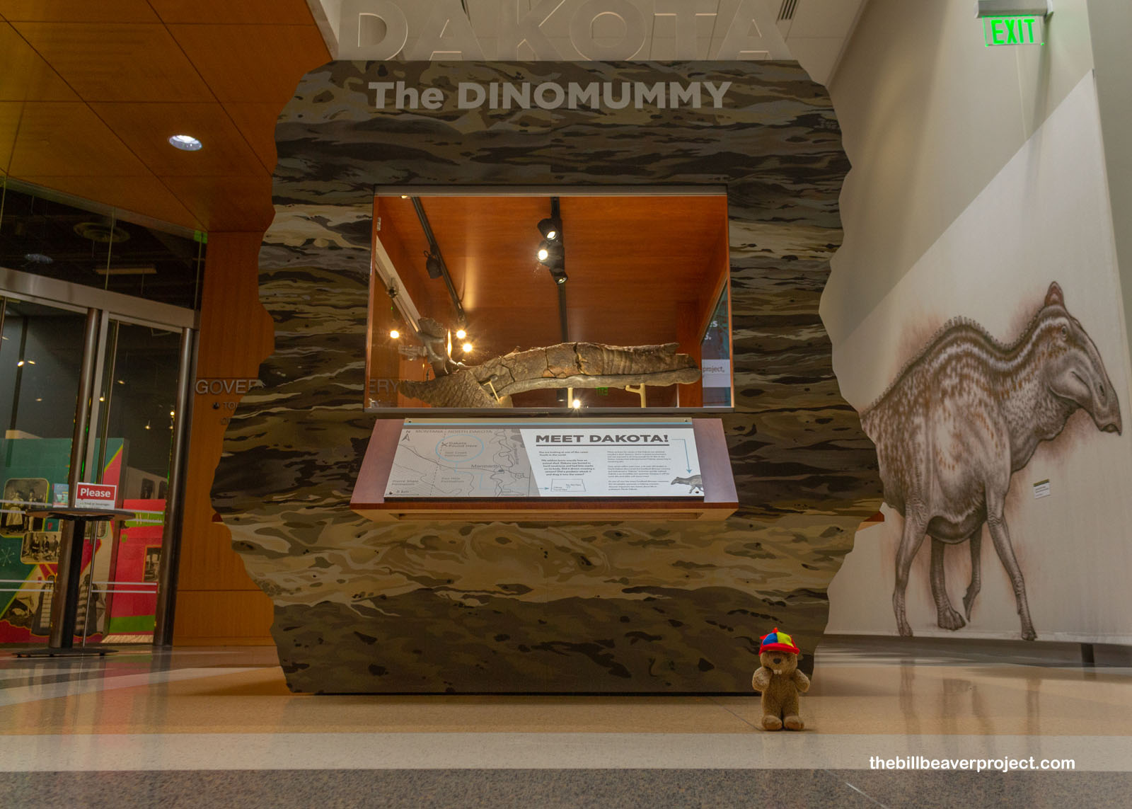
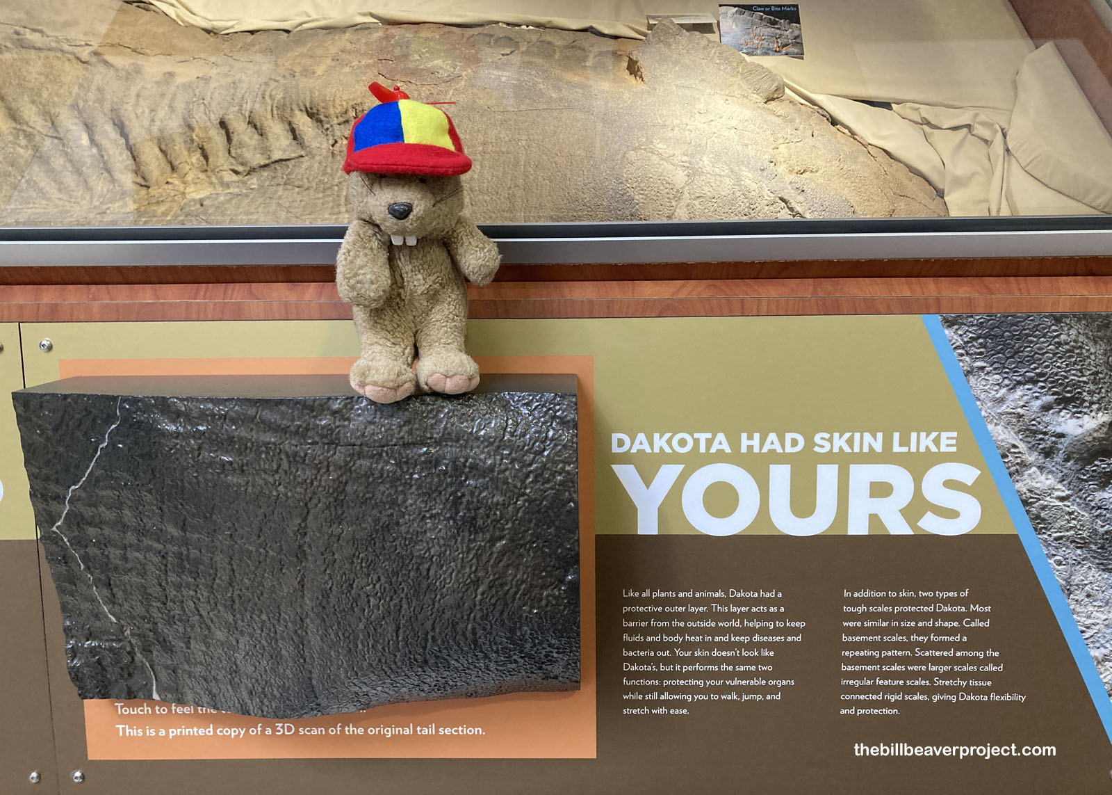
Inside, the nice lady at the counter directed me to the museum’s rarest treasure: a dinosaur mummy! Nicknamed Dakota by the 16-year old fossil hunter who found it, this Edmontosaurus was found with its skin and other soft tissues intact! It’s pretty likely that Dakota got attacked by a predator, maybe a crocodile, but when it died, it lay, uneaten, in a place where its skin was able to dry out, leaving behind amazingly preserved scales!
 |
 |
There weren’t many places to stand on the Dakota exhibit, so I sent up the Flutter Phone to capture a full 360 of the spectacular pieces on display!
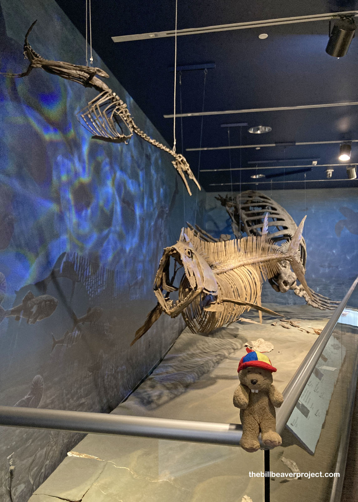
And then, I dove further into their fossil collection! Grassy as it is today, eighty million years ago, North Dakota was underwater! This was known as the Pierre Sea, and its remains, the Pierre Formation! Here lived humongous mosasaurs and sea turtles called archelons! Plus, this shallow sea was home to the most terrifying fish ever: the fang-toothed Xiphactinus!
 |
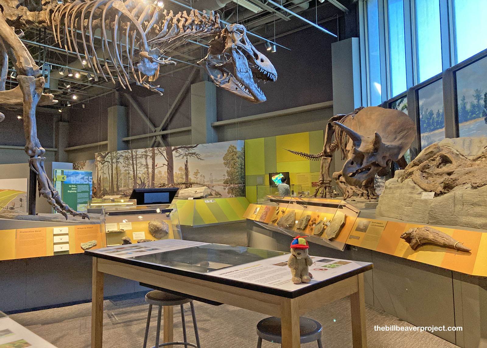
But North Dakota is more famous for its terrestrial critters, which came into the spotlight around 20 million years later. In the world of dinosaurs, there are few names so famous as Tyrannosaurus and Triceratops, whose fossils emerged from the rich, Cretaceous deposit called the Hell Creek Formation, covering huge swathes of both Dakotas plus Montana and Wyoming!
 |
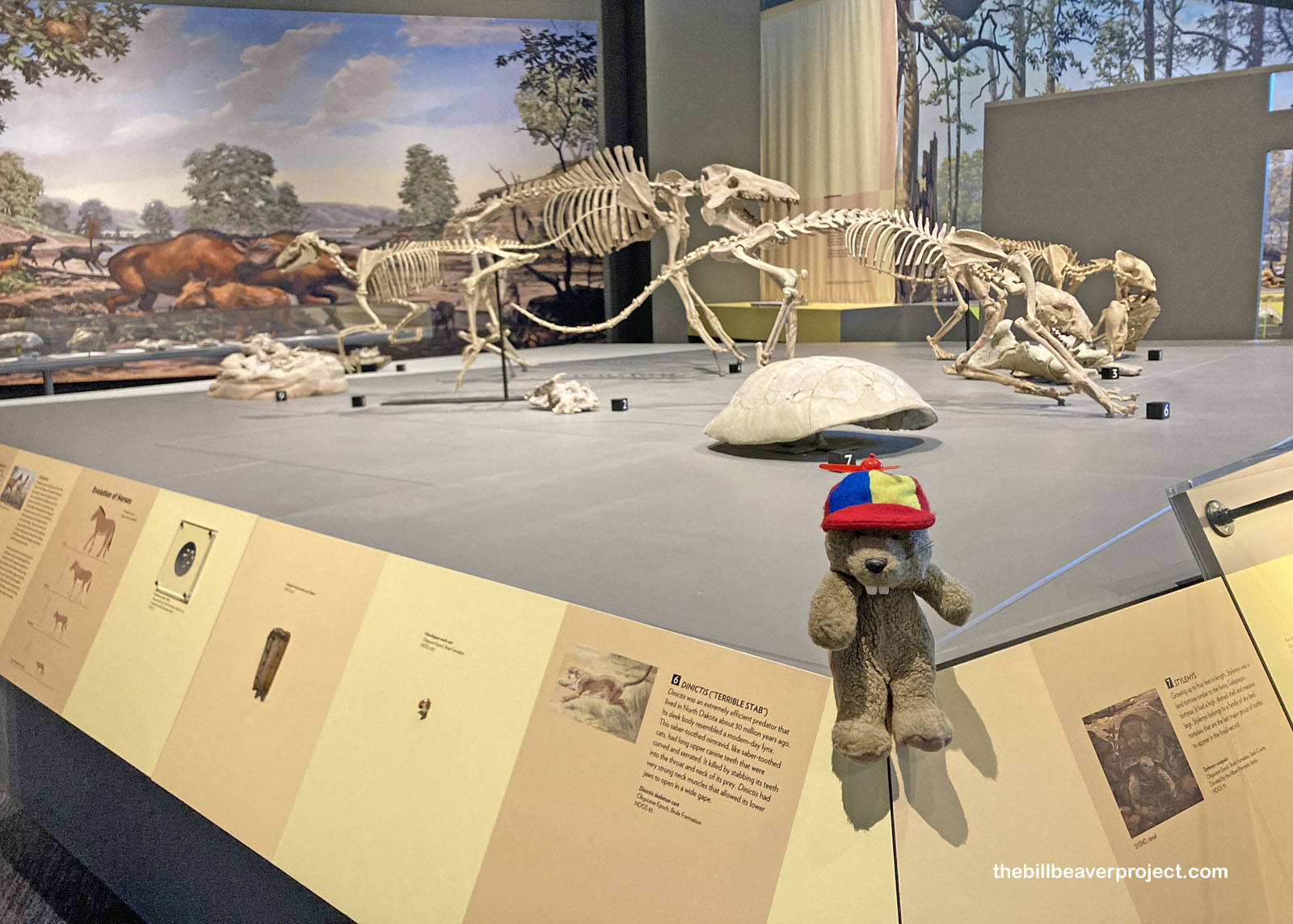
After the fall of the dinosaurs, the budding grasslands of North Dakota became a perfect place for new mammals to develop, like the horse ancestor, mesohippus, and the different types of saber-tooth: the cat called Dinictis and the marsupial called Hoplophoneus!
 |
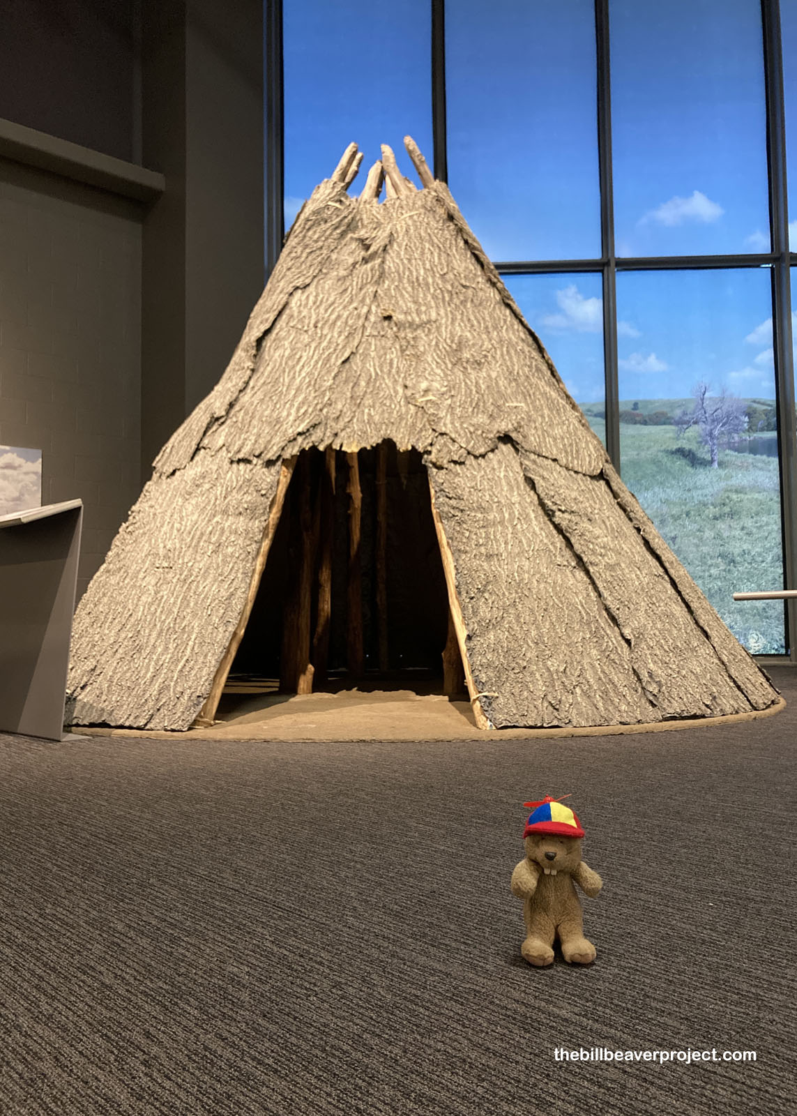
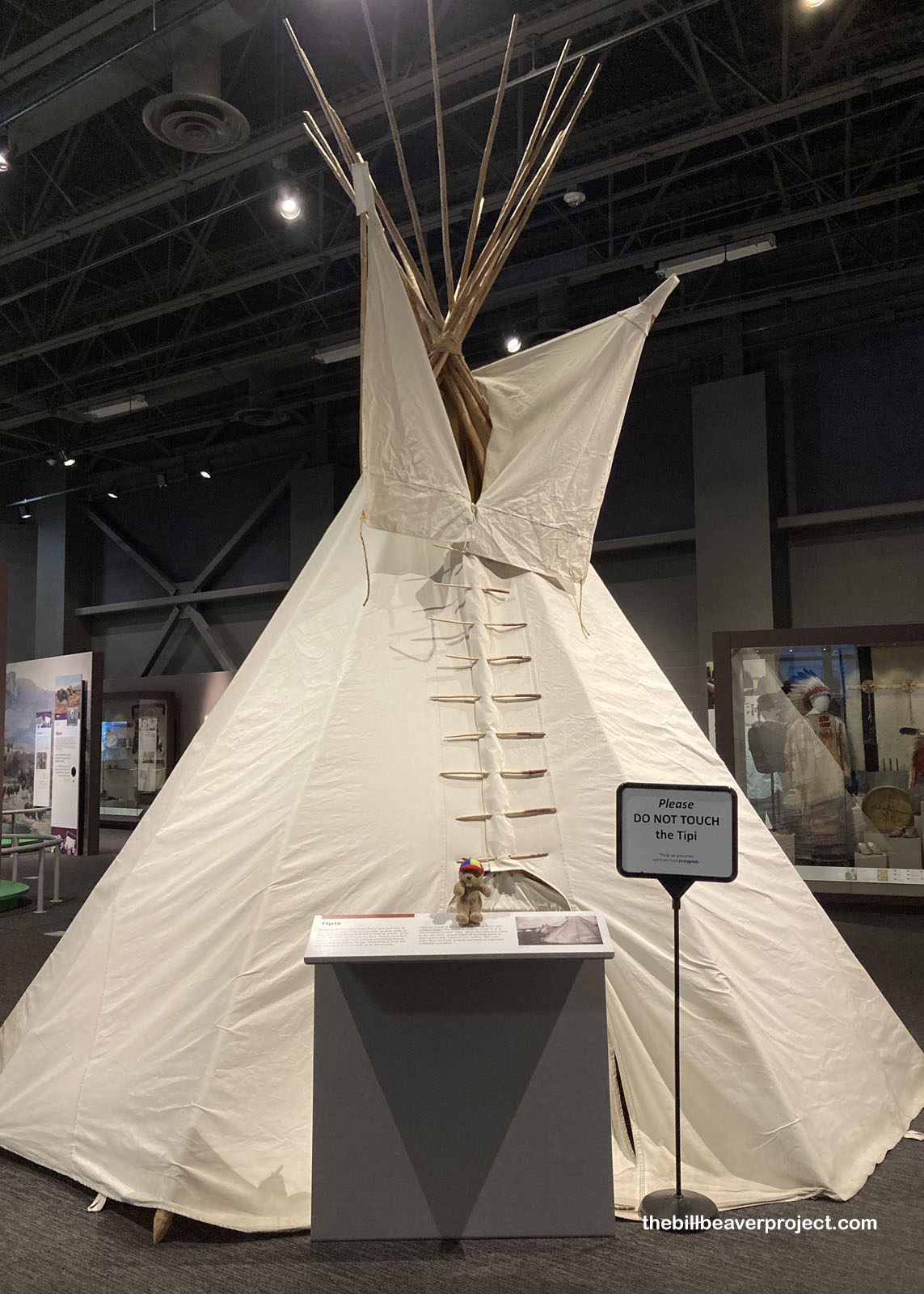
And then came the humans, following the herds of ancient bison! First, they lived in bark-coated homes, as evidenced by some remains found along the James River, which burned somewhere between 550 and 410 BCE! But as time rolled on, the development of bison-hide tipis made it easier to pack up and move with wandering herds! These Plains dwellings are, without a doubt, the most iconic of Native American dwellings!
 |
 |
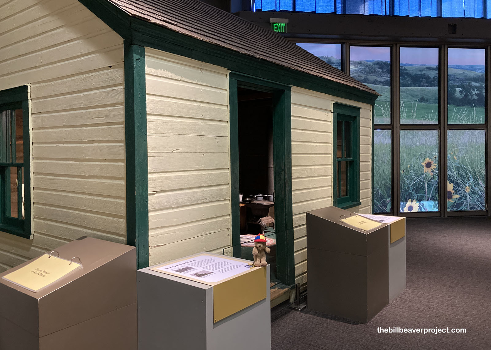
The final exhibit hall at the Heritage Center talked about post-settlement North Dakota, from its agricultural innovations to its role as a staging ground for Minuteman Atomic Missiles! One exhibit that caught my fancy was the original homestead shack of Nancy Hendrickson, who was born and spent her entire life on her family homestead. She stood out as a rough and tough, motorcycle riding farm gal who made a living selling photos! In fact, she turned her old homestead shack into a photography studio!
 |
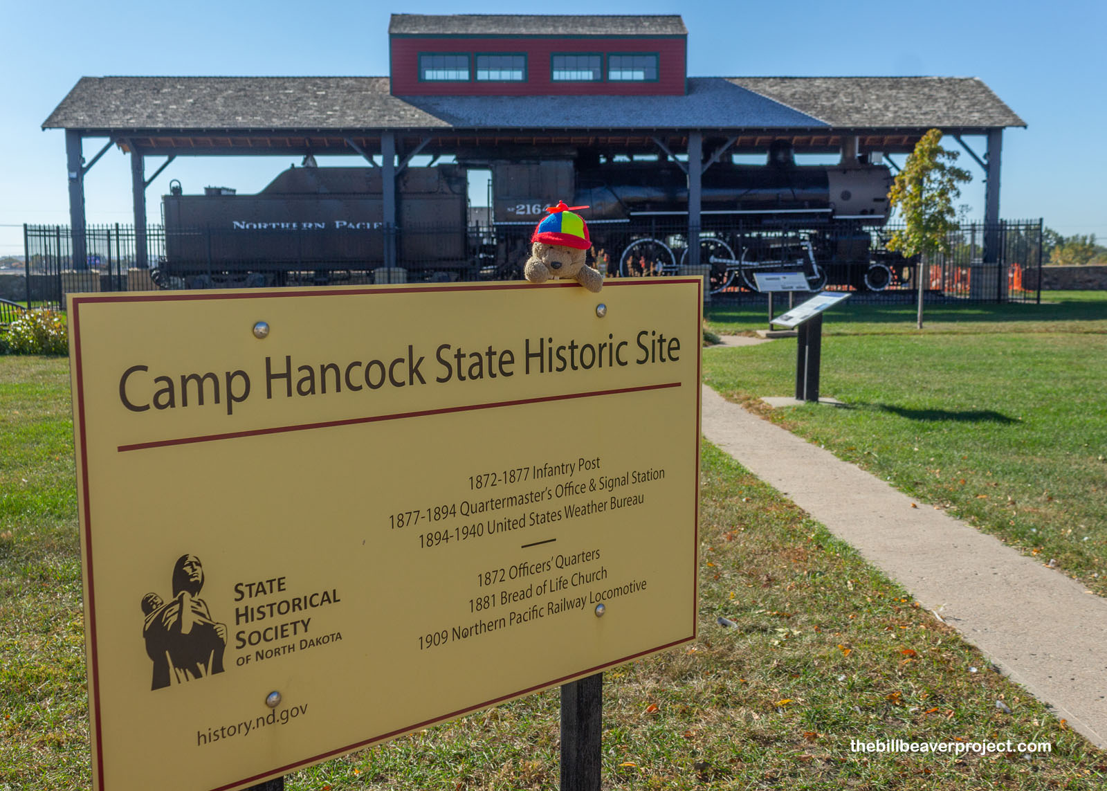
We may not know everything about these huge transitions in North Dakota’s history or prehistory, but we do know the capital city of Bismarck owes a lot to the railroad! I set off through downtown Bismarck to learn more that that! In 1872, crews from the Northern Pacific Railroad arrived in this area, building their new route to connect Duluth, Minnesota and Tacoma, Washington. To protect the workers and supplies, the US military sent the 17th Infantry here, and they set up Camp Greeley, later renamed Camp Hancock!
 |
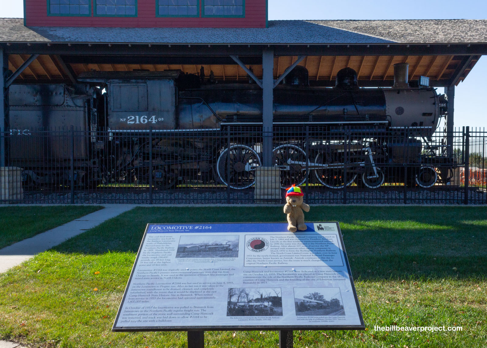 |
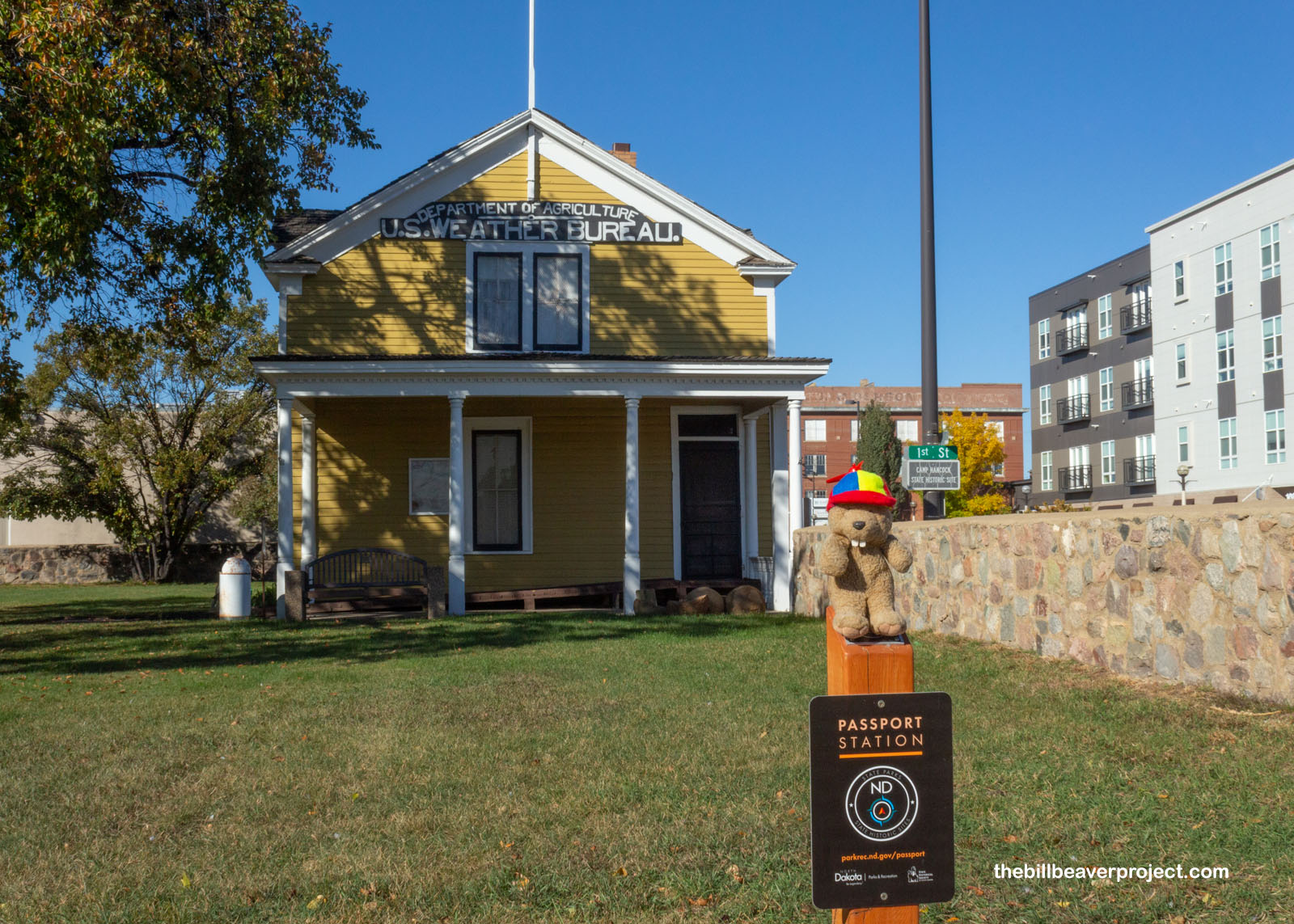
Troops were stationed here at Camp Hancock for five years, and then this became a supply depot for nearby Fort Abraham Lincoln until 1894. At that point, the post was decommissioned, and the U.S. Weather Bureau moved in, collecting data about weather across North Dakota to guide airplane travel routes and the best crops to plant each year!
 |
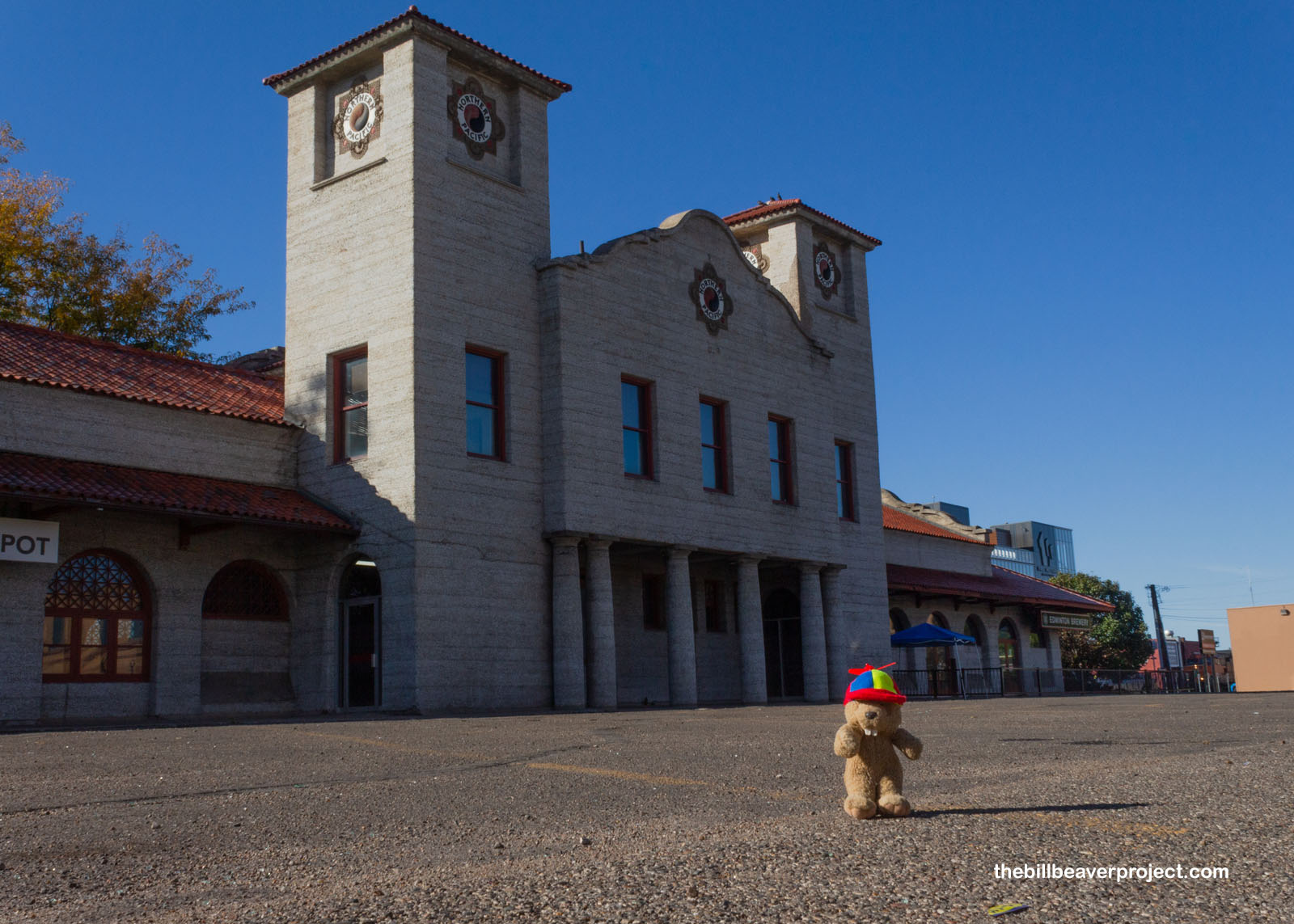
But even after the railroad continued through Bismarck, it kept its hold on the budding capital, including this Spanish revival depot, a rarity in the Midwest, constructed in 1901 and serving 24 passenger trains a day at its height! After the rise of highways, this Nationally Registered depot is now used as a restaurant!
 |
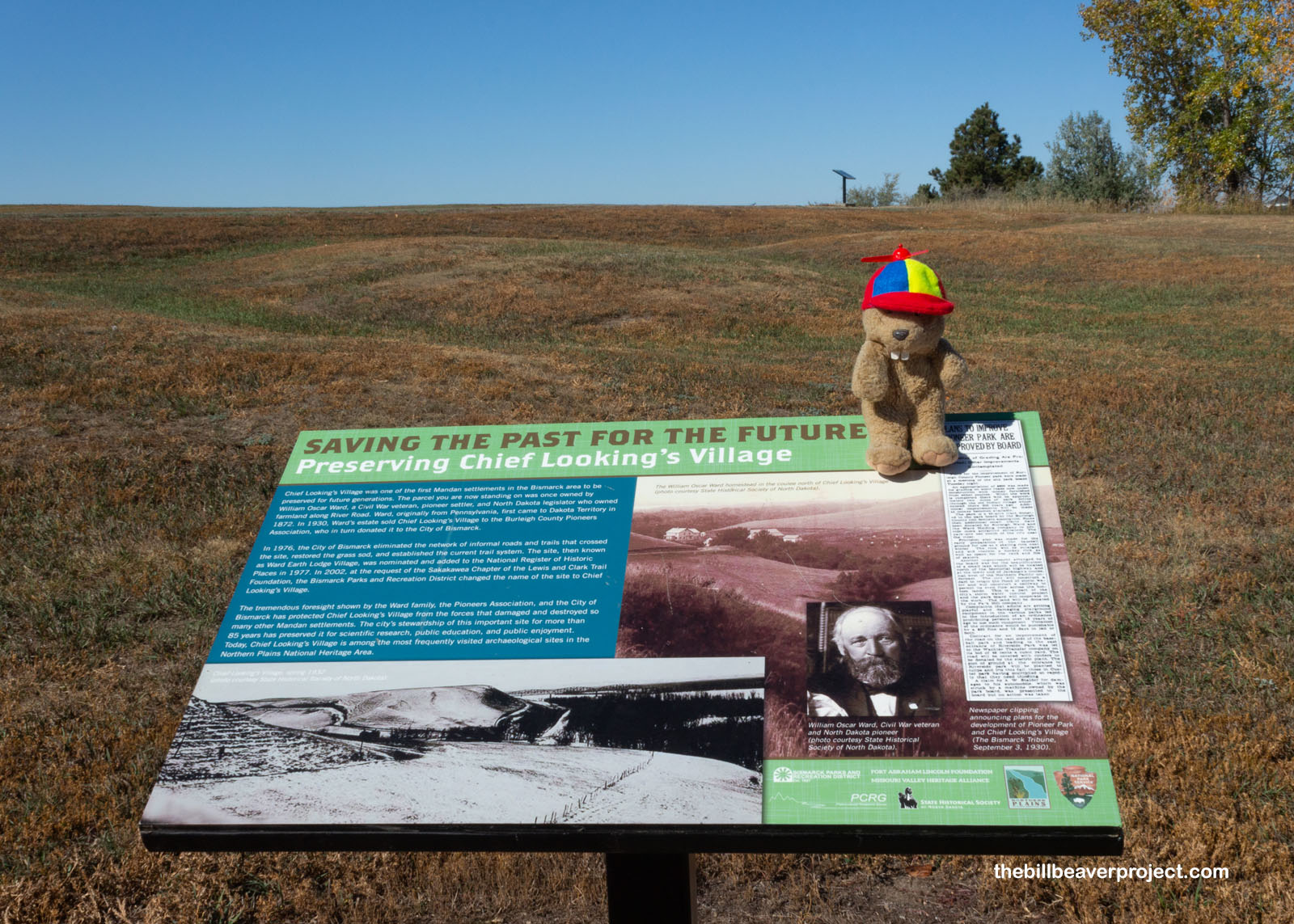
But this part of North Dakota is home to something super unique: the center of North America! I set off from Bismarck in a counter-clockwise loop to find it, stopping to see the remnants of Chief Looking’s Village! Not a whole lot is known about Chief Looking beyond some legends about how he looked after his son, but this Mandan village most likely dates back to 1550 CE. Not much is visible, because, like Yucca House National Monument, this site hasn’t been left excavated but reburied to keep away vandals and robbers!
 |
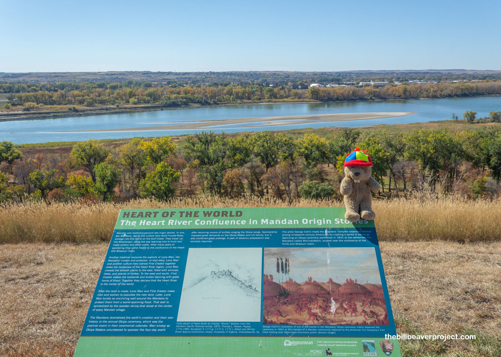
This area where the Missouri and Heart Rivers meet is important in the history of the Mandan, some of whom say their ancestors followed the river here from the Gulf of Mexico, while others say they originated here, surrounded by a wall that protected them from a massive flood, which left this spot as the Center of the Whole World! I thought they might have been onto something as I continued my journey to the center of the continent!
 |
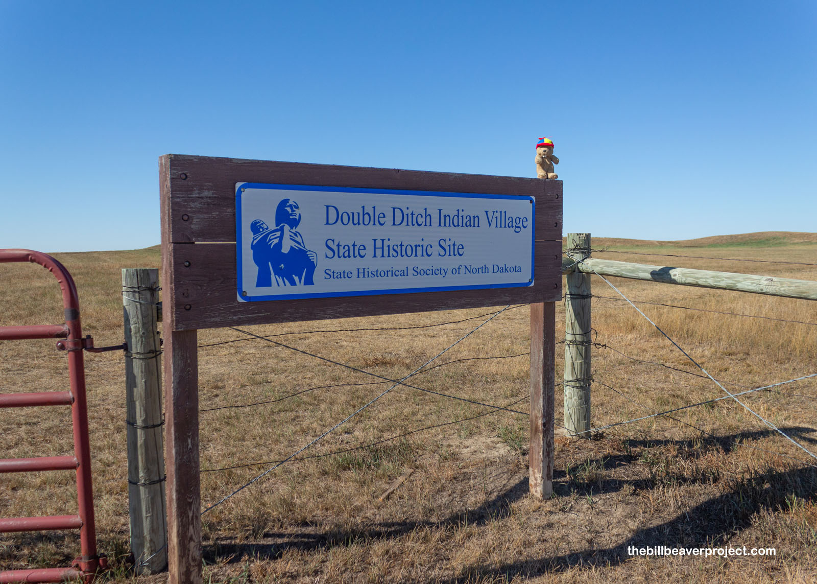
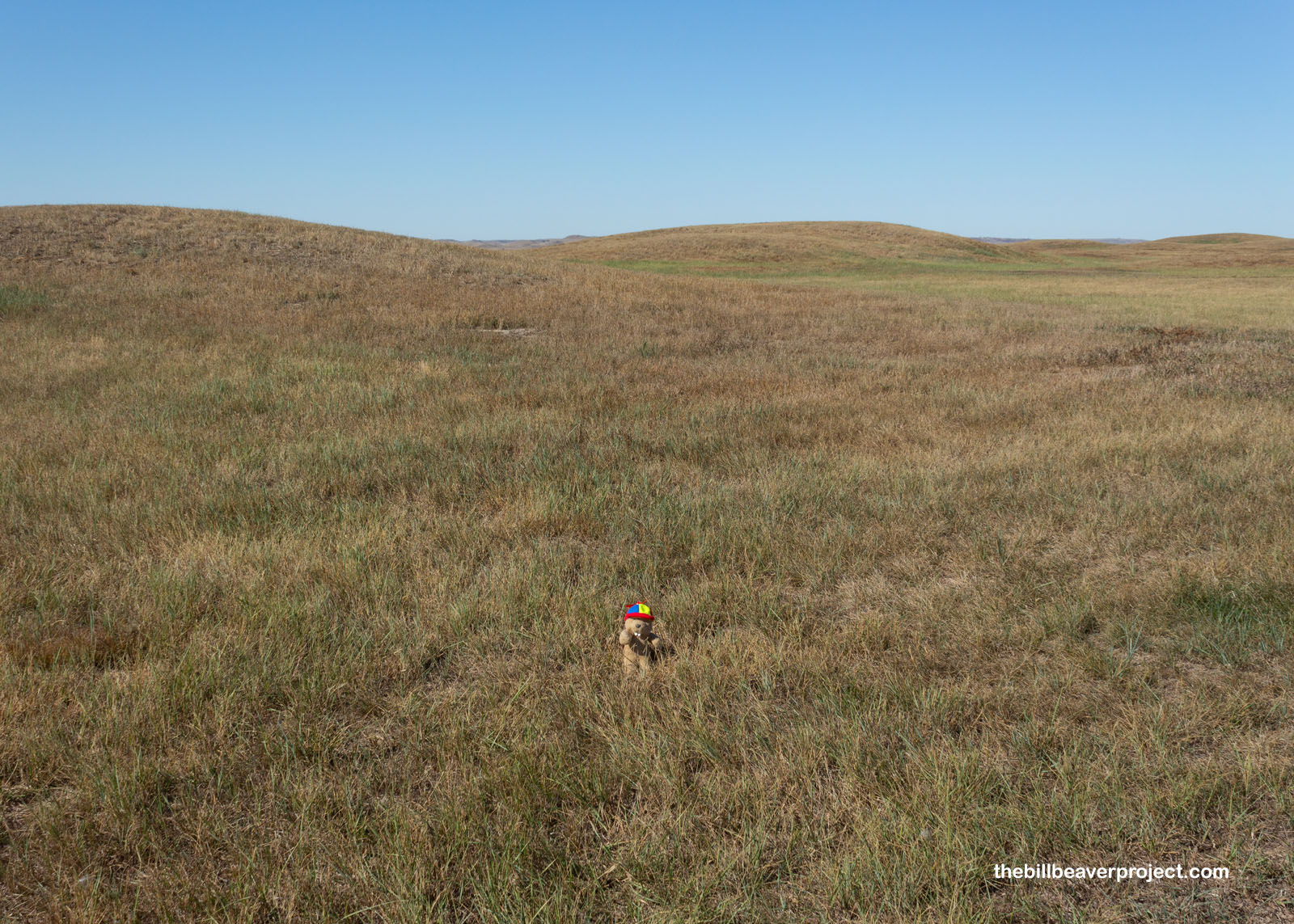
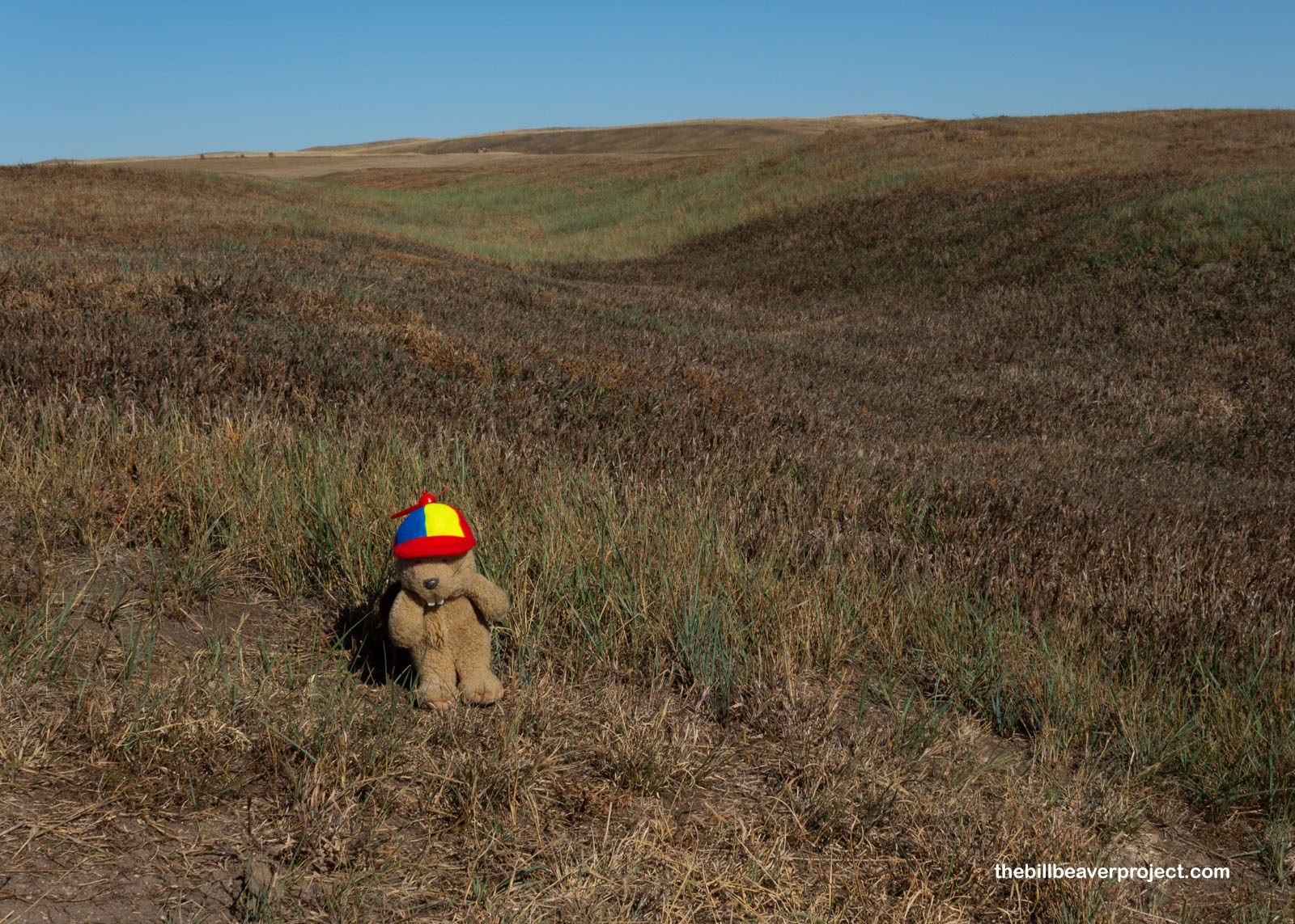
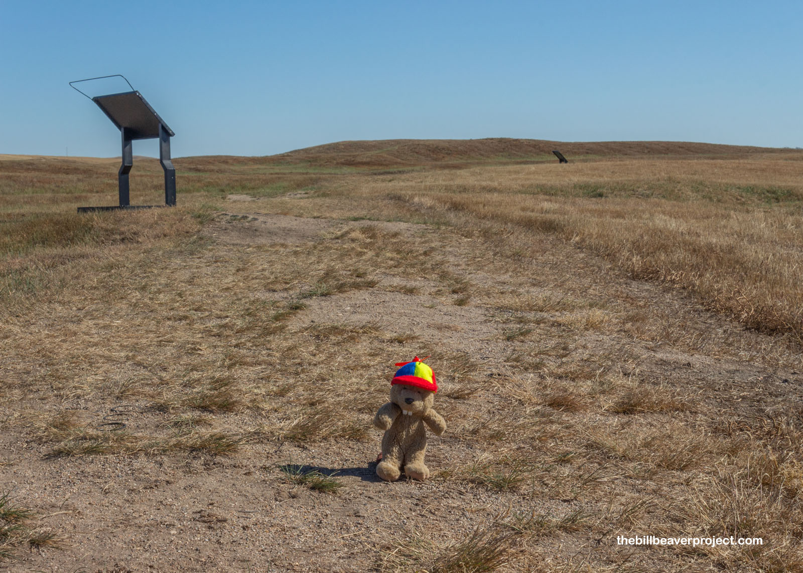
I came to a much larger Mandan village called Double Ditch, also reburied under earth mounds that were hard to photograph! This village was older than Chief Looking’s village and longer lasting, by about 200 years, one of seven to nine major villages to be settled in the area!
 |
 |
Double Ditch got its name for a pretty obvious reason: there were two ditches surrounding the entire village, likely the remains of fortifications. More of these ditches were later discovered, but the name stuck!
 |
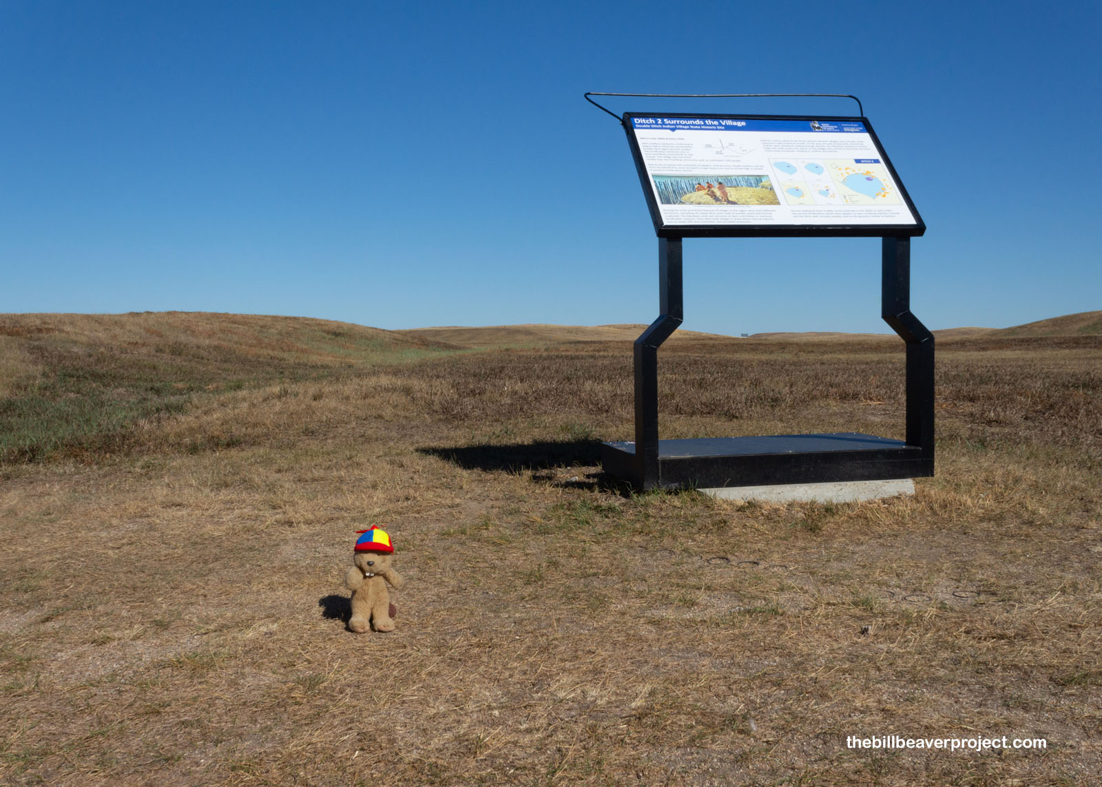 |
The inhabitants of Double Ditch lived in earth lodges, now pretty well buried by the ages, growing the three sisters (squash, corn, and beans) and hunting buffalo. With a peak population of close to 2,000 residents, they maintained a humongous trading network too, spanning all the way from the Pacific Northwest to the Gulf of Mexico, shipping produce and flint in exchange for shells, hides, and clothing! Sadly, all of this was not to last, because a smallpox epidemic hit the area, starting in 1781, wiping out most of the traditional Mandan villages, whose survivors moved further upriver and now mostly live on the Fort Berthold Reservation with the Hidatsas and Arikaras.
 |
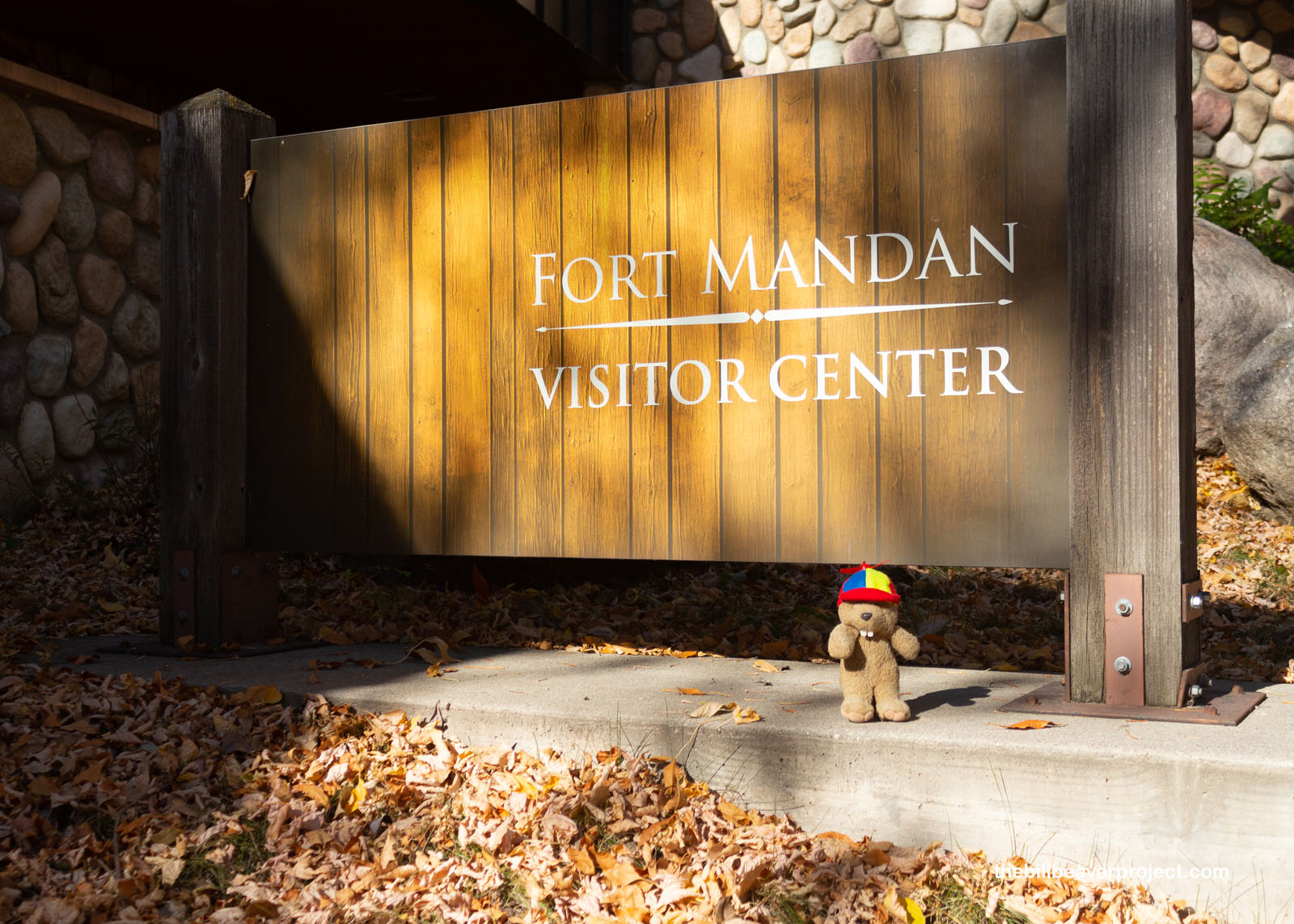
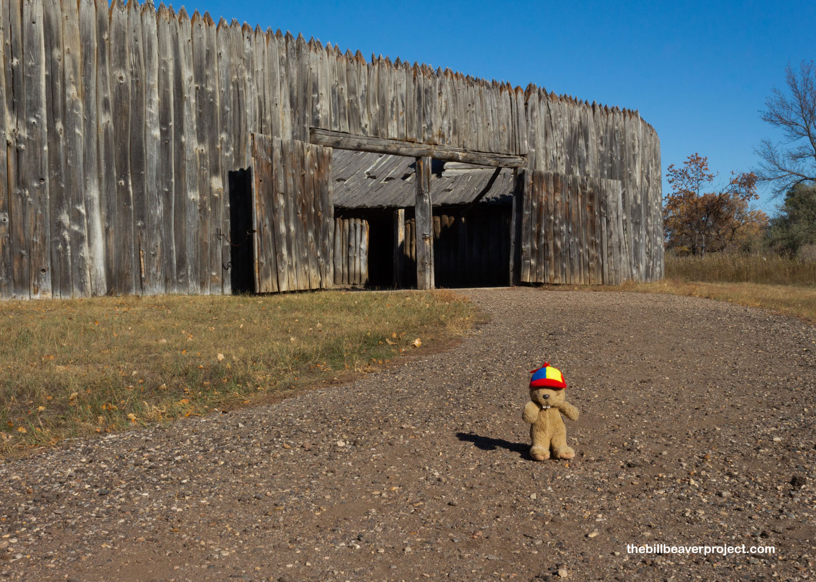
Two decades after the smallpox epidemic, Lewis and Clark passed through the area with the Corps of Discovery, setting up Fort Mandan on November 2, 1804, where they planned to spend that winter!
 |
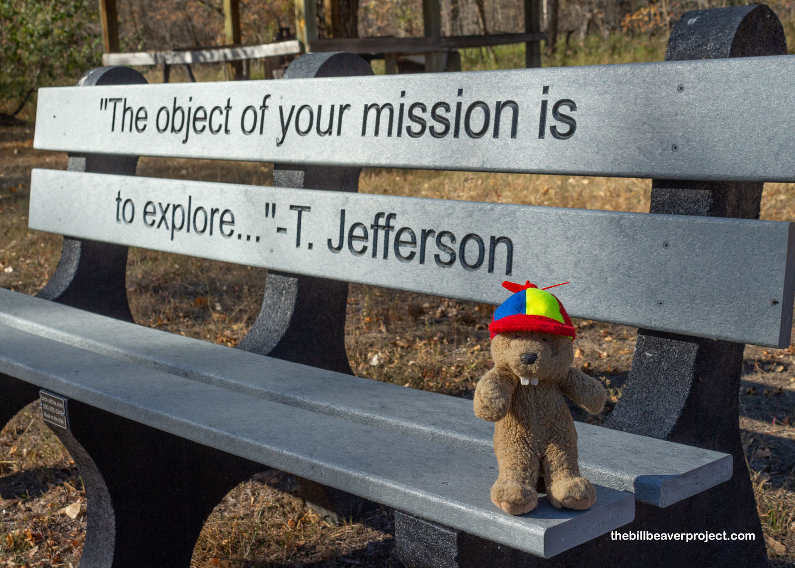
As we well remember, they were on a mission to explore the territory that the US had gained by the Louisiana Purchase, primarily to find a way to the Pacific coast by river, if possible! This quote by Thomas Jefferson, though, stands the test of time and circumstance!
 |
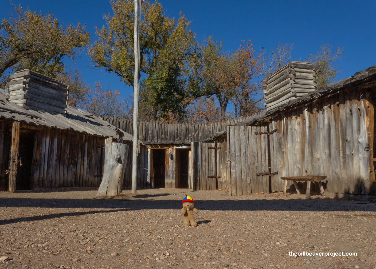
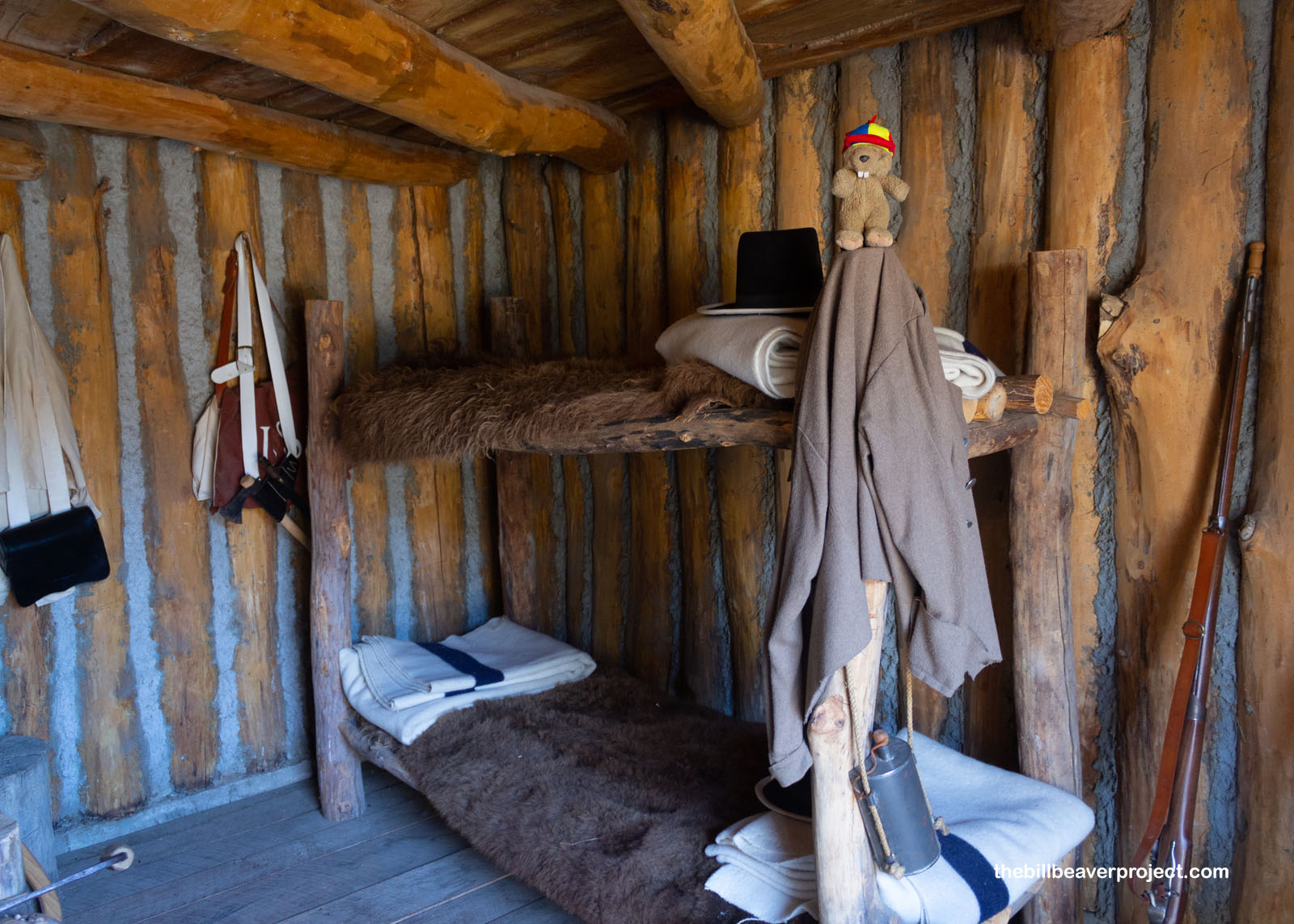
Technically speaking, the original fort was about 10 miles upriver, exactly where, no one knows. But this reconstruction was built in line with the expedition leaders’ notes and serves as a great place to learn about this winter camp!
 |
 |
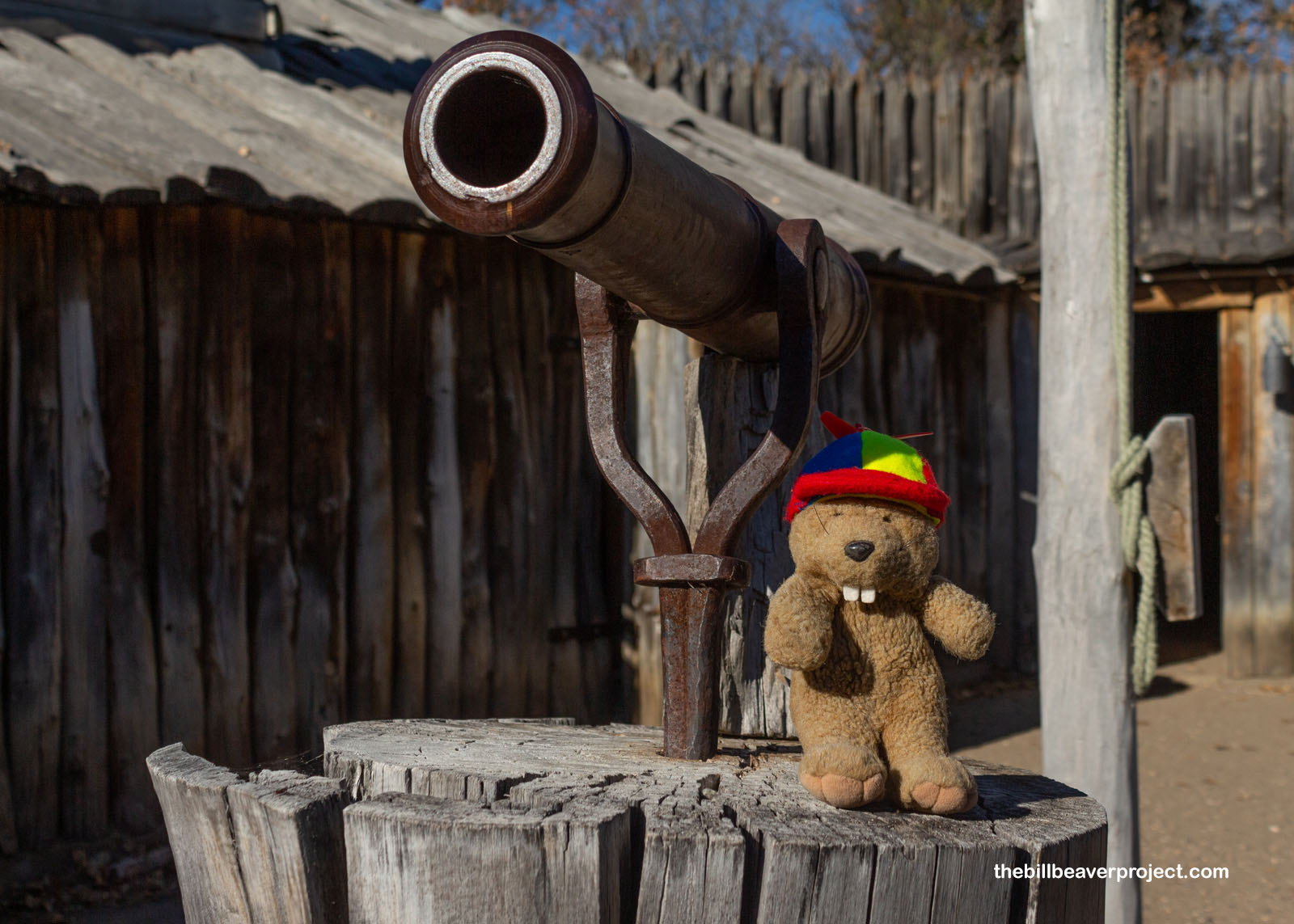
Guarding the post was a special swiveling gun that I mistook for a telescope! Luckily, they never had to use it during their five-month stay here, and a big reason for that was because of how much the Corps of Discovery focused on diplomacy with the local tribes, including their new neighbors, the Mandans! In fact, Chief Sheheke-shote joined them on their way back, even going on to visit Washington, DC!
 |
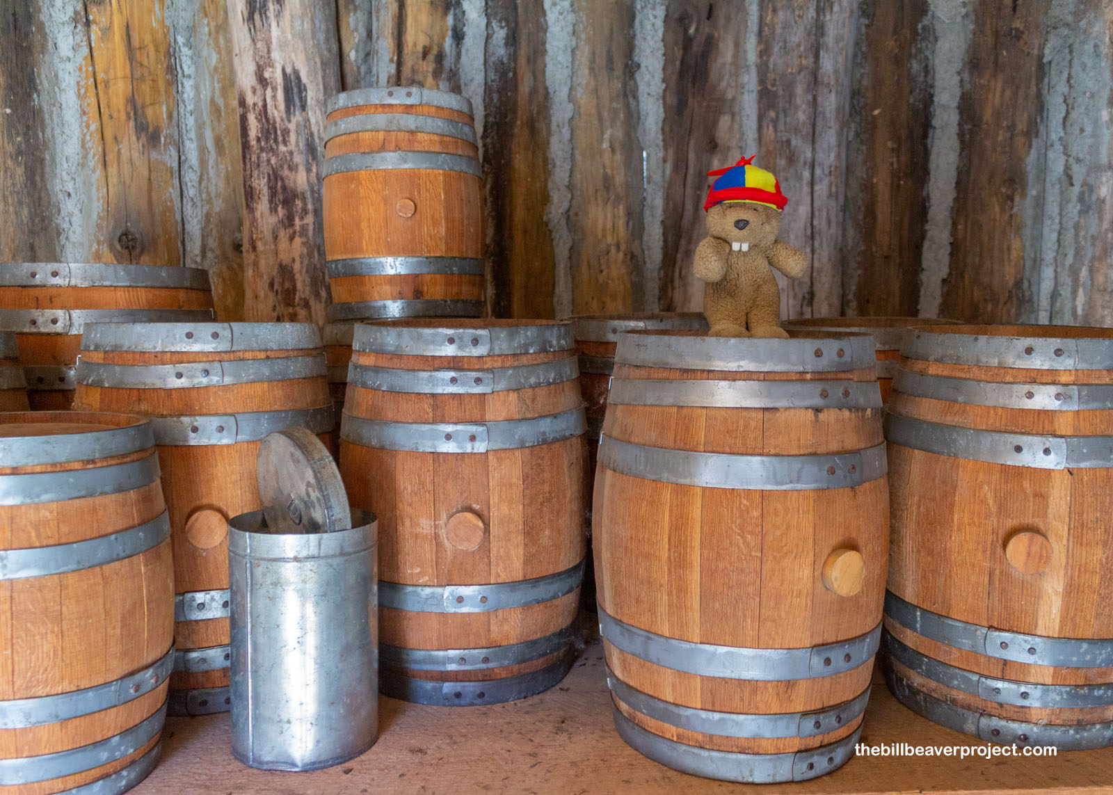
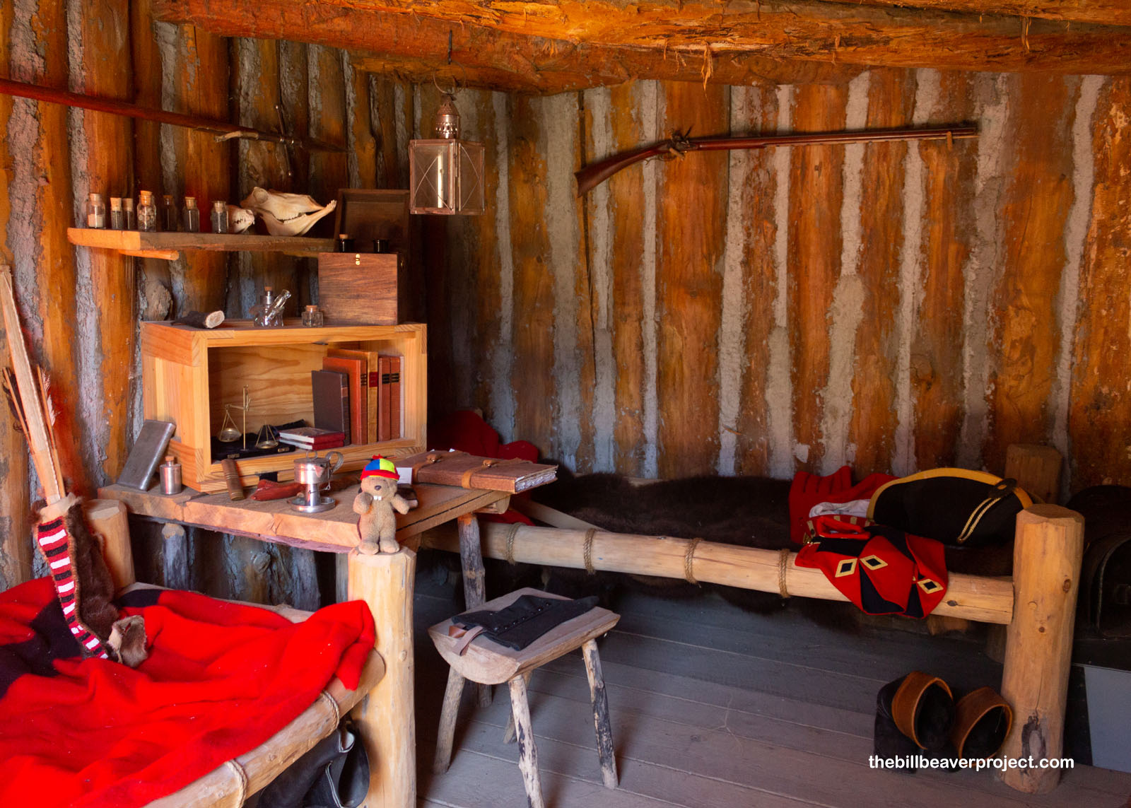
There were rooms for two soldiers each, along with storage and a smokehouse for storing whatever meat they were able to get in an otherwise poor hunting area! Some of these rooms had ladders, which soldiers could climb into lookout towers atop the fort!
 |
 |
There were also rooms for the expedition leaders, and significantly, for the interpreter, Toussaint Charbonneau, and his 16-year old wife, Sacagawea! This is both where she had their baby, Jean Baptiste, or Pompy, and where she famously joined their expedition as guide!
 |
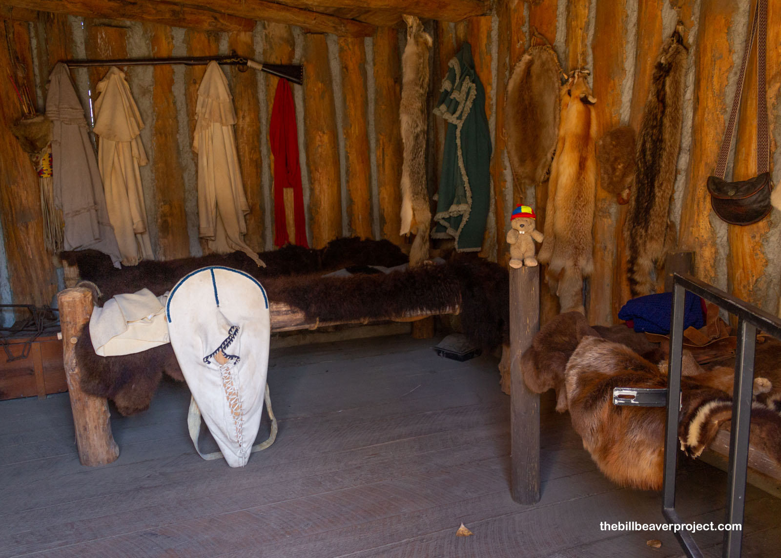 |
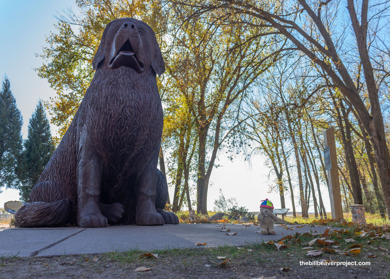
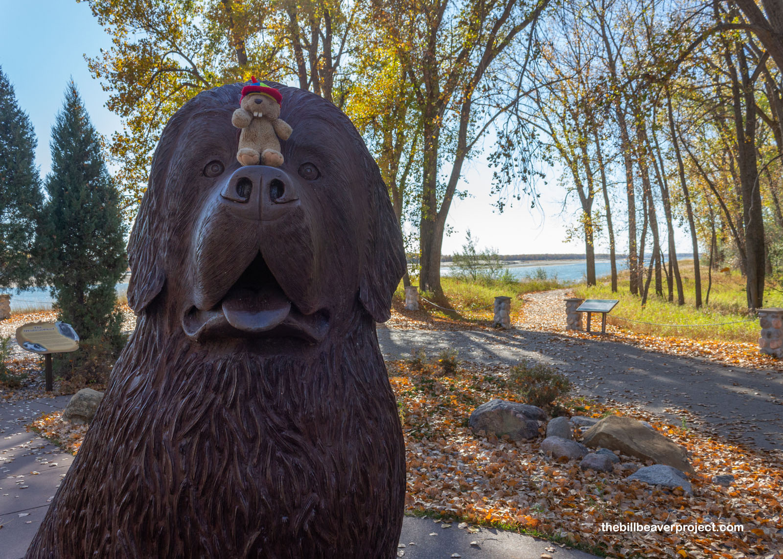
This was also the first place connected to Lewis & Clark that I’ve ever seen to honor their huge Newfoundland named Seaman! Captain Lewis had bought him for $20 in Philadelphia, and as an expert swimmer, he was super helpful in helping them catch food and in keeping watch! He isn’t mentioned much in the journals, but it seems he completed the entire journey with them!
 |
 |
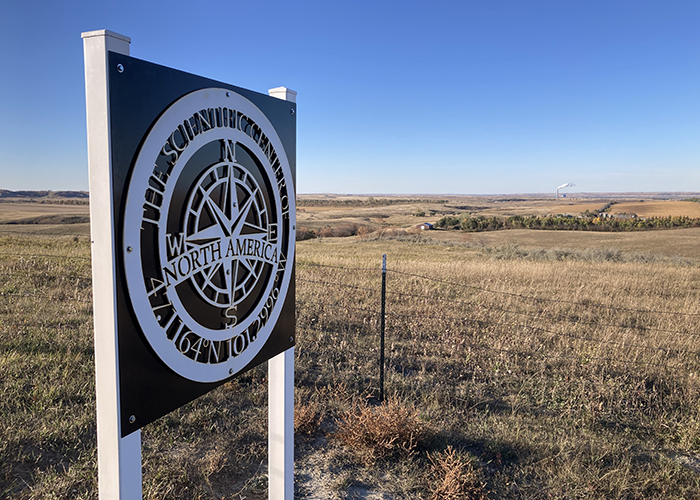
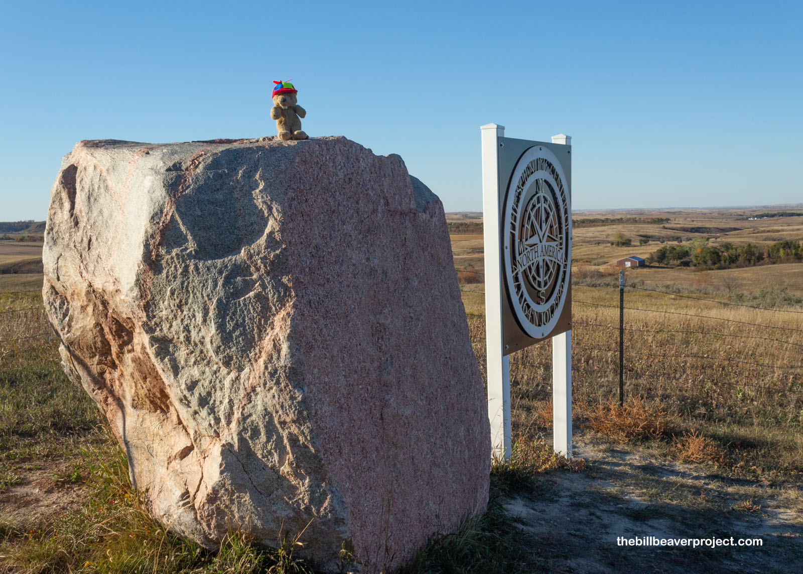
And then, like the Corps of Discovery in 1806, my journey concluded. Like the stories of the Mandan, I’d reached the center! This spot, marked by the flags of Canada, the USA, and Mexico, is the geographical center of North America! In fact, it’s located near the town of Center, a complete coincidence, as the town was named for being the center of Oliver County!
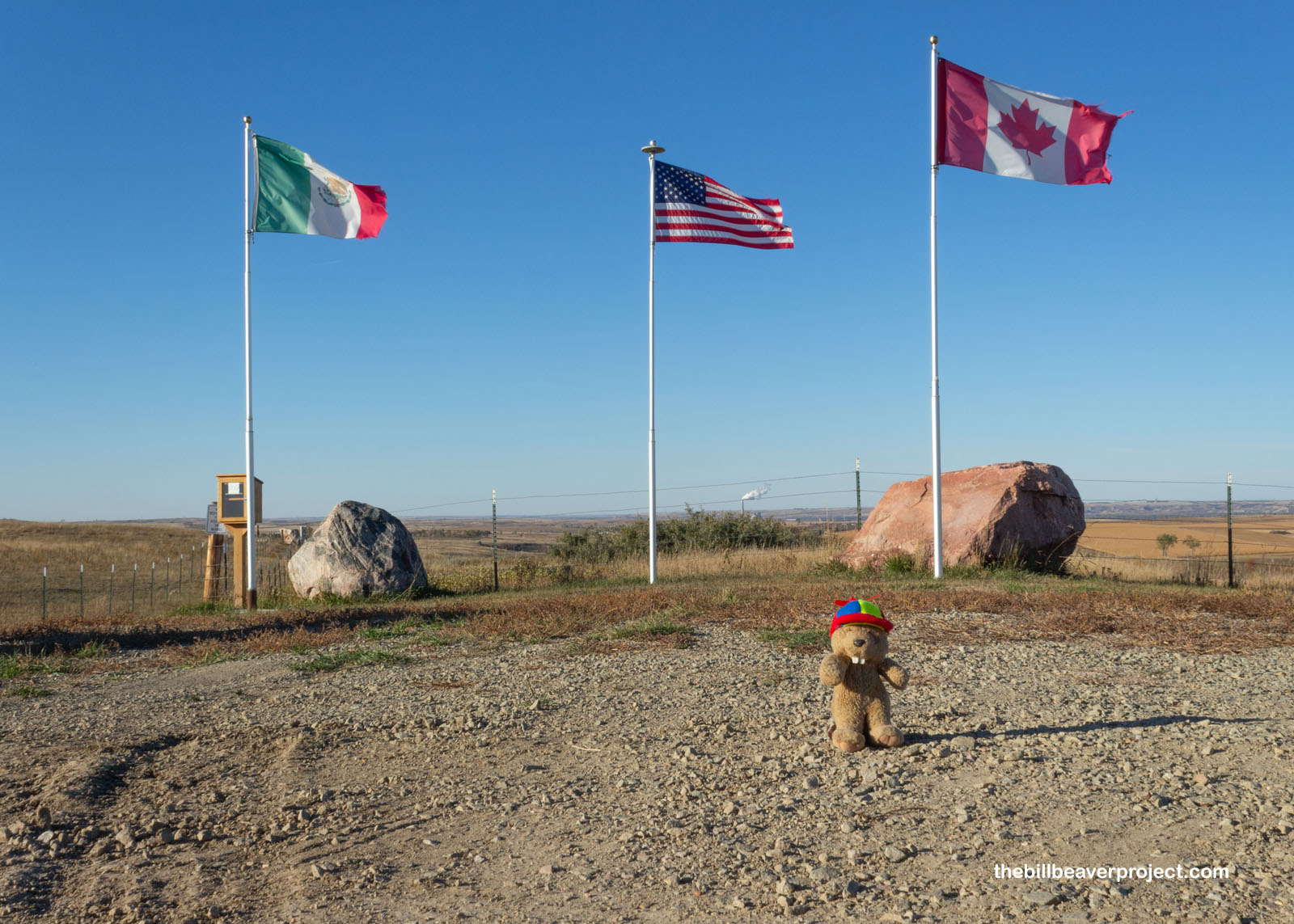 |
There’s some controversy over this spot, of course! The town of Rugby, North Dakota originally laid claim to North America’s belly button in 1931, setting up a monument and a small tourist industry around it. Unfortunately for them, they had calculated incorrectly without taking into account the curves of the globe! That much was done in 2015 by geography professor, Peter Rogerson, of the University at Buffalo, which led to some sternly worded letters from Rugby’s lawyer! But today, this rock marks the geographical center of North America!
 |
It’s kind of wild to imagine that a place like North Dakota would be the center of the continent. Calling the state “Middle Dakota” would sound weird with no states above it, after all! I felt sorry for the town of Rugby, but they have history and kitsch on their side, though it would have taken hours to get there from Bismarck. As the day closed out, I took out the Flutter Phone once more to capture my arrival!
And now, with the sun setting, the time has come to head west of Center to my next destination. North Dakota has already been so full of surprises. I wonder what other surprises will be in store when I visit Theodore Roosevelt National Park tomorrow!
Stay tuned!

More 2022 Adventures |
Bismarck, ND → Washburn, ND → Dickinson, ND 165.0 mi (265.5 km) |
Next Day |