 Previous Day |
Dickinson, ND → Theodore Roosevelt NP → Dickinson, ND 170.3 mi (274.1 mi) |
 Next Day |
I’m ready, Teddy (and everyone)!
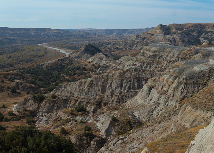
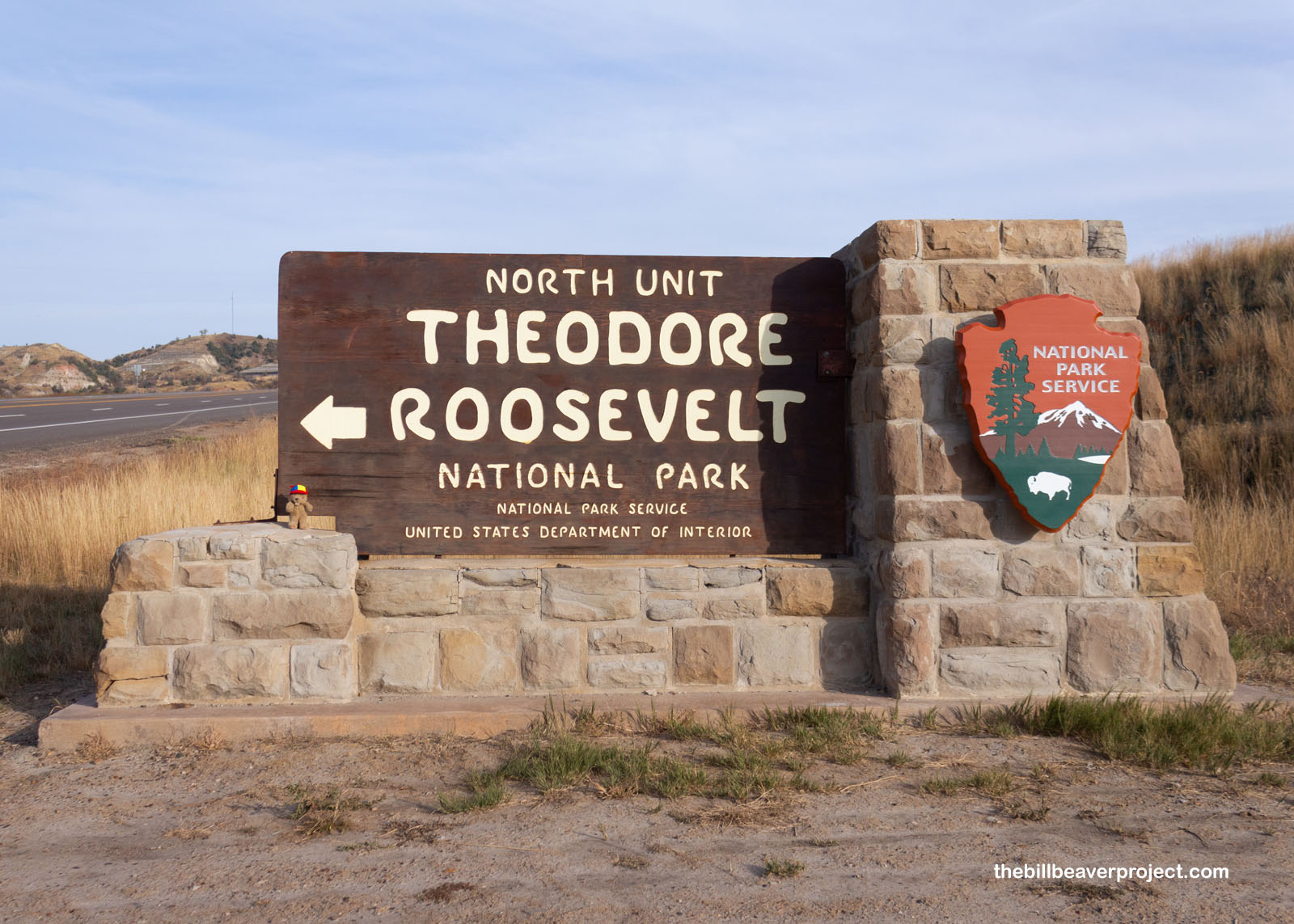
Today, I’m visiting North Dakota’s one and only national park! Split into two units, Theodore Roosevelt National Park surrounds the remote badlands where the 25th President of the United States set up his Elkhorn Ranch in 1884. I’m starting with the north unit, which is more remote!
 |
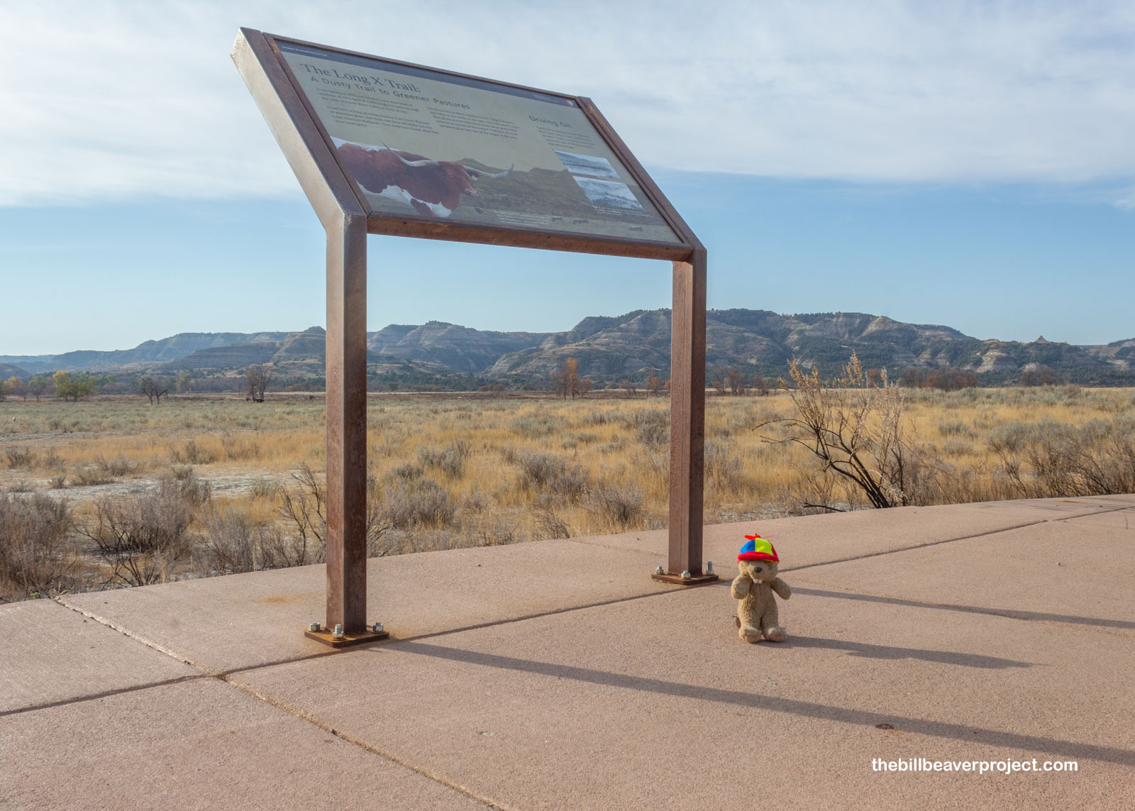
The one-way road leading into the park crosses the Long X Trail, the path that cowboys used in the late 19th Century to drive their cattle north from Texas to feast on the grasslands where the bison had been all but exterminated. Today, bison have been restored to the badlands along the Little Missouri River, but the park also maintains a herd of Texas longhorns as a callback to the days of the cowboy!
 |
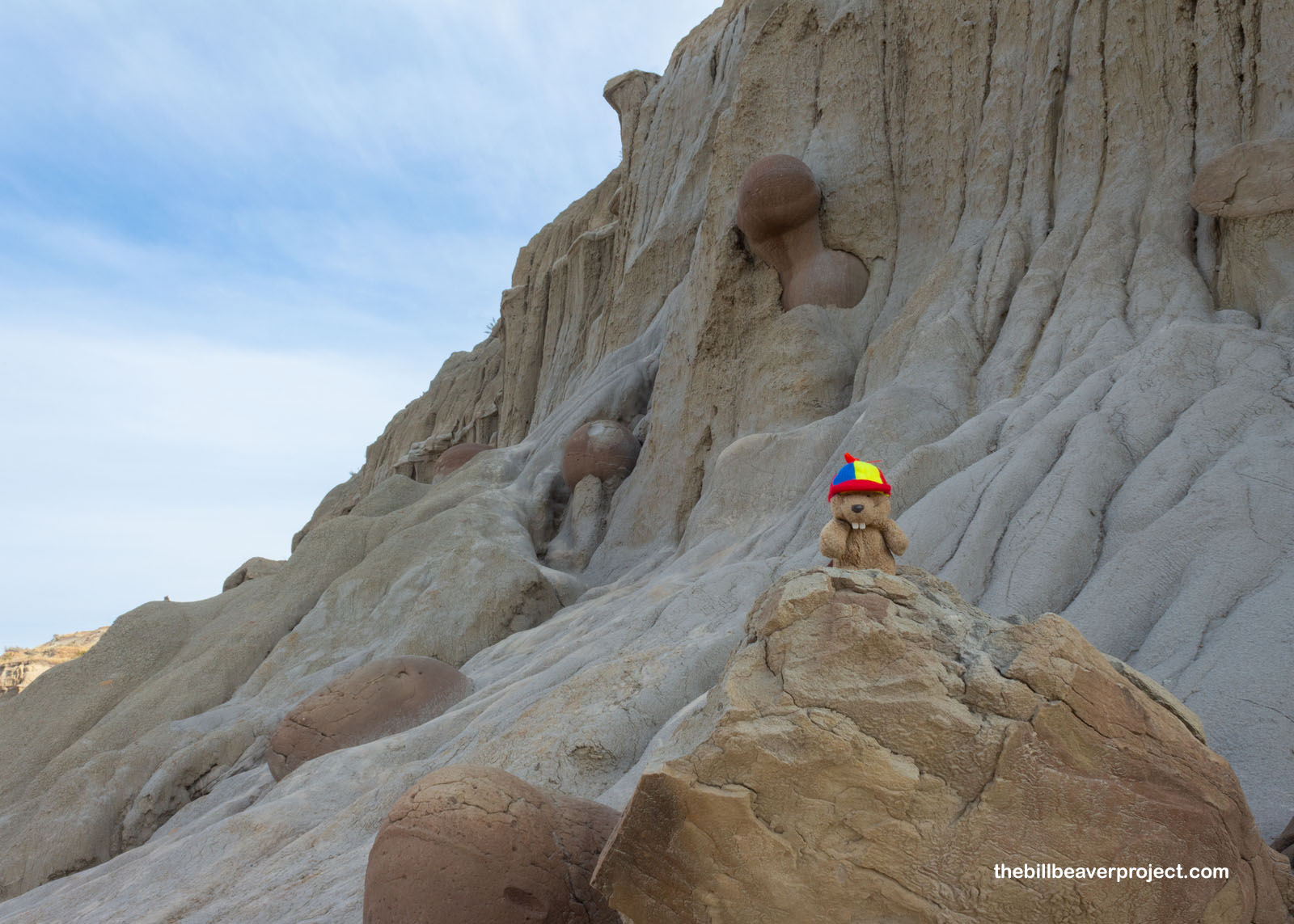
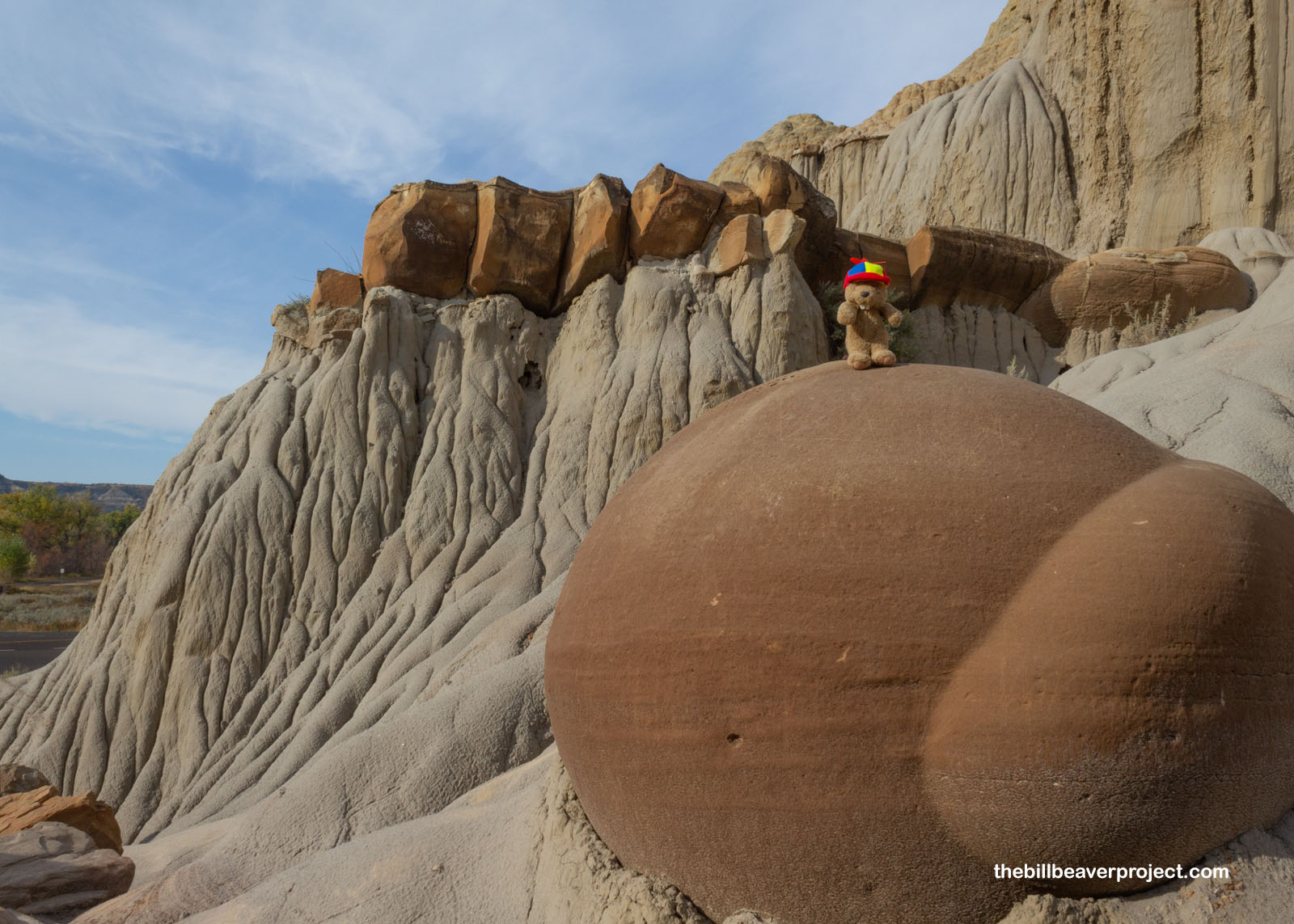
Apart from bison, some of whom I saw from far away, the park’s most famous roadside attractions are its cannonball concretions! I saw a bunch of them yesterday outside the North Dakota Heritage Center, but this is where they came from!
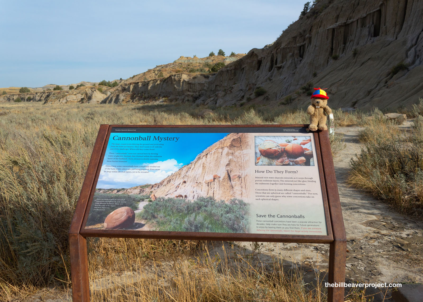 |
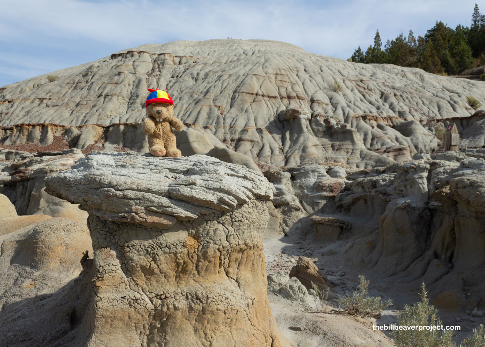
These huge spheres are made from mineral deposits building up inside looser sediments. As water flows down through the sediments, it leaves behind minerals in the gaps, which built up into unusual, hard shapes, like these cannonball concretions! Over time, they’ll erode out of the original sediment and roll on down to the ground! I was kind of sad to see that every single one had been vandalized, which is a hazard of roadside attractions!
 |
 |
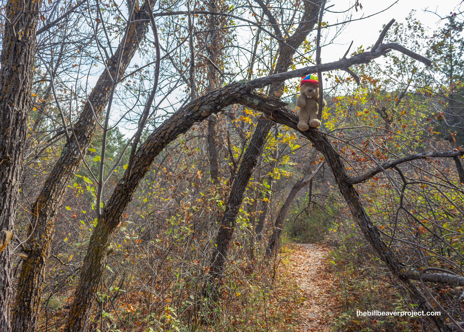
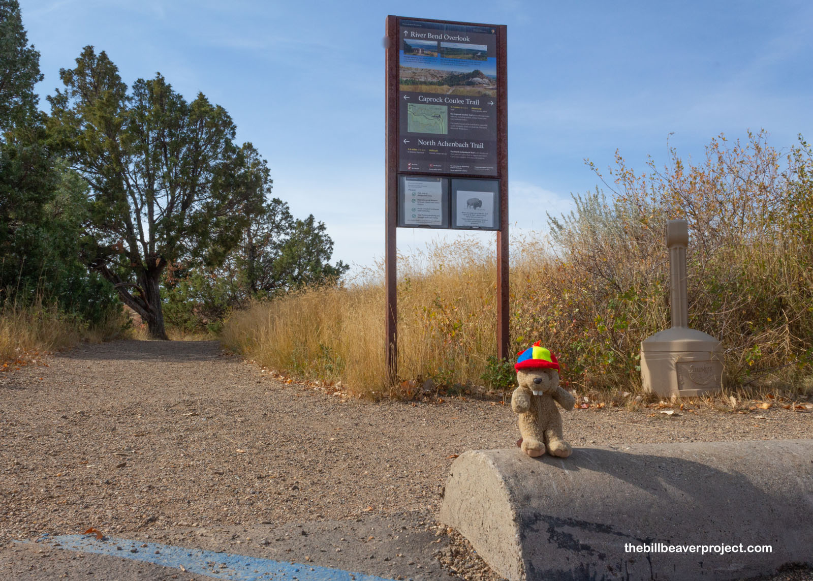
And then I came to my first crowded parking lot after barely seeing anyone else. October is definitely the low season for visiting the park, and I didn’t mind that one bit. However, I’d just arrived at one of the North Unit’s most popular loops: the 4.1-mile Caprock Coulee Trail!
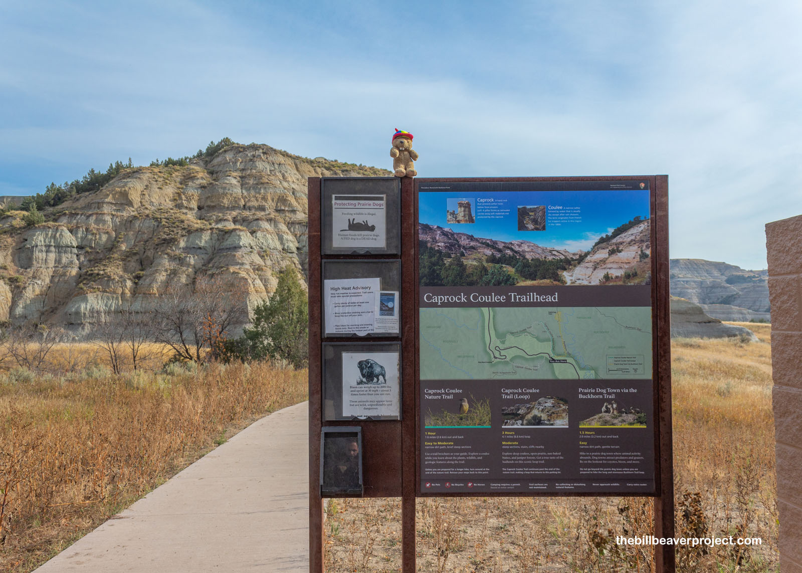 |
I was probably biting off more than I could chew, but I’ve never been one to turn down a must-hike trail! Besides, the morning was cool and pleasant as can be, though I had to keep my ears open just in case I ran into a big ol’ bison! By the way, a caprock is like a geological umbrella! When hard rock, formed like those cannonball concretions, sits on top of softer rock, it shields that softer rock from erosion, forming hoodoo-like pillars underneath it! And coulees? Well, those are just the narrow valleys winding across the Badlands!
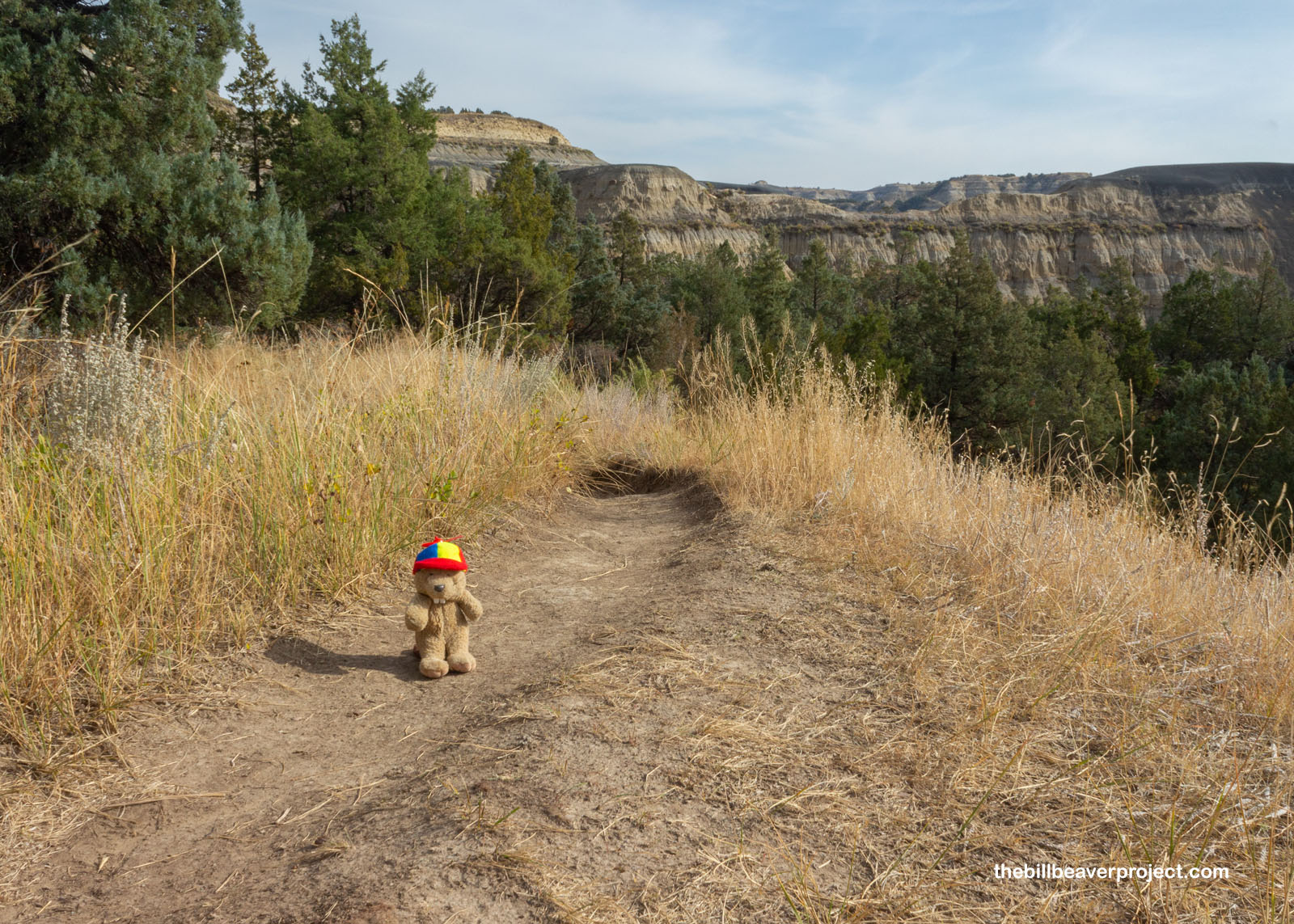 |
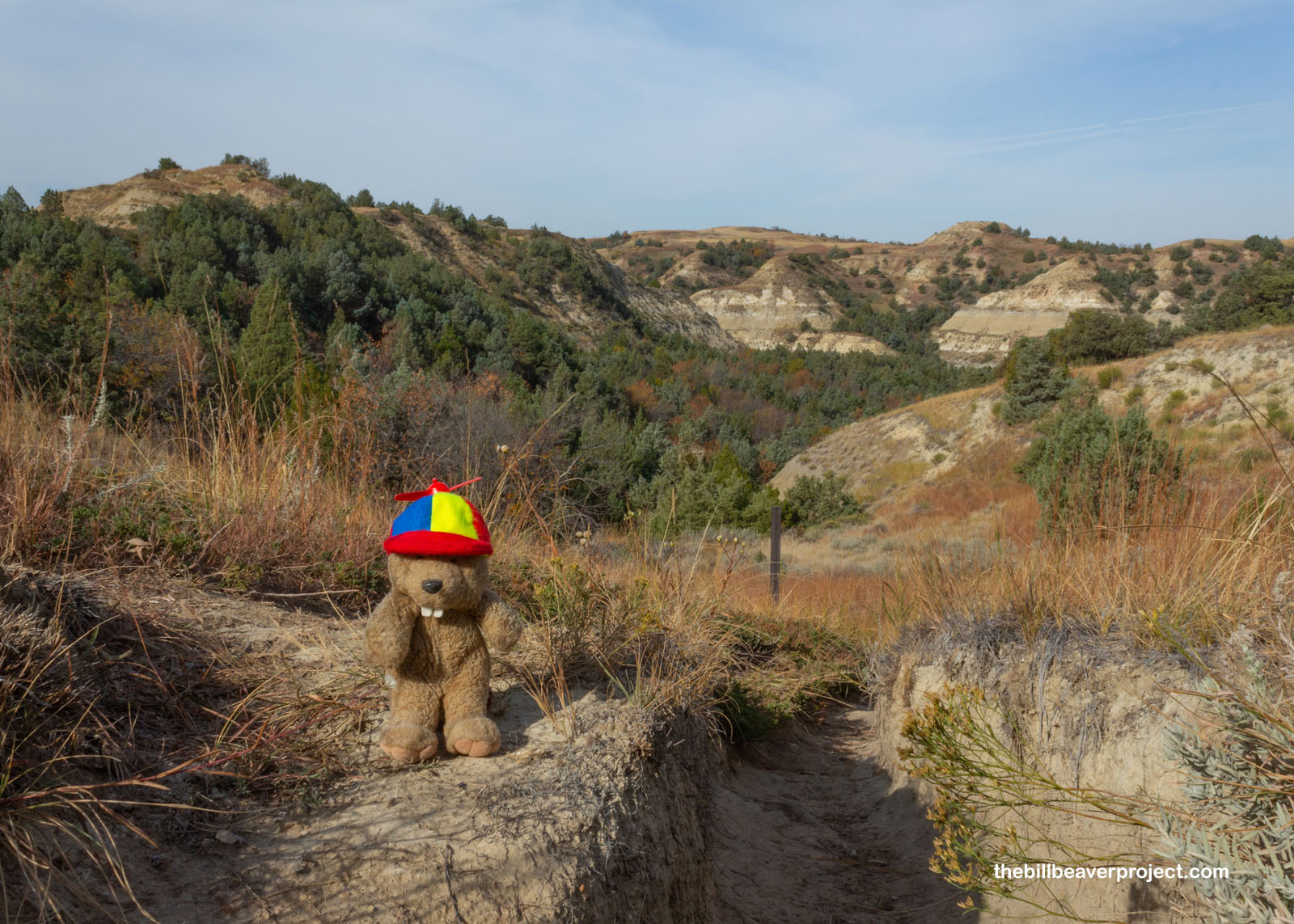
The trail started as a wander through woodlands with a couple glimpses of the huge alluvial formations that make the Badlands so distinct, and then the trail started to go upward. I could tell that a vista was up ahead!
 |
Sure enough, the trail kept on ascending right to the top of these hills! I left the trees behind in their coulees and trekked across the saddles with views getting grander on both sides!
 |
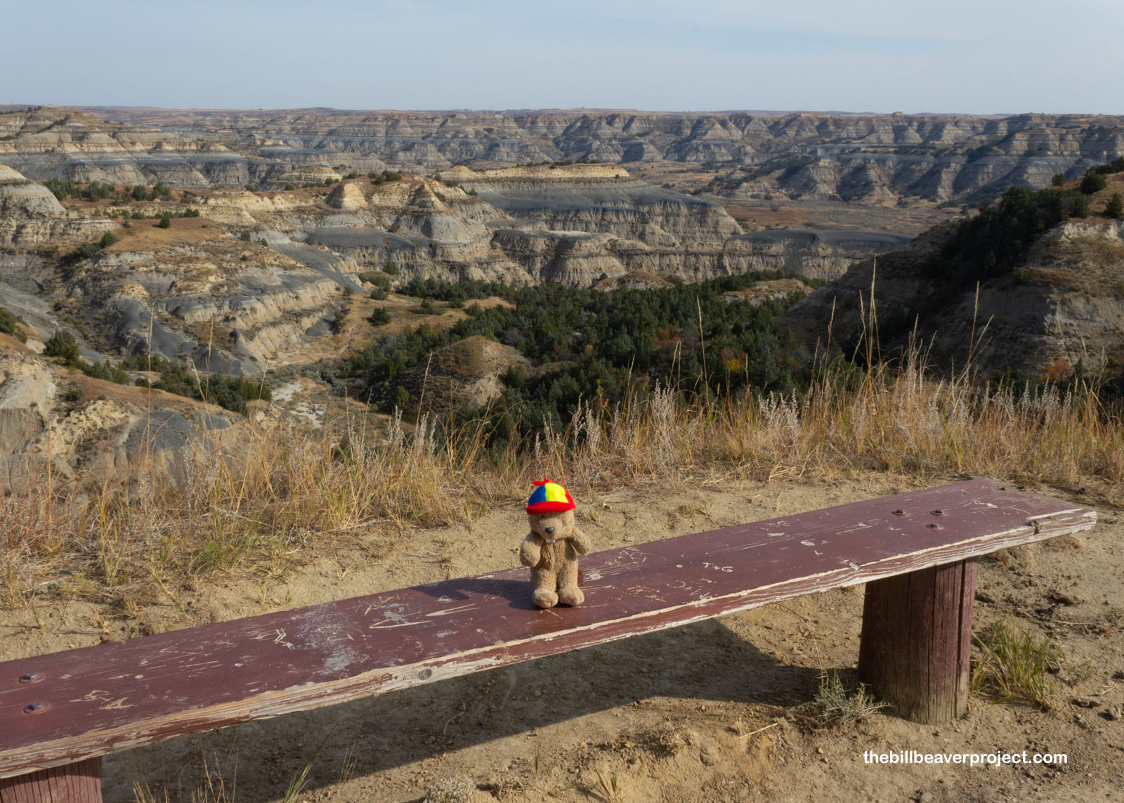
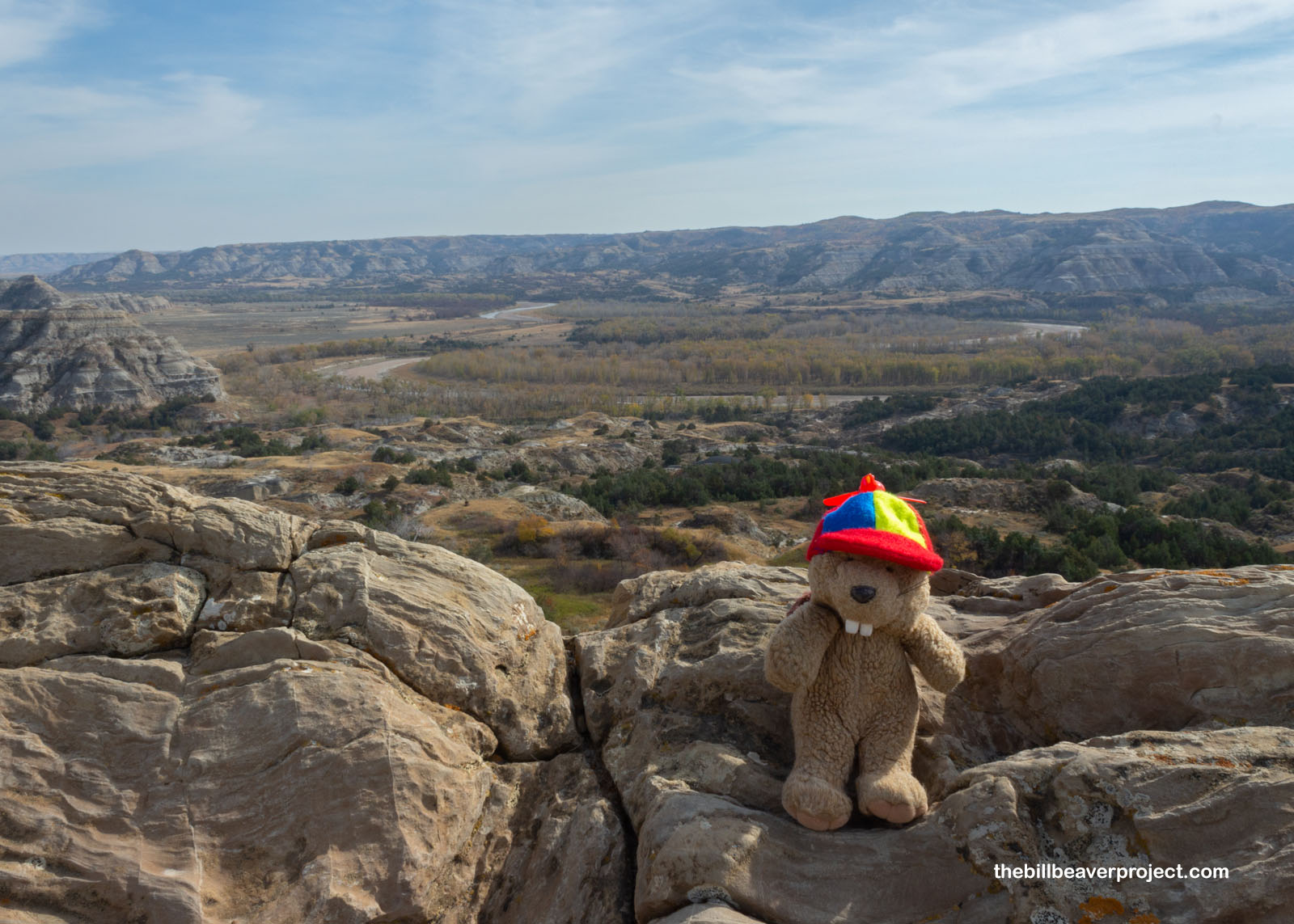
And then I reached a bench and took a look back. Whoa! The Badlands of North Dakota are layered with colors from yellow-ish bentonite clay to black coal to red sediments called clinker or scoria that have been baked by burning coal! Millennia of rainfall washing away the softer sediments have given us the neat shapes of the hills that we can see today!
 |
And then I got kind of lost, because I was approaching the road and one of the other spots on the driving tour. I couldn’t remember if I was supposed to be anywhere near the road on this loop! I’d been on longer-than-expected hikes before, but I was really hoping not to spend the whole day without lunch! After watching a couple other hikers go on their merry way, I decided to try my luck and follow them!
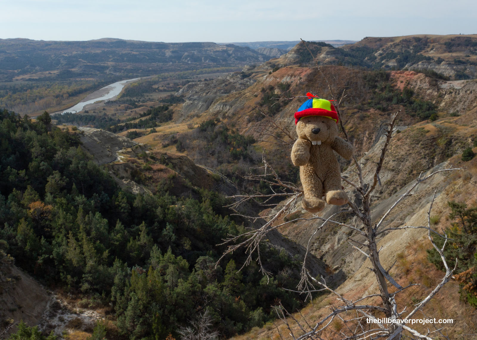 |
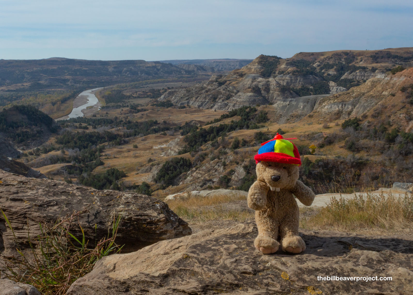
Luckily, that hunch brought me to the River Bend Overlook, where a useful sign showed I was still on the Caprock Coulee Trail! I took a little bit of a detour down to see the river valley before I continued on.
 |
Here are two different angles looking down over the Little Missouri River, one from that Overlook and the next from half a mile or so down the trail. The Little Missouri actually starts all the way over in Crook County, Wyoming, flows north through the Badlands of both Dakotas, then joins the main Missouri River in Dunn County, North Dakota after 560 miles! I couldn’t help but keep looking back as I wandered along the edge of its valley. I know they say it’s not good to look back, but on a day like today, I couldn’t help myself! Could you?
 |
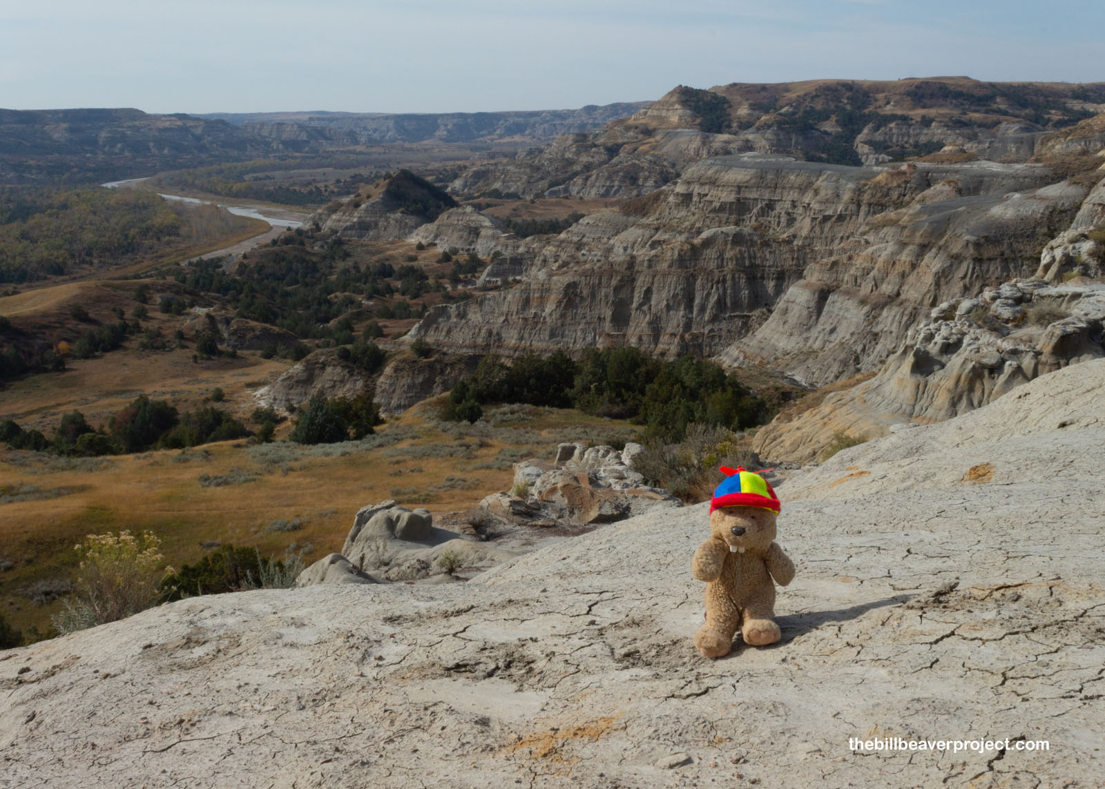 |
Climbing up over the hills, I found a great example of caprock! See how the hard stone on top is sheltering the softer clay from rain? That’s how it formed this neat stack! This part of the trail continued back up into the trees, then down around some dry hills that reminded me of Craters of the Moon National Monument before winding up right back at the parking lot where I’d started my trek! Quite the loop!
 |
Before saying farewell to the north unit of Theodore Roosevelt National Park, I stopped by the Oxbow Overlook, which interpreted the life of a wild river! As a river winds across a valley, it can form curves called oxbows, and sometimes those curves can get so deep that the tops join together, the water flows through the shorter route, and oxbow lakes get snipped off the original route! It’s a reminder that, no matter how long the landscape has looked a certain way, it’s always about to change!
 |
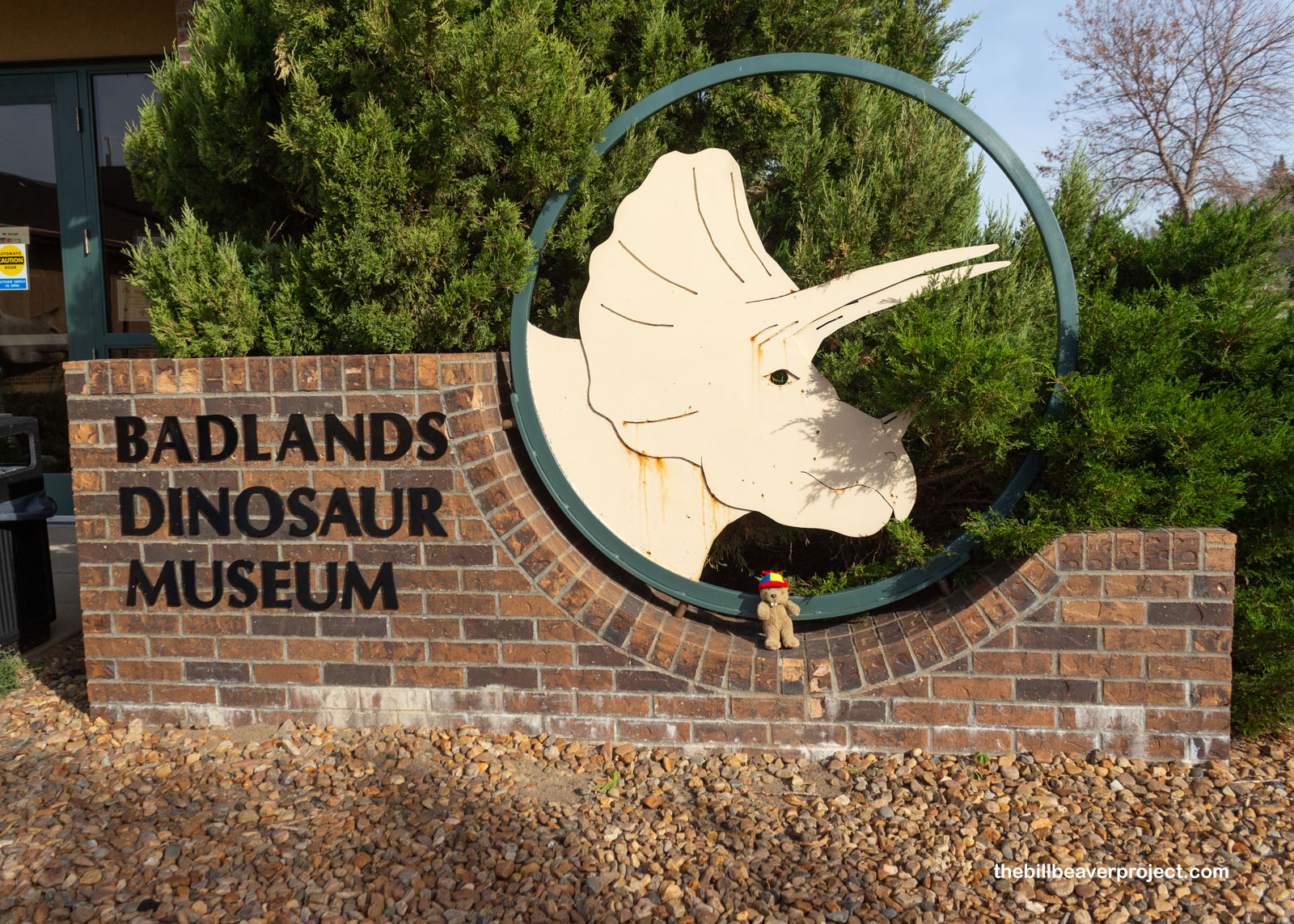
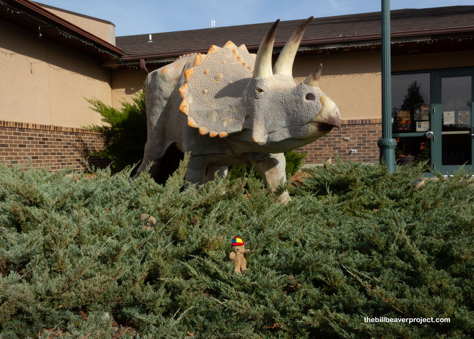
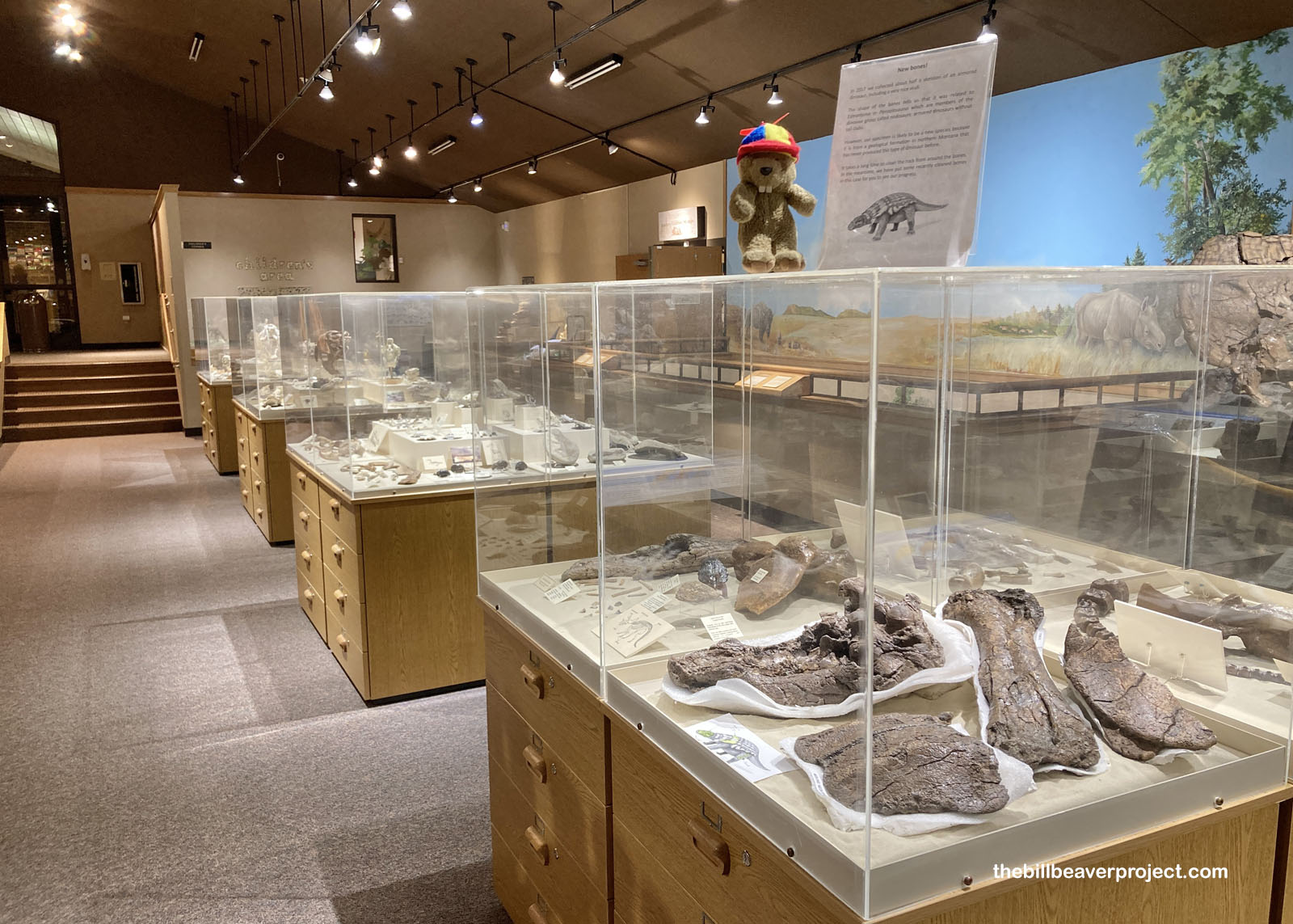
I returned to the city of Dickinson to get some lunch and because I wanted to see more dinosaurs! Dickinson is home to the Badlands Dinosaur Museum, after all, and what awaited me inside was much more than I bargained for!
 |
 |
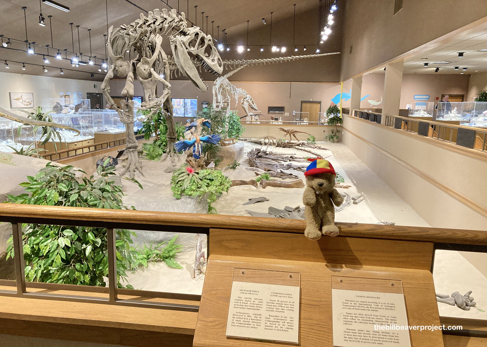
For being enclosed in a single room, this dinosaur museum was packed full of specimens from giant allosaurus and stegosaurus to tiny compsognathus! I expected their collection to be more local, but they had specimens from all around the world. The goal, after all, is education!
 |
But they did have some local finds for sure! In this case, the museum showed off some of its own excavation work, some freshly cleaned bones from what might be a new species of nodosaur! These armored plant eaters are well known from other areas of the Hells Creek Formation, but when these bones were found in 2017, they were in an area where no nodosaur had never been seen before! It could take even more work over even more years before a new species would be named though.
 |
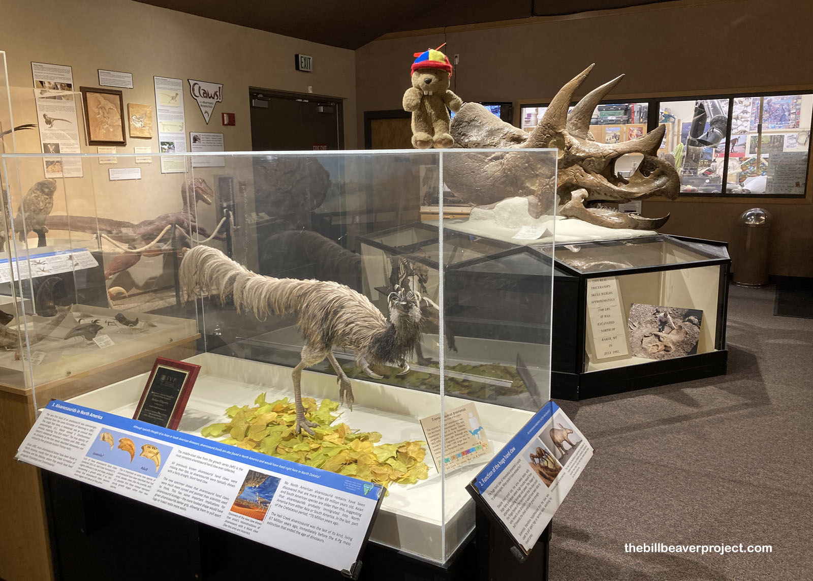
But the most unique member of the museum’s collection (apart from the Triceratops skull named Bill in the background) was this emu-colored reconstruction of a really strange dinosaur! Called Trierarchuncus prairiensis, or “Captain Hook of the Prairie,” this insect-eating critter had stumpy arms with only one claw! It’s believed that they used this claw to open up ant and termite nests like a modern anteater! For 103 years, these fossils were believed to belong to a different type of dinosaur, until 1995, when a grad student named Thomas Holtz noticed how similar they were to another species in Mongolia called Mononykus! Today, we have a much better understanding o Captain Hook and its fellow alvarezsaurids as they roamed the northern plains alongside their more familiar giant counterparts!
 |
North Dakota’s been full of neat surprises so far, and I can’t wait to see what the south unit of Theodore Roosevelt National Park has in store tomorrow! For being called badlands, this dry landscape sure offers up a good time!
See unit soon!

Previous Day |
Total Ground Covered: 335.3 mi (539.6 km) |
Next Day |