 Previous Day |
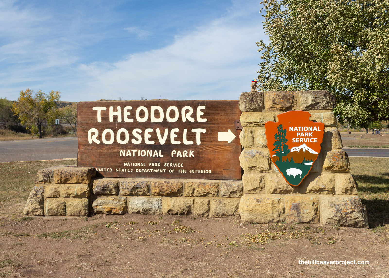
Dickinson, ND → Theodore Roosevelt National Park → Bismarck, ND 217.0 mi (349.2 mi) |
 Next Day |
Color me speechless, everyone!
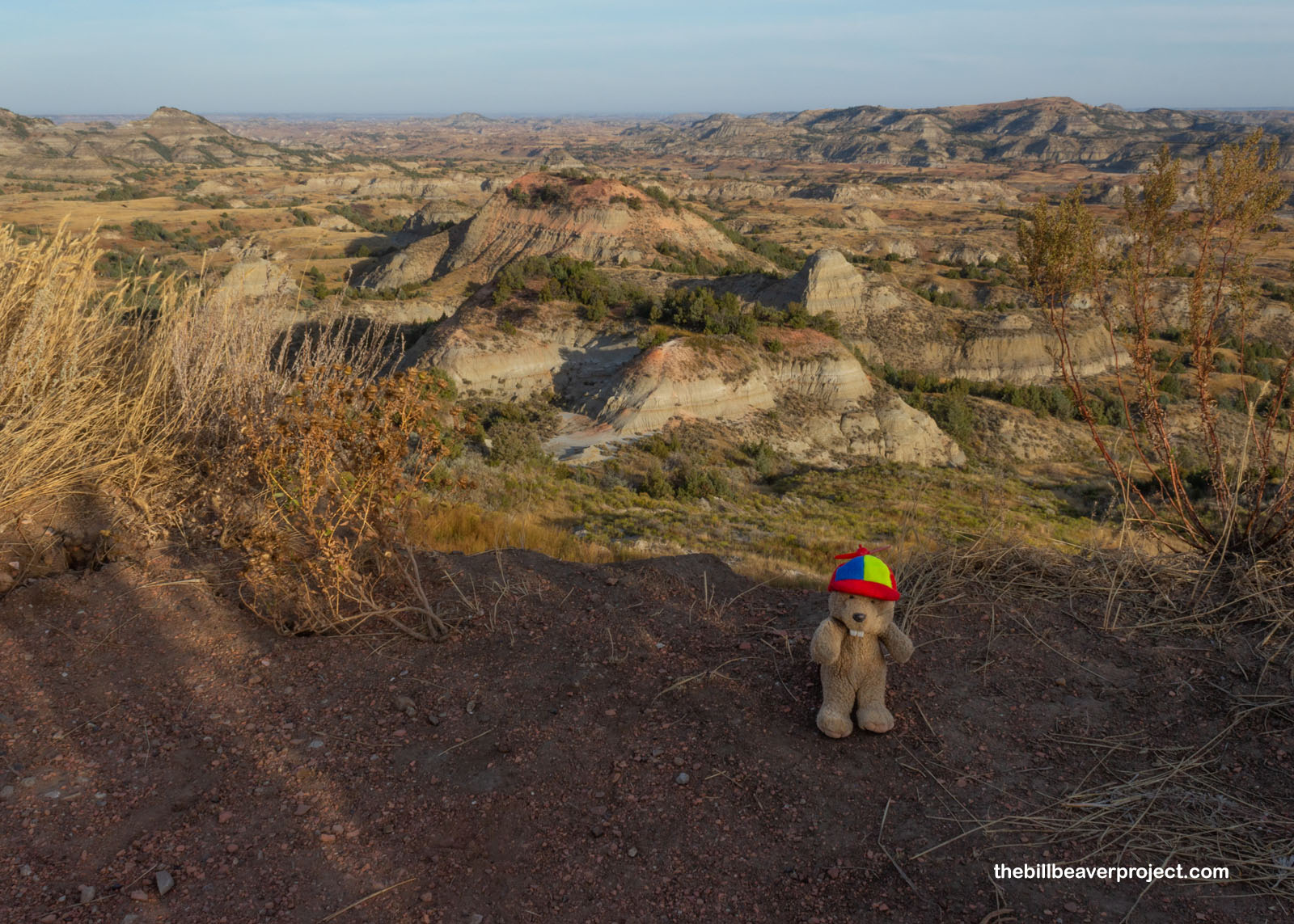
This morning, I set out to see what wonders awaited in the south unit of Theodore Roosevelt National Park! Without further ado, let’s jump right into my descent into Painted Canyon! Just look at that view in the morning light! I was quick to scramble down the very steep slopes that had nonetheless been trampled flat by herds of bison!
 |
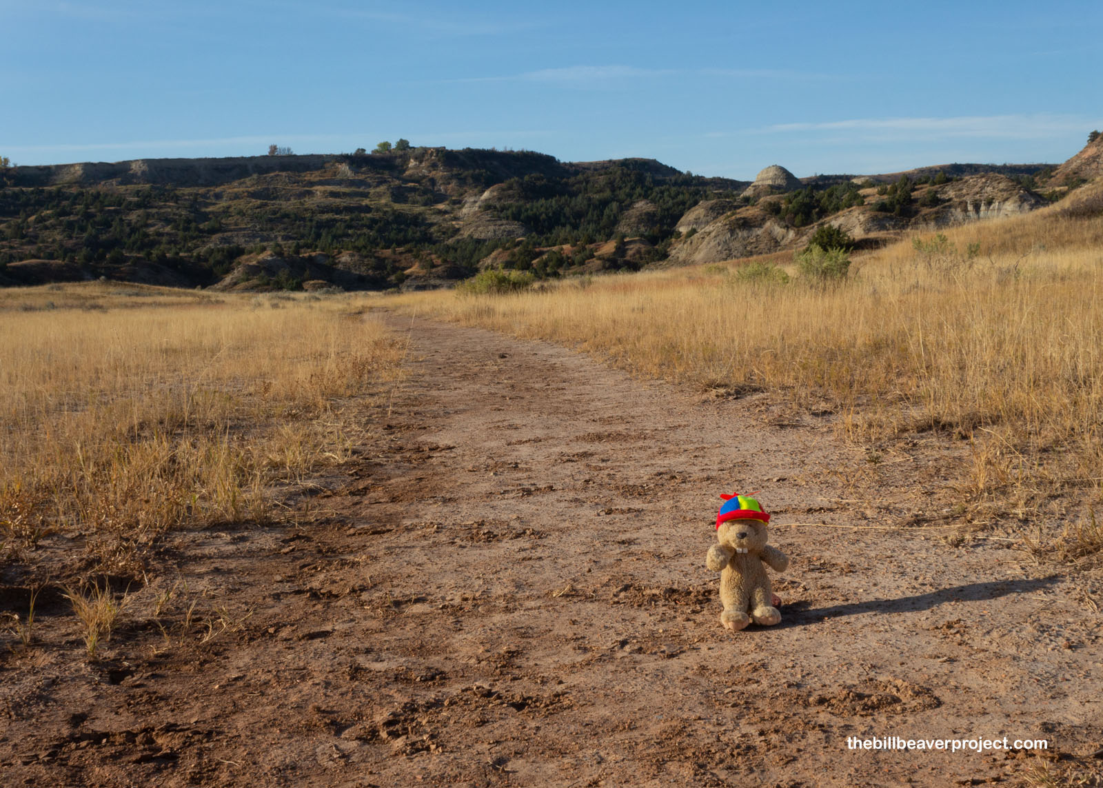
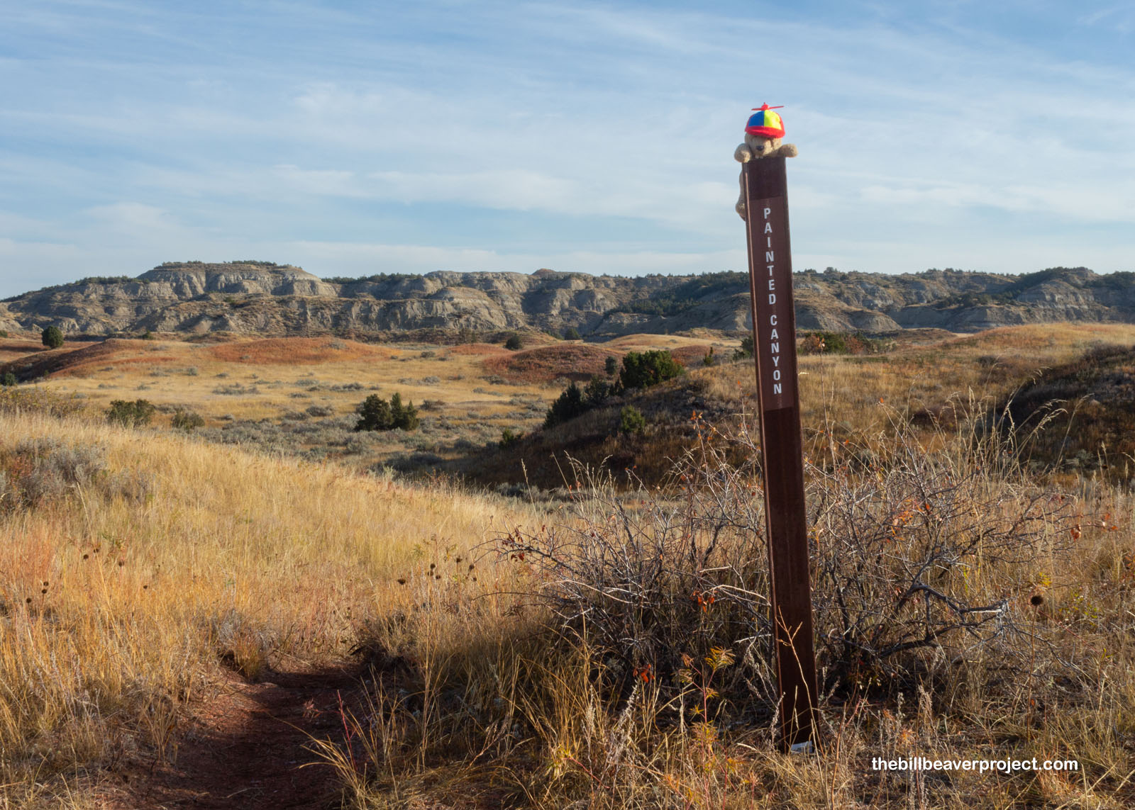
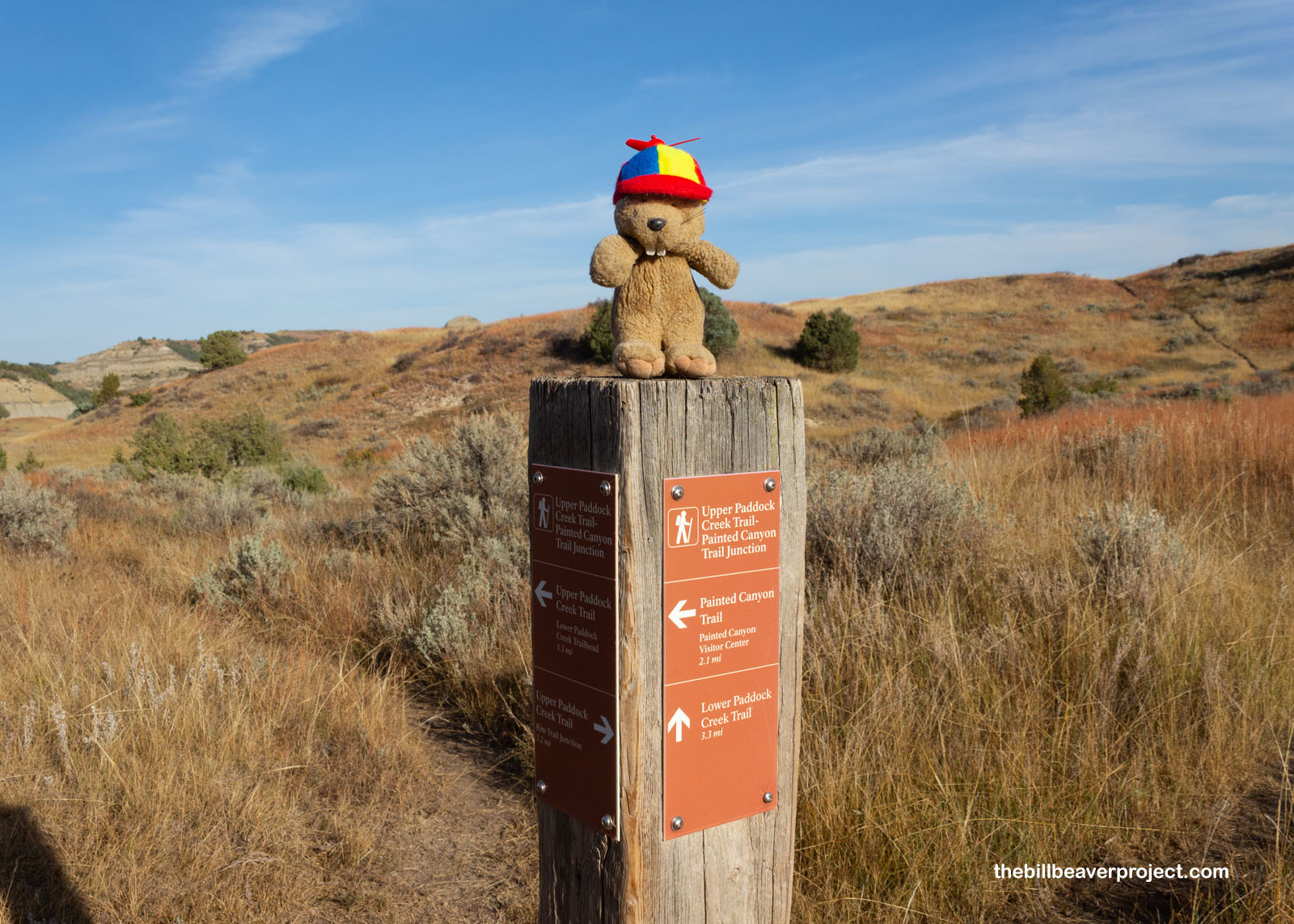
The guide had said this was a 2-mile trek, so I figured I would get to the Painted Canyon at the end of the trail. I scrambled down grassy slopes and across muddy ravines and down grassy lanes. I saw logs of petrified wood and a couple of cottontails until finally I saw my first sign for the Painted Canyon trail, leading off into the distance!
 |
 |
And then, without warning, I reached the end of the Painted Canyon trail! Where the heck was the Painted Canyon? I went up to the top of the next hill only to see more rolling prairie! Oh no! Had I been bamboozled on today’s adventure?
 |
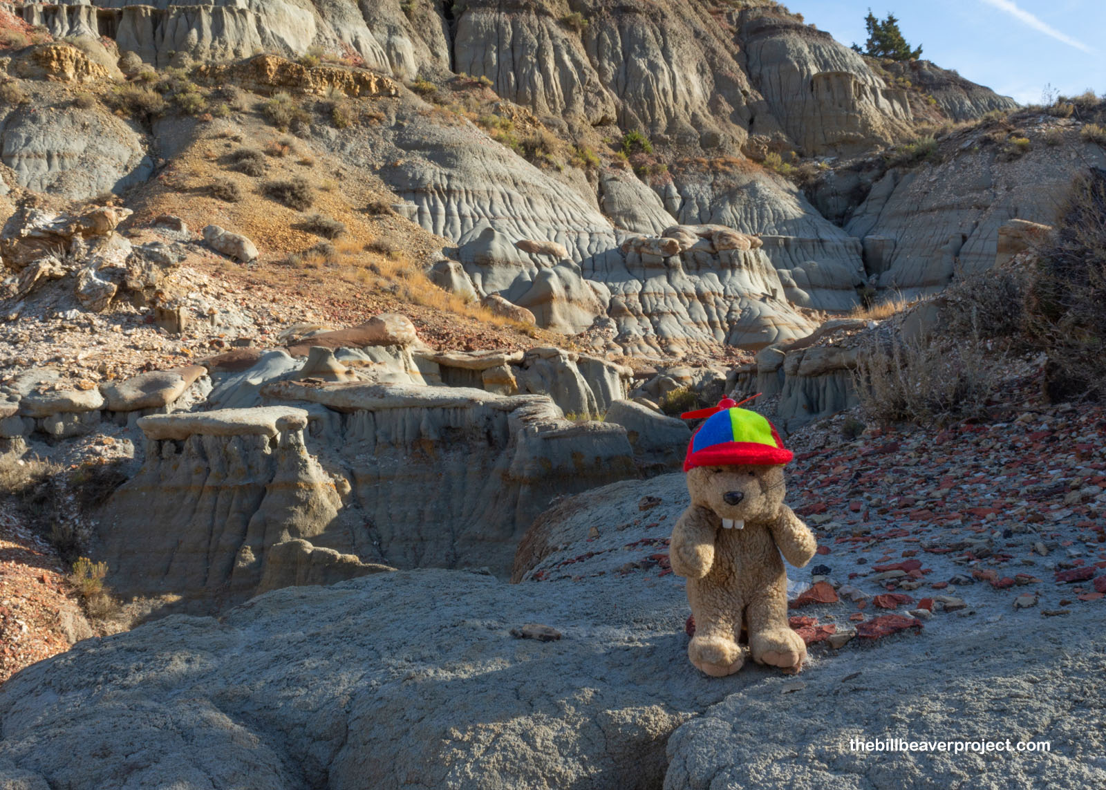
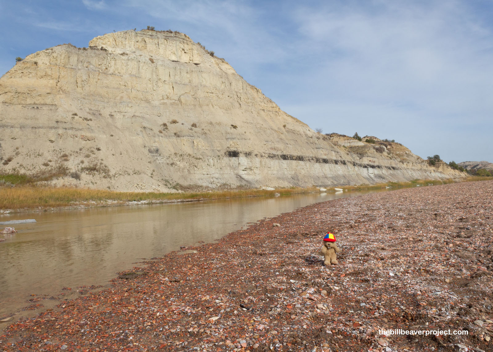
On the way back, I saw signposts leading in a different direction than the one I’d taken to get here. I’d come down the wrong way, or rather the buffalo way! Off the side of the trail, I found what I decided must be the actual Painted Canyon, with its peppermint-striped caprock formations leading up and down the hill. Even if it was not the real Painted Canyon, it was darn pretty to look at! This would do for the earliest part of today’s adventure, and I headed back up to the top of the bluff, warning a couple more hikers about the buffalo way!
 |
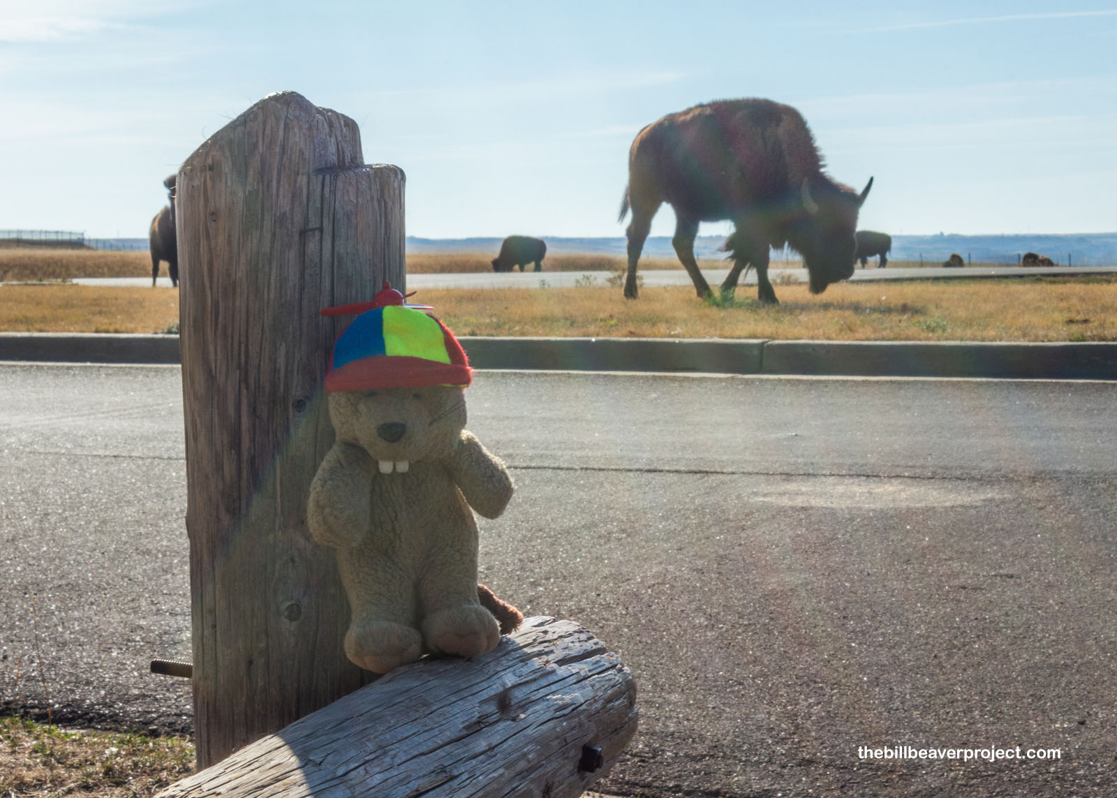
Speaking of which, when I got back, the parking lot was full of a huge herd of them! I got super nervous going anywhere near them, because of all the signs saying how dangerous they were. A beaver can get squished real easily by these titans of the Plains! But they seemed pretty content to keep grazing, so long as everyone steered clear and gave them room. As the park’s most famous residents, they sure were impressive to see so close!
 |
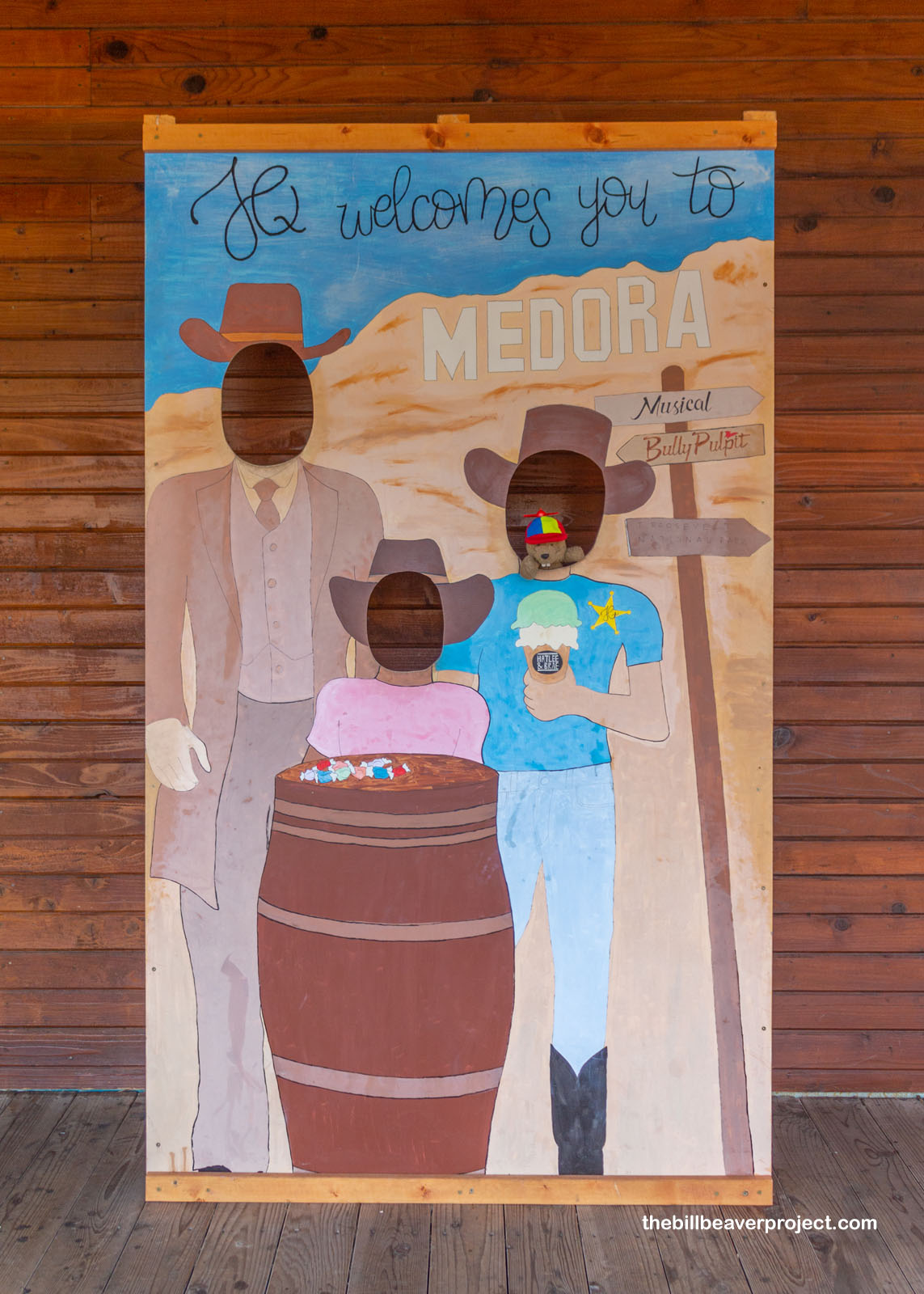
I left the Painted Canyon area to get some lunch in the town of Medora, the main jumping-off point for park visitors. As you can imagine, there are lots of tourist-friendly shops and activities along the Main Street of the town!
 |
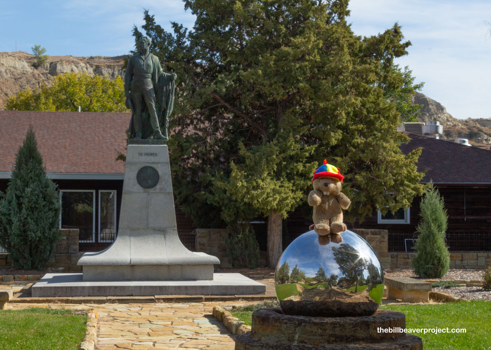
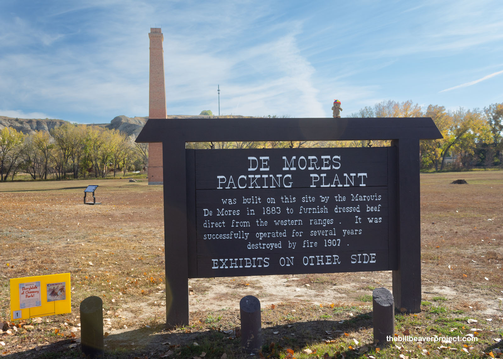
Medora got its name from Medora von Hoffman, a Wall Street banker’s daughter, who bankrolled the meatpacking business of her French husband, Antoine Amédée Marie Vincent Manca de Vallambrosa, the Marquis de Morès! He’d launched this business thinking that he’d produce higher quality beef than what was shipped to the East Coast, but he was a surly fellow, who located his town to spite the residents of nearby Little Missouri! He had conflicts with Teddy Roosevelt and was even accused of shooting hunter, Riley Luffsey! None of this boded well for his meatpacking empire, which closed three years after he opened it. The town’s name stuck though!
 |
 |
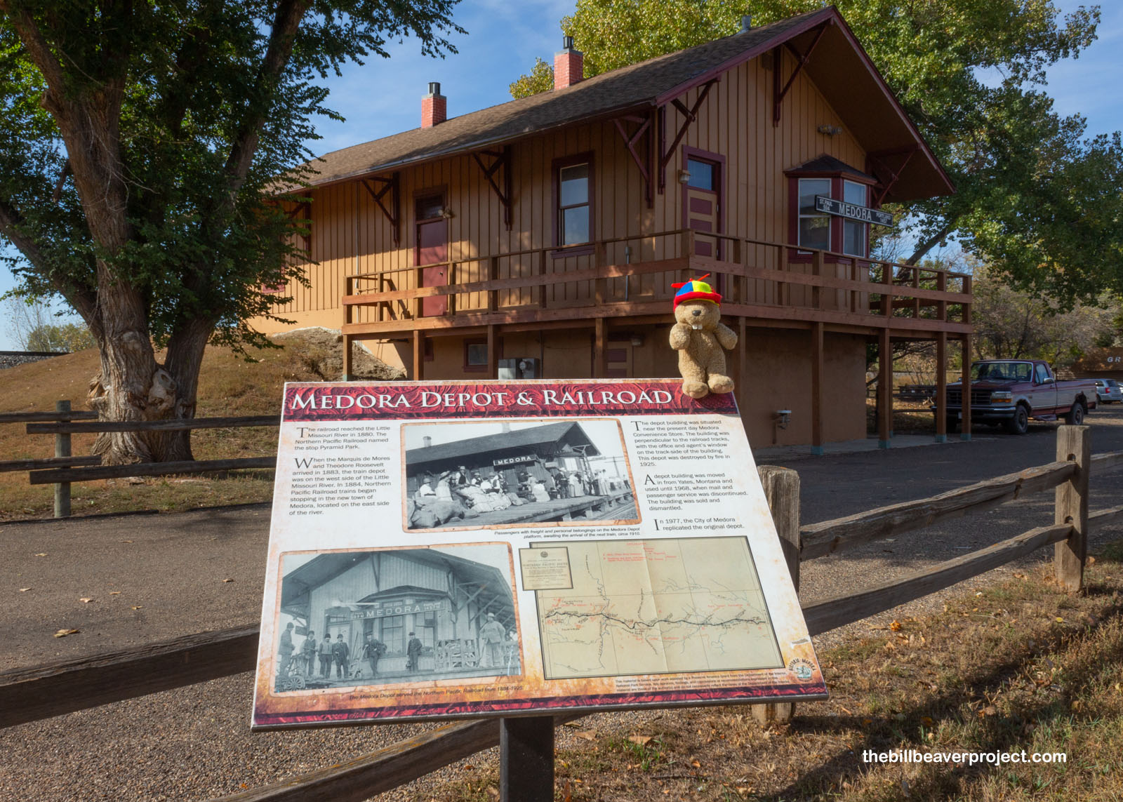
So did the railroad! Originally, the Northern Pacific Railroad set their depot in the town of Little Missouri in 1880, but four years later, Medora claimed that rail traffic! This is a replica of the original depot, which burned in a fire around 1925, but the original replacement for that depot? It was shipped in all the way from Yates, Montana!
 |
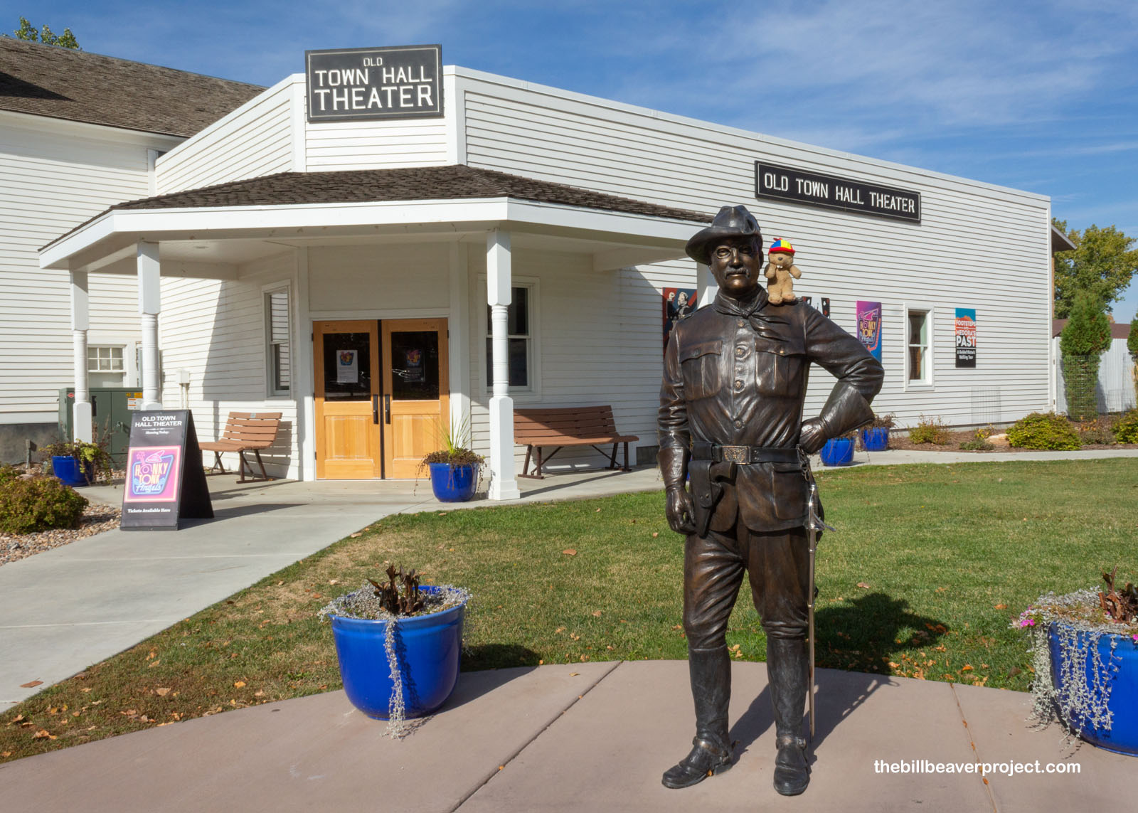
On the subject of Teddy Roosevelt, the namesake of the national park, he arrived at that Little Missouri depot on September 8, 1883 to hunt bison! After two weeks of hunting, he decided to pay $14,000 for a ranch of his own, called the Maltese Cross Ranch, and left Sylvane Ferris and Bill Merrilfield to manage it for him while he went back to New York! He’d later return and get himself a larger ranch, called Elkhorn Ranch, around which the national park now sprawls!
 |
Anyway, the day was wasting, and it was time to get into the park! Today was going to take longer than usual anyway because the last four miles of the park’s scenic loop had been shuttered due to erosion of the road! That would mean a long out-and-back rather than a gentle loop!
 |
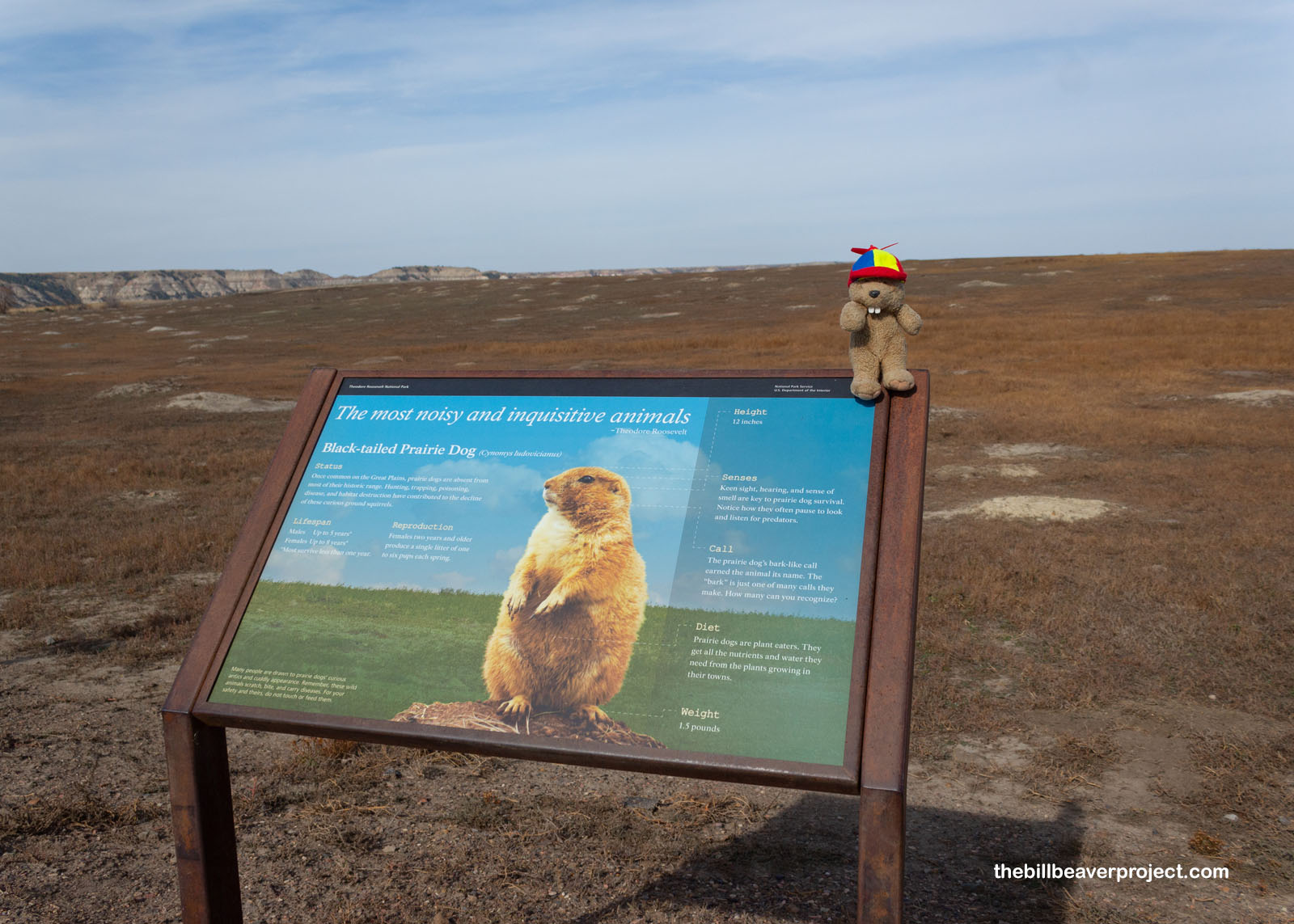
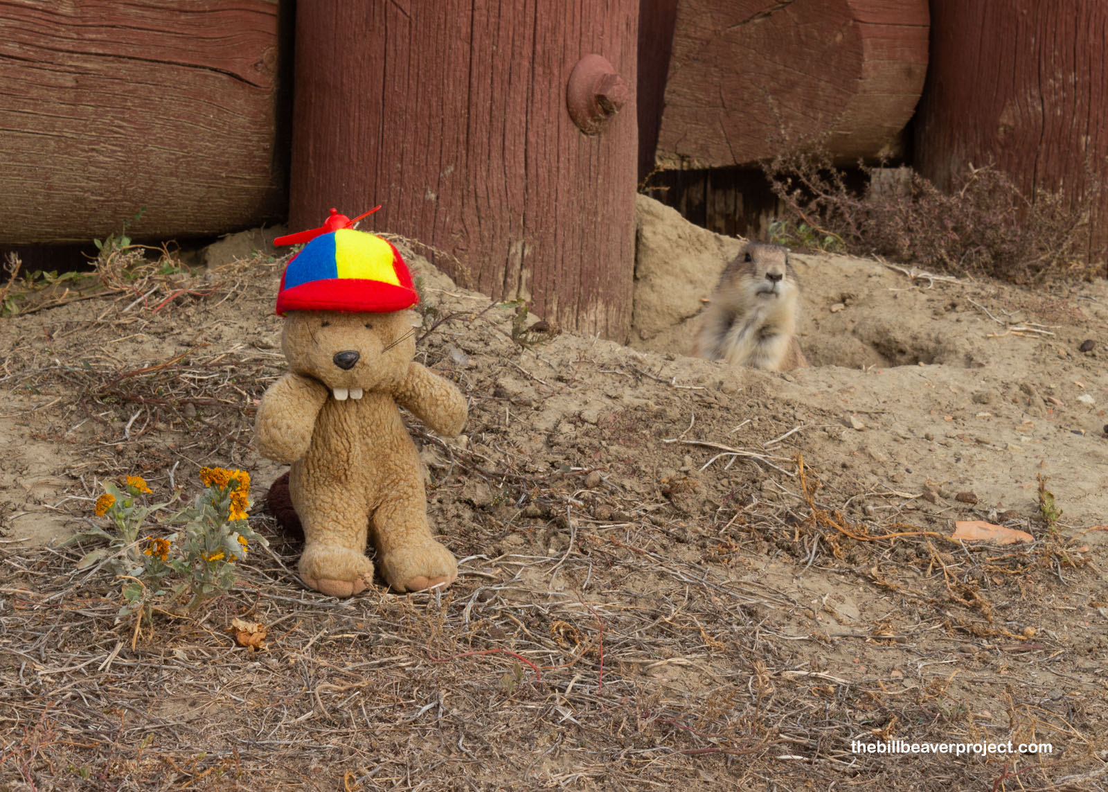
The first thing that grabbed my attention was a black-tailed prairie dog town! Unlike the little one I saw at Devils Tower two years ago, this one stretched far over the horizon! They were popping their heads out and browsing and filling the air with whistles! But they were busy, so I continued on my way without disturbing them!
 |
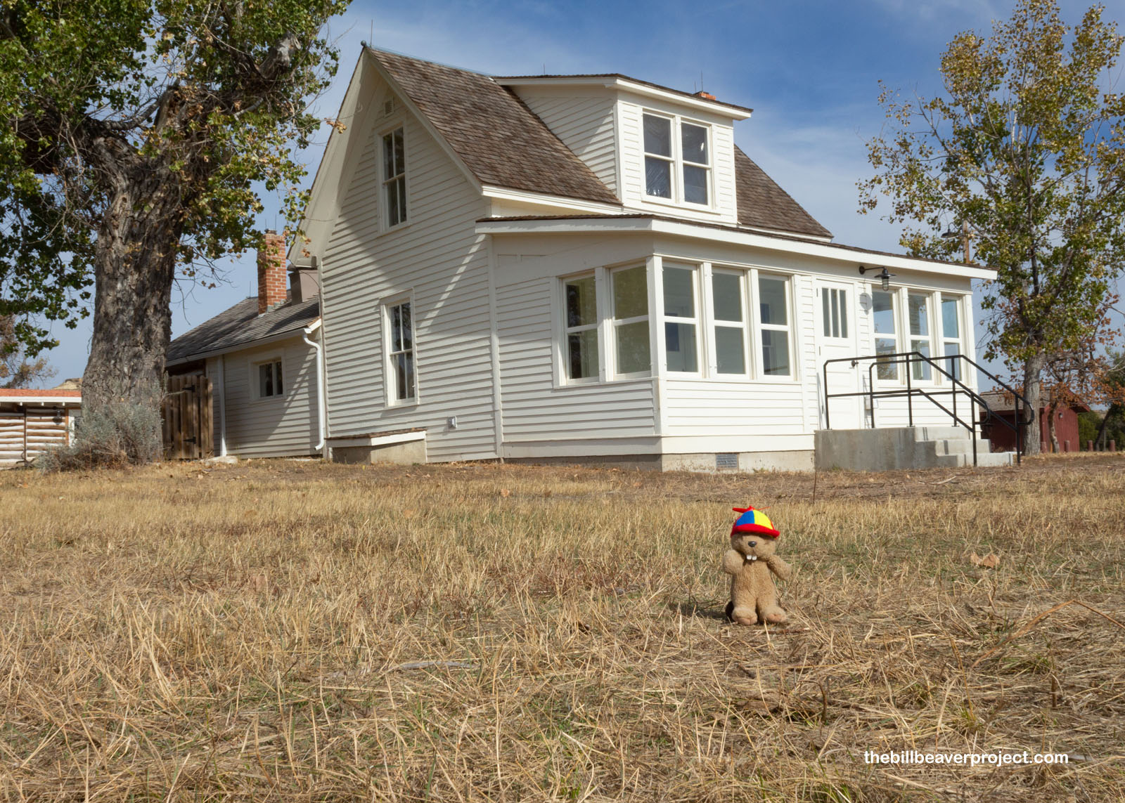
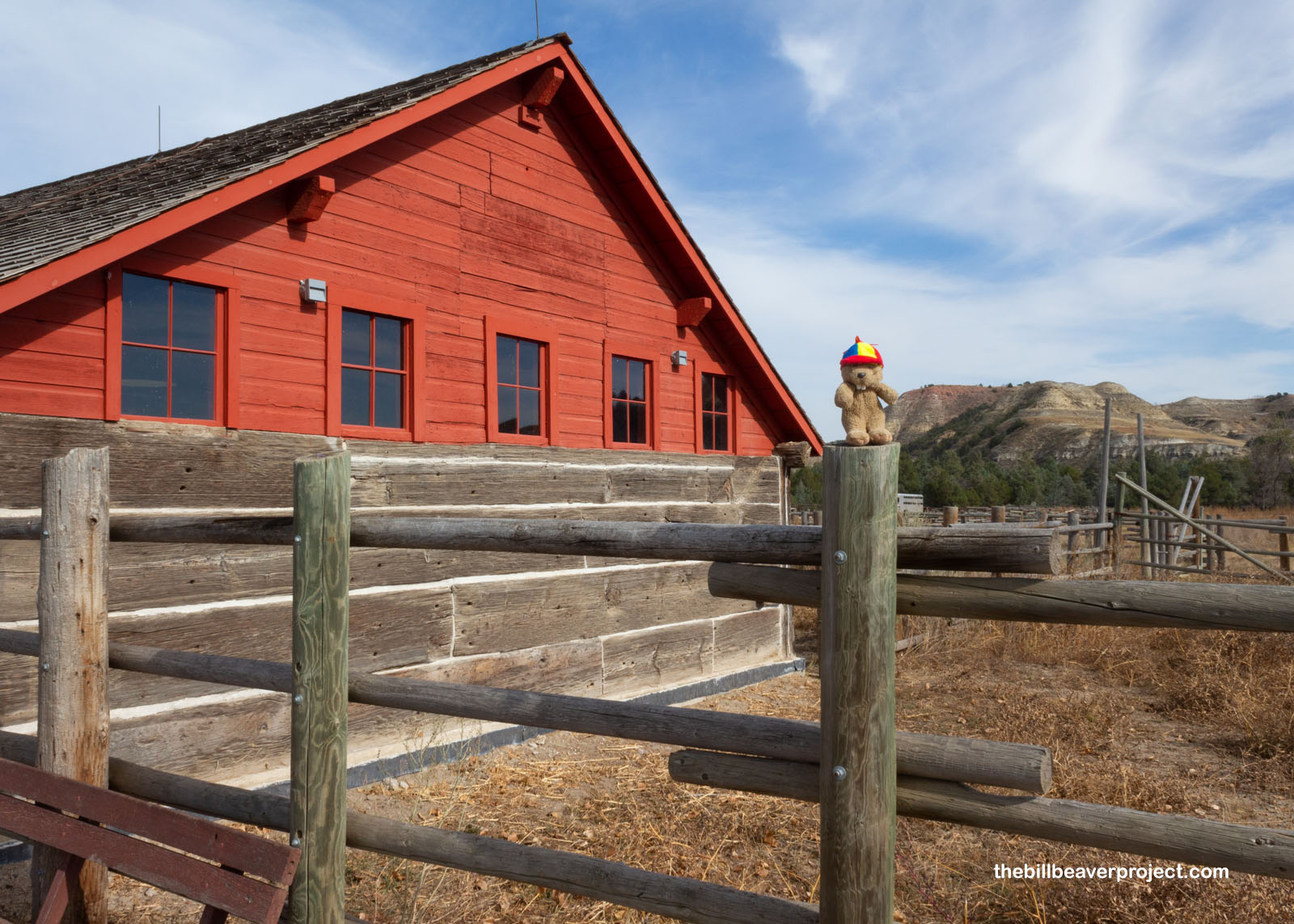
I explored the Peaceful Valley Ranch, which was one of the area’s first ranches, set up by “Gerry” Paddock in 1883. After changing hands many times over the years, the ranch settled into the hands of Harry Olsen and his family in 1915. The Olsens raised more horses than cattle, which was unusual, and opened one of the very first dude ranches, hosting guests for horseback riding, camping, and cookouts! When Carl Olsen took over in 1924, he helped with the creation of Theodore Roosevelt National Park!
 |
 |
I’d meant to take a detour here and visit the Little Missouri River, because it’s Lastleaf season, but after trekking down the short trail from the ranch, I was out of luck for fall foliage! I hope I find some more down the road!
 |
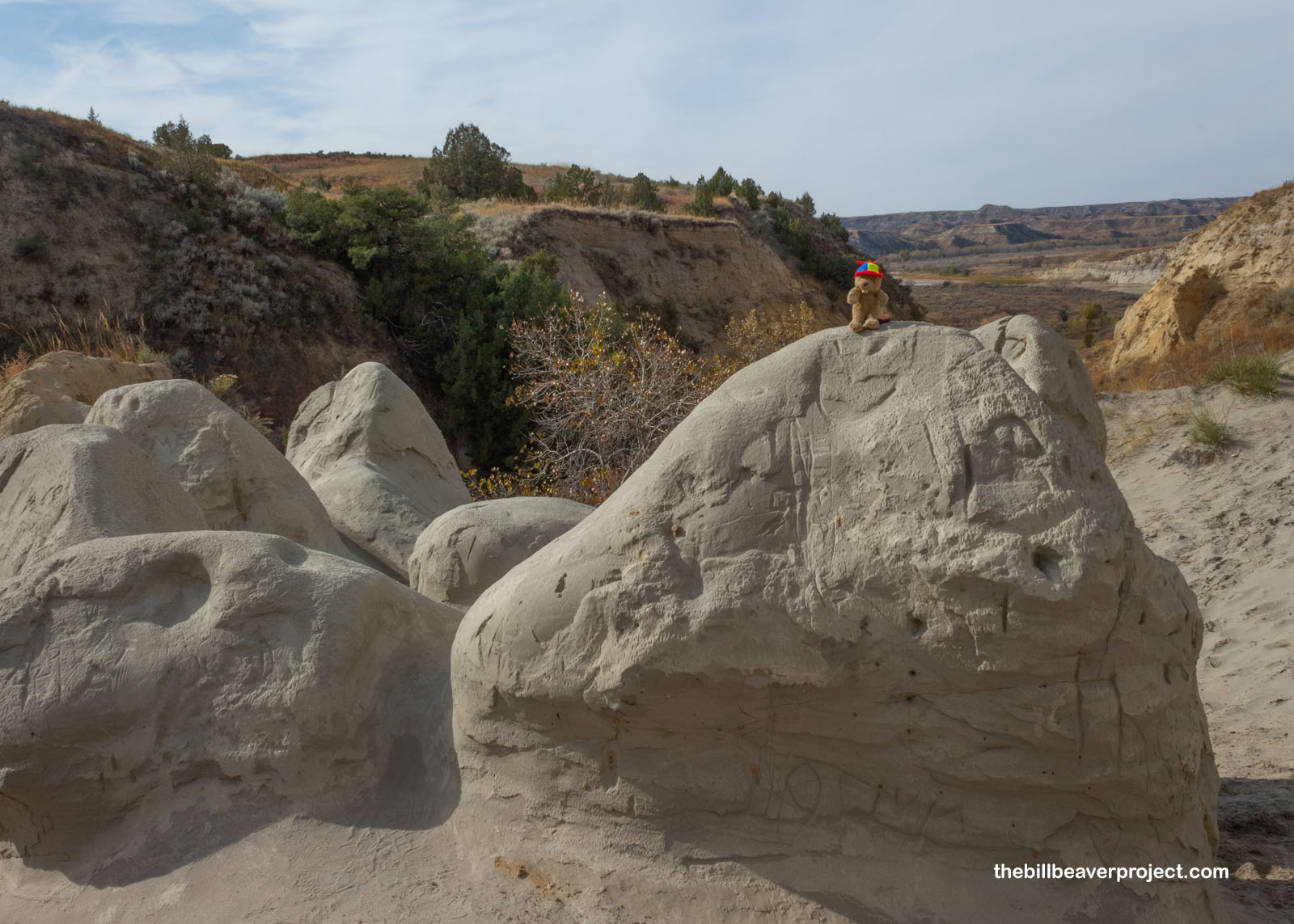
Instead, I moved on to Wind Canyon, ready to batten down the hatches and cling to some grasses the whole way. But Wind Canyon isn’t always windy, it turns out! It’s named for the wind-carved boulders inside it! Sadly, though, these boulders are more carved by vandalizing visitors than wind these days. Every single one had names etched into them.
 |
Next stop: Boicourt Overlook! Named for A.E. Boicourt, whose ranch was demolished in 1941 during the establishment of the national park, this overlook showed exactly what the clearing of ranches was meant to display: miles upon miles of badlands and prairie!
 |
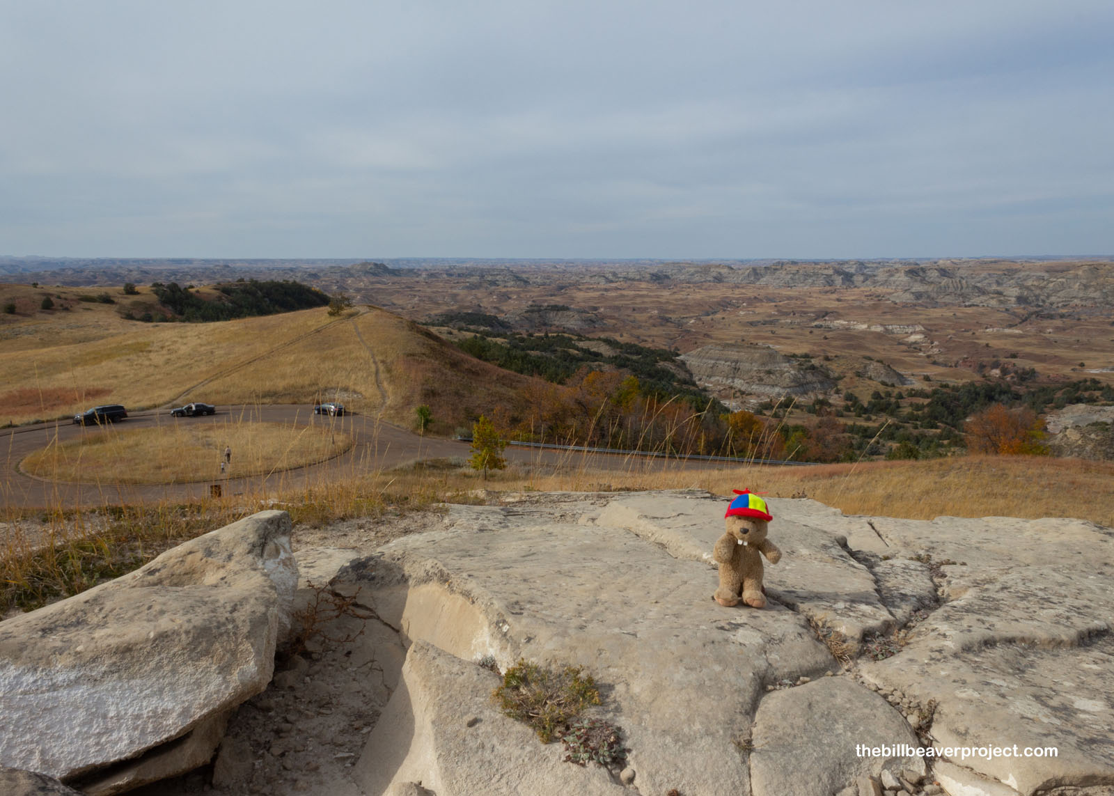
These were short stops, including Buck Hill, the second highest viewpoint in the park, overlooking more badlands while taking the time to point out, through signs, that this area of the park is one of the largest remaining stretches of prairie that has never been grazed or plowed! The photos showed this would be a spectacular sight in the springtime!
 |
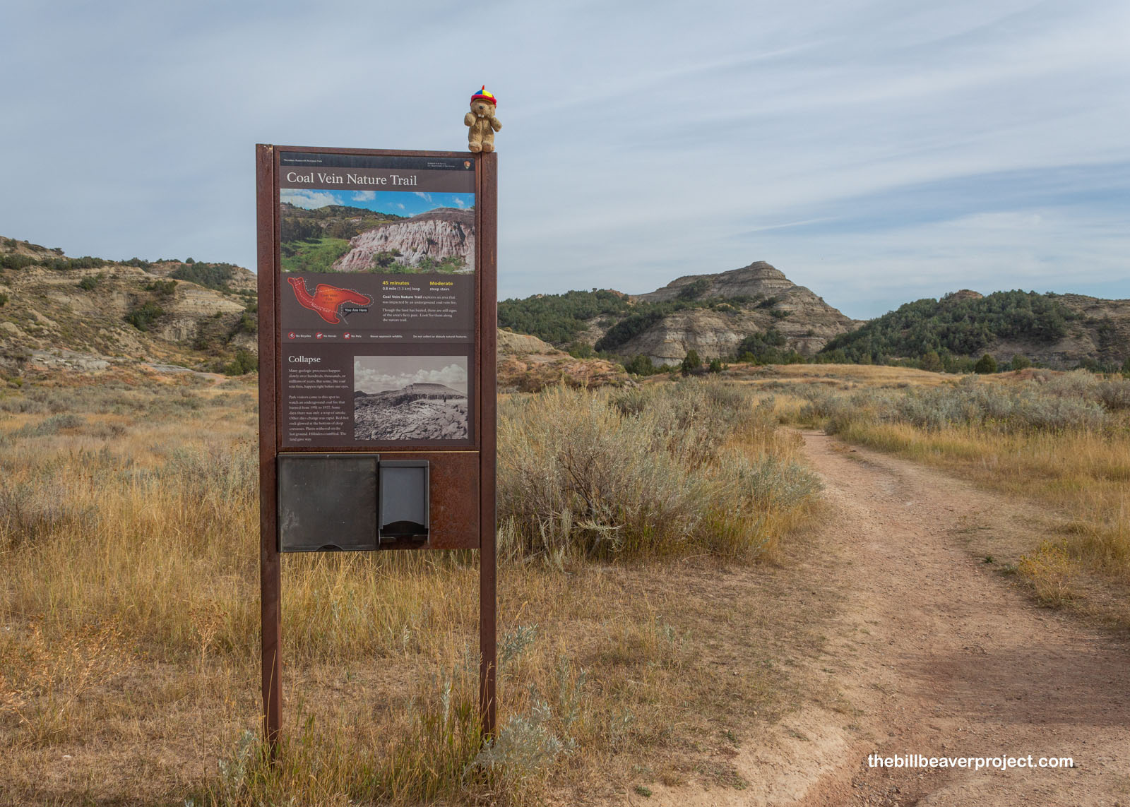
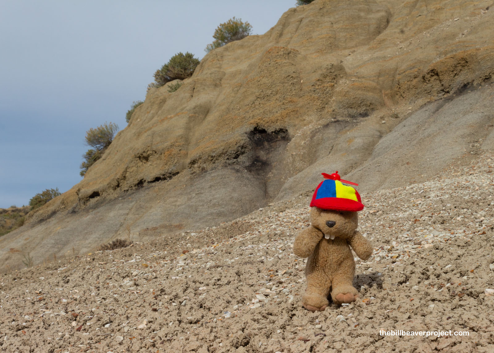
The next trail was longer, about 0.8 miles, leading to a coal vein! Coal is a major resource in North Dakota, and in fact, the state produces almost three times more electricity by coal than the population can use! Coal can come with perils though! Once it ignites, it stays lit for a long, long time! After a lightning strike in 1951, this coal vein burned for 26 years, reshaping the land around it!
 |
 |
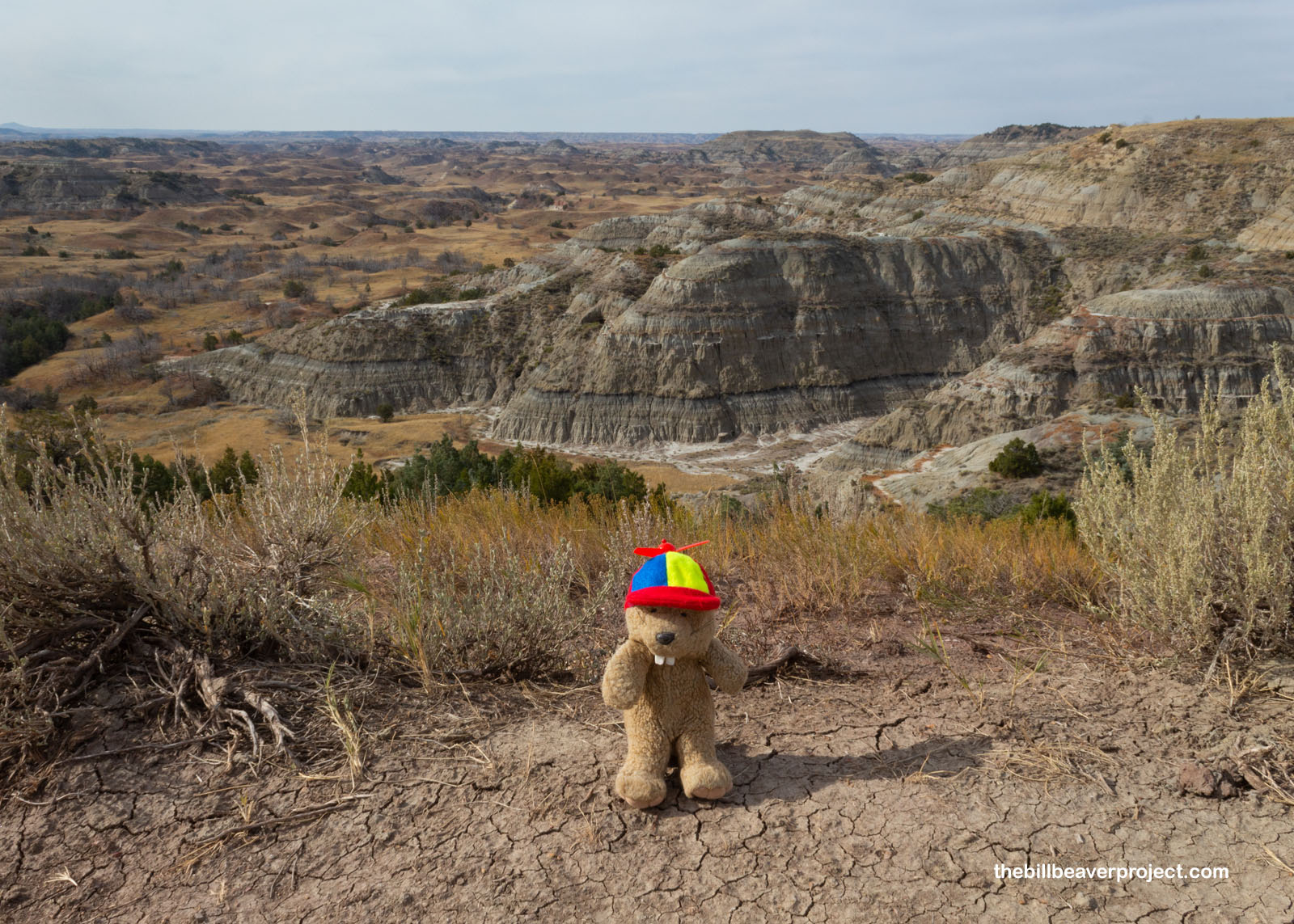
And then, I reached the last overlook of the day, which beautifully summed up what made these lands “badlands!” Dating back to the Lakota, who named it mako sica, this troublesome network of cliffs, creeks, and coulees made getting across very tricky! It really puts into perspective how easy we’ve got it now that there are roads to take folks across places that were once very treacherous! Here, have a Flutter Phone view of this wild country!
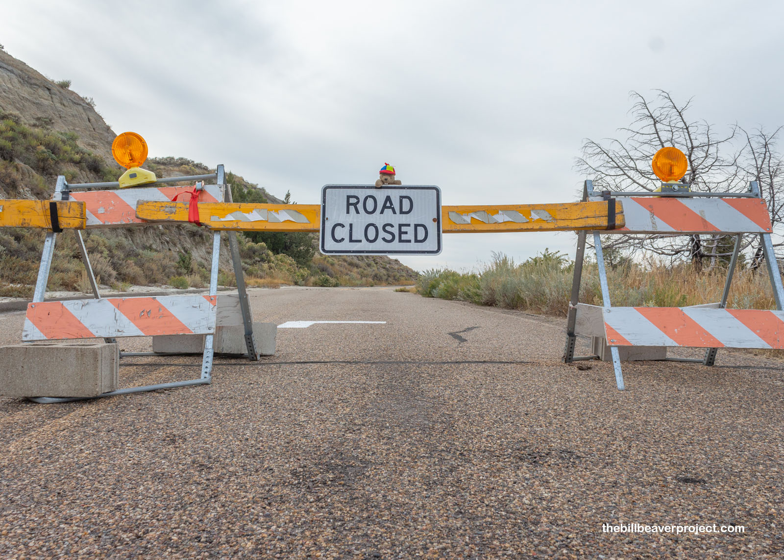
Oh no! I didn’t think I would get to the road closure so soon! And yet, here I was, so close to the park entrance but so far… Time to backtrack the whole way I came in!
 |
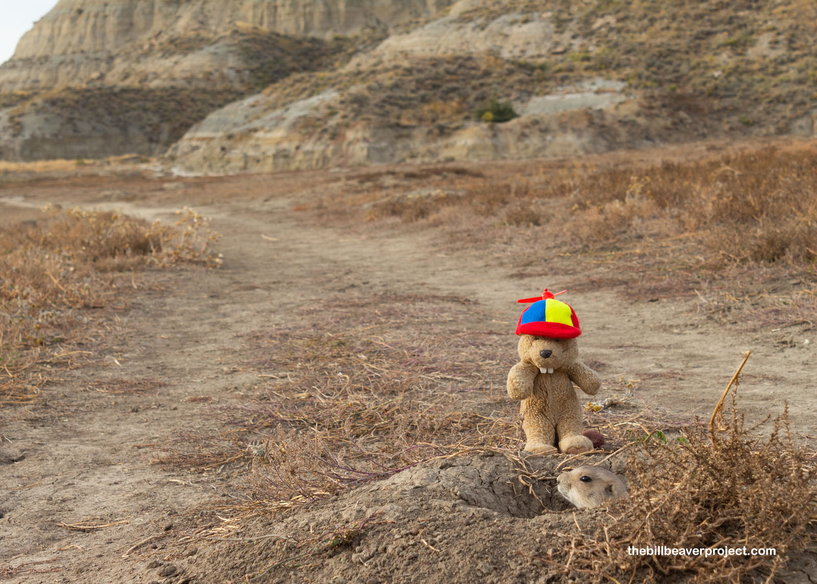
But that gave me time for one more detour. The entrance to Theodore Roosevelt National Park has shifted over the years, and the original entrance station has been preserved down a half-mile trail, which had been completely taken over by prairie dogs! Their whistles filled the air as I strolled along, and they popped out of everywhere, even the middle of the trail!I whistled back, but I’m not very skilled in their dialect!
 |
 |
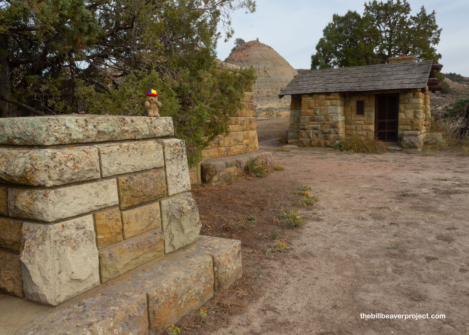
Behold! This was the original eastern entrance to the park, built by the Civilian Conservation Corps (CCC), who arrived here in 1934 with the sponsorship of the North Dakota State Historical Society! It gave visitors access to the brand new Theodore Roosevelt National Memorial Park, which opened in 1947, but it fell out of use when I-94 was completed in this area in the ’60s!
 |
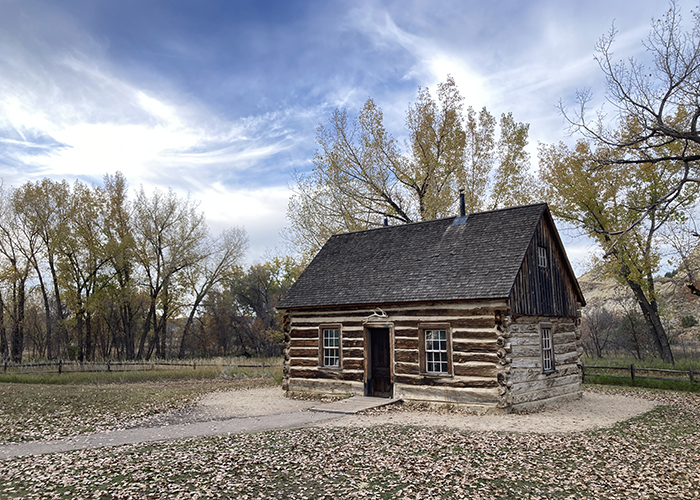
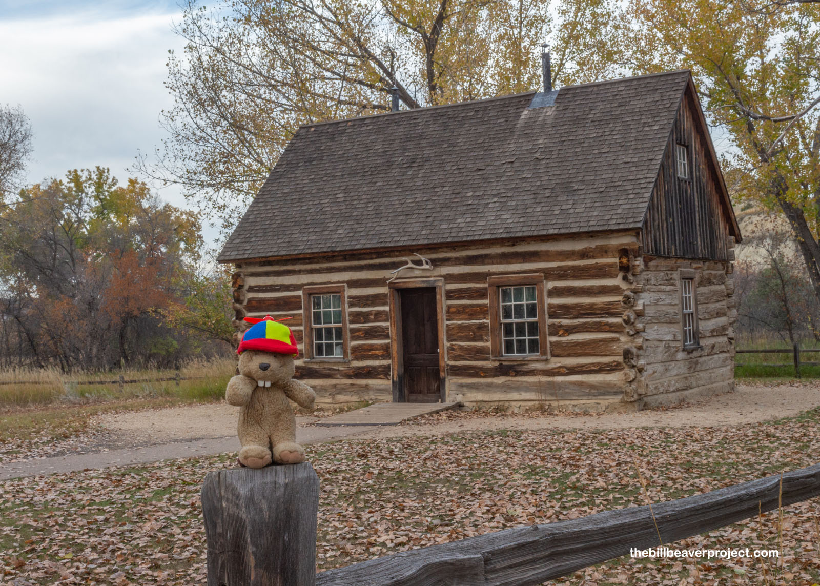
So then I wound my way all the way back up the loop to the current entrance, where Teddy Roosevelt’s first cabin from his Maltese Cross Ranch was on display! This cabin has had quite the tour of the nation, traveling all the way to St. Louis for the 1904 World’s Fair, then to Portland, Oregon for the Lewis and Clark Centennial Exposition in 1905, then to a resting place in Fargo, then the capital grounds in Bismarck, and finally, in 1959, the visitor center grounds of the national park named for this rancher dude turned president!
 |
And just like that, the day closed out on North Dakota’s signature national park, a haven for prairie dogs, a home where the buffalo roam, and a place where a future president connected with the nature he would later fight to preserve!
I’ll see you down the road!

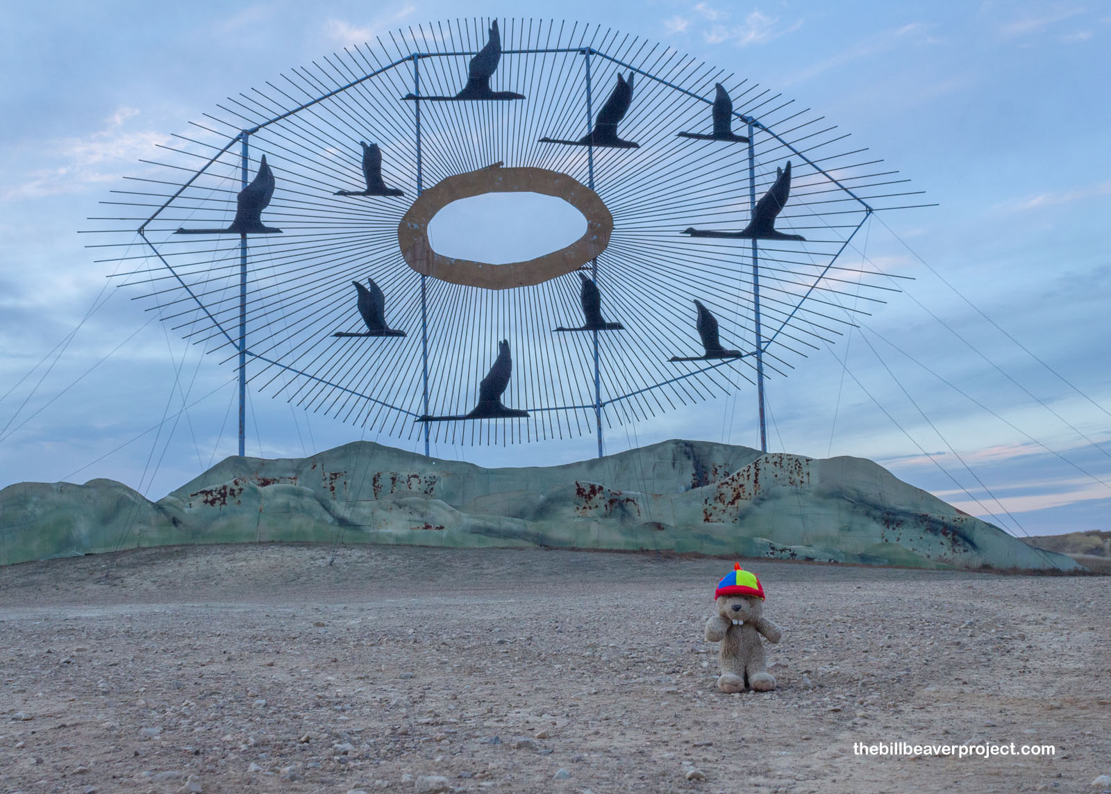
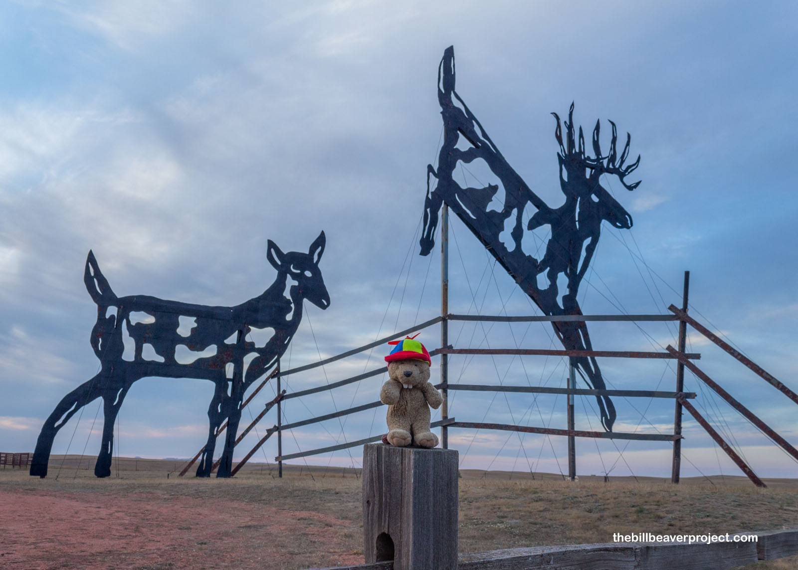
P.S! On my way back, to Bismarck, I encountered a couple magical monuments on the side of the road! This was the start of the Enchanted Highway, a 32-mile stretch of road lined by humongous animal sculptures from pheasants to giant deer to the world’s largest metal sculpture, Geese in Flight! Designed by Gary Greff, who was inspired by the movie Field of Dreams, this Enchanted Highway was built to bring more visitors to his town of Regent and hopefully save it from its slump! It worked!
 |
 |
Previous Day |
Total Ground Covered: 552.3 mi (888.8 km) |
Next Day |