 Previous Day |
Wheatland, WY → Crow Agency, MT → Rapid City, SD → Wellington, CO 963.0 mi (1,549.8 km) |
 Next Day |
Híŋháŋni!
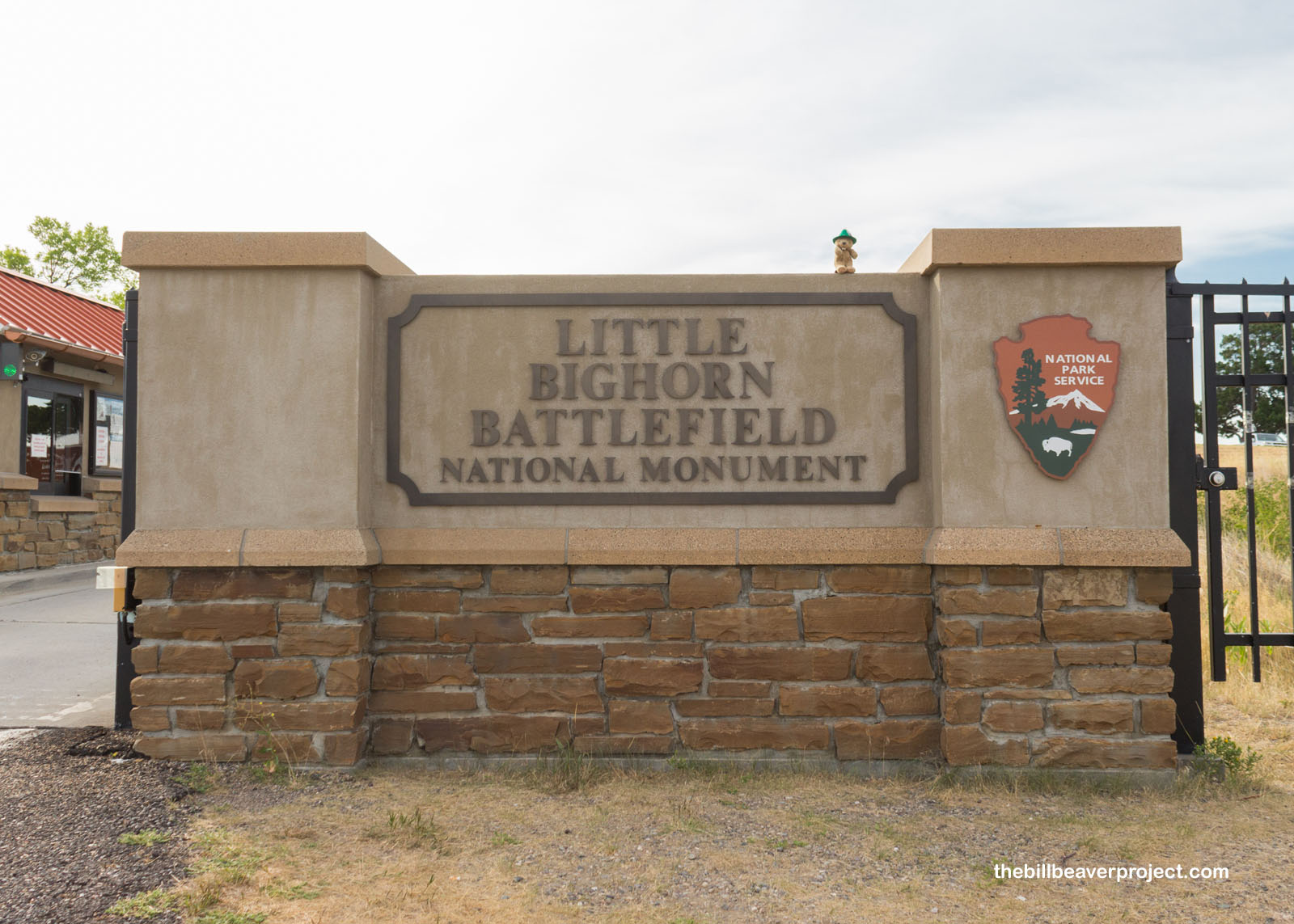
It’s not too often that I find myself with spare time on my adventures, but somehow, I wound up with a full day between my adventure in Great Sand Dunes and my timed entry to Rocky Mountain National Park! What’s a beaver to do with such free time? Well, I headed out the door at 4:30 AM for a day trip so ambitious that it just might be logged in the tomes of American myths! My first stop, after driving through the sunrise, was Little Bighorn Battlefield National Monument!
 |
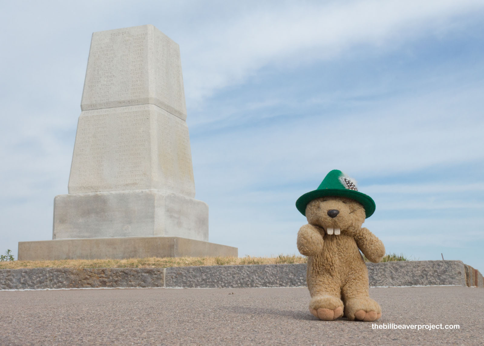
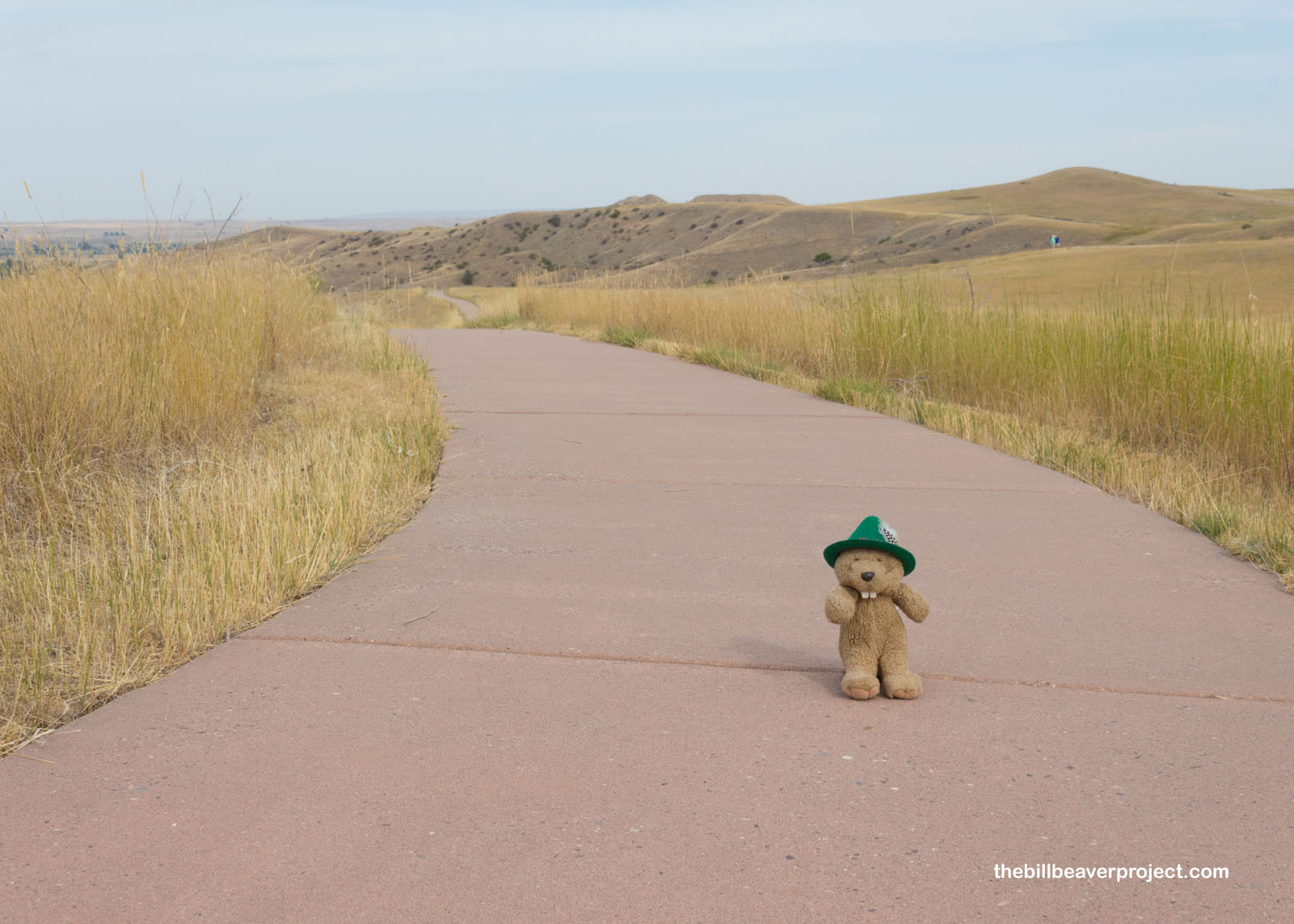
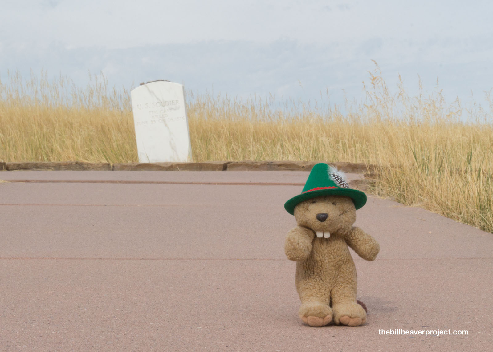
The Battle of Little Bighorn was one of the most famous clashes between indigenous tribes and the US Army! While it is most famous in American history as the site of Custer’s last stand, it also marked the last major victory for the Plains tribes. Right away, I was greeted by the national cemetery of the fallen (but since it was a cemetery, I didn’t take any photos). The 7th Cavalry Regiment lost 260 soldiers, and while it’s hard to tell for sure, there were about 31 warriors, six women, and four children lost among the Cheyenne and Lakota. There were a lot of graves here in the cemetery, while the hillsides were sprinkled with markers to show exactly where combatants fell.
 |
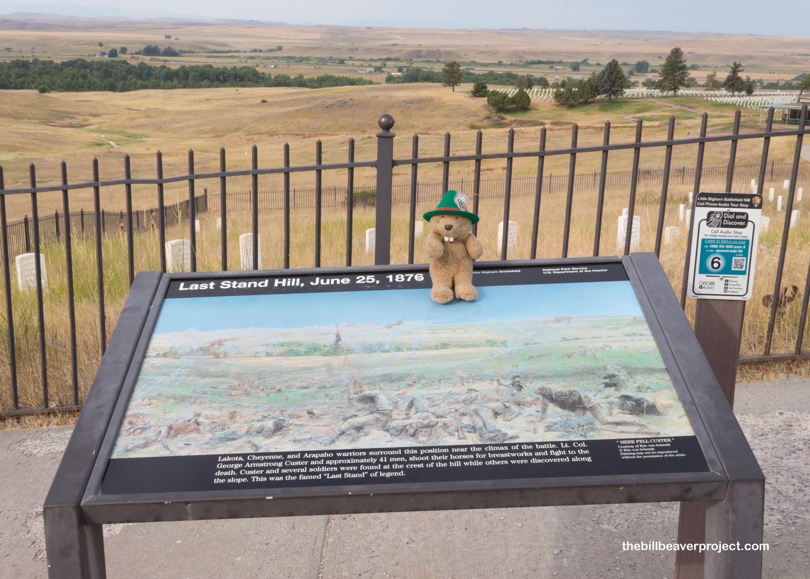
There’s a big monument at Last Stand Hill in honor of Lieutenant Colonel George Armstrong Custer and his last 41 soldiers fighting to the death against the combined forces of the Lakota, Cheyenne, and Arapaho. The main reason we know so much about this moment is because of the lifelong lobbying efforts of Mrs. Libby Custer, but there was a lot of context to this moment beyond the Libby lobby!
 |
 |
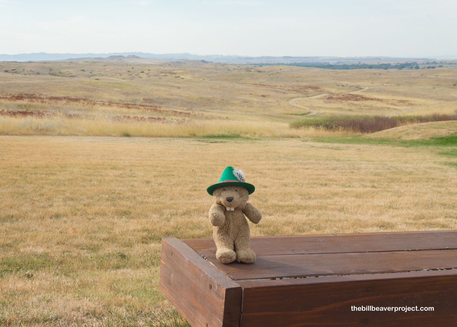
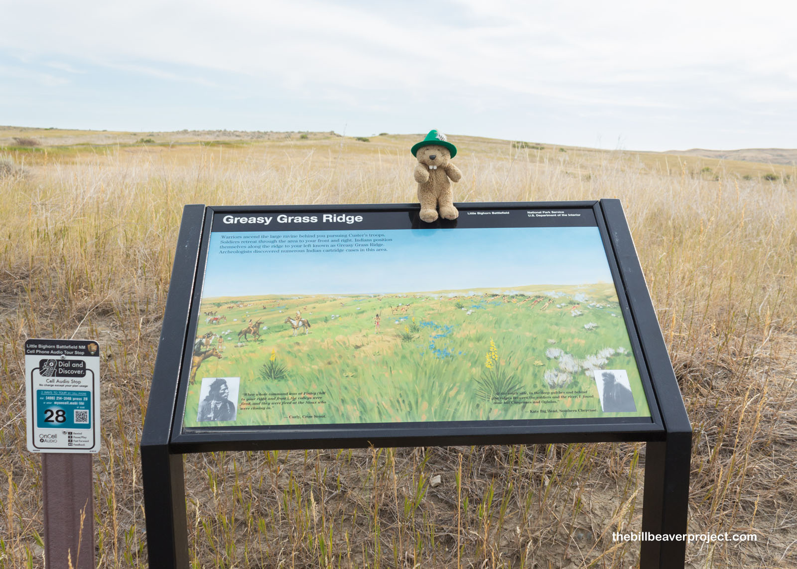
This area was originally known as the Greasy Grass because of how it shimmered in the sun. It was part of the Great Sioux Reservation set up by the Treaty of Fort Laramie in 1868, but it was rumored to be rich with gold! Custer, who had been courtmartialed after the Civil War for abandoning his command and ordering deserters shot without trial, was put in charge of the 7th Cavalry Regiment to scout the Black Hills for gold and a suitable place for a military post. With the discovery of Black Hills gold, miners flooded Sioux territory, and the US Army took their side, breaking the Treaty.
 |
On January 31, 1876, the Commissioner of Indian Affairs established a new reservation and ordered all Sioux to report to a new reservation, which they declined. After all, this was prime hunting territory and the place where tribes could come together for the annual sun dance! So, in late June, the US Army sent three forces to round them up. Custer’s 7th planned a surprise attack on an encampment of 8,000, but his cover got blown on June 25th. He decided to attack anyway!
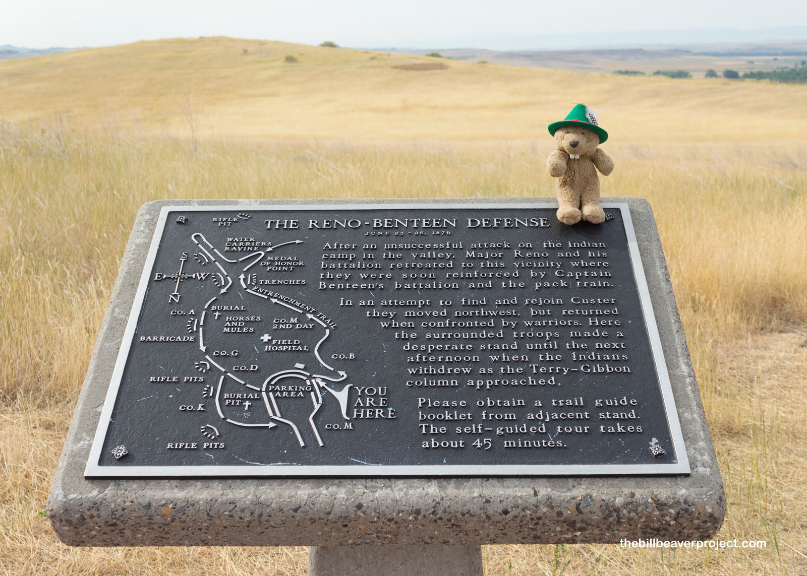
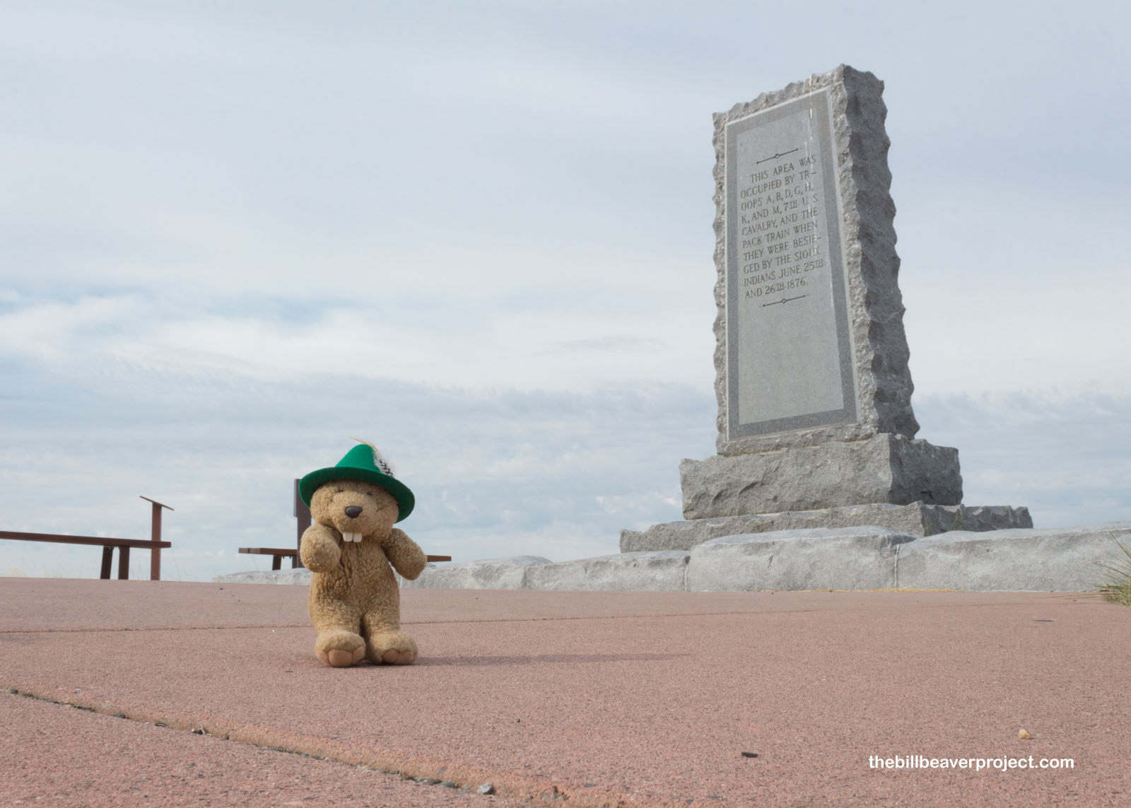
Custer sent Major Reno to attack any warriors leaving from the south of the village, but that backfired tremendously! They pushed him all the way back to the top of this hill, where he was joined by Captain Benteen, to no avail. This group surrendered, and the Custer command was destroyed.
 |
 |
I walked along the interpretive path, where signs pointed out the various positions of the camps, the battles, and the sites where soldiers and warriors were known to have fallen. It was kind of eerie visualizing this battlefield by bodies, but I think it’s important to know these things when learning about history. This was not as purely heroic a battle as it’s often conveyed.
 |
 |
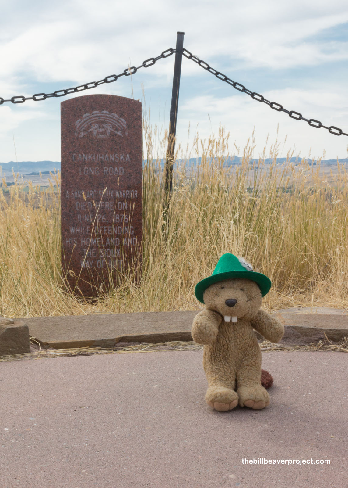
Only recently (1999 to 2001), markers for indigenous warriors started to be installed as well. This one honors Cankuhanska, or “Long Road,” who fell while attacking the Reno-Benteen defenses and was previously honored with a stone cairn and medicine bundles. Only then did I realize I had passed an important memorial to the fallen warriors at Last Stand Hill. It was a tree tied with medicine bundles, something I would not have recognized and feel bad for not.
 |
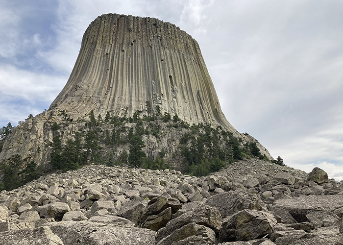
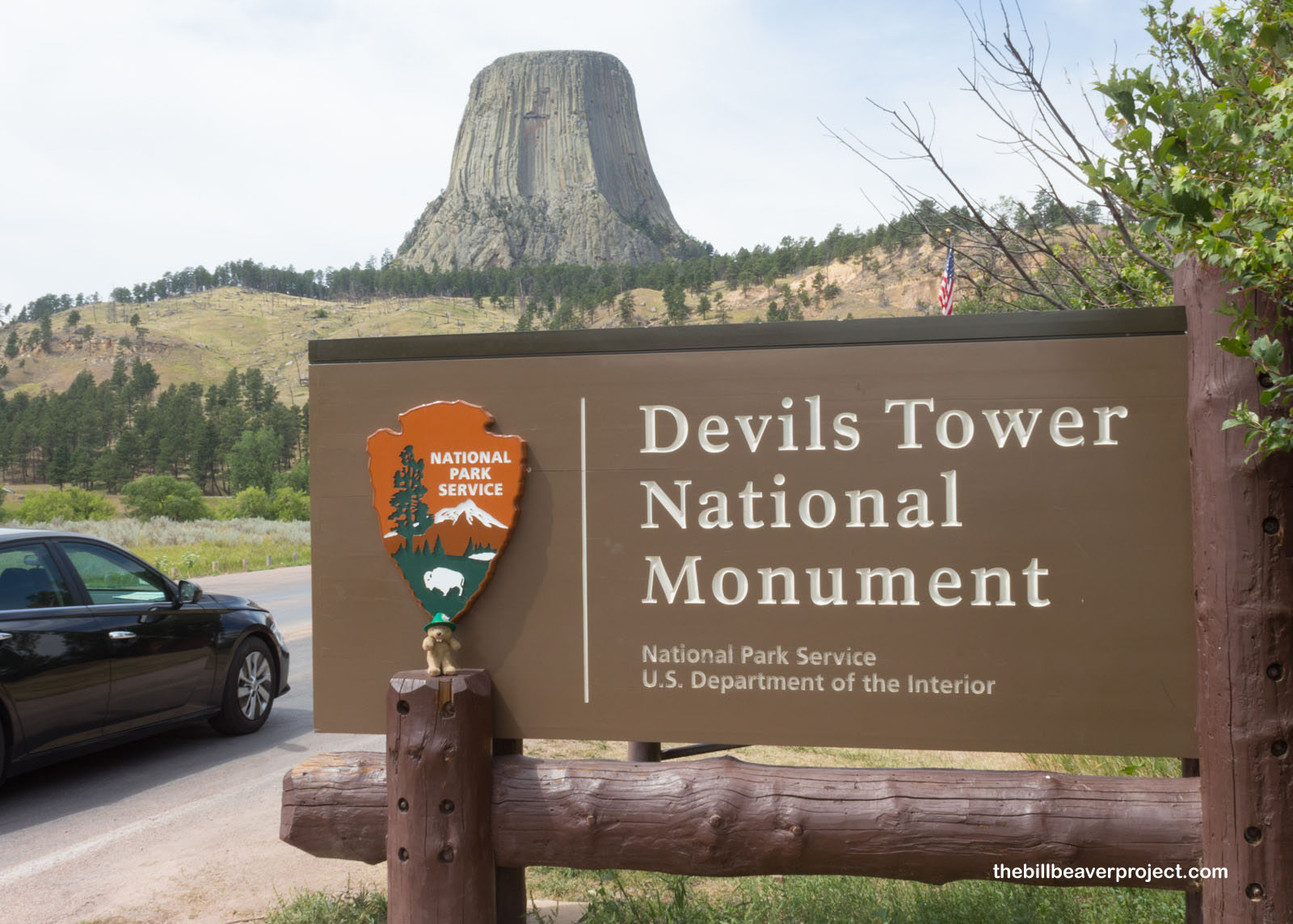
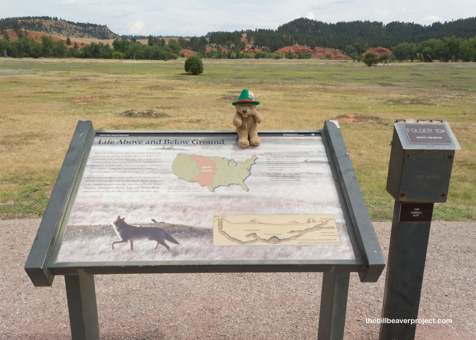
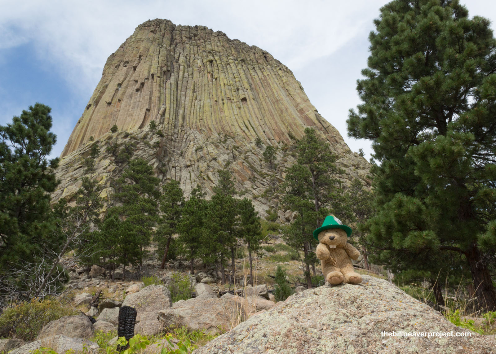
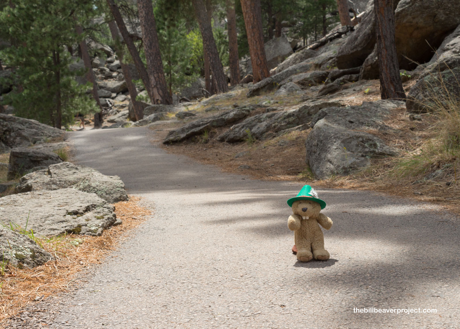
I didn’t have a lot of time here at Greasy Grass, because the nature of my day trip required me to cover a lot of ground during visitor center hours! I headed 3 hours east into a new state and a new monument, the first, in fact! President Teddy Roosevelt proclaimed Devils Tower National Monument via the new Antiquities Act in 1906, ten years before the formation of the National Park Service!
 |
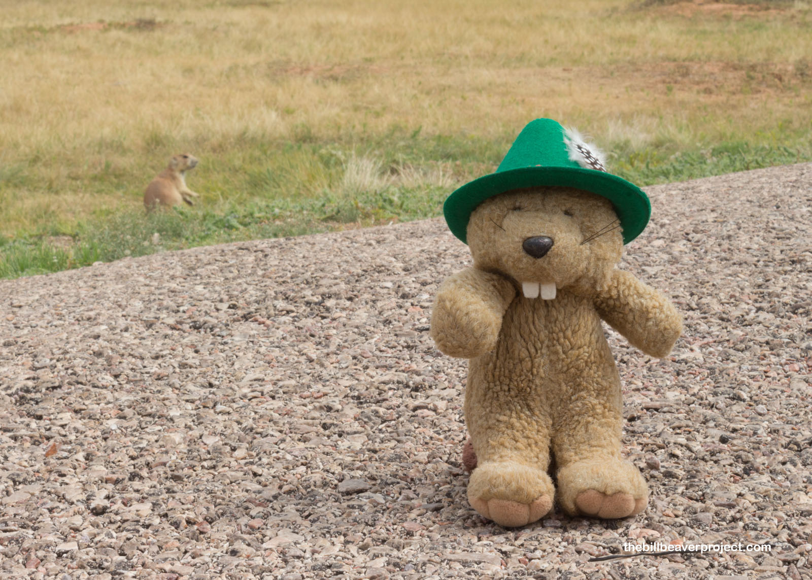
On my way up to see this magnificent volcanic formation, I stopped to greet some of the locals. Black-tailed prairie dogs used to live in burrows across the entire Midwest, but due to ranching, building, and extermination, they now only occupy special preserves like this one at Devils Tower. Like beavers, prairie does are super important rodents! They work the soil to help seeds grow, and their burrows create homes for burrowing owls, plovers, toads, and more! They even offered to let me spend the night with them, but I had to keep moving. They sent me on my way and told me to be on the lookout for a mysterious yodeling creature that sometimes visited their burrows. I told them I would keep my eyes and ears ready!
 |
 |
I arrived at the parking lot, where the visitor center was still closed due to COVID-19, and started strategizing how to get through the crowds. Wyoming has very different ideas about masks and social distancing. I think that might be because the three states I’m visiting today (Montana, Wyoming, and South Dakota) have a combined 3,188 coronavirus cases. Compare that to Los Angeles County, which reported 1,956 new cases today!
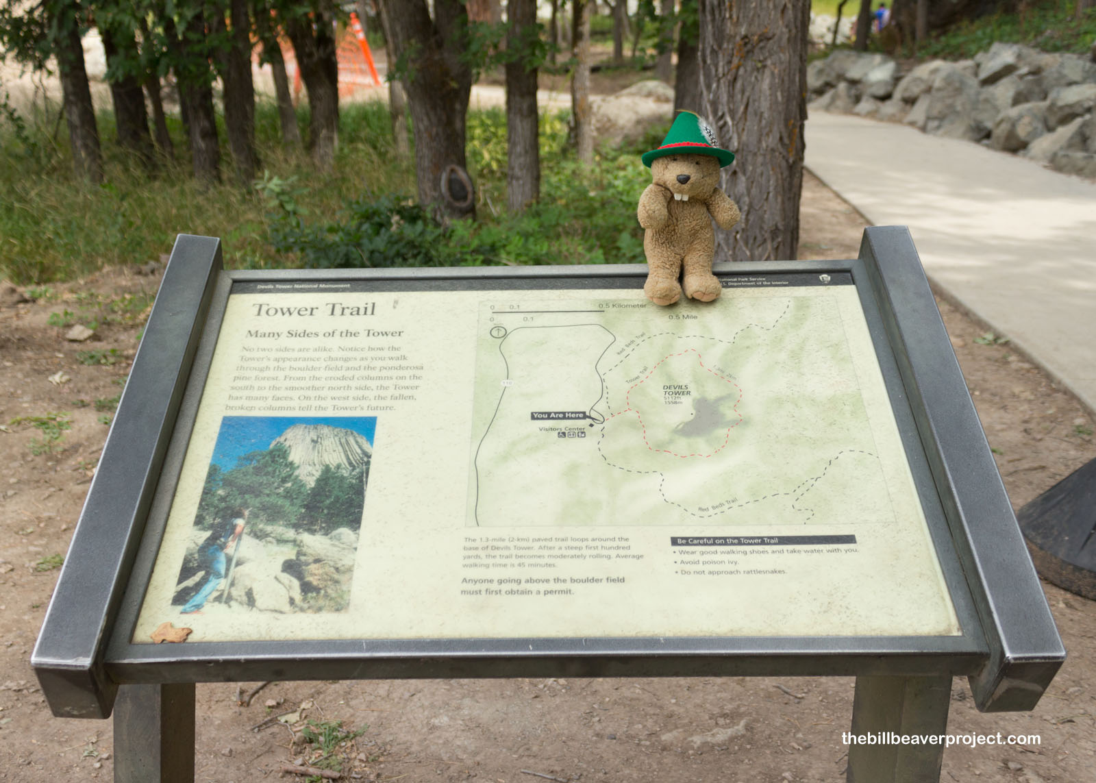 |
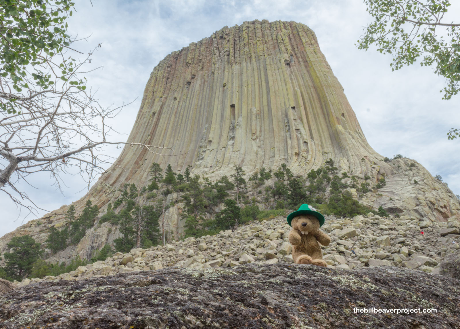
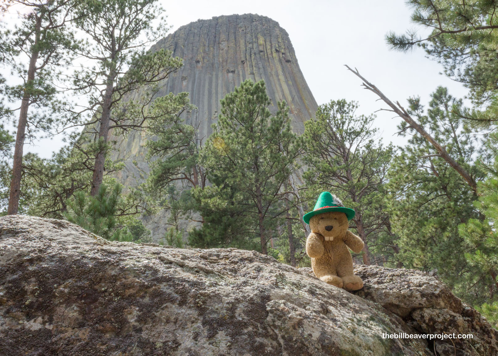
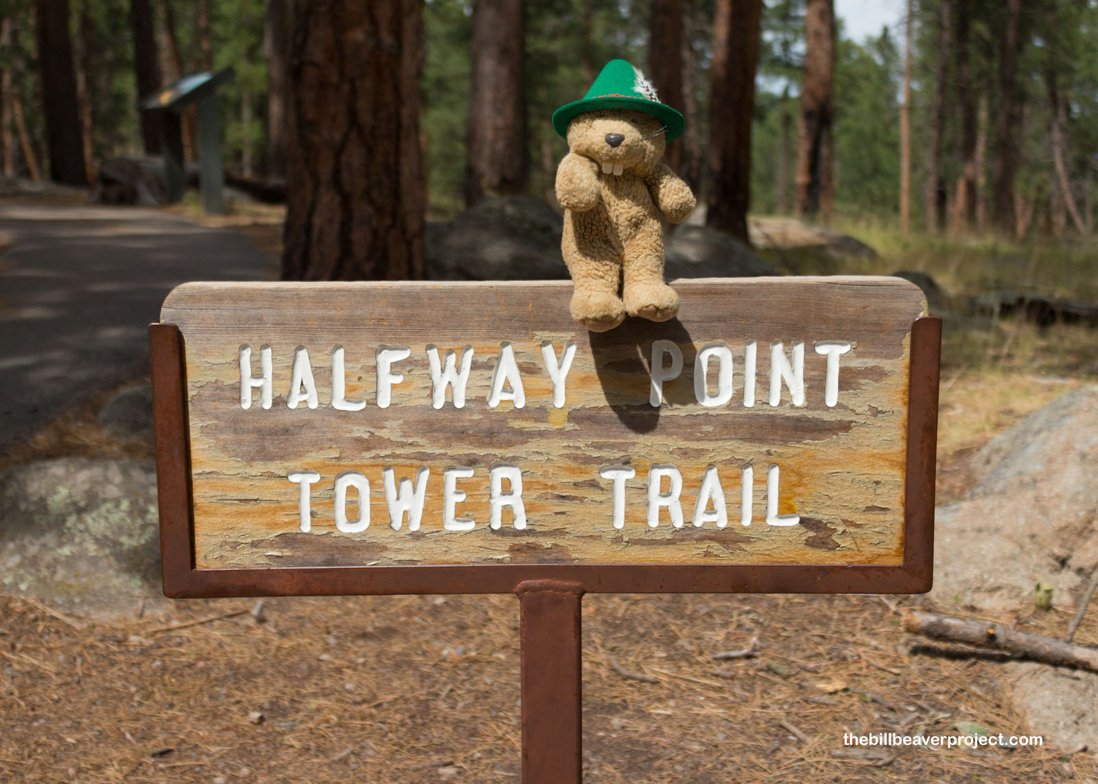
Most of the crowd clustered around the first viewpoint on the Tower Trail, so all I had to do was walk a little further to enjoy the world’s largest example of columnar jointing! While it’s up for debate how this igneous rock eroded the way it did, it is believed that this 867-foot monument has stood this way for at least 5-10 million years!
 |
 |
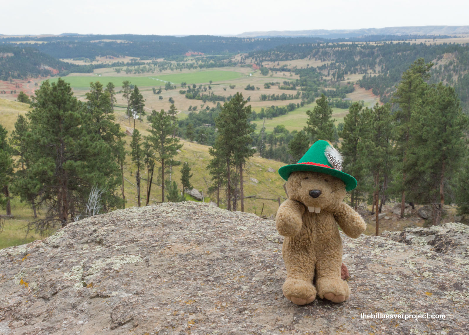
There were great views of the surrounding area from the Tower Trail too! Pines and oaks stretch right up from the plain to the base of the tower, and below, the Belle Fourche River still feeds fertile farmland. It’s not the same as it once was, though. To stop the river from flooding the plains, the Park Service changed its course in 1937. That was great news for farmers, but sad for the cottonwood trees that depended on the yearly floods.
 |
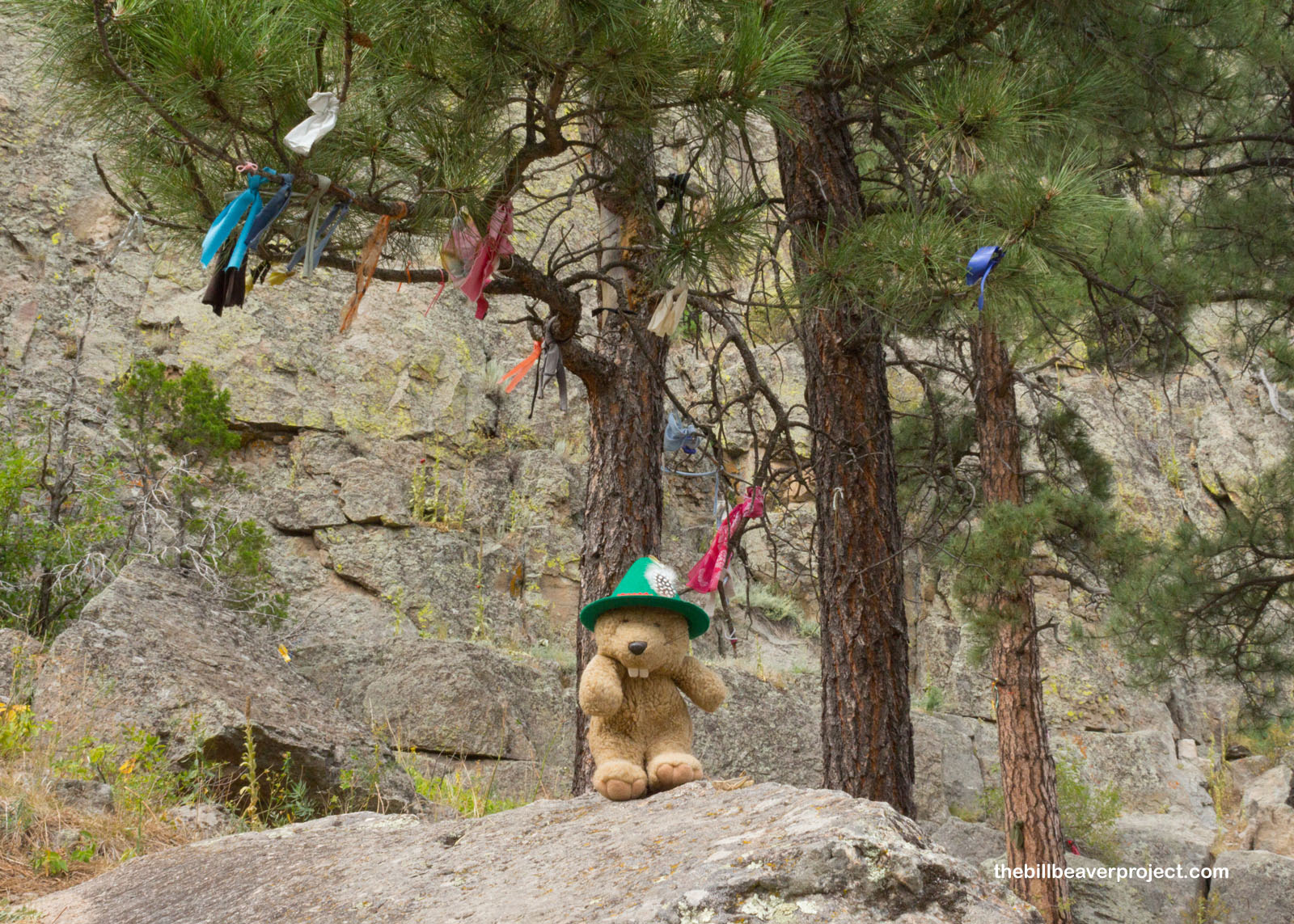
Encroaching farmers were also bad news for native people, who long viewed the Tower as a sacred site. I saw lots of medicine bundles tied to tree branches around the monolith, which is also called Bear’s Tipi, Bear’s Lodge, Tree Rock, or Grey Horn Butte. The big bear that appears in many of the names is different in each story. In one legend, the Great Bear, Hu Numpa, taught healing arts to shamans here. In others, shared among the Arapahoe, Cheyenne, Crow, and Kiowa, the giant bear was chasing a group of girls or warriors, and his huge claws gave the Tower its scratched appearance!
 |
It wasn’t until 1876 that Colonel Richard Irving Dodge gave this spot the name “Devils Tower” in his book, The Black Hills. He said the native term for this formation meant “Bad God’s Tower,” but he might have mistranslated wahanksica (“black bear”) as wakansica (“evil spirit”)! There are still efforts underway to fix this mistranslation, but the Wyoming state government says doing so will ruin tourism!
 |
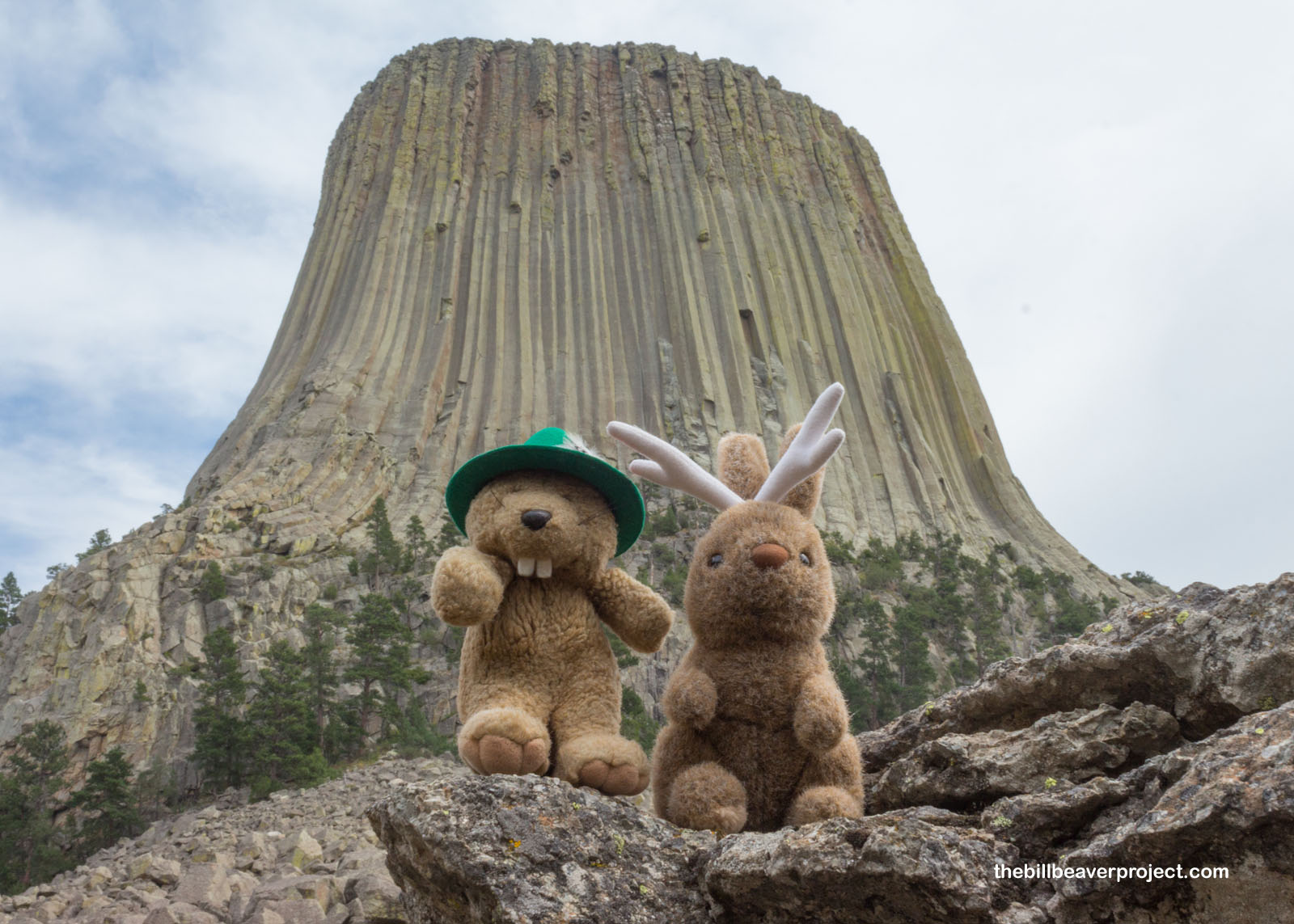
Speaking of tourism, it was actually really nice strolling the back side of the Tower! The huge crowds dispersed, and I was able to hear the breeze blowing and the birds chirping. I also heard the strangest yodeling sound in the distance. It was too high-pitched to be from a human. Could it have been the mythical creature that the prairie dogs had mentioned?
 |
 |
I got my answer as I finished my circuit and took one last look at the mighty Tower. The yodeling got closer, and with a whoosh, a jackalope (Lepus antilocapra) appeared! Jackalopes are the most revered of Wyoming’s “fearsome critters,” known to imitate the human voice and carry an unexpected fondness for whiskey. I didn’t have anything to imbibe, but this friendly jackalope, who went by Hécíkala, taught me a few bars of his yodel before a group of tourists approached and he whooshed away!
 |
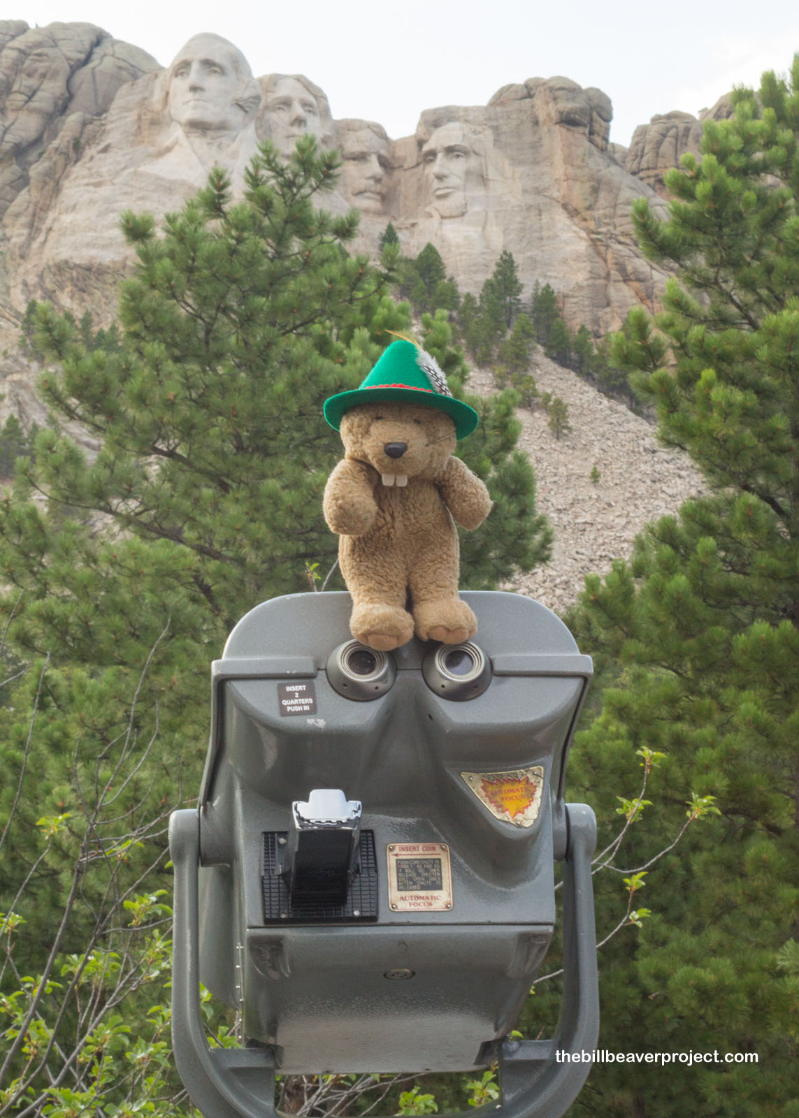
I also had to whoosh away, because it was 3:00 PM, and I needed to get to my next national park site before the visitor center closed at 5:00! En route to South Dakota, I got stuck behind a chain of residual bikers from last week’s Sturgis Motorcycle Rally (which gets its name from Union General Samuel D. Sturgis), and sadly had to bypass the famed town of Deadwood, until I pulled into the most famous monument in the Black Hills: Mount Rushmore National Memorial!
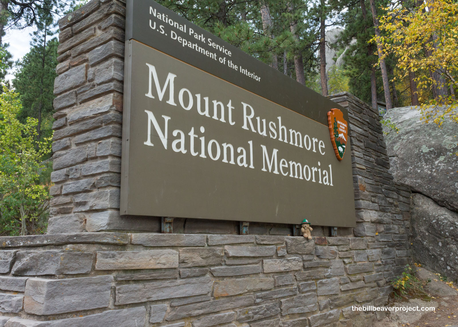 |
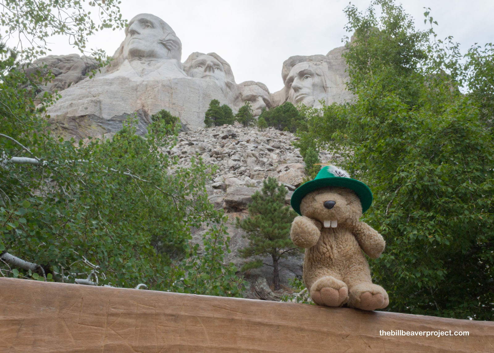
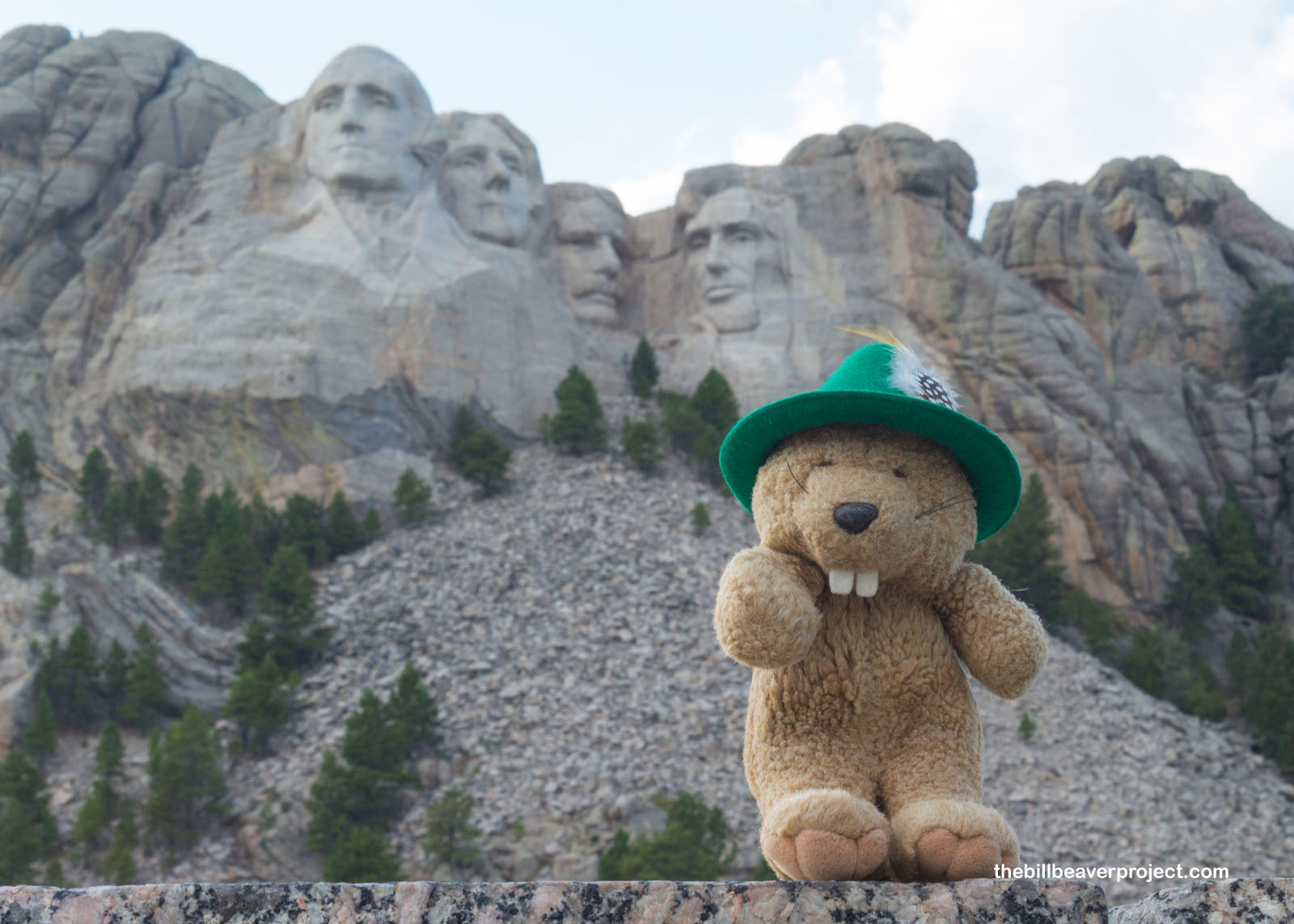
I really didn’t need to hurry, because nothing was going to close here any time soon! There were swarms of visitors here to see the four famous faces of George Washington, Thomas Jefferson, Teddy Roosevelt, and Abraham Lincoln, carved into the granite cliffs high above! This epic carving is a major part of South Dakota’s identity. It’s the Mount Rushmore State, after all, and this monument brings in millions of visitors each year! Based on the number of people without masks, I wondered if COVID-19 had impacted those numbers the way it had with other parks!
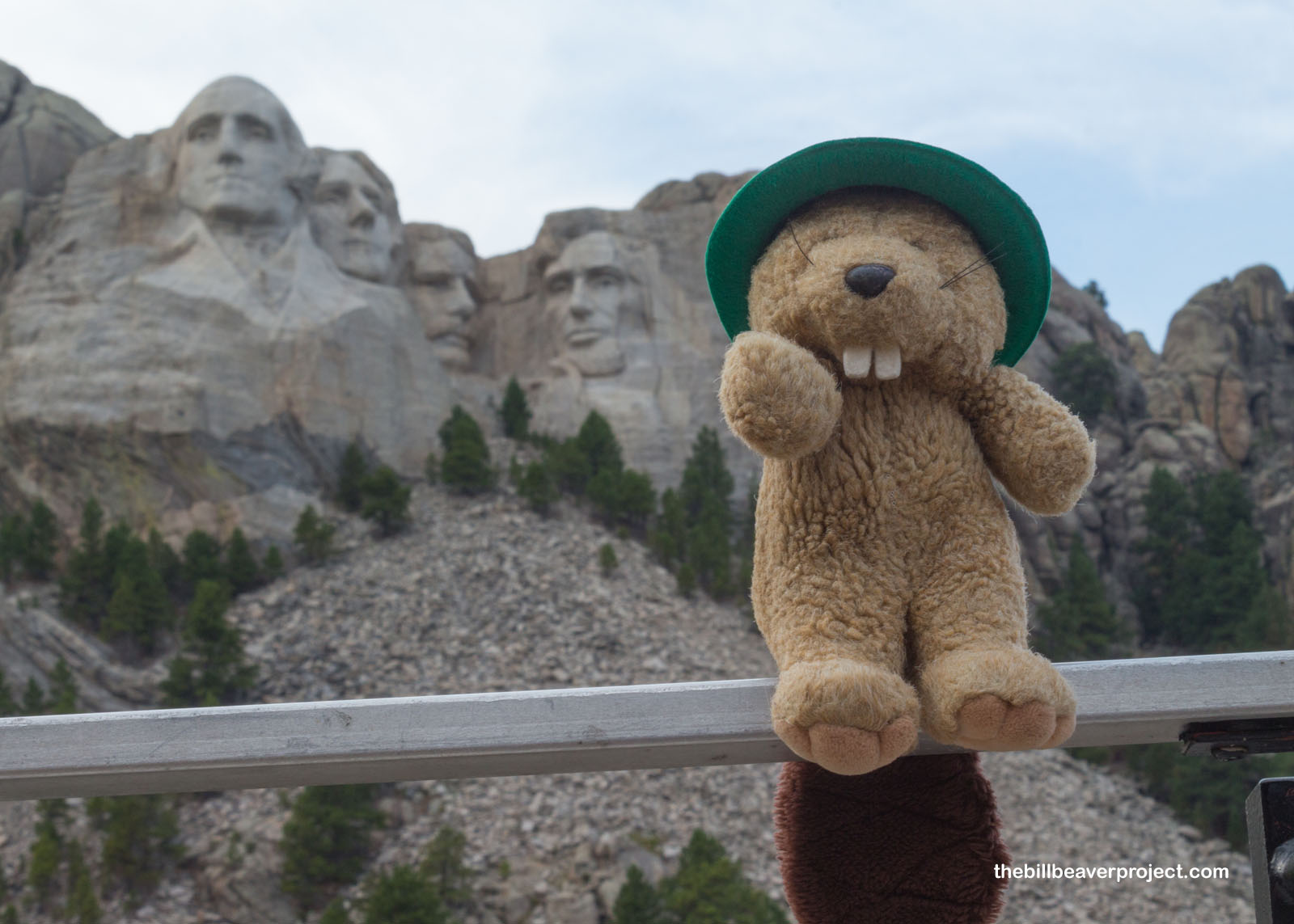 |
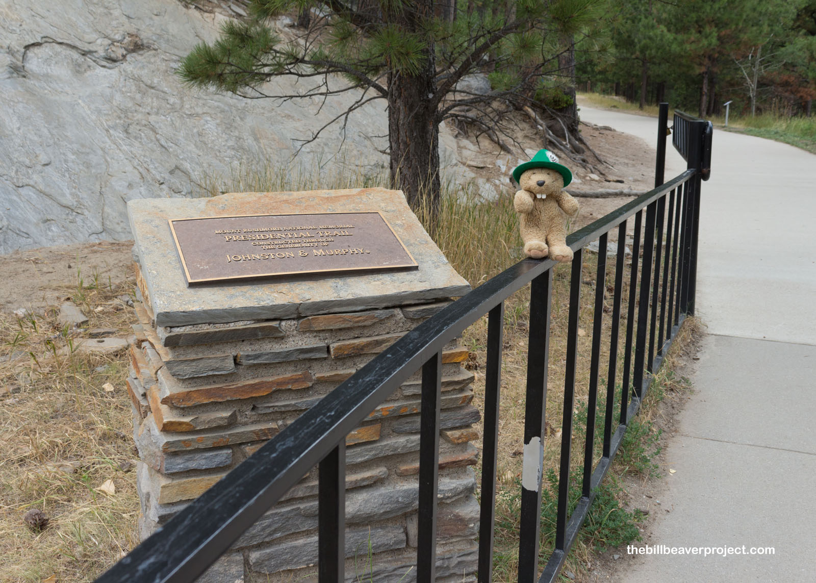
I took the Presidential Trail to get away from most of the crowd. If I were better at math, I’d say distance hiked is inversely proportional to crowd density! It cleared right up, and less than half a mile later, I got some great views right up the presidential nostrils!
 |
Mount Rushmore is named for Charles E. Rushmore, a lawyer from New York City, who spent time mining here between 1884 and 1885. His mining friends recorded his name for this rock with the General Land Office (now the Bureau of Land Management) in Washington, DC. What isn’t as widely taught is that this rock was originally called Tȟuŋkášila Šákpe, or “Six Grandfathers,” after a vision by Nicolas Black Elk of the six sacred directions, representing aspects of kindness, love, and wisdom. The mines that Mr. Rushmore worked were also part of the Black Hills land grab I learned about at Little Bighorn!
 |
 |
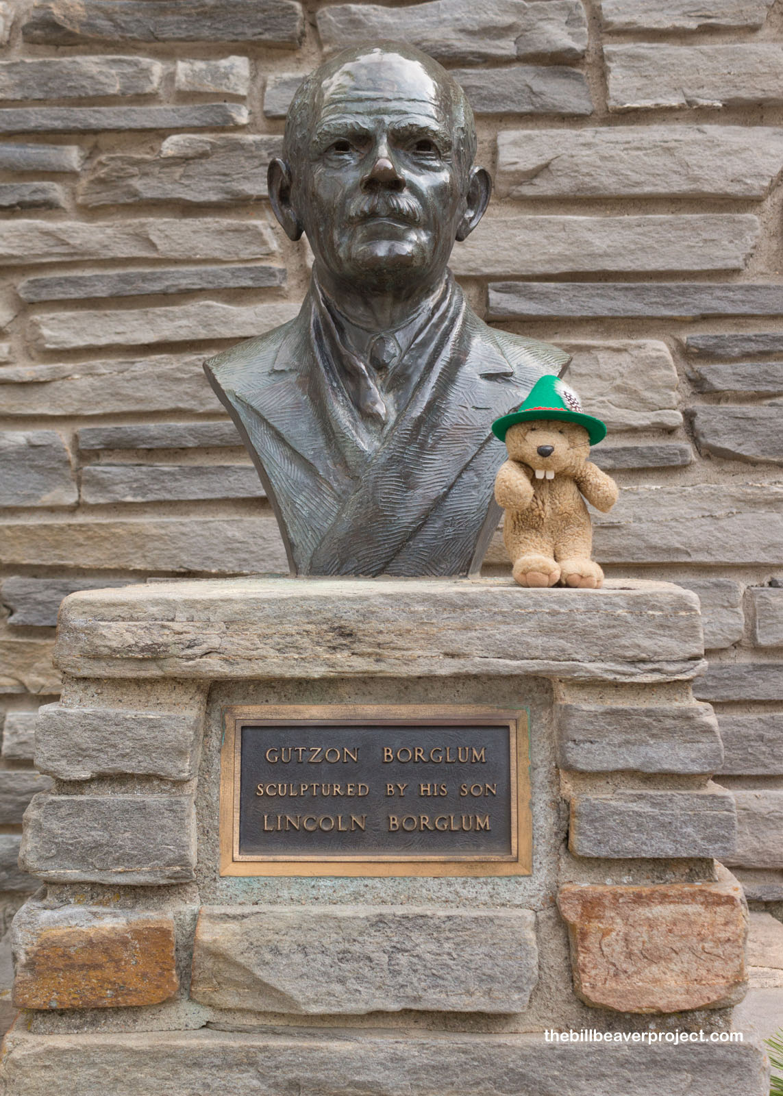
The idea to carve four presidential faces on this cliff came from South Dakota state historian, Doane Robinson, who, in August 1924, approached sculptor, Gutzon Borglum, as he was finishing the face of Robert E. Lee on Georgia’s Stone Mountain. After securing federal funding with a signature from President Calvin Coolidge, work on Mount Rushmore began on August 10, 1927. The head of Washington was completed on July 4, 1930, followed by Jefferson on August 30, 1936, then Lincoln on September 17, 1937, and finally Roosevelt on July 2, 1939! Final drilling, led by Lincoln Borglum, took place on October 31, 1941.
 |
 |
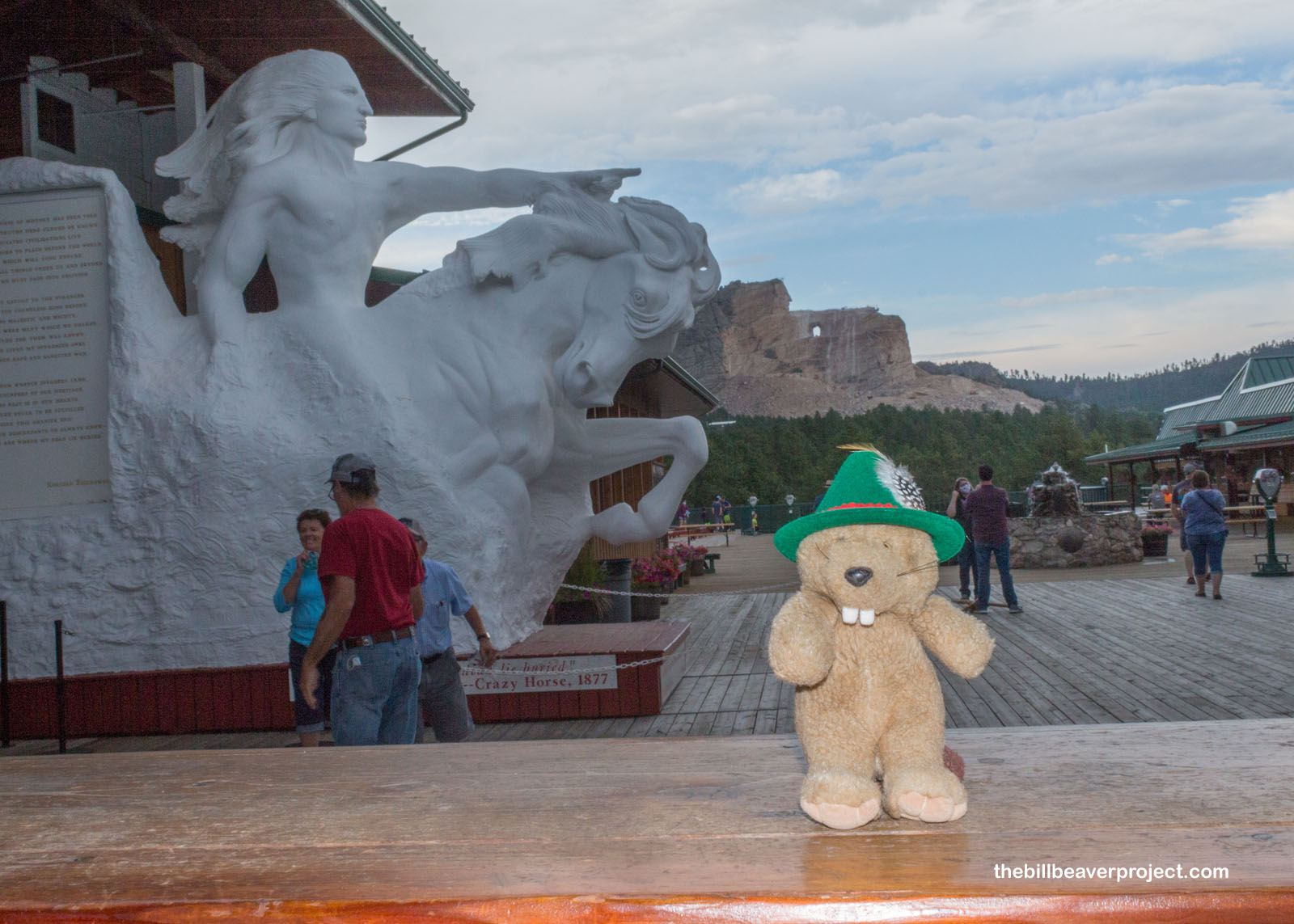
With daylight fading and a storm brewing, there was just enough time to see one more monumental work of art: the Crazy Horse Memorial! This one was actually sponsored by Chief Henry Standing Bear, the cousin of the famed Lakota warrior, who dreamed of creating both a monument to indigenous people equal in scope to Mount Rushmore, and a center of learning about native heritage. He first approached Gutzon Borglum for help but ended up with one of the Rushmore assistants, Korczak Ziolkowski, also a World War II veteran and winner of the World’s Fair prize for his marble sculpture, “PADEREWSKI, Study of an Immortal.”
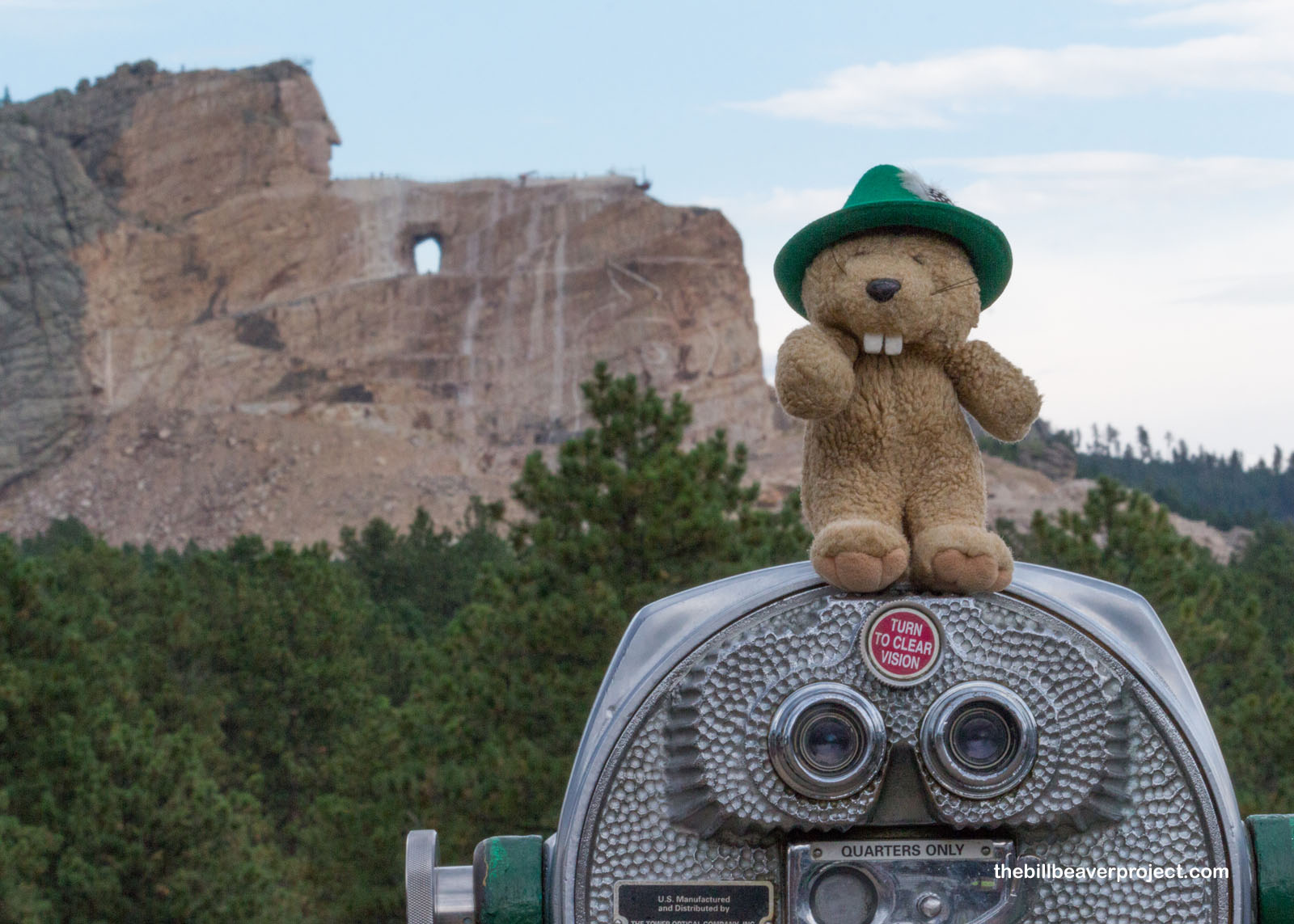 |
Mr. Ziolkowski worked on Crazy Horse from May 3, 1947 until he died on October 20, 1982. In that time, he created an outline and carved the horse’s mane, but Crazy Horse’s face, left to be carved by his family, wasn’t ready until June 3, 1998! Today, crews are still working on Crazy Horse’s hand, but there was plenty more to do here during the long wait, like explore the Native American Educational and Cultural Center and galleries! Sadly, I had a long drive ahead of me and a storm to race, so I couldn’t explore as deeply as I would have liked.
 |
On my long drive back to Colorado, I reflected on the complex stories surrounding today’s sites. As a resident of the United States of America, I like their familiarity and the way they stir a sense of pride in folks. I still can’t help but be ashamed by the way the land where these monuments stand today was acquired. I’m not sure how best to heal these old wounds, but I do feel that it’s super important to tell these stories before they’re lost to myth.
Tókša akhé!

Previous Day |
Total Ground Covered: 1,910.0 mi (3,073.9 km) |
Next Day |