 Previous Day |
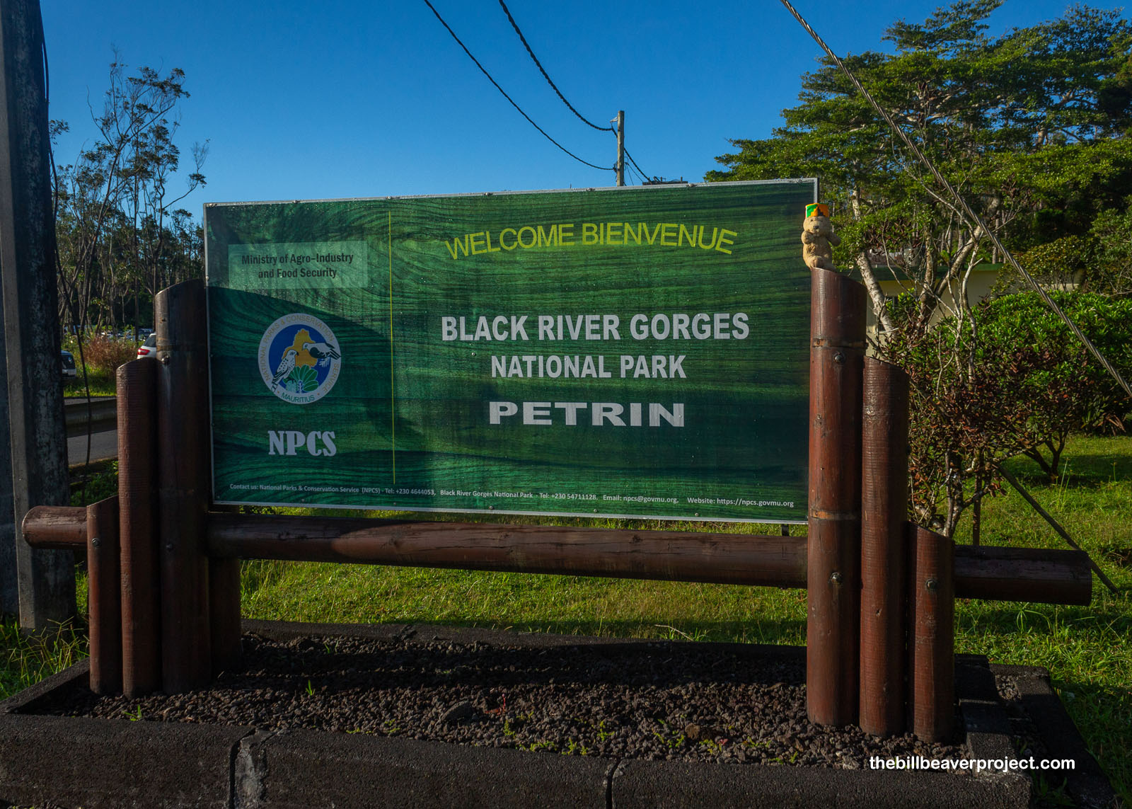
Vacoas-Phoenix, MU → Black River Gorges NP → Vacoas-Phoenix, MU 68.6 km (42.6 mi) |
 Next Day |
Anou ale, zot tou!
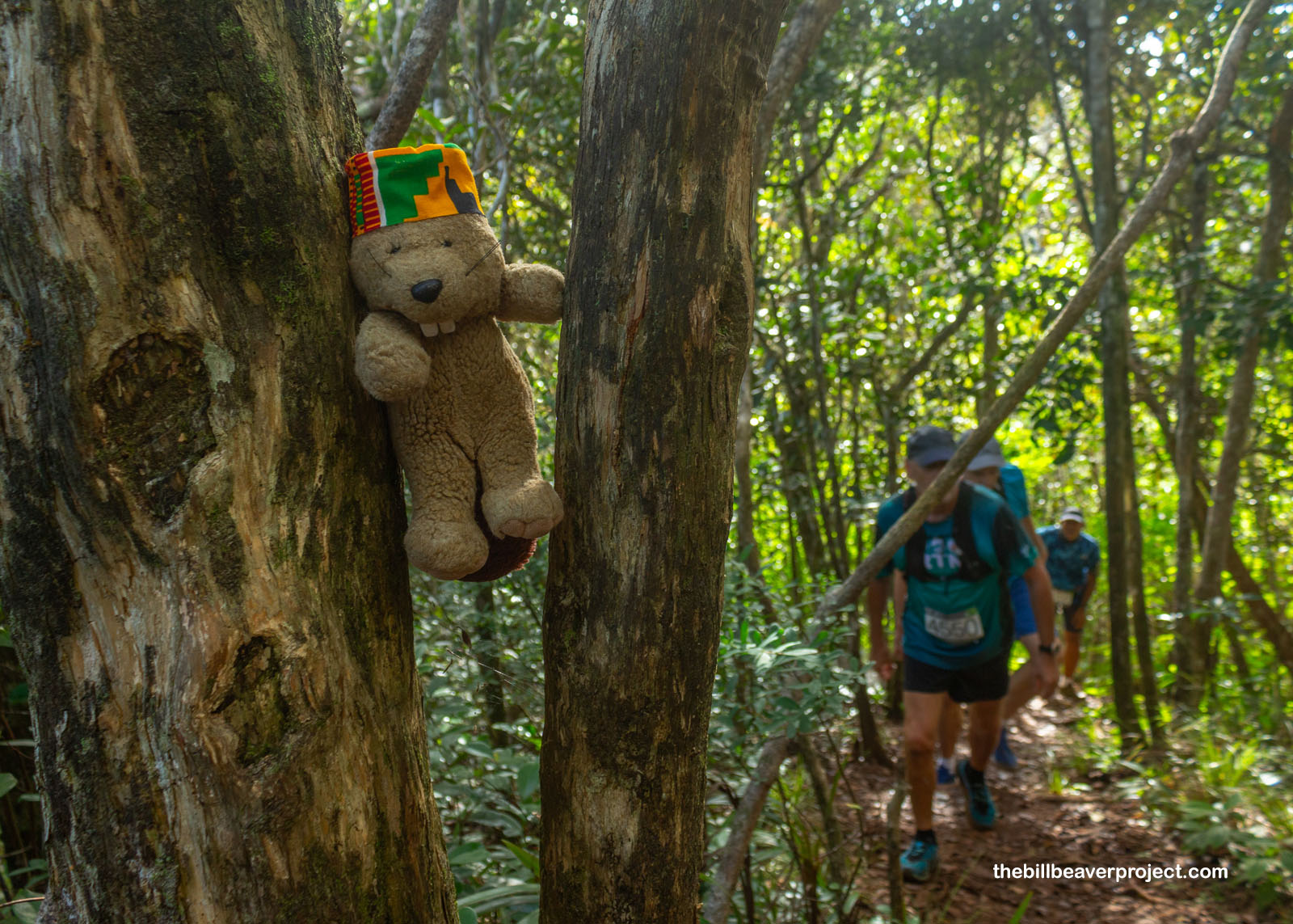
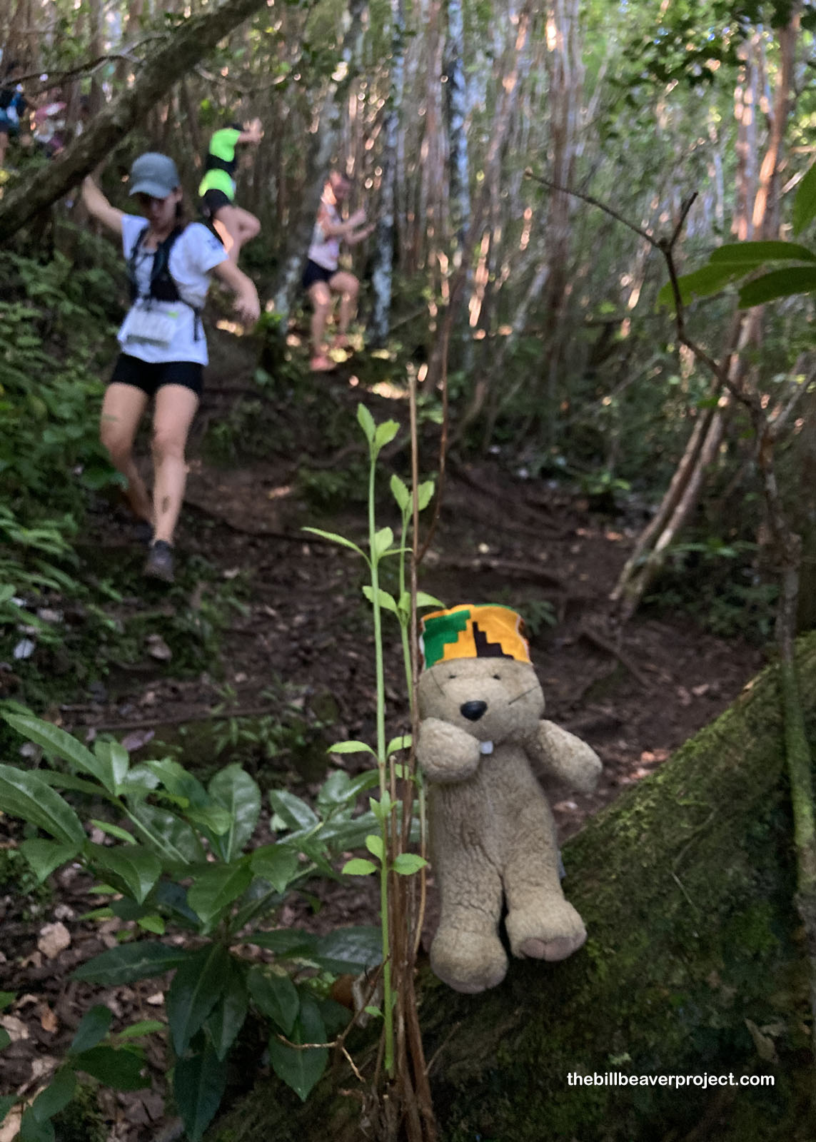
I’ve experienced national parks in a lot of unique ways over the years—by plane, by cruise, by deep dive—but I never thought in a bajillion years that I’d be running a trail race through one! Sure, I’ve hustled a fair amount over the years, but we beavers aren’t exactly famous for our cross-country racing skills. So when my pal, Buzz, signed us up for the 12K Championnat de Trail, the national trail running championship for the whole island of Mauritius, I was a little concerned, but since all the trails in Black River Gorges National Park were closed for the event, what else was I to do but say “dakor?”
 |
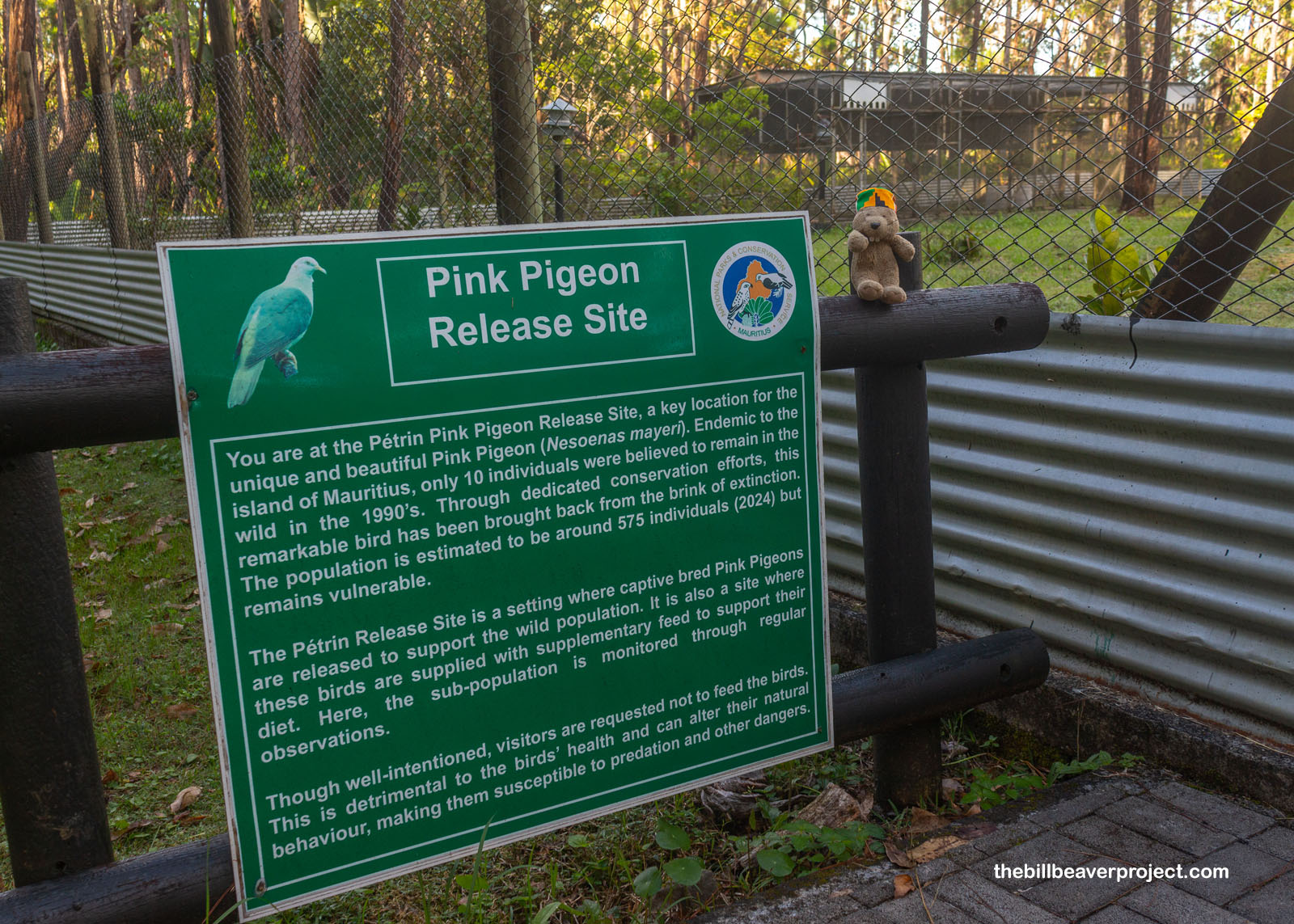
While stretching by Le Pétrin Information Centre, I spotted a fenced-in area with an encouraging sign. Here was the place where pink pigeons, hatched in captivity, were being released into the wild! Like the dodo, these uniquely Mauritian birds had been decimated by habitat loss and exotic predators, brought down to their last 10 individuals in the 1990s, but unlike the dodo, they have been brought back from the brink. At last count, they were numbering close to 600, making the pink pigeon the only pigeon in the Mascarene Islands (Mauritius, Réunion, and Rodrigues) to have not gone extinct! Now that’s the sort of good news I needed for my warmup!
 |
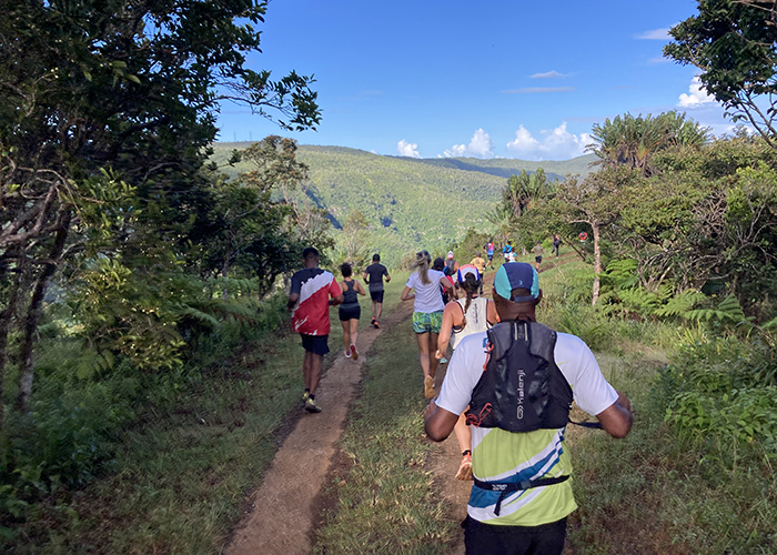
Since only Mauritians were eligible for a medal, Buzz and I set more measured expectations, focusing on the prize we’d been promised by the website: a breadroll and water! With the firing of the pistol at 8:00 AM, we and 381 other runners were off down the maintenance road leading into the park. I was completely overwhelmed by giant legs, so I clung to the side of the road, which meant more plants to dodge but way less mud! Over the first twenty minutes, the crowd thinned out, but then everybody stopped in their tracks as the road became a steep, slippery trail down into the first gorge, where folks were lowering themselves slowly, using the guava trees as handholds!
 |
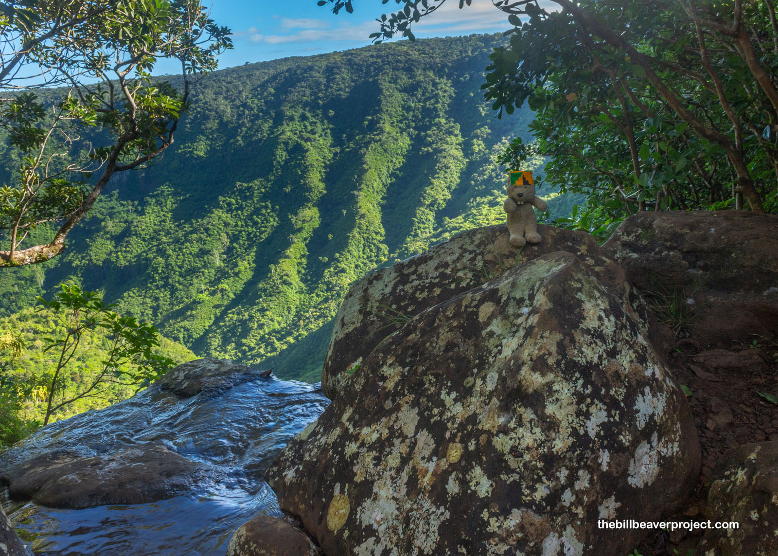
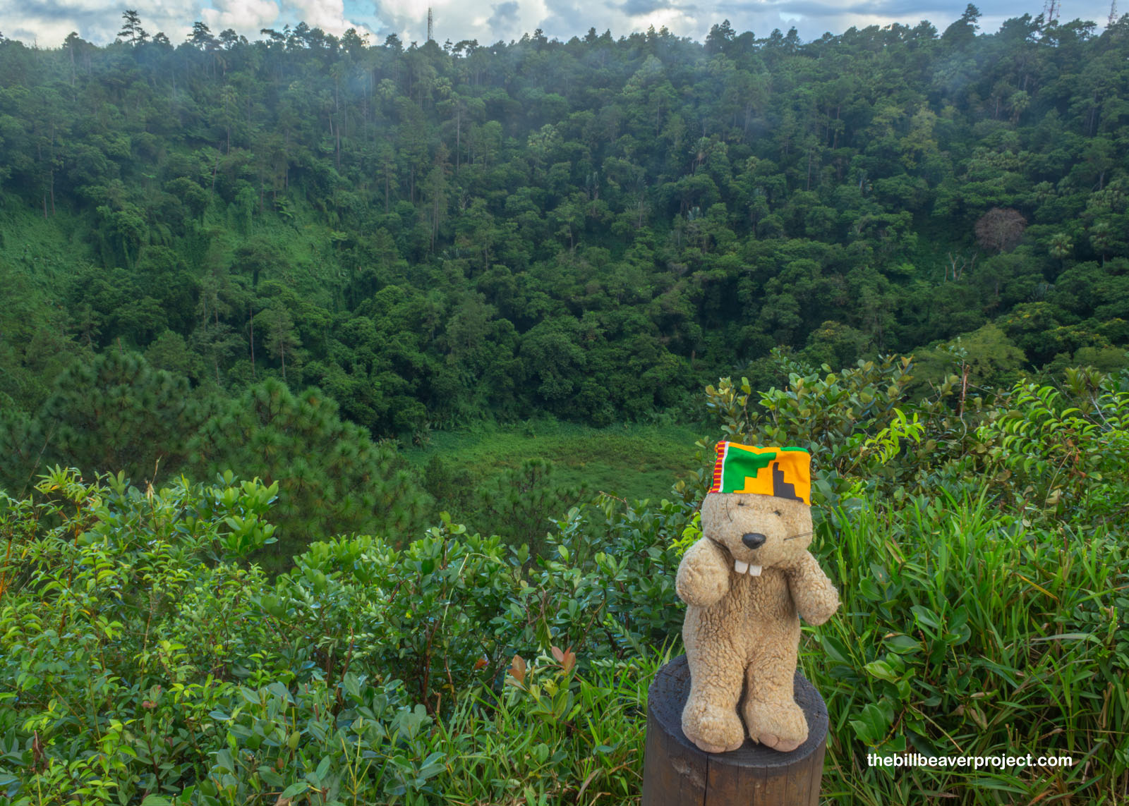
With wet leaves sloshing and mosquitoes buzzing, it was probably the slowest race ever (not) run, but I didn’t mind, especially when we reached the bottom of our descent, almost a thousand feet down from the top! A burbling stream marked the end of the downhill, and I decided, before embarking on what looked like an exhausting uphill, to stop end enjoy the view. As it turned out, we were crossing the top of the Mare aux Joncs Waterfall, which had created a window in the forest to the gorgeous gorge beyond!
 |
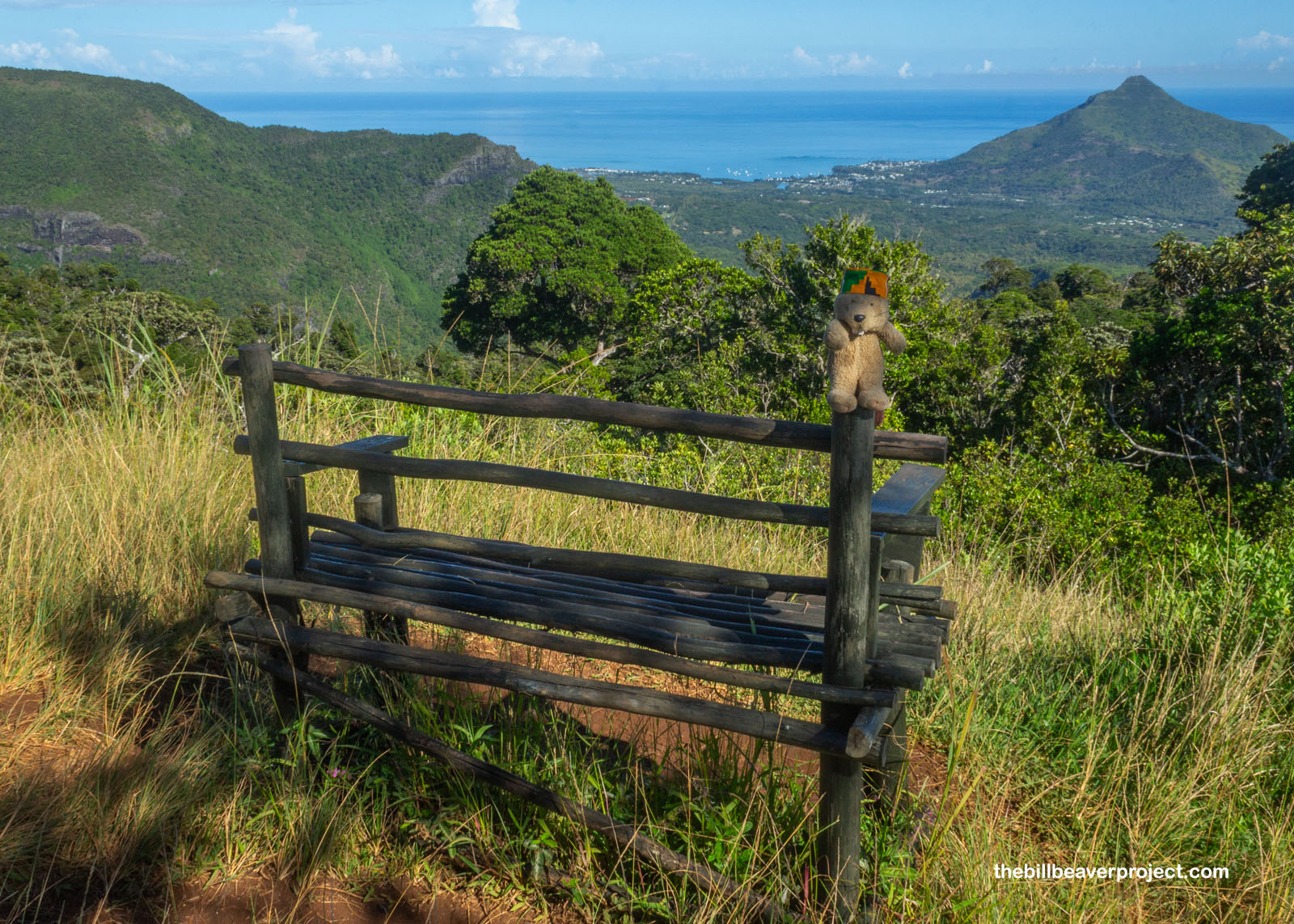
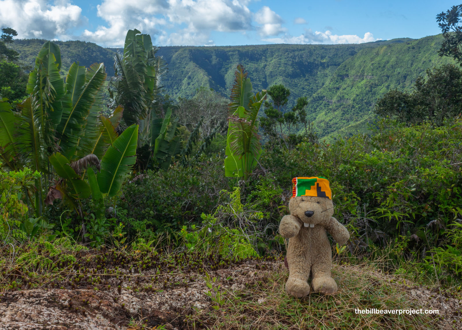
Just as I suspected, it was a real slog back up to the mountaintops, but after another twenty minutes or so, the trail emerged onto another flat maintenance road with clear views of the lush, green, forested cliffs on all sides. I lengthened my stride on the flat, about four inches, all the way to the Macchabée Viewpoint, marked by a gazebo and some benches, with spectacular views of Grand Rivière Noire and La Tourelle Tamarin Mountain, just south of where we went kayaking yesterday!
 |
 |
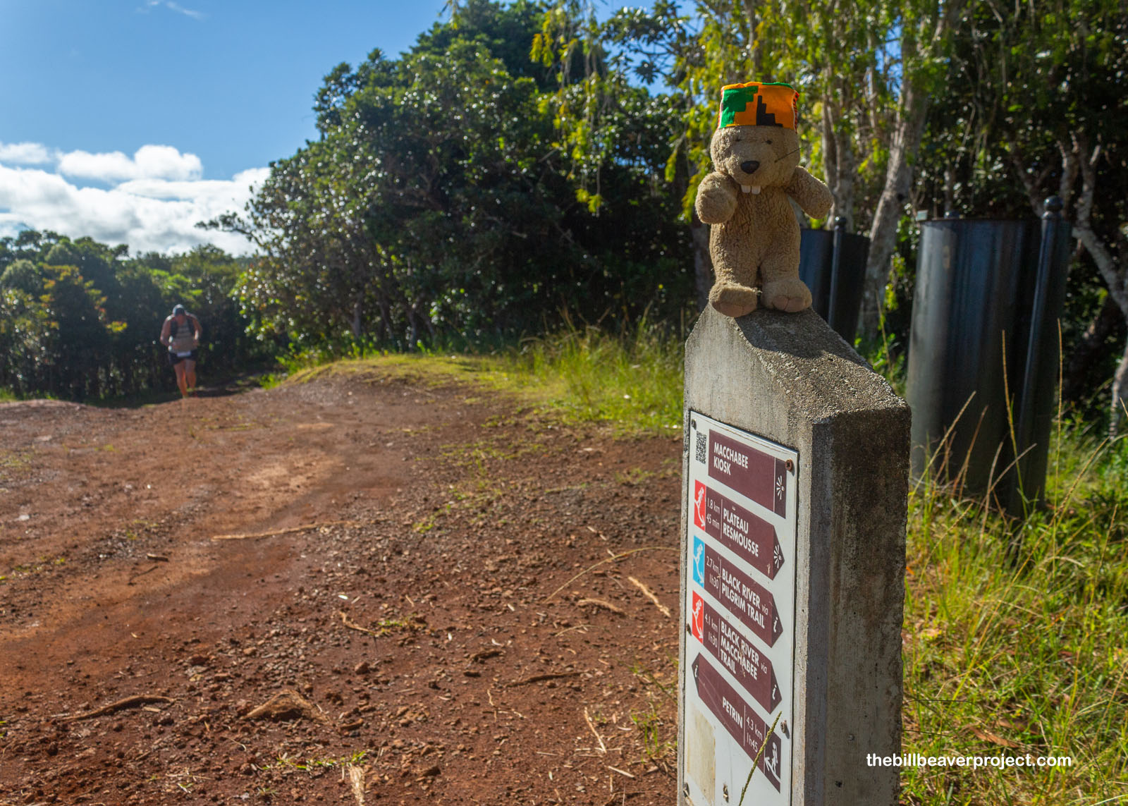
And then, it was time for another descent! I was an hour into my journey, and I hadn’t seen Buzz in a long time. Surely, this must be close to the halfway point, right? Nope! When I checked the distance marker, it measured 4.3 kilometers back to Le Pétrin! I was barely a third of the way through the race!
 |
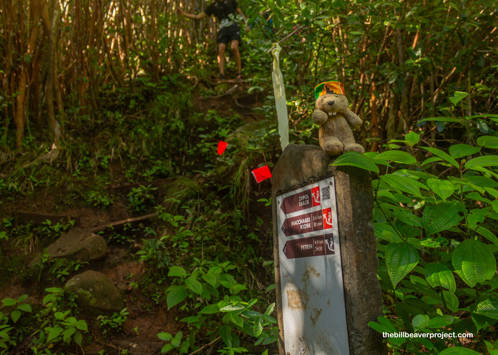
It was a nice view from the flat top, but it was not to last! From here, the course turned down via the Zepol Track, which was another hand-over-hand descent but a much wider one, so it wasn’t as bottle-necked as before. It was still pretty slippery though, and I had to catch myself a couple of times before I tumbled!
 |
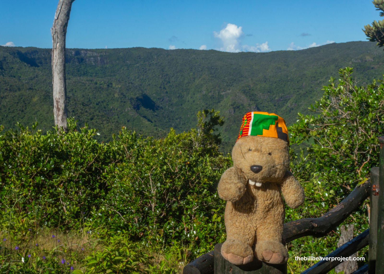
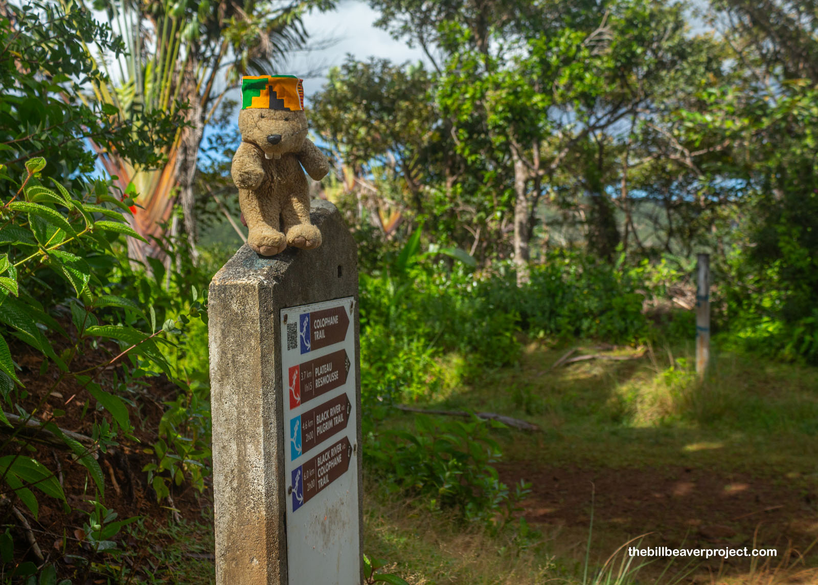
Reaching the bottom eight minutes later, I took a big breath and checked how far I’d come: only 0.6 kilometers! I still had seven whole kilometers to go! As I caught my breath, one lady asked in French if I was visiting from Africa because of my hat. I guess I technically was, but I hadn’t completely left Africa. After Mauritius gained independence from Britain on March 12, 1968, it had strong cultural ties to mainland Africa. Most of its population had been brought here from Africa in the 18th Century after all! So Mauritius joined the African Union and still has strong ties to that continent today! Anyway, that’s what was on my mind as I began the long, hot slog back up to the top via the Colophane Trail!
 |
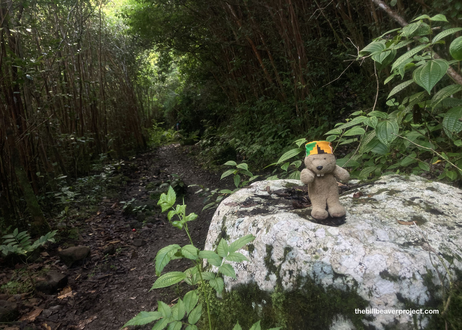
Luckily, there was a lot of shade on this stretch, and if I’m being honest, I spent a good chunk of time walking. While the slope was gradual, it was both constant and muddy! Mauritius is a hot, tropical island with rain practically every day in late afternoon, and with all those factors playing a part, the next kilometer or more was exploding with the smell of the rotting guavas that were covering the trail! Was it nice smelling? Kind of? But I wasn’t about to interrupt the fruit flies who were heeding their calling!
 |
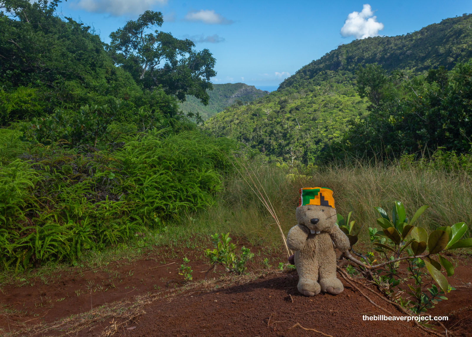
And the trail kept rising, breaking clear of the canopy and emerging once more into open skies with views of the steep, green cliffs on all all sides and the ocean beyond. Up, up, up the red dirt trail the trickle of racers went as that late morning sun started to swelter! I’d pass some folks, then stop to take photos, and they’d pass me, making the last half of the race course one spectacular and sultry game of leap-frog! My hustle took a hit, but then a seemingly random fellow, who turned out to be a photographer for Rando-Trail called out in French that it was only half a kilometer to the top! That gave me beaucoup courage!
 |
 |
The distance marker at the top told me much more about the direction I’d come than the direction I was going, but it looked like flat road ahead. In fact, it was the same flat road I’d been on earlier, climbing up from the Mare aux Joncs waterfall! Only this time, it blazed right past that trail and continued directly toward the Information Center. When the next sign said 2km to go, I kicked into as high a gear as my legs would kick!
 |
I hustled the whole rest of the way to the finish line as the surrounding forest became more familiar. It was a whole different experience not drowning in giant legs, and soon enough, the open line to the finish opened wide! Whoo hoo! I busted over that finish line and stood panting for a long while before checking out the results: a time of 2 hours, 3 minutes, and 57 seconds, 242nd place! I was bushed and ready for a breadroll!
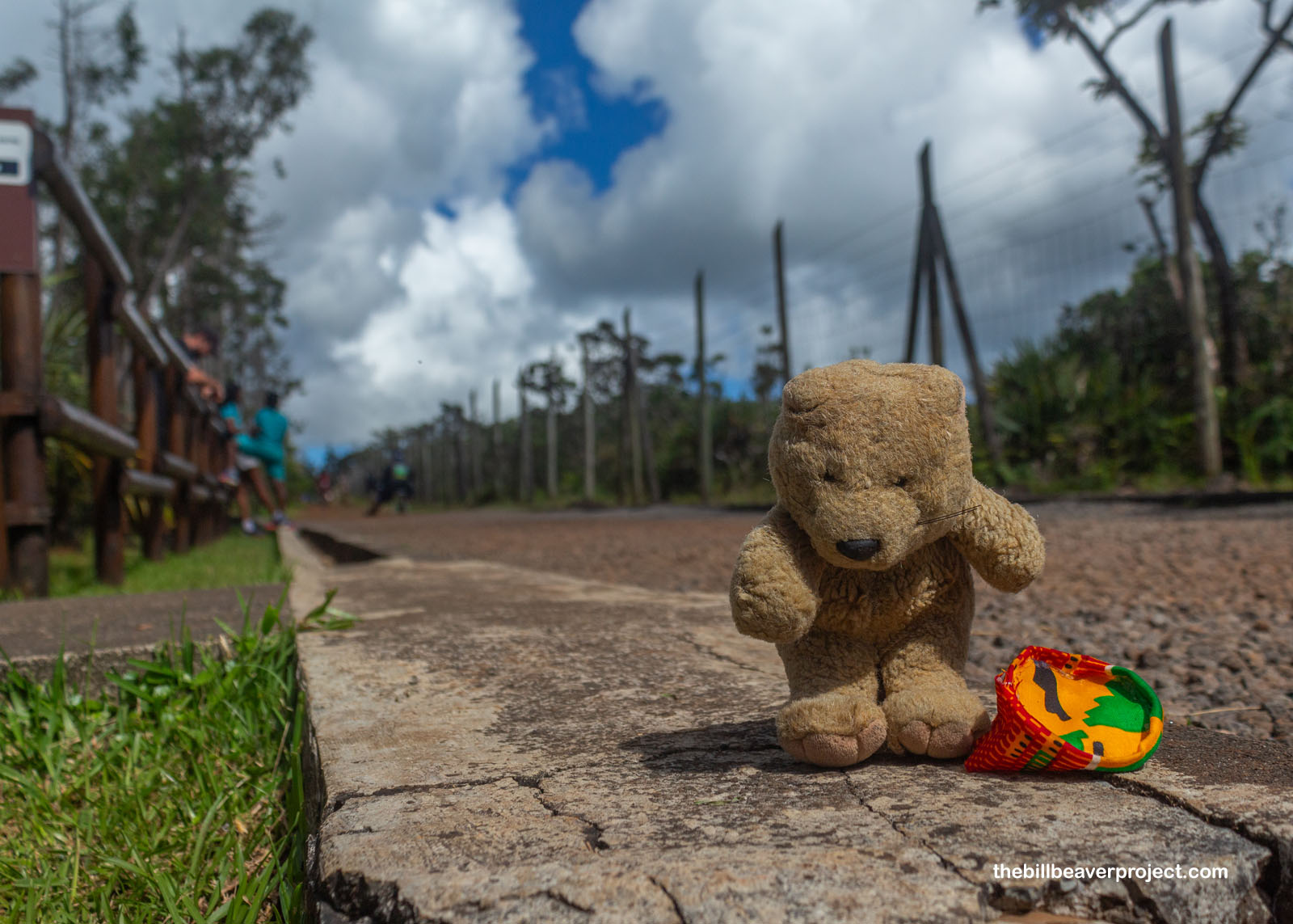 |
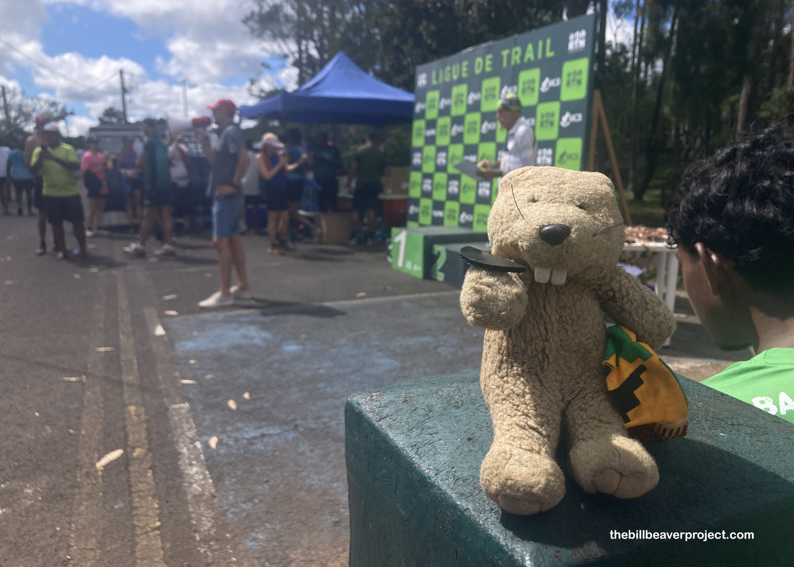
After collecting my black token for food and reconnecting with Buzz, we learned that the breadroll wasn’t just a roll but a whole sandwich, and the water wasn’t just water but also the choice of having your water bottle filled up with Coca-Cola! As to the winner of today’s championnat, that was Darius Fra in the 19-and-under division with a time of one hour and fifty-five seconds! Buzz and I were happy just to have been immersed in the beauty of the park!
 |
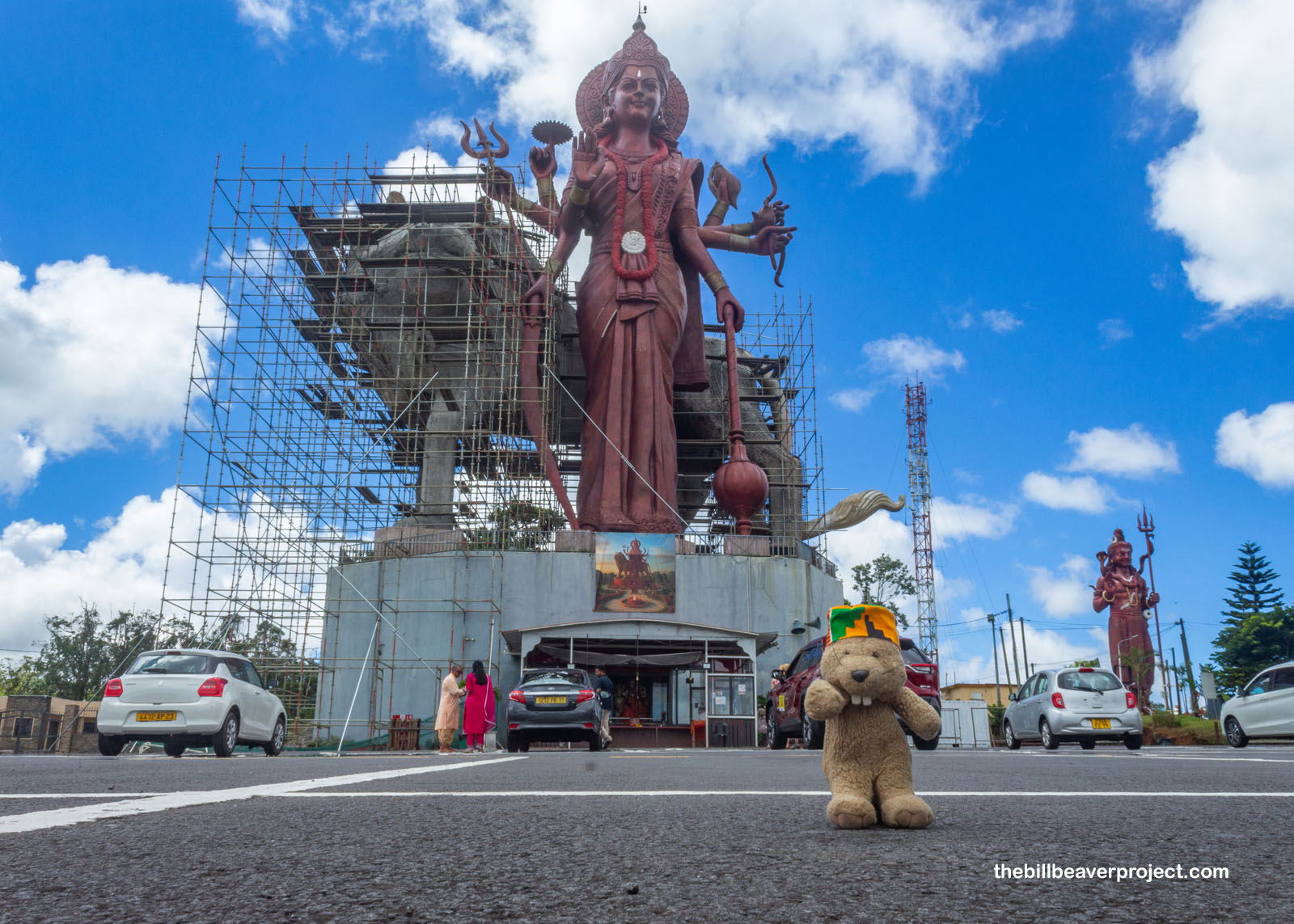
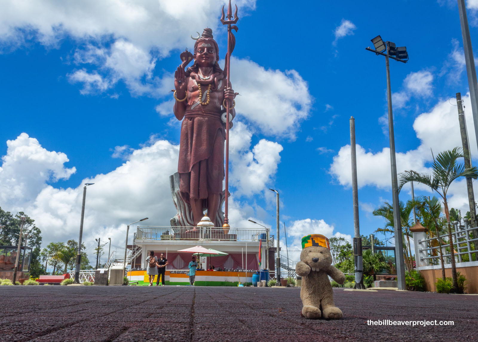
After some hobbling around and consuming our rewards, Buzz and I decided to explore the nearby Ganga Talao, or Grand Bassin Temple. There, we met an astonishing sight: two enormous statues of Hindu gods! On the left, 108 feet tall, was the world’s largest statue of Durga, demon-slaying goddess of protection, motherhood, and war, which took six years to build! On the opposite side of the road stood the Mangal Mahadev, equal in height to Durga and featuring the god of destruction himself, Shiva! Each had their animal companions tagging along: Durga with her lion, Dawon, and Shiva with Vasuki, king of the nagas, around his neck! Because of its history bringing in enslaved and indentured folks from India, Mauritius is the only African nation with a Hindu majority!
 |
 |
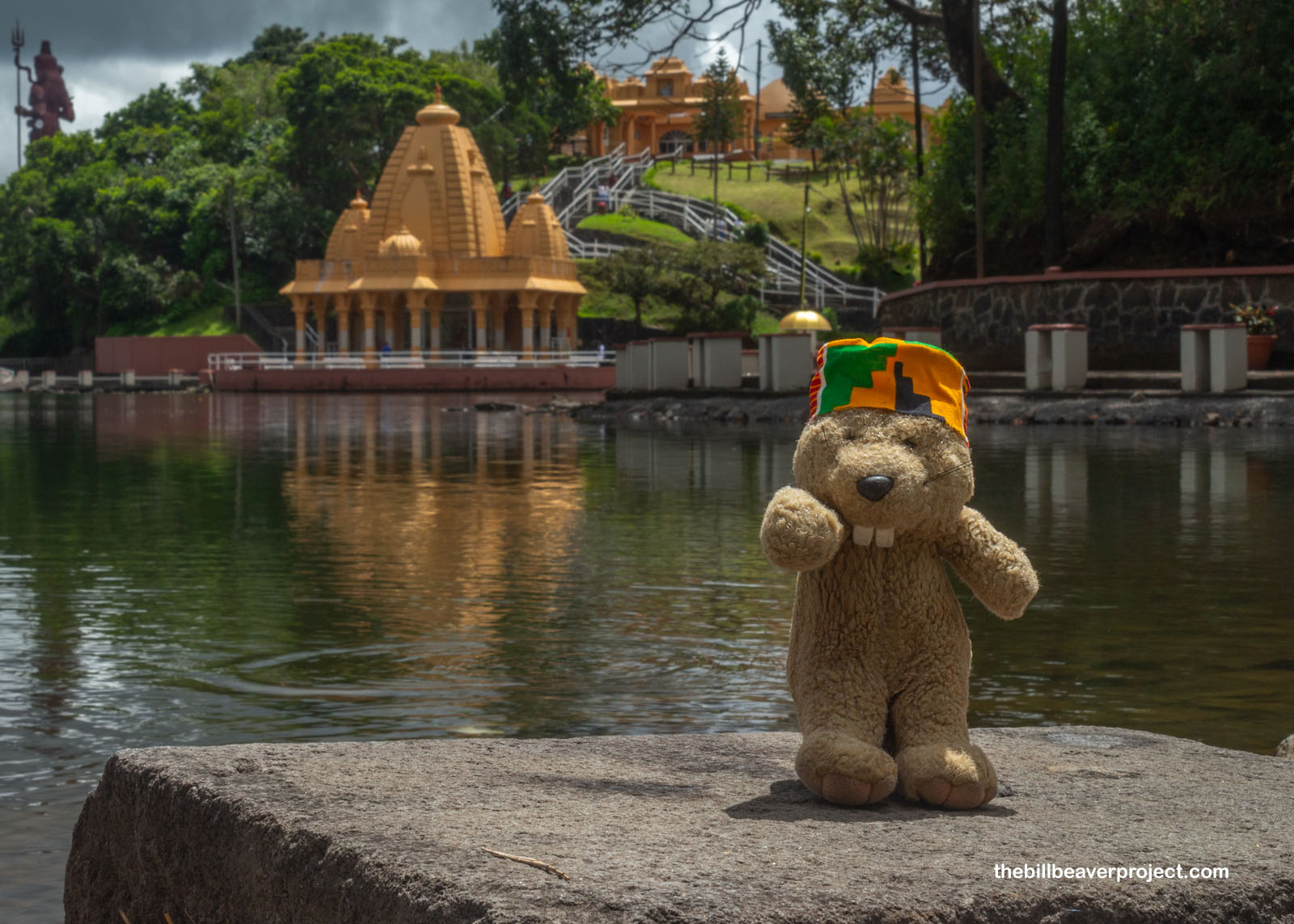
Then we ambled down to the Ganga Talao, a crater lake turned temple in 1887 when a Hindu pujari had a vision of its water flowing out of India’s Jahnavi River. When he first saw the lake, it matched his vision exactly, and so today, the lake is held as Mauritius’ most sacred Hindu spot! It’s a great place for pilgrims to practice prasad, giving food to animals as a way to build good karma, connect with ancestors, and even get special perks from the gods, like courage from Hanuman if you leave out fruit for monkeys! While there were quite a few visitors wandering the lakeside, and some cats feeding themselves on the fish, it still felt like a tranquil place, dropped down just below the surface of the world.
 |
After stopping by the AirBNB to clean up, we headed north into Èbene to sample a highly recommended local specialty, the dholl puri from Dewa & Sons! Super simple, it’s a fluffy crepe-like wrap stuffed with spicy chana dal chickpea filling. We munched the scrumptious national dish of Mauritius while the sky opened up outside, a colossal thunderstorm with sheets of rain that turned the streets into a three-inch deep river! After what felt like an hour, waiting alongside a street dog in the parking area, we took our chance and ran for the car!
We got pretty wet, but as luck would have it, the rain subsided not long afterward. Mauritius has showers like these pretty often it turns out! Anyway, with plenty of daylight left, we wrapped up the day of adventure with a stroll around the charming walking track surrounding Trou Aux Cerfs (“Deer Hole”), a 2-million year old volcanic crater that took part in the creation of Mauritius itself! Nowadays, it’s sleepy and overgrown, but it was the best spot for taking in views of the mountains and surrounding city, and for walking off all the aches and pains we’d built up during the race!
 |
So our major adventure day in Mauritius came to a close, and I think we made the most of it with unique Mauritian birds, views, and dishes. What we do tomorrow is a little up in the air because, it turns out, a lot of places are closed on Sundays up in Port Louis! I guess we’ll see which way the trade winds carry us!
Bonswar!

Previous Day |
Total Ground Covered: 496.0 km (369.3 mi) |
Next Day |