 Previous Day |
Captain Cook → Hilo → Captain Cook 180.0 mi (289.7 km) |
 Next Day |
Aloha kakahiaka i nā mea a pau!
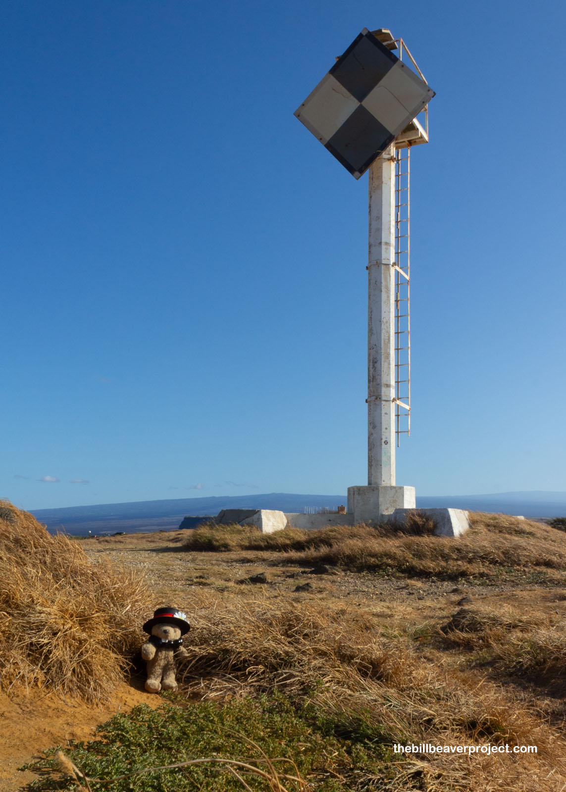
It’s a good thing I didn’t stay too late at the potluck last night, because I had a long way to go this morning! There was a big ol’ curve around the bottom of the Big Island to get to Hawaiʻi Volcanoes National Park, and I was hoping to beat the crowds! That didn’t stop me from a detour, though, and 12 miles south of the Mamalahoa Highway, I reached the historic, Ka Lae Light at South Point: the southernmost spot in (what is now) the United States!
 |
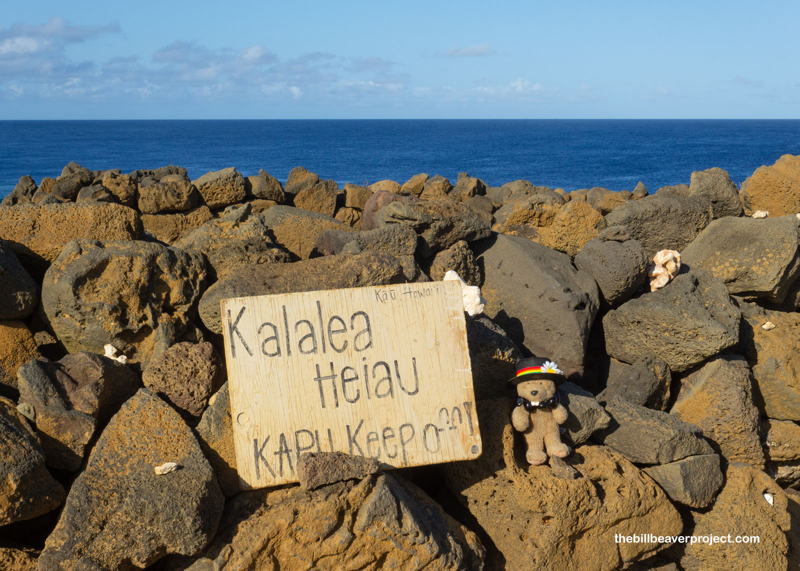
Some evidence suggests that South Point was the original landing spot of Hawaiʻi’s first human residents! There was a house with 14,000 artifacts excavated in 1956 at the Puʻu Aliʻi (Hill of Chiefs), and the remains of the Kalalea Heiau still stand over the prime fishing spots. This square-shaped heiau was dedicated to Kuʻula, the god of fishing, and folks here hoped he would not only bring them abundant fish, but also protect them from South Point’s famously huge waves!
 |
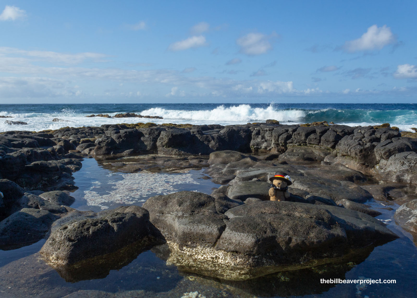
I scrambled on down the rocky shore to get a better view of those huge waves! Back in the day, fishermen would tie up their canoes through holes in the cliffs to keep from getting washed out to sea! How they managed to get safely back to shore with their catch of ahi, mahi mahi, or marlin is anyone’s guess, but maybe Kuʻula was listening after all!
 |
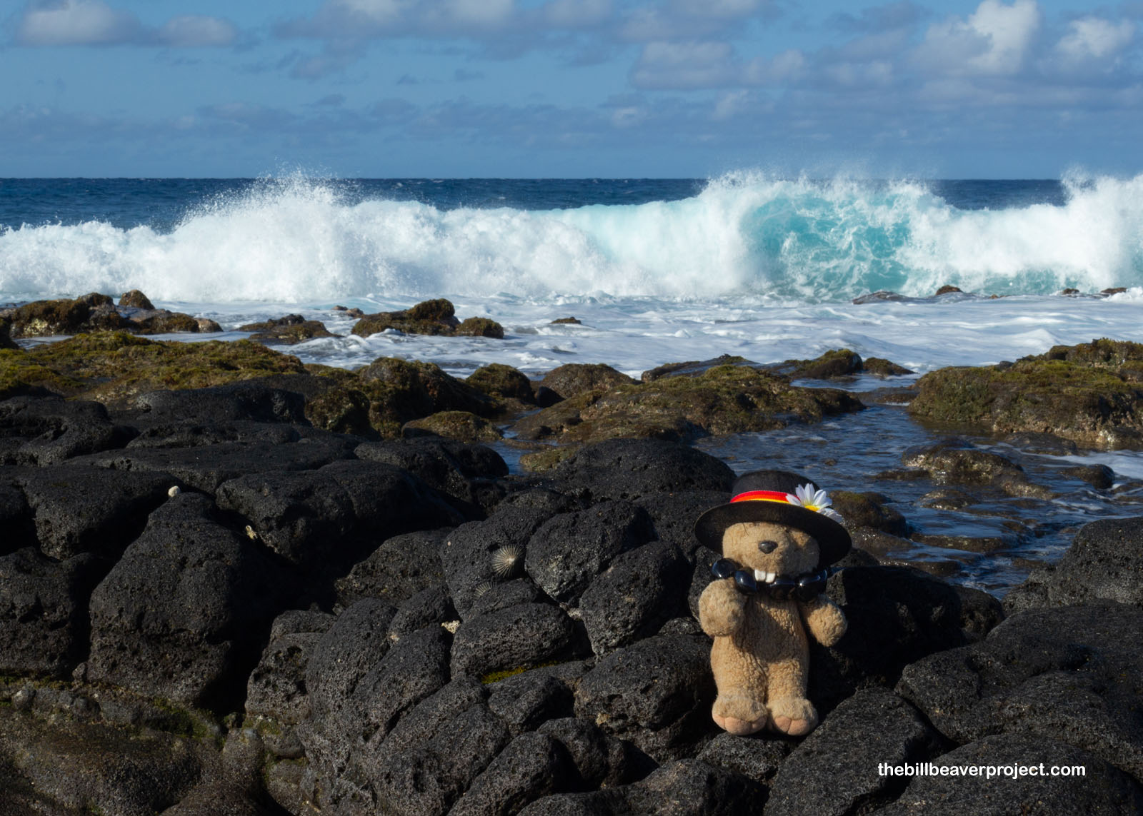 |
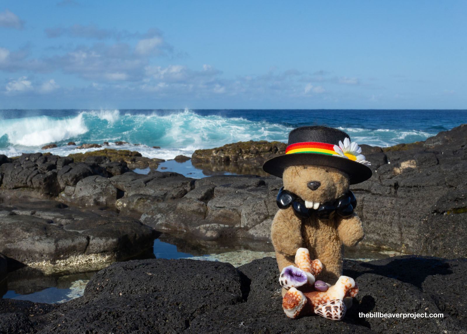
The bounty of the sea was pretty clear, even today! There were folks fishing and harvesting shellfish all over. The remains of broken coral branches completely covered the rocks, and I was lucky to spot some beautiful seashells in the mix: some dotted cone snails and a purple cowrie! How they endured the crashing waves is another mysterious feat!
 |
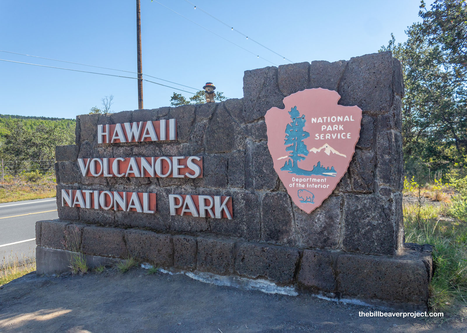
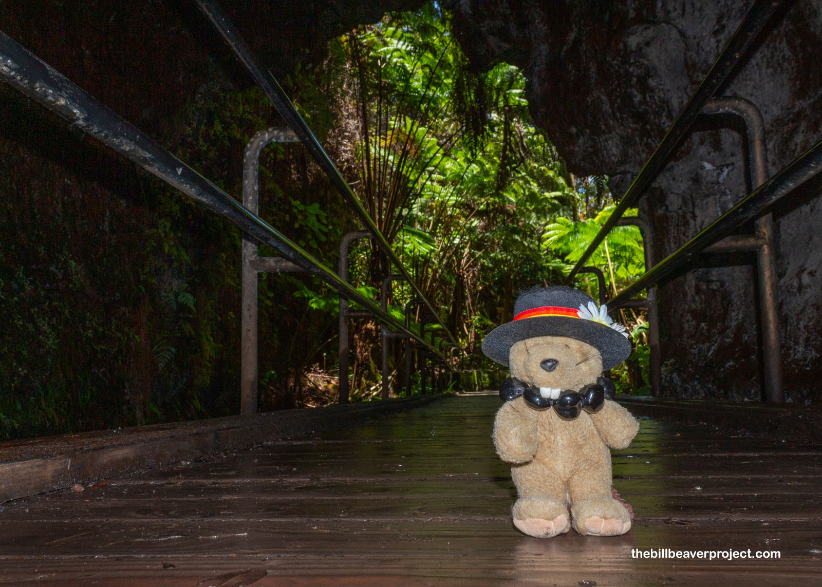
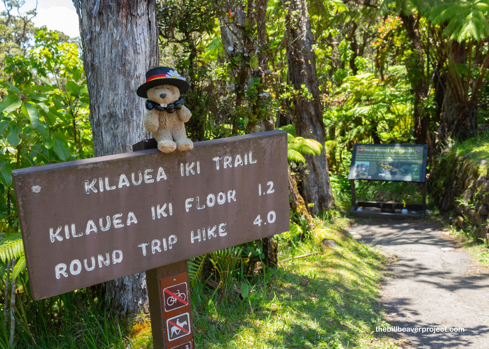
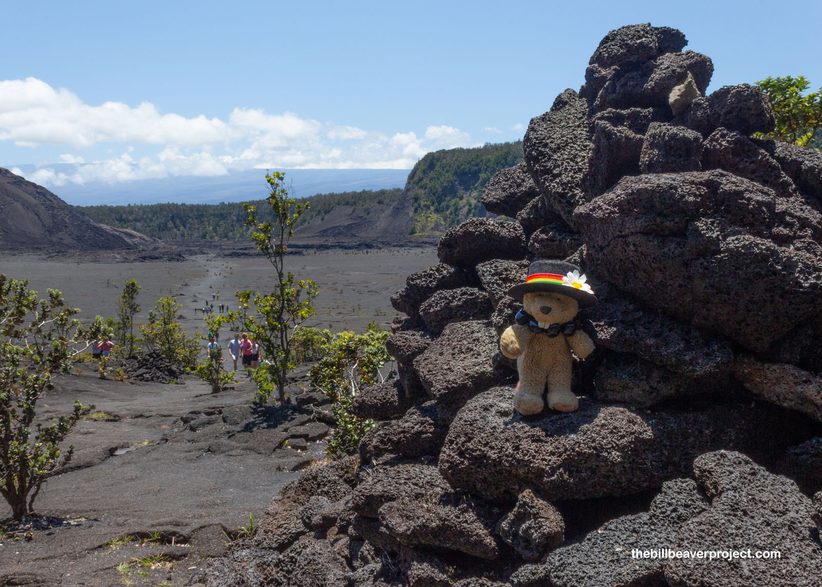
I could have lost myself in beach combing all day, but I was on a mission! Hawaiʻi Volcanoes National Park is one of the Big Island’s big draws, and the morning was already getting late! I headed into the park, hoping to hike into Kilauea Iki Crater, but the first lot was full, the second lot was full, and finally, quite a way down the road, I found a spot in the fourth lot!
 |
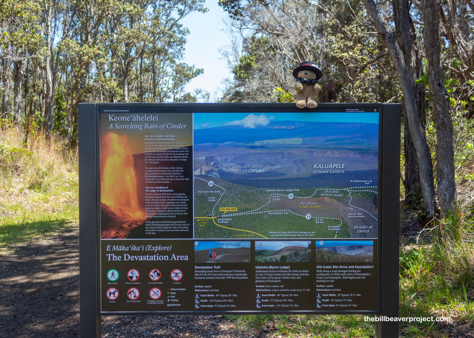
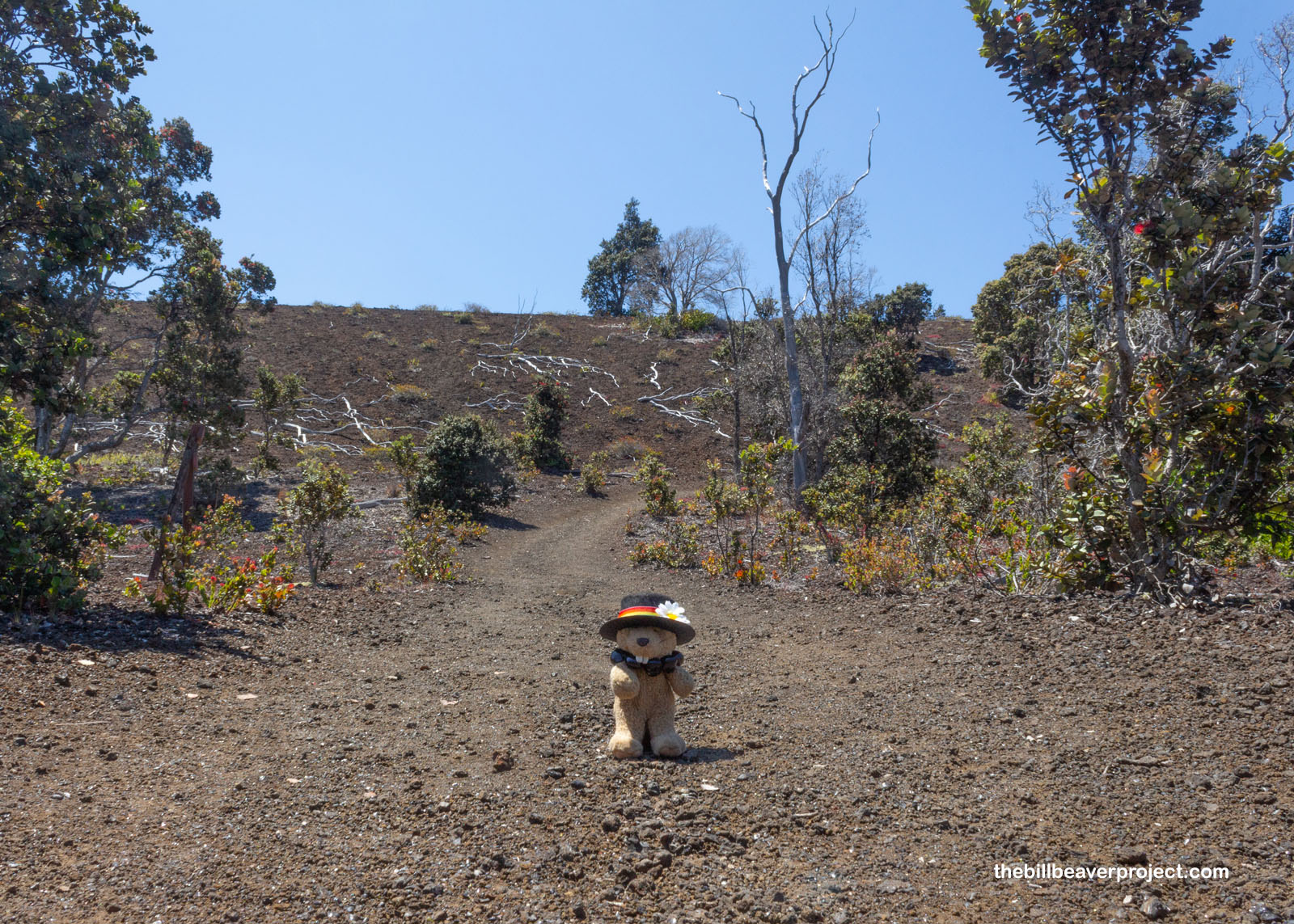
So, rather than start off my day descending into a volcanic crater, I was going to have to do some circling! I entered the network of trails through the Devastation Area, also known as the Keoneʻāhelelei, or scorching rain of cinder!
 |
Since this is the most volcanically active national park in the USA, I was kind of nervous seeing all the caution signs. There wasn’t a boardwalk, and there definitely were holes in the ground. What were the odds that one wrong step could open up a new lava pit?! I figured they’d be low, but in this part of the Pacific Ring of Fire, they’re never zero!
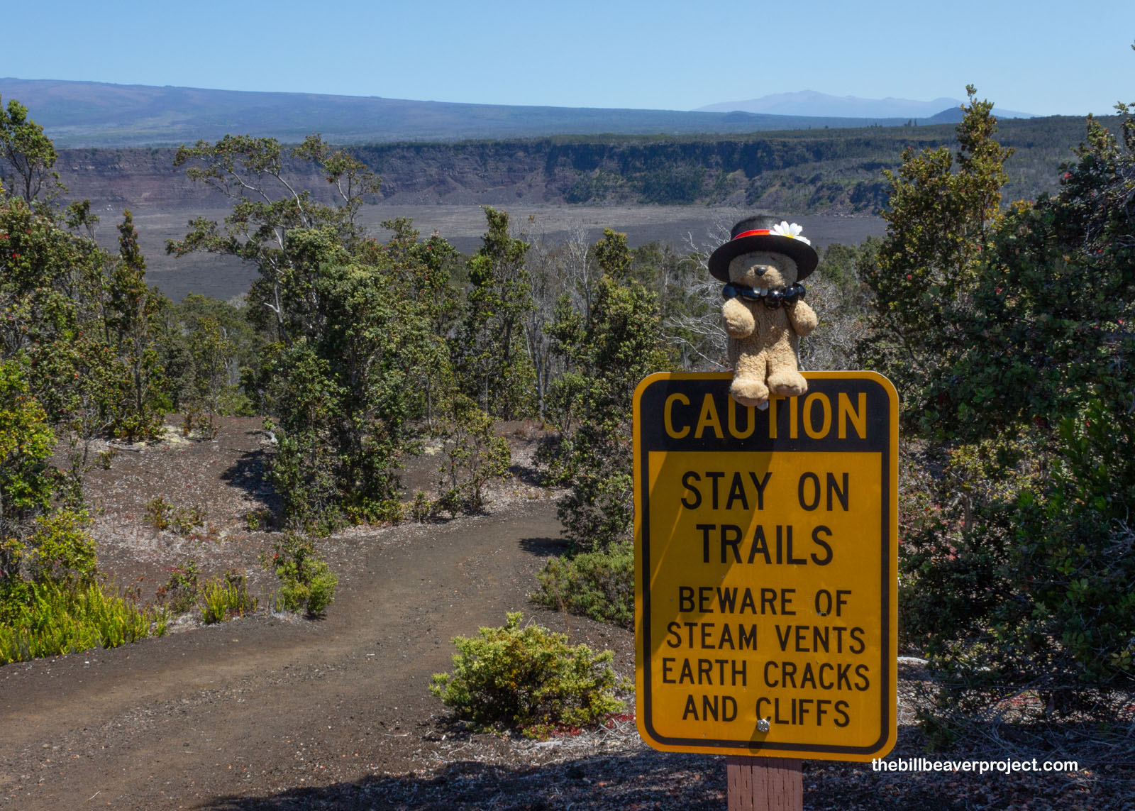 |
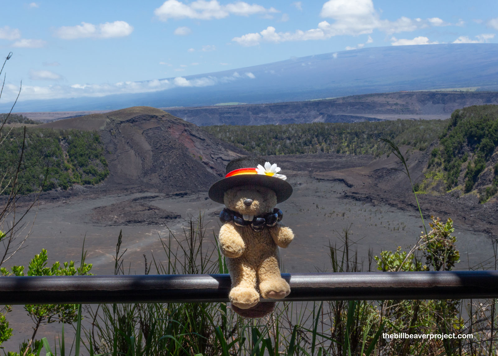
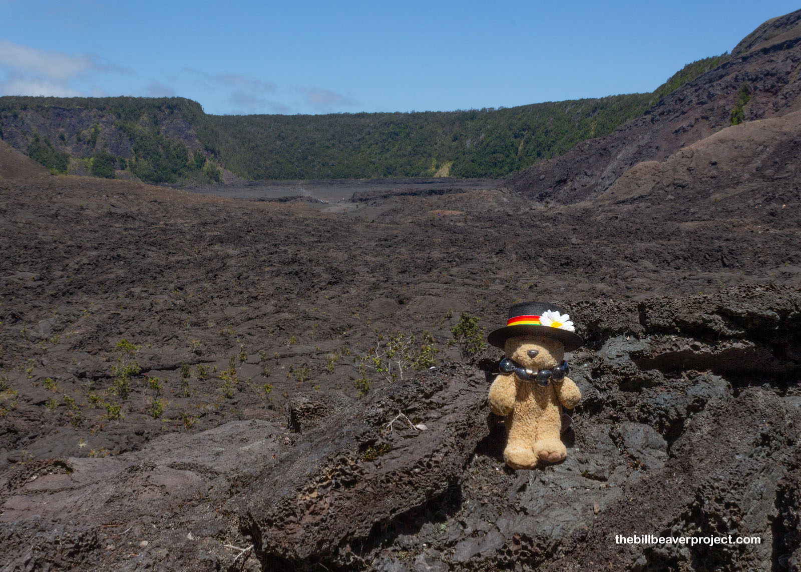
Off to the side of the main Kilauea caldera, Kilauea Iki (Little Kilauea) last erupted in 1959, sending cinders 6 miles in all directions and scorching the plant life all around. Greenery has been steadily returning over the last 64 years, but this first downward slope of the trail was nowhere near as lush as other areas in the park.
 |
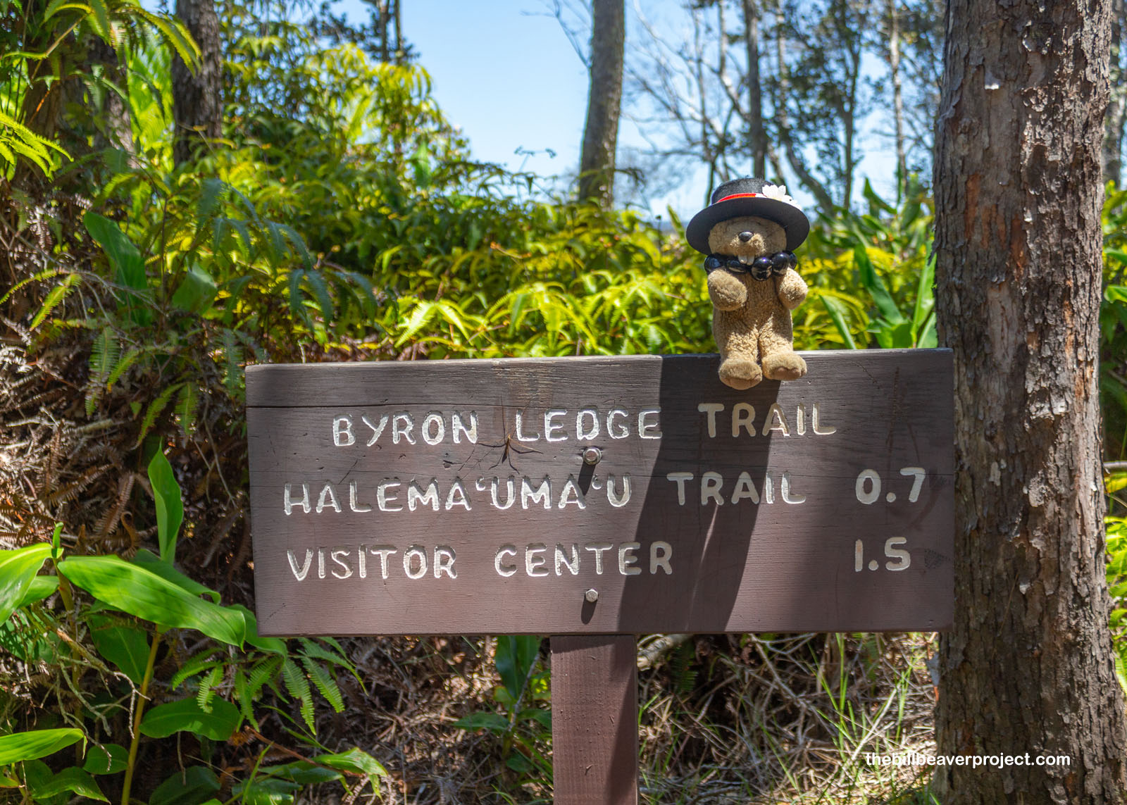
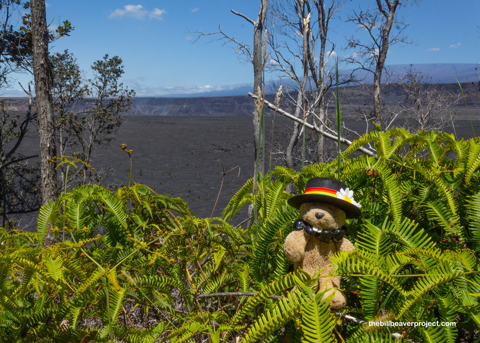
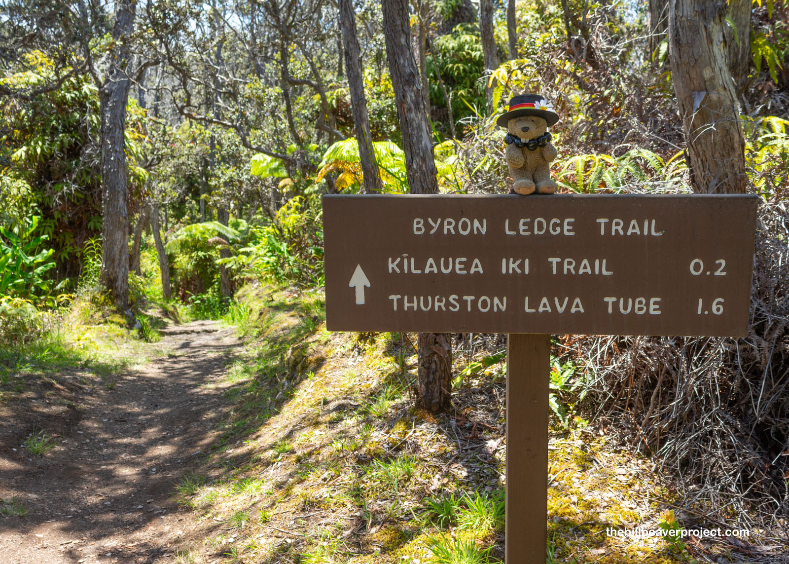
Skirting the edge between big and little Kilauea was Byron Ledge (Uēaloha), where I was able to peek through thick ferns to see the smoking monstrosity of the main Kilauea volcano, one of the world’s most active! Lava wasn’t flowing today, said the ranger, but this enormous volcano has put on plenty of shows for tourists over the years. I could see a teeny, tiny research station way down inside the crater, and I wondered how much time one of those researchers would have to get out if the volcano decided to wake all the way up!
 |
 |
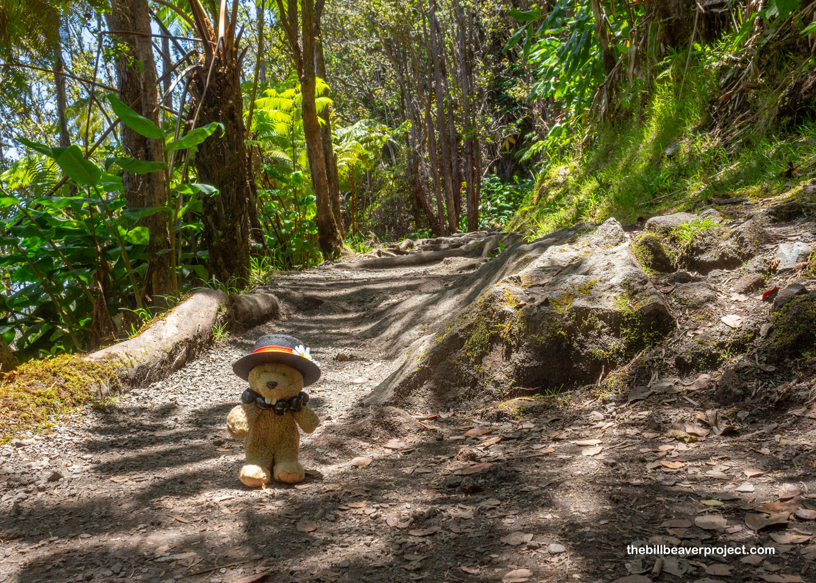
Despite all the parking troubles lengthening my journey today, I was still determined to take the Kilauea Iki trail all the way down to the crater floor. I’d taken plenty of long walks before, and as I circled up toward the road and caught my first glimpse of the crater with the trail running through it and enormous Mauna Loa in the background, I figured my determination was going to pay off if I kept going.
 |
 |
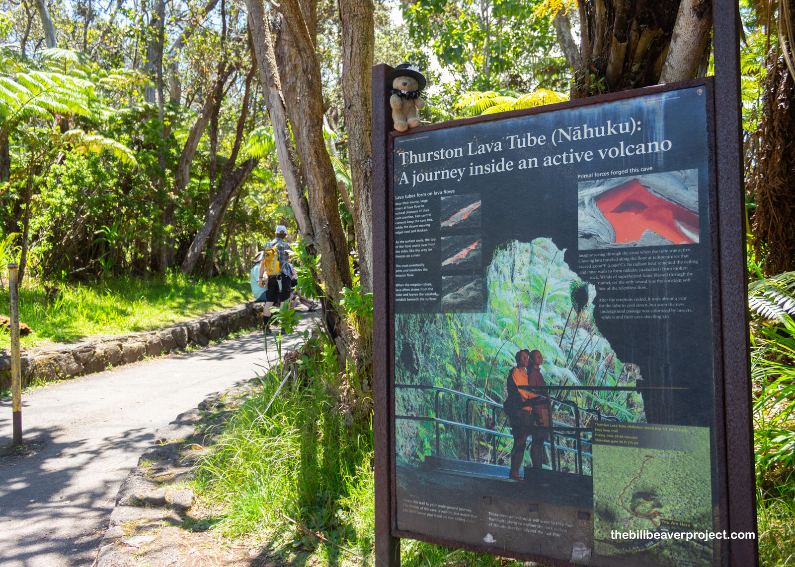
But first, I found a detour spot when I reconnected with the road: a chance to go underground, into the heart of an active volcano! This was the 500-year old Thurston Lava Tube, or more appropriately, Nāhuku! Why more appropriately? Well, even though Lorrin Thurston did explore this tube in 1913 and did lobby to make this a national park, fifteen years earlier, he led the efforts to overthrow the Hawaiian monarchy and suppress the Hawaiian language! And he discouraged hula as indecent! So today, I’m calling this tube Nāhuku, which refers to the lava drippings that hung from the ceiling before souvenir collectors stole them all!
 |
 |
Like the tubes in Lava Beds National Monument, Nāhuku formed when fast-flowing lava started to cool around the edges, forming a crust. As the eruption stopped, most of the lava drained out, while the crust around the edges remained! Even though it was once 2000°F in here, after a year of cooling, this tube became the perfect environment for unique, cave-dwelling plants and critters to call home! In fact, there are so many unique species in this park that UNESCO has recognized it as an International Biosphere Reserve and World Heritage Site! For this cave-going critter, it wasn’t exactly home, but it was a great break from the heat outside!
 |
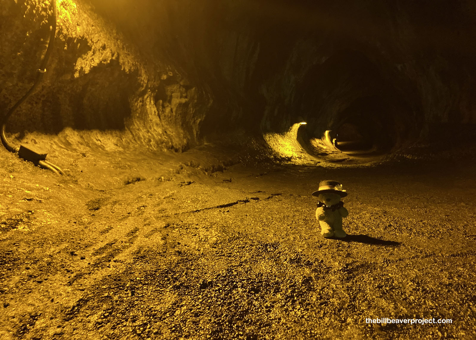 |
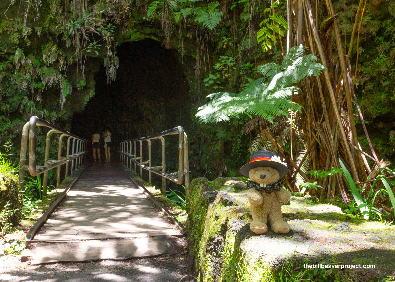
Less than half a mile long, the lava tube ended far sooner than I expected, and soon I was back outside on the trail! Finally, I was going to descend into the volcanic crater I’d meant to explore from the moment I arrived in the park! Unlike the trails I’d taken to get here, this one was pretty crowded, and there were groups of teenagers screaming at each other just to hear the echo! It took all my willpower not to break out one of the Deadly Arts, but I left it to the whim of the active volcano…
 |
 |
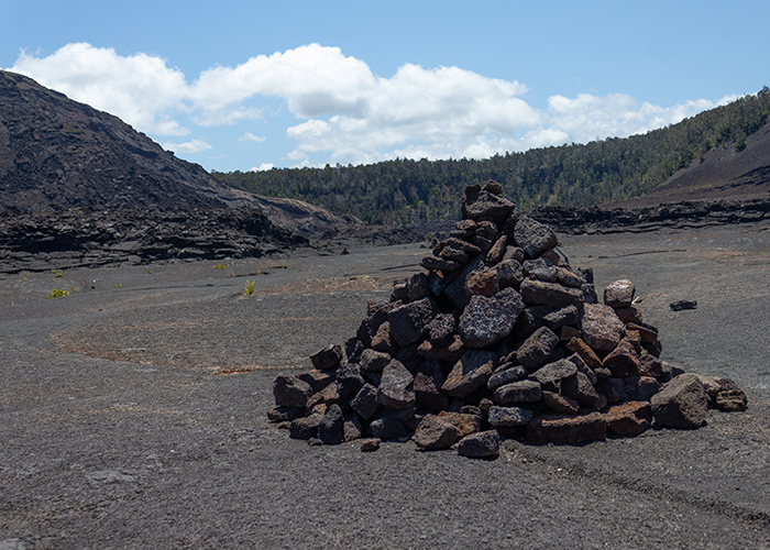
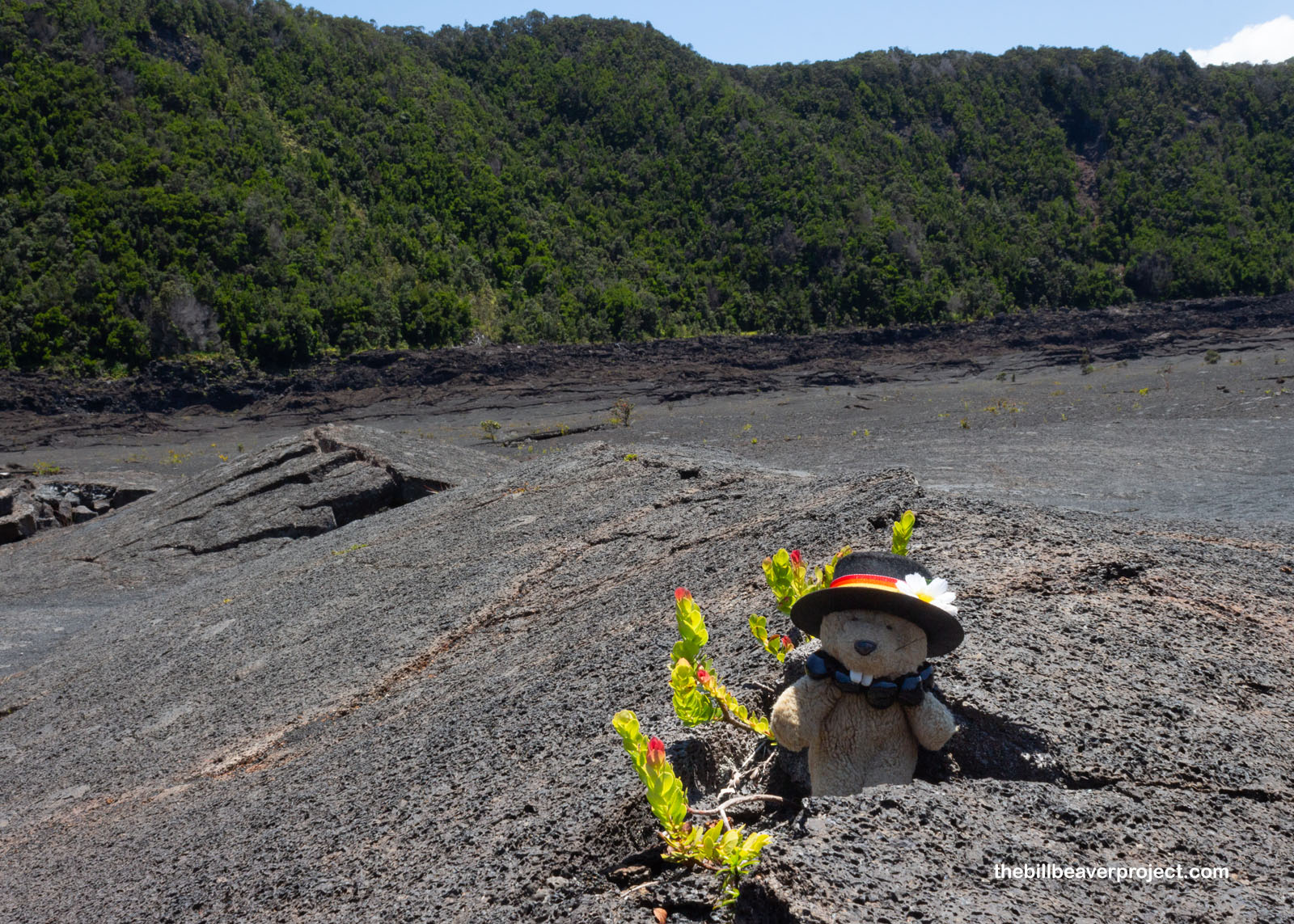
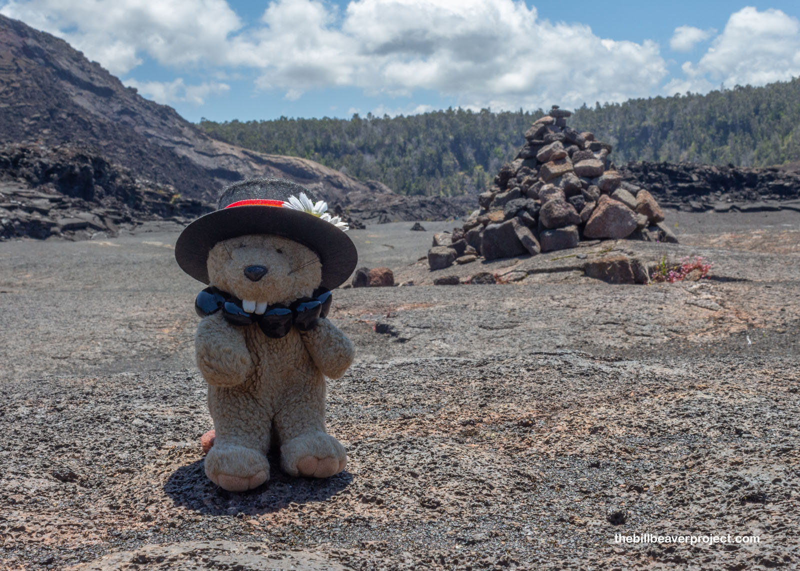
Then, from the shelter of a stacked up cairn called an ahu, the way across Kilauea Iki was clear! The path was well worn by feet, but even though decades had passed since its last eruption, it was right next to its big sister, which last erupted on June 19th. It would be a very good idea to stick to the tried and true footpath!
 |
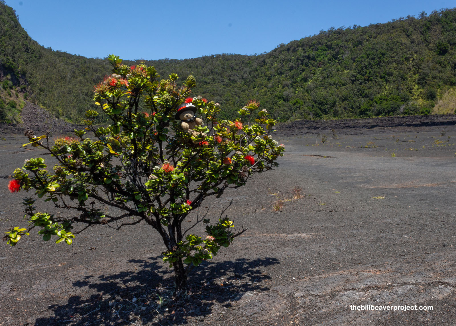
Amazingly, there was all kinds of life growing right out of the lava rock! ʻŌhelo, for example, is one of the first plant species to colonize fresh lava rock! For that reason, it was long considered sacred to Pele, the volcano goddess, and folks were not allowed to eat these relatives of blueberries, cranberries, and huckleberries (genus Vaccinium) without offering some to her first! Some ʻōhelo (ʻōhelo ʻai) are shorter than I am, while others (ʻŌhelo kau lāʻau) are big enough for me to hide in! They’re super important too! Endangered birds like the nēnē love the berries, and two endemic moth species can’t grow up without spending time inside an ʻōhelo berry!
 |
 |
Another thing about these ahu! Done traditionally, they’re much sturdier than the cairns I’m used to, because of the uhau humu pōhaku, or dry stacking technique, that makes use of the lava rock’s friction! These ahu are waypoints to guide folks across the crater, while others mark important ceremonial locations and are managed by a special steward called a kahu!
 |
For all my poking around under the sun, I was starting to get tired, and before long, I was pretty sure I’d appreciated all the ahu and ʻōhelo I could. There were eerie cracks along the way out, plus spots that sounded disturbingly hollow when I stepped on them. Even though the risk was probably pretty low, I was glad when I’d schlepped up over the ʻaʻā boulder field and back to the junction with the Byron Ledge Trail!
 |
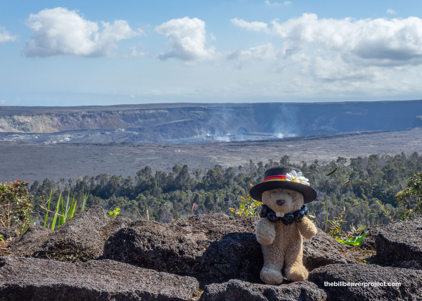
From there, it was a hustle back up to the trailhead, then a second hustle to the historic 1846 Volcano House to load up on fish & chips and lots of water while looking out over the breathtaking Halemaʻumaʻu crater of Kilauea! Back in May of 2018, the summit collapsed, doubling the size of the crater! The Volcano House oversaw all of it, so I imagine the sight and sound of it made a lot of folks spit out their fish & chips!
 |
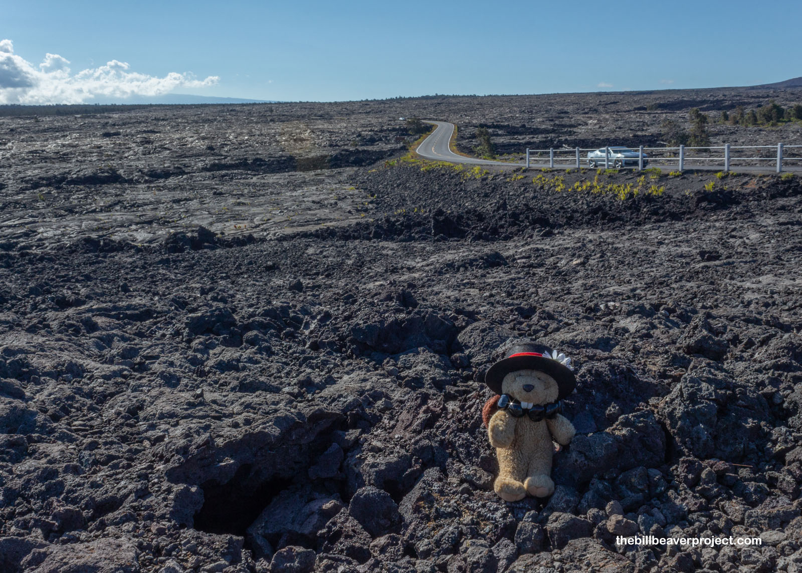
But there was still more to see in this national park, and I knew full well I was barely going to get to a clinker-sized chunk of it! So what better way to see that chunk than to take in a sea of clinkers covering the hillside from the Kealakomo Overlook? Kealakomo was an ahupuaʻa (remember those from yesterday?) where folks figured out how to grow sweet potatoes in the arid volcanic soil on Pele’s sacred ground. In 1969, a smaller volcano, Mauna Ulu, started erupting, forcing archaeologists to rush in and study as much of the remains of Kealakomo as they could, before it was all covered in lava rock. They were just fast enough to log 3,324 structures and agricultural features before lava swallowed up 70% of Kealakomo for good! Everything behind me in the photo was once Kealakomo!
 |
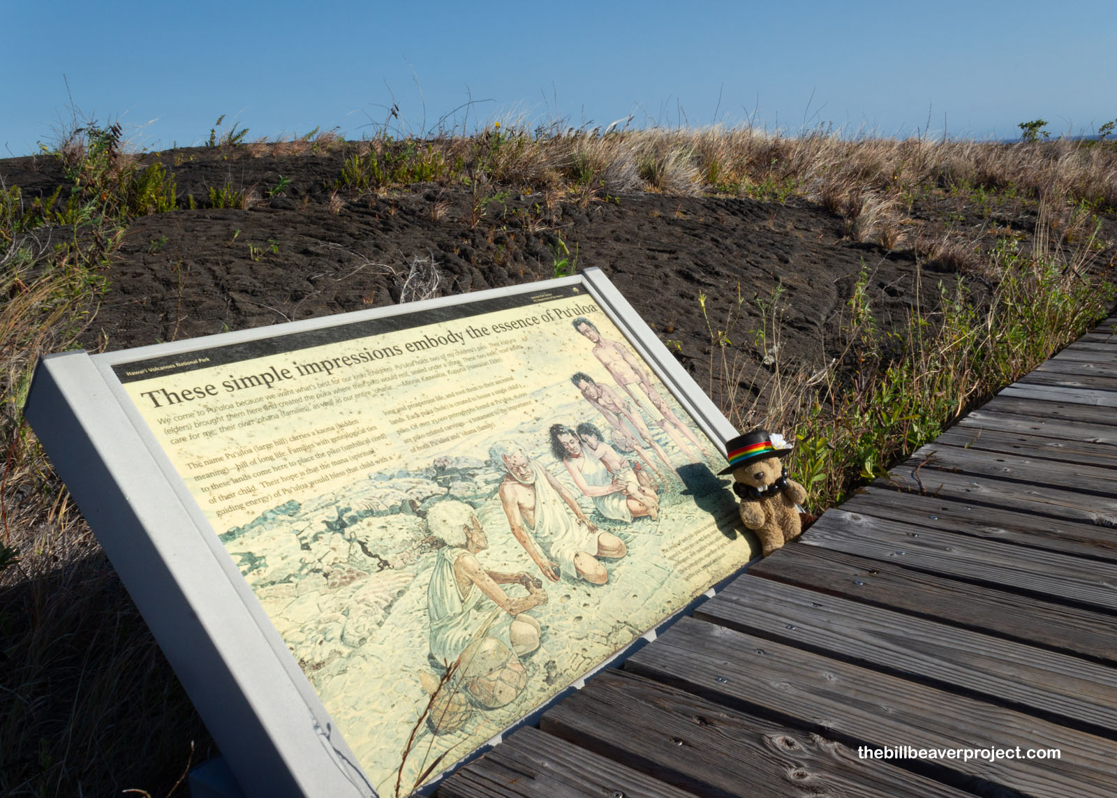
Next up, I wanted to see some more petroglyphs, but it was going to be a challenge, first because I was pooped after all the hiking today, and second because the wind was just blasting! I was pretty sure I wasn’t going to get any amazing petroglyph photos at the end of the 0.7-mile Puʻu Loa Trail. That was a shame, because it’s Hawaiʻi’s largest petroglyph collection!
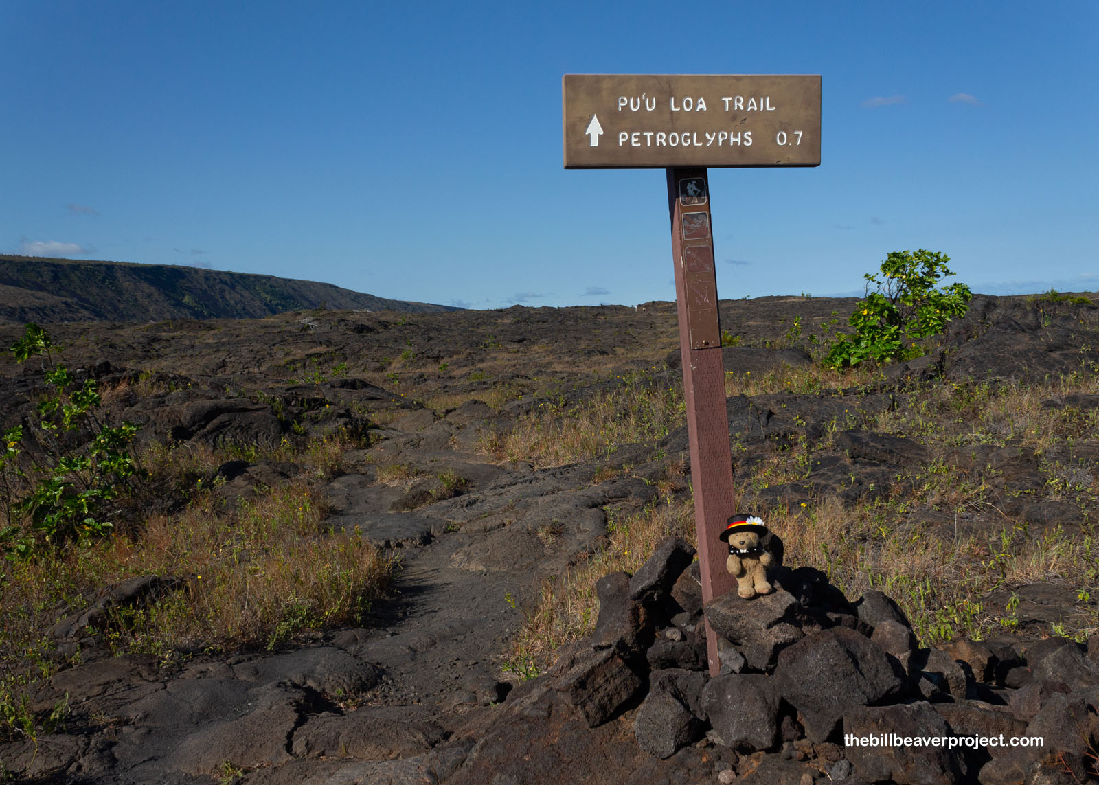 |
Of the 23,000 petroglyphs at Puʻu Loa, there are lots of humans, critters, and canoes, but the majority are special holes in the rock meant to bind together each family (ʻohana). When a new baby was born, folks would come to this spot and put the piko (umbilical cord) into one of these holes. This would imbue the child with the land’s mana and hopefully give them a long, prosperous life in the home of their ancestors!
 |
 |
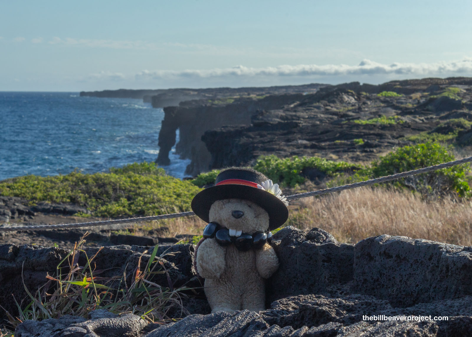
Lastly, I reached the end of the road to see the Hōlei Sea Arch but didn’t stick around long. The viewpoint was super high above it, and there were lots of lookie-lous crowding the overlook. I figured I better head for Hilo and see the last historic spot on my wishlist for the day.
 |
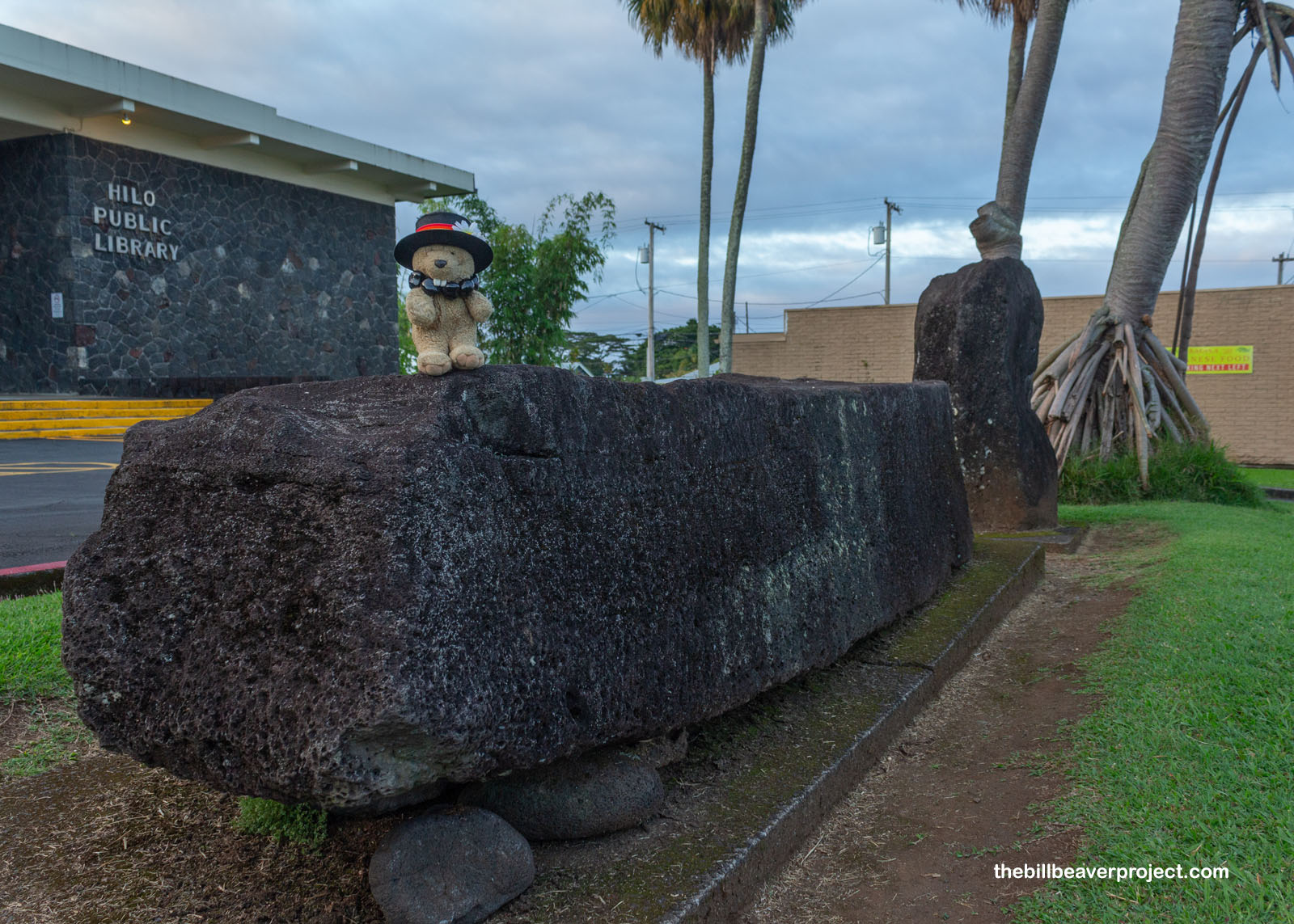
That, of course, was the Naha Stone. This stone was super important to the aliʻi (chiefs) of Hawaiʻi! Brought here all the way from Kauaʻi by a aliʻi named Makaliʻinuikuakawaiea, this huge stone was used to point out new aliʻis in two ways: an infant that did not cry when placed upon it was royal, and an adult who could lift the stone was considered a great aliʻi! Supposedly Kamehameha I lifted the Naha Stone in 1789, confirming, just like in Arthurian legends, that he would be the chosen king to rule all of Hawaiʻi!
 |
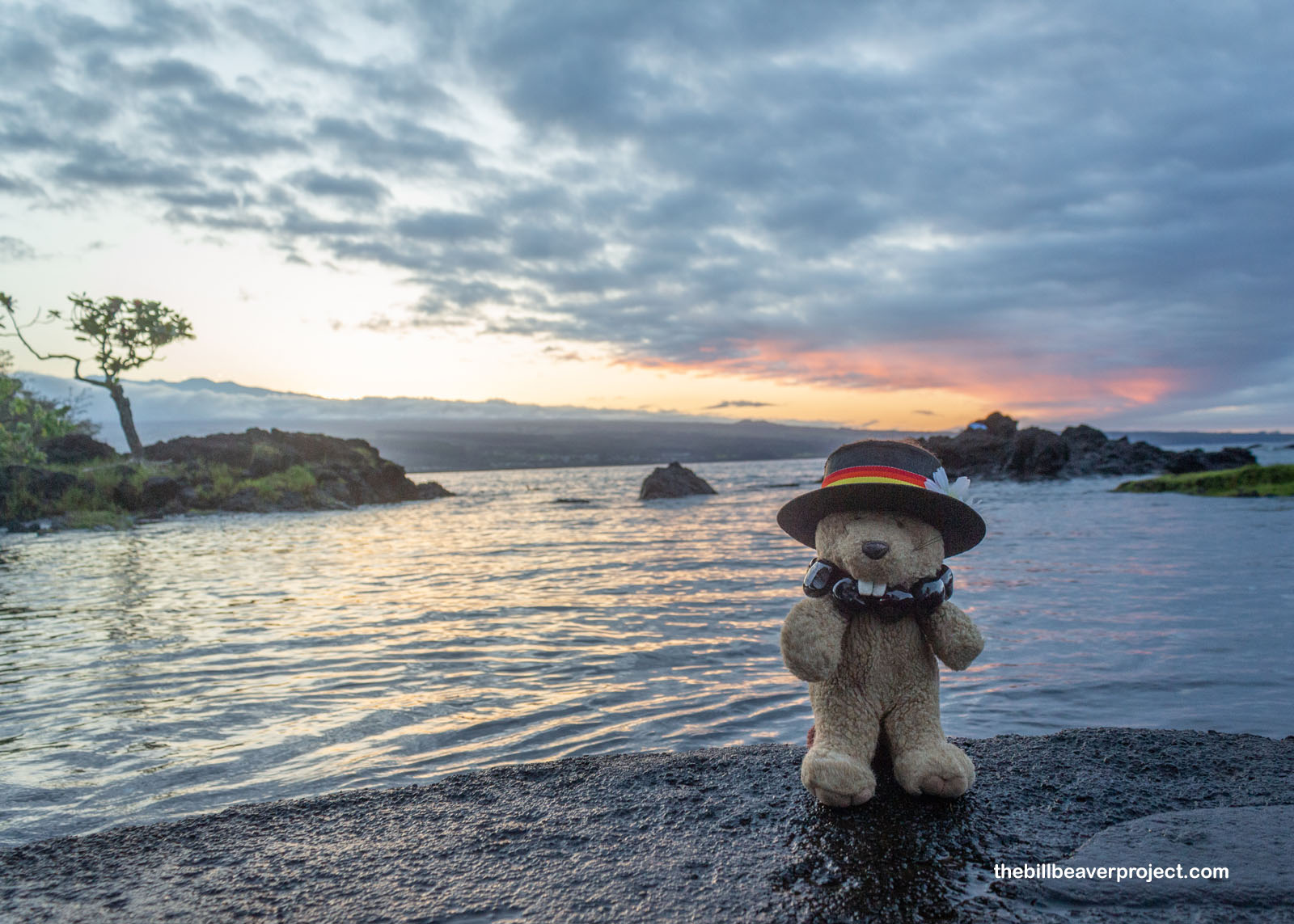
There wasn’t much daylight left to enjoy Hilo, so I settled in for supper at Ponds Hilo, where I watched a school of koi drift about below the window while I munched a salmon salad and guzzled more lilikoi iced tea than I should have been able to fit in my tummy. It may have been a fiery themed day, but like most adventures on an island, it all came full circle, back to the ocean.
 |
With two Big Island national parks under my kukui necklace, it was time to head back to the AirBNB. Tomorrow, I’ll explore some more neat historic sites along the Kona coast as I work my way up to the airport for the next leg of this Hawaiian adventure!
Hiamoe maikaʻi!

Previous Day |
Total Ground Covered: 329.0 mi (529.5 km) |
Next Day |