 Previous Day |
Ely, NV → Great Basin National Park → Los Angeles, CA 686.6 mi (1,105.0 km) |
 More 2020 Adventures |
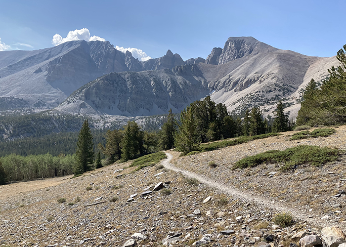
A-hiking I will go, everyone!
Today, I’m returning to Great Basin National Park to tackle the mountain in whose literal shadow I was frolicking yesterday! Before starting that hike, though, I paused to check out the historic beehive-shaped Ward Charcoal Ovens!
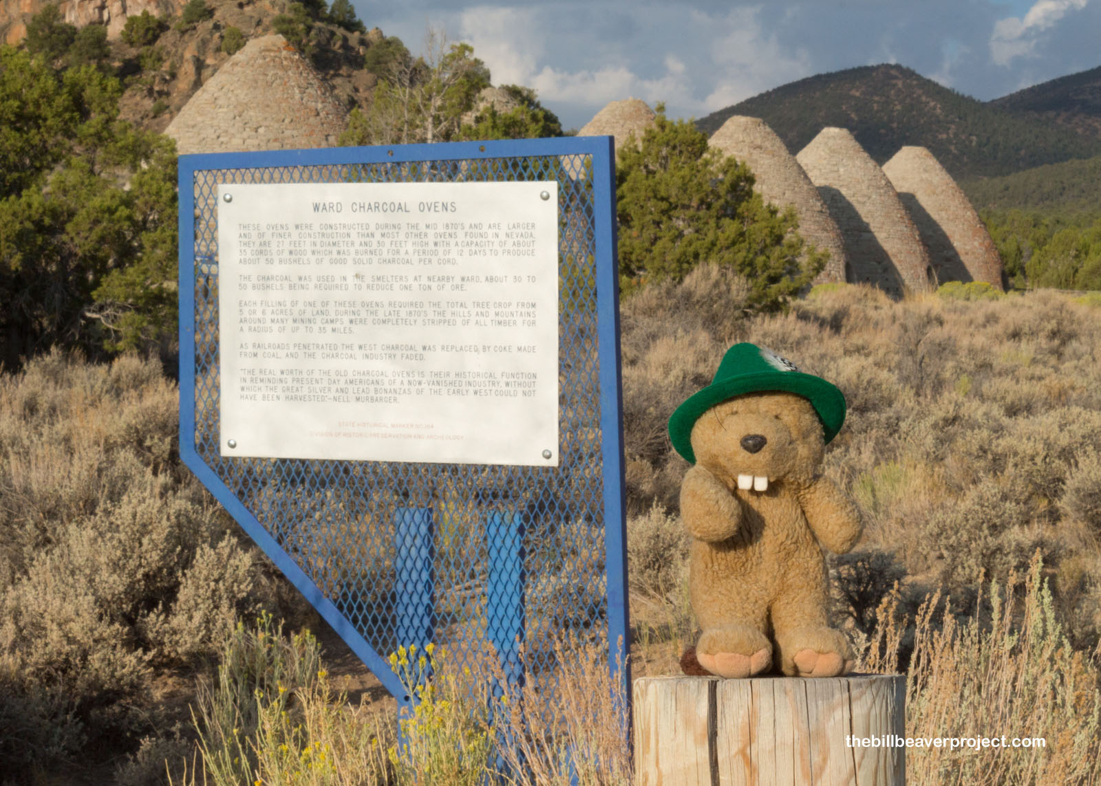 |
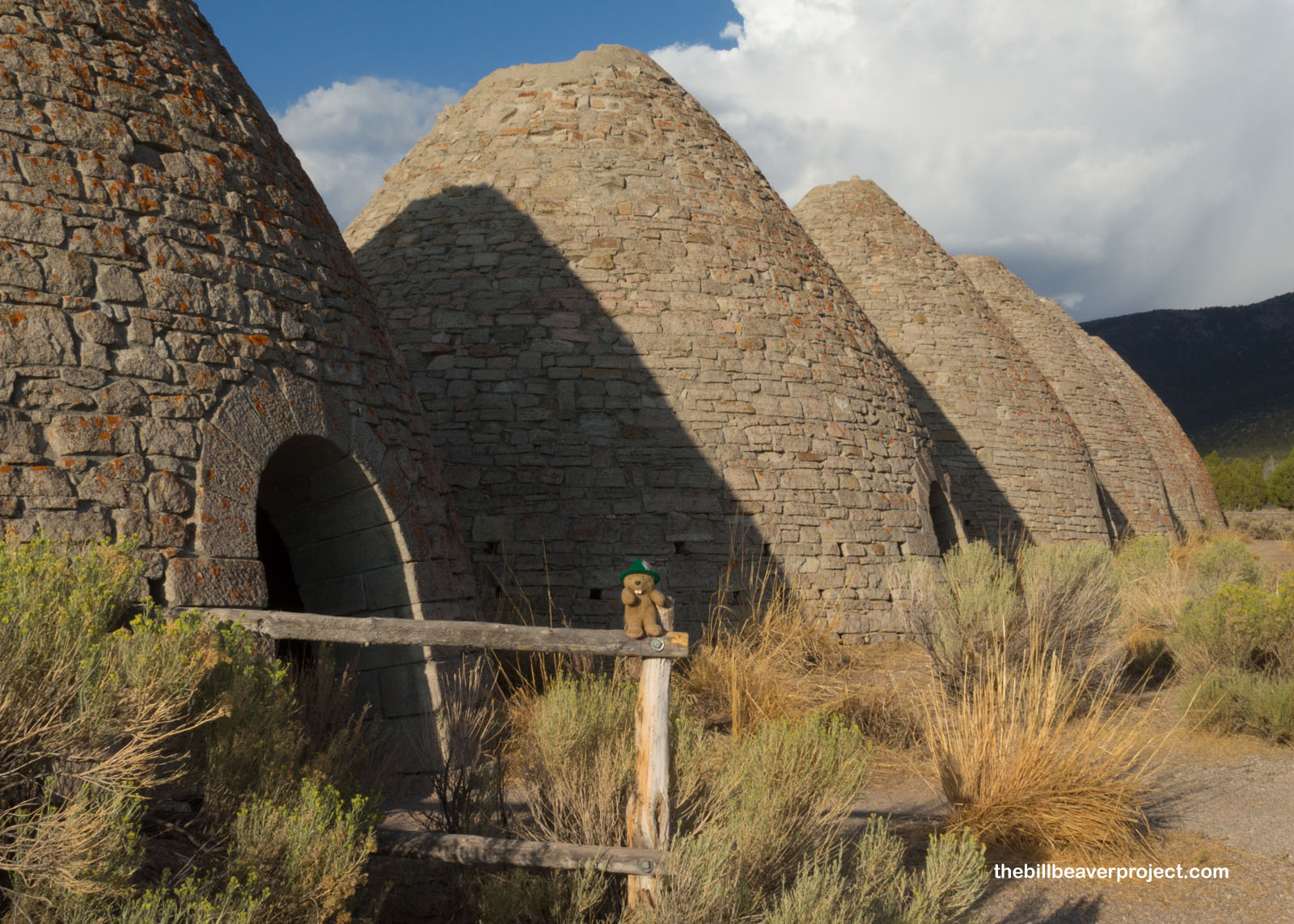
These nationally registered charcoal ovens burned up 5-6 acres of land at a time to produce charcoal for the silver mines in the nearby town of Ward. In fact, these are some of the best surviving examples of these charcoal kilns, which completely obliterated the trees in a 35 mile radius over the course of two years. By then, the ore had started to run out, and the residents of Ward moved to a new boom town: Taylor! Today, the charcoal ovens, having later served as an outlaw hiding place, still stand at their original height!
 |
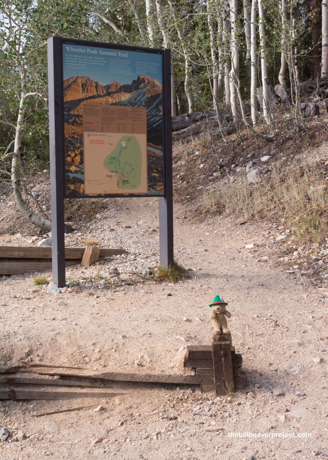
I could only afford a brief stopover at the charcoal ovens because I was super concerned about the weather conditions on my hike today. Wheeler Peak stretches up over 13,000 feet, which can make for pretty unpredictable weather. Though things have been pretty dry this summer (most of California is on fire right now), a beaver can’t be too careful at high altitudes! I reached the trailhead a little later than I had hoped, but I’ve been known to make up for lost time when the need arises!
 |
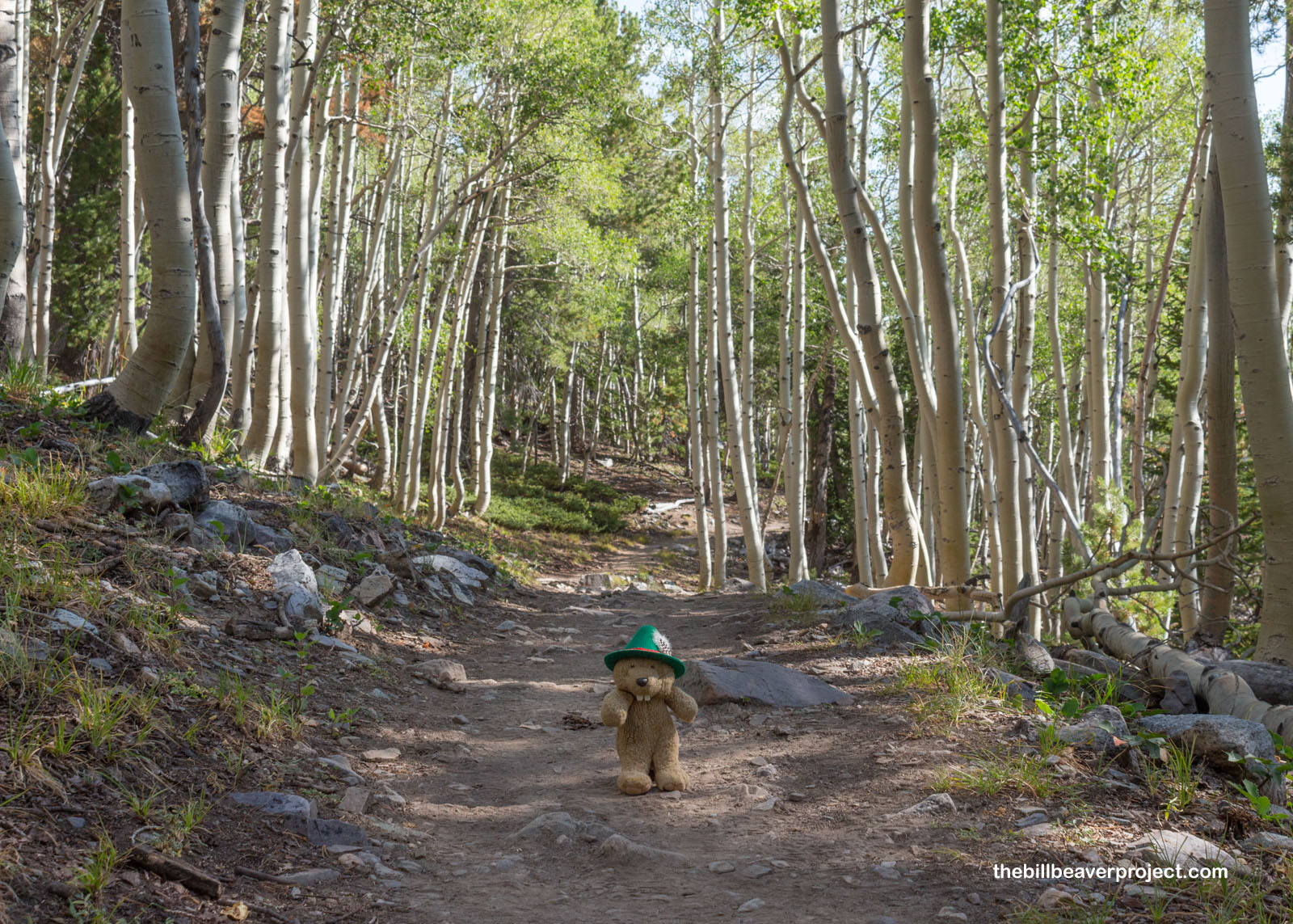
The trail started off as a nice, gentle slope through aspen woodlands. I called “Good morning!” to some deer, who blinked at me in response. Maybe they didn’t hear me…
 |
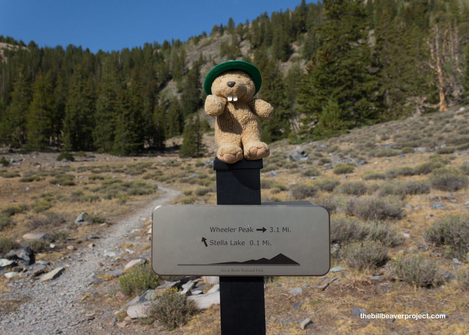
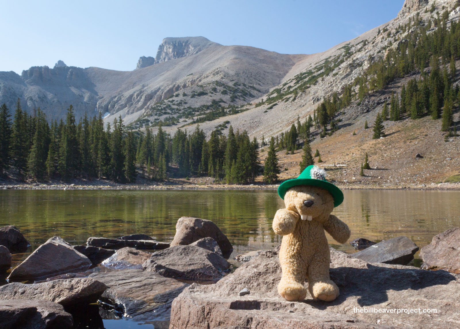
Like the charcoal ovens, it turns out I was cooking, because in no time flat, I reached a sign that told me I’d gone over a mile! I had my doubts, but how was I supposed to resist a brief detour at a mountain lake? This semi-aquatic rodent needs his water!
 |
Stella Lake is one of six subalpine lakes in the park, fed by runoff from melting snow! Though there are no fish in this lake, there are lots of bugs, like black flies, caddisflies, and mayflies that lay their eggs here and would normally be food for fish. At very least, this clear mountain lake makes a great mirror for the mighty peak in the background!
 |
Back on the main trail, the forest began to thin a bit. This was more from altitude than the clear-cutting I saw back at Ward. It was also pretty warm and windy, and I sure was glad to have made a water stop!
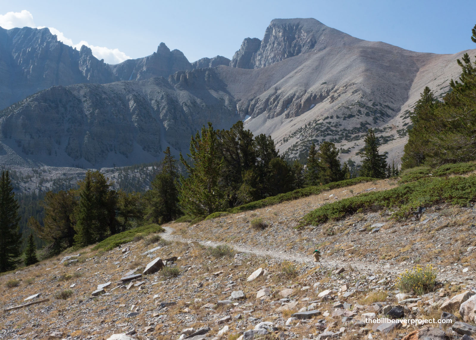 |
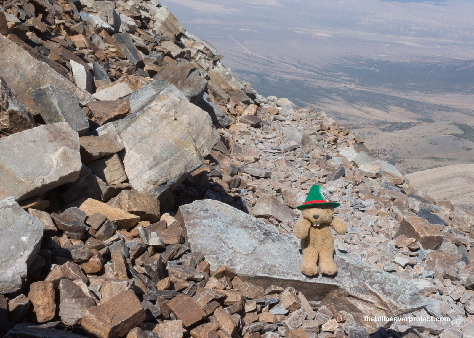
A few long switchbacks later, and I was already above the treeline and facing another mile of scree! Without the trees in the way, I could now see for miles, through the murky residue of California’s fires, all the way to the scary bands of clouds forming over the western mountain ridges! The wind was also starting to pick up a lot, so I knew I’d need to keep low and fast, a challenge when passing the 12,000 foot mark!
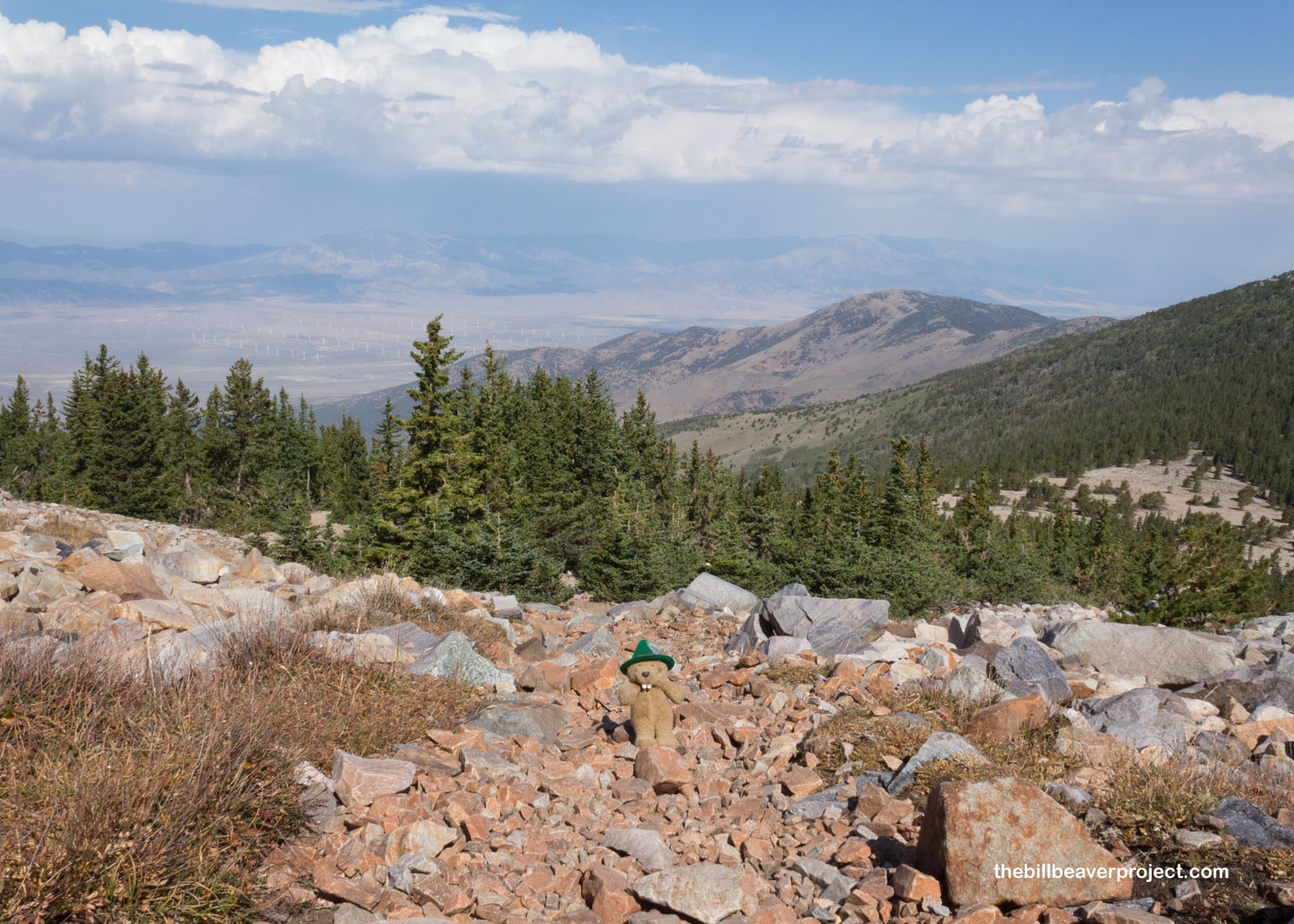 |
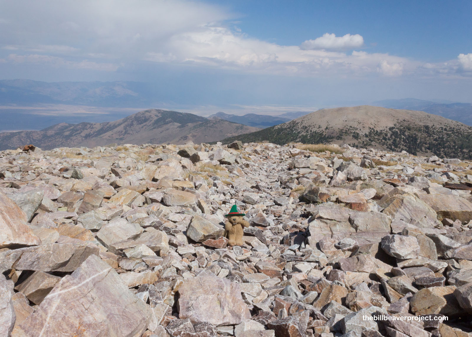 |
I sure was happy to stumble upon a stacked stone wind shelter! Some nice folks had prepared a few refuges from the blasting wind along this very barren, rocky final ascent. I was starting to have flashbacks to my low-oxygen schlep up Mount Whitney, and that made me nervous! Still, if I was going to beat those clouds in the west, I had to keep moving!
 |
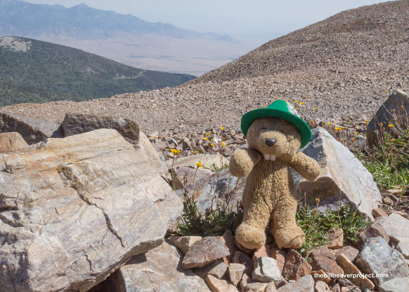
That didn’t mean I couldn’t pause every few switchbacks or so to admire the hardy Ross’ avens (Geum rossii), still blooming at these high elevations and wind gusts! This flower takes its name from Sir James Clark Ross, the same Ross whose name is all over Antarctica as an ice shelf, a gull, and a seal! What’s the connection, you ask? The botanist from the Ross Expedition of 1839–1843, named Joseph Dalton Hooker, made a later voyage to the Western United States and documented plant life from the Rockies to the Sierra Nevada range!
 |
 |
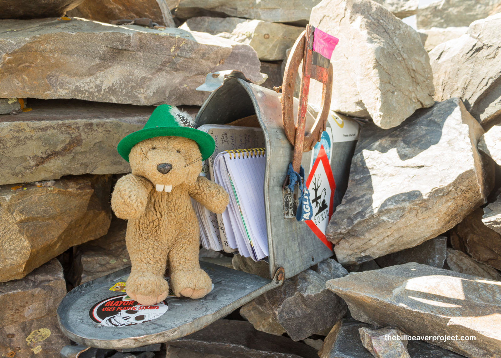
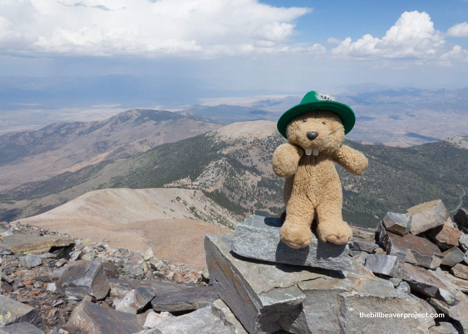
Speaking of names, did you know Wheeler Peak is named for George Montague Wheeler, who ran a topographical survey of the western United States from 1872 to 1879?! I couldn’t find his name in the mailbox register at the top, but there were a whole bunch more names of this peak’s conquerors! I left a note with my hiking time, so if you ever tackle Wheeler Peak, see if you can find it!
 |
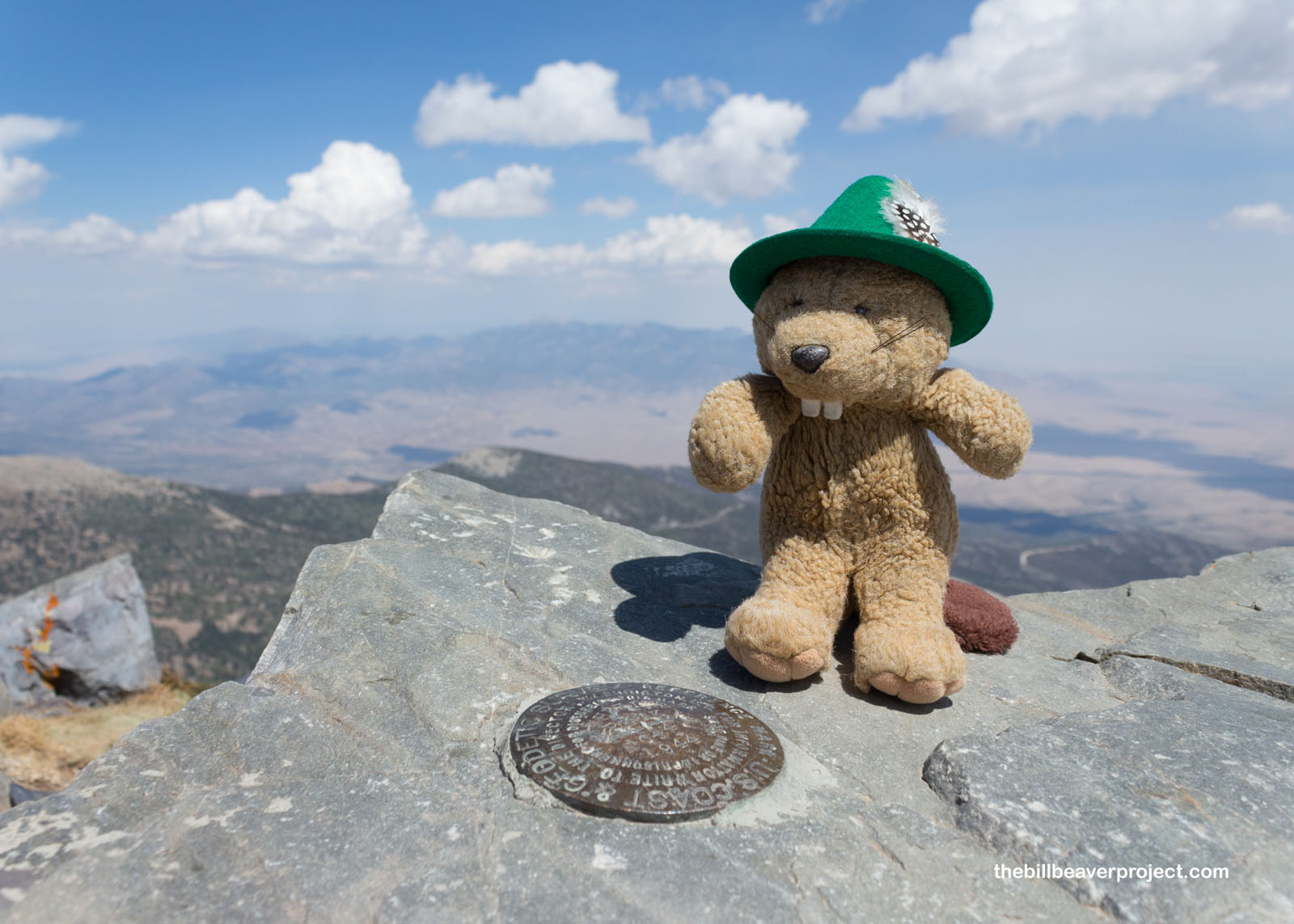
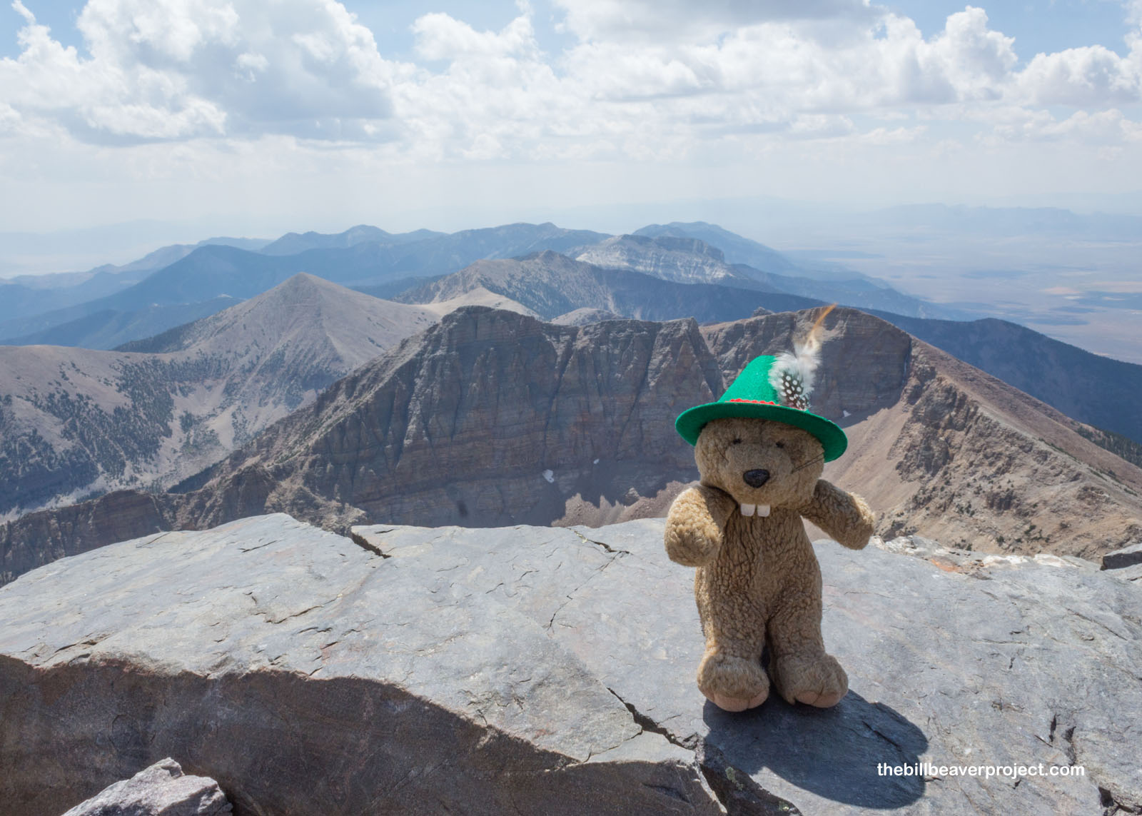
It took some hunting, but I did find the USGS summit marker. I’d done it! I felt surprisingly good, given the elevation of 13,064 feet and the one-way climb of 4.3 miles in a little over two hours! Whew! Now it was time to relax, have snacks, and enjoy the view!
 |
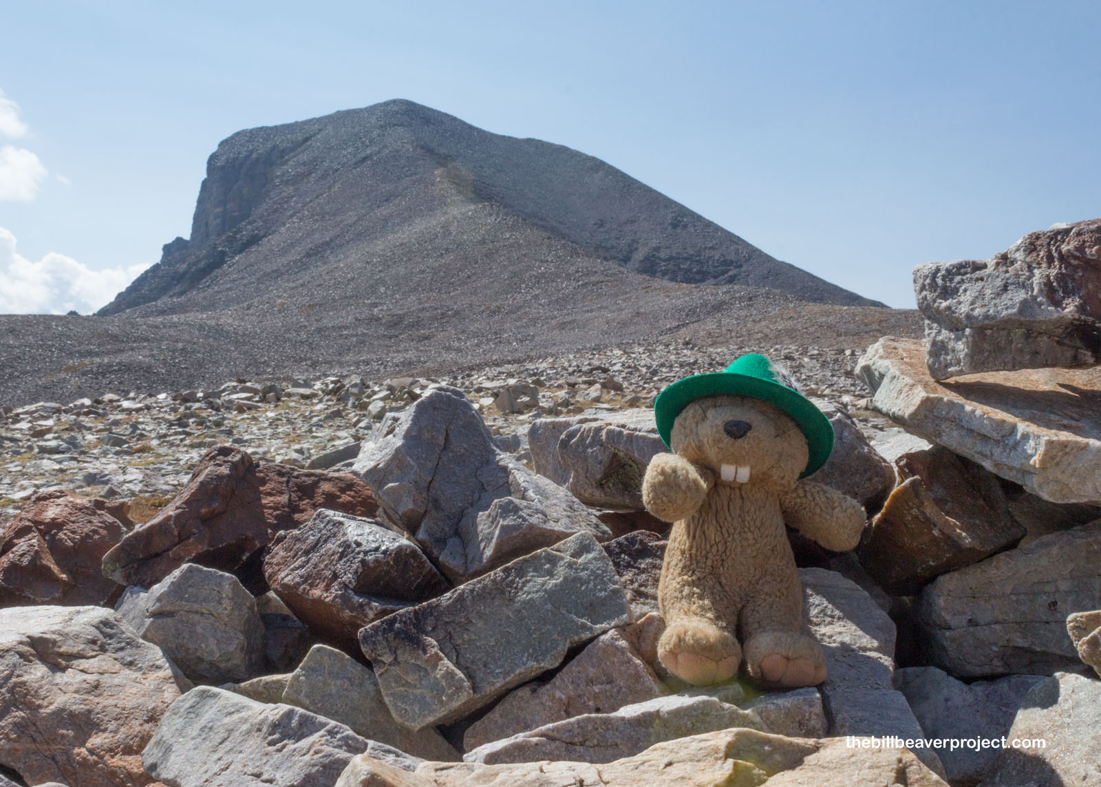
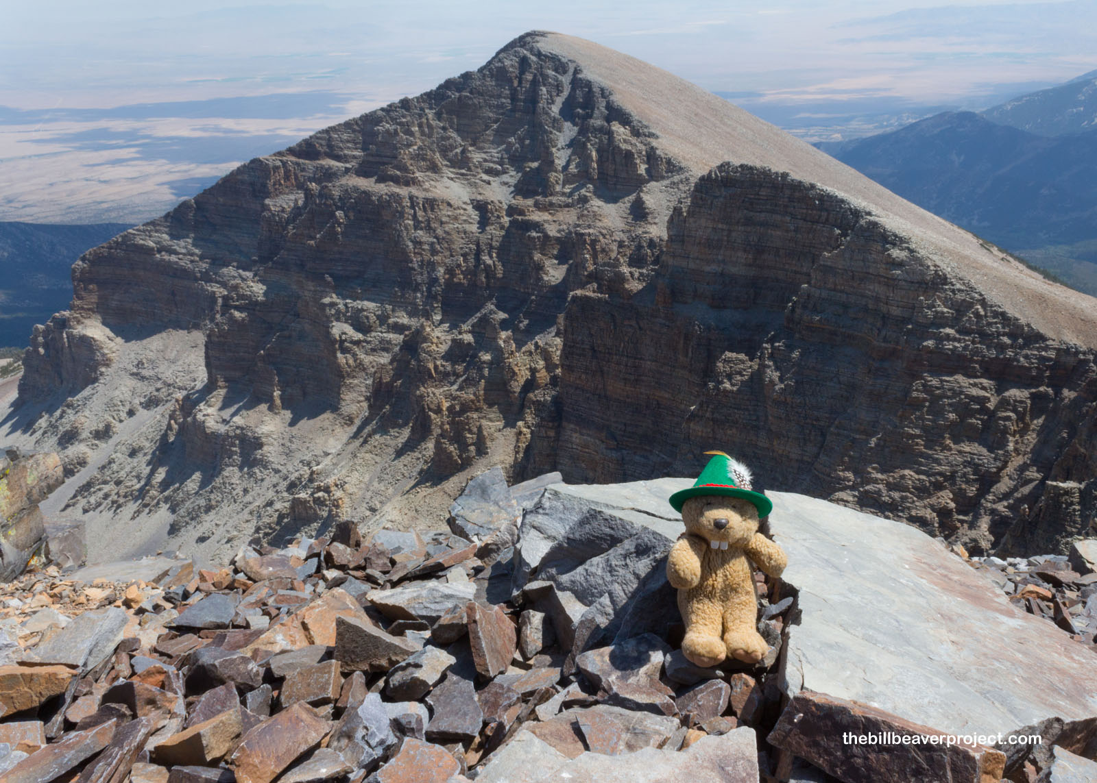
I looked east to Jeff Davis Peak, which actually got its name from Lieutenant Colonel Edward Steptoe of the U.S. Army Corps of Topographical Engineers. Circa 1855, he thought it would be nice to name the peak after his boss, Secretary of War, Jefferson Davis. What he could not have predicted was that, six years later, his boss would become the president of the Confederacy! No one has been able to change the name since!
 |
I cautiously scanned the base of the peak for signs of Señor Castorieti’s remains down on the glacier, but that rock last night had smashed him to smithereens! He’ll be back! For now, I took in one more sweeping vista across the Snake Range before heading back down. The storm that I was worried about didn’t seem to be brewing after all!
 |
 |
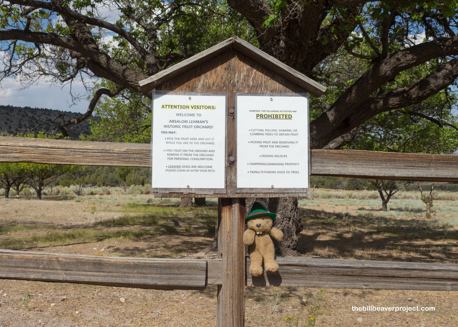
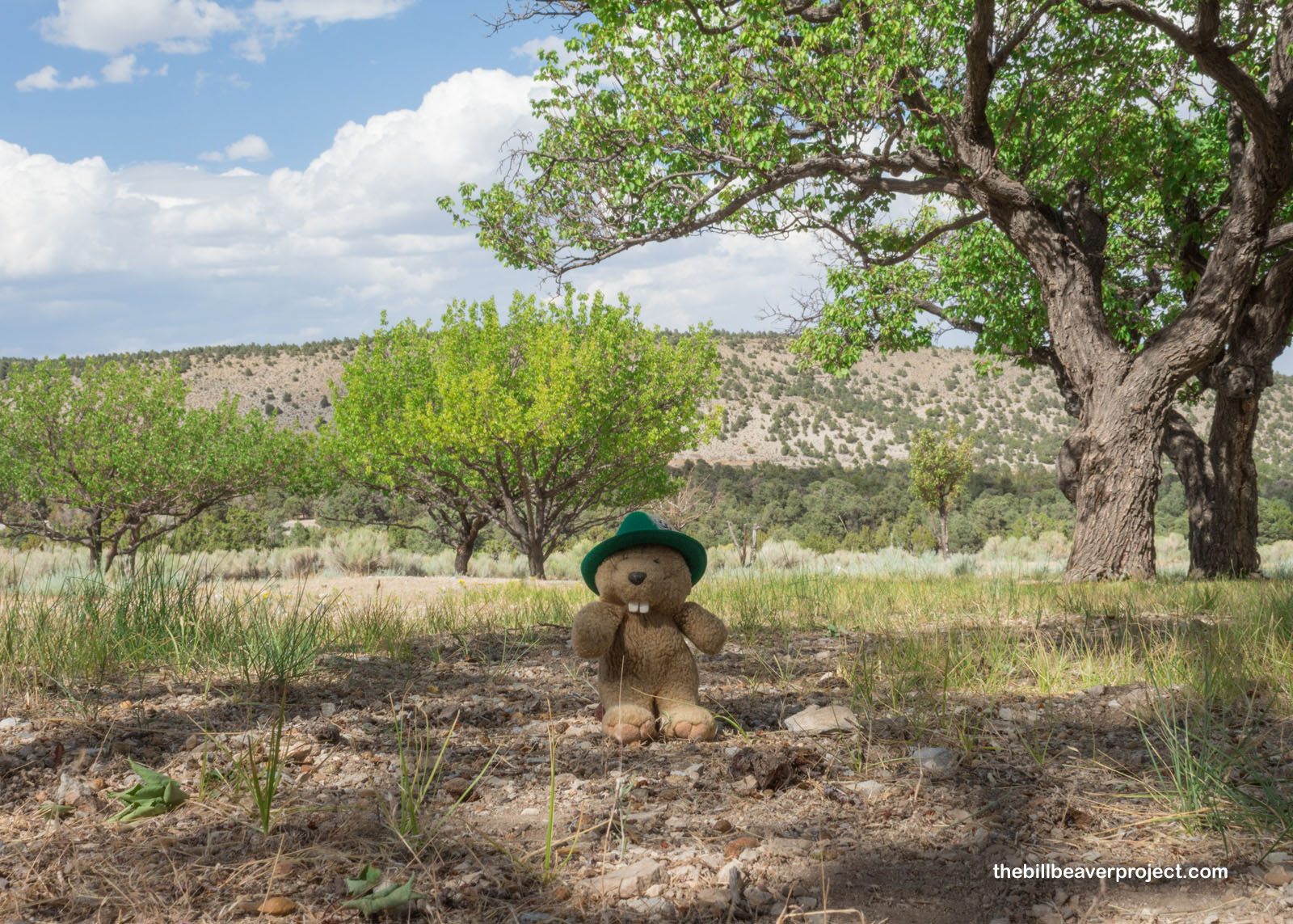
I hustled right down to the bottom and went to the Lehman Caves visitor center. While the caves were closed because of COVID-19 shutdowns, I was able to get into the café and have a celebratory sundae! Afterward, I took a stroll through the historic orchard of Absalom Lehman, who settled here to ranch after mining adventures in California and Australia! In this orchard, he planted 40 apricot, pear, crabapple, peach, plum, and apple trees, but only seven apricot trees and a peach tree survive today! You can still pick and eat fruit from this historic orchard, but it was a little late in the season by the time I got here!
 |
 |
It was only about 3:00 when I finished my orchard stroll and realized I needed to be heading homeward to conclude my biggest adventure in a long time. I’ll break up my trip a bit, grab a taco with Woodchuck, and mosey my way home. It’s hard to say when I’ll be traveling again with the pandemic going on, but I’ll keep finding adventure wherever it may spring up! You wait and see!
California, here I come!

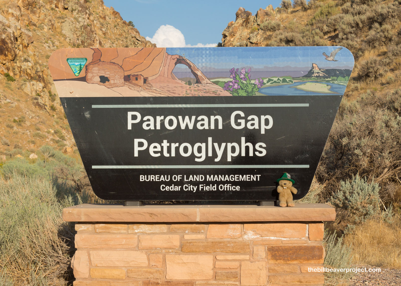
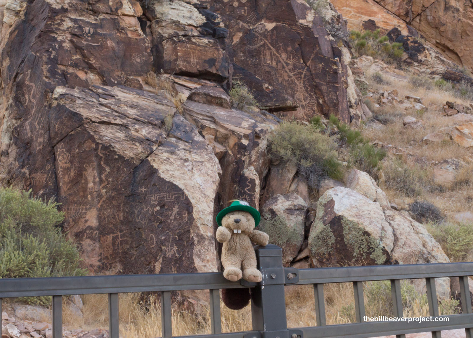
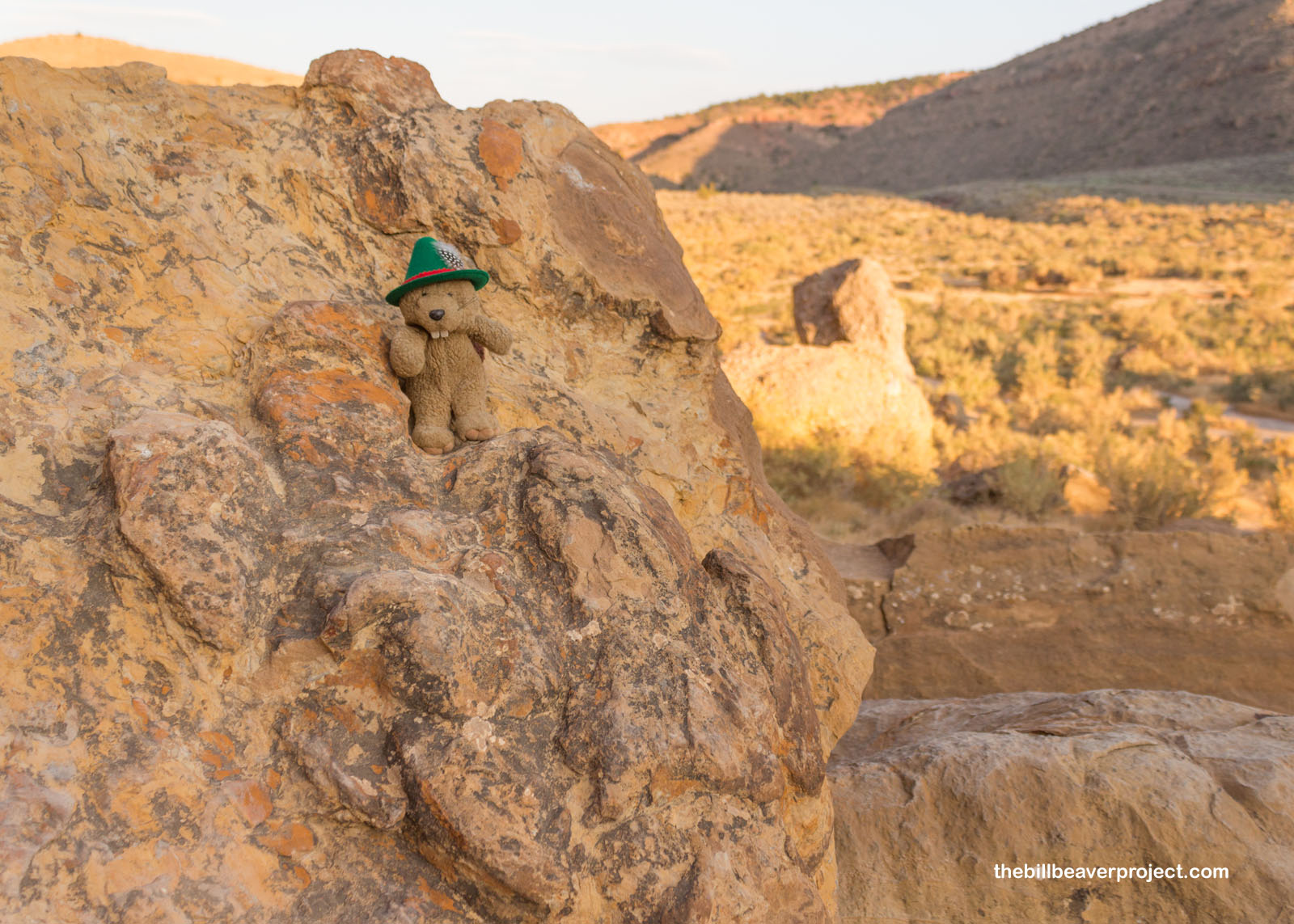
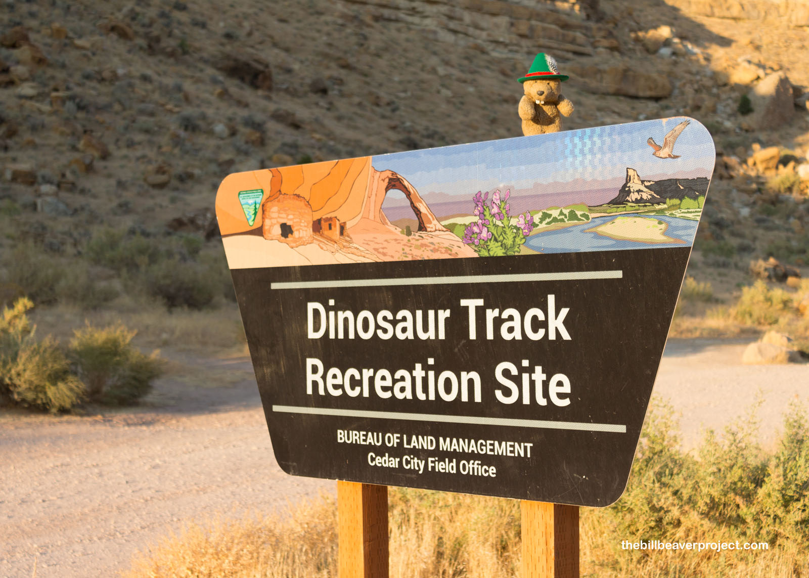
P.S. I saw some more really neat sites on my two-day journey back to Los Angeles, like the Parowan Gap Petroglyphs and Dinosaur Tracks, which I’ll talk more about later!
 |
 |
 |
 |
Previous Day |
Total Ground Covered: 3,454.2 mi (5,559.0 km) |
More 2020 Adventures |